
The Bidasoa River flows through the Spanish regions of Navarre and Guipuzcoa, and is a very popular water source in the country, as there are walks along its course where you can enjoy wonderful views of the Jaizkibel mountain. In this article we will learn a little more about this river, which you can read about below.
Surface, height and flow
To begin with, we will find out how this river is divided, its course, its size and many other characteristics. The interesting thing about this river is that it offers a great walk along its course before reaching Txingudi Bay. Below is a more detailed description of its characteristics:
Surface area
It has a surface area of 710 square kilometres, which makes it the 13th largest in the Cantabrian Hydrographic Federation.
Between its northern borders are France and Guipuzcoa, while in the south is the city of Navarre, whose extension remains intact thanks to this municipality, as it is part of this small municipality. It is important to note that there are at least 26 municipalities in this area, most of which belong to Navarre and only one to Guipuzcoa.
Altitude
This river has an average altitude of 485 metres, remember that altitude is the vertical distance that exists between any point on the earth in relation to sea level.
Flow
In this area there are different altitudes, without exceeding 1,500 metres. Despite its great extension, it does not reach the coast and has an altitude of only 6 metres above sea level. The only flat areas are along the Bidasoa river, especially in the areas near the Pyrenees.
Generally speaking, this is a simple area in the Pyrenees, which has suffered tectonic damage over the years, causing some fractures in its lithological composition (corresponding to the rocks), the most extensive being the shale (homogeneous rocks with a fine-grained appearance), located in the north-western part, which gives way to the Mesozoic sands present in this place.
At this point it is appropriate to clarify that, in the study of the Earth, the Mesozoic period occurred 251 million years ago, and it was during this period that the surface of the Earth fragmented to form the continents we know today. Mesozoic sands are the product of sediments that are thought to have originated at this time in history.
Where does the Bidasoa River originate?
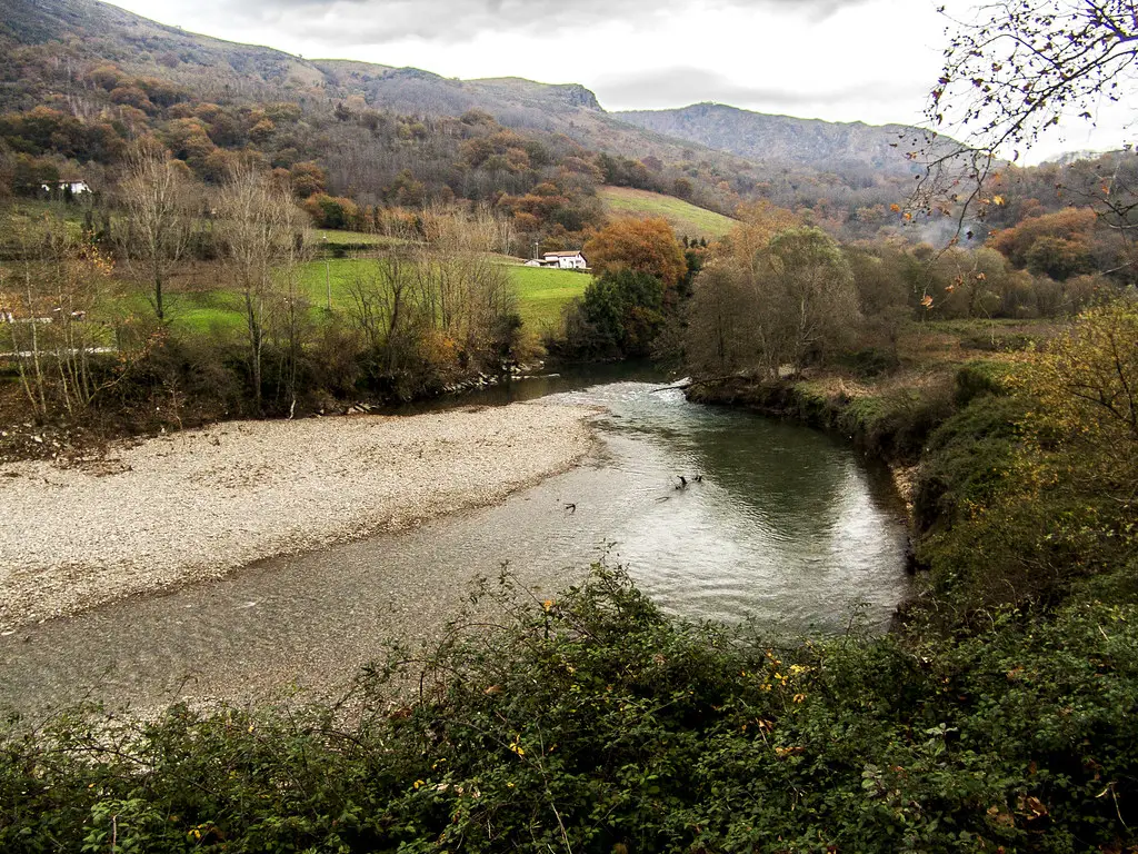
The source of the River Bidasoa stretches over 67 kilometres and rises from the peak of Astaté, very close to the town of Erratzu and the confluence of the Izpegui and Iztauz watercourses. This river was originally known as the Baztán, which was later changed to Bidasoa by the inhabitants of the town of Oronoz-Mugairi.
Its waters leave the Baztán valley to enter the Bertizarana valley, which is made up of the regions of Oieregi, Narbarte and Legasa. Along its course, the town of San Esteban is on the left, and later Sunbilla. In its last stretch it meets the border between Spain and France, just before reaching the Cantabrian Sea, between Hondarribia and Hendaye.
Map of the river
Along its course, the Bidasoa meets other rivers and regattas. These include the Ceberia regatta, the Ezcurra river, the Iruribieta ravine, the Laza river and the Echalar regatta, which reaches Endarlatsa in Navarre, 10 kilometres from the border between Spain and France. The following map shows the route the river takes through these towns:
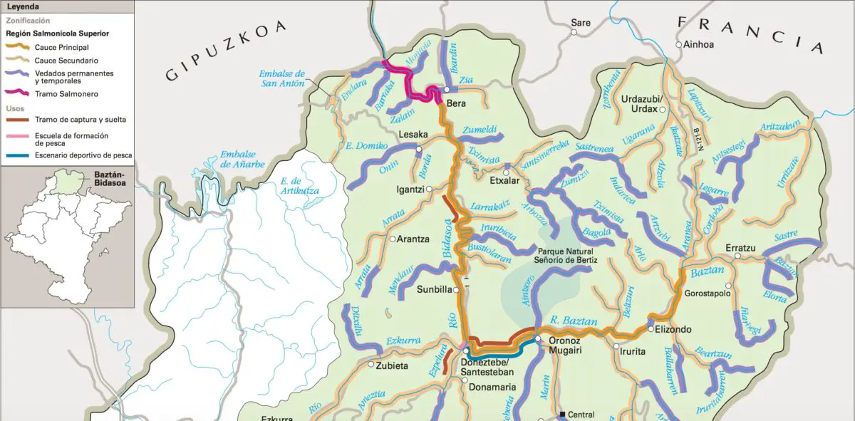
Municipalities and towns it crosses
The map of the Bidasoa River shows that it crosses several municipalities, including Doneztebe, Santesteban, Subilla and Igantzi: Doneztebe, Santesteban, Subilla and Igantzi, it passes through Lesaka, before Etxalar and then the town of Vera de Bidasoa.
Tributaries of the Bidasoa
Its most important tributaries are the Baztán (27 km), Ezkurra (20 km), Perumendi (8 km), Iruribieta (9 km), Latza (8 km), Tximista (19 km), Mugako and many others, since it is an area where many streams converge.
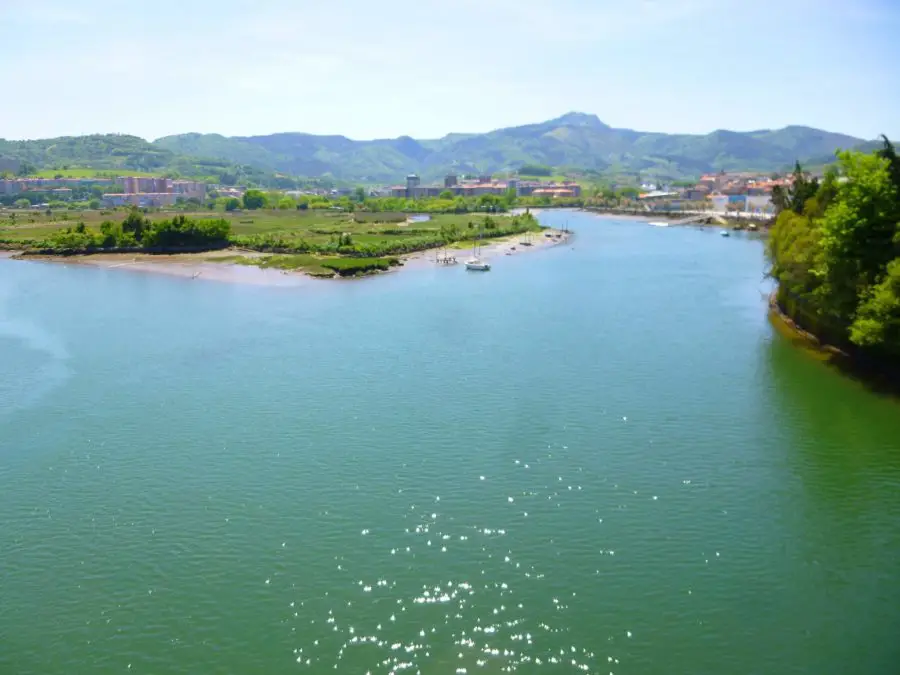
The mouth
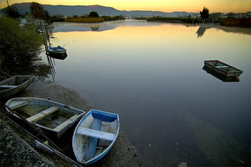
The mouth of the river is located between Hendaye (France) and Fuenterrabía (Spain), in the Cantabrian Sea, in the Bay of Chingudi, near Cape Higuer, creating the famous Chingudi Marshes, which are located in the areas of Jaizubia, Plaiundi, the Bidasoa Islands, Pheasant Island, among others.
It is important to mention that this is the second largest marsh in the country, followed by the Urdaibai marsh in Bizkaia. In its inner part, the Plaiaundi Ecological Park was created in 1999, thanks to the recovery of the marsh, which at that time was dry and damaged.
Climatology
The climatology of this river is very varied, considering that its extension covers several regions that tend to be different in this area. However, it is possible to take into account the seasons that correspond to the nearest regions, whose climate is similar to that of Hondarribia, warm and temperate, with fairly frequent rainfall.
As far as the town of Malkarroa is concerned, rainfall is also very frequent throughout the year, especially in the month of November, reaching at least 1,800 mm per year. There is no minimum amount of rainfall, as there are occasions when it does not occur, but most of the time it is a hot climate, similar to the humid oceanic climate.
Water system
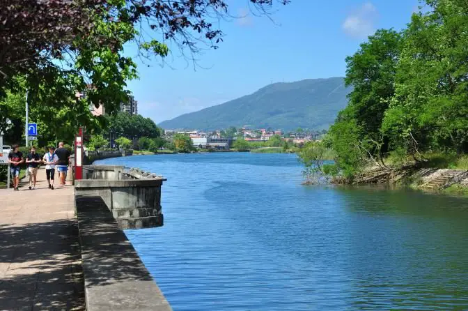
The hydrological system of Bidasoa is marked by two distribution points, the rivers Ezcurra and Batzan, which form part of the Bidasoa basin, from where its waters take different directions towards the outlet of the system, located on the border between Spain and France, to flow into the Cantabrian Sea.
Uses of the Bidasoa River
Natural forests are very abundant and have the greatest use in the area, covering at least 40% of the total surface. Meadows, on the other hand, form their own landscape with utilities for the livestock sector, without losing ground to the weeds that are a sign of the abandonment of this sector by the main economy.
There is no regular timber industry in the area, although there are mixed forests in the northern part, with enough raw material to supply this type of trade.
River Rafting
This is a non-competitive activity on the Bidasoa River that can be enjoyed by all types of people, from sports enthusiasts to beginners who want to be part of nature through canoeing.
It is a sport that consists of competing with kayaks, canoes or rafts, driven by one or more people, through calm or fast waters, with the paddle as the only means of propulsion. In the following video you can see how this strange sport is practised, which is a little different from what we are used to:
Protected areas
Almost a third of the river’s territory is protected by the Spanish environmental authorities, mainly in the southern part, where the Belate Community Site is located, with an extension of more than 140 square kilometres, and there is also a special area for the care of birds in the north-western part of Aritzakun.
Flora and fauna of the river
There are several species that are protected due to their high ecological value, including mammals such as the European mink, the otter and the Pyrenean desman, reptiles such as the pond turtle and birds such as the kingfisher and the dipper.
The Bidasoa marshes are undoubtedly one of the areas of greatest ecological interest, as they provide shelter and food for fish, amphibians and migratory birds from the north of the continent to the south of the Iberian Peninsula and Africa.
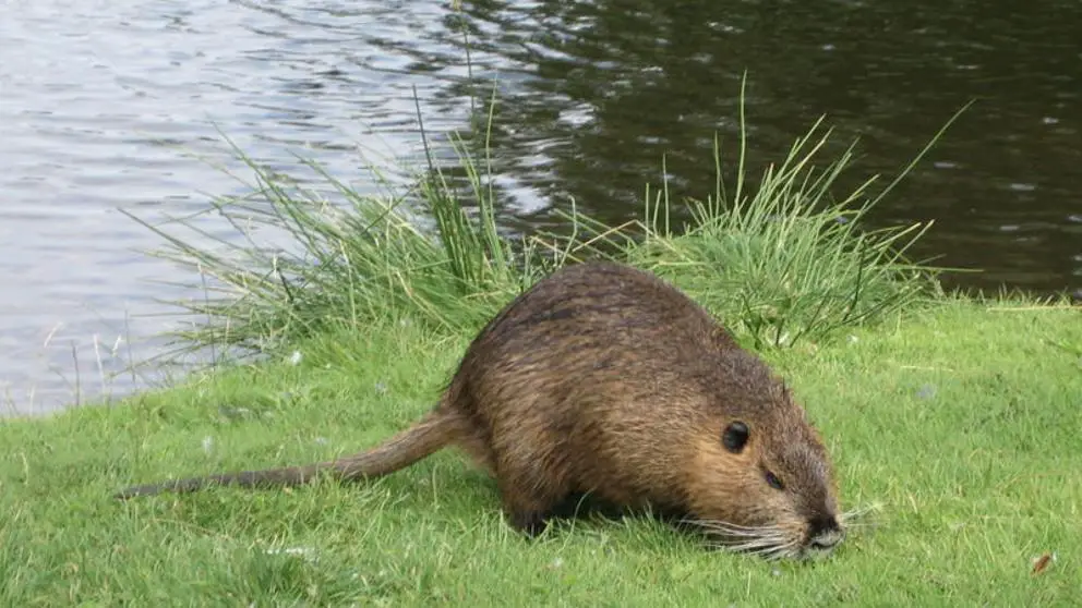
The trout and salmon that live in the river come here to lay their eggs, two of the symbolic species of the Bidasoa. There are also animal and plant species that are not part of the natural environment, such as the madrilla, the rainbow trout, the coipú or the acacia.
Pollution and environmental threats
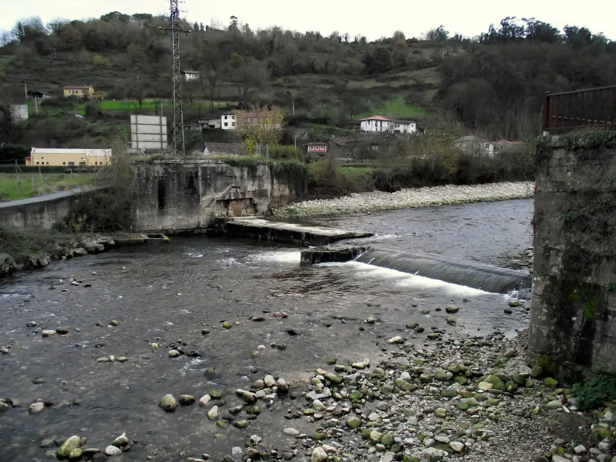
The waters of the Bidasoa River are so polluted with organic matter that fewer and fewer salmon are being caught. This damage is caused by the populations that border its waters, such as Elizondo, Lesaca, Vera de Bidasoa and Irún.
According to the studies carried out, this is a problem that has been brewing for ten years and has worsened over time to the point where the pollutants dumped in the river are killing all the organisms that live there.
The inhabitants of these places are demanding that at least two sewage treatment plants be built in the Lesaca area to treat the river water, because although there is currently one, it has never been in operation, precisely because it receives an excessive amount of river water and water from the subsoil. It is hoped that the local council and the surrounding industries will take action to resolve this situation so that the plant can become operational as soon as possible.
In the same vein, there is a steel industry known as “Laminaciones de Lesaca” which, according to ecologists, is one of the main causes of pollution in the river, as it discharges chemical components and industrial oils into the water that affect life in the river.
The Bidasoa River has recently been the victim of numerous pollution incidents, including a cyanide spill that burned much of its vegetation and killed hundreds of trout. The effects of all this damage have been reduced by the installation of the above-mentioned facilities.
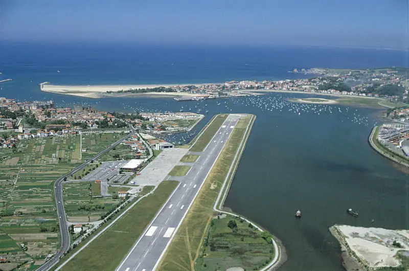
Other threats to the river’s environment include the San Sebastian airport, also known as Hondarribia airport, located at the mouth of the river, whose activities could affect the development of the natural life of this important element.
Between 2000 and 2009, a plan was drawn up to extend the runway a little so that safety strips could be created on both sides. To this end, the runway would be extended by at least 200 metres towards Irún and 50 metres towards the sea, from 1800 metres to 2000 metres.
However, many groups of residents are opposed to this extension, claiming that it will cause inconveniences such as noise. Likewise, the members of the Berdeak-Los Verdes organisation denounce the fact that the extension will be carried out in a reclaimed area thanks to the help of the LIFE, ZEPA and RAMSAR wetlands companies, for which reason it is believed that the extension of this airport will not be possible.
If you have enjoyed reading this article about the Bidasoa River, we invite you to continue discovering these different rivers:
- River Duratón
- River San Pedro
- Piedra River