
Last Updated on May 27, 2020 by Hernan Gimenez
Seine River: History, Birth, Location and More
Updated On January 16, 2020
The Seine River is the most important river in France, both for its route, its commercial and tourist wealth, and for being an inseparable icon of fame that accompanies the multifaceted Parisian life.
Seine River History
The history of the Seine River, former Sequana, can be fascinating, because in addition to being very important in the development of large European cities, it has witnessed countless events that range from the most sublime, like art and literature to historical events of great impact on world transformation. It is as famous as the Nile River and as fun to look at as the Detroit River.
With several centuries of existence, the Seine River has provided extraordinary cities like Paris to grow, for example, which gave it the motto that its inhabitants adopted in a unique way, which says: Fluctuatnecmergitur, “Floats, but does not sinks.”
Although the Seine River flows through several important cities in France, such as Troyes, Melun and Rouen, without a doubt for its capital, Paris, the river has an inseparable link to its history, being considered the backbone of the metropolis. It has been known, according to specialists that the beginnings of the so-called light city, were around one of the river islands, the island of Cité.
There are many legends that nourish and embellish the history of the Seine River and that give it that poetic and novel tone with which it seems to come alive as it happens with other famous historic rivers such as the Nile River, in Africa, for example.
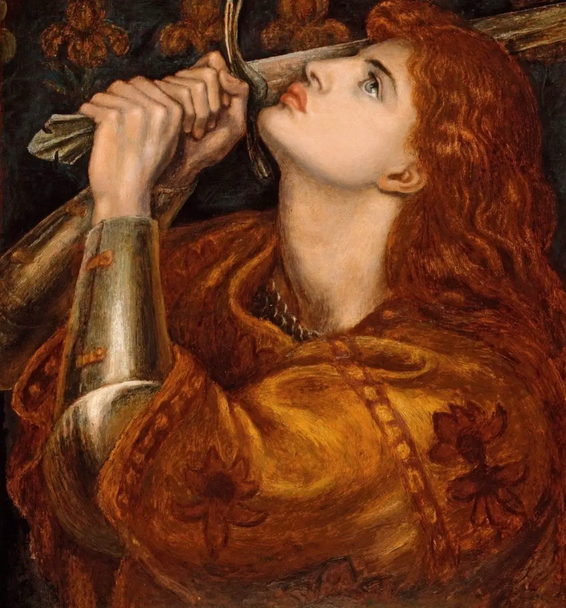
For example, it is said that the ashes of Joan of Arc were scattered in its waters, after being burned at the stake, in 1431.
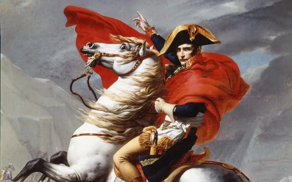
In Napoleon Bonaparte´s will, after his dead in 1825, he expressed the desire to be buried on the banks of the River Seine, although his request was not respected.
An event of significant impact on the history of the waters of the Seine was the massacre of Paris in 1961, whose victims drowned after being thrown into the river from the Saint-Michel bridge and other places in the capital city.
Another event involving the Seine River took place in 1944, during the Allied War against Germany, also known as Operation Overlord. There the allies intended to reach the Seine River in about 90 days, but managed to reach their goal much earlier than expected, after the collapse of the resistance of the German army in August.
Other event of historical importance that is worth mentioning was the achievement, in 1960, of stopping what is known as Le Mascaret, which meant preventing waves and tides in the Seine through dredging.
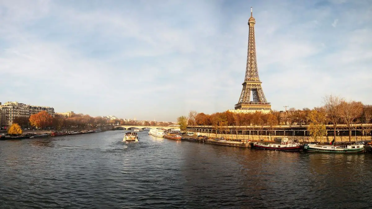
Likewise, the series of architectonic wonders built over many years around the Seine River (See also River Thames), give a unique and transcendent character to its history. The Eiffel Tower, a Parisian emblem, the Luvre Museum, the Place de la Concorde, the Grand and the PetitPalais, the Arc de Triomphe, the Haussmann boulevards, are just some examples of the architectural wealth guarded by the Seine.
In January 1910 the water levels of the Seine River in Paris increased notably, which produced heavy floods. Later, in the years 1924, 1955, 1982 and 1999 and 2000, the river again reached threatening heights and subsequently caused emergency alerts in Paris, due to possible floods in 2003, approximately 100 thousand works of art were moved out of the city. This was the most important protection program of art work relocation since World War II.
Since ancient times, much of the art remains in underground warehouses that could be flooded and according to a study prepared in 2002 an event of flooding of the Seine in its greater proportion would cost 10 billion euros and would suspend public services which could leave the city without telephone, gas and electricity.
Below the Island of the Cité, next to Notre Dame, you can still see remains of the Gallo-Roman town that was located in that spot millennia ago living in a very different environment than today (See also Amazon River). For example, the canoes found in that locality dating back more than 6000 years ago shown that this first settlers adapted very easily to the riverside life.
The ancient Romans built very solid bridges to protect the great currents in each region and learned to take advantage of the points where some island divided the riverbed into two or more parts to find surface solidity and better river traffic, as well as an environment optimal for trade which contributed to the basic sustenance and development of the towns.
As a result of this successful strategy, important cities and places of great commercial importance emerged. The city of Paris represents one of those. It is an island in the middle of the river current that turned out perfect to build the metropolis that we now can enjoy.
Currently, the Seine River in Paris is still literally linked to the city, and vice versa. The flow of the river divides the great capital, cradle of poets and painters, into two halves. In land there are large and beautiful buildings and over the mighty but meek waters, countless bridges, of very varied architectural styles.
You can no longer see those simple canoes that used to exist since ancient times in the Seine River, instead, commercial transport ships cross the waters as well as passenger boats filled with tourist eager to contemplate the cultural wealth that remains in both sides of the stream.
Birth and Location
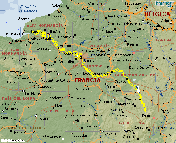
The river Seine is a European current of the Atlantic slope, located in the north of France. It has its birth at about 470 meters above sea level, on the Langres plateau, near Dijon, in the department of Côte-d’Or and flows northwest through the cities of Troyes, Fontainebleau, Paris and Rouen, until it reaches its mouth in a wide estuary between Havre and Honfleur, to the northwest, in the Bay of the Seine, in the English Channel.
The Seine is the second longest river in France, after the Rhone (although part of it moves through Swiss territory), with 776 kilometers in length. Its basin reaches 78650 square kilometers, being mostly within the Bassin parissien or Parisian basin, which from a geological point of view, is basically a sedimentary basin that seems to have the shape of an open bucket towards the English Canal and the Atlantic Ocean.
This basin includes geological formations that form a steep slope in convergence towards the center, interposing important aquifer formations between them. Its relief generally does not rise above 300 meters, with the exception of the southeast margin located at the height of the Morvan where it culminates at 900 m.
The Seine River is born or has its birth as we mentioned earlier about 470 meters above sea level. The Seine is navigable from Bar-sur-Seine, more than 563 kilometers from its mouth, for small boats, and for others with greater weight capacity, to Rouen, about 121 kilometers from its mouth.
Route and length of the Seine River
Along its extension of 776 kilometers, the Seine River makes a route that can be divided into five parts which are:
- The Little Seine or Petite Seine, which runs from its source to the Montereau-Fault-Yonne commune at the confluence with the Yonne river.
- The Upper Seine or Haute Seine starts from Montereau-Fault-Yonne and ends in Paris.
- The course of the crossing of Paris, called the Paris Canal.
- The Lower Seine or Basse Seine flows from Paris to Rouen.
- The Seine Maritime is the stretch flowing from Rouen to the English Canal.
It expands as it passes through Châtillon, and near Romilly it is joined by the Aube River, and then, in the Montereau Valley where the Yonne river becomes a tributary, and arriving in Paris the Marne also joins it by its right bank. Additionally, a few kilometers after passing the capital city, the Oise River also joins to the right, although it is kilometers after the French capital.
During its constant flow towards the sea, the Seine River slows its course and in the formation of the bay of Le Havre, it makes its way to the North Sea. There, at the junction of the river with the sea, it forms a large estuary that years ago experienced the phenomenon known as macareo, which is a sea wave that goes back in the opposite direction to a river.
Also in its extensive route, the waters of the Seine River cross four important regions and 14 departments, which are: in the region of Burgundy-Franche-Comté, the department of Cöte-b´Or; in the Great East region, the departments of Aube and Marne; in the deÏle-de-France region, the departments of Seine-et-arne, Essonne, Val-de-Marne, Paris, Hauts-de-Seine, Seine-Saint-Denis, Val-d’Oise and Yvelines; and in the Normandy region, the departments of Eure, Seine Maritime and Calvados (located at the end of the mouth).
On its journey the river flows into some important cities such as Troyes, Melun, Rouen and especially the capital, Paris, which is flanked by its two margins. From Source-Seine, which was the old-Saint-Germain-Source-Seine, to Honfleur, there are 164 riverside communes on the Seine, including Paris and one of them, L’Île-Saint-Denis is located on the homonymous island.
The current of the Siena River presents variations in its route, finding tides and waves at different points, which have been controlled with the use of technologies and different tools that men has implementing over time, in order to avoid accident risks .
Until the 1800s the Siena was considerably less deep, so it was impossible for large ships no navigate it, until approximately 1910, when a great flood took place due to torrential rains that caused a substantial increase in the water level which les to an inquiry into new strategies to allow navigation means without major danger.
The flow of this great French river is somehow regular, but preventive measures have been taken against possible changes in the current of its waters. When it reaches the capital it is only 24 meters above sea level and 445 kilometers from its mouth, which allows it to flow slowly and much more easily to sail.
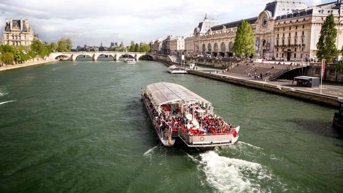
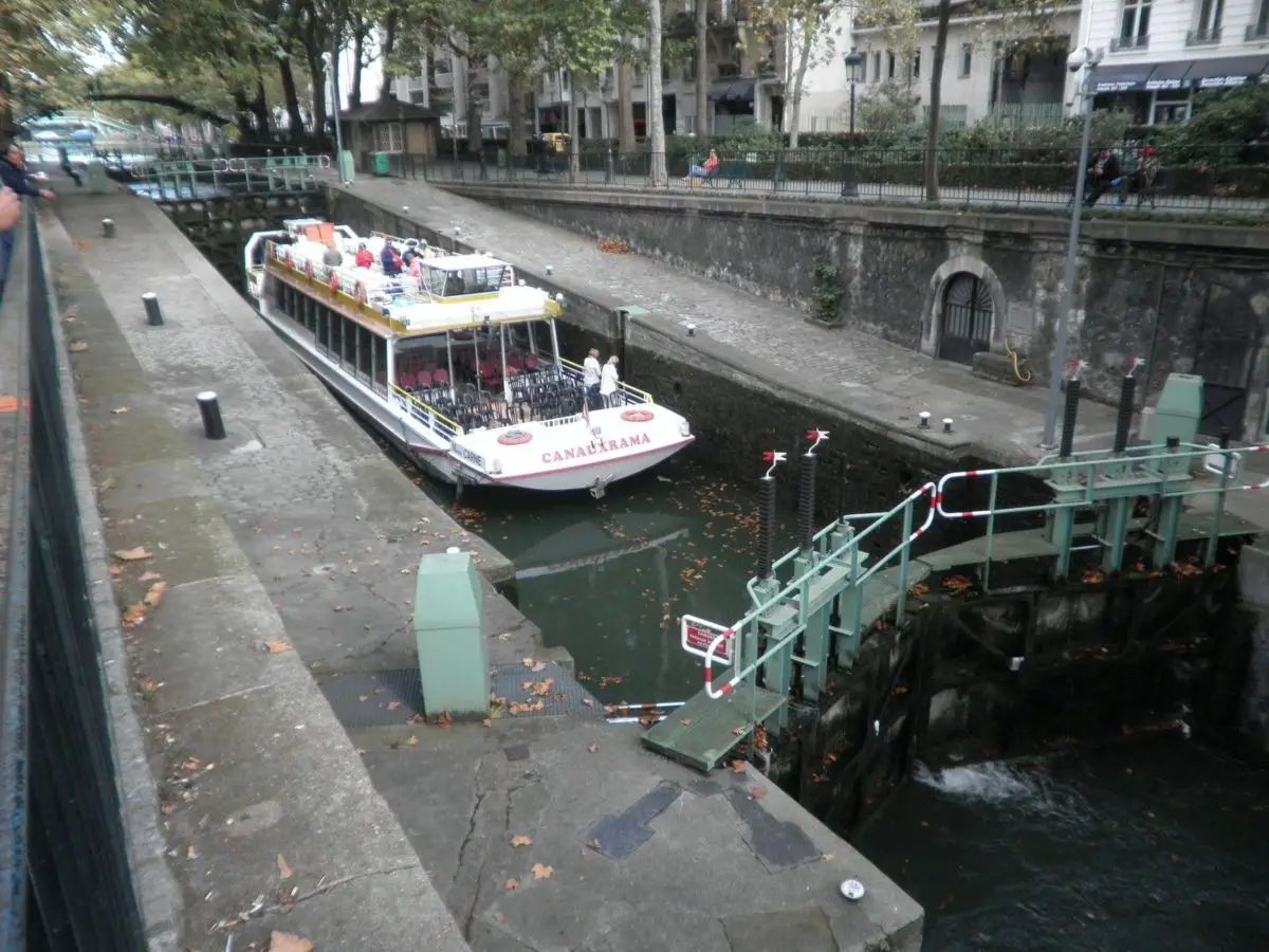
The Seine River is today an excellent option for commercial transport and commercial exchange, and without a doubt, an ideal way for tourist transportation as well as people in general between various places in the region. The famous bateaux mouches “fly boats” are very popular and picturesque.
There is a latent important project to implement daily transport by river, which seeks among other things, reducing the existing pollution and offer a new alternative to vehicle traffic and the subway, which also already becomes too saturated in peak hours.
Commercial vessels can navigate the Seine River from the commune of Bar-sur-Seine (east), 560 kilometers from its mouth and transatlantic ships can dock in Rouen, 120 kilometers from the sea. The area of the river where the tides can be agitated, from Le Havre to beyond Rouen, is followed by a stretch that is channeled with four large locks thru the mouth of the Oise in the commune of Conflans-Sainte-Honorine (northwest) .
Two other multiple locks are located at the height of Bougival and in Suresnes, near Paris, to raise the ships to the level of the river in the French capital, where the mouth of the Marne River can be reach. From there, upstream, more locks ensure navigation to Saint Mammä, where the Loing flows.
Then, through the eighth sluice, the Yonne River is reached in the commune of Montereau and from its mouth, other larger ships can continue along the river until they reach Nogent-sur-Seine. From there, the river is only navigable for small boats. Later, any form of navigation ends at the height of the commune of Marcilly-sur-Seine, where the old canal of the Upper Seine again allows the passage of the boats until Troyes.
Before the 1800s, when the locks were put in place to artificially raise the level of the Seine River, it was less deep, and it was practically a small continuous water canal, bordered by sandy shores.
Now the depth is carefully controlled, allowing the canal to remain with a good water level and with a relatively slow flow which only changes occasionally turning little faster after periods of heavy rain, although it does not rain as much as in the banks of other rivers like those from South America, like the Cauca River or from Africa, like the Mekong River.
The Seine River passes through Brussels, capital of Belgium and the French towns of Burgundy, Champagne-Ardenne, Ile-de-France, Upper Normandy and Lower Normandy.
Tributaries of the Seine River
The Seine River receives tributaries that nourish and enrich its waters, at various heights of its route.
Among the tributaries of the Seine River to the north the main ones are the Aube river, the Marne river and the Oise river and, from the southern part, it is joined by the Yonne river and the Eure river.
It also receives water through of the Escalde, the Meuse river, the Rhine river, the Saôna river and the Loire river, completing its water sources to continuing its flow until it reaches the Atlantic Ocean.
The Seine river map shows its route and extension
As for the location and map of the Seine River below you can see all the terrain that covers and the entire route that it has, from its birth to its mouth.
Mouth of the Seine River
The Seine River flows into a wide estuary located between Havre and Honfleur, in the Seine Bay, in the English Canal.
The Canal de la Mancha area is characterized by great diversity and beauty in its landscapes, with marshes, cliffs, dunes and extensive sandy beaches washed by the tides.
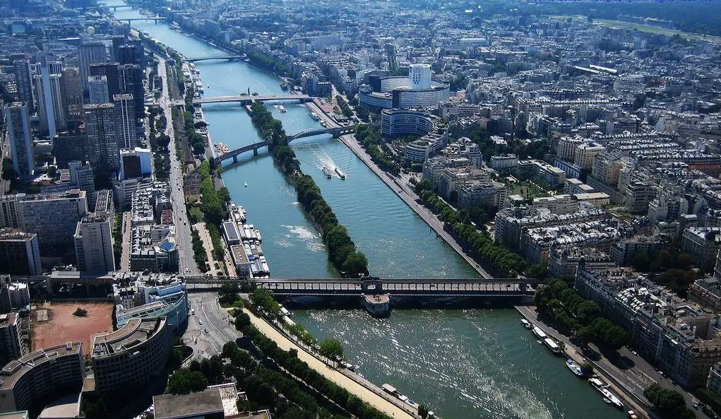
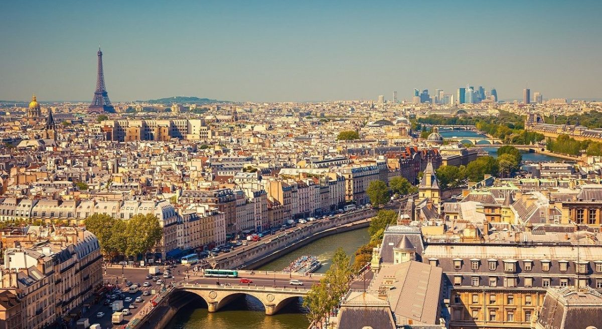
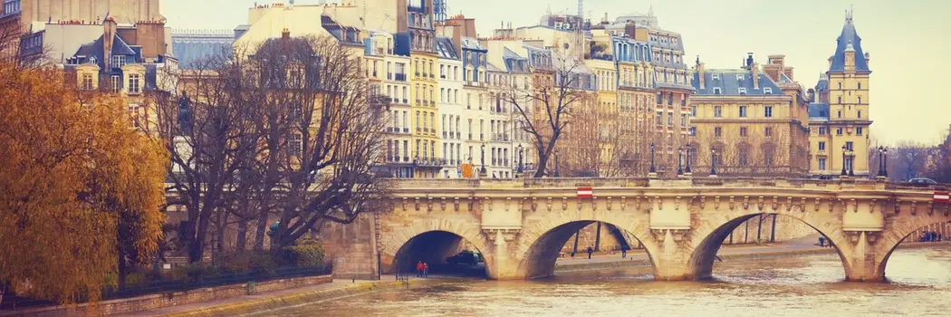
Seine River in Paris
When heading west towards the Norman estuary, the Seine River flows through the city of Paris and divides it into two, one bordering it to the right and another to the left, with views as beautifully picturesque as those of the River Rhine.
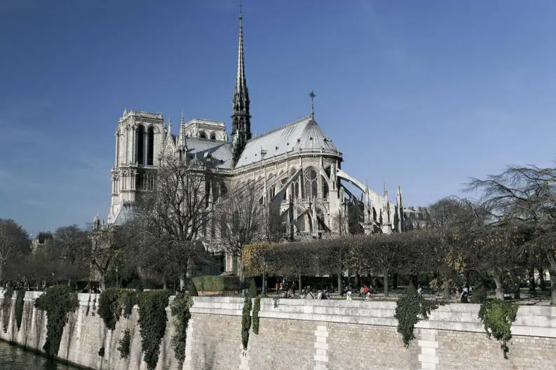
On the banks of the Seine in Paris you can see some of the most beautiful monuments of the capital of France, from the Eiffel Tower to the Notre-Dame Cathedral through Concord, but also the historic bridges that unites the two stretches of land.
The two banks are inscribed on the Unesco World Heritage list since 1991. The inscription that the Seine River received on the World Heritage Site only refers to the banks and monuments that were built there.
On the right bank or Droite River is the Town Hall, also known as Hotel de Ville. Also located on that side are the Musée Picasso, the Musée Carnavales and the Musée National d’Art Modern, among others. And in the famous Maison that bears his name lived Victor Hugo.
In addition the Tuileries Garden, the Jeu de Paume, the Orangerie, the Arc de Triomphe above the tunnel where Diana of Wales died we can found the Place de l’alma.
The Gauche Rive or left bank is no less striking and interesting. There we can found the Eiffel Tower, followed by Les Invalides where the remains of Napoleon rest, it is also home to the Army Museum and others such as the Musée Rodin and the Musée d’Orsay, behind which the Latino Neighborhood is located, with two immense green spaces: the Luxembourg Garden and the Plantes Garden.
Curiosities of the Seine River
There are many legends and curiosities of the Seine River among them the fact that its banks have been included in the UNESCO World Heritage List since 1991.
Important 19th and 20th century painters such as Vuillard, Richard Parkes Bonington, Albert Marquet, Eugène Isabey and Camille Corot among others were inspired by the Seine River to create great masterpieces.
Also Astor Piazzolla a tango artists dedicated a song to the Seine River itself and writers like Victor Hugo also dedicated part of his work likes the novel Les Miserables, where he explains how one of the protagonists was able to escape from the sewers of this wide river.
The legends of the Seine River have also inspired great artists of the twentieth century such as Rainer Maria Rilke and Vladimir Nabokov, as happened with the legend of the mortuary mask of a young woman found on its banks.
Seine River contamination
The Seine River like the other European rivers and almost every river in the world has been affected by industrial contamination. With the aggravating factor in the case of this river of its reception of domestic sewage which has caused a very serious damage to its ecosystem.
During the 1920s, the authorities responsible for the maintenance of the Seine tried to find solutions to these environmental problems, but it wasn´t until 1960 that the French started to make adequate investments in the construction of wastewater treatment plants.
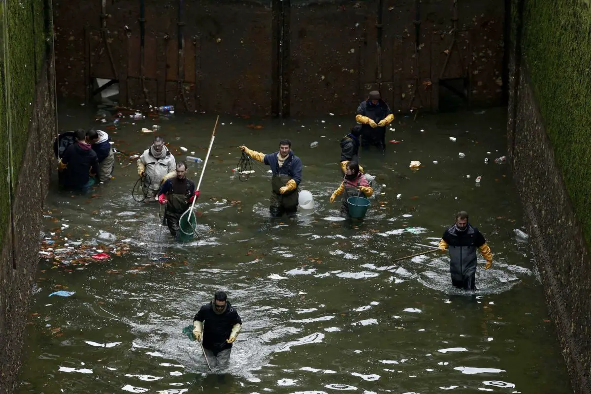
The sanitation process has been slow, but fortunately considerable achievements have been made and today about 30 species of fish can be found in the river.
The operation began with eleven stations and by the year 2008, many more had already been added to reach two thousand. Various laws that regulate the subject were also passed. Companies that pour inappropriate substances into the water and between 100 and 150 euros per hectare were offered as a monetary incentive to farmers who live near the river to encourage them to not contaminate the river. The goal is to totally decontaminate the Seine River.
Seine River in Brussels
The city of Brussels was founded around 979 in the Seine River valley, but there is a peculiar part of its history where this beautiful European city seemed to have no river around it.
Why? It will be interesting to find out.
By the middle of the 19th century, the center of the city of Brussels was divided into two quite different sectors. The first was the upper area, where the Royal Palace or Mont des Arts is located, and in which the bourgeoisie and the nobility lived.
The second was the lower part of the city, crossed by the Seine or Senne River, which in turn was divided into two sides before entering the Anderlecht area and forming two islands in the middle of the city. The largest of them was the so-called island of Saint Géry, and in whose surroundings, the Senne River became a stream of polluted and unhealthy water thanks to the high population density that existed, coupled with the fact that it was an industrial zone.
At the time several periods of drought and constant floods, as well as a severe cholera epidemic attributed to the low living conditions of the population and the pollution of the river, led the authorities to seek solutions and ways to end the problem that affected so many people and multiplied to other areas.
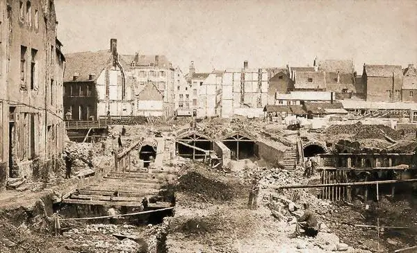
Various studies, plans and ambitious projects were carried out on which the idea of burying the river as it passed through the city prevailed. The plan belonged to the architect Léon Suys, and was presented in 1865, supported by Mayor Jules Anspach.
Once the water was channeled that way, several “Y” shaped boulevards were built that currently cross the center of Brussels, communicating the northern (Nord) and southern (Midi) stations. Since then a period of great transformation to the city center began resulting in the inhabitants of the area ceasing to have their river in sight.
Thus, the Seine River is completely domed, and you can only appreciate a museum located in the port of Anderlecht and Saint-Gery, between the Convent of Poor Clares and the Golden Lion, in the building located at the place of Saint Géry number 21-23.
This somewhat hidden history of the Seine River in Brussels creates a lot of curiosity among those who discover it and many inhabitants and visitors of the city have ventured down to the underground galleries through which the water circulates under the city, and even the artist Laurent Taquin made a musical sculpture that was installed in the area where the Senne is visible.
Bridges of the Seine River
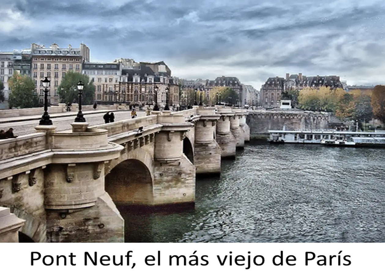
There are a total of thirty-seven bridges crossing over the Seine River only in Paris, and a few others on its route outside the city. Among the Parisian bridges, the Louis-Philippe Bridge and the Neuf Bridge stand out, both of which date back to 1607.
It is worth mentioning the important bridge of the Tournelle which connects the districts IV and V of the city. However, it is now known thanks to history and data provided by the inhabitants of the area that this is not the first bridge built there, but that many constructions of territorial and transit communication preceded it.
Much earlier there was a wooden bridge that was partially destroyed by a flood in 1651. It was restored in 1956, with stone as the main material but in 1918 it was again destroyed, giving way to the construction of the one currently standing.
Its name comes from its proximity with a small tower that is part of the fence of Felipe Augusto and that was later replaced by a small castle. This bridge consists of a large central arch and two lateral arches adorned by a 15 m high pillar. Additionally it has an extraordinary statue of Santa Genoveva, patron saint of Paris made by the artist Paul Landowski.
Outside the city there are also a few bridges, from which is important to mentioned the Normandy Bridge, one of the longest cable-stayed bridges in the world, linking Le Havre with Honfleur.
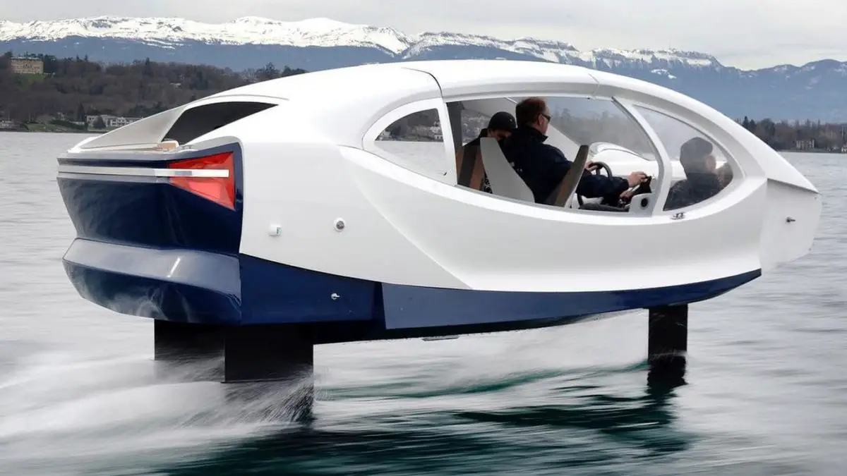
The innovative electric boat that sails the Seine
Thru this magnificent river sailed the first fully electric ship. It is called Seabubble and works entirely using electric power that feeds its two engines and also works with a technology called hydrofoils which reduces the drag of the ship on the water making the navigation more pleasant and being an electric boat significantly reduces water contamination.
Flora and fauna of the Seine River
Now this is the most used river in France and has a great amount of flora and fauna species that inhabits it. Although with the accelerated progress of commercialization this has been reduced a great variety of fish can be found such as: Lota several sections of its course, as well as European pikes. In another parts of the higher cause there are perches, spiny loins, and also species like the river wolf, etc.