Last Updated on May 27, 2020 by Hernan Gimenez
Paraná River: history, origin, characteristics, height, and much more
Updated On January 16, 2020
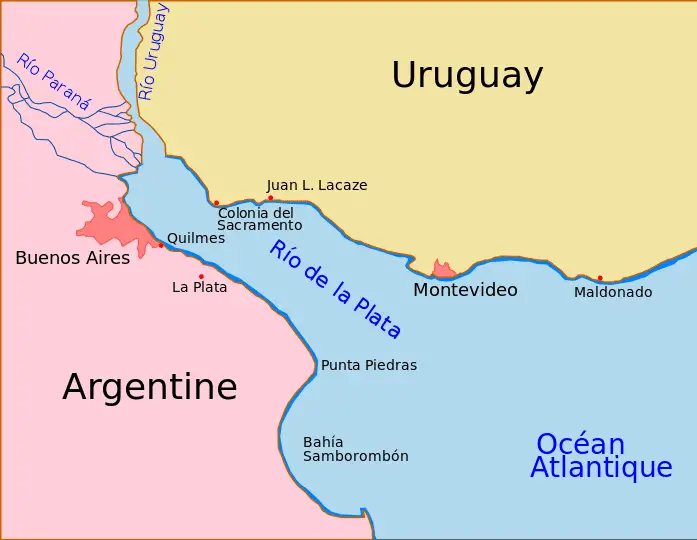
The Paraná River, the South American river, the second longest after the Amazonian, rises on the plateau of southeastern Brazil and generally flows south to the point where, after a journey of 3,032 miles (4,880 km), it joins the Uruguay River to form the vast Atlantic Ocean estuary on the Río de la Plata.
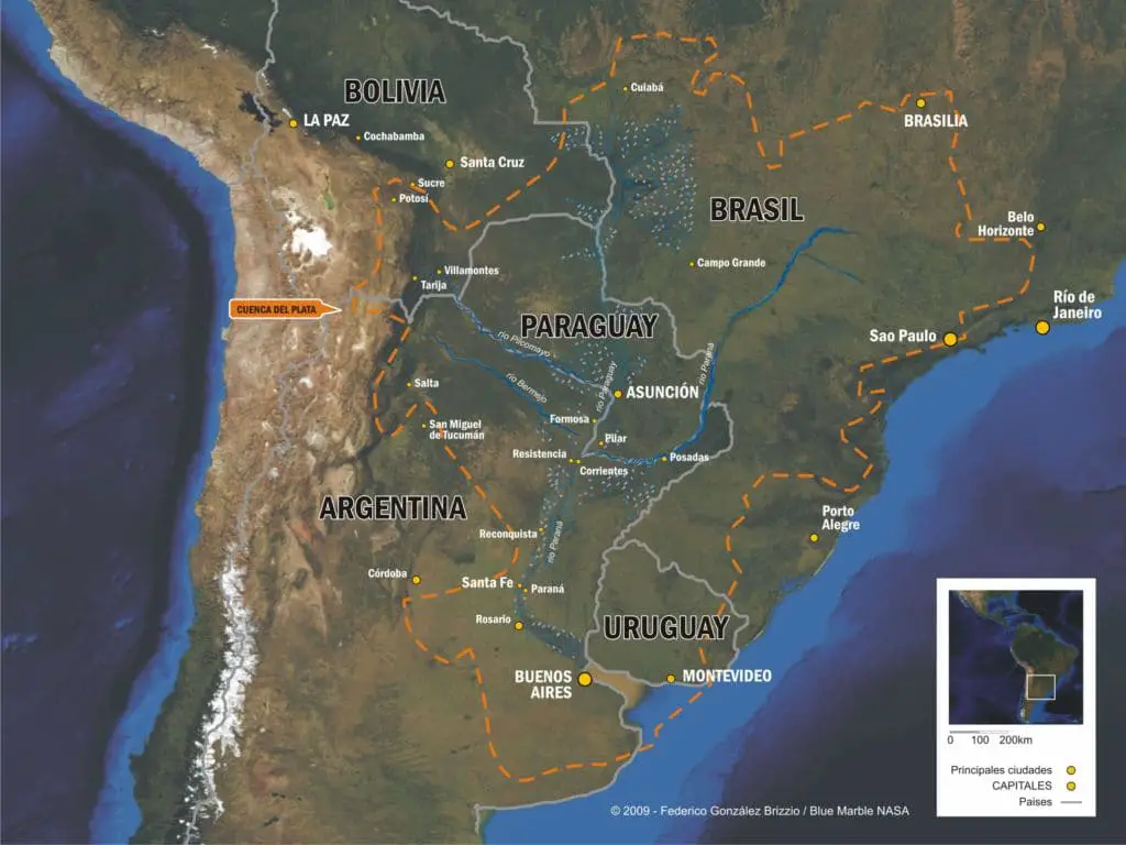
The Paraná River drainage basin, with an area of approximately 1,081,000 square miles (2,800,000 square km), includes most of southeastern Brazil, Paraguay, southeastern Bolivia and northern Argentina.
From its birth at the junction of the Grande and Paranaíba rivers to its confluence with the Paraguay River, the river is known as the Alto (High) Paraná. This upper basin includes three important rivers, the Tiete, the Paranapanema and the Iguazú, all three have their sources near the Atlantic coast in the southeast of Brazil.
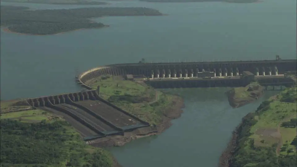
The route of the Alto Paraná through the mountains was previously marked by the Guaíra Falls; this series of massive waterfalls was completely submerged in the early 1980s by the reservoir of the recently built Itaipu hydroelectric complex, which runs along the Upper Paraná.
History of the Paraná River
The first European to travel to the “Father of the Waters” (of the Guaraní language) was Sebastian Cabot in 1526. In 1525 Cabot took charge of a Spanish expedition of three ships destined to develop trade with the East.
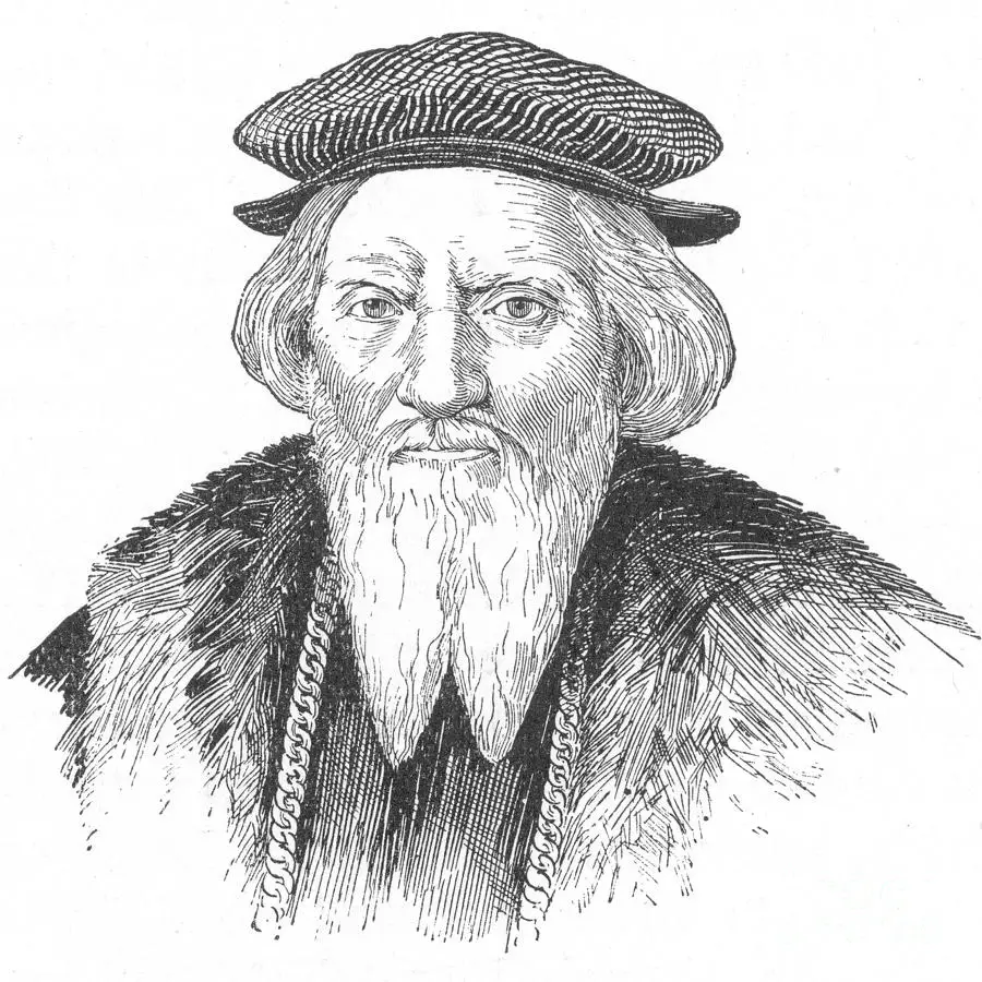
However, he diverted the expedition to the South American continent due to reports of fabulous wealth in the Río de la Plata region. After three years of what was considered a fruitless exploration, he returned to Spain where he was held responsible for the failure of the expedition, and was banished to Africa.
The Europeans had a great steam merchant and the warships became capable of navigating the rivers at good speed and with heavy load. Lord Palmerston was the first to propose the use of vapors for trading along the internal waters of Argentina in 1841.
This technology allowed the British and French governments to avoid Argentine customs in Buenos Aires by navigating directly through the Plata estuary and participating in trade directly with the cities of the interior of the country.
This avoided taxes, guaranteed special rights for Europeans and allowed them to export their products at a lower price.
The Rosas government tried to stop this practice by declaring that the Argentine rivers were closed to foreign countries, preventing access to Paraguay and other ports in the process.
The governments of England and France ignored the statements and decided to face Rosas heading down the river with several warships, setting the stage for a military confrontation, which finally took place in the Battle of Vuelta de Obligado.

The first steamboats on the Paraná River were warships that sailed the waters around 1840. The Argentine navy built PS Merced in 1849. The ability of ships to overcome the currents was an asset. It allowed the trade of supplies from inner republics like Paraguay. The rivalry between Argentina, Brazil and Paraguay in the 1840s resulted in Argentina closing the river to international trade, bottling Paraguay.
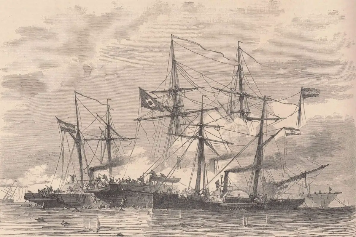
On June 11, 1865, Brazilian and Paraguayan ships met at the Paraguay-Argentina border. Paraguay’s naval squad consisted of 23 steamboats and other five ships that could navigate the river. The Paraguayans passed in a line parallel to the Brazilian fleet and continued along the current.
Following Captain Meza’s order, the entire fleet opened fire on the docked Brazilian vapors. The ground troops rushed, realizing they were under attack, boarded their own ships and began returning the fire.
One of the Paraguayan vapors was hit in the boiler and one of the “flat” was also damaged. Once out of reach, they turned upstream and anchored the flat, forming a line in a very narrow part of the river. This was meant to enclose the Brazilian fleet.
Naval Battle in Humaita, 1866
Admiral Barroso noticed the Paraguayan tactics and went downstream to go after the Paraguayans. However, Paraguayans began firing from the shore towards the main ship, Belmonte.
The second ship on the line, Jequitinhonha, inadvertently turned upstream and was followed by the entire fleet, thus leaving Belmonte alone to receive the full firepower of the Paraguayan fleet; He was soon out of combat. Jequitinhonha ran aground after the turn, becoming an easy prey for Paraguayans.
The four steamboats sailed down the Amazonian River. The Paraguayan admiral (Meza) left his position and attacked the Brazilian line, sending three ships after Araguari.
Parnaíba remained near Jequitinhonha and was also attacked by three ships. The Brazilian line was effectively cut in two. A fierce battle was taking place within Parnaíba when the Marlin de Olinda joined the attackers.
Barroso, at this time sailing upstream, made the decision to change the course of the battle with several actions. The first ship that faced Amazonas was the Paraguarí, which was rammed and put out of combat.
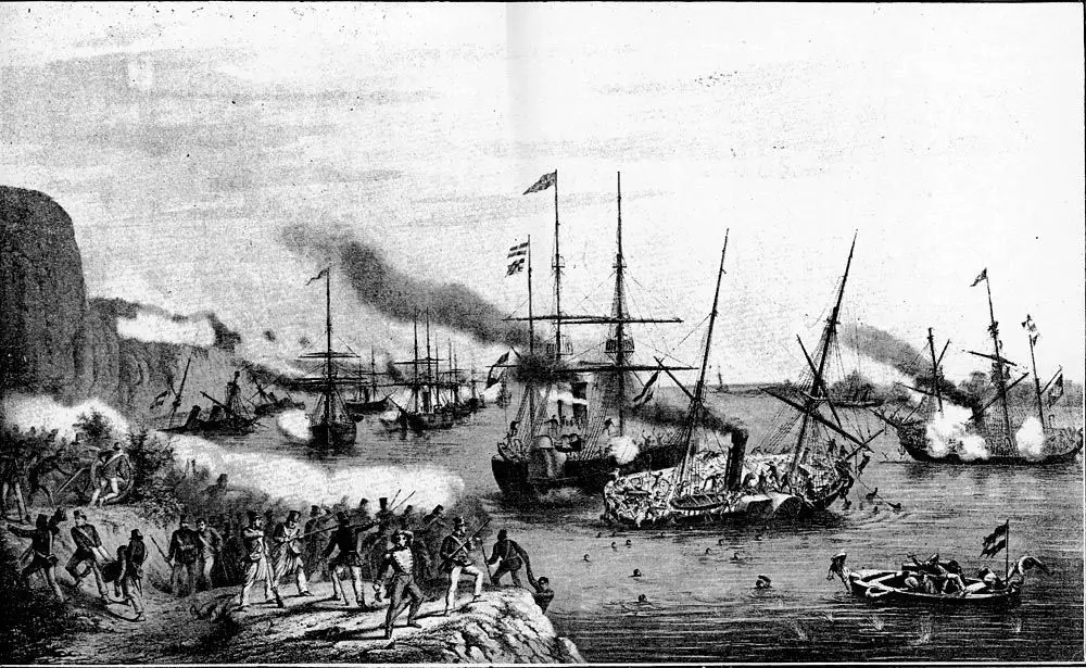
Then he rammed Márquez de Olinda and Salto, and sank a “flat.” At this point, Paraguarí was already out of action. Therefore, the Paraguayans tried to separate. Beberibe and Araguari pursued the Paraguayans, causing serious damage to Tacuary and Pirabebé, but the nightfall prevented the sinking of these ships.
Admiral Barroso, aboard the Amazon steam, trying to avoid chaos and reorganize the Brazilian fleet, decided to take the fleet back to the current and fight the Paraguayans to prevent their escape, instead of saving the Amazon.
The Jequitinhonha had to be set on fire by Paraguarí and Márquez de Olinda. At the end, the Paraguayans lost four vapors and all the “flats”, while the Brazilians only lost the Jequitinhonha.
A new Argentine government under Justo José de Urquiza opened the river to international trade in 1852. The Paraná River soon became the main exploration route in the interior of the South American continent.
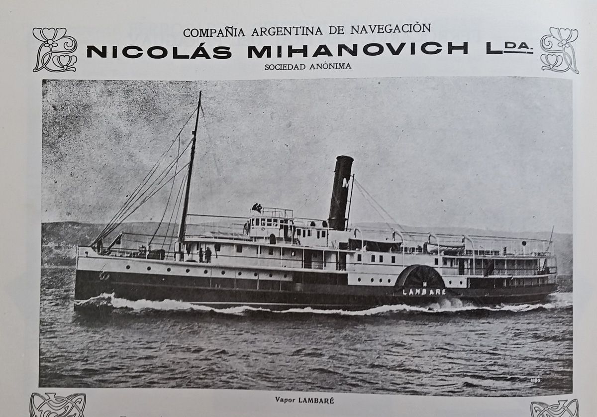
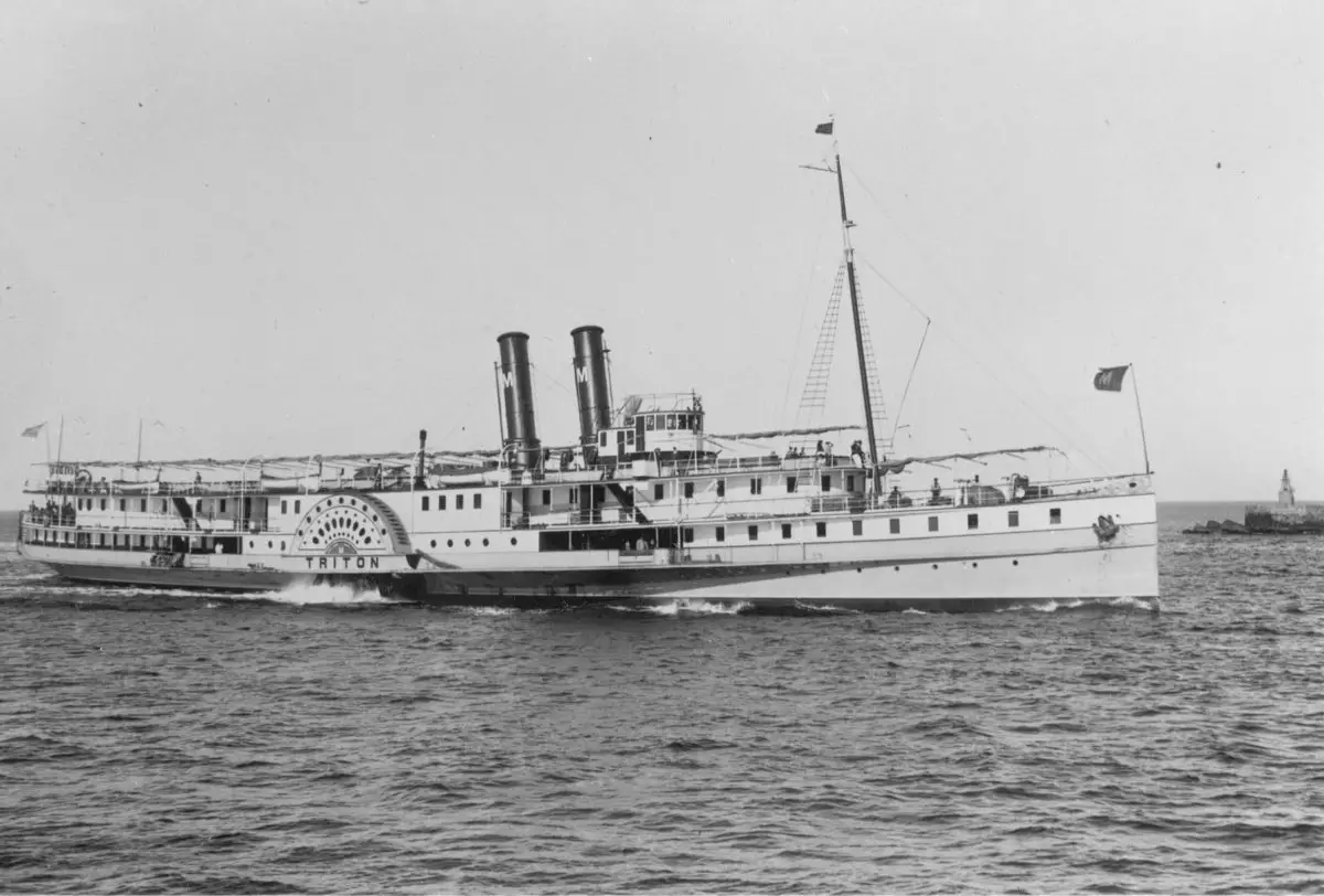
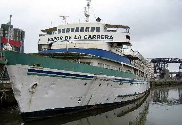
Nicholas Mihanovich
Nicolás Mihanovich was from Dalmatia and emigrated to Uruguay in 1864. He later became a shipping magnate in Argentina. His company dominated trade and passenger steam traffic on the Paraná and Paraguay rivers until 1948 in galleys similar to those of the Mississippi River.
The vapors of the Buenos Aires-Asunción service leave Buenos Aires on Sundays and Thursdays and Asunción on the same days. Four vapors are used in this race. The trip upstream requires a little more than four days and the return about three days.
The fares for the ticket between the two cities are the following: First class, one way, 110 Argentine pesos ($ 46.76); round trip, 192.60 pesos ($ 81.76); second class, one way, 66 pesos ($ 23.36); round trip, 96.26 pesos ($ 40.90).
Roundtrip tickets are valid for three months. The baggage allowance is 50 kilos (110 pounds), but this maximum is interpreted liberally. The accommodations are very comfortable and, in general, the trip is one of the most pleasant to be made in South America.
On the lines north of Asunción, rates are higher and rooms for travelers are poorer. Between Asunción and Buenos Aires, Mihanovich steamers are forced to compete with the international train, but in Upper Paraguay there is no competition.
The stops are more frequent, since the vapors are directed towards any stay house on the banks where signaling cannons are fired or where there is cargo or passengers.
In addition, the vapors moor on the shore for two or three hours each day, while enough firewood is taken to feed the boilers until another woodpile is reached the next day. This wood costs the company at a rate of 3 cents of gold per bar.
Although the service is much lower than that of the largest vapors in Buenos Aires-Asunción, the boats are comfortable and the landscape is more picturesque than in the lowest part of the country through which the river flows south.
Other vapors of the Paraná-Paraguay River
Among other cargo services offered to Paraguayan shippers are those maintained by Domingo Barthe Co. and Augusto Bisso. Although Barthe’s interests are largely limited to the Alto Paraná region, this company still operates cargo ships between Asunción and Buenos Aires.
By agreement with Mihanovich Co., they offer the same rate of cost that is charge on that line. Augusto Bisso has chartered a number of cargo ships and is now conducting a general maritime business between Puerto Max, Concepción, Asunción and the Río de la Plata.
The company’s current fleet consists of four vapors of 150 to 370 tons, two of 600 tons each and two of 1,000 tons. The latter, Cerea and Miranda are the largest ships to sail the Paraguay River.
In addition to these, there are 36 lighters, three of which carry 700 tons of cargo each, representing a total tonnage of 8,165. There are also eight tugs in the fleet. Twenty oil combustion vapors are been constructed in the United States, to be employed in the company’s service. Most of the ships in the existing fleet have been rented to Lloyd Brasileiro, which maintained a navigation service in Paraguay-Paraná before the war.
In fact, there is a very close relationship between the two companies. The Brazilian government exercises a great measure of control over the operations of the new company’s transport service and the company’s ship officers are at the same time officers of the national navy.
Llovd’s schedule was too intermittent to be trusted and his operations were generally too slow, but his successor promised local consignors the same facilities offered by Mihanovich Co.
The Minas e Viacao Company plans to operate at least one ship per week between Corumbá and Montevideo. The only stop at an Argentinian port is in Rosario, since Argentine law prohibits foreign-owned shipping companies from conducting a coastal trade between its ports.
In Paraguay, their vessels stop in Asunción, Concepción and other river ports. The company has promised to facilitate transshipment or trading in Montevideo between ships sailing from the United States and Europe and their own riverboats.
As the expenses and delays caused by the transshipment in the ports of the Río de la Plata have been one of the biggest obstacles to Paraguay’s foreign trade, any attempt to alleviate this and establish more direct and faster connections with the outside world is enthusiastically received by Paraguayan commercial interests.
Characteristics and Location of the Paraná River
Among the characteristics of the Paraná River, we can mention that together with its tributaries, it forms the largest of the two river systems that flow into the Río de la Plata. It is 3,032 miles (4,880 km) long and extends from the confluence of the Grande and Paranaíba rivers in southern Brazil, generally running southwest most of its course, before turning southeast to flow into the Rio de la Plata.
The Paraná River name means from Tupi to: “sea” and na: “like”, which means “that resembles the sea” or “like the sea”. It is the main river that forms the La Plata Basin.
When considered in its total length to the mouth of the Río de la Plata, in Buenos Aires, it is the eighth largest river in the world with an area of 4,880 km and the largest in South America after the Amazonian River.
Another very important characteristic of the Paraná River is that it is also the tenth largest in the world in flux, draining much of Central South America, including part of five states in Brazil. Its basin covers more than 10% of the Brazilian territory. Two large rivers, Grande and Paranaiba, drain part of the waters of the states of Goias, Minas Gerais and Sao Paulo, forming the Paraná River from its confluence.
The Tiete, Paranapanema and Iguazú rivers are its tributaries, all flowing into the left side. The Paraná River, in its upper section, limits the states of São Paulo and Mato Grosso do Sul. Until its incursion into the Argentine territory, four hydroelectric plants, Jupia, Ilha Solteira, Porto Primavera and Itaipú block its course.
On its way, just after the confluence with the Paranapanema River, Paraná waters the state of the same name. It limits the border between Brazil and Paraguay for 190 km downstream, exactly where the Itaipú reservoir was formed to the mouth of the Iguazu River.
In this section, it is worth highlighting a sub-basin of high interest for Itaipu, which drains part of the hydrographic network of the territory of the state of Paraná directly to its reservoir: the Paraná III river basin. It has 8,000 km2 and covers all or part of the 28 municipalities of the state.
The Paraná River from the mouth of the Iguazú River becomes the natural limit between Paraguay and Argentina. At the confluence of the Paraguay River, the river waters go exclusively into Argentinian lands draining towards the Río de la Plata, naming this important basin.
Upon receiving the waters of the Uruguay River, it forms the fourth basin in the world: the La Plata basin with 3,190,000 km2.
Location and Map of the Paraná River
As for the Paraná River, the map shows how it forms at the confluence of the Paranaíba and Grande rivers in southern Brazil. From this confluence, the river flows in a generally southwest direction for approximately 385 miles (619 km) before encountering the city of Saltos del Guaira, Paraguay.
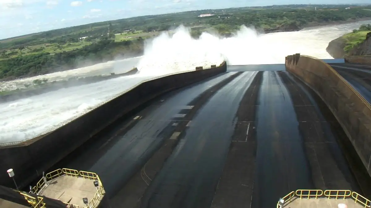
This was once the location of the Seven Quedas waterfall, where the Paraná fell on a series of seven waterfalls. This natural feature is said to rival the world famous Iguazú Falls to the south. However, the falls were flooded with the construction of the Itaipu dam, which began its operations in 1984.
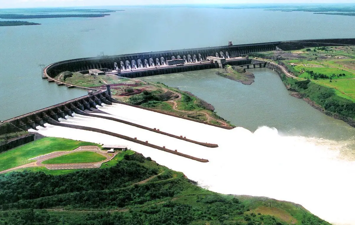
For approximately 118 miles (190 km), Paraná flows south and forms a natural boundary between Paraguay and Brazil to the confluence with the Iguazu River. Shortly after this confluence, however, the river is dammed by the impressive dam of Itaipu, the largest hydroelectric power station in the world, which creates a massive and shallow reservoir behind it.
After merging with the Iguazu, Paraná becomes the natural border between Paraguay and Argentina. The river continues its general course to the south for approximately 291 miles (468 km) before making a gradual turn west for another 510 miles (820 km), and then meets the Paraguay River, the largest tributary along the river course.
Before this confluence, the river goes through a second large hydroelectric project, the Yacyretá Dam, a joint project between Paraguay and Argentina. It is the second largest dam in the world. This massive water deposit has been the source of a series of problems for people living along the river, especially merchants and poorer residents in the lower areas of Encarnación, an important city on the southern border of Paraguay.
River levels increased dramatically after the completion of the dam, flooding large sections of the lower areas of the city.
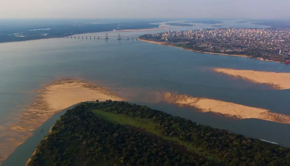
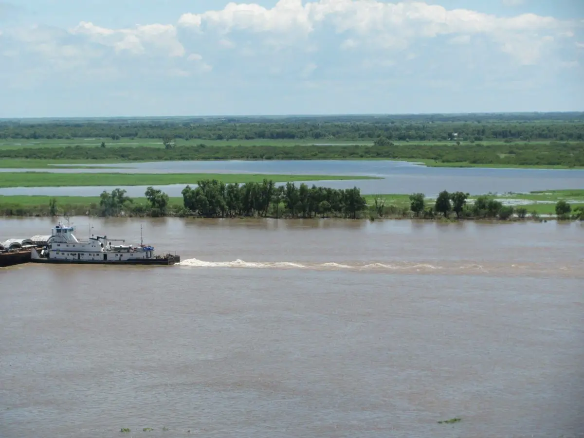
From the confluence with the Paraguay River, the Paraná turns south again for approximately 510 miles (820 km) through Argentina, making a slow turn east near the city of Rosario thru its final stretch of less than 311 miles (500 km) before merging with the Uruguay River to form the Río de la Plata and emptying into the Atlantic Ocean.
During this part of its course, the downstream at the city of Diamante in the province of Entre Ríos, is divided into several branches and forms the Paraná Delta, a long flood plain that reaches up to 39 miles (60 km) wide (see article: Ohio River).
Parana River height and depth
The volume of the lower Paraná River depends on the amount of water it receives from the Paraguay River, which provides about 25 percent of its total flow; The annual average discharge of the Paraná is 610,700 cubic feet per second (17,293 cubic meters per second), the width of the Paraná River is between 1 and 2 km, the maximum depth in the Parana River is 170m although it can vary.
Height of the Parana River in Santa Fe
The height or flow of the river in the province of Santa Fe is approximately 2.26m
Height of the Parana River in Rosario
The height that the river reaches in the city of Rosario is 1.98m
Height of the Parana River in Posadas
Here its height is 9.90m
Height of the Parana River in Corrientes
The height at this point is 2.09m
Now that we already mentioned the volume and width of the Paraná River, let´s talk about the Alto Paraná basin. It has a warm and humid climate throughout the year, with dry winters and rainy summers. The climate of the middle and lower basins varies from subtropical in the north to temperate humid in the south, with less abundant rainfall.
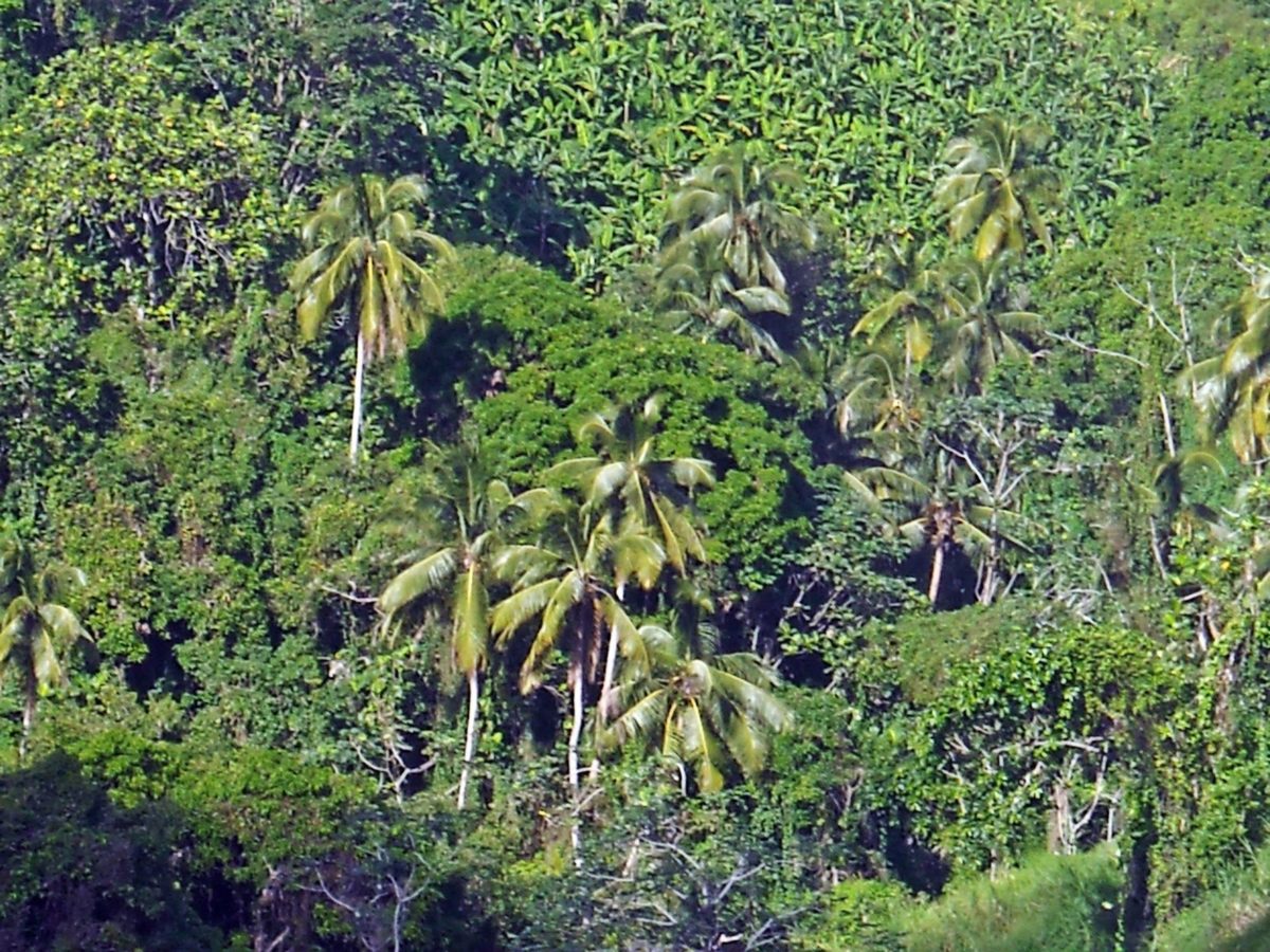
Alto Paraná has two vegetation variations, forests to the east and savanna to the west. The forests continue along the Paraná downstream to Corrientes, where the savanna begins to dominate both banks.
Birth and Length of the Paraná River
The second largest river in the South American continent, the Paraná River makes its way through the South American countries of Brazil, Paraguay and Argentina, covering a total distance of approximately 4,880 kilometers (see article: Arkansas River).
Where is the Paraná River born? This river is born in Brazil with the confluence between the Grande and Paranaíba rivers, and continues to flow in a southwest direction until it meets the Paraguay River on the southern border of Paraguay.
Where does the Paraná River flow? From its birth in Brazil, it continues to flow further south through Argentina, finally joining the Uruguay River, and then draining into the estuary of the Río de la Plata that eventually flows into the Atlantic Ocean.
Tributaries of the Paraná River
After merging with the Iguazu, Paraná becomes the natural border between Paraguay and Argentina. The Paraná River can be seen from Encarnación, Paraguay, and across the river, is the center of Posadas, Argentina (see article: Río Segura).
The river continues its general course to the south for about 468 km (291 mi) before making a gradual turn west for another 820 km (510 mi), and then meets the Paraguay River, its largest tributary. Before this confluence, the river goes through a second large hydroelectric project, the Yaciretá dam, a joint project between Paraguay and Argentina.
Paraná Guazú River
The Paraná Guazú River is the largest of the arms of the Paraná Delta. It has a depth of between 12 and 30 meters and a width of between 1 and 2 km. The Paraná Delta is a maze of 8,400 square miles of rivers and rainforest, with more than a thousand small islands.
Locally, it is called the Tigre region, because of the jaguars that once stalked the dam there. The Tigre region is only one hour north of Buenos Aires, and today is a popular tourist destination.
Visitors can hop on river cruises to meet the islander-inhabitants of Tigre who live in houses on stilts and who make their buys in supermarket boats that travel from island to island. You can also do bird watching thanks to the multiple colorful tropical birds in the area, being this one of the best places for this activity the world.
Importance of the Paraná River
The Paraná Riveralong with its tributaries creates a massive hydrographic basin that extends throughout much of the south-central part of the continent, essentially covering all of Paraguay, much of southern Brazil, northern Argentina, and even reaching Bolivia.
If the Uruguay River is counted as a tributary to the Paraná, this river basin extends to Uruguay as well. The volume of water flowing into the Atlantic Ocean through the Río de la Plata is approximately equal to the volume in the Mississippi River delta.
This basin serves several large cities, including Buenos Aires, Asunción and Brasilia. The Paraná and its tributaries are a source of income and even daily sustenance for numerous fishermen who live along its banks.
Some species of fish, such as the surubí, which reach four feet (130 cm) in length, and the shad, which are an average of two feet long, are commercially important and are exploited for mass regional consumption or for export.
Another important species on the river is the tarpon, since it forms the base of the food chain that ends with larger fish such as the surubí. To maintain a continuous supply of these species, experts recommend maintaining a catching limit of up to 20,000 tons; however, in 2004, 34,000 tons were exported.
In an attempt to facilitate the reproduction of the shad, the Argentinian national government banned the export of fish from the Paraná River for eight months from January 1, 2007.
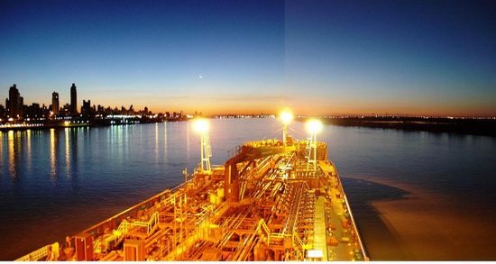
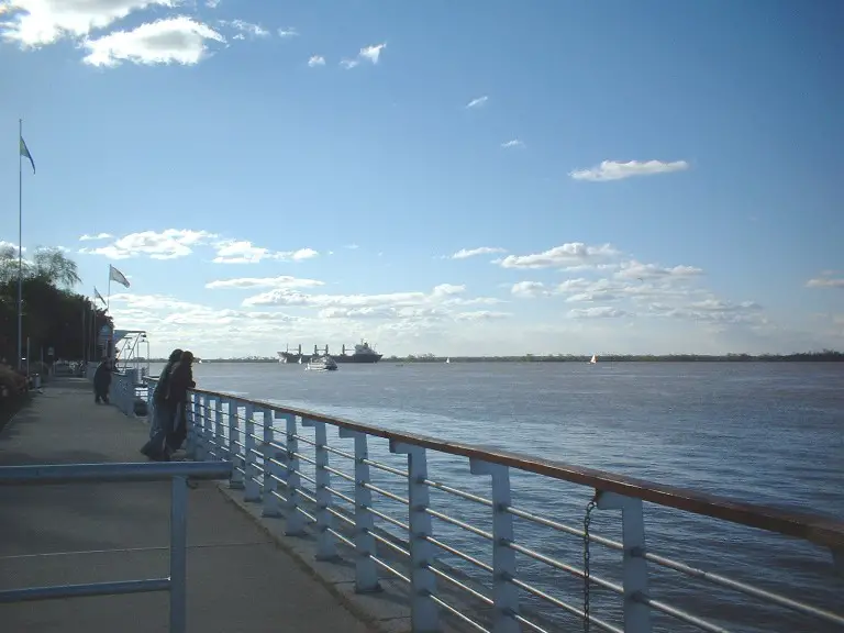
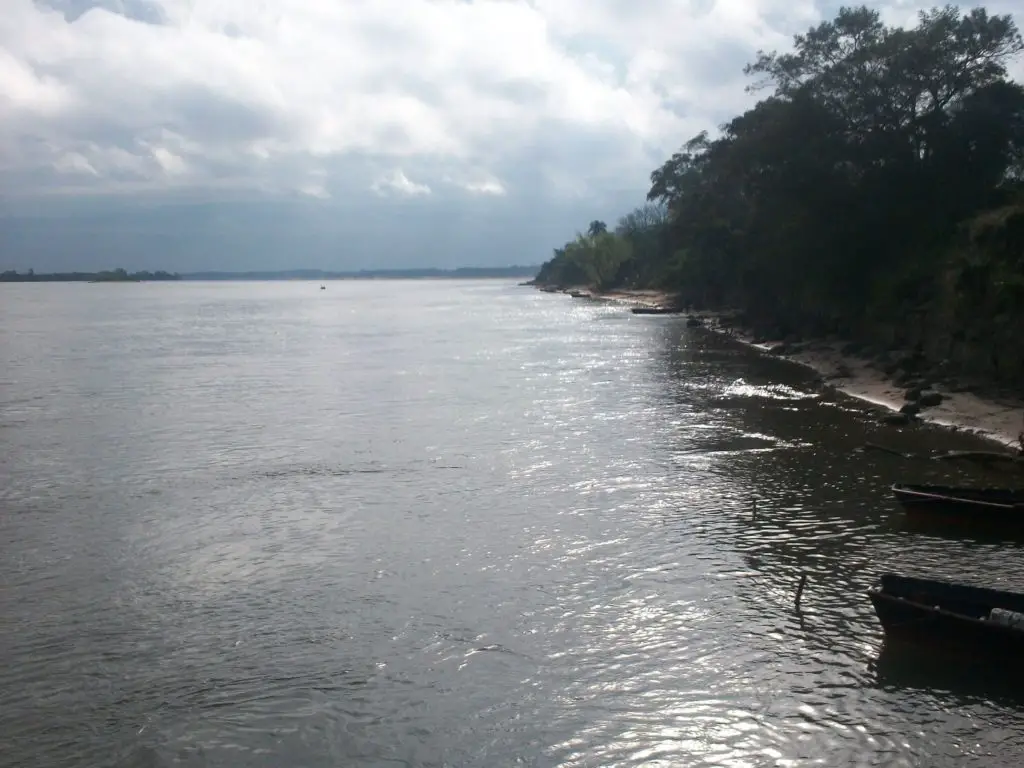
Much of the length of the Paraná is navigable and is used as an important waterway that connects the cities of the interior of Argentina and Paraguay with the ocean, providing deep-sea ports in many of these cities.
The construction of massive hydroelectric dams along the length of the river has blocked its use as a shipping corridor to upstream cities, but the economic impact of those dams is considered to compensate for this.
The Yacyretá and Itaipú dams on the border with Paraguay have made the small nation, largely undeveloped, the world’s largest exporter of hydroelectric power.
Economic activities of the Paraná River
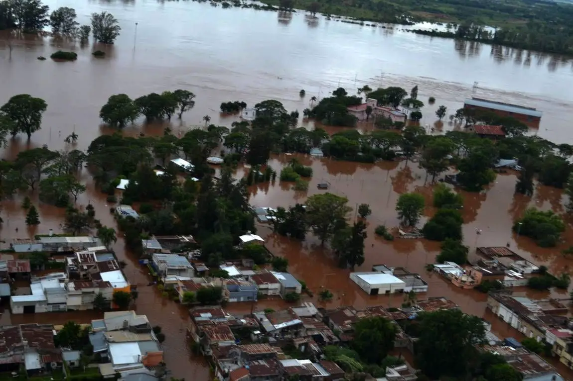
The Paraná Delta region is a large mosaic of wetlands that exhibits a rich biodiversity highly adapted to annual hydrological cycles. However, the history of the Paraná River tells us that in the last decade, flow patterns have changed due to the combined effect of dam regulation in the upper basin, the construction of inland waterways, new road infrastructure and climate changes.
These changes have affected the livestock, fish, other forms of wildlife and even the forest uses thanks to modifications associated with the landscape that are aimed at transforming the Delta into a productive area of drylands.
Such a vision fails to frame the value of the benefits of wetlands and environmental services and how traditional resource management can be more sustainable in the long term. And that an eco-hydrological workforce is needed to guide future development, where economic, social and environmental factors must be harmonized.
Tourism
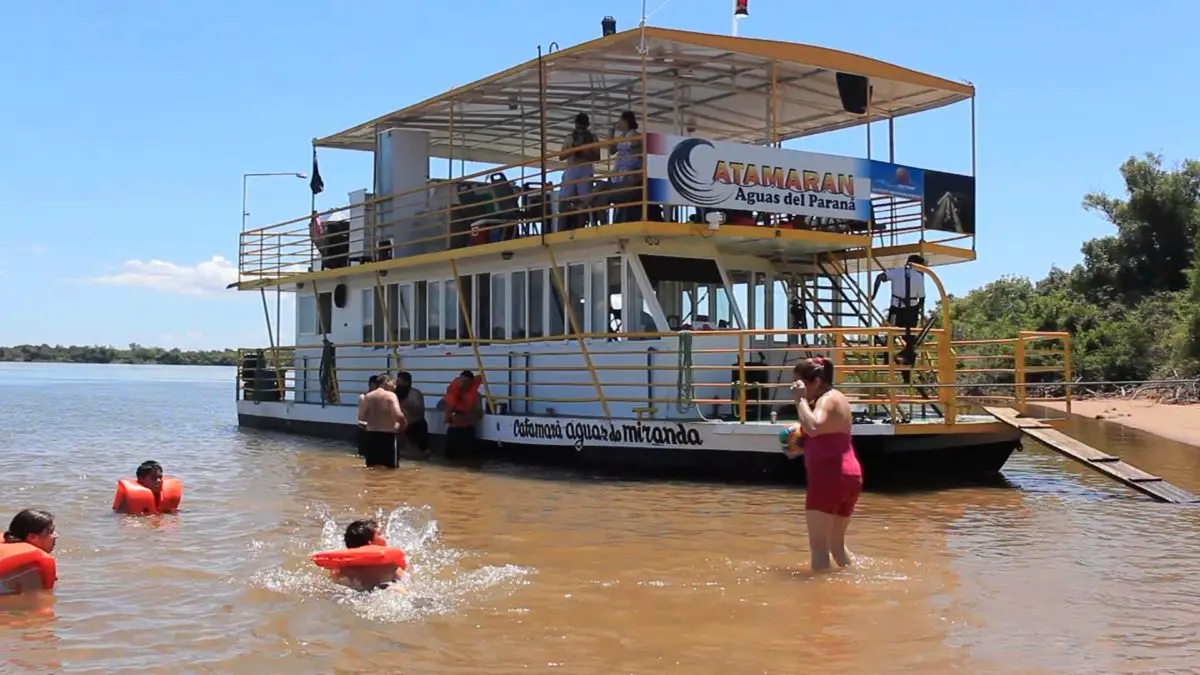
The town where the impressive Iguazu Falls are invites you to navigate through the waters of the intense Paraná River in specially built boats called catamarans.
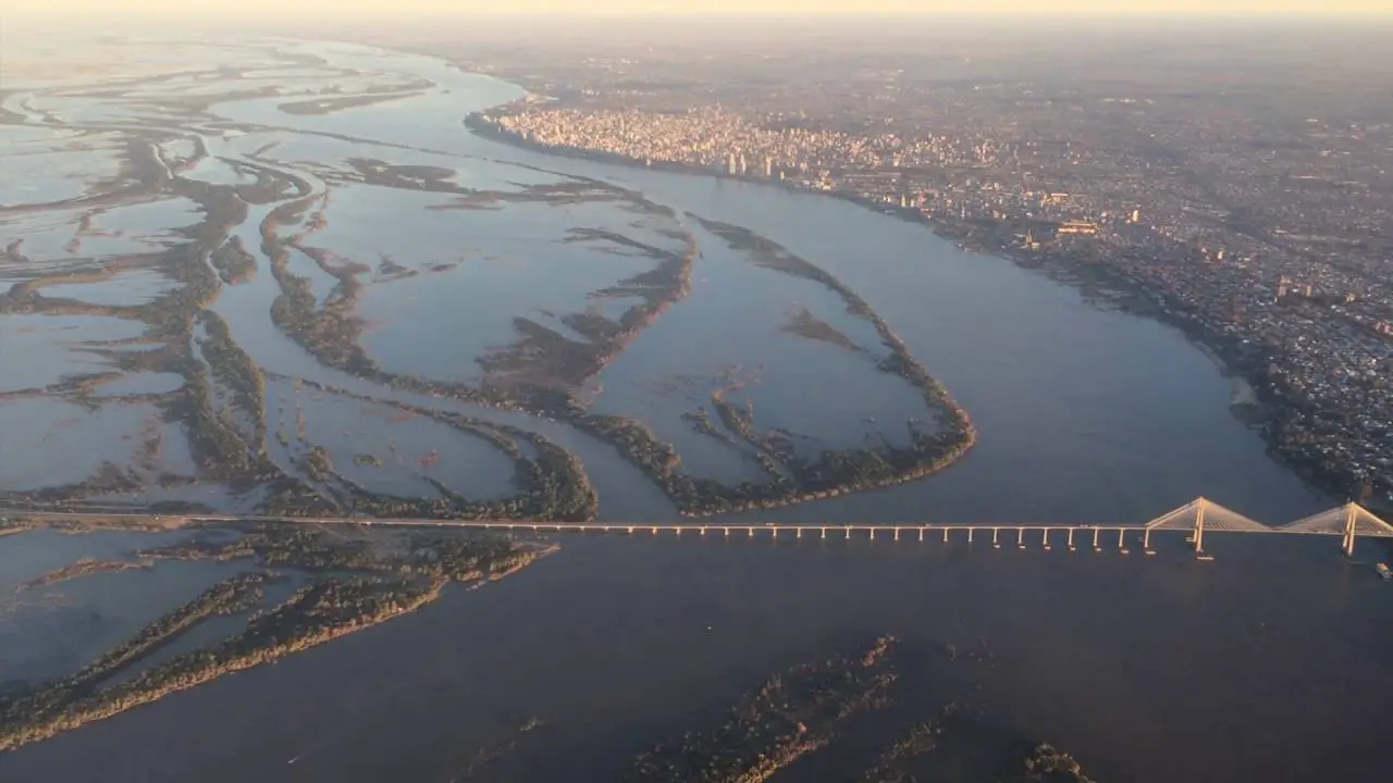
During the day, these boat tours teach passengers, adult and children, stories and anecdotes from the region. From the river, it is possible to observe the city of Posadas and its new coastal areas: Balneario El Brete, Costa Posadas, Heller Peninsula and the San Roque González de Santa Cruz International Bridge that connects the provincial capital with the Paraguayan city of Encarnación.
In the evenings, navigation is accompanied by elegant cocktails and delicious dinners with meals based on the unique cuisine of the province. These night trips always end with beautiful parties on board with good DJ music.
Sailing through the Paraná aboard catamarans equipped with excellent services and technology is also available for business meetings and social events and for the enjoyment of all its areas. There are plenty of activities to be enjoyed by adults as well as by children.
Paraná River fish
Goldfish fishing can be done in the calm waters of the delta. The goldfish is a great trophy for any fisherman thanks to its spectacular size and weight.
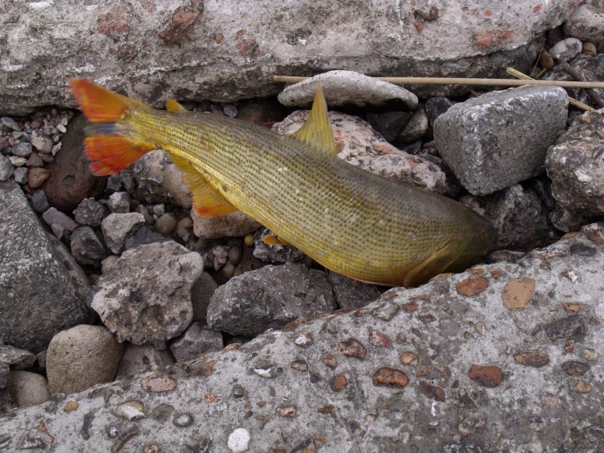
This fish has the same hunting habits as the trout and can maintain itself at the bottom of the water using structures like sunken logs and undercut banks. In addition, the Dorado generally can be easily catch with fishing poles, which becomes a very effective fishing technique, thus providing an extremely fun and interesting fishing experience.
At the time of capture, a hard fight begins between the fisherman and the fish, which, far from exaggerating, will leave them both exhausted. Once the specimen is trapped, the Dorado will show its beautiful golden scales, which shine under the sun.
Paraná River Salmon
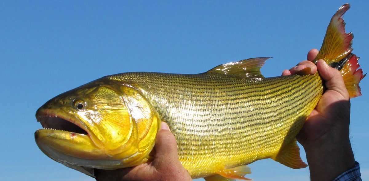
The Tiger of the River (Salminus brasiliensis), is rapidly becoming one of the most prized freshwater fish species in the world. This aggressive and powerful freshwater migratory fish is constantly on the lookout for baitfish schools to hunt and this makes them susceptible to both bait and fly fishing.
Its scientific name is Salminus brasiliensis in reference to the trout species and the country where the first scientist found and described this species in the Paraná River basin. In general, the shape of the Dorado’s body is similar to that of a salmon, with a golden body, black stripes and a somewhat scalloped tail. The golden ones, which can grow to more than 50 kg, have huge heads and their powerful jaws are full of small, gleaming teeth like razors.
They usually move in groups, feeding on schools of shad and other baitfish. Unlike salmon, the Dorado does not die after spawning and never ventures beyond the mouth of the river in the open sea. They grow huge and are tremendous fighters when they get hooked.
The Dorado not only has sharp enough teeth to prick through plastic baits, it can bite wooden baits into pieces with great ferocity. It also performs aerial turns that remind more of acrobatic saltwater species. Sandwiched between these high-flying jumps you can hear some squeaky noises.
Fishing on the Paraná River
Between January and October, the Paraná River becomes a mandatory destination for dorado fishermen. This goldfish is one of the sporting preys to withstand the toughest fight in the water and, therefore, occupies a prominent place in the list of any good fly fishermen.
To make this fishing excursion, Iguazú Anglers makes available to the fishermen the floating cabin called Paraná Gypsy. This three-story seventy-foot luxury cruise ship has all the features of modern ships and the comforts of a five-star resort.
With a capacity for 6 fishermen, the Gypsy has air conditioning. With four comfortable rooms, all with private bathrooms, a large dining room with large windows and a terrace with sun loungers, the Gypsy is well equipped for a perfect fishing experience.
When it comes to meals, the cuisine at the Gypsy is simple but tasty. Ready to please the most demanding palates, all dishes are accompanied by excellent wines from renowned Argentine wineries.
Flora and Fauna of the Paraná River
The suffocating climate of the Paraná River ecosystem supports the existence of a diverse and unique variety of flora and fauna. Where human intervention is scarce, the forests and savanna vegetation have continued to flourish along the banks of the river as well as in the Amazonian River.
The forested region of the upper Paraná is known as the Alto Paraná Atlantic Forest. 50% of the plants and 90% of the amphibians of this forest are endemic to the area.
The Paraná River has a huge colorful wildlife that stretches thousands of kilometers from Brazil to central Argentina. A rich variety of wildlife depends on it and since the river is so rich in food, birds can easily move along it. A common bird of the Argentine part is the Red-crested Cardinal.
The Paraná is the second most important river in terms of biodiversity after the powerful Amazonian, dumping its colossal waters in the delta of the Río de la Plata between Montevideo and Buenos Aires and depositing silt in the Atlantic that is visible from space.
A large number of species that inhabit the Atlantic forests of Alto Paraná, such as the jaguar and the seven-colored tanager, are also on the verge of extinction.
In addition to all the information on the Paraná River that we have mentioned, it is important to note that this river also supports a large number of aquatic species, including migratory fish such as the Atlantic saber anchovy, the Sabalo and dorado, as well as other fish such as piranhas, fish cat, moonfish and a diverse variety of tiny phytoplankton and macrophages.
The Paraná River Delta also forms an important wetland ecosystem, although a large part of it has been damaged by human intervention. Species such as the pampas cat, swamp deer and capybaras are found in the last surviving natural habitats of this delta region.
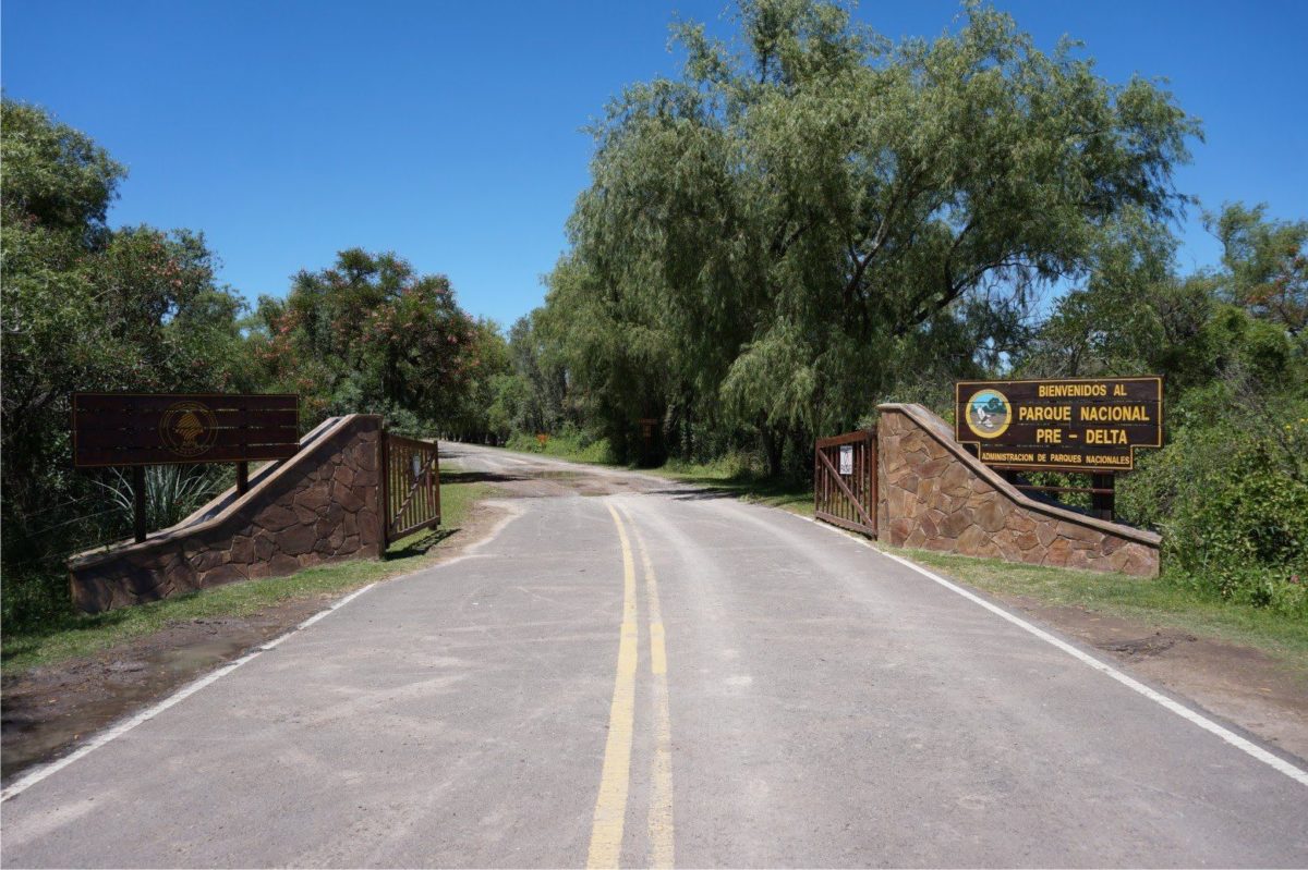
The Pre-Delta National Park and the Reserve of the Paraná River Delta Species have been established in the Paraná delta area to protect the native flora and fauna of the region.
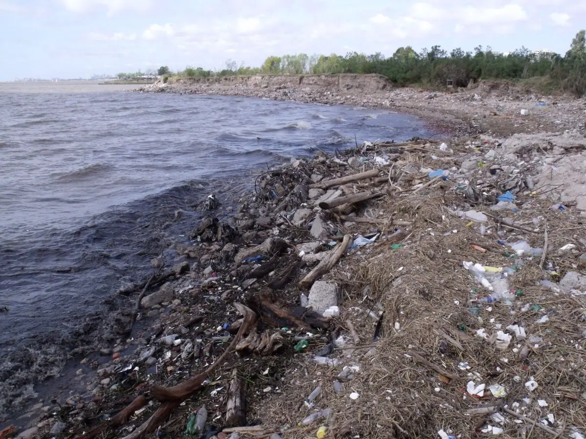
Paraná River Contamination
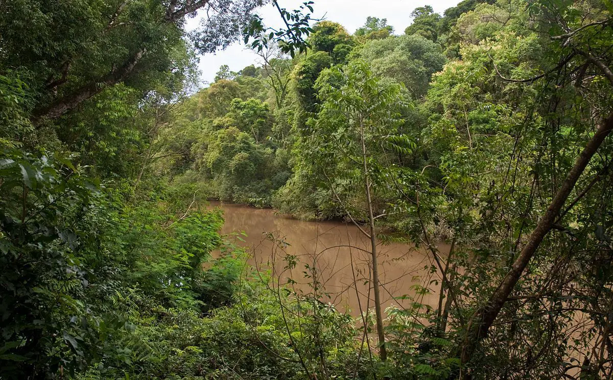
At the origin of the Paraná River, it winds through the Atlantic Forest, which at one time covered 330 million acres, an area twice the size of Texas in the United States, and spread throughout eastern Brazil at the north from Argentina and eastern Paraguay. Only seven percent of this forest remains today.
The waters of the Paraná have become murky with sediments that have been washed from the updraft. Scientists have determined that one of the main culprits was the rapid deforestation of the Atlantic Forest.
With the loss of forested areas along the streams that feed the Paraná, there was no way left to filter the sediment of the water destined for the river.
The health of the great rivers is affected by the surrounding lands. Changes in land management can result in a decrease in water quality and new patterns of water flow; both are considered major threats to the life of plants and animals.
Restoration of natural filters along the stream is a land management technique that improves water quality, a benefit for downstream people who depend on the river for drinking water as in the Colorado River.
Large-scale reforestation is underway in the forest to restore the health of the river. This is carried out by The Nature Conservancy in conjunction with the Brazilian water agencies. Data is being examined to determine where restoration will be most effective and strategic. Currently, there is a strong support system on the way between the water agencies in Paraíba do Sul, Piracicaba Capivari and the Iguazu basins.
Farmers and ranchers, many of whom settled in recently cleared land, are being encouraged to use best practices and adhere to an environmental law that requires 20 percent of their land to be forested.
Water and sediment samples were collected in the lower Paraná delta at four different places with different levels of exposure to contamination to assess the anthropogenic impact through chemical analysis and mortality bioassays.
Polychlorinated biphenyls, chlorinated pesticides, aliphatic hydrocarbons, polycyclic aromatic hydrocarbons and heavy metals were measured in the water, pores and sediments. The same three phases were also subjected to toxicity tests with juvenile Corbicula fluminea.
The concentrations of several pollutants were above the recommended levels for the protection of aquatic life: in waters, Zn, Cu and Cr were 1.6-4.9 times higher, while in Cr sediments it was 1.8-3.6, and benzo (a) pyrene was 2.8-5.6 times taller.
Pollutant concentrations followed a clear geographical pattern with the highest values in the densely populated area of the Reconquista and Luján rivers, the lowest levels in San Antonio and the lowest loads in the remote Paraná de las Palmas.
This gradient corresponded adequately with the pattern of mortality of early juveniles of C. fluminea, which were higher in the Reconquista-Luján (40-93%) and lower (and not significantly different from the control) in Paraná (3.3- 2. 3%). Mortality rates also increased from surface waters (3.3-53%), to pores (12-73%), to sediments (23-93%).
Although the toxicity was probably due to pollutants, the concordance between chemical and biological evidence of contamination was better for sediment compartment, while water and surface water showed a greater degree of variability.
Threats and Disputes
Currently, the Paraná River ecosystem is suffering the damaging effects triggered by human activities of indiscriminate exploitation. Construction projects that build dams and other artificial impediments along the Paraná River have caused irreparable damage to the river’s ecosystems.
During the construction of the Itaipu Hydroelectric Dam in 1979 in Paraná, the Guaira Falls were drowned completely in the process.
These dams and water courses have also affected the aquatic and terrestrial habitats of native flora and fauna, as they have endangered the migratory routes of fish and even displaced thousands of people from their homes.
Rapid deforestation along the banks of the river for agricultural expansion has contributed to the erosion of the land, in turn overloading the river with massive amounts of eroded sediments and debris, and hampering the quality of water resources in Paraná.
Almost 88% of the original surface of the Atlantic forest around the Paraná River has been lost, which endangers the existence of much of the native flora and fauna of the region.
A scientific report states that almost 50% of the Paraná fish species had been dilapidated in the course of only 20 years. El Sabalo, a key species of the Paraná River ecosystem, which forms an important link in the food chain, is also being mitigated by fishery exploitation.
Unfortunately, these fishermen do not seem to realize that they are not only seriously damaging the ecosystem with their irresponsible practices, but they are also depleting fisheries in the region of economic resources of vital importance to future generations of fishermen. This information about the Paraná River is of the utmost importance, to raise awareness and stop the damage caused.
Parana River and Uruguay
Together with the Paraná River, the Uruguay River forms the estuary of the Río de la Plata which is navigable from around Salto Chico.
Its main tributary is the Río Negro, which is born in the south of Brazil and crosses Uruguay for 500 km until its confluence with the Uruguay River, which is 100 km north of the confluence of the Uruguay with the Río de la Plata, in Punta Gorda, Department of Colonia, Uruguay.
Paraná River in Brazil
When talking about the history and origin of the Paraná River, we should also mention that a part of it is located on the border between Brazil and Paraguay. The construction of the hydroelectric dam that was contested for the first time by Argentina began, but the negotiations and the resolution of the dispute ended up laying the foundations for the Argentine-Brazilian integration later.
The name “Itaipu” was taken from an island that existed near the construction site. In the Guaraní language, Itaipu means “the stone that sounds”.
The Itaipu Dam hydroelectric plant produced the largest amount of energy in the world as of 2016, setting a new world record of 103,098,366 megawatt hours (MWh), thus surpassing the Three Gorges Dam plant in 2016 and 2015 in Energy production
Completed in 1984, it is a bi-national company run by Brazil and Paraguay on the border between the two countries, 15 km (9.3 miles) north of the Friendship Bridge.
The project covers from Foz do Iguazú, in Brazil, and Ciudad del Este in Paraguay, in the south to Guaíra and Salto del Guairá in the north. The generation capacity of the plant is 14 GW, with 20 generating units that provide 700 MW each with a hydraulic design head of 118 meters (387 feet). In 2016, the plant employed 3038 workers.
Of the twenty generating units currently installed, ten generate at 50 Hz for Paraguay and ten generate at 60 Hz for Brazil since the production capacity of Paraguayan generators far exceeds the load in Paraguay.
Most of its production is exported directly to the Brazilian side, from where two 600 kV HVDC lines, each approximately 800 km (500 miles), carry most of the energy to the Sao Paulo / Rio de Janeiro region where the terminal equipment converts the power to 60 Hz.
Paraná River Delta
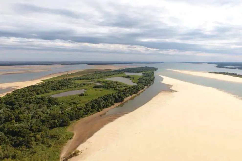
As we have already mentioned, we know where the Paraná River is born, now it is important to mention the Paraná Delta is the Delta located in Argentina and it is made up of several islands known as the Paraná Islands. The Paraná flows from north to south and becomes an alluvial basin (a flood plain) between the Argentine provinces of Entre Ríos, Santa Fe and Buenos Aires that later flow into the Río de la Plata.
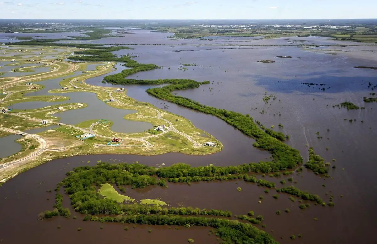
It covers approximately 14,000 square kilometers (5,400 square miles) and begins to form between the cities of Santa Fe and Rosario, where the river is divided into several branches, creating a network of islands and wetlands. Most of it is in the jurisdiction of the province of Entre Ríos and parts in the north of the province of Buenos Aires.
The Paraná Delta is conventionally divided into three parts:
- The Superior Delta, from Diamante – Puerto Gaboto line to Villa Constitución.
- The Middle Delta, from Villa Constitución to the Ibicuy Islands.
- The Lower Delta, from the Ibicuy Islands to the mouth of the river.
The total length of the delta is approximately 320 kilometers (200 miles), and its width varies between 18 and 60 kilometers (11 and 37 miles), its depth is approximately between 80 and 100 meters.
It carries 160 million tons of suspended sediments (approximately half of them come from the Bermejo River through the Paraguay River) and advances from 50 to 90 meters (160 to 300 feet) (according to sources) per year on the Rio de la Plata. It is the only river delta in the world that is in contact not with the sea but with another river (see article: Río Balsas).
The Lower Delta was the site of the first modern settlements in the Paraná-Plata basin and today is densely populated, being the agricultural and industrial nucleus of Argentina and home to several important ports. The main course of the Paraná is located west of the delta, and is navigable downstream from Puerto General San Martín by boats to the Panamax type.
Rivers of the Delta
Among the many arms of the river are the Paraná Pavón, the Paraná Ibicuy, the Paraná de las Palmas, the Paraná Guazú, the small Paraná Miní and Paraná Bravo.
Paraná Pavón is the first important branch. It has a meandering course that starts on the east side, in front of Villa Constitución. Between the main Paraná and the Pavón Paraná are the Lechiguana Islands (see article: Mekong River).
The Paraná Pavón flows east and then turns south to continue along the Ibicuy, which in turn gives rise to the Paranacito River, a tributary of the Uruguay River that passes through Villa Paranacito.
The Paraná de las Palmas begins around the mouth of Paraná Ibicuy, downstream of Baradero, flows west in the province of Buenos Aires and then turns southeast again.
The main course is continued by the other main branch, the Paraná Guazú. In turn, the Paraná Guazú sprouts two branches that flow eastward into the territory of Entre Ríos: first the Paraná Bravo, and then the Paraná Miní.
Parana Rosario River
The city of Rosario is located on the bank of the river. The economic activity that takes place here goes from the trade of cereals to other forms of general commerce. It also has a buzzing tourist activity since it has islands in front of the city where you can enjoy beaches and recreation spaces.
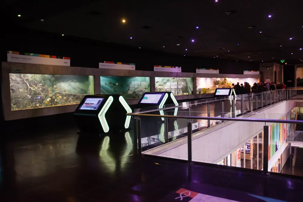
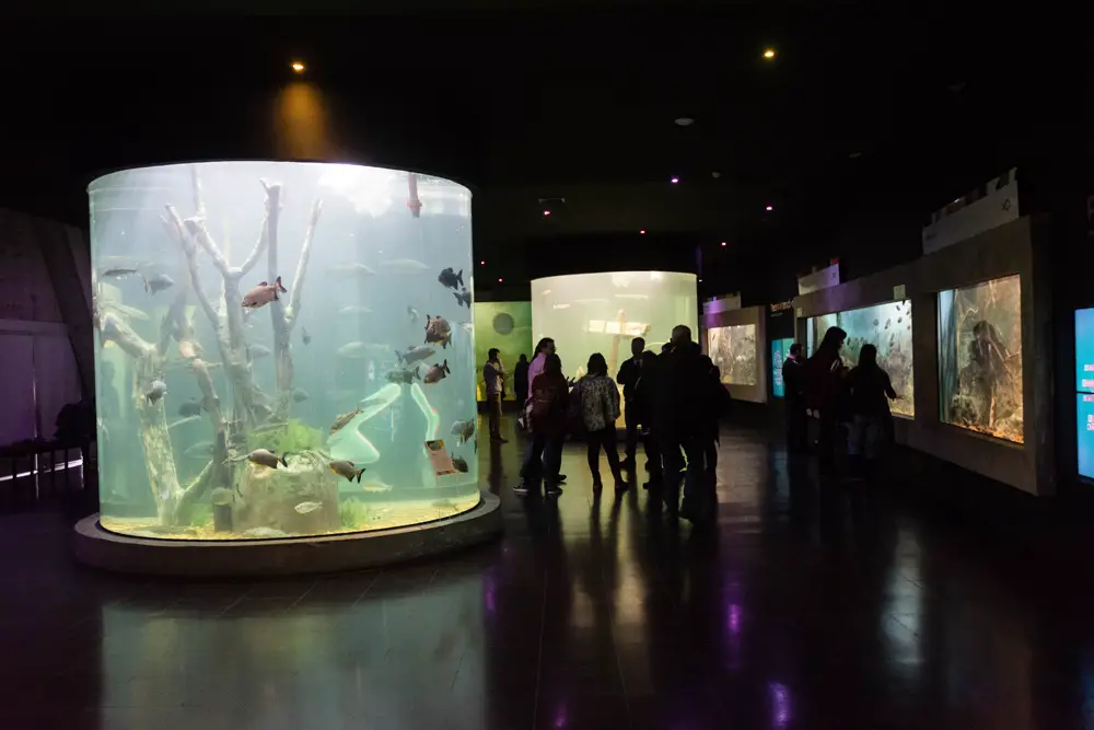
Parana River Aquarium in Rosario
The Parana River Aquarium was inaugurated on February 9, 2018 in the city of Rosario. It is located in Av. Carrasco and Cordiviola. There visitors can enjoy various activities related to the fauna of the river and an excellent aquarium with all the species that inhabit the Paraná.
Within the spaces that the site is the aquarium room which is a main educational room that allows us to visualize the biodiversity of the river’s ecosystem. In its 1000 square meters of surface hundreds of species are distributed in 10 fish tanks adapted to the different environments of the Paraná.
We can also find a mixed aquatic biotechnology laboratory that is responsible for studying the fish that are in the Paraná River, their genetics as well as its ecosystem.
It also has a fishing port where collaborative social work is developed with the artisanal fishermen community.
Weather
Each habitat in the Paraná Delta is named, not numbered. Due to the low altitude and the ubiquitous presence of water, the Paraná Delta is subject to a particular climate within the Pampas climatic zones. As in the entire region, there are four distinct stations; however, the Delta has slightly colder nights, milder winters and higher humidity, which allows some species of warmer weather to thrive.
The summers are hot with daily maximums between 18 and 22 ° C (64 and 72 ° F) and the temperature at night can reach between 16 and 20 ° C (61 and 68 ° F). Heat waves are common but they are not as intense as in central Argentina.
Usually the temperatures will not exceed 36 ° C (97 ° F), although in the past they have reached the 40 ° C (104 ° F). Storms are common and can bring torrential rains and a much cooler climate. As in the entire Pampas region, summers are “cut off” for short and cool periods when winds blow from southern Pampero.
March is noticeably cooler than the rest of the summer, and April is characterized by a very pleasant climate: the maximum ranges from 21 ° C (70 ° F) to 25 ° C (77 ° F), with nights of 10 ° C (50 ° F) at 14 ° C (57 ° F), and May has generally a great climate, with cold nights similar to the climate of the Yukon River.
Winter runs from the end of May to the end of August. Then temperatures generally range between 13 ° C (55F) and 18 ° C (64F), while nights range from 3 ° C (37F) to 7 ° C (45F), with less rainfall but greater cloudiness and relatively common fog.
As in the entire Pampas region, there are often brief moments in the winter when temperatures can reach 25 ° C (77 ° F), followed by much colder weather and cold nights.
Temperatures generally reach 0 ° C several times a year, but rarely fall much lower than -3 ° C (27 ° F), with historical lows close to -7 ° C (19 ° F). However, in general terms, the windy and humid climate makes you feel much colder than it actually is.
Spring is usually delicious, but very sudden changes can occur: temperatures similar to those of summer and winter often alternate, and there can be a big difference between daytime and nighttime temperatures.
Spring is also the season most prone to violent weather. October has the same average temperatures as April, with slightly colder nights, although extreme changes from heat to cold are more likely: frosts can occur rarely, as temperatures of 35 ° C (95 ° F) can also occur, sometimes in the same week.
Precipitation in the region ranges from 1,000 to 1,400 millimeters (39 to 55 inches), with two peaks at the end of spring / early summer, and at the end of summer / early fall, and a drier, but cloudier winter.
Images of the Parana River