Last Updated on May 27, 2020 by Hernan Gimenez
Indice De Contenido
- 1 Douro River: Map, Birth, Length, and Much More
- 2 Douro River Map
- 3 Birth of the Douro River
- 4 Duero River Length
- 5 Tributaries of the Douro River
- 6 Mouth of the Douro
- 7 Reservoirs in the Douro River
- 8 Activities that can be done in the reservoirs
- 9 Is the Douro River Navigable?
- 10 Tourism in the Douro River
Douro River: Map, Birth, Length, and Much More
Updated On January 16, 2020
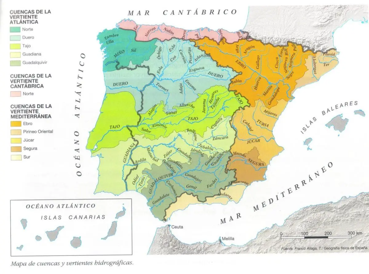
The Douro River is the third longest river in the Iberian Peninsula and has the largest river basin. It has a very high touristic value because it keeps many secrets from the time of the conquest, having a variety of castles and other buildings that form a window directly to the past.
The Douro River is often used as a transport route; it has being useful and still is for the manufacture of one of the most famous wines such as the Porto. Get ready to know one of the longest, most varied and dynamic rivers in all of Europe. (see Rio Usumacinta)
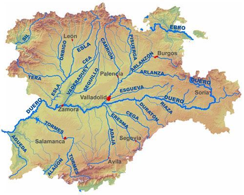
Douro River Map
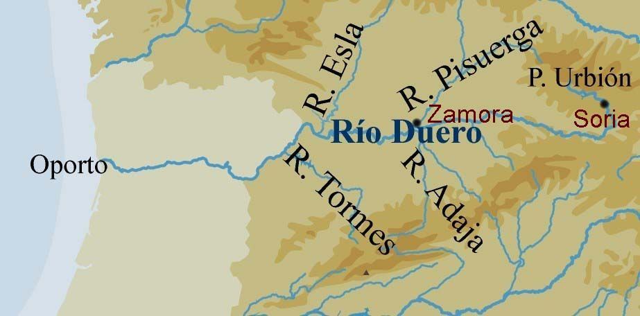
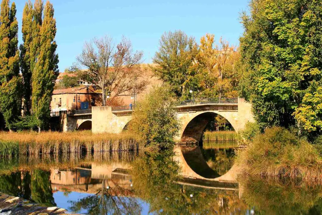
Here you can see a map of the Douro River, where you can observe the route with its main tributaries. As is visible, it flows thru part of Spain from the Iberian system in Soria, going down to Valladolid and following up to Zamora.
Douro River Route
As for the route of the Douro River, below you can see a map showing the final route of the River being the Spanish Province of Zamora the last one of its passes through the Spanish territory. From then on the Douro River continues its cause towards Portugal where it finally flows into the Atlantic Ocean.
Therefore these two maps complement each other, just as the flow of the river thru these two countries, Spain and Portugal do. These will serve as information to locate, know the route of the Douro River and in turn give a better spatial reference.
Finally, you will understand why the Douro River is one of the most important rivers in Europe, you will understand that its great extension is not just a number, that it is more than a “simple river” or another of the group of rivers that cross Europe to flow into the sea or the Ocean, the Douro represents history, anecdotes, ingenuity, beauty and diversity.
Origin of his name
The name of this river is from the Latin Durius flumen originating from the roman occupation. The Romans could have taken the name from the roman God Durius which was represented with a fishing net in his hands
Birth of the Douro River
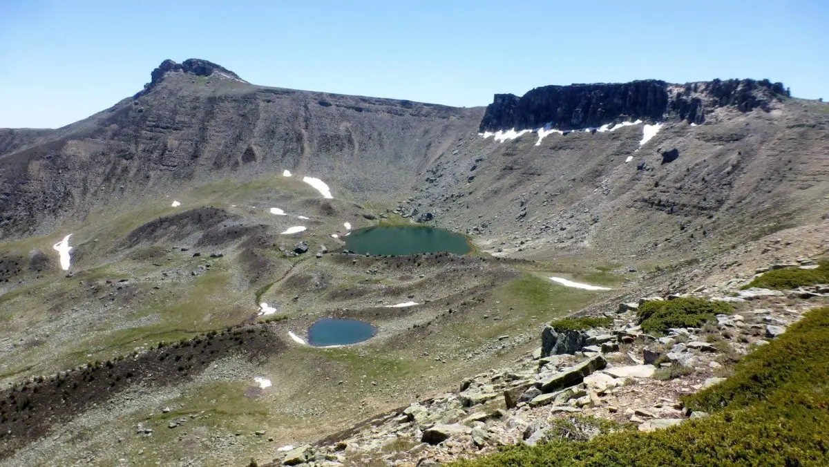
The Douro River is one of the most important in the northeast of the Iberian Peninsula (2228 masl). Where is the Douro River born?; its birth is in Soria, Spain, specifically in the municipality Duruelo de la Sierra at about 2160 meters above sea level on the southern slope of the Urbión peak.
Duero River Length
The length of the Duero River is about 897 kilometers long and is divided into 572 kilometers of Spanish territory, 213 kilometers of Portuguese territory and 112 kilometers of international territory thanks to its location between the border of Spain and Portugal. Its basin measures about 97,299 km² being one of the largest in the entire peninsula, the Spanish basin has about 78 859 km² and the Portuguese basin about 19 214 km². (see Rio Arauca)
By the way, if you would like to know how rivers are measured, here you can know the instruments for measuring length.
The provinces and cities that the Douro River crosses in Spanish territory are:
- Soria
- Burgos.
- Valladolid
- Zamora.
- Salamanca.
These represent 80% of its route; in the opposite direction we have the districts or cities through which the Douro River passes in the Portuguese territory:
- Baganza
- Guard.
- Royal Villa
- Viseu
- Aveiro
- Porto.
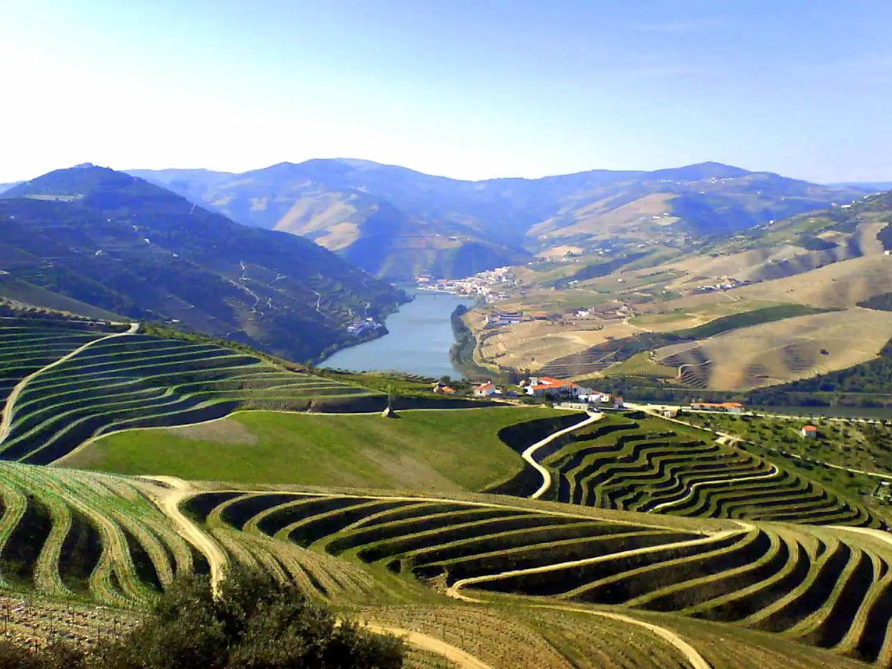
The Arribes del Duero park (Spain) and the Duero Internacional Natural Park (Portugal) were created with the purpose of protecting water resources and vegetation throughout the entire route.
The Douro river basin mostly presents dry weather, with the exception of the northern tributaries that carry waters from the Cantabrian mountain range where the climate is wetter, since at its mouth the Douro River is narrow and deep forming the famous arrivals (arribes) that are geographical accidents formed by two or more rivers in an enclaved area.
Tributaries of the Douro River
The crowded network of tributaries of the Douro River include the waters of the Iberian system, the Cantabrian mountain range and the Central System, being one of those responsible for its high flow. The main tributaries of the Douro River in the north are the Pisuerga and Esla rivers, and in the south the Tormes and Adaja rivers. (see Río Segura)
High basin
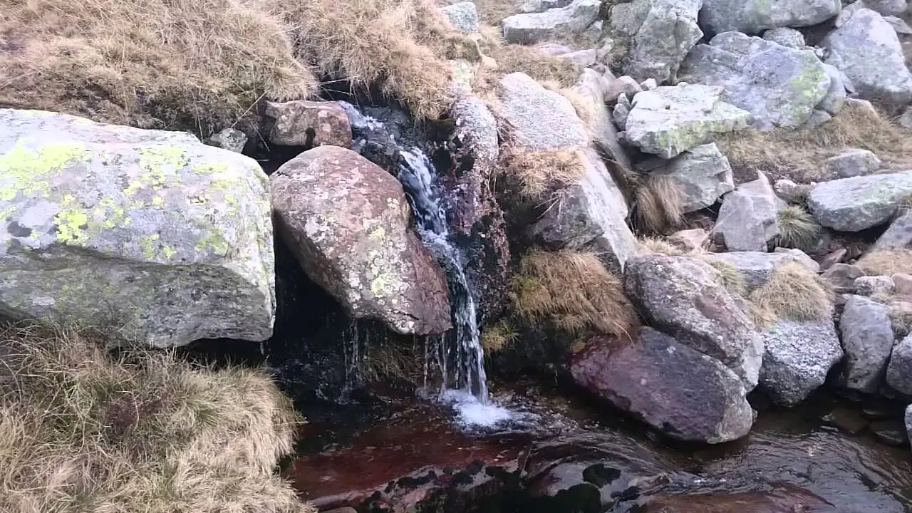
The river flows from the mountain range of the Douro with many streams that in turn descend from the summits of the mountain range, with the Ebrillos on the right and the Revinuesa on the left. This is an effluent (watercourse that from its confluence emerges from a river to form a small lake) of the Black Lagoon that is located at the foot of the walls of the Urbión peak. These three rivers join and flow until they end up at the Cuerda del Pozo Reservoir.
Before reaching the town of Soria, the Tera River pours its waters on the left. The confluence of the Tera and the Douro rises at the Numancia ruins, then, the river is joined by the Garray. Up to this point, the Douro River has collected waters from the Sierra de Urbión, the Sierra Cebollera and Oncala. On this route the average slope goes from 15 m / km to reach 1100 meters above sea level in the Cuerda del Pozo dam. The total route of the Douro River is 73 km.
Middle basin or central section of the Douro River
At this point the River first runs through the Spanish provinces of Soria, Valladolid, Burgos, Zamora and Salamanca. Its waters flow through the abundant terraces that have been created by the transit of Cenozoic sedimentary material in the water. The Douro River continues its direction towards the south (Almazán) receiving the waters that come down from the Madero mountain ranges and the Moncayo mountain range, leaving behind the Iberian system, flowing through the other end of the basin in the province of Zamora.
In Almazán, the river remains its route with an east west direction, maintaining this direction will allow it to reach Porto (Portugal). The tributaries that it receives in this stretch are short and of little flow as a result of the dependence of the Iberian system with the Central. The total route that the Douro River has in this part is 500 kilometers.
In Roa the Douro River takes a turn, leaving a population to the right and following its course to the left through the Riaza River in the highlands of Segovia. Entering the province of Valladolid, the river receives thru the left the waters of the Cega River and later those of the Pisuerga River.
The Adaja River and the Eresma join in a few kilometers down with the Tordeaillas ford. In Castronuño, the Douro River changes its direction up to the Toro River. The minor tributaries such as the Bajoz River and the Hornija are between the two causes which form the limit of the province of Valladolid and the province of Zamora.
Arrivals of the Douro River
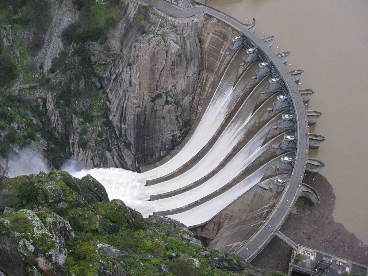
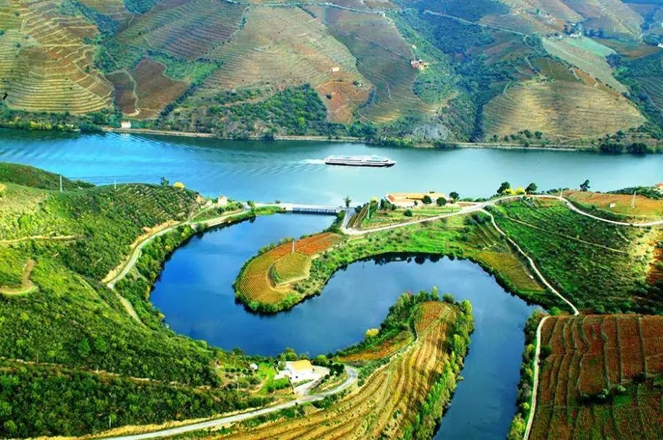
The Douro River when arriving at the province of Zamora and Salamanca narrows its channel and descends about 400 meters until reaching 200 meters of altitude. In the so-called arrivals are the reservoirs. In this place we can find the Aldeadávila, Ricoballo, Almendra, Villalcampo, Castro and Saucelle dams and reservoirs belonging to Spain, and the Picote, Bemposta and Picote dams and reservoirs belonging to Portugal.
Portuguese Upper Douro
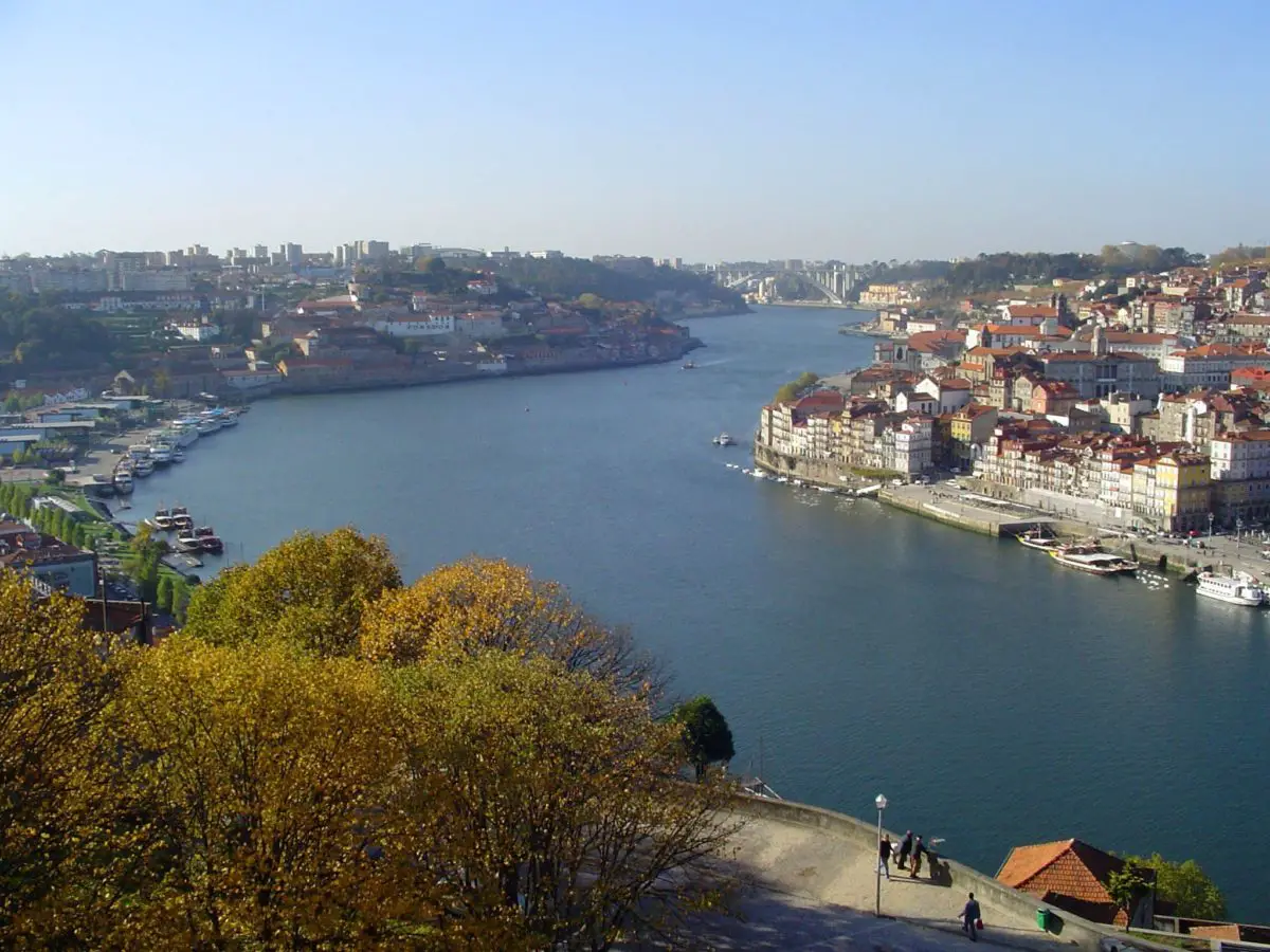
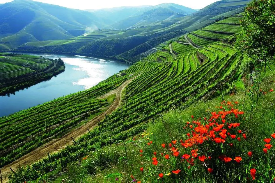
Finally, where does the Douro River flow to? It flows into the Atlantic Ocean, through the Águeda River in Porto. There it has a low slope of 0.6 m / km which makes it navigable. In this area we can run into the Côa river valley, considered one of the largest sites where paleolithic art can be seen, and where the Alto Douro wine region is located. This is where the vine has been cultivated and the wine has being produced for over 2000 years thanks to the characteristics of the land and its natural terraces.
Tributaries of the Douro River to the right
Among the tributaries of the Douro River on its right we have the following:
- Sousa river
- Esla river
- Tua river
- Teixeira river
- Sabor River
- Támega River
- Valderaduey River
- Pisuerga River
- Corgo River
- Tera river
- Pisuerga River
- Esla river.
Tributaries of the Douro River to the left
The tributaries to the left of the river are:
- Riaza River
- Rituerto River
- Adaja River
- Duraton River
- Cega River
- Zarpadiel River
- Tormes River
- Agueda River
- Huebra River
- Torto River
- Côa river
- Tedo River
- Távora River
- Cabrum River
- Varosa River
- Paiva river
- Bestanca River
- Guareña River
- Arda river
- Eresma river.
Mouth of the Douro
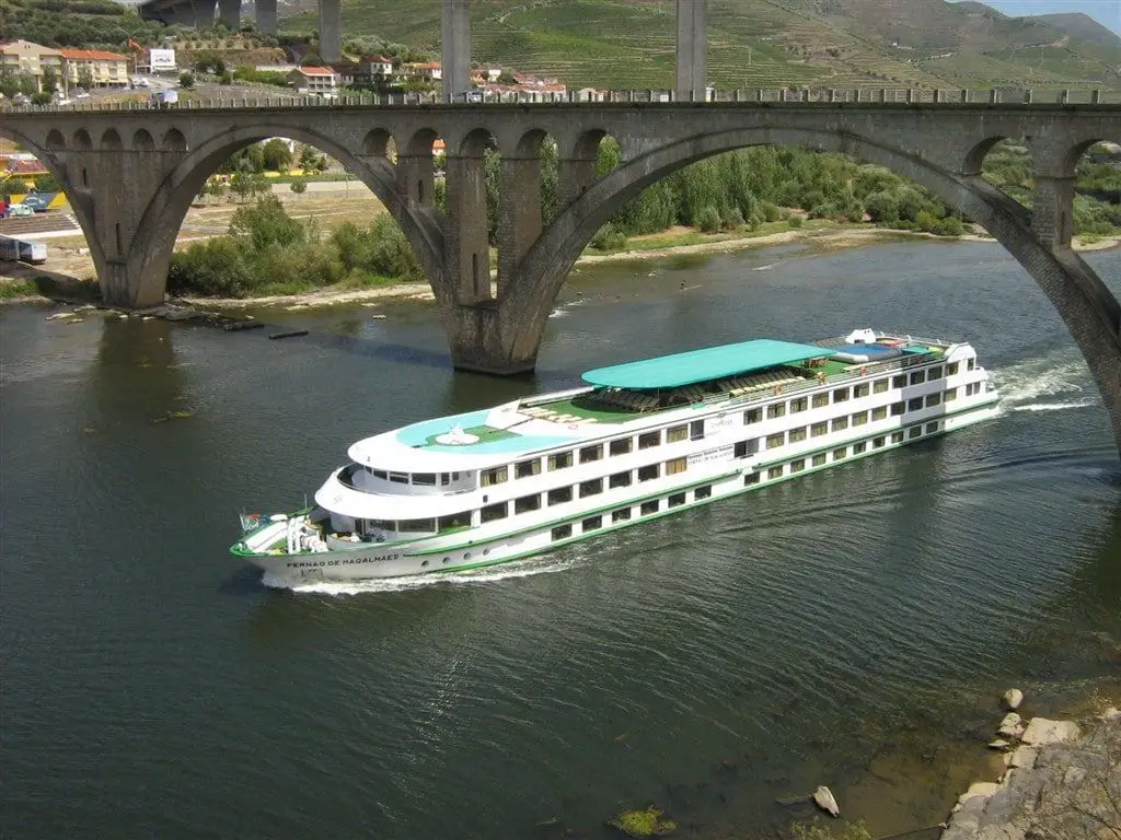
Finally, the Douro River founds its destination, flowing through the Águeda River to the Atlantic Ocean in Porto, Portugal. Having a very minimal slope gives it the quality of being an easily navigable river. In its waters you can see small boats, cargo barges and cruises. (see Caqueta River)
Reservoirs in the Douro River
As the Douro River travels through two countries, nine reservoirs in Portugal and 7 in Spain have been created, we decided to place them separately as follows:
Reservoirs belonging to Spain:
- Cuerda del pozo
- Los Rábanos
- San José
- Villalcampo
- Castro
- Aldeadávila
- Saucelle.
Reservoirs belonging to Portugal:
- Miranda
- Peck
- Bemposta
- Pocinho
- Valeira
- Regua
- Carrapatelo
- Crestuma-Lever.
Among the most prominent reservoirs and falls are:
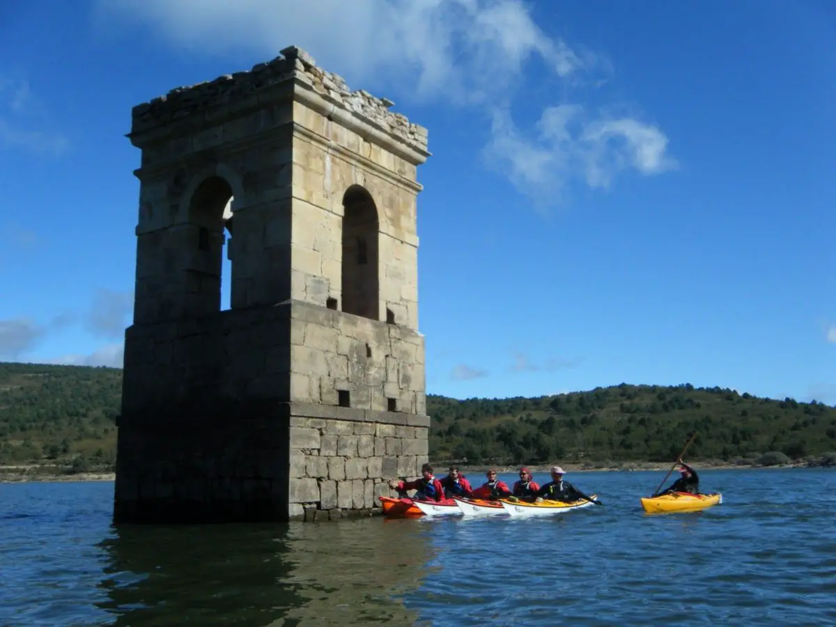
- Cuerda del Pozo: This reservoir is located in Vinuesa, Soria. It stands out because it is the reservoir with the greatest capacity of about 249 hm³, being the only one that regulates the flow of the river at its head. As for its hydroelectric capacity, it produces a power of 6,080 kW. It is mainly used for tourism and sports, irrigation and most importantly is the water supply to Soria and Valladolid.
- Salto de Aldeadávila I and II: These stand out for being able to produce 1,139 MW in power and 3,500 GWh in annual production, being first in Spain to produce these amounts. This reservoir attracts a lot of attention thanks to its retaining wall which has the shape of a vault and is 140 meters high and 250 meters wide.
- The Saucelle I and II Dam: It has a power of 525,000 MW and an impressive wall 92 meters high and 178 meters wide.
Activities that can be done in the reservoirs
If you go on a tour to this area, the reservoirs offer several attractions and active tourism is allow. The visitors can practice sports such as canoeing, swimming in its refreshing waters, or admire its flora and fauna. (see Rio Snake)
Starting from its birth, the reservoir of the Cuerda del Pozo is the most recommended for tourism purposes, there you will find beaches suitable for swimming with relaxing calm waters. Another option is the Natural Area of the Urbión Peaks where at your feet you can admire the amazing nature surrounded by pine trees that will leave you enchanted.
Los Rábanos stand out for its intense hydroelectric activity but you can also find a river beach with calm waters where you can bathe or practice canoeing. The San José reservoir located in the Natural Area of the Riberas de Castronuño, is a must stop on the plain of Valladolid.
Finally we have the Arribes del Duero where reservoirs of great magnitude and beauty can be seen. These include the Almendra reservoir, the Bemposta reservoir bordering Portugal and the Aldeadávila and Saucelle reservoirs, the last which stands out for being the largest hydroelectric producers of the entire route.
The answer is yes, both in its 572 kilometers of Spanish territory and in the Portuguese territory. In León and Castilla the Douro River makes its majestic journey through 5 cities such as Soria, Burgos, Valladolid, Zamora and Salamanca, representing 80% of the route that the river has.
With its many tributaries, reservoirs and jumps, this is an environment conducive to hydroelectric uses, irrigation of the vine, water sports, swimming and, of course, to enjoy a fabulous cruise.
It is also worth mentioning that the banks of this river have been used through history for the construction of castles, forts, bridges and other buildings that are still standing today and are a great tourist attraction. The use of its waters for the irrigation of the vine, an activity that has over 2000 years of history, is another important attractive of the Douro. And with this, the river has had an important history of commercial and tourist transportation.
Culturally speaking the Douro River has an unparalleled wealth on its banks containing 35% of the historical and artistic heritage of the region. In the vast territory it flows thru, more than a hundred hermitages, castles, palaces, forts, Roman and medieval bridges remain standing as well as more than twenty monasteries and convents, and four beautiful cathedrals.
If you like to travel and want to feed your adventurous spirit, the Douro River will allow you to explore its various historic buildings and reservoirs built on its course. These have been converted into reserves for both flora and fauna.
The Douro River along with its tributaries is the responsible for watering the numerous vine or vineyard plantations, mainly in the wine-growing communities of southern Europe such as Porto.
Tourism in the Douro River
The most emblematic places for the practice of water sports, a quiet walk or to admire the landscape are the Arribes de Duero and the flow from Salamanca to Porto where you can practice Kayak on the Douro River. Below we will describe what you will find in each of the places you cannot miss, and the activities you can do in this important and prominent body of water.
Arribes de Duero
The Arribes de Duero is the border between Spain and Portugal. Here the landscapes are sculpted in granite accompanied by large canyons where two species of very important birds for the region nest, such as the golden eagle and the black stork. If you make this beautiful and impactful route you will find a deep granite crack along the international waters of the Douro River running along 122 kilometers; remember that it belongs to two countries.
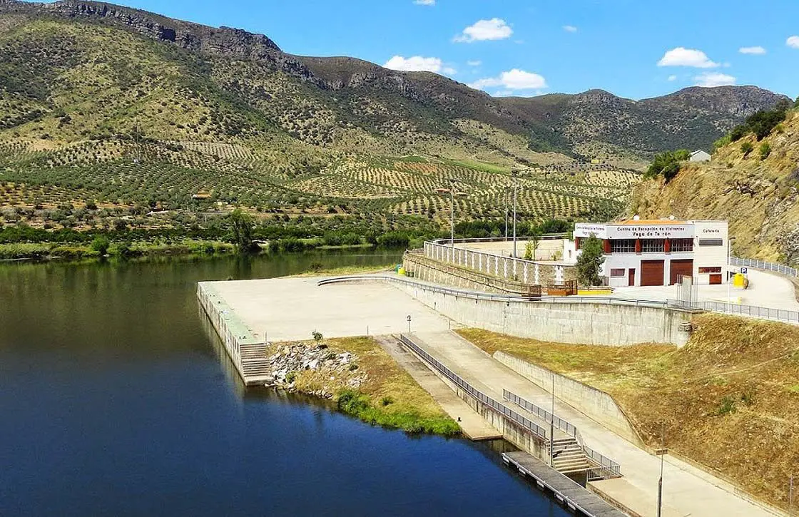
Through this route the waters take a road where they have to flow tightly but flexibly, easily adapting to the relief as a fish in the water, starting from the Castro reservoir in Zamora to the Vega Terrón pier in Fregeneda. Arribes de Duero limits in the southwest with the province of Zamora and in the northwest with the province of Salamanca.
The Arribes de Duero natural park comprises an area of 237,500 hectares, forming an international territory between Spain and Portugal; this makes the Arribes one of the largest protected natural areas in all of Europe.
Another important thing to point out is that in this park are located the last Spanish rivers, here in this last confluence the water flows into an abrupt fall from 800 meters to 100 meters in a very short distance, so changing is the relief. (see Casiquiare River)
The Arribes de Duero are characterized by the beauty of its landscapes, composed of steep valleys, very changing water courses, granite, unevenness, and water flowing as if it were inside a box. There tributary rivers Águeda, Esla, Huebra, Uces and Tormes can be seen.
Sailing 22 kilometers below, we can find the Aldedávila reservoir, the Bemposta dam, the Smoke well and the Uces river. On the way from the Aldedávila reservoir to the Bemposta dam you will find fluvial cuts and granite moles where the birds of the area like the golden eagles and the black storks nest, about 400 meters high.
In the Pozo de los Humos you will see an impressive waterfall about 40 meters high. And finally, the Uces river that impacts on the granite making its waters look like a beautiful cloud over the water, which gives this place it name, Smoke Pit, thanks to the mist form by the water.
But if you only want to admire the landscape quietly, there are many viewpoints for you; the most prominent is the Mirador del Fraile or Masueco. The towns that stand out the most are Aldeadávila and La Fregeneda (Salamanca) and Fermoselle (Zamora), where you can stay in hotels or rural houses and eat in delicious restaurants.
Route from Salamanca to Porto
Starting from the Vega Terón (Salamanca) to Porto (Portugal) you will have 240 kilometers to travel with an unevenness of one 130 meters, which will not affect the trip since there are locks that tame the rhythm of the water so you will not have to worry about some drastic movement of the ship.
Leaving behind the iconic landscape of Salamanca, you will arrive at the port of Vega Terrón where the landscape changes to a forest generally made up of holm oaks and cork oaks, and pastures or thickets, where the cows grazed wandering. From now on you will find the typical Mediterranean vegetation composed of olive groves, almedros and citrus trees, as a result of a microclimate.
While traveling on a boat, the aromas that you will perceive are olive, citrus like orange, and grapes from the vineyards, all characteristic aromas of the area.
In this route, the river width it is varies a lot, in some points it narrows very much and in others it opens very widely. In parts of the road you will not find vegetation, but you´ll be able to see the “Cachào” of Valeira an immense rock that has an interesting past. To be specific, it caused a lot of shipwrecks until the 18th century; It is said that Queen Mary of Portugal had it demolished.
As for the locks there are five, helping the river to remain calm. The first is in Pocinho with about 20 meters high, taking us to a concrete parking lot, an iron gate prevents us from passing. But the trip does not end here, while the captain makes some maneuvers you can enjoy a delicious wine and some snacks until you go out again to open river; all this in the towns of Regua and Lamego.
To finish the trip through the locks, we reached the last one in Carrapatelo, 36 meters high, being the highest in Europe and one of the highest in the world.
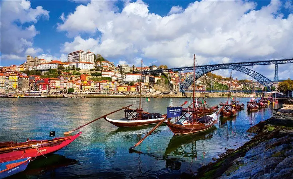
Then you´ll know you arrive in Porto because you start to see the little houses, boats and people walking, fishing or bathing. Up on entering you will see more people, more movement and buildings. Arriving at the city you will pass under its five emblematic bridges to then reach the mouth of the Duero River to join the Mediterranean Sea, in Porto.
The Douro River occupies the third place as the longest river in Spain, and is navigable throughout its journey in Portugal thanks to the locks created to counteract the unevenness. As a consequence, several tourist agencies offer cruises along the river in all seasons.
The variety of its relief, landscapes, old buildings, the diversity of water activities such as cruises trips, water skiing, placid rides on pedal boats, riding a motorboat, canoeing or windsurfing, rowing or sailing make this river a wonderful attraction to visit.
Kayak on the Douro River
One of the most popular sports to practice in this important and extensive river is Kayak. This activity has multiple health benefits, as it improves the heart rate, strengthens arms and legs, the lost of calories and learning synchronization and balance. It is not about speed if not intelligence and flowing with the current as if one.
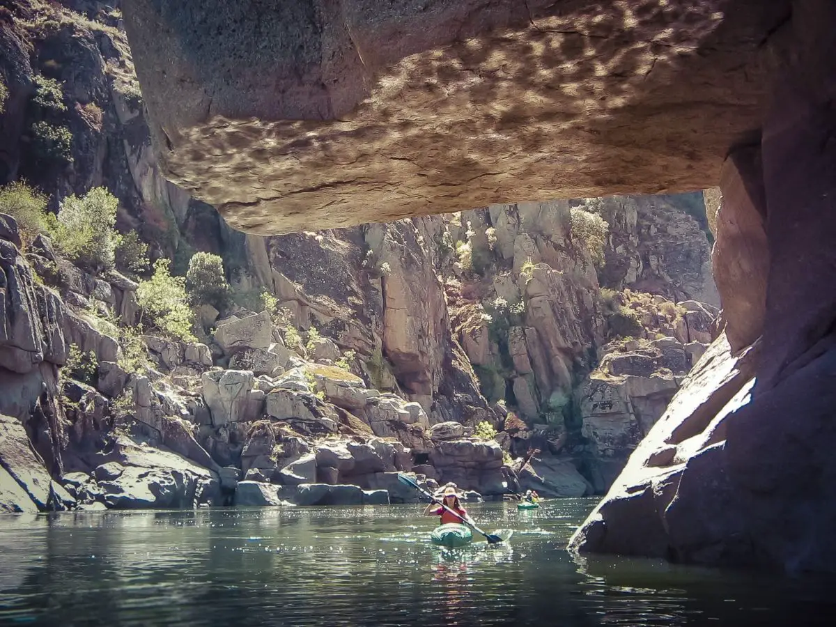
The most recommended places to practice this sport are Arribes del Duero and Lake Sanabria. In the natural park of Arribes del Duero, river canyons await you, in them you can live the experience of navigating while enjoying beautiful landscapes, having a crossing along the Duero River to the city of Porto, leading to the Atlantic Ocean.
It is this route you will have the opportunity to discover a variety of landscapes such as terraces, mountains, forests, vineyards, landscapes with a shortage of vegetation but naturally sculpted in granite, see how the river is encased to then fall abruptly therefor admiring its majesty.
It can be said that the Douro River is one of the most interesting and fun river borders in Europe, thanks to the beauty of its landscapes, sculpted in granite by time and falling in high waterfalls at others. Its scented vineyards, olive trees and trees of citrus fruits represent what is the perfect Mediterranean micro climate. From the summits of its birth to the wide mouth towards the Atlantic Ocean where its waters flow freely everything makes this a fantastic place to visit.
It is beautiful and fascinating to be able to do this tour and see the evolution of one of the longest rivers in Europe.
The navigability of the Douro River dates back several centuries ago, where ancestors valued the potential of the river as a means of river transport and communication; in addition to this they noticed the beauty of its varied landscape, its species and its vegetation so much so that many of them decided to live in its territory building castles, churches, sowing and of course sailing. (see Putumayo River)
In the fifteenth century they decided to make improvements to better transportation and communication routes in the river, when the land routes became damage causing several provinces to be held uncommunicated which resulted in the decline in trade. For more than twelve centuries, the people of these settlements just walked the roads, without even thinking about the opportunity that the river could give them.
When their daily activities are affected by problems in the land roads, they finally look at the Douro River as an excellent new transport route, a kind of waterway that could make their lives easier.
That discovery meant that they will no longer have to spend days wandering on uncomfortable roads, they could only flow with the river and they will be able to get where they wanted. From that moment on the inhabitants will not only work, but they will also delight in the views that nature gave them with its summits, its glaciers, its narrow, sculpted landscapes in granites, on terraces and plains.
Perhaps you may think that the Douro is a simple river but just need to navigate through it to know that it is not. Diversity and dynamism are its main characteristics. You can be in a mountain a moment and in a reservoir the other enjoying variety of scented trees in one path and even near the sea on another.
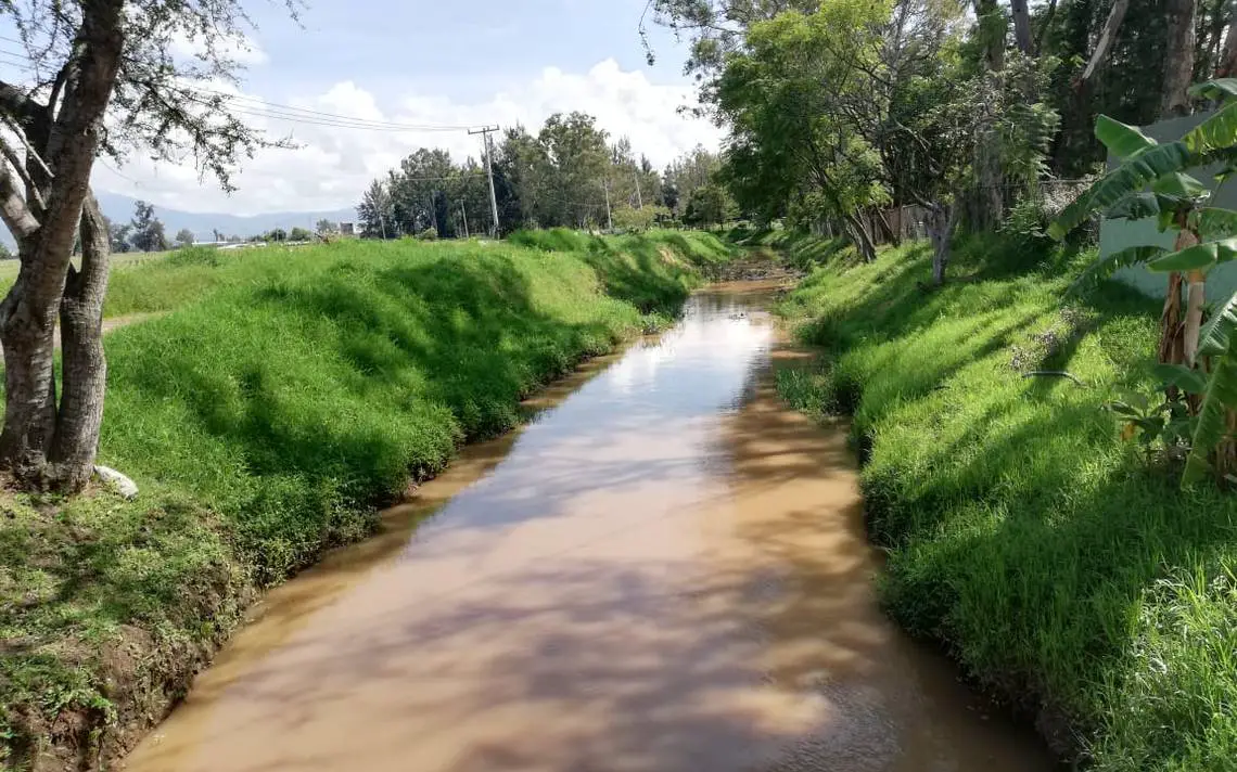
Contamination in the Douro River
In the capital of Soria, the waste discharge in the river generates poor quality and water, which has become a worrisome matter. There is presence of binders of floating organic matter.
The group of environmentalists in action Asden made a basic analysis of binders in the river. The result of the presence of this substance is a large amount of microbial fauna and flora similar to what we can find in stagnant water. This makes experts think that along the river bed there can be a layer of organic matter that is overlooked in a basic analysis and its permanence can deteriorate the water quality of the river.