
Last Updated on May 27, 2020 by Hernan Gimenez
Indice De Contenido
- 1 Amazonian River: History, Origin, Characteristics, Depth and Much More
- 2 History and Origin of the Amazonian River
- 3 Length, width and depth of the Amazonian River
- 4 Dispute about length
- 5 Amazonian River: Characteristics and location
- 6 Relief formations and drainage patterns
- 7 Physiography of the Amazonian River course
- 8 Hydrology
- 9 Amazonian River Climate
- 10 Soils
- 11 Importance of the Amazonian River
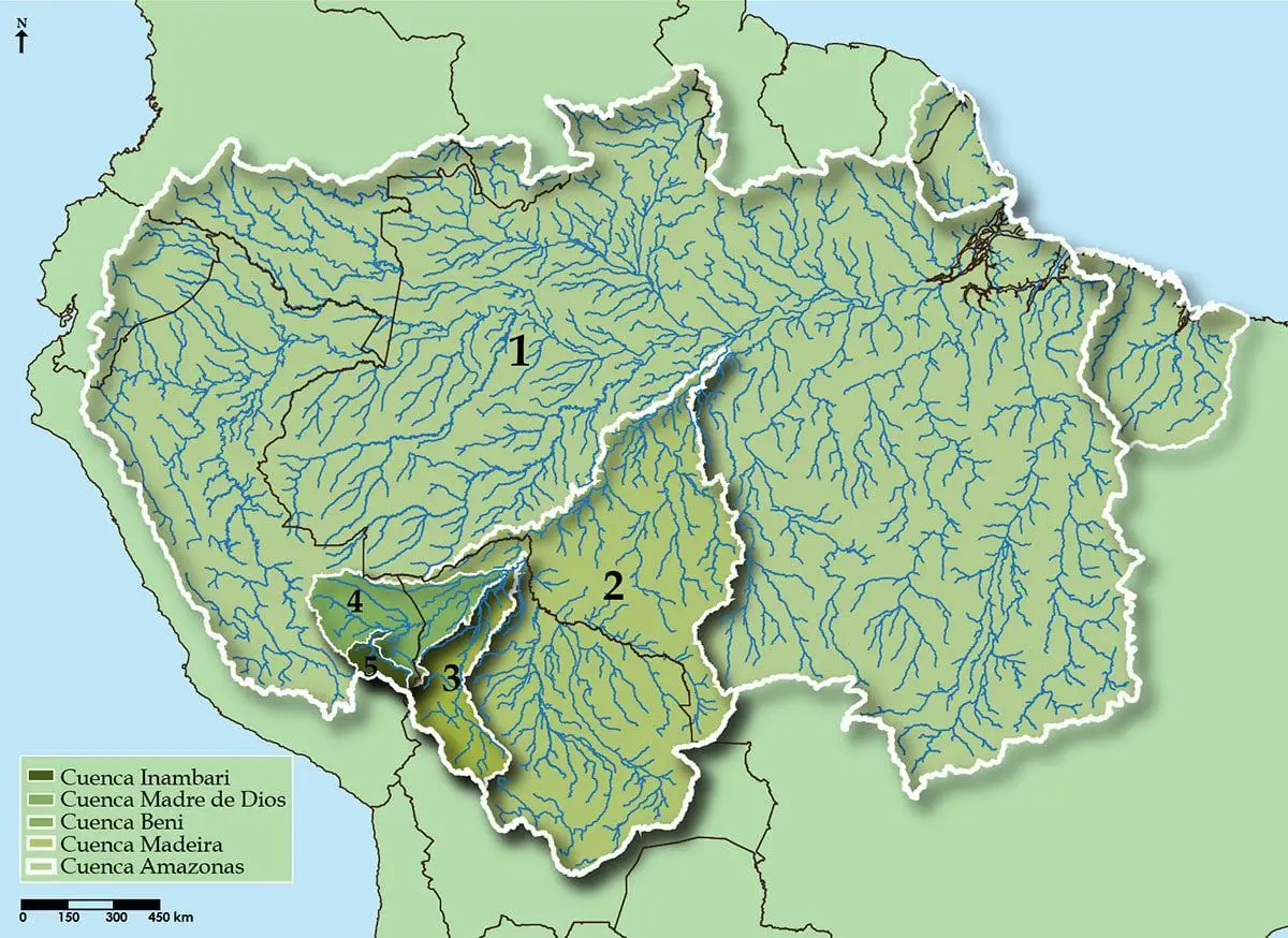
- 12 Tributaries of the Amazon River
- 13 Economic activities of the Amazonian River
- 14 Is the Amazonian River Contaminated?
Amazonian River: History, Origin, Characteristics, Depth and Much More
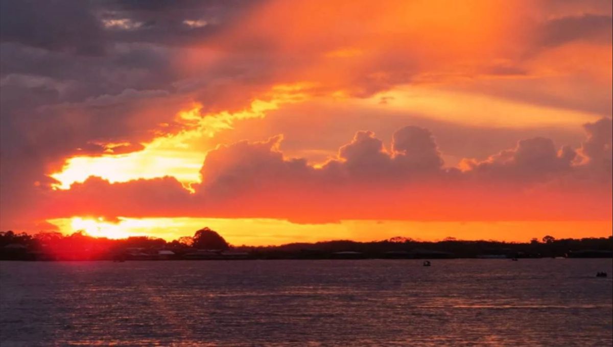
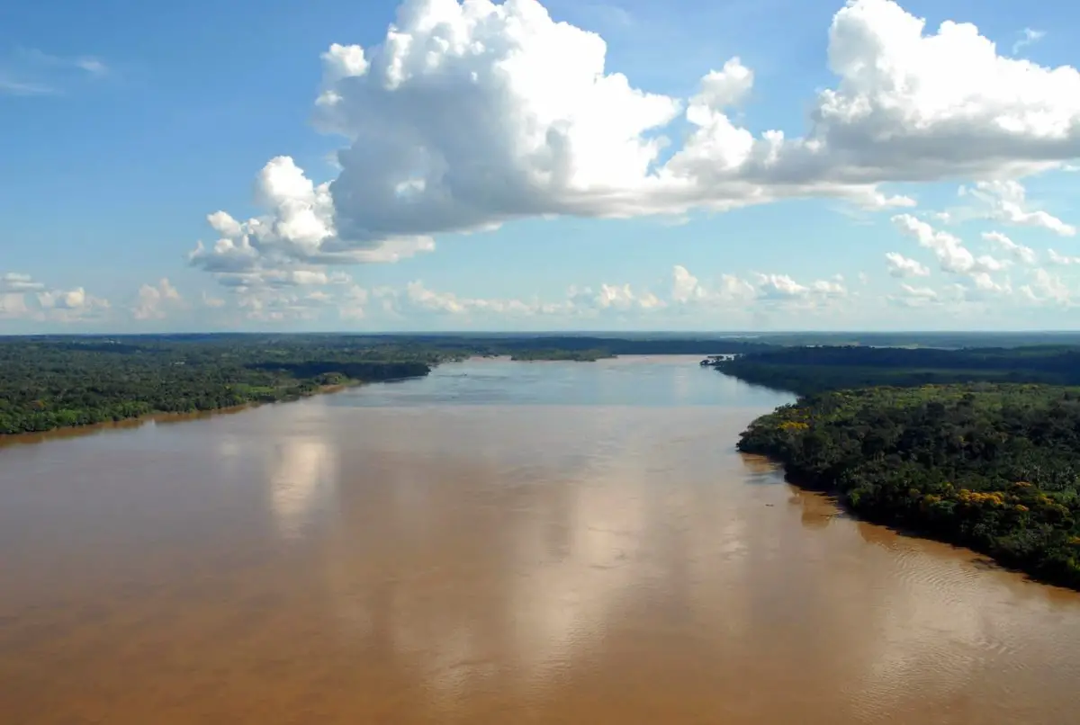
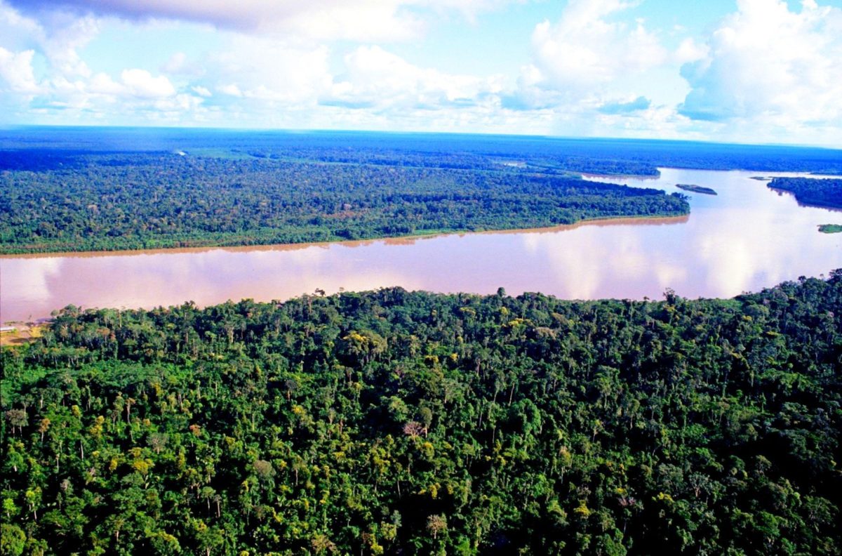
The Amazonian River, also called Marañon River and Solimões River is the largest of South America and the biggest drainage system in the world in terms of flow volume and the area of its basin.
The total length of the river, measured from the Ucayali-Apurímac river system in the South of Peru, is at least 4.000 miles (6.400 Km) which makes it a little shorter than the Nile River, but equals the distance between New York and Rome.
Its most western source is high in the Andes Mountains in the 100 miles from the Pacific Ocean, and the river mouth in the Atlantic Ocean on the north east cost of Brazil.
However, both the length of the Amazonian River and its final source have been subjects of debate since the middle of the XX Century, and there are those who assure that the Amazonian River is longer than the Nile.
If you don’t know yet in which continent you can find the Amazonian River, we tell you that it is located in South America.
History and Origin of the Amazonian River
During what most archeologists call the formative period, the amazonian societies were deeply involved in the emergence of agrarian systems on the high lands of South America.
Trade with the Andean civilizations on the land near the head of the river in the Andes, made an essential contribution to the social and religious development of the higher altitude civilizations, among other, the Muiscas and the Incas. The first human settlements were usually on lower hills or mounds.
5 types of archeological mounds have been observed in the Amazonian region:
- Shell waste
- Artificial mounds
- Artificial land platforms for entire villages
- Soil mounds and crests for cultivation
- Roads and canals, and figurative mounds, both geometric and biomorphic

- The Shell waste mounds: These were the first evidence of habitation; they represent piles of human waste and are mainly dated between 7500 and 4000 years. They are associated with cultures from the ceramic age; there are no pre ceramic age mounds documented by archeologists so far.
- Artificial mounds: to entire villages this is the second type of mound. They are best represented by the Marajoara culture. The figurative mounds are the most recent type of occupation.
There is ample evidence that the areas surrounding the Amazonian River housed large and complex indigenous societies, mainly led by chiefs or “caciques”, which developed into large villages and towns.
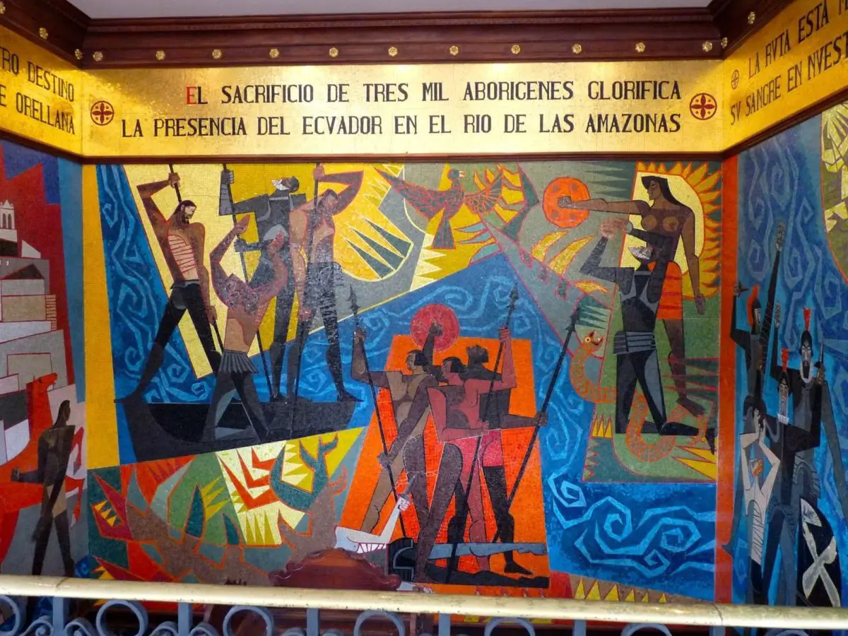
Archeologists think about the History of the Amazonian River, that when Spanish conquistador De Orellana traveled thru the Amazonas in 1541 over 3 million indigenous people lived in the banks of the river. These pre-Columbian settlements established highly developed civilizations. For example, the pre-Columbian indigenous from Marajó Island may have developed social stratification and may have supported a population of nearly 100.000 people. To achieve this developmental level, the indigenous habitants of the Amazonian rain forest altered the ecology of the woods thru selective farming and the use of fire.
Scientifics argue that by repeatedly burning some wooded areas, the natives made the soil richer in nutrients. This created areas with darker soil known as “terra preta de indio” or darker indigenous soil.
Thanks to those darker soils, the native communities were able to create a more fertile land making them more sustainable for large scale agriculture able to sustain bigger populations and complex social structures.
Additional investigations have presented the hypothesis that this practice began 11.000 years ago. Some say that its effects on the ecology of the woods and the regional climate can explain the unusual band of lesser precipitation thru the Amazonian basin.
Many of the native tribes were involved in constant war. James Stuart Olson wrote: The expansion of Munduruku dislocated and displaced the Kawahíb which divided the tribe in much smaller groups. Munduruku first came to the attention of the Europeans in 1770 when a series of generalize attacks began against the Brazilian settlements alongside the Amazonian River.
Talking about the history of the Amazonian River, we already mentioned that in 1500 the Spanish conquistador Vicente Yáñez Pinzón was the first European documented traveling the Amazonian River. Pinzón named the stream Santa María del Mar Dulce (Saint Mary of Sweet Sea) later shortened to Mar Dulce thanks to the sweet water that flows to the ocean.
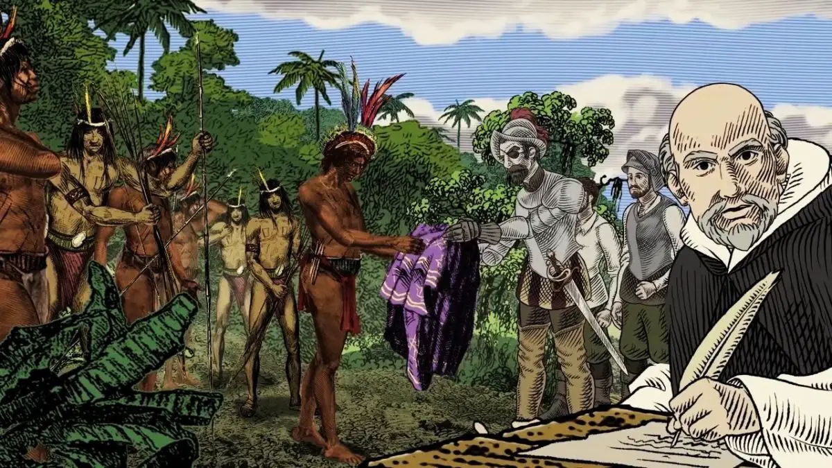
Another Spanish explorer, Francisco de Orellana, was the first European to travel from its origins in the basin up river situated in the Andes, to the river mouth. During this trip, Orellana named some of the Amazonian River tributaries as Río Negro (Black River), Napo and Jurua.
Francisco Orellana named the Amazonian River, the most abundant of the world… Orellana, who lost an eye on this adventure, told upon his return to Spain that the ships had been attacked by numerous worrier women that dominated the bow and arrow.
What does Amazonian River means? This name was inspired by the worriers who attacked the expedition, mostly women, who reminded Orellana of the Amazonian Worriers from the ancient Hellenistic culture.
Exploration
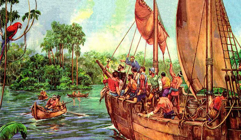
Gonzalo Pizarro set off in 1541 to explore the east of Quito in the interior of South America looking for El Dorado (the golden city) and La Canela (the cinnamon valley). He was accompanied by his second in command, Francisco De Orellana.
After 100 miles, the Coca River joined the Napo River (in a spot now called Francisco De Orellana Port); the entourage stopped for a few weeks to build a boat just up river from this confluence.
De Orellana was ordered to follow the Napo River, then known as La Canela River, and come back with food for the entourage. They went on down the river thru an uninhabited area where they couldn’t find any food. Based on the information given to them by a captive native chief called Delicola, they hoped to find food a few days river down going up another river to the north.
De Orellana took some 57 men with him, the boat and some canoes and left Pizarro’s troops December 26th 1541. However, De Orellana apparently missed the confluence (probably with the Aguarico) where he was looking for provisions for his men.
When he and his men got to another village, many of them were starving and had eaten poisonous plants so they were near death. Seven men died in that village. The other men threatened with mutiny if his orders continued, so the returned to join Pizarro’s entourage. Then he decided to change the purpose of the expedition to discover new lands in the name of the Spanish King, so the men built a larger ship to sail down the river.
After travelling more than 370 miles on the Napo River they reached a bigger confluence at a point near Iquitos, then, they followed the upper part of the Amazonian River, now known as Solimões for another 750 miles to its confluence with Rio Negro (near modern Manaos) which they reached June 3rd 1542. At the Nhamunda River, an affluent of the Amazonian River, down river from Manaos, Orellana’s group sustained a fierce battle with warriors that, as informed, were led by fierce warrior women that pounded the men to death with sticks if they tried to leave.
Orellana’s men began calling the women Amazonas, as a reference to a tribe of warrior women from the Greek mythology. The river was first known as The Marañón (the name with which the Peruvian part of the river is still known) or Orellana River. Later on it was known as the Amazonian River, name with which it is still known both in Spanish as in Portuguese.
With respect to the initial mission of founding cinnamon, Pizarro informed the King that they had found cinnamon trees but that these could not be harvested profitably. In fact, true cinnamon (Cinnamomum verum) is not original of South America. Other related plants that contain cinnamon (from the Lauraceae family) are pretty common in this region of the Amazon and Pizarro probably saw some of them. The expedition got to the river mouth August 24th 1542, showing the navigability of the big river.
In 1560, another Spanish conquistador, Lope de Aguirre, may have done the second descent of the Amazonian River. Historians are not sure if the river he descended was the Amazonian or the Orinoco that runs parallel to the Amazonian but further north.
Discovery of the Amazonian River
Portuguese explorer Pedro Texeira was the first European who traveled thru the entire river. He got to Quito in 1637 and went back the same route. From 1648 to 1652, the Portuguese bandeirante Antonio Raopso Tavare led an expedition from São Paulo by land to the mouth of the Amazonian River, investigating many of its tributaries, including the Río Negro, and covering a distance of more than 6.000 miles.
In what is now Brazil, Ecuador, Bolivia, Colombia, Peru and Venezuela, a series of colonial and religious settlements were stablished along the banks of the main rivers and tributaries with the purpose of trading, enslave and evangelize the indigenous people of the vast rain forest like the Urarina. At the end of the 17th century, the Spanish Jesuit priest Samuel Frit, apostle of the Omaguas, stablished some 40 mission villages.
Where does the Amazonian River in born?
For almost a century it was thought that the further source for the Amazonian River was in the drainage of the Apurímac River. These studies continued to been published as recently as 1996, 2001, 2007 and 2008.
Various authors had identified the snowy Mismi (Nevado Mismi) (5.597mtrs), located nearly 99 miles (160Km) west of the Titicaca River and 430 miles (700Km) south east of Lima as the utmost origin of the Amazonian River.
From this point, the Carhuasanta Brook emerges from the Nevado Mismi and joins the Apacheta Brook to form the Lloqueta River which in turn becomes the Hornillos River and finally joins the Apurímac River. A study from 2014 by the Americans James Contos and Nicolas Tripcevich from Area, a magazine reviewed by the Royal Geographic Society, show how they were able to identify the upmost distant source of the Amazonian River and how it is in the drainage of the Mantaro River.
A series of methods were used to compare the lengths of the Mantaro River with that of the Apurímac from their further points of origin to their confluence, showing the largest length of the Mantaro River.
Then the distances between Lago Junin to various potential points of origin of the Mantaro River were measured, which allowed them to determined that the Rumi Cruz Mountains was the origin of the Amazonian River, being the most distant source of water of the Mantaro basin (and intel, of the entire Amazonian basin).
Birth, path and river mouth of the Amazonian
The birth of the Amazonian River lies in the Nevado Mismi in the Andes Mountains, Arequipa, Peru, this is why the most precise measurement was that made with a GPS obtained by Contos kayaking down every one of the tributary rivers to their confluence.
Obtaining these measurements was hard given the nature of the class IV-V of each one of these rivers, especially on their inferior sections or “Abysms”. Ultimately, they determined that the most distant point in the Mantaro drainage is almost 50 miles (80Km) upstream compared with the Mismi Mountain at the Apurímac drainage, therefore the complete length of the Amazonian River is nearly 50 miles longer that it was thought.
Contos continued down river to the ocean finishing the first complete descend of the Amazonian River. Since the identification of its source (November 2012), two more teams have completed the journey.
After 430 miles (70Km), it is known that the Apurímac joins the Mantaro River to form the Ene River that later joins the Perene to form the Tambo River, this then joins the Urubamba to form the Ucayali River.
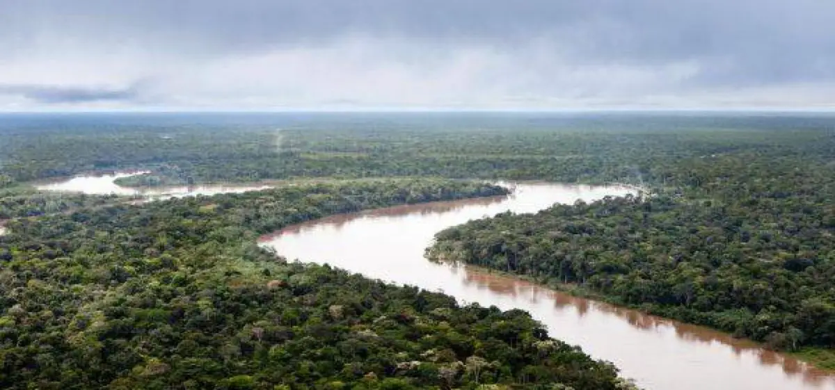
After the confluence of the Apurímac and the Ucayali, the river leaves the Andean terrain and is surrounded by flood plains. From this point to the confluence of the Ucayali and the Marañón, 990 miles downriver, forested banks are located just above the water and flood long before the river reaches its maximum flood stage. The lower banks of the river are interrupted by just a few hills and the river goes into the Amazon jungle.
The big question was where is the Amazonian River born? Given the route we now know that this river goes thru Peru which is considered the place of birth of the Amazonian River, then, it also goes thru Colombia and Brazil where the mouth of the river can be found.
High Amazon
Even though the confluence between the Ucayali and the Marañón is the point most geographers consider the birth of the Amazonian River, in Brazil this point in known as the Solimões das Águas, the fluvial systems and the flooded plains in Brazil, Peru, Ecuador, Colombia and Venezuela, whose waters flow out on Solimões and its tributaries, is called High Amazon.
The proper Amazonian River runs mainly thru Brazil and Peru and is part of the frontier between Colombia and Peru. It has a series of important tributaries in Colombia, Ecuador and Peru, some of which flow out to the Marañón and the Ucayali, and others do it directly in the Amazonian River. These include the following rivers:
- Putumayo
- Caquetá
- Vaupés
- Guainía
- Morona
- Pastaza
- Nucuray
- Urituyacu
- Chambira
- Tigre
- Nanay
- Napo
- Huallaga
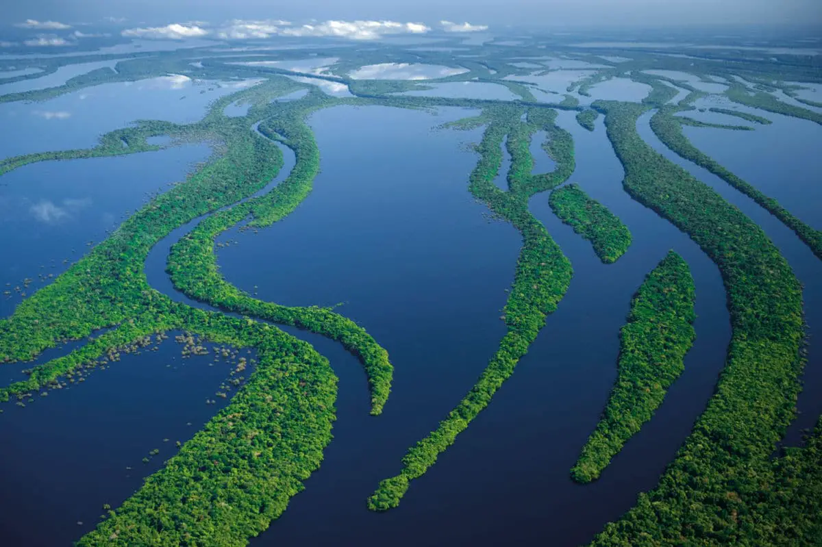
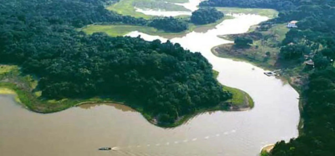
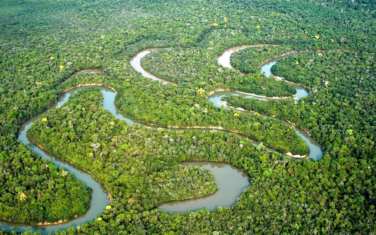
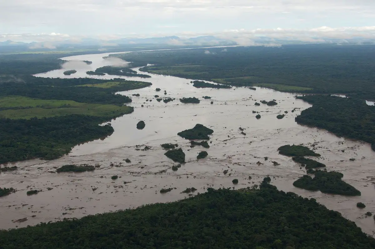
At some points the river is divided into multiple canals, often very long, with interior and side canals, all of them connected by a complicated system of natural canals, cutting thru the lower plain lands of Igapó, which never surpass 5 meters over the lowered river in many islands. From the village of Canaria at the big curvature of the river to the Negro, big extensions of land are submerged in the high waters, above which only the top or the trees can be seen.
We already mentioned that the mouth of the Amazonian River is in Rio Negro a Serpa, almost in front of the Madeira River, the river banks are low, until they get closer to Manaos when they elevate to become hills.
The lower Amazon
The lower Amazon begins where the dark waters of the Rio Negro join the sand color waters of the Solimões River, and for more than 4 miles (6Km) these waters run side by side without mixing together.
In Óbidos, a 56feet (17mts) crag over the river is backed up by low hills. The lower Amazon seems to once have been a gulf of the Atlantic Ocean, whose waters washed the cliffs near Óbidos.
Length, width and depth of the Amazonian River
Many may ask how much does the Amazonian River measures?. Its size is nearly 4000 miles (6400km). In other words, only ten percent of Amazon water enters downstream of Óbidos very little of which comes from the northern slope of the valley, the drainage area of the Amazon basin over the city of Óbidos. The depth of the Amazon River varies; it has been registered in some areas from 20 to 50 meters, as in others it has been registered from 90-100 meters.
Many studies also reveal that the depth of the Amazon River does not exceed 7 meters, since depending on the place it always varies. It is approximately 5,000,000 square kilometers (1,900,000 square miles) and, below, only 1,000,000 square kilometers (390,000 square miles) (about 20%), excluding the 1,400,000 square kilometers (540,000 square miles) of the Tocantins basin. The Tocantins River enters the southern portion of the Amazon Delta.
In the lower part of the river, the north bank consists of a series of steep and covered table hills that extend about 240 kilometers (150 miles) from the Xingu mouth to Monte Alegre. These hills are reduced to a kind of terrace that lies between them and the river.
On the southern shore, above the Xingu, a line of cliffs that line the alluvial plain extends almost to Santarém in a series of gentle curves before turning southwest, and, adjacent to the lower Tapajós, merge into the cliffs that form the terrace margin of the valley of the river Tapajós.
- Belém: is main city and port in the mouth of the river to the Atlantic Ocean. The exact location of the river mouth and its width is a matter of controversy due to the peculiar geography of the area.
- The Pará and the Amazon are connected by a series of river canals called furos near the city of Breves; Among them is Marajó, the largest combined river / sea island in the world.
If the Pará River and the oceanic façade of tha Marajó Island are included, the estuary of the Amazonian has a width of nearly 202 miles (325Km). In this case the width of the river mouth is generally measured from Cabo Norte, a cape situated east of the Pracuúba peninsula in the Brazilian state of Amapá, to Ponta da Tijoca, near the city of Curuçá in the state of Pará.
A more conservative measure that excludes the Pará river, from the mouth of the Araguari River to Ponta do Navio in the north coast of Marajó would still give the mouth of the Amazon a width of more than 110 miles (180 kilometers). If only the main canal of the river between the islands of Curuá (Amapá) and Jurupari (Pará) are considered, the width drops to a 9.3 miles (15Km).
The feather generated thanks to the river flush covers nearly 1.3 million square kilometers and is responsible for the muddy river bottoms that influence a big area of the tropical north Atlantic in terms of salinity, Ph, light penetration and sedimentation.
Dispute about length
While the debate over whether which is the longest river in the world, the Amazon River or the Nile has lasted many years, the historical consensus of the geographical authorities has decided to consider the Amazon River as the second longest river in the world, with the Nile being the longest.
However, different geographers have measured the Amazon between 6,259 and 6,992 kilometers (3,889 and 4,345 mi) long. It is often said to be “at least” 6,400 kilometers (4,000 miles) long.
According to reports, the Nile is between 5,499 and 6,690 kilometers (3,417 to 4,157 miles) long. It is often said to be “approximately” 6,650 kilometers (4,130 miles) long. There are many factors that can affect these measures.
A study made by Brazilian scientists concluded that the Amazon River is actually longer than the Nile. Using the Nevado Mismi, which in 2001 was labeled by the National Geographic Society as the source of the Amazon River, these scientists made new calculations of the length of the Amazonian River.
They calculated the length of the Amazon River to be 6,992 kilometers (4,345 miles). Using the same techniques, they calculated the length of the Nile as 6,853 kilometers (4,258 miles), which is longer than previously estimated, but shorter than that of the Amazonian River.
They made this possible by measuring the Amazonian downstream to the beginning of the tidal estuary of Canal do Sul and then, with a sharp turn, following the tidal canals that surround the island of Marajó and finally including the marine waters of the Bay of the Pará River.
Guido Gelli, science director of the Brazilian Institute of Geography and Statistics (IBGE), told the Brazilian television network Globo in June 2007 that it could be considered as a fact that the Amazon was the longest river in the world.
However, other geographers have had access to the same data since 2001, and a consensus has not yet been reached to support the claims of these Brazilian scientists. The length of the Amazon River and the Nile remains open to interpretation and is an ongoing debate.
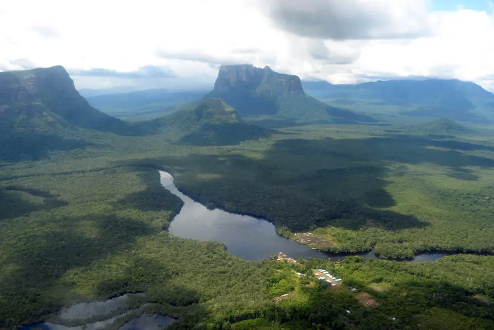
Amazonian River: Characteristics and location
The vast Amazonian Basin (Amazonia), the largest plain in Latin America, has an area of approximately 2.7 million square miles (7 million square kilometers) and is almost twice as large as that of the Congo River, another large Earth’s equatorial drainage system.
Extending approximately 1,725 miles (2,780 km) from north to south at its widest point, the basin includes most of Brazil and Peru, significant parts of Colombia, Ecuador and Bolivia, and a small area of Venezuela as seen on the map of the Amazonian River.
Approximately two thirds of the mainstream of the Amazonian and, by far, most of its basin are located within Brazil. The Tocantins-Araguaia area of influence in the state of Pará covers another 300,000 square miles (777,000 square km). Although the Brazilian government and popular thought consider it part of the Amazonian River, it is technically a separate system. It is estimated that about one fifth of all the water that escapes from the Earth’s surface is transported by the Amazonian River.
Among the characteristics of the Amazonian River that the discharge in the flood stage at the mouth of the river is four times of that of the Congo and more than 10 times the amount transported by the Mississippi River. This immense volume of fresh water dilutes the salinity of the ocean for more than 100 miles (160 km) from the coast.
The extensive lowland areas that border the main river and its tributaries, called Várzeas (floodplains), are subject to annual flooding, with the consequent enrichment of the soil; however, most of the great basin is made up of highlands, well above the floods and known as the mainland.
As it can be seen on the map of the Amazonian River, more than two thirds of the basin are covered by an immense tropical rainforest, which extends to the dry forest and the savanna in the highest north and south margins and to the montane forest in The Andes to the west. The Amazon Rainforest, which represents approximately half of the remaining rainforest on Earth, also constitutes its largest reserve of biological resources.
Since the last decades of the twentieth century, the Amazon basin has attracted international attention because human activities have increasingly threatened the balance of the highly complex forest ecology.
Deforestation has accelerated, especially to the south of the Amazon River and in the foothills of the Andes, as new roads and air transport facilities have opened the basin to a wave of settlers, businesses and researchers in the Rio Hirviente of the Amazon.
Important mineral discoveries have brought more population influxes. The ecological consequences of such developments, which potentially transcend the basin and even acquire global importance, have attracted considerable scientific attention.
Relief formations and drainage patterns
The Amazon basin is a major structural depression, a subsidence canal that has been filled with immense amounts of sediments from the Cenozoic age (that is, dating to approximately the last 65 million years). This depression, which extends to its greatest extent in the upper parts of the Amazon, lies between two ancient and relatively low crystalline plateaus, the rugged Highlands of Guyana to the north and the highlands of Brazil (somewhat further from the main river) to the south .
The Amazon basin was occupied by a large sea of fresh water during the Pliocene Era (5.3 to 2.6 million years ago). At some point during the Pleistocene Era (approximately 2,600,000 to 11,700 years ago) an exit to the Atlantic was established, and the great river and its tributaries were deeply entrenched in the seabed of the previous Pliocene.
The modern Amazonian River and its tributaries occupy a vast system of drowned valleys full of floods. With the rise in sea level that followed the melting of Pleistocene glaciers, steep-sided canyons that had eroded on the Pliocene surface during the period of lower sea levels gradually flooded. In the upper part of the basin in eastern Colombia, Ecuador, Peru and the Amazonian River in Bolivia, the most recent overflow of the Andes has covered many of the oldest surfaces.
Physiography of the Amazonian River course
The main exits of the Amazonian River are the two canals to the north of the island of Marajó, a low land with a size slightly larger than Denmark, through a group of semi-submerged islets and shallow sandbars.
There the mouth of the river is 40 miles (64 km) wide. The port city of Belém, Brazil, is found in the deep waters of the Pará river estuary south of Marajó. The Pará is fed mainly by the Tocantins River, which enters Pará southwest of Belém.
The link between the port city and the main canal of the Amazonian is to the north alongside the oceanic facade of Marajó or following the narrow furos (canals) of Breves that connect the island to the west and southwest and join the Pará River with the Amazon.
There are more than 1,000 tributaries of the Amazonian River that flow into the highlands of Guyana, the highlands of Brazil and the Andes. Here are six of these tributaries:
- Japurá River.
- Juruá River.
- Madeira River
- Black river
- Purus River.
- Xingu River
These are more than 1,000 miles (1,600 km) long; The Madeira River exceeds 2,000 miles (3,200 km) from its source to the mouth.
Larger ships sailing across the ocean can ascend the river 1,000 miles to the city of Manaus, Brazil, while smaller cargo ships and passengers can reach Iquitos, Peru, 1,300 miles (2,090 km) upstream, at any time of the year.
The sedimentary axis of the Amazon basin comprises two distinct groups of geographical accidents: the Várzea or alluvial flood of the Holocene age (that is, up to approximately 11,700 years), and the mainland, or highland surfaces of Pliocene and Pleistocene (11,700 to 5,300,000 years) that are well above the highest flood level.
The floodplain of the main river is characteristically 12 to 30 miles (19 to 50 km) wide. It is irregularly limited by low cliffs 20 to 100 feet (6 to 30 meters) high, beyond which, the oldest undulating highlands extend both north and south to the horizon.
From time to time, these cliffs are undermined by the river that oscillates from side to side through the flood, producing the tierra caída, or “fallen earth,” so often described by Amazonian travelers. In the city of Óbidos, Brazil, where the width of the river is approximately 1.25 miles (2 km), a low range of relatively hard rocks narrows the wide flood plain.
Hydrology
Most of the 1.3 million tons of sediments that the Amazon pours daily into the sea are transported northward by coastal currents to be deposited along the coasts of northern Brazil and French Guyana. As a consequence, the river is not building a delta. Normally, the effect of the tide can be felt as upriver as Óbidos, Brazil, 600 miles (970 km) from the mouth of the river.
A tidal hole called pororoca sometimes occurs in the estuary, before the live tides. With an increasing roar, it advances upstream at speeds of 10 to 15 miles (16 to 24 km) per hour, forming a breaking wall of water 5 to 12 feet (1.5 to 4 meters) high.
In the Óbidos Strait, river flow has been measured at 7,628,000 cubic feet (216,000 cubic meters) per second; its width is restricted to just over a mile. Here the average depth of the canal below the average watermark is more than 200 feet (60 meters), well below sea level.
In most of the Brazilian river, its depth exceeds 150 feet (45 meters). Its gradient is extraordinarily slight. On the Peruvian border, about 2,000 miles (3,200 km) from the Atlantic, the elevation above sea level is less than 300 feet (90 meters).
The maximum free width (without islands) of the permanent bed of the river is 8.5 miles (14 km), upstream from the mouth of the Xingu. However, during large floods, when the river completely fills the floodplain, it stretches in a band of approximately 55 km (55 miles) wide or more. The average speed of the Amazonian River is approximately 1.5 miles per hour, a speed that increases considerably at the time of flooding.
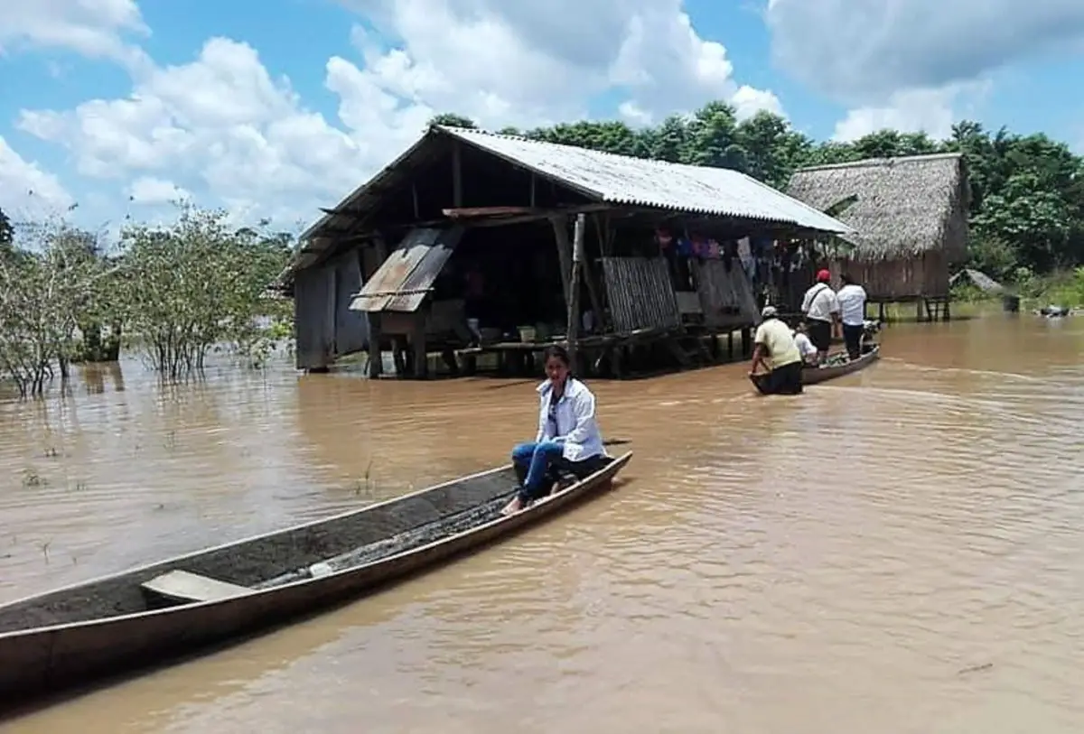
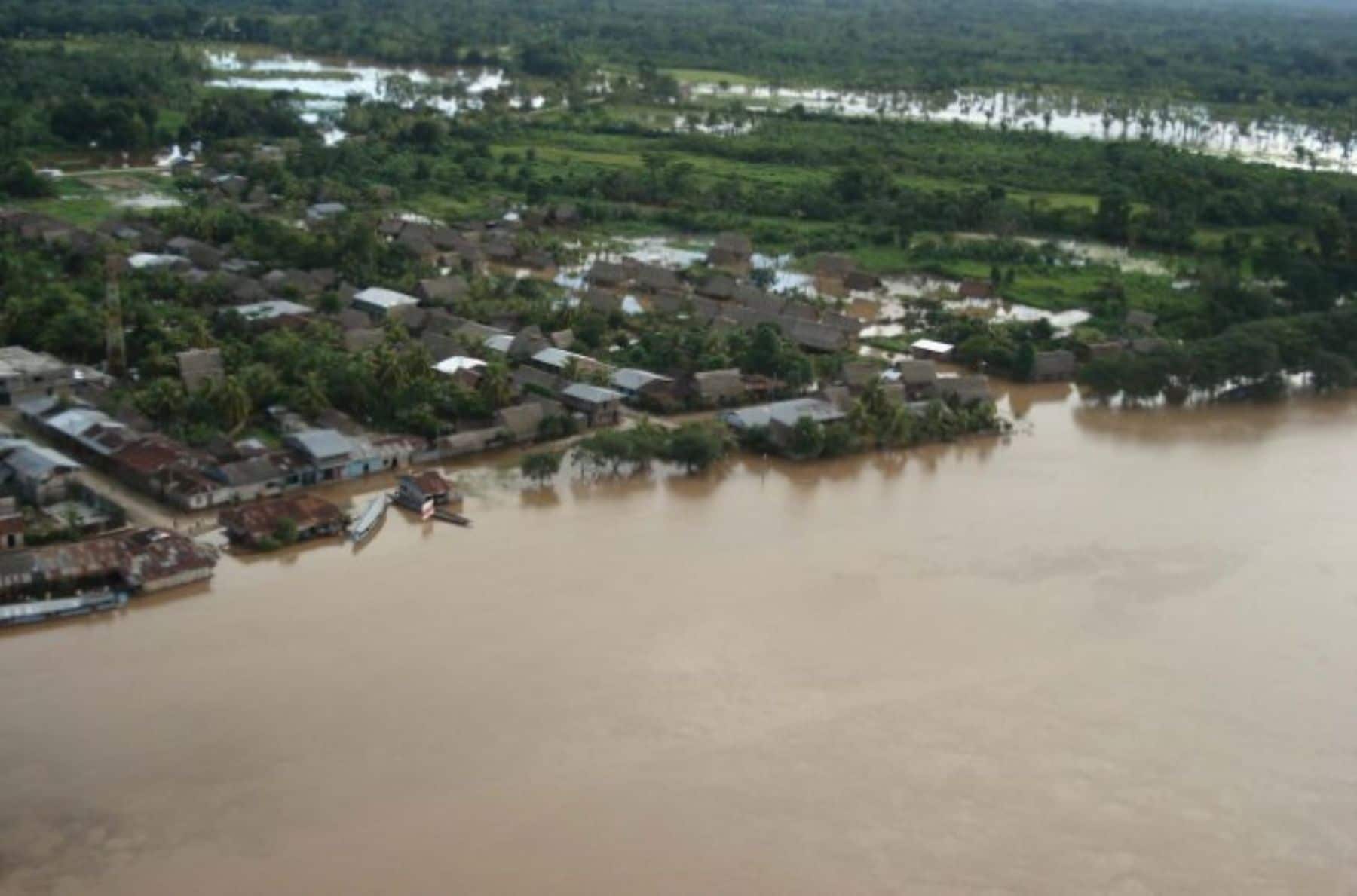
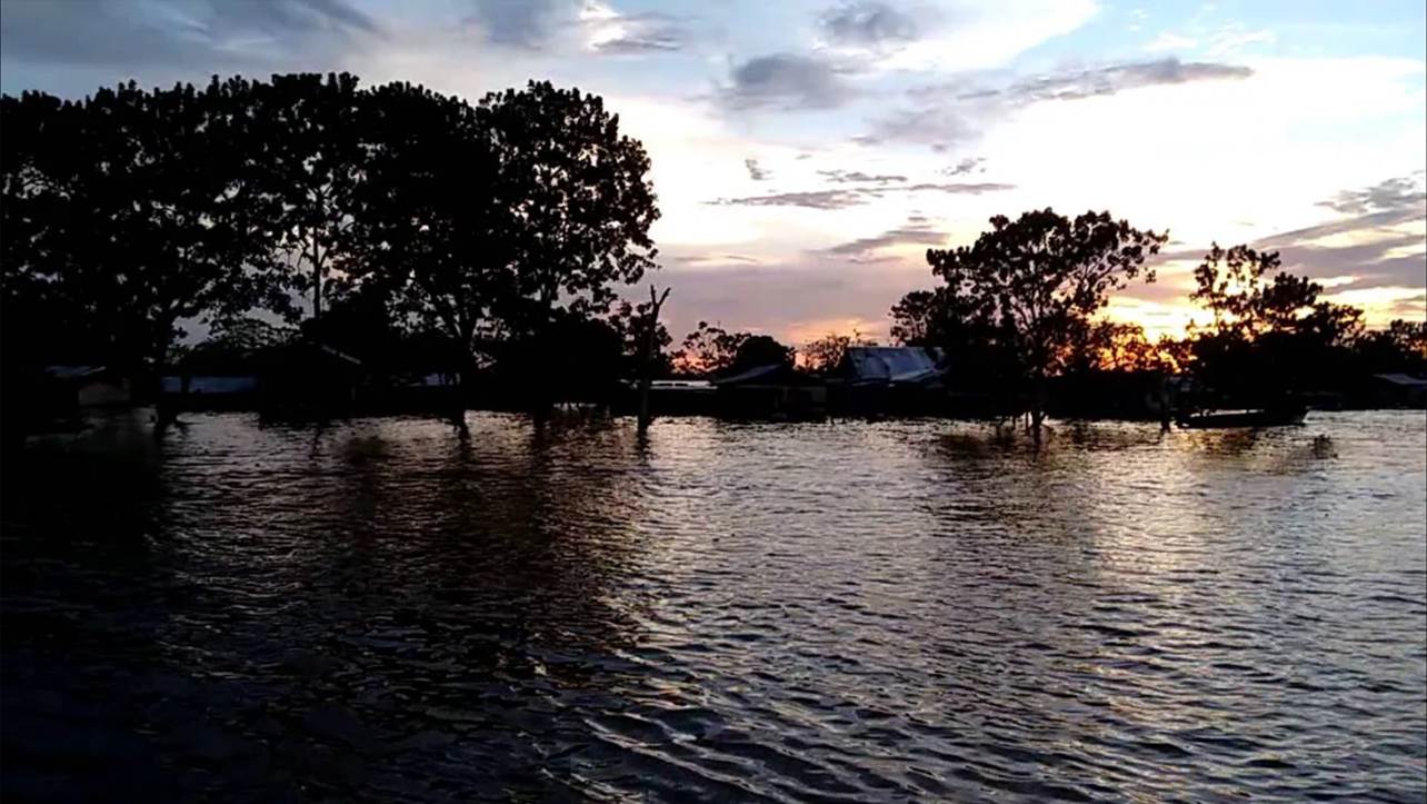
The rise and fall of water are controlled by events outside the flood plain. The Amazon floods are not disasters, but distinctive and anticipated events. Its marked regularity and the gradual change in water level are due to the enormous size of the basin. There are smooth gradient and large temporary storage capacity of both the flood plain and the estuaries of the river tributaries. The upper course of the Amazonian River has two annual floods.
The river is subject to the alternative influence of tributaries that descend from the Peruvian Andes (where rains fall from October to January) and from the Ecuadorian Andes (where rains fall from March to July).
This alternating pattern disappears later, as the two high-flow stations gradually merge into one. Therefore, the ascent of the river progresses slowly downstream in a gigantic wave from November to June, and then the waters recede until the end of October. Flood levels can reach 40 to 50 feet (12 to 15 meters) above the low river.
Amazonian River Climate
The climate on the Amazonian River is warm, rainy and humid. The lengths of day and night are the same that those of the equator (which runs only slightly north of the river), and normally clear nights favor relatively rapid radiation from the heat received from the sun during the 12-hour day.
There is a greater difference between daytime and nighttime temperatures than between warmer and colder months. Therefore, the night can be considered the winter of the Amazon.
In Manaus, the average daily temperature is between the upper 80 ° F (approximately 32 ° C) in September and the mid 70 ° F (approximately 24 ° C) in April, but the humidity is constantly high and often oppressive.
During the winter months of the southern hemisphere, a powerful mass of south-polar air drifts occasionally northward in the Amazon region, causing a sharp drop in temperature, known locally as friagem, when it can be register at 50 ° F (around 14 ° C).
At any time of the year, several days of heavy rains can be replaced by clear and sunny days and cool nights with relatively low humidity. In the lower reaches of the river basin, the refreshing trade winds blow most of the year.
The main influx of atmospheric water vapor in the basin comes from the east. Approximately half of the precipitation that falls comes from the Atlantic Ocean; the other half comes from the evapotranspiration of the tropical forest and the associated conventional storms.
Lowland rainfall generally ranges from 60 to 120 inches (1,500 to 3,000 mm) annually in the central Amazon basin (for example, Manaus). On the east and northwest margins of the basin, rainfall occurs throughout the year, while in the central part there is a defined drier period, usually from June to November.
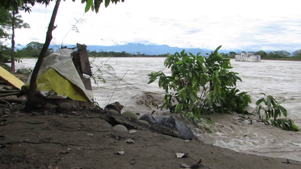
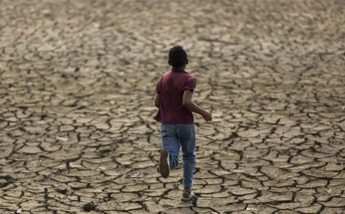
Manaus has experienced up to 60 consecutive days without rain. In addition, in 2005, the Manaus region experienced a devastating drought, which caused dryness in several parts of the river; this made transportation difficult, depleted drinking supplies and leaving millions of rotten fish in the riverbed.
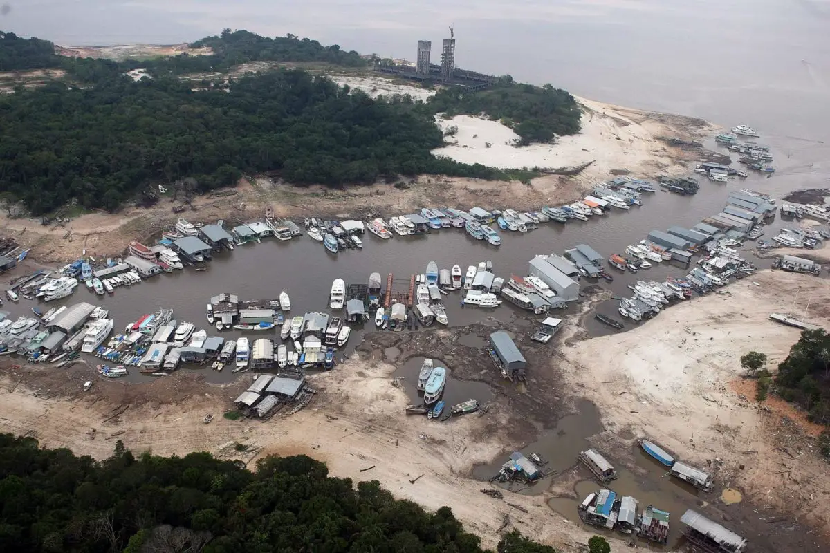
Such extreme periods of drought are uncommon in the Manaus region, but fluctuations in the level of the river – which are believed to be related to climatic events and continuing deforestation in the area – have remained a cause for concern. The dry season is not intense enough to stop plant growth, but it can facilitate the onset and spread of fires, whether natural or not. To the west, the Andes form a natural barrier that prevents most of the water vapor from leaving the basin.
The influence of the mountains on the rain is indicated by the high levels of precipitation in the upper foothills and by the Andean flanks filled with clouds, which feed the rivers that form a large part of the Amazon system. The highest amounts of precipitation, up to 140 inches (3,500 mm), are recorded in the upper Putumayo River along the Colombian border.
Soils
The vast vegetation of the Amazonian forest seems extremely lush, leading to the erroneous conclusion that the underlying soil must be extremely fertile. In fact, the nutrients in the system are enclosed in vegetation, including roots and leaf litter, and are continuously recycled through the fall and decay of the leaves.
In general, the soils above the flood level are well drained, are porous and of variable structure. They are often sandy and of low natural fertility due to their lack of phosphate, nitrogen and potash and their high acidity.
The small areas are covered by basaltic rocks, with a reddish soil known as terra roxa of considerable natural fertility. Terra preta dos Indios (“black land of the Indians”) is another type of localized and superior soil, created by the settlement activity of the past.
The agricultural potential of the annually flooded areas of várzea is excellent. Its soils do not lack nutrients, since they are rejuvenated every year by the deposit of fertile sediments that remain when the waters recede, but their use for agricultural purposes is limited by periodic flooding.
It is estimated that these valuable soils occupy about 25,000 square miles (65,000 square km).
Importance of the Amazonian River
The importance of the Amazonian River is not defined solely by its size. It is the blood of an incredibly vast and diverse jungle. This tropical forest is the largest in the world. It overlaps the boundaries of nine countries and its wildlife is so abundant that it is estimated that one third of the world’s animal species can be found there.
Some of the best known animals in the region are the jaguar, the ocelot and the three-toed sloth. The waters of the Amazonian River are also filled with life, and some estimates put the number of fish species at 5,000.
The interior of the Amazonian basin saw little development until the 20th century, and the area remained largely inaccessible and uncultivated. Since then, a road network has been built linking the main cities creating a greater access to available resources. Even so, as of 2014, the region contains large areas of tropical forests, grasslands and savannas that have not yet been developed.
Tributaries of the Amazon River
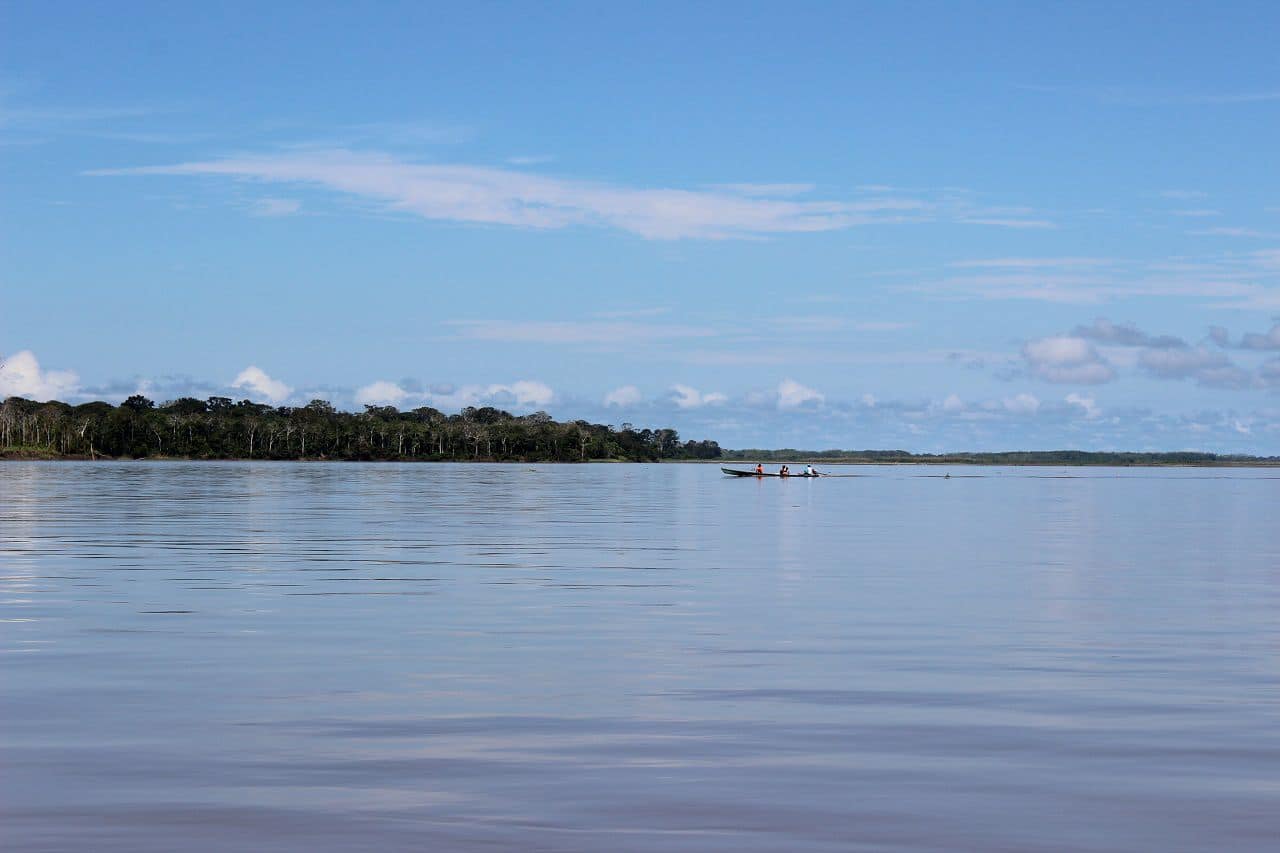
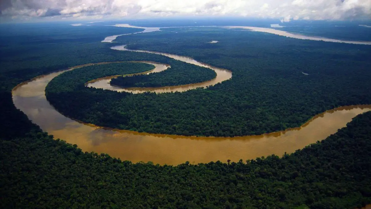
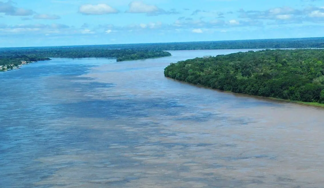
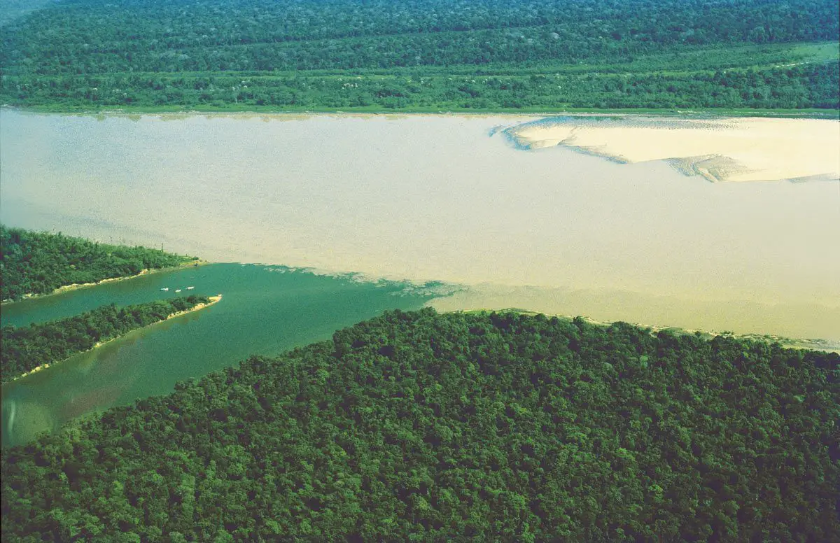
People see pictures of the dark Amazonian and think about pollution when they are really seeing sediments. The white-water tributaries of the Amazon originate in the Andes, where nutrient-rich sediments disappear.
The shaking of the sediment makes these tributaries appear white, but most of the materials that the rivers carry are actually milky brown. The tributaries of white waters of the Amazonian River are neutral to slightly acidic and flood periodically. These include the Madre de Dios, Beni, Jutai, Madeira and Napo Rivers. The Solimes River and the Amazonian River itself are white colored rivers.
The dark water tributaries are slow, dark brown, very light in color and very acidic, which makes them inhospitable for parasites, bacteria and insect larvae. This is an advantage for visitors, since that means that mosquitoes in and around these tributaries are less annoying. On the other hand, the lower diversity of trees results in a lower diversity of wildlife in the rainforest.
This is not true for fish species. Having adapted to the conditions, they are quite diverse in these rivers and easy to see due to the clarity of the water.
The rainforest areas surrounding the dark water rivers flood regularly during the flood season. The dark water rivers have a low pH and nutrient content because the river is composed of ancient rock that no longer decomposes and because it was leached from the vegetation of the decomposing floodplain due to almost constant flooding.
Although they are found elsewhere, most of the world’s dark watered rivers are tributaries of the Amazonian. Among these tributaries are the Negro and Urubu, as well as the Yarapo River near Iquitos, Peru. Some tributaries of the Amazonian River are clear water rivers, with an even lower pH than the black ones. These include the Tapajos river in Brazil, the Trombetas River that flows from Venezuela and the Xingu River from the south, all east of Manaus.
The black and white water systems meet near Manaus, Brazil, and flow side by side for several thousand miles, locals described it as “the meeting of the waters.” This phenomenon is an interesting day trip for visitors to the Amazon tours in Manaus.
Flora and Fauna of the Amazon River
The predominantly dominant feature of the Amazon basin is the rainforest, or jungle, which has a disconcerting complexity and a prodigious variety of trees. In fact, up to 100 tree species have been counted in a single acre of forest, and few of them occur more than once.
The Amazonian rainforest has a surprisingly stratified structure. The giant sun-loving giants of the upper reaches, the canopy, rise as high as 120 feet (40 meters) above the ground; Occasional individual trees, rise beyond the canopy, often reaching heights of 200 feet (60 meters).
Its straight and whitish trunks are dotted with lichens and fungi. A feature of these giant trees is their buttresses, the basal enlargements of their trunks, which help stabilize the heaviest trees during strong winds.
Other characteristics of the canopy trees are their narrow, pointed down, “drip tip” leaves, which easily shed water, and their cauliflory (the production of flowers directly from the trunks instead of the branches).
The flowers are discreet. Among the prominent members of the canopy species, which capture most of the sunlight and perform most of the photosynthesis, are:
- Rubber trees (Hevea brasiliensis).
- Silk trees (Ceiba pentandra).
- Chestnut trees (Bertholletia excelsa).
- Sapucaia trees (Lecythis).
- Sucupira trees (Bowdichia).
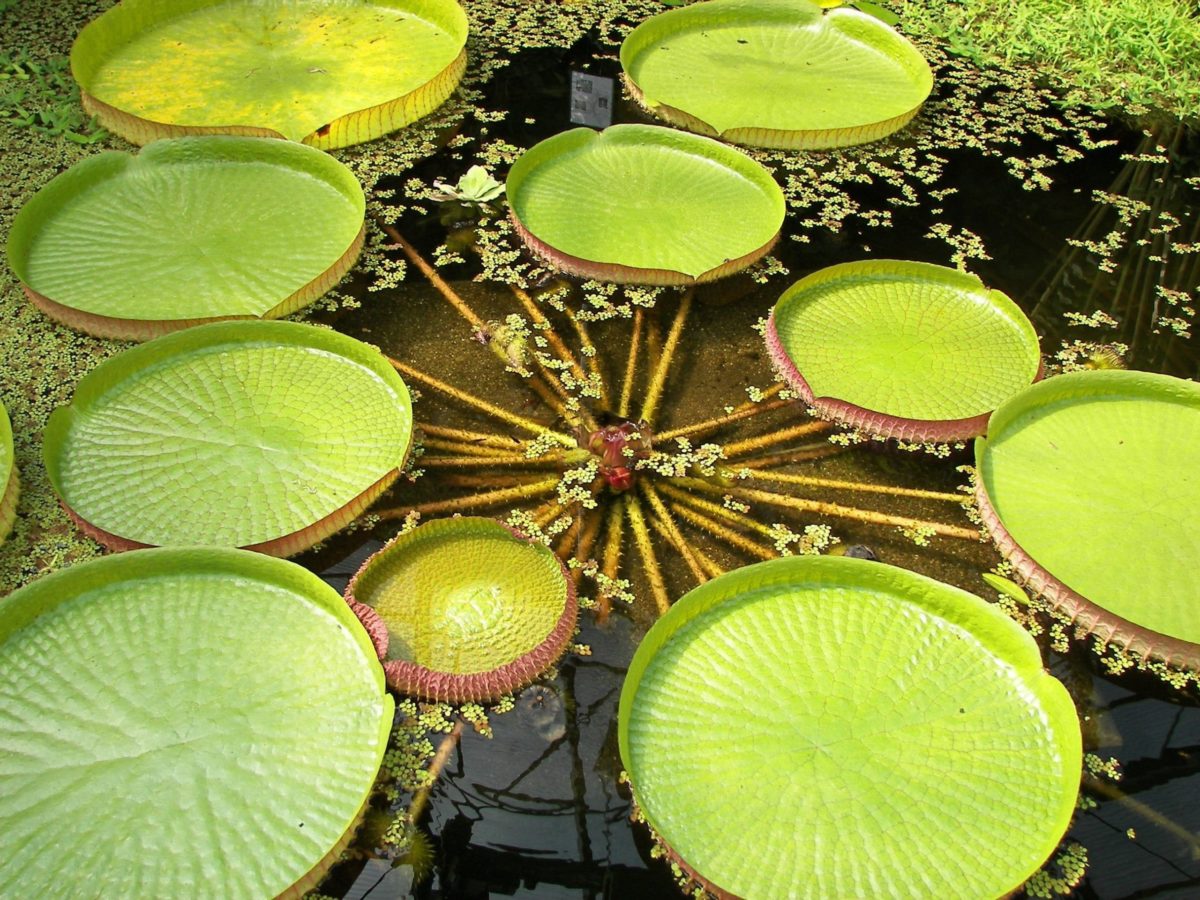
Under the canopy there are two or three levels of shade-tolerant trees, including certain species of palm trees, of the Mauritia, Orbignya and Euterpe genera. Myrtle, laurel, bignon, fig, Spanish cedar, mahogany and rosewood are also common. They admit a large number of epiphytes (plants that live in other plants), such as orchids, bromeliads and cacti, as well as ferns and mosses. The entire system is entwined by a bewildering network of milky antler known as vines.
In addition to the rainforests of the mainland, there are two types of flooded rainforests, Várzea and igapó, which constitute approximately 3 percent of the total Amazon rainforest. The forests of Várzea can be found in the flood plains rich in silt and nutrients of the white water rivers such as the Madeira and the Amazonian, with their constantly changing mosaic of lakes, marshes, sandbanks, abandoned canals and natural dikes.
They are generally not as tall, diverse or old as those on the mainland, and are subject to periodic destruction by floods and human manipulation. (The Várzea and its flood-free margins attract most human settlements).
Wild cane (Gynerium) and aquatic herbs, as well as the fast-growing pioneer tree species of the Cecropia, Ficus and Erythrina genera, are conspicuous.
The forests of Igapó grow along the sandy plains of the dark water and clear water rivers such as the Negro, the Tapajós and the Trombetas. These forests can reach a maximum flood level of 40 feet (12 meters) for up to half the year, but can be accessed by canoe.
The lowland forest of the Andean strip becomes a mountainous forest, discontinuous and matted, formed by deformed trees covered with mosses, lichens and bromeliads. There you can find cinchona, or tree of fever-bark, once exploited by its antimalarial agent, quinine. At even higher elevations grass and shrub of the páramo growth in this areas and the cold region of the Antiplano.
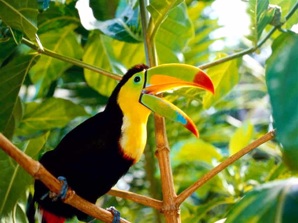
Giving a succinct description of the complete fauna of the Amazon is as impossible as adequately describing the great diversity of its flora; In part, because many of the species in the region have not yet been identified. The rivers and streams of the basin are full of life, and the forest canopy resonates with the cries of birds and monkeys and the hum of insects. There is a notable shortage of large species of land mammals; in fact, many of the mammals are arboreal.
Animals found in the Amazonian River
More than 8,000 species of insects have been collected and classified. Myriads of mosquitoes can transmit diseases such as malaria and yellow fever. Leaf-cutting ants (of the Atta and Acromyrmex genera) are frequent, as are the ubiquitous black small flies known as pions in Brazil.
Fireflies, bees, hornets, wasps, beetles, cockroaches, cicadas, centipedes, scorpions, ticks, red insects and giant spiders are abundant. The most spectacular, however, are the hundreds of species of brightly colored butterflies; sometimes thousands of them gather in riverside sandbanks in the afternoon.
Alligators are hunted for their skin, river turtles and their eggs are considered a delicacy, and the giant sea cow, or manatee, is wanted for its meat and oil. All are threatened by excessive hunting, and the manatee has been included as an endangered species.
Aquatic animals also include river dolphins (Inia geoffrensis); the semi-aquatic capybara, the largest rodent in the world (weighing up to 170 pounds [80 kg]); and the otter, or coipo, valued especially for its skin. Other common rodents are paca, agouti, porcupine and local species of squirrels, rats and mice.
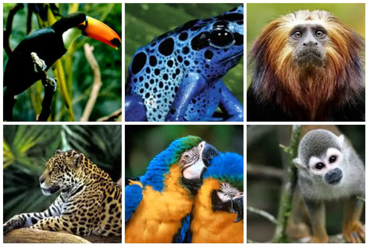
The tapir, the white-lipped peccary and several species of deer are native to the Amazonian basin and highly sought after for their meat. The water buffalo, introduced from Southeast Asia as a working and dairy cattle, predominates in the remote and swampy parts of the island of Marajó.
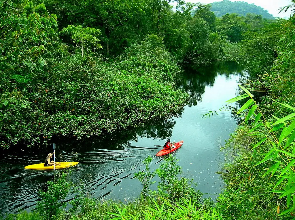
Fishing in the Amazon River
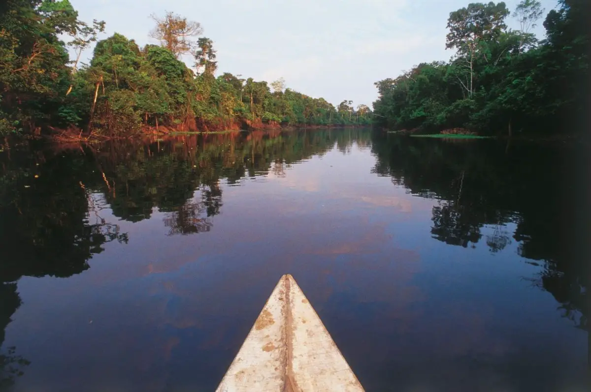
The immense ecosystem of the Amazon rainforest means that searching for fish in the Amazon can be a very exciting experience. From the weird and wonderful to the utterly strange, the Amazonian River is full of fish, many of which you may never have heard and could never find anywhere else.
Conforming approximately 30% of South America, the Amazonian River basin is home to more than 2,000 different species of fish that are endemic to the Amazon region, this includes 15,000 tributaries and a total length of 6,520 km. Brazil has some of the most interesting and largest fish in the region, while many more reside in the waters of the other countries that are home to the Amazonian.
Fish of the Amazon River
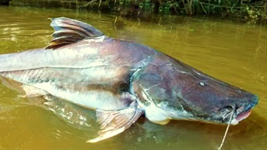
About 1,500 species of fish have been found within the Amazonian River system, but many more have not been identified. Most of the fish are migratory and move in large schools at the time of spawning.
Fish represent a critical source of the dietary protein often poor in meat of the caboclo population. (The term caboclo refers to people of mixed European and Indian descent in Brazil who live from rivers and forests).
Among the most important commercial species are the pirarucu (Arapaima gigas), one of the largest freshwater fish in the world, and several giant catfish. The small meat-eating piranha usually feeds on other fish, but can attack any animal or human that enters the water.
His sharp teeth cut pieces of meat, stripping the corpse of meat in a few minutes. Some fish species have become threatened locally as global demand for frozen and dried fish has increased.

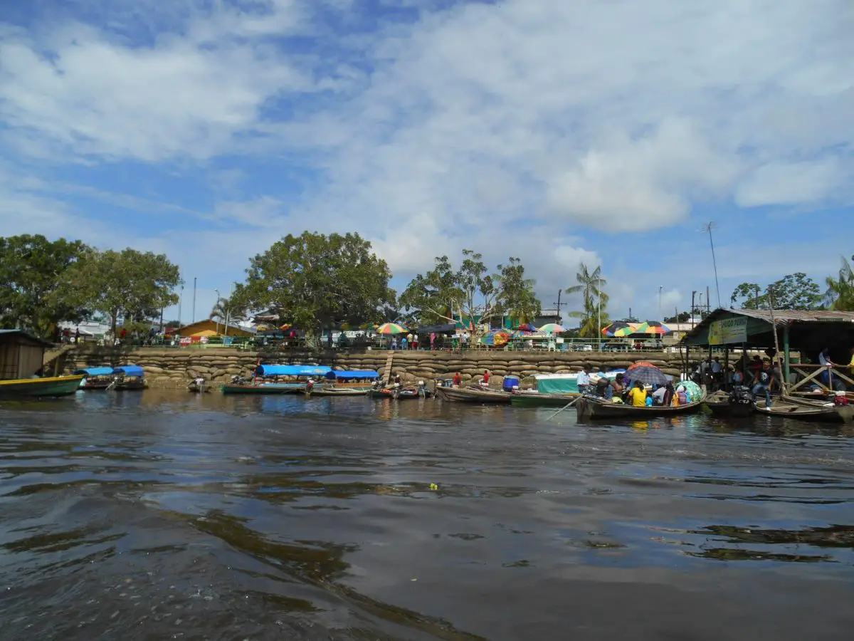
The tropical fish of the Amazonian River are also some of the most desired for food and breeding and for use as aquarium specimens. Iquitos, Manaus and the Colombian port of Leticia are centers of these exchanges.
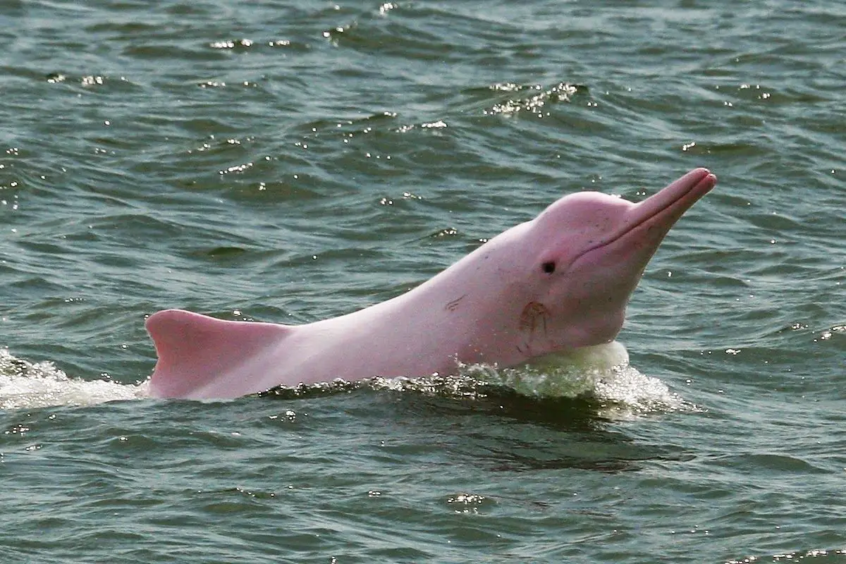
Amazonian River Dolphin
The Amazonian River dolphin, also known as the pink river dolphin or boto, lives only in fresh water. It is found largely in the Amazonian and Orinoco river basins in Bolivia, Brazil, Colombia, Ecuador, Guyana, Peru and Venezuela.
It is a relatively abundant freshwater cetacean with an estimated population of tens of thousands. However, it is classified as vulnerable in certain areas due to dams that threaten certain populations, and other threats such as pollution of rivers and lakes.
Curiosities found in the Amazonian River
• The Amazon is the largest tropical forest in the world. Covering more than 5.5 million square kilometers, it is so large that the United Kingdom and Ireland would fit into it 17 times!
• Running through the north of the jungle is the Amazonian River. With a length of approximately 6,400 km, it is the second longest river in the world. The longest is the Nile River, which extends over more than 6,650 km!
• In 2007, a man named Martin Strel swam along the Amazonian River! To complete his jungle trip, Martin swam through the water for up to ten hours a day for 66 days.
• Around 400-500 indigenous Amerindian tribes call the Amazon rainforest home. It is believed that about fifty of these tribes have never had contact with the outside world.
• The Amazon has an incredibly rich ecosystem: there are about 40,000 species of plants, 1,300 species of birds, 3,000 types of fish, 430 mammals and a whopping 2.5 million different insects.
• The Amazon is home to a lot of fascinating and deadly creatures, including electric eels, piranhas that eat meat, poison frogs, jaguars and some venomous snakes. These are several of the many curiosities and characteristics of the Amazon River.
Amazonian River Countries
The Amazonian River is located in South America, covering Brazil, Bolivia, Peru, Ecuador, Colombia, Venezuela, Guyana, Suriname and French Guiana.
Economic activities of the Amazonian River
Since World War II, the economic development of the Amazonian basin has been a priority for the countries it covers. From the mid 1940’s onwards, a series of “penetration roads” have been built from the highlands of Colombia, Ecuador, Peru and Bolivia to the East.
These roads have channeled an incalculable number of landless farmers into the lowlands. They have also served to facilitate the development of important discoveries of oil and wood resources.
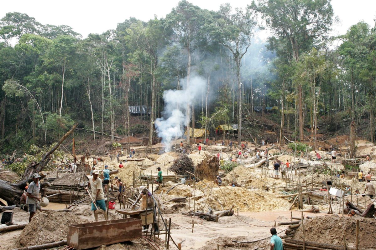
Tropical hardwoods, river fish and, since the 1980’s, clandestinely produced cocaine have been commercially exploited, along with Brahman-type cattle raised in freshly carved pastures in the jungle.
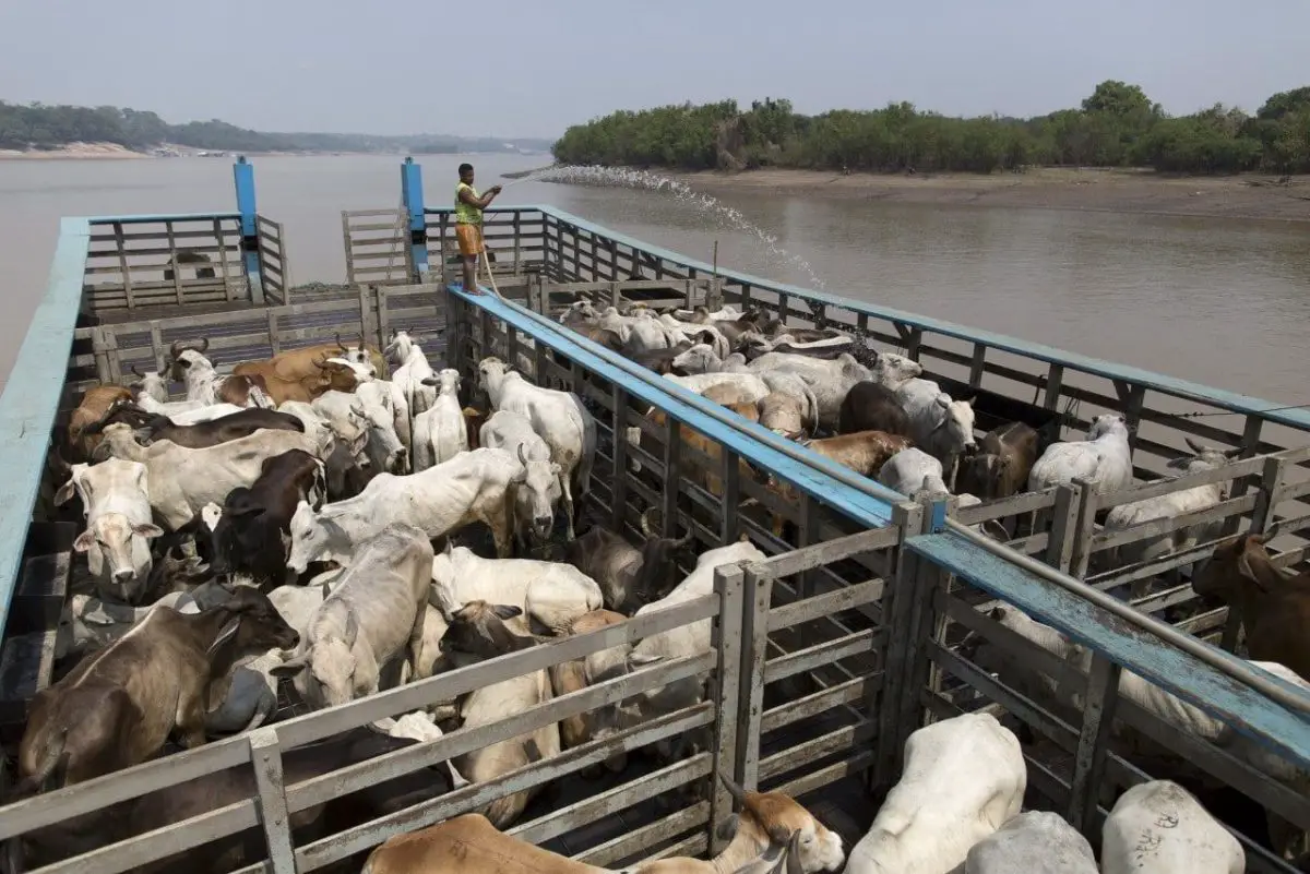
Such activities have led to a widespread displacement of indigenous groups, which have been forced into new reserves or have been left to survive as best they could. The opening of the Amazonian basin has been carried out more aggressively in Brazil. In the mid 1950’s, the decision was made to reorient the country inland by building a new interior capital, Brasilia.
A consequence of this decision was the beginning of a massive road construction program that aimed to integrate the North (consisting of the current states of Acre, Amapá, Amazonas, Pará, Rondônia and Roraima) with the rest of Brazil while establishing an exhaust valve for the crowded and hit by drought northeast.
A 1,100-mile (1,770 km) long road linking Brasilia with Belém, the trade center at the mouth of the Amazon, was completed in 1964. The even more ambitious Transamazon Highway of 3,400 miles (5,100 km) for all the cities of the Amazon River from the Atlantic port of Recife to Cruzeiro do Sul, on the border with Peru, with extensions north of Santarém and Manaus (later to the border with Venezuela) and south to Cuiabá (Mato Grosso ) and Pôrto Velho (Rondônia).
It was to provide the framework for a network of almost 20,000 miles (32,000 km) of roads and feeder routes that would replace the traditional river transport system. At the beginning of the 21st century, the road had not been completed, and remained largely unpaved and impassable at several points.
Is the Amazonian River Contaminated?
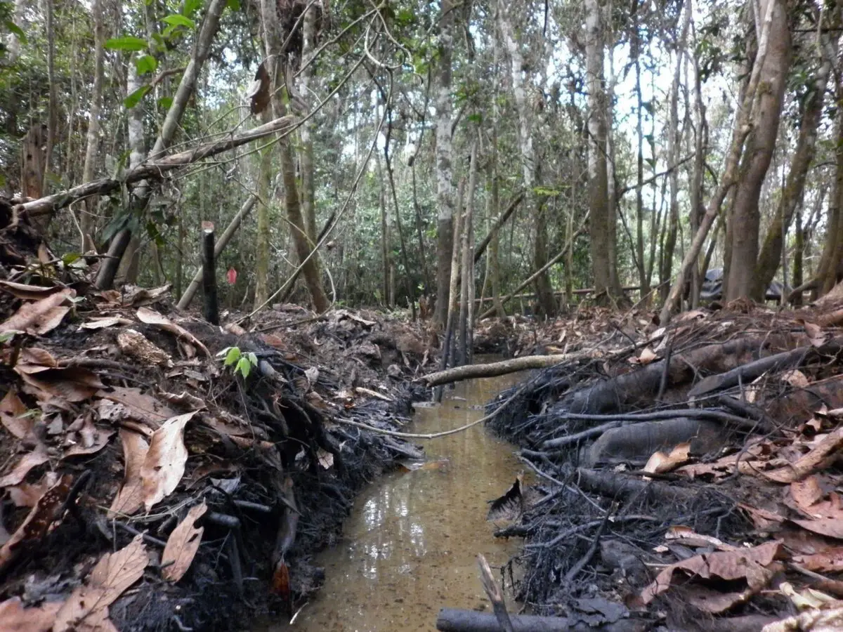
The world’s largest river system is rapidly being degraded and threatened by dams, mining, overfishing and deforestation, warns a study published last week by an international team of scientists.
Researchers led by Leandro Castello, a research associate at the Woods Hole Research Center, catalog the litany of threats facing the Amazonian River and its tributaries. They point out that existing terrestrial protected areas may not be sufficient to protect river ecosystems affected by upstream and downstream activities, including oil extraction, gold mining, overexploitation of plants and animals, logging and forest conversion and the construction of dams.
Amazonian River in Peru
The headwaters of the Apurímac River in the Nevado Mismi had been considered for almost a century as the most distant source of the Amazonian, which is where the Amazon River is born; until a 2014 study discovered that it was the Rumi Cruz Mountain Range at the head of the Mantaro River in Peru. The Mantaro and the Apurímac join, and with other tributaries, they form the Ucayali River, which in turn meets the Marañón River upstream of Iquitos, Peru, to form what other countries apart from Brazil consider the main source of the Amazonian.
Brazilians call this section the Solimões River on its confluence with the Rio Negro to form what Brazilians call the Amazonian at the Water Encounter (Portuguese: Encontro das Águas) in Manaus, the largest city in the river.
Amazonian River in Colombia
The Amazon region in southern Colombia comprises the departments of Amazonas, Caquetá, Guainía, Guaviare, Putumayo and Vaupés, and covers an area of 403,000 km², 35% of the total territory of Colombia. The region is mainly covered by rainforest or jungle, which is part of the massive Amazon rainforest.
Amazonian River in Leticia
Leticia, as we know, is one of the municipalities of Colombia, which is located at the southern tip of the country. It is also the Capital of the Department of the Amazon, and has a very important commercial link with Brazil, since it borders the Amazonian River, giving it the name “The Three Borders”, with Peru and Brazil. It has an elevation of 96 meters above sea level and an average temperature of 27 ° C (80.6 ° F). Leticia has long been Colombia’s boarding point for tropical fish and aquarium trade.
Leticia has approximately 33,000 inhabitants on the left bank of the Amazonian River, and is located at the point where Colombia, Brazil and Peru meet in an area called the Three Borders as mentioned above.
Amazonian River in Venezuela
The state capital is Puerto Ayacucho. The capital until the early 1900’s was San Fernando de Atabapo. Although named after the Amazonian River, most of the state is drained by the Orinoco River. The state of Amazonas covers a total area of 176,899 km² and, in 2007, has a population of 142,200. Its density is 0.8 inhabitants per km².
Poem to the Amazonian River
Blood and veins of my body,
and of my life, source of irrigation,
like the heart and bomb,
of hope for the world
in our food.
I
It is I, who suffers indiscriminate felling,
She is my hope, she is my lung
to keep them always, without diminishing,
No pollution, and no deforestation.
II
There are three of us, who you should take care of
If you don’t know, I’m going to list them,
heaven, earth and seas, whom you should take care of
and we will always have life, not deforestation.
III
Long live our glaciers, Pasco, Cusco, Nazca,
and those I still don’t know,
may our Loreto live forever,
and may those who fight for him also live.
IV
Long live our Kuélap, as a viewpoint of the Amazon
may our Gocta live, as a spring, and many like him
and that our species live, like Gallito de Roca, and the Hummingbird
May our Amazon live neatly, as the only Sun in the world,
and live for it on high, our dear Peru.