Last Updated on May 27, 2020 by Hernan Gimenez
Indice De Contenido
Congo River: Location, Cities, Tributaries, and All you need to know
Updated On January 16, 2020
The Congo River, formerly called the Zaire River, flows through the center-west of Africa. With a length of 2,900 miles (4,700 km), it is the second longest river on the continent, after the Nile.
Where is the Congo River?
To know where the Congo River is, we know that it is born in the highlands of northeastern Zambia between the Tanganyika and Nyasa (Malawi) lakes just like the Chambeshi River, at an altitude of 5,760 feet (1,760 meters) above sea level and at a distance of approximately 430 miles (700 km) from the Indian Ocean.
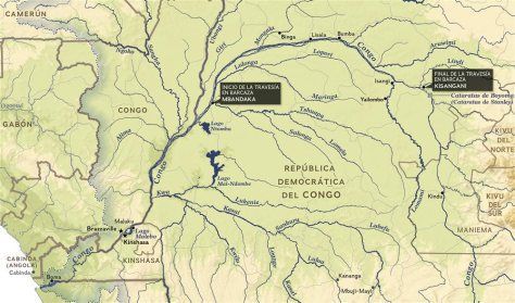
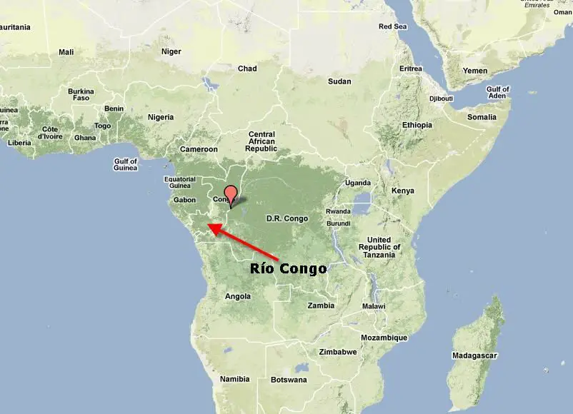
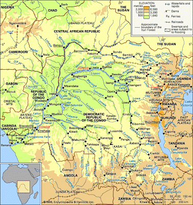
On the Congo River Map below we will be able to locate exactly where the Congo River is located, its route and also its place birth and where is its mouth.
Where does the Congo River flow?
In the map of the Congo River shown above we can pinpoint its entire route from its birth to its mouth. Its course takes the form of a gigantic arch running counterclockwise, which flows northwest, west and southwest before it flows into the Atlantic Ocean in Banana (Banane) in the Democratic Republic of the Congo.
Congo River Basin
The Congo River Basin, covering an area of 1,335,000 square miles (3,457,000 square km), occupies almost the entire territory of the African country as well as most of the countries that make up the Republics of Africa. (see article: Rio Salado).
The Congo Basin is the most distinguished between the various geographical depressions located between the Sahara to the north, the Atlantic Ocean to the south and west, and the lake region of East Africa to the east. In this basin, a network of fan-shaped tributaries of the Congo River flows down along concentric slopes ranging from 900 to 1,500 feet (275 to 460 meters) in elevation and enclosing a central depression.
The basin extends over 1,200 miles (1,900 km) from north to south (from the Congo-Chad Lake watershed to the interior plateaus of Angola) and also measures approximately 1,200 miles from the Atlantic in the west to the basin of the Nile-Congo in the east.
The central part of the Congo River basin, often called the Congo bucket is an immense depression that contains quaternary alluvial deposits that rest on thick sediments of continental origin.
The soil in the Congo basin consists mainly of sand and sandstone. These underlying sediments form outcrops in the valley floors at the eastern edge of the bucket.
The filling of the basin however, began much earlier. Perforations have revealed that since pre-Cambrian times (that is, at least 570 million years ago) considerable sediments have accumulated derived from the erosion of the formations located around the periphery of the basin.
The surface relief arrangement, thick deposition strata and amphitheater-shaped substrate around the main Congo Canal that it has been uniform over time, is evidence of a persistent sinking trend in this part of the continent.
This sinking is accompanied by rising at the edges of the basin, mainly on its east side, which has also been influenced by the formation of the Western Rift Valley.
Congo River tributaries
The term “Congo Basin”, strictly speaking, refers to the river basin. This is not only vast but it is also covered by a dense and branched network of tributaries, sub-tributaries and small rivers, with the exception of the sandy plateaus of the southwest.
Along its basin, the Congo receives its main tributaries, mainly the Ubangi and the Sangha Rivers on the right bank and the Kwa on the left.
This means a huge increase in the average rate of water flow, which goes from less than 250,000 cubic feet (7,000 cubic meters) per second in Kisangani to almost its maximum flow in Kinshasa with a large number of tributaries that go to the river forming great waterways of the continent (see article: Order River).
These are the Congo River Tributaries:
- Upemba Lake
- Lomami River
- Luapula river.
- Lukuga River
- Lulonga River.
- Moero Lake
- Ruzizi River.
- Lufira River.
- Sankuru River
- Ubangui River.
- Uele river.
Another tributary is the Lualaba, which rises near Musofi in the southeast of the Democratic Republic of the Congo and carries most of the water. And, therefore, it can be considered as the most important and original tributary of the Congo River in terms of water volume.
From its sources to its mouth, the Congo River system has three opposite sections: the upper part of the Congo, the middle part of the Congo and the lower part of the Congo.
In just over 60 miles (100 km), the upper Lualaba joins the Luvua and then the Lukuga. Each stream during part of its course undergoes at least one type of lake expansion, even when it doesn’t form a lake.
Lake Upemba, another tributary, is located in the upper part of the Lualaba; The Bangweulu and Mweru lakes are enclosed in the Chambeshi-Luapula-Luvua system; and Lake Tanganyika, which is fed by the Ruzizi (which flows from Lake Kivu) and by the Malagars, flows into the Lukuga.
As for the navigability of the Congo River, it is said that the multiple falls on its path make the Congo not navigable between the seaport of Matadi, at the head of the Congo estuary, and Malebo Pool, a lakelike expansion of the river. (see article: Río Ter).
It is on the opposite banks of the Malebo Pool, which represents the starting point of inland navigation, where the capitals of the former states of the French Congo and the Belgian Congo were founded.
On the left bank of the river is Kinshasa (formerly Léopoldville), now the capital of the Democratic Republic of the Congo, and on the opposite side is Brazzaville, now the capital of the Republic of the Congo.
Therefore, navigation is only possible along the sections of the upper part of the Congo by low tonnage vessels. However, these sections are in danger of being covered by aquatic vegetation, particularly water hyacinths.
Kisangani (formerly Stanleyville), located just downstream of Boyoma Falls which are a series of seven waterfalls, marks the true beginning of the navigable part of the Congo River upstream. (see article: Río Tormes).
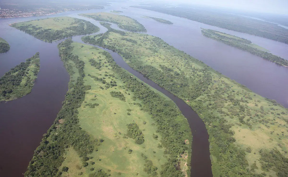
This central part of the river flows constantly for more than 1,000 miles (1,600 km) within 22 miles (35 km) of Kinshasa. Its course at the beginning is narrow, but it soon widens, and in that stretch many islands begin to form halfway thru.
It increases from a width of more than 3.5 miles (5.5 km) downstream from Isangi (where the Lomami enter the Congo) to a width of 5 to 7 miles (8 to 11 km) but this can vary, for example, at the mouth of the Mongala the width reaches the 8 miles (13 km).
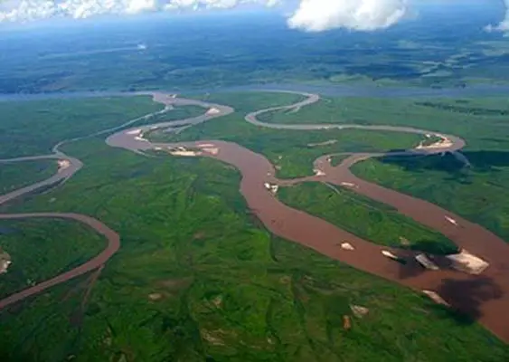
Beyond the natural dikes (formed by silt deposits) that occur on any shore, some areas are subject to extensive flooding that increases the river’s limits even further. It is not always easy to distinguish these areas from the “rain swamps” in the regions that form between the rivers. The middle course of the Congo ends in a narrow section called Chenal (“Canal”), or Couloir (“Corridor”).
Between banks no more than half a mile to a mile wide, the riverbed deepens and the current becomes rapid, flowing through a valley that cuts several hundred meters deep into the sandstone bed of the Batéké plateau.
Upon leaving the Chenal, the Congo is divided into two branches, forming Malebo Pool, a vast lake area of approximately 15 by 17 miles (24 by 27 km), which marks the end of the middle Congo.
Immediately downstream the first waterfalls of the final section of the river course form. The falls and rapids are grouped into two series, separated by a fairly quiet central range, in which the elevation drops from a little less than 900 feet (275 meters) to a few meters above sea level.
Congo River Depth
The estuary of the Congo begins in Matadi, downstream of the rapids that close the interior of the Congo. The length of the Congo River is 134 miles (134 km) and it forms the border between Angola and the Democratic Republic of the Congo. (see article: Loire River).
At first, the estuary is narrow, less than half a mile to about a mile and a half wide, with a central canal 65 to 80 feet (20 to 24 meters) deep, but it widens downstream from Boma.
There the river, obstructed by islands, is divided into several arms, and in some places the depth does not exceed 20 to 25 feet (6 to 7.5 meters), which makes dredging necessary to allow taller ships to navigate to Matadi.
Beyond the mouth of the estuary, the course of the Congo River continues to the sea as a deep underwater canyon that extends for a distance of approximately 125 miles (200 km).
Importance of the Congo River
In addition to all the information on the Congo River provided above, it’s important to note that the Amazonian and the Congo are the two great rivers in the world that flow out of the equatorial areas where heavy rains occur all or almost all year.
Upstream of the river, the basin receives a large amount of rainfall, 58 inches (1,400 mm) per year, of which more than a quarter is poured into the Atlantic.
Having already measured the Congo River, it can be said that the drainage basin of the Congo is, however, only half the size of the Amazon, and the flow rate of the Congo -1,450,000 cubic feet (41,000 cubic meters) per second at its mouth it´s considerably less than the flow of the Amazonian with more than 6,180,000 cubic feet (175,000 cubic meters) per second.
The Chambeshi River, as its most remote source, can form the original mainstream of the Congo in terms of the length of the river. (See article: Mosel River).
When the river was first known to Europeans at the end of the 15th century, they called it the Zaire River, a word that has many varieties such as nzari, nzali, njali, nzaddi and niadi.
The original name of the Congo translates into “river” in local African languages. At the beginning of the 18th century it was given the name of “Congo River”, a name taken from the Kongo kingdom that had been located along the lower course of the river.
From that time on the river continued to be known throughout the world as the Congo. For people with a literary vain, the river evokes the famous 1902 story “Heart of Darkness” by Joseph Conrad.
This book conjured an atmosphere of omen, betrayal, greed and exploitation. Today, however, the Congo River is a very important key to the economic development of the interior of Central Africa.
Congo River continent
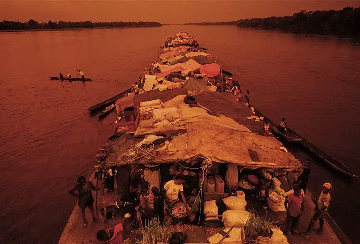
In which continent is the Congo River found? The Congo is an important navigation system in Africa. Only within the territorial limits of the Democratic Republic of the Congo, there are some 8,700 miles (14,000 km) of waterways.
Of its total lenght, 650 miles (1,050 km) are accessible at all stations to barges with capacities between 800 and 1,100 tons, depending on the height of the water.
The amount of goods transported by water consisting mainly of agricultural products, wood, minerals and fuel is very modest compared to the traffic on European rivers (for example, commercial traffic from the port of Kinshasa does not reach one million tons ).
But river transport is still essential for communications with regions that are inaccessible by road, especially in the bucket. To answer the question of in which continent is located the Congo River, it is important to say that the Congo River is located in the center-west of Africa, being one of the largest rivers in this continent.
Congo River Cities
If we talk about the cities that the Congo River flows thru, we have the three main routes, all of which converge in the downstream terminal in Kinshasa in the Malebo pool, going from Kisangani, from Ilebo (formerly Port-Francqui) in Kasai, and from Bangui in Ubangi.
River transport, however, does not fulfill the role it could play in economic development. In fact, the transport in the river has declined since the states of the Congo Basin became independent in 1960 due to serious problems caused by the aging of the equipment, the lack of maintenance of the infrastructure and the poor functioning of the public navigation agencies.
In the Democratic Republic of the Congo, only the section of Ilebo to Kinshasa remains important, since it constitutes the water link (the other is a railroad between Kinshasa and Matadi) used to transport copper production from Katanga to the coast.
This network has encouraged economic development in inland areas far from the coast. Varied activities include the production of palm oil on the banks of the Kwilu, centered on the port of Kikwit, and the establishment of robust coffee plantations in the Kisangani area.
However, before such developments could take place, it was necessary to overcome the sea barrier formed by the lower Congo course. That feat was achieved in 1898 with the opening of the railway between Matadi and Léopoldville (now Kinshasa) and in 1934 with the completion of the Congo-Ocean railway line on the right bank between Brazzaville and Pointe-Noire.
While the river system facilitates navigation, it also makes ground transportation difficult. Only a small number of bridges cross the Congo River and its tributaries.
The Kongolo railway bridge over the Lualaba was rebuilt in 1968, and in 1983 a bridge over the Congo in Matadi was inaugurated.
However, there are numerous projects to improve the situation, especially one to create a link between Kinshasa and Brazzaville. This project has been in discussion for a long time, although the difficulties caused by political dissent are added to the financial obstacles.
Several times since the two countries gained their independence in 1960, dissension has disrupted ferry traffic between the two capitals.
Hydrology
The Congo River has a regular flow, which feeds on rains throughout the year. In Kinshasa, the flow has remained for many years between 2,310,000 cubic feet (65,000 cubic meters) per second registered during the 1908 flood, and the lowest level of 756,000 cubic feet (21,000 cubic meters) per second, recorded in 1905.
However, during the unusual flood of 1962, by far the highest for a century, the flow probably exceeded 2,600,000 cubic feet (73,000 cubic meters) per second.
In reality, the Congo downstream represents a climatic influence that extends more than 20 ° latitude on both sides of Ecuador, at a distance of about 1,400 miles (2,250 km).
It has a drought that occurs for several months in the southern part of the basin, as well as a delay before the flooding of the Ubangi tributary that flows down from the north, which does not occur before August.
The Congo River basin is so vast that no meteorological circumstance is capable of disturbing the slow movement of rising and falling waters.
However, annual fluctuations can be drastically altered when flood waters of different tributaries that normally coincide with each other arrive at different times.
Lake Tanganyika, in addition to brief seiches caused by wind drift and sudden changes in atmospheric pressure, can experience considerable variations in its water level from year to year.
In 1960, for example, its waters flooded parts of Kalemi, Democratic Republic of the Congo, and Bujumbura, Burundi. A series of particularly rainy years followed by a blockage of the exit by floating vegetation can explain this phenomenon.
Contamination in the Congo River
Beginning in 1482 with the Portuguese explorer Diogo Cao, there were many attempts to cross the river. However, these efforts were often shortened and rarely led to permanent settlements in the region.
It was not until more recently, when the explorers overcame the challenges of the Congo River and established permanent settlements that the most substantial human impacts began to pose a more serious threat to the river’s natural ecosystem.
As we mentioned earlier the Congo River´s length increases the population on its banks, so the contamination due to the emerging urban centers along the river in recent decades has posed a threat to the Congo River ecosystem.
As cities develop and more people congregate in these regions, there is an increase in pollutants going into the river.
One of the main causes of contamination in the Congo River comes from the ships used for transport. These boats not only use a lot of fuel, but it is common for debris to fall off ships transporting goods and materials.
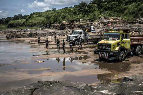
The river has also been affected by logging operations that cause soil erosion, a non-point pollutant that ends up in the river, increasing the amount of sediments in the water.
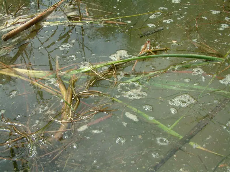
Some turbidity in a river is a completely natural phenomenon and to which animals and plants adapt.
However, excessive sediments in a river, often caused by human interference, can affect the ecosystem and reduce the ability of light to penetrate the water and allow photosynthesis.
Plants that are very sensitive to changes in turbidity can suffer greatly from a substantial increase in sediments.
Erosion particles can damage the gill system of a fish and the accumulation of sediments at the bottom of the river can damage the development of vulnerable larvae.
While small plants and animals in a river may seem relatively insignificant, the destruction of only one such species can have important effects on the rest of the ecosystem. Not only small animals in the Congo River ecosystem have been impacted by the increase in civilization around the river, but also by larger species.
The hippo, for example, has been greatly threatened by poachers. In the mid-1970s, Virunga National Park housed some 29,000 hippos. In 2008, there were only 800 left and scientists fear they will soon become extinct in Congo.
While the Congo River has undergone some minor changes in its ecosystem due to human interference, the state of conservation of the ecosystem and its species of plants and animals is relatively stable.
The urban areas described above are quite scarce and have not yet grown so extensively as to severely threaten the ecosystem. This ecoregion is still very rich in biodiversity. In fact, it is home to more than 700 species of fish, 500 of which are endemic.
It is because of this wealth of species that it is so important to preserve the Congo River ecosystem. While the increase in civilization in the regions surrounding the river has made minimal damage so far, is industrialization continues at a rapid pace, there may be greater signs of environmental disturbance.
Weather
The typical climate in the countries through which the Congo River runs is that of Yangambi, a city located on the right bank of the river, slightly north of Ecuador and slightly lower than Kisangani. The humidity is high throughout the year, and the annual rainfall is 67 inches (1,700 mm) and occurs quite regularly; even in the driest month, the rain totals more than 3 inches (76 mm).
Temperatures are also uniformly high throughout the year, and there is little daytime variability. The average temperature in Yangambi is mid 70 ° F (mid 20 ° C).
The northernmost points of the basin, located in the Central African Republic, receive only 8 to 16 inches (200 to 400 mm) less of rain over the course of a year than other points near the Ecuador. The dry season, however, lasts four or five months, and there is only a maximum of annual rainfall, which occurs in summer.
In the southernmost part of the basin, at a latitude of 12 ° S, the climate becomes definitely Sudanese, with marked dry and wet seasons and with a precipitation of approximately 49 inches (1,250 mm) a year.
Congo River Fauna
The animal life of the Congo River basin is related to some extent with that of the equatorial forest, which is very different from the savannah wildlife.
The animal population of the large waterways often has fewer affinities with neighboring marshes or dryland forests than with other river systems, either from the coastal region or from savannas.
Riparian swamps, which often dry, are inhabited by lungfish, which survive dry periods buried and engulfed in mucus cocoons.
In wooded marshes, where the water is the color of black tea, the black catfish assumes the color of its surroundings. The wildlife of the marshes and that of the small parallel streams do not mix with the wildlife of the river.
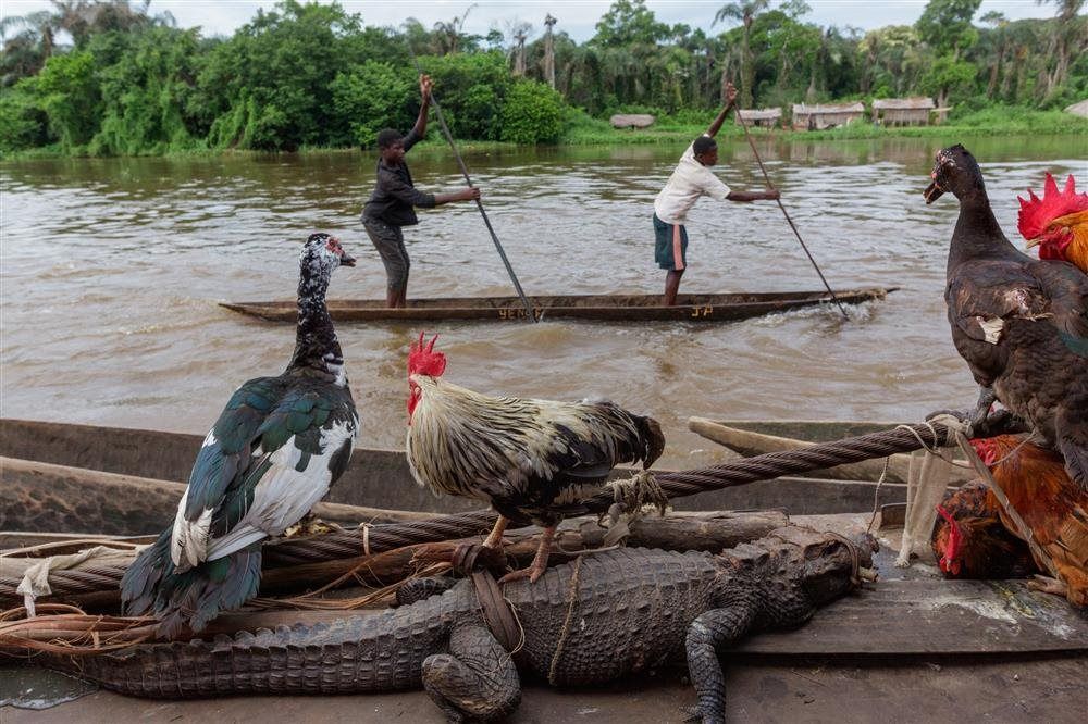
In the waters of the Congo you can see several types of reptiles, of which the crocodiles are the most common in the river basin. You can also see turtles, as well as several water snakes.
The birdlife of the forest constitutes, together with the birdlife of the mountains of East Africa, the most specifically indigenous found in the African continent. In the Congo region, more than 265 species typical of the equatorial forest have been recorded.
Occasionally or seasonally, however, non-typical birds can be observed. Seabirds, like the tern, fly upstream of the ocean. This depends on the countries of the Congo River.
Ducks, herons, storks and pelicans are abundantly represented. Aquatic mammals are rare, and consist of the hippo, two species of otters and the manatee.

