The vast Caspian Sea is a very interesting and peculiar lacustrine sea with characteristics that deserve to be studied. We invite you to get to know this lake, its history, climate, flora and fauna, its importance and aspects related to pollution.
Location of the Caspian Sea
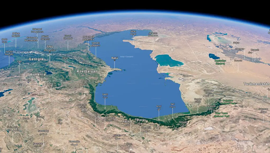
The Caspian Sea, formerly known as Caspium Mare or Hyrcanium Mare, is a lake located between Asia and Europe, today bordered by five countries that share its coastline, viz: Azerbaijan, Iran, Kazakhstan, Turkmenistan and Russia.
Kazakhstan lies to the north and east of the Caspian, Russia to the north-west, Azerbaijan to the south-west and Iran and Turkmenistan to the south.
In addition to these five countries, the Caspian Sea drains Armenia, eastern Georgia, western Uzbekistan and north-eastern Turkey.
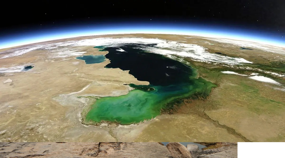
It is the largest inland body of water in the world, surrounded on all sides by land, and accounts for between 40 and 44% of the world’s lake water. You may also be interested in The Great Marine Protected Area in Colombia.
It has a total area of about 386,400 km2, a length of about 1,200 km and a width of 320 km. The lake’s surface is about 27 m below sea level and its volume is 78,200 km3. We recommend that you read about a similar lake, Lake Baikal, it will shock you.
The Caspian Sea is a terminal or endorheic lake, which means that its waters do not reach an ocean. In other words, the Caspian is a basin without an outlet.
Since it has no outlet to other basins or to the sea, nor does it percolate into the ground, its only form of water loss is evaporation.
As a result, minerals accumulate in the water, causing the lake to have a high salt content and, despite being a lake, its water is salty.
This phenomenon makes it more susceptible to pollution than bodies of water that drain into an ocean.
History of the Caspian Sea
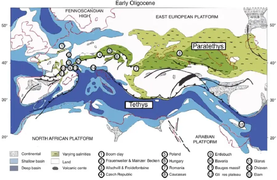
The Caspian Sea was part of the Paratetis Sea, the ancient sea of the Thetis Ocean, which existed more than 60 million years ago, connected to the Pacific and Atlantic Oceans, and stretched from Western Europe to Central Asia during the Oligocene and most of the Neogene.
Following a change in continental landforms, the Thetis Ocean became separated from the two oceans and over time much of its water evaporated, leading to the formation of the Black Sea, the Aral Sea and the Caspian Sea.
The Caspian Sea lost its outflow to the ocean due to the drift of the continents about 5-6 million years ago, as a result of tectonic uplift and lowering of the sea level.
As a result, the seabed of the Caspian Sea still contains remnants of oceanic basalt rather than continental granite.
Human settlements began to appear along its shores very early, around 75,000 years ago, according to archaeological evidence.
Among these settlements was that of the Caspian tribe, or Caspian people, who inhabited the northwest, and who, according to one hypothesis, gave the sea its name.
Water levels in the Caspian Sea have fluctuated over the years, so much so that between the 19th and 20th centuries the water level varied by about 3 metres.
This has led to floods, such as the 1977 flood, which caused massive destruction due to rising water levels over the last four decades.
Why is it called that?
The Caspian Sea has been referred to by various names throughout history.
The earliest cultural evidence comes from pottery inscriptions found in the Assyrian region, which refer to a “southern sea”.
The Greek historian Hecataeus of Miletus, writing in the 6th century BC, also referred to it as the “Caspian Sea in Hyrcania”, the first name referring to the Caspian tribe living on the south-western shore of the Caucasus in what is now Azerbaijan, and the second to the shore near Hyrcania, a region on the coast of what is now Iran and southern Turkmenistan.
Other ancient names include ‘Alban’, ‘Joshgun’ and ‘Hyrcan’.
The changing history of settlement gave rise to many other names, such as the Tatar name Ag Deniz, meaning “White Sea” or “Khazar Sea”, and confusions, for example “Blue Sea” in ancient Russian documents with the Aral Sea, or “Kasar Danizi” among the Turkic-speaking Khazars who settled in the northwest in the 5th to 10th centuries.
In all, different peoples have given the lake some 70 different names, including less established terms such as “Sea of Baku” in the 14th and 15th centuries, reflecting the economic importance of the city of Baku at the time.
Another theory is that the name of the Caspian Sea may have come from the Caspian people who lived in the southern Caucasus Mountains, a name that has prevailed in many places.
The Persians and Greeks, on the other hand, called the sea the Hyrcanian Ocean, after the ancient region of Hyrcania on its southern coast.
Formation
Like the Black Sea and the Aral Sea, the Caspian Sea is a remnant of the Paratetis, which, as we know, is an inland sea of the Thetis Ocean.
Towards the end of the Miocene a boundary with the Black Sea was formed, and from the beginning of the Pliocene there was a series of strong fluctuations in water level, which caused the size of the sea to vary greatly.
When the water level was low, the Caspian Sea was reduced to a lake in the deeper southern parts, and when the water level was high, it merged with the Black Sea.
The last time this happened was at the end of the Ice Age, when the ice masses of the Siberian glaciers thawed and flooded the Manychal Plain in southern Russia, creating the Caspian Basin.
To the east, a connection to the Aral Sea developed in the Aral-Caspian lowlands.
As the continental shelves moved, the Caspian Sea lost its connection first to the Pacific and then, with the disappearance of Thetis, to the Atlantic, becoming an isolated, highly saline body of water.
Characteristics of the Caspian Sea
The Caspian Sea consists of three separate regions: the South, North and Central Caspian.
The Mangyshlak Threshold forms the boundary between the North and Central Caspian, while the Absheron Threshold separates the South Caspian from the Central Caspian.
The North Caspian is a shallow region with an average depth of 5-6 metres. It accounts for less than 1% of the sea’s volume.
The Middle Caspian is about 1,900 metres deep, while the South Caspian is the deepest region at about 1,000 metres.
The southern region accounts for 66% of the total water volume, while the central region accounts for 33%.
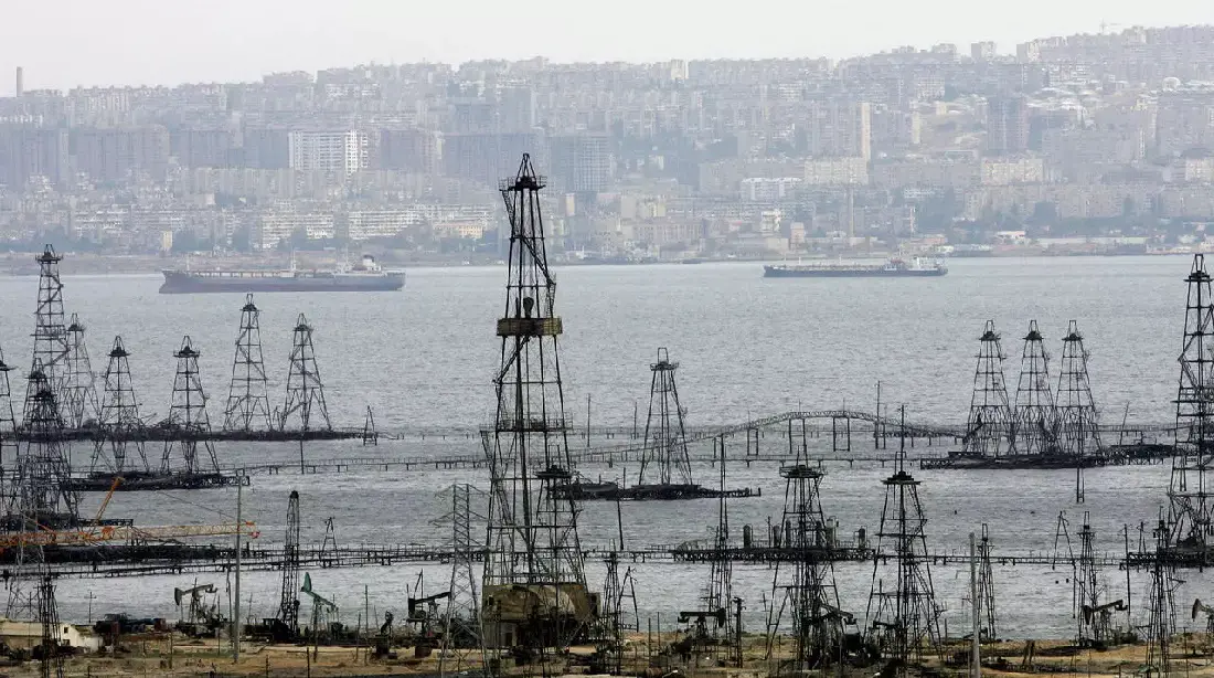
The lake is rich in oil and gas and is highly valued for its vast reserves of these two natural resources.
It is also renowned for the quality of its caviar, which is prized around the world.
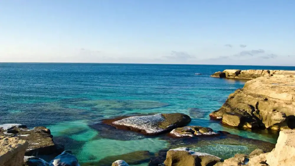
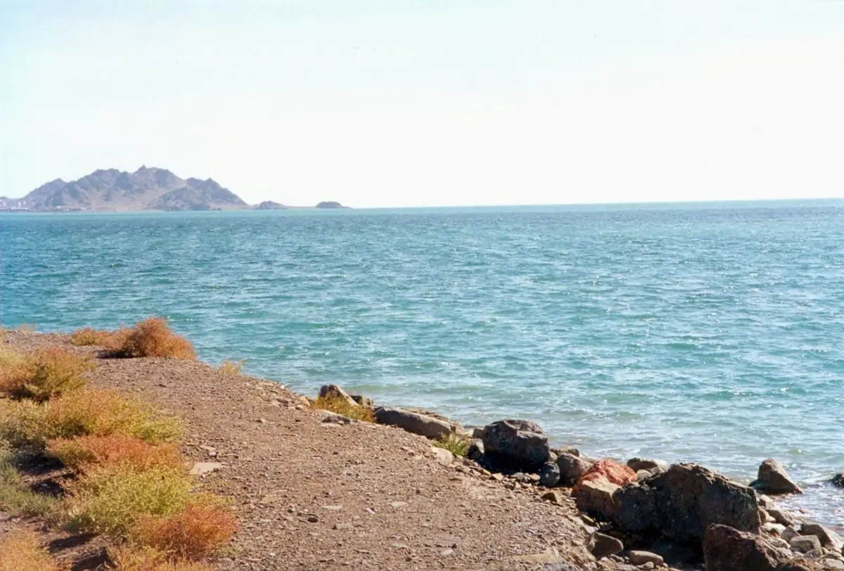
The Caspian Sea is also home to numerous islands, all of which are close to the coast. There are no islands in the deeper regions.
Ogurja Ada, off the coast of Turkmenistan, is the largest island at 37km long.
Most of Azerbaijan’s islands are of great economic and geopolitical importance because of their oil reserves. Among them is the island of Bulla, which has immense oil reserves.
There is also Pirallahi Island, which has significant oil deposits, being one of the first places in Azerbaijan where crude oil was found and the first island in the Caspian Sea where sectional drilling was practised.
Also worth mentioning is Ostrov Nargin Island, a former Soviet military base and the largest island in Baku Bay.
Another island is Ashuradeh, the only Iranian island in the Caspian, located on the easternmost coast of the Miankaleh peninsula.
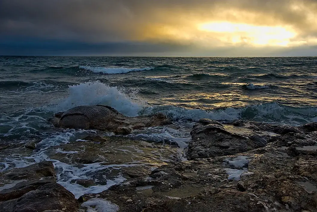
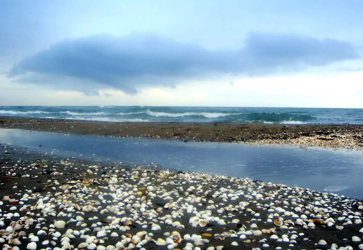
The Caspian Sea is a huge lake that forms waves like the sea on all its shores. The composition of the water also varies, from almost fresh in the northern parts of the lake to saltier towards the south.
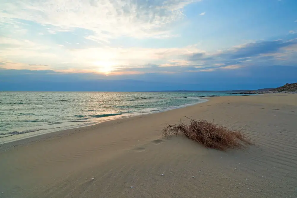
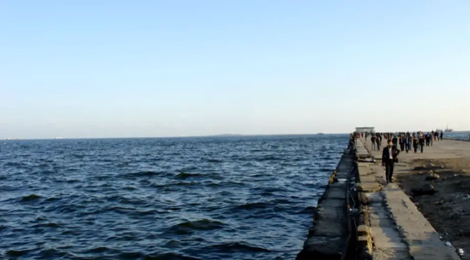
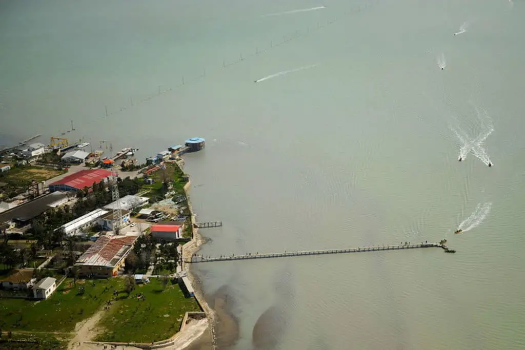
The coastal areas of the Caspian Sea attract a significant number of tourists, generating additional income for the local economy.
The Climate
The Caspian Sea region is one of the driest areas in the world. This large body of water crosses more than one climatic region.
The different climatic regions coincide with the climate of the different countries that share the sea’s shores.
The northern end, shared by Kazakhstan and Russia, has a temperate, cold and dry continental climate. The southern part of the sea, shared by Azerbaijan, Turkmenistan and Iran, is much warmer.
The surface temperature of the Caspian Sea varies from region to region. However, the average summer temperature is 24-26°C. July and August are the hottest months.
July and August are the warmest months due to high temperatures. Winter temperatures are significant but vary from region to region.
Temperatures range from 0 to 7°C in the north and 8 to 10°C in the south.
Flora and fauna
The Caspian Sea is rich in biodiversity and is considered one of the world’s independent zoogeographical regions. It is home to some rare and endemic plant and animal species.
More than 2,000 animals and species are found in the region, 400 of which are endemic.
Birds use this sea as a migratory route and refuge.
The coasts have shallow saline pools that are home to small invertebrates, fish and birds.
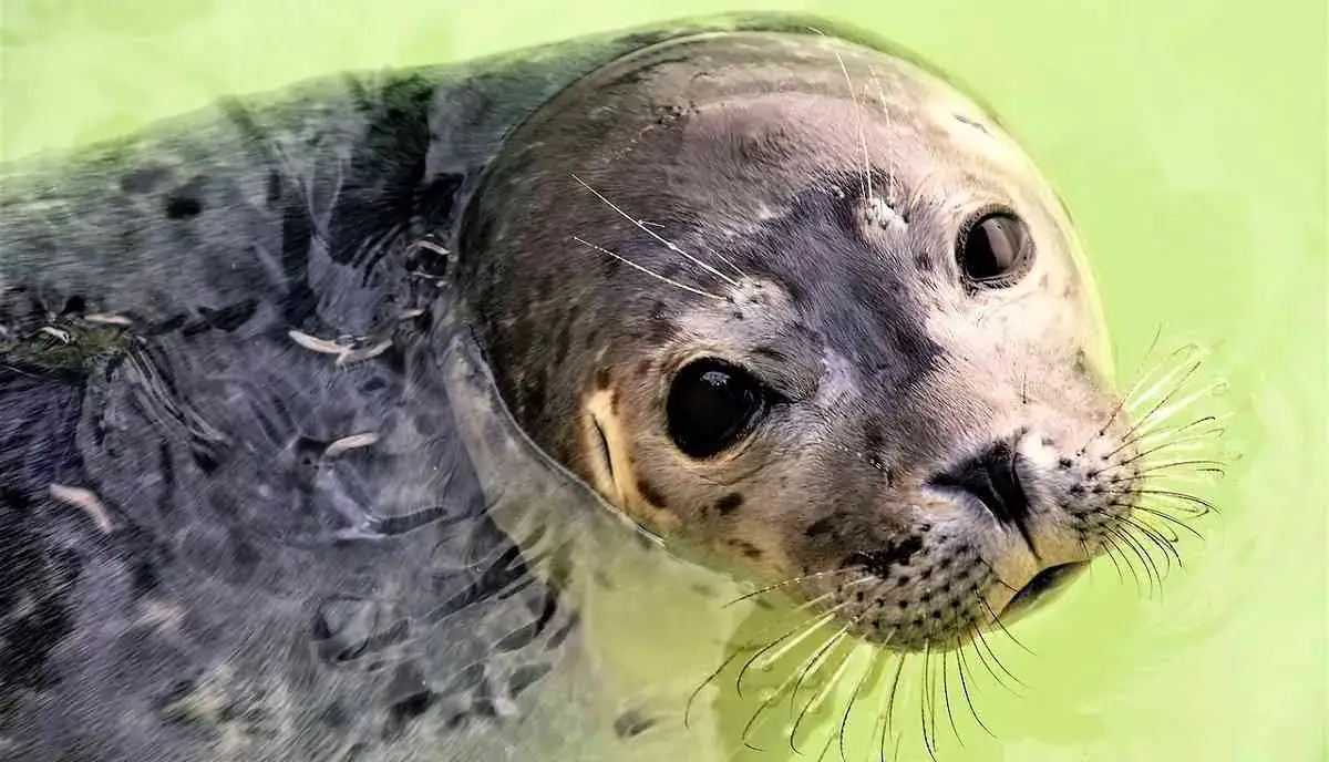
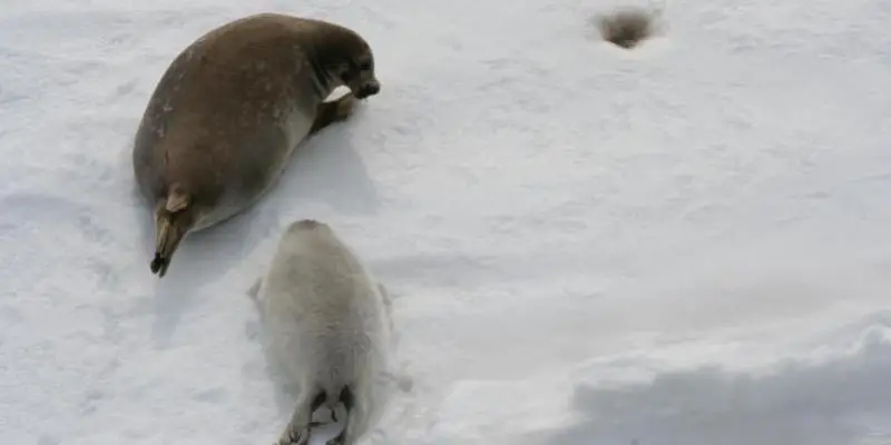
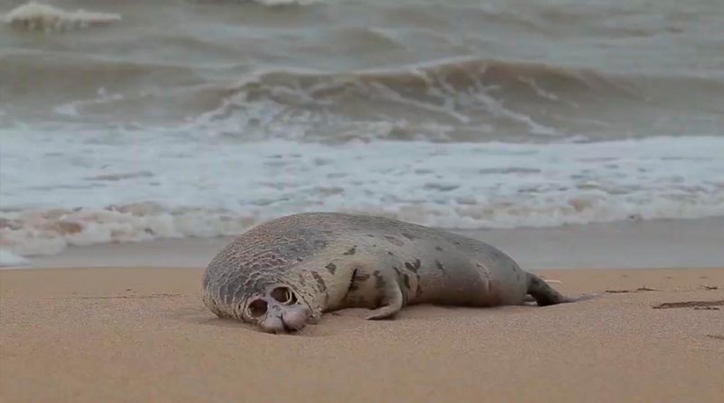
Fish species include perch, herring and carp. Endemic species include the spurred turtle, Caspian gull, Caspian salmon, Caspian whitefish and the Caspian seal.
The Caspian seal, also called Pusa caspica, is one of the few species of seal that live in inland waters.
Other mammals in this habitat include the Asiatic lion, Asiatic tiger and Caspian tiger. There are no sharks in the Caspian Sea.
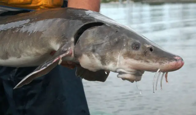
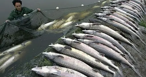
The Caspian is famous for the beluga sturgeon, known for its gastronomically valuable caviar roe, which is the most valuable animal in the lake.
Sturgeon
Several species of sturgeon live in the Caspian Sea. Seven subspecies have been identified, making it the most diverse sturgeon in the region.
Insiders say that 80-90% of the world’s caviar comes from the Caspian Sea, making it the largest source of this marine delicacy, which is considered one of the best.
However, these percentages have been declining in recent decades due to pollution of the lake.
According to a 2002 report on Caspian resources, the sturgeon is on the verge of extinction as a result.
The UN has carried out studies on the subject and found that oil pollution is affecting the migration routes of sturgeon.
This is because sturgeon migrate through highly polluted waters near Azerbaijan’s Absheron peninsula.
This limits their food and oxygen supply.
A new threat to the sturgeon has also emerged. This is bacterial contamination from sewage from Iran.
Recently, the problem of overfishing has also emerged as a life-threatening factor for sturgeon.
Environmental groups have spoken out and launched campaigns calling for a ban on sturgeon fishing.
However, the price of sturgeon caviar is so high that fishermen bribe the authorities to get around the law.
However, it has been possible to establish certain bans on the fishing of this fish, as well as some regulations on the marketing of caviar.
Salinity
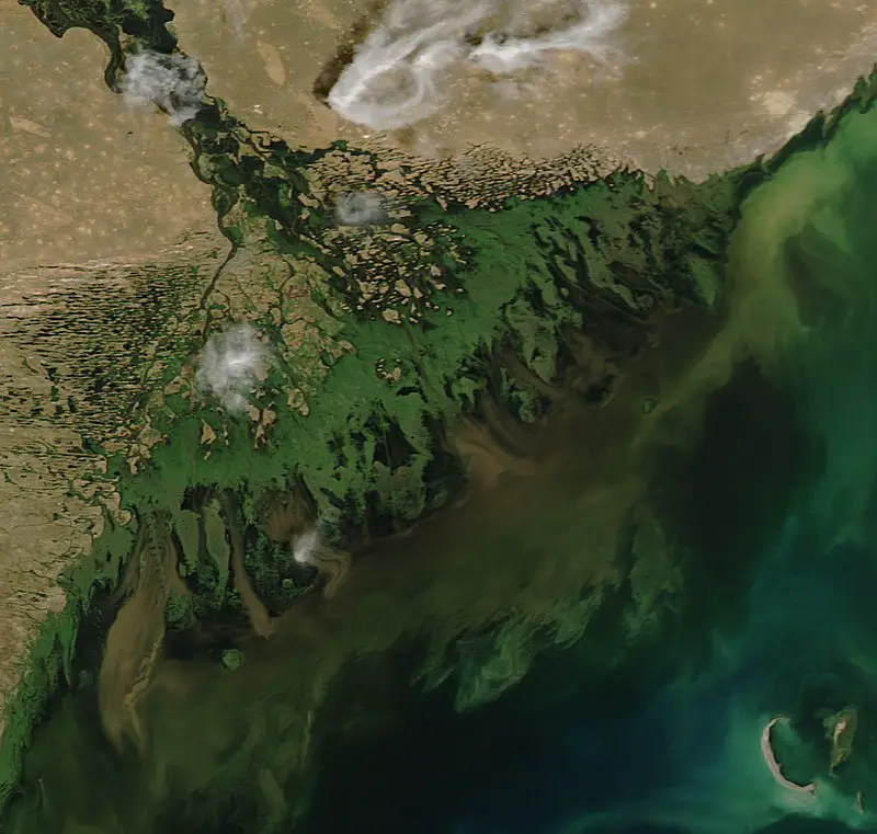
Fresh water reaches the Caspian Sea via the Volga, Ural, Emba and Kura rivers, but the sea remains somewhat salty in the south and centre.
Its salinity is currently a third of that of the oceans.
But why is this sea so salty and not fresh at all? The reason, as has been said, is that the Caspian Sea is the remnant of the ancient Thetis.
But today the Caspian is three times less salty than the world ocean, also known as the global ocean, which is the interconnected system of water masses on planet Earth and encompasses most of the hydrosphere.
Because of its isolation, the salinity of the Paratetis has fluctuated and has been decreasing.
In ancient times, during hot, dry climatic periods with little or no rainfall, it dried up and divided into several water masses that were saltier than those of the World Ocean.
During wet and cold climatic periods with abundant rainfall, these water masses would overflow and recombine, becoming less saline.
Melting glaciers would also have a strong influence, reducing the salinity of the water in the Paratetis.
Thus, a large amount of newly thawed water lowered its salinity, and because of this phenomenon, the sea today has a salinity three times lower than that of the World Ocean.
Freezing
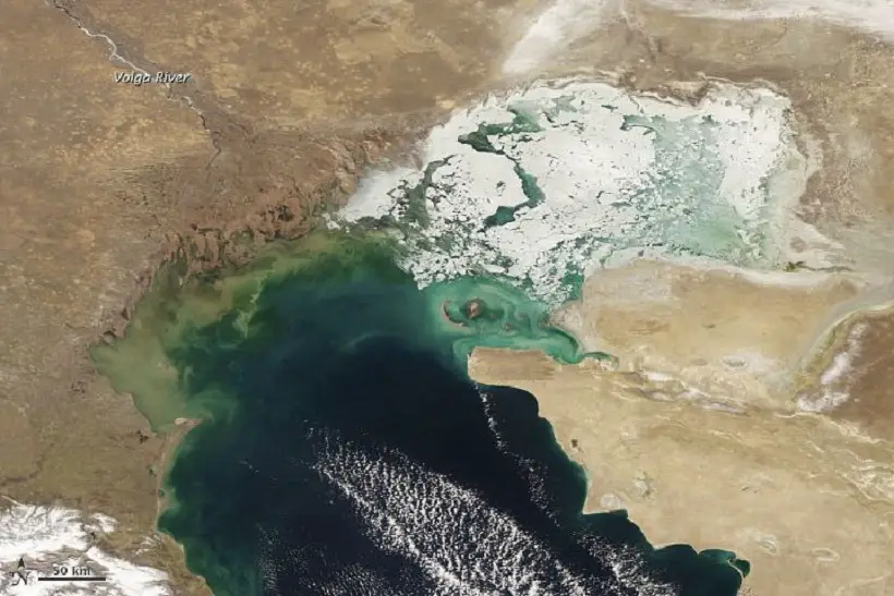
In winter, ice usually forms in the northernmost parts of the lake, while the central and southern parts remain ice-free.
Temperatures tend to be lower in the north, so you might think that the ice is only there because of the higher latitude. But the reality is more complex: from north to south, the Caspian also has differences in salinity and depth that affect how the lake freezes.
The water is saltier in the south and cooler in the north because of the 130 or so rivers that feed the huge lake, almost all of which enter from the north or west.
The largest is the Volga, which flows into the Caspian from the north-west, bringing a generous supply of very cold fresh water.
Fresh water freezes at 0ºC, but because the Caspian Sea is brackish, the temperature has to fall below that for salt water to freeze. For every five parts per thousand of salt (salinity), the freezing point drops by 0.28 ºC.
But a lower freezing point is not the only obstacle to salt water freezing. Saltwater behaves differently to freshwater, which makes it difficult for ice to form on the surface.
Ice is known to float because liquid water is denser than ice. But liquid water is not uniform in density. Fresh water is densest at 4°C, several degrees above freezing. As it cools below 4°C, it starts to rise to the surface.
If a layer of ice has already formed on the surface of the lake, this cooling water rises and can easily freeze to the bottom of the ice.
Salt water, on the other hand, usually reaches its maximum density near its freezing point. Because this salt water tends to sink (rather than rise) just before freezing, more of the water column must cool before the salt water can form a layer of ice.
Crude Oil
The Caspian Sea is a major supplier of crude oil, with around 50 billion barrels of oil and almost 8.4 trillion cubic metres of natural gas produced daily from beneath its seabed, accounting for 1.9 per cent of the world’s total.
Although oil was discovered in the 10th century, it was not until the 16th century that Europeans began to explore for oil in the region; the first oil well was drilled in 1820, and by 1873 exploration was taking place throughout the region and gradually increasing.
By 1941, Azerbaijan was producing about 23 million tonnes of oil a year.
The Caspian economies export up to 80% of total oil, with Russia producing about 66% of total exports.
Oil and gas production platforms are located along the entire coast of the sea.
However, several islands, particularly around Azerbaijan, have suffered extensive environmental damage from oil production.
For example, Vulf has suffered severe ecological damage from industry on neighbouring islands; fortunately, Caspian seals and various bird species can still be found.
Pollution
Pollution, especially from the oil industry, is undoubtedly one of the main threats to the ecology of the sea.
In fact, several environmental organisations are calling for industrial activities in the region to be controlled.
Industrial activity around the sea has become an ecological risk, not only for flora and fauna, but also for the people who depend on the sea.
Intensive oil exploration has already been shown to cause serious pollution and damage to wildlife. But tackling these threats is a challenge because of the current dispute between the five countries over ownership of the sea.
Importance of the Caspian Sea
The strategic importance of the Caspian Sea lies primarily in its wealth of energy resources.
As noted above, the sea contains large quantities of oil and natural gas, both in offshore and onshore fields in the immediate region.
These reserves are estimated at around 50 billion barrels of oil and 8.4 trillion cubic metres of gas in proven or probable reserves.
As a result, there are numerous oil and gas projects in the region, and all the Caspian littoral states are major energy producers.
However, much of the Caspian Sea’s oil and gas remains unexploited due to disputes over maritime boundaries and energy resource sharing, which have been under negotiation for almost two decades.
Many proposals and counter-proposals have been discussed, but these negotiations have yet to produce a solution acceptable to all five states.