
Lake Chapala is a natural reservoir in the Jalisco region of Mexico, which is the main source of drinking water for the entire Guadalajara area. Find out all about the history, characteristics, flora, fauna, geology and much more of this great natural lake, considered the largest in the Republic of Mexico and also part of North America.
History of Lake Chapala
In pre-Hispanic times, Lake Chapala welcomed groups of people who arrived in its vicinity and stayed there, creating the first settlements. At that time, the lake was known as Chimaloacán, which, translated into Spanish, means region where the shield is used.
The original inhabitants of this region were the Tecuexes, descendants of the Toltecs of pre-Columbian origin, whose law was governed by the Lordship of Tonalan, a form of government. According to contemporary accounts, it was a chief called Chapa who encouraged the group of settlers to create Chapala.
In 1526 the lagoon was already known and called Mar Chapalico because of its size. A region conquered by Alonso de Avalos, under the authority of the Viceroy, as well as New Spain, but also related to the Kingdom of New Galicia.
Throughout its history, this lake has been admired by historical figures such as Alexander von Humboldt, who admirably described it as different from other Mexican lakes, whose watercourses diminish over the years, while Lake Chapala always remains the largest water reservoir in Nueva Galicia, as the region was known at the time.
How did it originate?
The Earth is a planet that, during the Pleistocene period, about two million years ago, was affected by the presence of natural elements that caused volcanism and the collision of the great tectonic plates that make up the territories.
This led to the birth of mountain ranges and the presence of volcanoes that caused unevenness, giving rise to the continents and the geological structures that gave rise to mountains, plateaus, rivers and lakes.
All this is linked to the Pacific Orogenic Belt, where seismic and volcanic activity is recorded from Alaska to Patagonia. The basin identified as Lerma-Chapala-Santiago is located in the Neovolcanic Axis, right in the heart of Mexico.
As a result of natural processes of erosion and changes in the relief, the water managed to reach the Pacific Ocean in the form of rivers, but some of its deposits remained isolated due to the fact that they were geologically young regions. This is how Lake Chapala was formed in western Mexico, between the Jalisco and Michoacán rivers, but mainly fed by the Lerma River.
In short, Lake Chapala was formed by the presence of a depression in the earth’s crust, due to the fracture known as the San Andrés-Chapala line, which created a trench that trapped the waters of the hydrological system known as Lerma-Santiago.
Characteristics of Lake Chapala
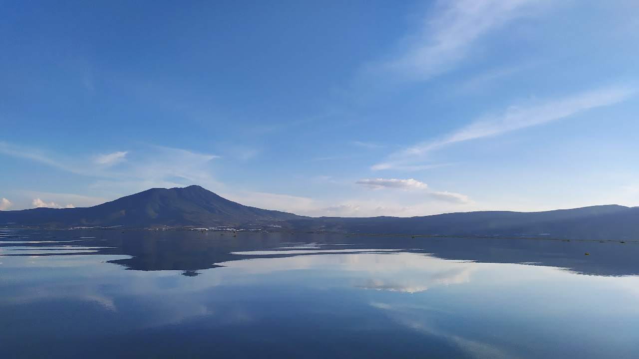
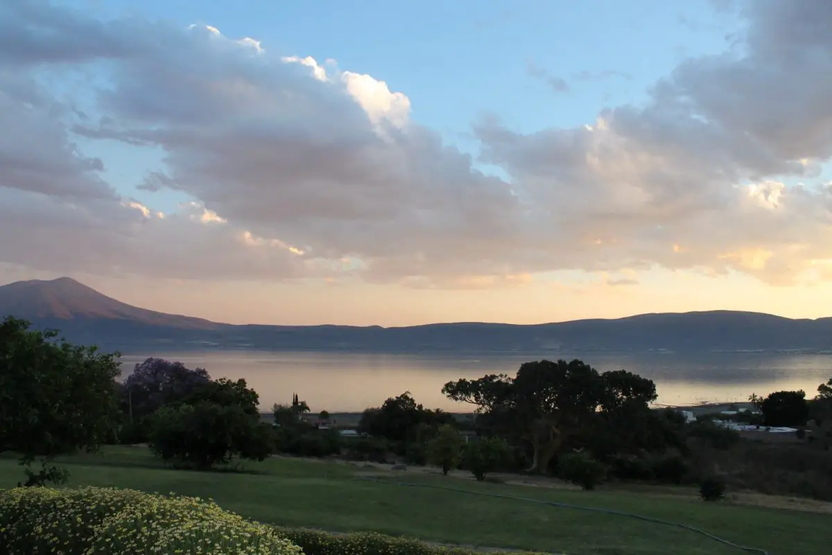
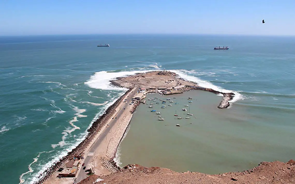
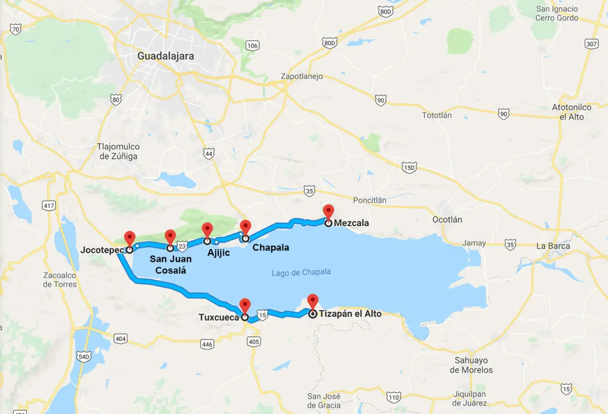
Lake Chapala is located in the western region of Mexico, between the states of Jalisco and Michoacán, and includes the islands of Los Alacranes, Mezcala and La Menor.
In terms of its characteristics, it has a surface area of 1,112 km² and is part of a larger basin formed by the Lerma River, which has a surface area of 560 km² and from which it receives most of its water, and the Santiago River, which has a surface area of 443 km², with a smaller contribution.
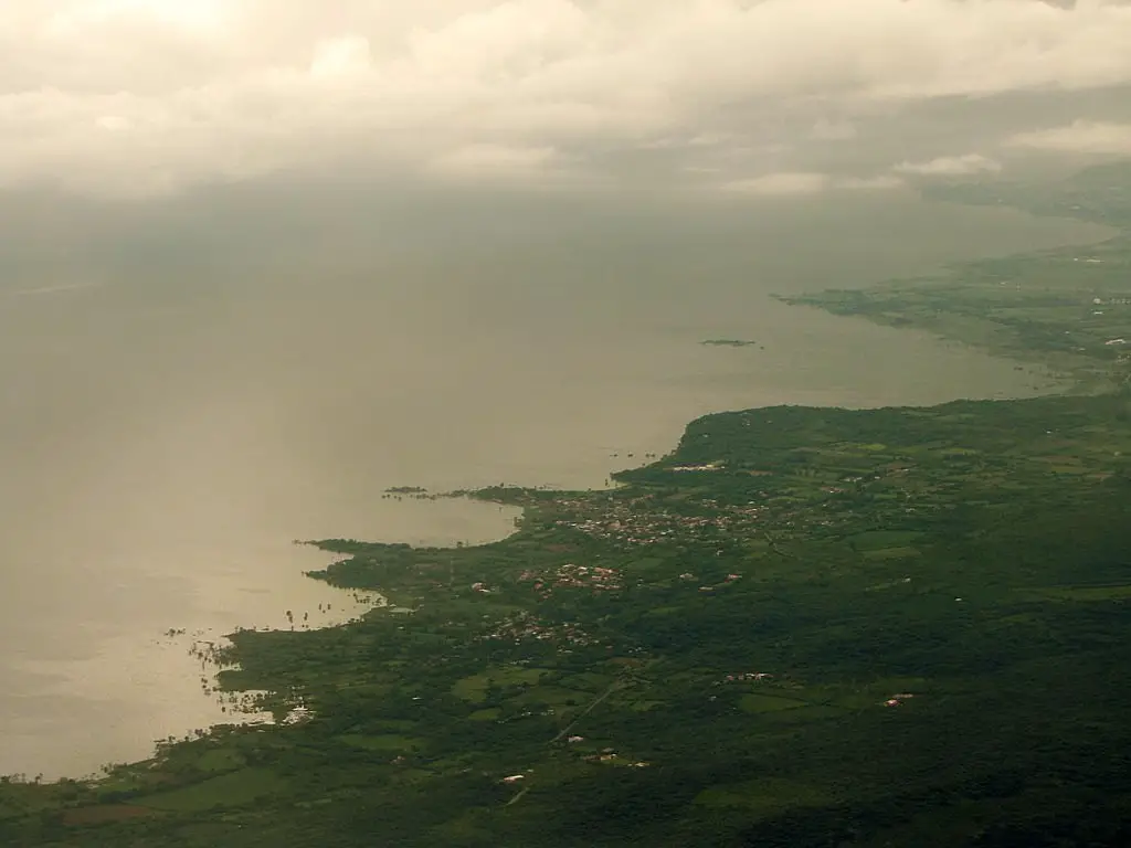
It also has a number of towns located around it, among which we can mention Chapala, Ajijic, El Chante, San Juan Cosalá, Jocotepec, La Barca and Ocotlán.
The length of the lake is about 80 km, with a width of 18 km and an average depth of 15 metres and a maximum depth of 100 metres, with a volume of 8.1 km³, which has been reduced in critical moments due to the climate of the area.
The region in which Lake Chapala is located has been used as a settlement for numerous towns and cities near its shores, some of which we have already mentioned. Since the 1950s, it has been the preferred location for an important colony of retired people who choose this area for its pleasant climate and attractive scenery, especially in the town of Ajijic.
As a final peculiarity, it is worth mentioning that its name has different meanings depending on the language in which it is translated. For example, in Náhuatl “Chapala” means “place of búcaros or small pots”, but in Coca it also means “very wet or soaked place”, and there is even a second interpretation of the name in Náhuatl that attributes its meaning to “place of locusts on the water”.
Climate of the Lake
The climate of Lake Chapala is temperate, with the presence of rain in the summer, especially in the months between June and October; but for the period between December and February it is quite cold, with an average temperature of 19.9°C. This temperature varies with the seasons.
However, this temperature varies according to the seasons of the year, becoming quite hot when it is around 35°C or very cold when it is close to 0°C or even less.
In general, the climate of Lake Chapala is ideal for relaxation, and this is why many elderly people from colder areas of the north choose to retire here, as it is a quiet environment, with little variation in temperature throughout the year, but basically managed according to two seasons: one warm and one cold, which makes it easier for its inhabitants to adapt.
Flora, Fauna and geology
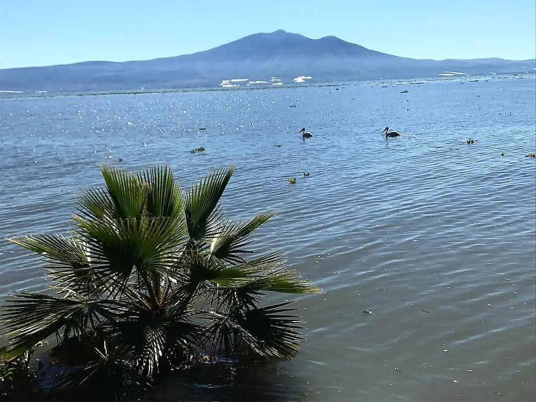
From a geological point of view, the lake is a natural reservoir formed on a tectonic rift and receives its water from the Lerma-Chapala-Santiago hydrological stream, whose islands are also of volcanic origin.
It is worth mentioning that the faults present in the relief of the area are due to its great seismicity, which has given rise to the famous Tequila volcano and some of the hills that surround Lake Chapala.
The flora of this region is very diverse, represented by species such as the Tripilla, also known as the duckweed, whose scientific name is Promageton angustissimus, which generally lives on the shores of the lake, creating a shadow under the water.
There are also lilies, usually found near the estuaries, but this is a type of flora that must be taken care of, as it can become a plague, as it has the property of altering the ecosystem of the lake, causing the loss of animal species.
In general, the lake has a series of plant species, among which we can mention: juncal, guaje, papelillo, pajonal, huamúchil, zapote blanco, pochote, copales, hydrophilic trees, and many others, where the pines and holm oaks that grow in the nearby hills stand out and have an additional importance because they serve as a refuge and protection for innumerable animal species that are in danger.
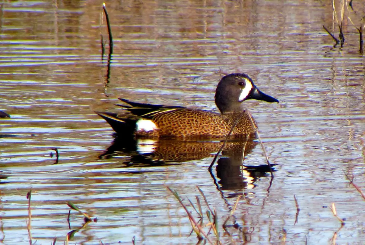
The lake’s fauna is closely linked to its water element, so that nine families of fish can be observed, made up of thirty-nine native species, not counting some others introduced to create hybrids.
Among the fish that belong to Lake Chapala is the charal, which is typical of this lake, there are also species of crabs, mussels and birds such as pelicans, herons, ducks and some migratory birds from the Atlantic.
As far as reptiles and amphibians are concerned, frogs are abundant and some are considered endemic, such as the common frog. All these animals, with the exception of the lizard and the chameleon, are considered endangered species due to the pressure they are under because of their poisonous nature.
On the mainland it is also possible to see deer, coyotes, skunks, rabbits and rattlesnakes, among others. More specifically, it is estimated that 31% of the mammals in the area are of Neotropical origin, 25% are of Nearctic origin and 44% share these characteristics, being species whose distribution extends between these two regions.
Although it is clear that the number of animal specimens is much lower today, refuges and traces can still be found in oak, pine and subtropical scrub forests, places where human access is much more difficult and which have therefore served to protect them.
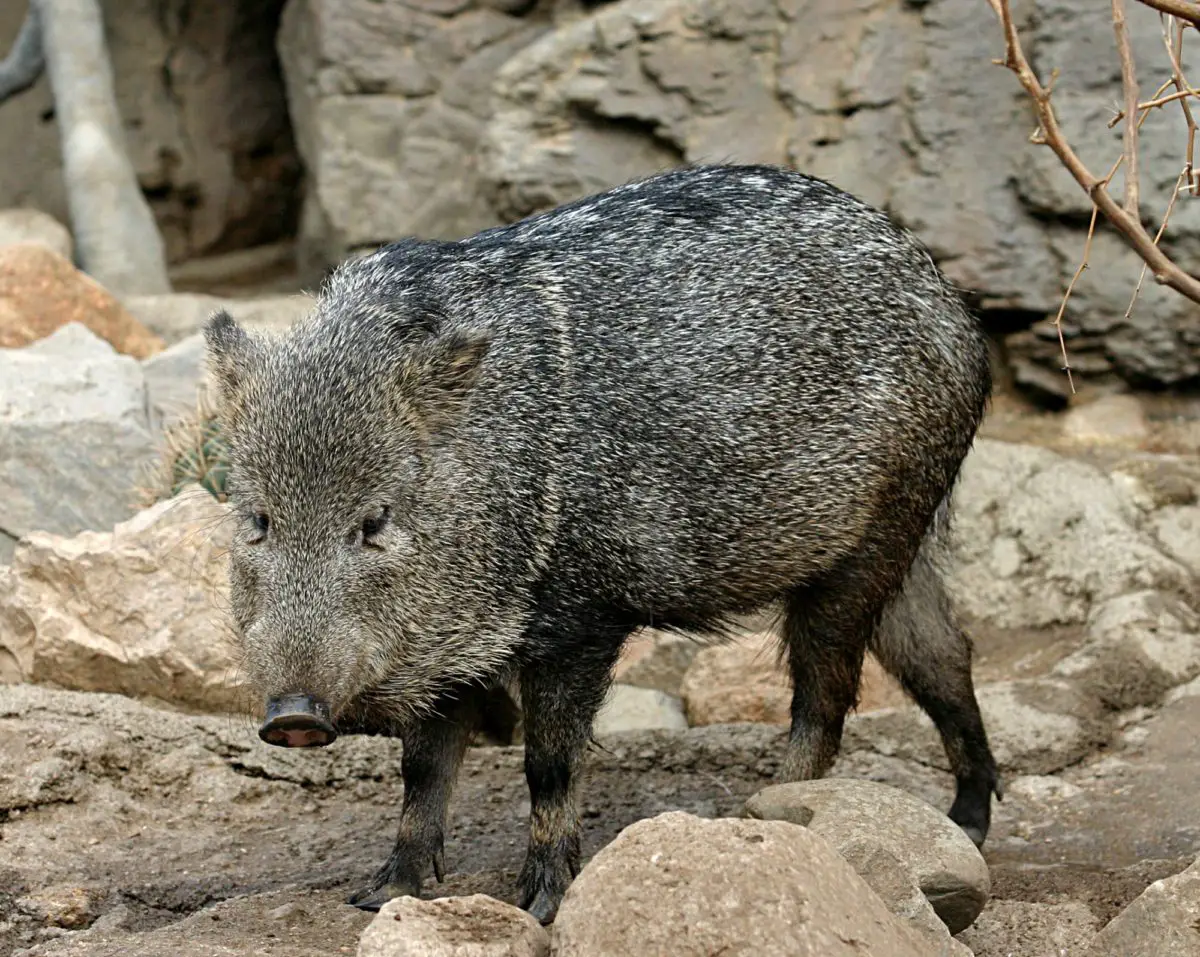
In this sense, we can offer a detailed list of some unique species of the area, threatened or in danger of extinction, which are currently protected by the ecological authorities of the country. These are: the bat with the scientific name Leptonycteris nivalis and the collared wild boar, scientifically identified as Tayassu tajacu, both catalogued as endangered species, while the puma Felis concolor is in danger of extinction.
There are also some species of great interest to hunters, which are also protected by a permanent ban in this region. We are talking about animals such as: tlacuache, coyote, armadillo, raccoon, Castilian rabbit, puma, wild cat, grey fox, white-tailed deer, cheetah and squirrel.
It is the right time to call on all residents and visitors to the area to make a positive contribution to the conservation of these species and all those who live in this natural space, so that future generations can get to know them and develop a deep respect for the nature that has given us so much.
Islands of Lake Chapala
Lake Chapala has three beautiful islands, identified by the following names: Isla Mezcala, Isla de los Alacranes and Isla Menor, which form part of its extension, with a total surface area of 114659 hectares, 86% of which is in the state of Jalisco, while 14% of the lake is in the state of Michoacán. Below is a detailed description of each of the islands mentioned:
Mezcala Island
Also known as Isla del Presidio, it is located off the town of Mezcala de la Asunción, in the waters of Lake Chapala. The reason for its name comes from the time of Mexican independence, when the insurgents were imprisoned in a prison on this island, which was built by the territory of Jalisco.
The island has an area of approximately 200,000 square metres, with striking elements such as the Virgin of San Juan de Los Lagos, which is placed under the Tree of Life. Interestingly, the shape of this tree, with its roots and trunk, is associated with the figure of an elephant.
On this island there is also a beautiful chapel, used for prayer or simply for voluntary fasting for three days; there is a fort that was used for war and is of great historical interest, there is also an old barracks from the XVIII century and a natural landscape that, although quite degraded, allows it to be considered a pre-Columbian archaeological island.
Island of the Alacranes
Located in the area that corresponds to Lake Chapala, this island is called Alacranes because of its scorpion-like shape. Since 2017, it has been declared a Cultural Heritage Site by the State of Jalisco, but it is also the heritage of the Wixárika people.
The Wixárika are an ethnic group from the Mexican state of Nayarit, also known as the Huichol; they are indigenous tribes who live nearby and for whom the lake is known as Xapawiyemeta, where they perform their ritual ceremonies.
Smallest island
This is the smallest of the three islands in the Lake Chapala area, and although there is no information about it, it is considered to be a tourist resort or for leisure activities related to visits to the lake.
Popular Activities of Lake Chapala
Lake Chapala is a frequently visited place by both locals and tourists coming to Mexico, especially since it is the largest lake in the country and is located less than an hour from the city of Guadalajara.
Tourism in this place has its origins in the 19th century, when Lake Chapala received its first tourist. From then on it was possible to travel by train from Ocotlán to Chapala and to take boat trips around the lake. During the administration of President Porfirio Diaz, tourism in the region reached its peak, but it was not until the fifties that tourism was consolidated as an economic activity that sustained the inhabitants. It is worth noting that this lake is a favourite of many Americans and Canadians, as there are many colonies of these types of immigrants.
In this section we have included some suggestions for those who wish to visit this place in search of a well-deserved rest or simply with the idea of getting to know this magnificent area, which is mainly located in Jalisco, but also has a part of its surface in Michoacán.
In this sense, some of the best activities to do during a visit to this famous lake include
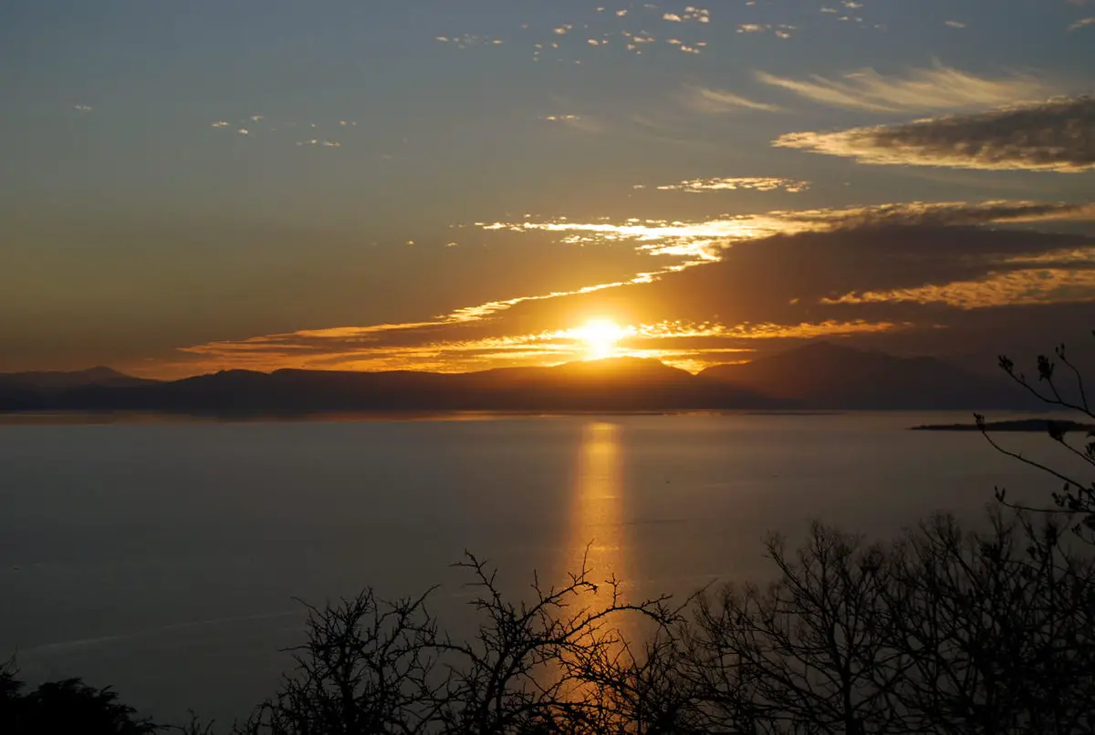
- Enjoying the sunset, which can be seen from the Malecon or any of the towns that line its shores, especially in Ajijic or simply in Chapala itself.
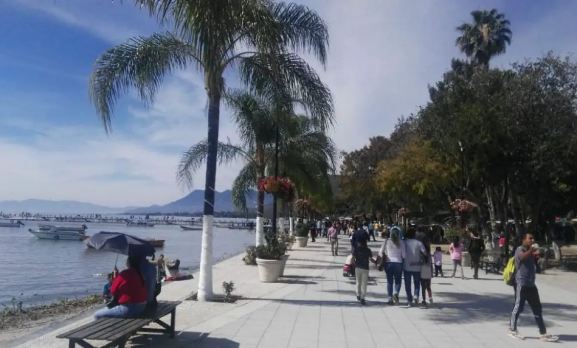
- Take a stroll along the cobbled streets that lead to the lake and make up the beautiful promenade of Ajijic, enjoy a long and relaxing stroll where you can let your imagination run free or do your morning exercises, visit the pier and the lighthouse and finish off with an unforgettable boat ride.
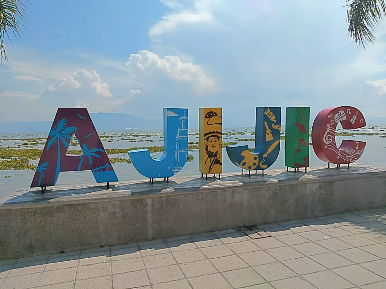
- Pictures are another way to pass the time, especially as the scenery is perfect for creating great postcards, the most popular among tourists are the image of the parish of San Francisco de Asis or the colourful letters that identify Lake Chapala.
- Another of the attractions of this place is the Malecon of Chapala, where the craft market is concentrated, where you can buy beautiful souvenirs of the place and enjoy the skills of the Voladores de Papantla, with their aerial show, something not to be missed during your visit to this magical place.
- This lake has a typical pier made of Jocotepec wood, very well maintained, which allows you to walk all the way around it, enjoying the outdoor life while contemplating the beauty of the lake.
However, tourism is not the only economic activity that is developed in this place, and it is a region that is part of many municipalities at the same time, such as Jalisco, Chapala, Poncitlán, Ocotlán, Jamay, Jocotepec, Tuxcueca, Tizapán el Alto, Michoacán, Cojumatlán de Régules, Venustiano Carranza and Briseñas.
As a result, its economic impact has benefited municipalities in Jalisco such as La Barca, Jamay, Ocotlán, Chapala, Ajijic and Jocotepec, and in Michoacán such as Venustiano Carranza, Chavinda, Jiquilpan, Sahuayo, Pajacuarán and Villamar. However, it is important to note that development has been uneven among them, with some enjoying a good economy and others barely acceptable.
The agricultural activities carried out in the areas close to the river and the tourist areas correspond to the economically poorest places, whose main means of subsistence is fishing. But it is thanks to the waters of Lake Chapala that its inhabitants have been able to develop this type of agriculture and livestock farming. In the areas most visited by tourists, there are also local handicrafts, restaurants and hotels that contribute to the economic development of the region.
Pollution of the lake
The problem of pollution in Lake Chapala is very worrying, as the River Lerma, as it passes through the populated region of El Bajío, is exposed to contamination from urban and agricultural waste.
But this is not the only pollutant that reaches Lake Chapala, as its other tributary, known as the Rio de Santiago, is also exposed to pollution from the sewers of the city of Guadalajara and other nearby towns.
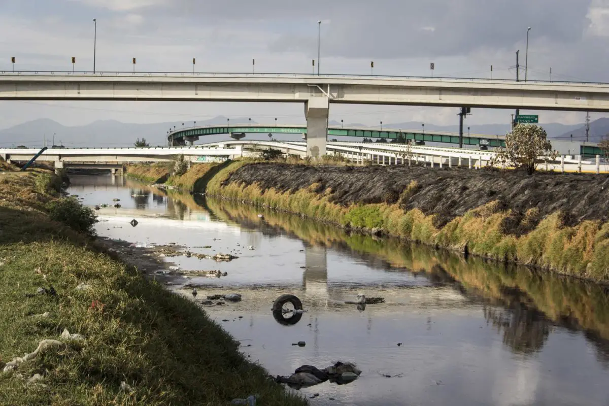
All this leads to the obstruction of the riverbeds, which in turn slows down the flow and inevitably leads to the stagnation and pollution of the water, which directly affects the quality of the water in Lake Chapala, which is fed by these rivers.
In the same way, the situation of environmental pollution is also complex, due to the use of water for the consumption of the communities and the presence of silt, garbage and climatic changes, as the lake gradually loses its level during the dry seasons, a sum of factors that have a negative impact on all the inhabitants of the area and that require timely awareness before it becomes irreversible.
Map of Lake Chapala
Finally, we present the map of Lake Chapala, where you can see its exact location in the states of Jalisco and Michoacán in the western region of Mexico.
If you have enjoyed the information in this article, we invite you to discover more rivers through the following links:
- River Sella
- River Bidasoa
- River Guadalete
- River Magdalena