
The Urubamba River, which drains into the Amazon, rises in the Andes of southern Peru. It flows for about 450 miles (725 km) until it joins the Apurimac, where it forms the Ucayali.
The upper part of the Urubamba, called the Vilcanota, passes through the towns of Sicuani, Urcos and Urubamba and is densely populated by Indian farmers.
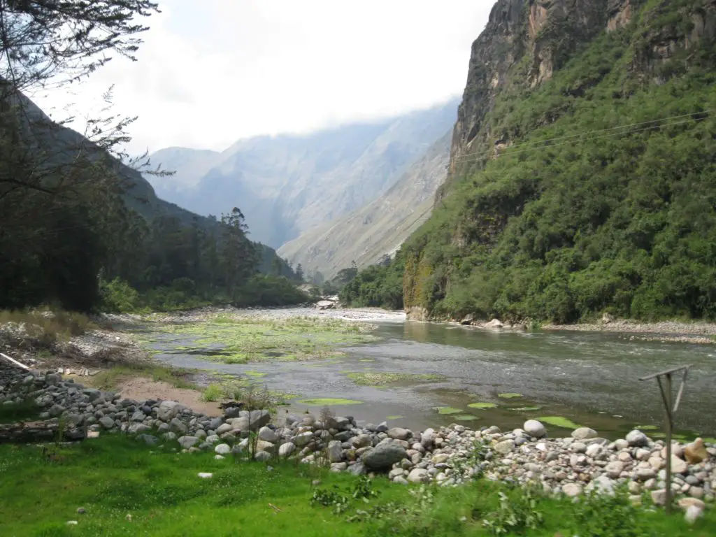
Below Urubamba, in the Torontoy Gorge, the river drops from 11,000 to 8,000 ft (3,400 to 2,400 m) in 20 miles (32 km). The Cuzco to Aguas Calientes railway, popular with tourists on their way to Machu Picchu, runs parallel to this part of the river. The lower course, downstream from Quillabamba, is sparsely populated.
History of the Urubamba
The origin of its name comes from the Quechua dialect Urupampa, which means ‘plateau of spiders’. In Inca times it was known as Willkamayu and was sacred to them.
It is one of the most important rivers in Peru and forms part of the Amazon basin. Traditionally, the Urubamba River is divided into two parts, one being the Pongo de Mainique, which is a rather small part of the river and difficult to navigate as many tragedies have occurred on it (see article: Yukon River).
Urubamba is the province where the white corn is grown, of immense size and considered the largest in the world, and is the place where the Vilcanota River is renamed the Urubamba River; at the height of this city the river becomes more powerful and turbulent, allowing you to practice rafting level III.
Along 110 kilometres and with a flow of 600 m3 / s, after enriching this land for the production of corn, the river continues its descent to the city of Ollantaytambo, where you will have to board the train to Machu Picchu, or from the start of the incredible Inca Trail to Machu Picchu (see article: Euphrates River).
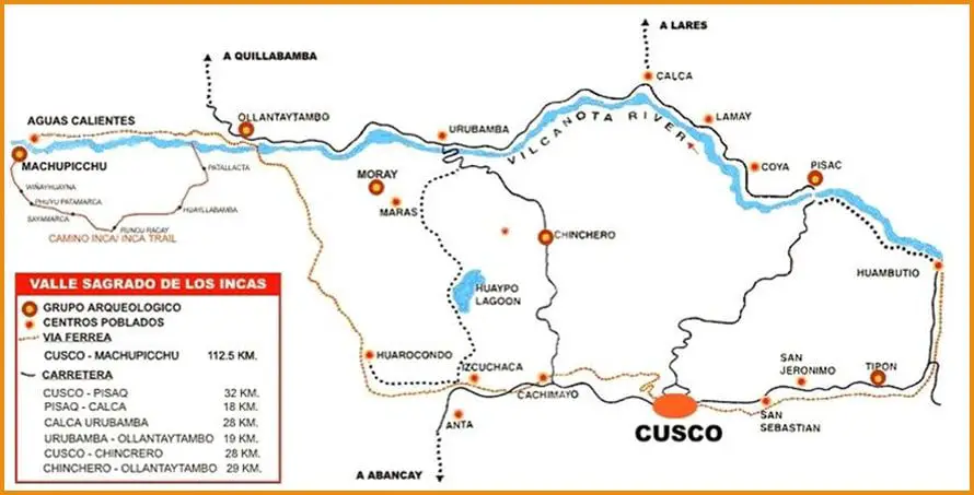
Map of the Urubamba River
River Urubamba Cusco
Its journey through the northeast of the department of Cusco takes you through the archaeological complex of Raqchi, where the famous temple of the god Wiracocha (creator of the universe according to the Incas) is located; it crosses the southern valley through the village of Andahuaylillas, place where it is called the Sistine Chapel of America, 36 km from the city of Cusco.
The Urubamba River in Machu Picchu
The Urubamba River runs along the mountains where the Inca city of Machu Picchu is located and crosses the valley from the city of Ollantaytambo to the city of Aguas Calientes; trains to Machu Picchu travel along the banks of the Urubamba River to the Inca city.
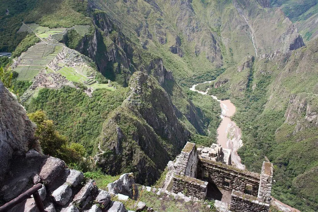
The river surrounds the Huayna Picchu mountain in a circle, creating an imposing and magnificent landscape that has inspired thousands of visitors.
The Urubamba River in the southern valley of Cusco
Its journey through the northeast of the department of Cusco takes you through the archaeological complex of Raqchi, where the famous temple of the god Wiracocha (creator of the universe according to the Incas) is located; it crosses the southern valley through the village of Andahuaylillas, place where it is called the Sistine Chapel of America, 36 km from the city of Cusco.
The Urubamba River in the Sacred Valley of the Incas
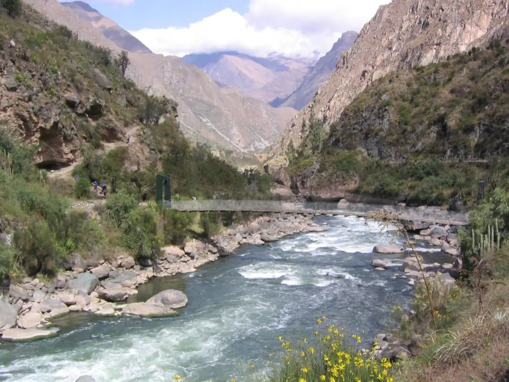
After crossing this city, the river continues its journey through the Sacred Valley, where it passes through one of the most beautiful villages of the valley and where you can find amazing Inca ruins; it is the ancient Inca city and the colonial city of Pisac (see article: Ohio River).
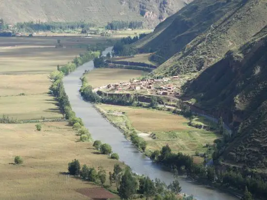
From here you can see the entrance to the Sacred Valley of the Incas and the pass to cities like Urubamba, which is called Ollantaytambo and Machu Picchu.
Rafting Urubamba River Peru
Crossing the Sacred Valley, this scenery is one of the most popular for rafting enthusiasts. There are several routes: Calca – Urubamba and Huambutío – Pisac; Ollantaytambo. Between December and March.
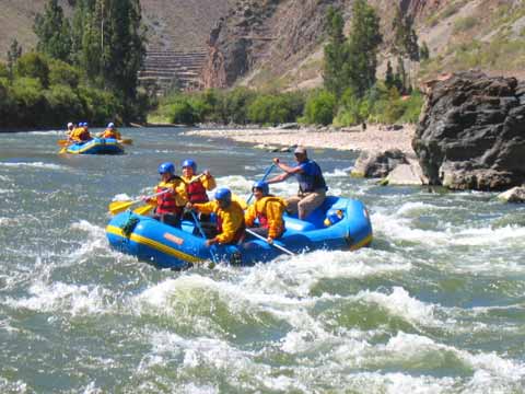
The river is excellent for rafting and kayaking. In several places the river passes through impressive expanses of jungle and adventurous rapids. As such, it offers travellers an impressive way to experience the wilderness of Peru’s Sacred Valley.
The Urubamba River is at its best between December and May, when the tributaries along the riverbed are at their best. When the river is low, between June and November, rafting is usually practised on the lower part of the river between Ollantaytambo and Chilca. The rapids in this section are class III.