
The Tumbes River gives its name to a province in northwestern Peru on the banks of the river. It is the capital of the region of Tumbes, the province of Tumbes and the district of Tumbes. Located near the border with Ecuador, Tumbes has a population of 111,595.
Features of the Tumbes River
The city of Tumbes, capital of the province and state of the same name, is located on the northern coast of Peru, just 30 km from the Ecuadorian border. Its name derives from the aboriginal “Tumpis” who inhabited this area until the arrival of the Spanish invaders in the 16th century (see article: Eno River).
Due to its proximity to the equator and the influence of the warm oceanic current from the Gulf of Guayaquil, it has a semi-tropical climate with an average temperature of 27°C during the summer months (December-April), reaching 40°C, and no rain (see article: Guayllabamba River).
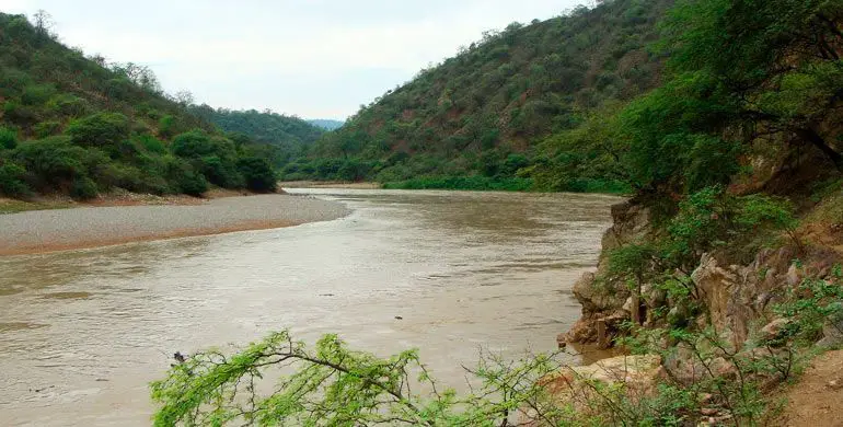
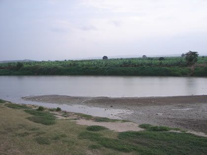
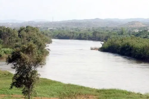
The city of Tumbes, located on the Tumbes River, the only river on the Peruvian coast navigable by small boats, is surrounded by vast tropical vegetation and agricultural areas, a uniquely green part of coastal Peru.
Its buildings are republican and modern, and it has a modest economic development. Near the main square are 19th century houses, some made of wood and split bamboo, pedestrian streets and modern monuments where the locals used to meet, local galleries and handicrafts.
The promenade along the Tumbes River offers beautiful views of the area. In Tumbes, don’t miss the famous seafood, such as black scallop ceviche, shrimp or majarisco.
Around the square are the Cathedral, the Town Hall, the Municipal Library and some colonial houses. It is the meeting place of the population on holidays. It is located at 100 m. Malecón de Benavides, overlooking the Tumbes River (see article: Río Jubones).
Located on the northern bank of the Tumbes River, 100 metres from the main square, at the southern end of the town, it is an emblematic building of the town. It was restored after the severe flooding caused by El Niño in 1998.
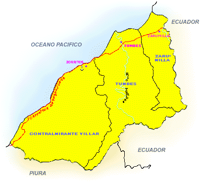
Location of the Tumbes River
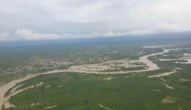
The sources of the river are located between the Ecuadorian provinces of El Oro and Loja. It forms the border between El Oro and Loja, and then the border between Loja and the Tumbes region of Peru. At its confluence with the Cazaderos stream, it enters the northern coastal region of Peru, called the Tumbes Region, and flows out of the Gulf of Guayaquil into the Pacific Ocean. The largest city on its banks is Tumbes, Peru.
Pollution of the Tumbes River
The problem of polluted and poorly managed river basins is becoming increasingly acute around the world. One such basin is the Tumbes River, which flows through Ecuador and Peru. This binational watershed, which flows into the Pacific Ocean, is one of the most important regions along the Pacific coast of South America.
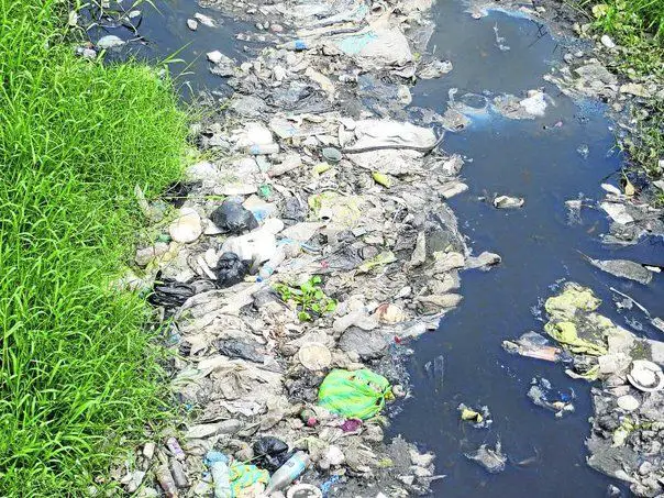
It covers a large area of diverse land, some of which is devoted to agriculture. The Tumbes River is an important source of water for irrigating crops in the agricultural areas. These are located in the downstream valleys on the north and south sides of the river (see article: Rio Aar).
Conservation of the Tumbes River
The Puyango-Tumbes binational watershed is bounded by the Tumbes region in northwestern Peru and the departments of Loja and El Oro in southeastern Ecuador. This important watershed includes three protected natural areas: the Margarés Tumbes National Sanctuary, the Tumbes National Reserve and the Las Colinas de Amotape National Park. It is the beginning of a process of territorial classification and ecological zoning.
It has been established that the conservation of biological diversity requires that we urgently begin to manage and treat the most sensitive elements. Action is needed to prevent the deterioration of some species and the extinction of others. It is considered essential to develop conservation and sustainable use strategies with mechanisms for the participation of local populations.
An assessment in accordance with the categories and criteria of the IUCN Red List version 3.1 revealed that in the plant formations of dry heather, deciduous forest and semi-deciduous forest, the species Centrolobium spp:
- The native forest species Centrolobium ochroxylum, Laxopterigium huasango, Zizipus thyrsiflora are endangered;
- Bursera graveolens, Myroxylon peruiferum and Alseis peruviana are vulnerable;
- Riplaris cumingiana is critically endangered.
The conservation and sustainable management of this important watershed should be included in the agenda of the binational plans of Ecuador and Peru. This will help efforts to plan learning experiences, strengthen the capacity of local people and promote the construction of a vision where conservation and progress go hand in hand.