
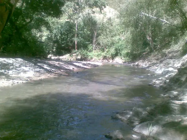
The Tuy River in Venezuela is an important water resource for the local population in terms of human, animal, agricultural and industrial consumption. Located between the states of Miranda and Aragua, it flows into the Caribbean Sea at the mouth of the Paparo River and is 239 km long (see: Río Manzanares).
It is worth noting that only some stretches of this vast tributary are navigable, and not all. This is due to the fact that the water level drops and becomes more rocky in different sections. This makes it impossible to navigate from its source to its mouth.

Location
It is one of the twenty-three states of the Republic of Venezuela, whose capital is Maracay. It is located in the central region of the country. It has an area of 7,014 square kilometres, divided into four regions: the coastal highlands, the depression of Lake Valencia, the interior highlands and the central plains (see: Río Cuervo).
State of Aragua
Its territory is drained by the San Miguel, Ocumare, Cata, Aroa, Aragua, Turmero, Maracay, Caño Grande, Tapatapa, Tocorón, Las Minas and Tuy rivers, which originate in the state on the flanks of Pico Codazzi.

State of Miranda
Miranda is one of the twenty-three states that make up the national territory, plus the Metropolitan District and the Federal Dependencies. Located in the north-central part of the country, its capital is Los Teques and it has an area of 7,950 km2.
Its main watercourse is the Tuy River, 239 km long. Its source is near the Codazzi Peak, where there is a natural park or monument of the same name, which together with the Henri Pittier National Park and the Macarao National Park form one of the highest peaks of the Venezuelan coastal mountain range.
Map of the river basin

There are few rivers in Miranda, with the exception of the Tuy River, whose course begins at an altitude of 2,100 metres along the Litoral mountain range and continues towards Tacata and the Tuy and Barlovento valleys, culminating in the Caribbean Sea. It passes through two reservoirs, the Agua Fría reservoir, near Los Teques, and the Ocumarito reservoir, near Ocumare del Tuy. Its main tributary is the Guaire River.
The importance of the river Tuy
The waters of the Tuy River are dammed in the La Mariposa reservoir, located in the city of Caracas, in north-central Venezuela, along the Las Mayas road. This is to supply drinking water to a large part of the city of Caracas, which has been growing over time. This uncontrolled and unregulated growth has led to a process of serious pollution (see: Nazas River).

Reservoirs
In order to process the water flow of rivers, reservoirs or natural dams are built to supply drinking water to the surrounding population. The Tuy River is one of the most important, as it supplies water to the most populated area of Venezuela.
La Mariposa Dam
It was the first modern and efficient aqueduct for Caracas in 1946. Since 1957, the Tuy River has been pumping water through the Tuy I system.

Pollution:
Factors such as indiscriminate deforestation, domestic, industrial and toxic waste, sedimentation, the presence of bora and slime, and the lack of timely dredging have caused this reservoir to gradually deteriorate, reducing the quantity and quality of the water it supplies. (See: Cauca River)
The Tuy River collects all the garbage from Caracas, Guarenas and Guatire, densely populated areas, degrading and destroying natural life. It is called the sewer of Caracas and the Tuy valleys. The flora and fauna of the basin, which flows into the Caribbean Sea, are also affected, polluting the beaches and towns where tourists come.

The fauna:
There is a wide variety of fish, including species such as carroncho, guabina, sardine, yucca, panaca, tuyero catfish and even some lobster, shrimp and crab, among others.
Tributaries
River Guaire:
One of the main tributaries of the Tuy River. It rises at the confluence of the San Pedro and Macarao Rivers, in Las Adjuntas. It is 72 km long. This river was once the main source of water for the inhabitants of the Caracas valley, long before the 20th century, but is now heavily polluted by man.
Caucagua River:
It rises in the Venezuelan Coastal Range and its mouth is the Tuy River. It is also known as the Rio Grande. It is important to the population because it is surrounded by Guarenas, Guatire and Caucagua, highly urbanised centres that use its waters, but have also mistreated and polluted them, which now pose a threat to the health of the communities.

Flooding
One of the most tangible risks is flooding, the swelling or overflowing of watercourses and streams. The communities around Colonia Tovar, in the state of Aragua, suffered a few months ago, in September to be precise, the flooding of houses in several areas, as well as landslides and ruptures in the pipes that supply the affected area, due to the rise of the river.
Excursion along the Tuy River: