
Last Updated on September 27, 2023 by Hernan Gimenez
Before 1800, the Salado River marked the border between the Spanish colonists (to the north-east) and the Indians (to the south-west).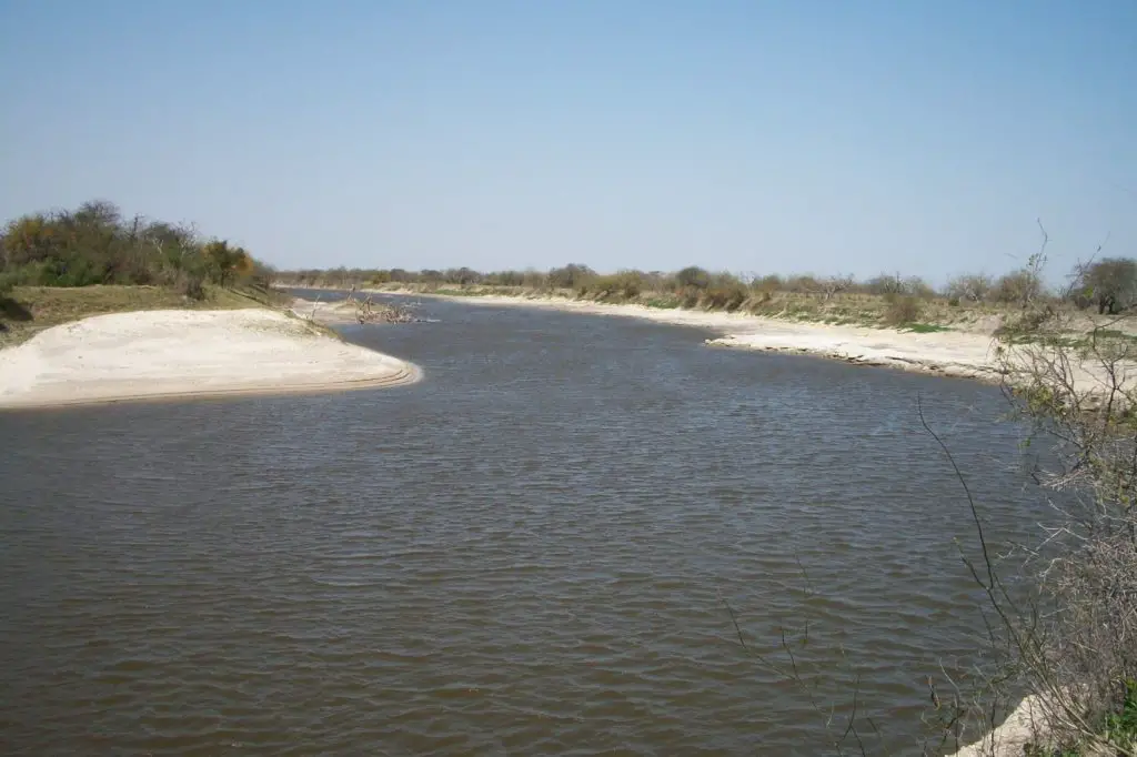
Europeans first became aware of the Río Salado in 1573, when it was discovered by Juan de Garay. During the colonial period, the river was an active border between the southern Chaco and the province of Córdoba.
On its banks, the Army of the North, commanded by Manuel Belgrano, swore allegiance to the Confederation of United Provinces of the Río de la Plata in 1813.
The history
The original inhabitants of these lands were the Juríes-Tonocoté, Sanavirones and other tribes. There are still around 100,000 speakers of the local Quechua language.
This makes it the southernmost outpost of the Inca language. When and how the language arrived in the area remains unclear.
It may even have arrived with the indigenous troops that accompanied the first Spanish expeditions.
Diego de Rojas first came to the region in 1542. Francisco de Aguirre founded the province of Santiago del Estero in 1553.
The Salado River flows through it, making it the northernmost city founded by Spanish conquistadors from the Pacific Ocean.
Santiago then passed through several governments, from the intendancy of Tucumán to the Audiencia de Charcas, then back to Tucumán, of which it would later become the capital.
In 1699, however, the bishop moved to Córdoba and two years later the government moved to Salta. In addition, the silver route between Buenos Aires and the viceroyalty of Peru passed through Tucumán instead of Santiago.
The combination of these circumstances drastically reduced the importance of the city and the territory, and by the beginning of the 19th century the city had barely 5,000 inhabitants (see article: Río Amur).
With the creation of the Province of Salta, Santiago del Estero became part of the new Province of Tucumán. In 1820, in the midst of the national conflict, Santiago del Estero separated from Tucumán.
It came under the control of the autonomous governor Juan Felipe Ibarra. One of the most effective defenders of the new province in its first decades was Jacinto Alcorta.
A young composer of sacred music who, as the representative of his province from 1826 to 1862, helped to modernise trade and taxation in the unstable young nation and to promote domestic banking and credit. The provincial constitution was drafted in 1856. At the beginning of the 20th century, the province acquired part of the land that was the subject of a dispute with the province of Chaco.
At that time, the province had four towns and 35,000 inhabitants, most of whom lived in precarious conditions. The construction of the Los Quiroga dam in 1950 increased the productivity of the otherwise arid land through irrigation.
In the 1890s, national legislators became aware of a little-known tourist route northwest of the Salado River in Buenos Aires.
Where, despite a complete lack of transport or accommodation, a steady stream of visitors rode over rugged terrain. To enjoy a group of mineral springs that had barely been mentioned since the Spanish first noticed them in 1543.
The Argentine Ministry of Agriculture commissioned Hercules Corti, a chemistry professor at the University of Buenos Aires, to study the springs. Completing his report in 1918, Corti claimed that the springs of the Rio Salado were among the most therapeutic in the world (see article: Zambezi River).
And at a time when the springs were becoming a leading destination for health tourism, the Rio Salado de Buenos Aires began to attract visitors from all over Argentina.
Booked as a public resort in 1932, the hotel’s first formal facilities opened in the late 1940s.
In 1948, the province elected the Peronist activist Carlos Juárez as governor. He was the central political figure of the late 20th century. Energetic and ambitious, Juárez soon became indispensable in local politics (mainly for power).
Considered a caudillo, he easily ordered the deaths of his opponents in the 1990s, including former governor César Iturre in 1996 and Bishop Gerardo Sueldo in 1998.
The deaths of two local youths, however, exposed Juárez’s killer, Antonio Musa Azar, and in the face of undeniable links to Musa Azar’s litany of murders and extortions, he was able to get away with murder and extortion.
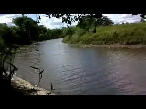
The Salado River has its source in the Laguna El Chañar, located near Teodelina (in the south of the province of Santa Fe), and its mouth on the coast of Buenos Aires in the La Plata River or in the Paraná River.
Location and map of the Salado River
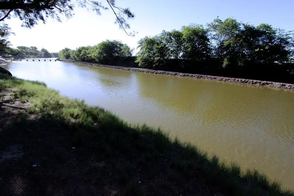
The Salado River is located in the northeast of the province of Buenos Aires, Argentina. The river flows through the Pampas in a generally southeasterly direction for about 400 miles (640 km) to the Atlantic Ocean.
The mouth of the Rio Salado is at Samborombón Bay, 105 miles (170 km) southeast of the city of Buenos Aires (see article: Rio Trancura).
Below is a map showing the exact location of the Rio Salado.
Route of the Rio Salado
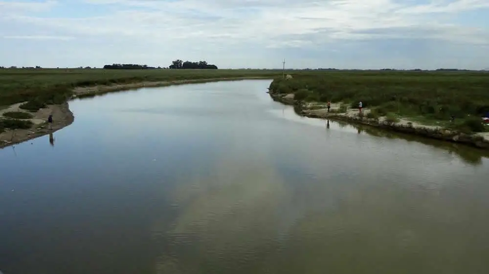
The river meanders through the towns of Junín and General Belgrano, often passing through small lakes and swamps. The peripheral canalisation of the lower course has improved the river’s drainage system.
From the north, the Salado flows through the province of Santiago del Estero, near the border with the province of Tucumán. It also flows through the Pampa.
The Salado and the Río Dulce, to the south, flow in a south-easterly direction and are the main rivers that cross the arid lands of Santiago del Estero, being the economic and demographic axis of the province.
The river’s flow is regulated in the department of Figueroa by the Los Figueroa reservoir and a diversion dam that diverts some of its water to irrigation canals up to 200 kilometres long.
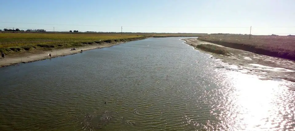
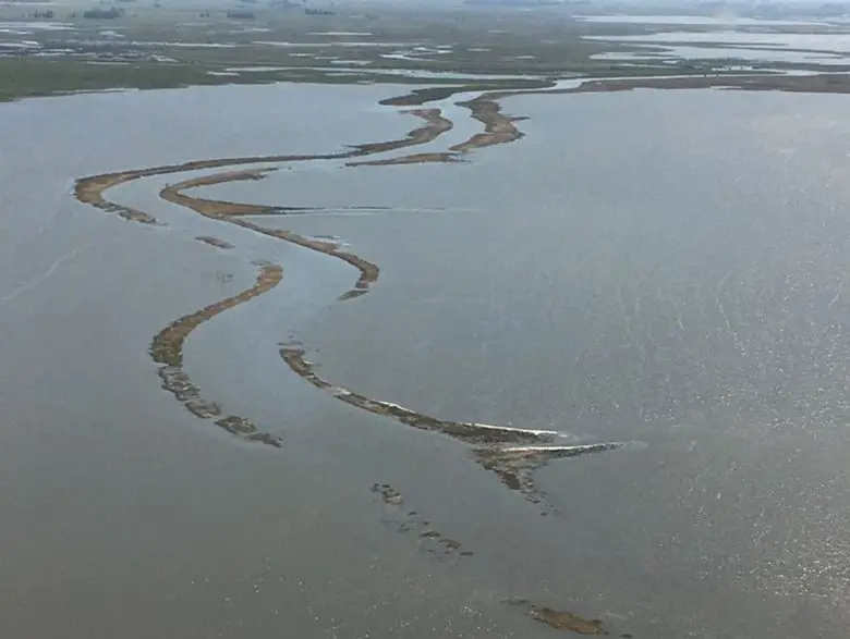
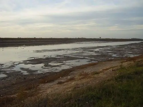
Further downstream, the river forms extensive marshy wetlands and areas are seasonally flooded during the main summer floods. Downstream of the Añatuya marshes, the flow is greatly reduced and the river is dry for much of the year.
After a journey of 800 kilometres (500 miles) within Santiago del Estero, the river reaches the province of Santa Fe as the Salado del Norte, where it finally joins the Paraná River, the last major tributary of the Paraná.
During periods of higher rainfall in the province of Santa Fe, the flow of the Salado increases. During rainy summers, the river can overflow into the riverbed, causing flooding. A flood in 2003 severely affected the city of Santa Fe. This is the time of year when the Salado rises the most.
The Salado flows into the Parana River south-east of the city of Santa Fe, in a flood plain with lagoons.
Height of the Salado River
Below we can see in the video the height of the Salado de Buenos Aires River or also called Salado del Norte River.
Salado River Basin
The Salado River has its headwaters on the eastern edge of the Altiplano under the name of Juramento River in the Andes, from snowmelt and precipitation collected from the 6,500 metre (21,300 ft) Acay and Cachi Mountains in the province of Salta.
Near the province of Catamarca. The Cabra Corral dam regulates its flow and diverts part of it for irrigation. When the river enters the plains of the Gran Chaco, it forms several branches in a wide, partially populated riverbed.
Climate of the Salado
The province has a subtropical climate. It is divided into two different climatic zones: a more humid one in the east and a drier subtropical climate in the centre and west (see article: Río Sinú).
The eastern parts of the province have a humid subtropical climate (Cfa in the Köppen climate classification) without a dry season.
The west, where rainfall is lower, has a subtropical climate with a dry winter and is classified as semi-arid because potential evapotranspiration exceeds precipitation.
Precipitation
The wetter (eastern) parts of the country receive rainfall throughout the year, with no dry season.
These areas receive about 1,400 millimetres (55 inches) of rainfall per year. Rainfall decreases westwards and is more concentrated in the summer months.
The Temperature
Average annual temperatures range from 21 to 23°C (70 to 73°F), decreasing from north to south. Summers are hot, with temperatures reaching up to 38-41°C. In the eastern parts.
The western parts experience a greater variation in temperature due to continental influences (see article: Rio Piedras).
Summer temperature extremes often exceed 40°C (104°F). In winter, cold and polar air enters the region.
Frost and temperatures below freezing can occur from the south. Located in an area of high solar radiation.

One consequence of this is that a low pressure system forms over the province during the summer.
Humidity
Humidity in the Salt River is high due to its climate, especially in the north, the wettest part of the river.
Most of the winds carrying moist air come from the north and east. Winters are the wettest seasons (high humidity), as this season is characterised by frequent fog.
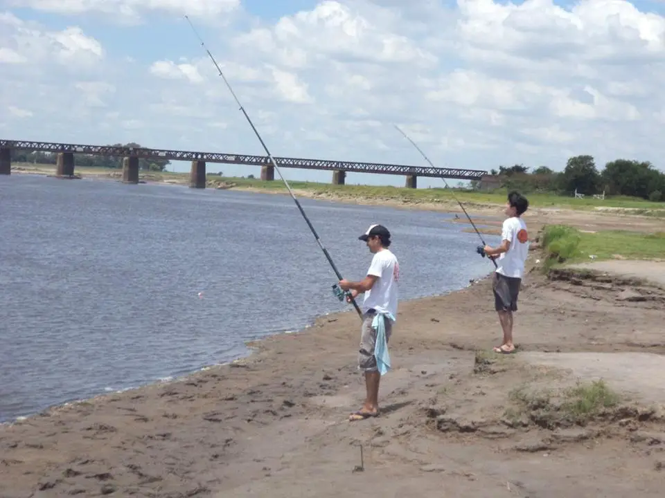
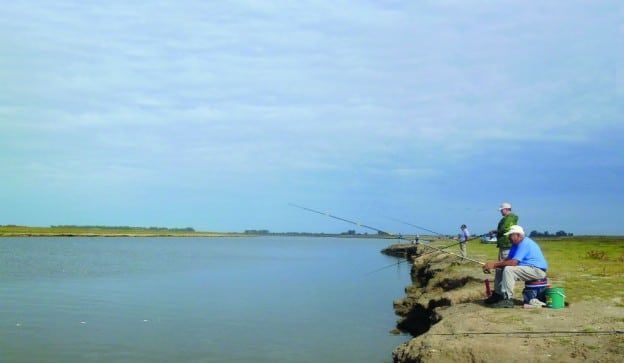
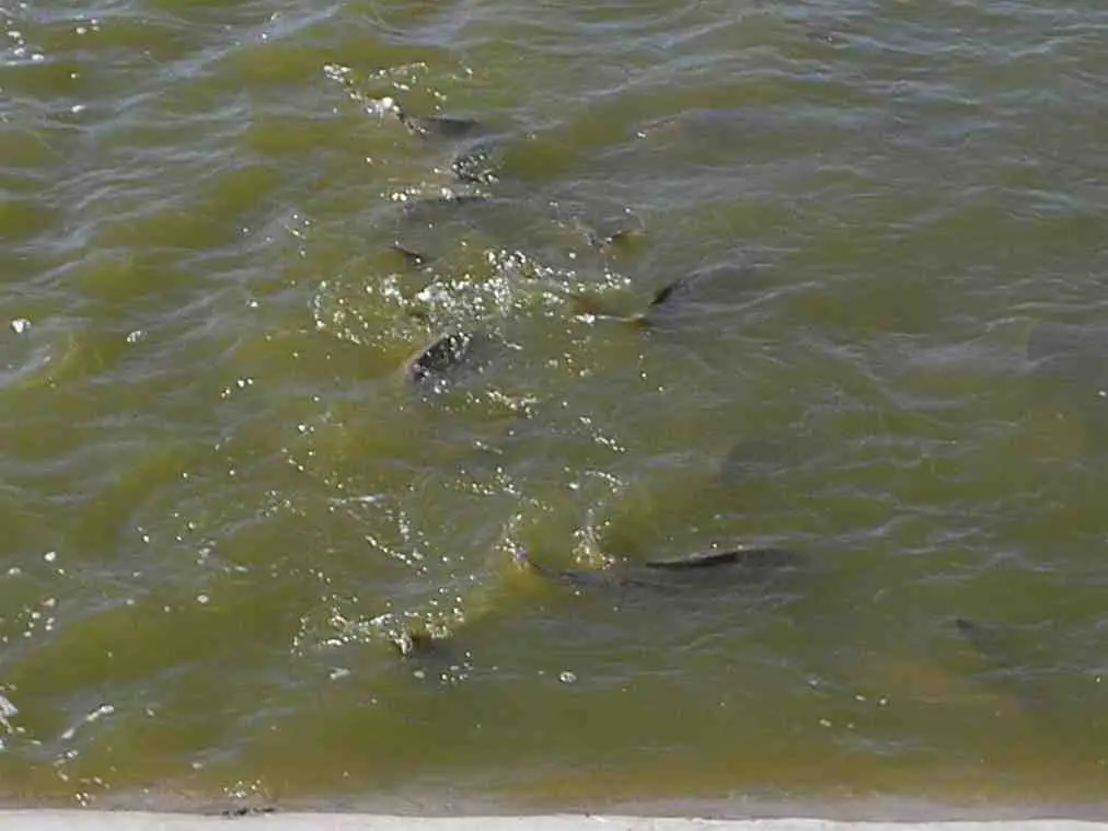
Fishing in the Rio Salado
The so-called “tiger of rivers” is always a challenge. In the province of Santiago del Estero, among the Salado’s fishing grounds, the adventure of fishing for dorado vibrates in the waters of the Dulce and Salado rivers.
The Dulce crosses Santiago, forming wetlands (Humedales in Spanish means “estuary”, hence the name of the province: Santiago de los Humedales) and then forks into the Saladillo River, whose main course feeds two dams.
Los Quiroga and Rio Hondo, the latter being one of the most important reservoirs in the country. The Salado River, on the other hand, crosses the province from north to south, and both rivers are other Salado fishing spots.
The southern part of the Dulce River is considered the best place for dorado fishing. The most common fishing method is trolling, although it is also possible to practice casting or spinning from the banks with waders, due to the accessibility of the coast.
Both rivers are suitable for the practice of all these forms and strategies of fishing, because they have an important variety of geographical features, such as sandbanks, inlets and creeks between one and three metres high. (It is possible to enter the water with bare feet, as long as there are no stripes).
Fishing on the Rio Salado in Buenos Aires
The fishing season is mainly in spring and summer. It is during the hot months that anglers come to Buenos Aires to meet the giant dorados, which weigh between 11 and 28 pounds and are always ready to put up a fierce fight.
In addition, as anglers navigate sandbanks and other geographical obstacles in search of the mythical dorado, they can find radiated fin fish, wolf fish, mojarra, boga, catfish and jacks, and in some cases even pacu and surubi.
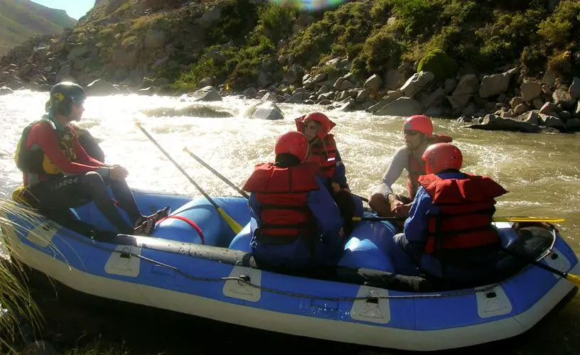
Rafting on the Salt River
Malargüe’s rivers are ideal for rafting. Their waters, full of waterfalls and rapids, make it possible to enjoy this magnificent natural environment from a boat with a good dose of adrenaline. The adventure begins on the Salado del Norte river, 50 kilometres from Malargüe.
We leave the city and follow the Route 40 north, and after about 20 kilometres we take the Route 222, which leads to the ski resort of Las Leñas.
We stop in the district of Los Molles, a small town with many cabins for rent. Once there, we descend to the banks of the Salado River.
This is the perfect river for a family adventure, as it has a 2+ rating on the International Scale of River Difficulty, ideal for adults and children to feel like protagonists without any risk.
River rafting consists of descending from the mountain in rubber boats. As it is a team sport, it is important to pay particular attention to the instructions given by the guide before embarking on the adventure.
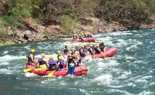
So everyone can enjoy the trip by paddling according to the instructions. To be equipped with all the necessary equipment to go down the Salado River. Dry suits, helmets, life jackets and neoprene warmers were some of the items to be worn.
After asking permission to board and doing the typical wave with the paddles upright, the raft turned and before we knew it we were floating down the Salado River. The rafting circuit is about 10 kilometres in total. The guide uses her commanding voice to keep you from hitting the rocks.
The economy of the Salado
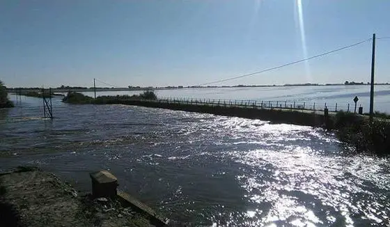
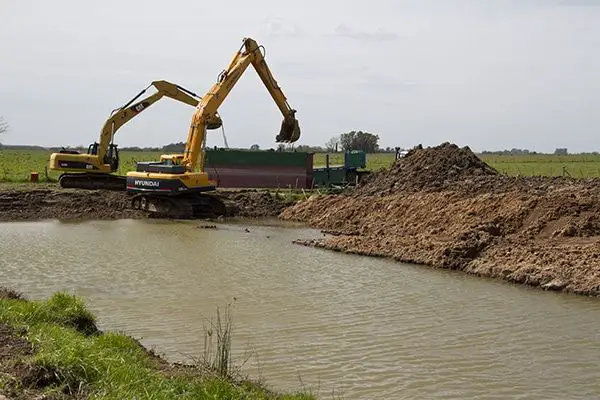
The President of Argentina, Mauricio Macri, has announced the launch of a new plan to increase the capacity of the Salado River in the province of Buenos Aires, an important agricultural area.
Several of his cabinet ministers were on the river to witness the announcement: the Minister of the Interior, Public Works and Housing, the Minister of Public Works and the Governor of the Province of Buenos Aires, María Eugenia Vidal. We are going to start a new era on the river, one that aims to put an end to the damage caused by the flooding of the Salado, with a master plan that was drawn up 20 years ago.
This is worrying because these are 20 years that we could have used for growth, development and progress,” said the president in an official press release.
The works in the basin will be financed entirely by the national government and will be carried out on 27 km of the river between La Laguna de Las Flores and the Beguerie bridge in Lobos, with the aim of increasing the river’s water capacity. To prevent flooding in productive areas. This will involve widening and deepening the river channel.
On 17 November, Argentina’s Ministry of the Interior announced public tenders for the first three phases of the Salado River works, worth a total of 1.7 billion pesos (US$110 million). The President also thanked Queen Máxima of the Netherlands for the European nation’s cooperation in providing technical capacity and expertise in works related to water logistics management.
Work is expected to start in March and last 12 months, benefiting 95,000 people in the districts of Junín, Roque Pérez, Alberti, General Belgrano, Villanueva and Bahía de Samborombón.
The soil removed by the excavations will be redistributed to areas affected by erosion, creating higher ground and contributing to the reclamation of 6,500 hectares of land around the three stretches of river.
The province’s economy, like that of most of northern Argentina, is relatively unproductive, but totalled US$2.863 billion in 2006.
Its per capita product of US$3,559 was the lowest in the country and 60 per cent below the average. Santiago del Estero has long been very rural and agricultural (known for its excellent cotton, tobacco and leather), with almost no manufacturing; yet this modest province has grown so rapidly.
Like many of its better-off counterparts, it has benefited from the recovery that Argentina has enjoyed since 2002. The province’s economy is still based on primary production, especially agriculture, which accounts for about 12% of the province’s output.
Centred on the Salado and Dulce river basins, the main crops are cotton (20% of national production), soybeans, corn and onions. Livestock is also important, especially in the east where the climate allows it, but goats, which account for 15% of national production, are better suited to the rest of the province.
The quebracho and algarrobo wood industries are also important, with an average annual production of over 300,000 tonnes. Of this, about 100,000 tonnes are used for timber and the rest for firewood and charcoal.
There is little mining activity, except in the salt pans in the southwest. Manufacturing (less than 10% of production) consists of small industrial enterprises, mainly focused on food, textiles and leather.
Tourism is somewhat developed, but only around the main tourist attractions. Tourists visit Santiago del Estero (Argentina’s oldest city).
Its historical buildings and museums, the Termas de Rio Hondo and the Rio Hondo Hot Springs, with its 200 hotels, and the Frontal Dam, where water sports are practised.
The province is home to the Copo National Park and four protected areas: Bañados de Figueroa, Sierras de Ambargasta, Sierra de Guasayan and Sierras de Sumampa.
Agricultural development along the river is mainly linked to the commercial cultivation of timber and quebracho cotton.
These include crops such as soybeans, sorghum and maize. Sugar cane is also grown in the south, as well as rice and, to a lesser extent, tobacco. Cattle breeds consisting of zebu crosses are considered better adapted to high temperatures, scarce pasture and occasional flooding than intensively bred purebreds.
Industry contributes about 10% to the provincial economy and includes textiles made from local cotton, oil and coal production, and sugar, alcohol and paper, all derived from sugar cane. The Salado River is home to the Chaco National Park, but tourism is not a well-developed industry in the province.
The province’s main airport, Resistencia International Airport, handles about 100,000 passengers a year.
The Salado River Waterfall
There aren’t many places in the world that offer world-class fishing and world-class hunting in the same place.
It is found almost entirely on the plains of the Gran Chaco, with some depressions. In these depressions lagoons have formed (see article: Río Cea).
Mainly in the Bañado de Figueroa, the Bañado de Añatuya and those near the basin of the Salado and Dulce rivers. The Sumampa and Ambargasta mountain ranges are the result of the influence of the pampas in the southwest. The soil is arid, rich in limestone and salt, and is characterised by semi-deserts and steppes. The predominant climate is subtropical, with a dry season and high temperatures throughout the year.
The annual average is 21.5°C, rising to 24°C in recent years, with highs of up to 50°C, with a noticeable increase in temperature since 1970. Surprisingly, the maximum before 1910 was 38°C, and the minimum -5°C, which has risen to -2°C. During the dry winter season, the average rainfall is 120 mm, but the annual average is 700 mm.
Culture on the Salt River
Among the important figures associated with the history of Santiago del Estero is Colonel Juan Francisco Borges, leader of the War of Independence (and ancestor of the writer Jorge Luis Borges).
The revolutionary leaders Mario Roberto and Francisco René Santucho, founders of the Partido Revolucionario de los Trabajadores and the Ejército Revolucionario del Pueblo.
Among the most important cultural figures of the province in the last century are the painters Taboada, Gómez Cornet, Sánchez Gramajo, Gogna and Rafael Touriño.
Writers include Washington Ábalos, Canal Feijóo, Rosa Quenel and Carreras (h). Jacinto Alcorta, a celebrated composer of flute concertos and religious music. He also represented Santiago del Estero in Congress with distinction for most of the 19th century.
The musical heritage is one of the most important cultural aspects, with typical folklore, chacarera and zamba. Famous artists and groups include Los Manseros Santiagueños, Alfredo Ábalos, Leo Dan, Jacinto Piedra and Raly Barrionuevo.
The best known folk music group in the province is probably the Ábalos brothers, who have been performing since 1945 and recording since 1952. Despite being in their eighties and nineties, the five of them are still performing and over the decades have become the most famous group of musicians in Argentina.
Salado River Paraguay
The Salado River is one of the arteries of Lake Ypacaraí. This lake is located in Paraguay, 47 kilometres east of the capital Asunción.
The lake is surrounded by three towns where visitors stay overnight for sightseeing, and one of the towns is on the shore of the lake.
The lake is the most polluted in Paraguay due to toxic algae or cyanobacteria blooms. The government has banned access to its waters.