
Located in Peru, the Marañon River is the source of the Amazon River and its tributary is the 11th longest. Find out what you don’t know about it.
Marañon River
The Marañon River is considered one of the main sources that feed the Amazon River. It is one of the most important rivers in Peru.
The route of the Marañon River crosses the waters of ten regions of the country; it is estimated that these regions are inhabited by approximately 14% of the total population of Peru.
It has a wonderful and extensive biodiversity, with a varied ecosystem due to the conditions of the Marañon River along its entire length. The same can be seen in the Napo River.
Source and Mouth of the Marañón River
The biologist and geographer Antonio Raimondi and the agricultural engineer Augusto Cardich have proposed two different places for the source of the Marañon River.
In the case of the biologist and geographer Antonio Raimondi, he points to the so-called glaciers on the eastern slope of the Huayhuash mountain range, the Peruvian Andes.
The engineer Augusto Cardich, for his part, suggests that the source of the Marañón River is in the glacier of the Nevado de Yapura, located at an altitude of around 5800 metres in the Cordillera de Raura, a mountain range of the Peruvian Andes in the Lima region.
Origin of the water source, direction and end of the Marañon River
Now that we know the places where the Marañon River is born and where its waters originate, it receives the waters of the thaws that descend from the Nevado Matador and, in a place called Huanuco, also those that come from the lagoons:
- Niñococha.
- Santa Ana.
- Lauricocha.
Before arriving at the lagoons, it was given the name of Guayco, from which point it continues its journey in a northerly direction in the part called the high course of the Marañon. Then, when it reaches the middle course, it turns northeast. During its passage, its source of water is deposited in 9 regions of Peru.
Since 20% of the river is located in Ecuador, its basin also crosses 9 other regions of that country. The Tigre River is also shared with its neighbours.
After a journey of about 1,600 kilometres, it joins the Ucayali River, which is responsible for giving birth to the Amazon River, where it flows into the Marañon River.
Characteristics of the Marañon River
Among the characteristics of the Marañon River we have that it has an approximate length of 1,600 kilometres, has an average flow of about 11,360 m³/s and covers a watershed of about 764,183 km², its course has been divided into two parts called the Upper Marañon and the Lower Marañon.
Upper Marañón
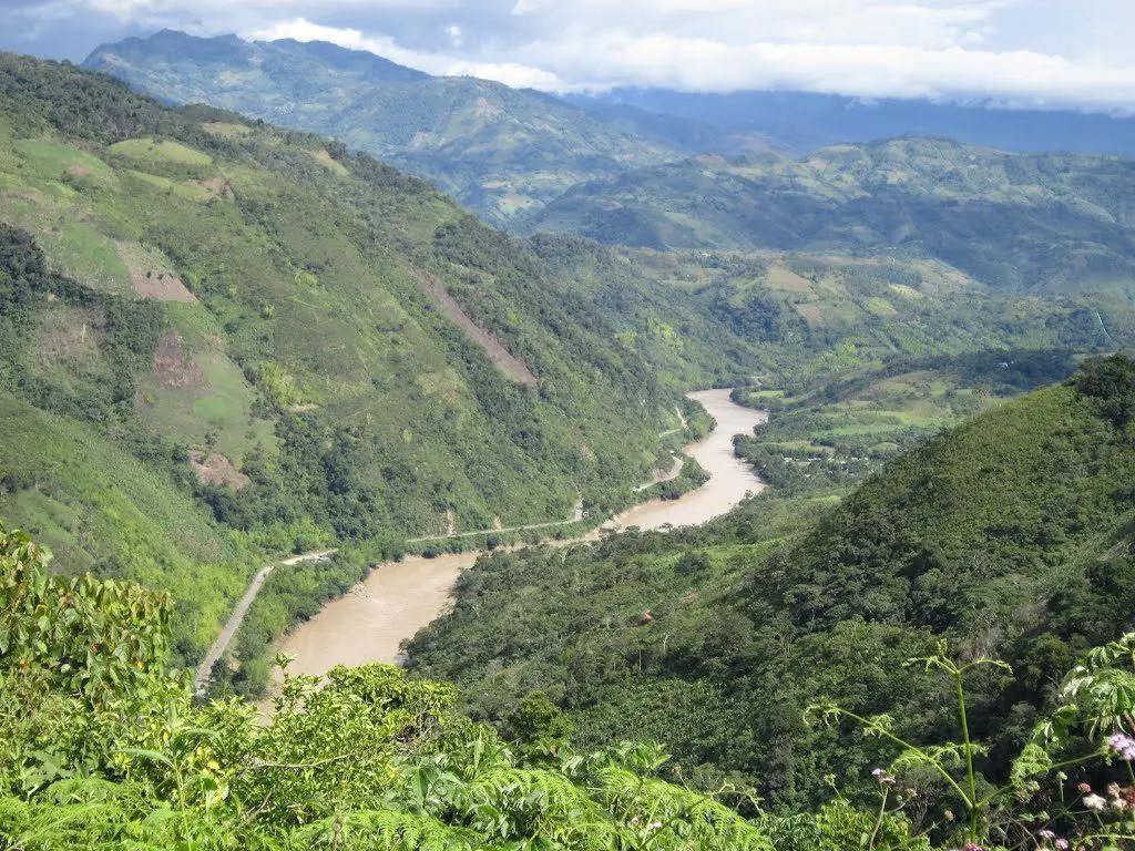
The Marañón is characterised by a narrow and deep riverbed, with a steep slope and turbulent flow. The Urubamba is also turbulent.
Its course in this sector is with an orientation from southeast to northwest, from the so-called western and also the central chains of the recognized northern Andes, until a place called Pongo of Rentama.
After that, it begins to run along the so-called cadenas, but now along the central and eastern ones, in a north-eastern direction, until it reaches the so-called Pongo de Manseriche. It should be noted that there are numerous pongoes and ravines along this route, which makes it difficult to navigate.
It should be noted that the pongo is a kind of canyon with a narrow and deep formation cut into the mountains by the rivers.
There the river bed makes a drastic reduction being placed to about 60 or 80 metres, the mountains being like vertical walls that limit it. This makes the water turbulent when it hits these walls, and navigation dangerous due to the many whirlpools and currents.
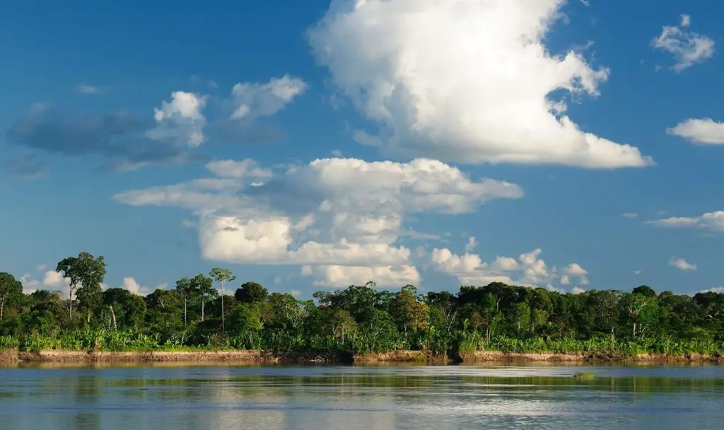
Lower Marañon
From the Pongo de Manseriche and its confluence with the Ucayali River, on its way to becoming the Amazon River, the Marañón River turns from west to east.
From this point, it crosses the Amazonian plain, with a riverbed that has no rocks, it is covered with sand, it is called meandering.
In November, the river begins to rise and floods large areas of the Selva Baja, abandoning its previous course and opening up a new one.
In this way, its flow becomes abundant and favourable for navigation, especially at this time of year.
The fluvial fauna and flora of this part of the Marañón becomes rich. The towns of Nauta and Borjas are the most important on the left bank.
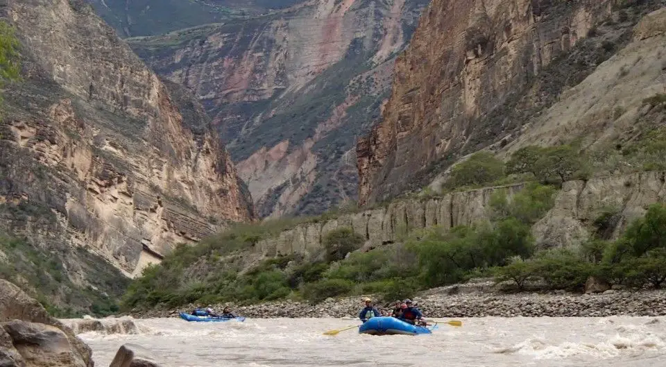
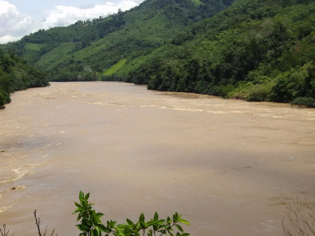
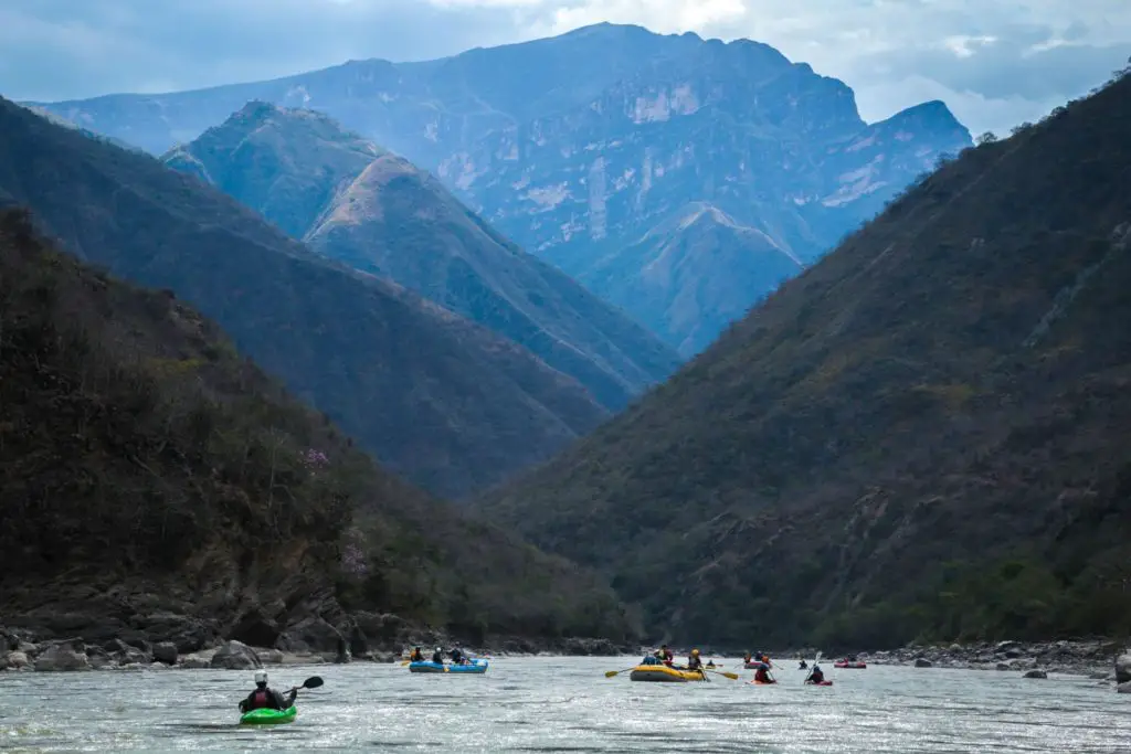 Navigating the waters of the Maranon River
Tributaries of the Marañon River
Upper part of the Marañon River, as for the tributaries are draining from the left bank of the river, which would be the following:
- Puccha.
- Pomabamba.
- Chusgón.
- Crisnejas.
- Llaucano.
- Chamaya.
- Cenepa.
- Santiago.
From its right bank it has the following tributaries:
- Río Utcubamba.
- Río Utcubamba.
- Los Ríos Chiriaco o Imaza.
- Río Nieva.
For the lower part of the Marañón River, its tributaries are the Ríos:
- Huallaga.
- Morona.
- Pastaza.
- Tigre.
Location and Map of the Marañon River
The Marañon River is located about 150 km north of the city of Lima, Peru. 80% of the Marañon River basin is in Peru and 20% is in neighbouring Ecuador.
Here is a map showing the exact location and route of the Marañon River.
Curiosities
Among the curiosities of this river is that, according to two researchers, the Marañon River has two possible sources, one in the glaciers of the Cordillera de Huayhuash and the other in the glacier of the Nevado de Yapura.
Another curiosity is that there is a Peruvian department between Ecuador and the Marañon River.
However beautiful the nature that surrounds us is, it is important to be aware that it is nature that provides us with what we need to survive. So it is we who need it, it does not need us.