
The Napo River Basin is 60% in Ecuador and the remaining 40% in Peru. The Napo River basin is an important tributary of the Amazon River basin within Ecuador.
The Napo River basin in Peru is entirely within the Loreto region. The Ecuadorian section of the valley is divided into four provinces, with more than half of it in the larger Napo Province.
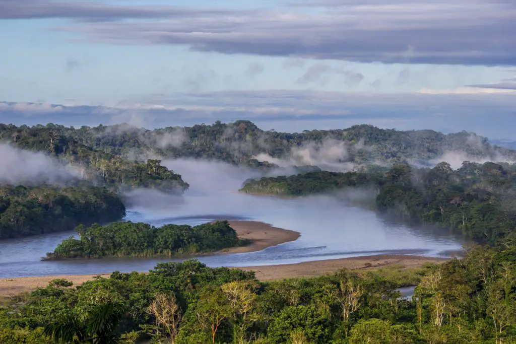
Features of the Napo River
Before reaching the plains, the Napo River receives a large number of small streams from impenetrable, saturated and very rugged mountain areas, where the dense and varied vegetation seems to fight for every piece of land (see article: Vistula River).
From the west it receives a secondary tributary, the Curaray, from the slopes of the Andes, between Cotopaxi and the Tungurahua volcano. From its Coca branch to the mouth of the Curaray, the Napo River in Ecuador is full of traps and sandbanks (see article: Río Caqueta).
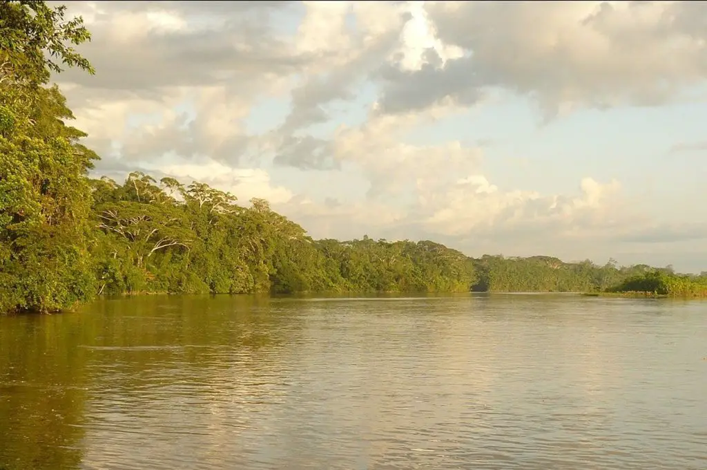
It throws many canoes between jungle islands that are flooded in the rainy season, giving the river an immense width. From the Coca to the Amazon (Rio Napo in Amazonas), it flows through a forested plain where not a hill can be seen from the river; its even banks are interrupted only by swamps and lagoons.
Its upper waters can rise as high as Santa Rosa, the usual embarkation point for any enterprising traveller descending from the Quito plateau.
The Napo can be traversed as far as its middle reaches, where it is squeezed between two mountain walls in a deep canyon where it plunges over high waterfalls and numerous reefs. This is the river made famous by Gonzalo Pizarro’s expedition.
Location and map of the Napo River
The Napo River is located in Ecuador on the flanks of the eastern Andean volcanoes Antisana, Sinchulawa and Cotopaxi. Its total length is 1,075 km (668 mi). The river drains an area of 100,518 km2 (38,810 sq mi). The average annual discharge is 6,976 m3 (246,400 cubic feet) per second.
Below is a map of the Napo River, showing its exact location and the path by which the Putumayo and Napo rivers join to form the Amazon.
The source of the Napo
The headwaters of the Napo River in Ecuador rise within 100-200 km of Quito, the capital of Ecuador, in the high Andes. The Andean headwaters of the Napo, about 400m above sea level, are clear except during heavy rains.
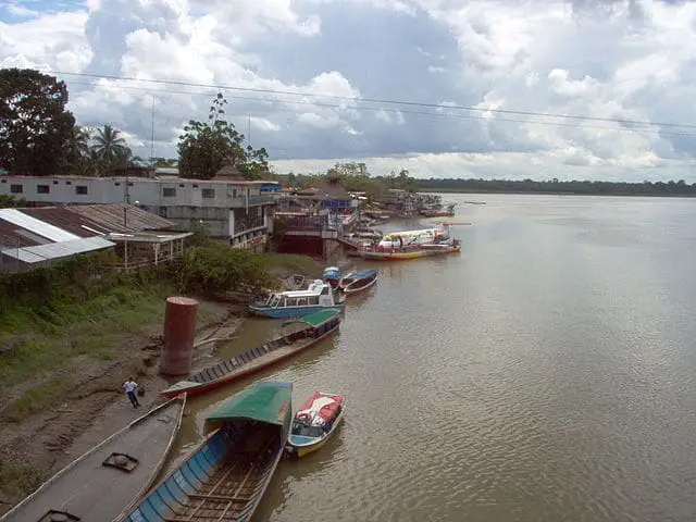
[In the lowlands, the Napo is a muddy, meandering river with a large alluvial plain. The Curaray, a dark water river with sections in Ecuador and Peru, is the only major tributary of the Napo. There are also several dark water Napo rivers that flow into the Napo basin from the headwaters to the estuary region.Napo River Bridge
The bridge over the Napo River in Ecuador. It is 740 m long and 16.4 m wide. It has two towers that are 85 mts. high and was built 15 mts. above the water level (see article: Rio Mundo).
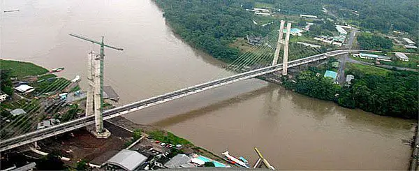
It has two lanes for vehicles and bicycles, a pedestrian walkway and lighting for public use and decoration. There is also a pier with natural green areas at each end of the bridge.
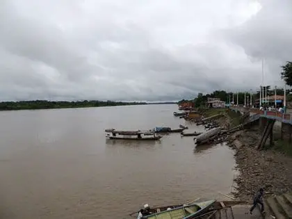
Napo River, Peru
Peru has not yet established any large protected areas in the Napo basin, but Ecuador has two relatively large protected areas. Yasuni National Park lies south of the Napo River near the border with Peru and covers some 6,500 km2 of mostly montane forest.
Two indigenous groups, the Waorani and Quichua, inhabit much of the park. Settlers have recently moved into the park and have cleared large areas for cultivation. Hunting and fishing have also increased in the park to supply a local market in Coca.
The Cuyabeno Wildlife Production Reserve covers about 2,500 km2 near the Colombian border along the Aguarico River, a tributary of the Amazon. Cuyabeno receives 3,500-4,000 mm of rainfall per year, and most of the reserve is subject to seasonal flooding.
Hydrology
[The average annual rainfall in the Napo River basin is between 2,500 and 5,000 mm. The highest totals are found on the slopes of the Andes. The average annual variable at the lower reaches of the Napo River in Peru is 8.5 m, which is similar to that of the Amazon River at Iquitos.The plains along the Napo River are flooded from about December to May each year. The Napo Amazon is navigable by riverboat from the Amazon to its Curaray tributary, a distance of about 216 miles (348 km), and perhaps a little further; from there it is a gruelling canoe trip.
Here is a video about the Napo River to learn more about it.