
The Mendoza River is one of the most important rivers in Argentina, both for agriculture and recreation (see Sil River).
Location and map of the Mendoza River
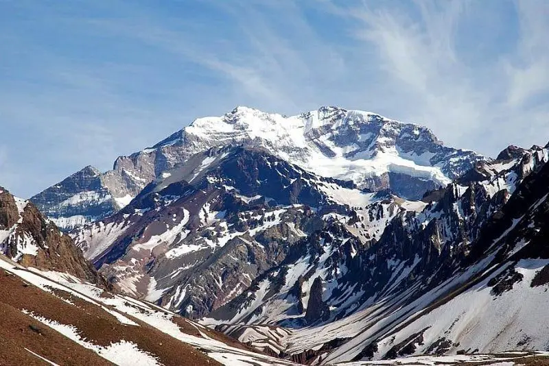
The Mendoza River rises in Aconcagua, northeast of the province of Mendoza and south of the province of San Juan, Argentina. It is formed by melting snow. Its source is in the town of Punta de Vacas, where the rivers Cuevas and Tupungato meet.
Since we are talking about the course of the Mendoza River, we can say that the rivers of Mendoza are both on its right and left banks. On the right bank (north) flow rivers such as the Río Vacas with its tributaries the Río Blanco and the Colorado; on the left bank (south) flow the Uspallata and the Picheuta. Below is a map of the Mendoza River.
Before flowing into the Guanacache Lagoons, the Mendoza River in Argentina passes through the departments of Luján de Cuyo, Guaymallén Maipú, San Martín, Las Heras and Lavalle (see Lujan River).
Over the years the Guanacache lagoons have dried up as a result of the construction of dams and hydroelectric plants, which we will discuss later, which prevent water from flowing into the lagoons.
Boundaries
The boundaries of the Mendoza River in Argentina are as follows
To the north, the Aconcagua mountain range and the basin of the Los Patos Sud rivers are connected by an imaginary line. This line passes through the Punta del Agua, the Tambillo, del Valle, del Tigre, Punta de Agua and Corataderas hills, the Villavicencio hot springs, Jócoli, the Villavicencio hot springs and the Lagunas de Guanacache.
To the south, it leaves the Cordón del Plata and reaches the hill of Vertientes. Along the way it passes through Aguadita, Perdriel and Palmira.
To the west, it meets the Andes mountain range, with the Aconcagua and Tupungato hills.
To the east, it reaches the town of Palmira, turns northwest at Tres Porteñas, then continues north along the Mendoza to Pie de Palo railway line, and finally reaches Capilla del Rosario, on the shores of the Guanacache Lagoons.
The Guanacache Lagoons are located within the Biological Corridor of Wetlands of Central-Western Argentina, and were declared a RAMSAR site in 1999 for their biodiversity.
Length and basin of the Mendoza River
The Mendoza River has a length of 273 km and its basin can drain 90 km. Its source is at an altitude of about 2600 metres, while its mouth is at an altitude of about 600 metres.
What is the river’s terrain like?
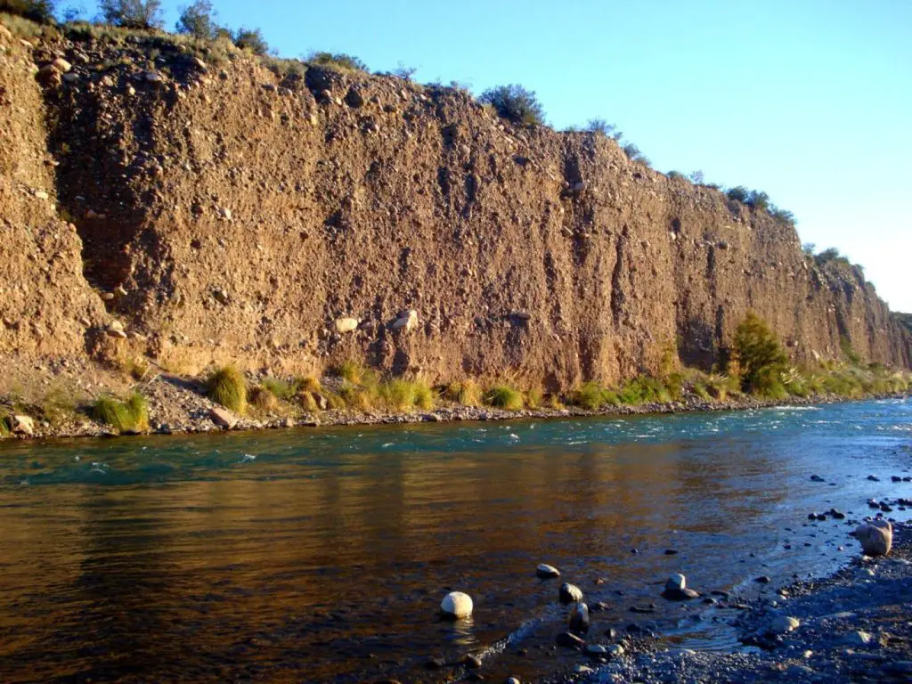
The predominant relief of the Mendoza River is made up of steep slopes, plateaus, detritus or rock particles that end up forming sandy or stony soils.
On the other hand, we have the peaks, which are snow-covered all year round and have a cold climate that causes heliophany, or the duration of sunshine.
In the upper part of the basin, the Mendoza River has a soil composed of sediments, but since these are impervious, they end up forming an alluvial fan. This is divided into a free and a confined aquifer fan.
The free aquifer is due to the porosity of the rocks, which allows them to store water. This characteristic is compromised at about 650 metres as the water is diverted to the east and the absorption capacity of the rocks is reduced. After 650 metres, the aquifer becomes a confined aquifer.
In the Mendoza River basin, the soils are divided into three groups: the upper Mendoza, with a large alluvial cone formed downstream of the Cipollettise dam; the middle Mendoza, with heterogeneous soils due to salinisation processes and the merging of aquifers; and the lower Mendoza, where salinisation processes are strong and surface water drains away (see Hamza River).
Climate of the Mendoza River
The climate is semi-arid, with cold winters and hot summers. Due to the difference in altitude, which ranges from 600 m to 6,000 m above sea level, the climate is humid in the upper basin, semi-arid in the foothills and arid in the lower zone.
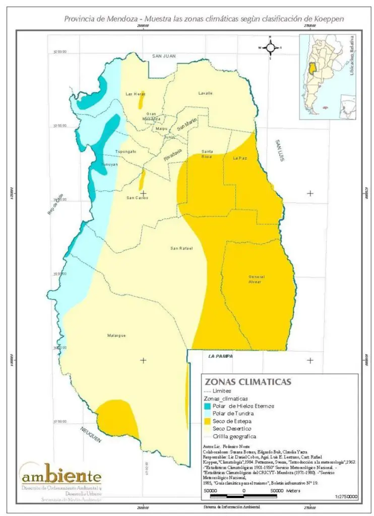
The factors that influence the climate of Mendoza are the Atlantic Ocean and the Andes mountain range. If we add other factors, such as the distance and altitude from the Atlantic Ocean, and the fact that the Andes act as a barrier against the humid winds from the Pacific Ocean, the result is a semi-arid climate.
Departments crossed by the Mendoza River
The following are the most important rivers in Mendoza.
- Zonda
- Sarmiento
- Capital city
- Guaymallén
- San Martin
- Junín
- Maipú
- Godoy Cruz
- Lujan de Cuyo
- Las Heras
- Tupungato
- Lavalle.
Dams and reservoirs
Listed below are the reservoirs and dams on the Mendoza River.
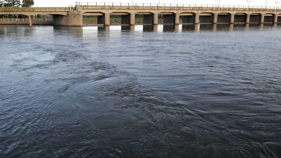
- Cipoletti Dam: It is used to prevent flooding of the river and to divert irrigation water that is transferred to the Cacique Guaymallén Canal. As the water is abundant and of good quality, it is used for water sports.
- Las Compuertas Dam: Consisting of a fuselage dam and a mobile dam, it is used for water intake. It has its moderating channel, its discharge and flushing buildings.
- Potrerillos Dam: Construction began in 1999 and was completed in 2003. Its main objectives are the supply of drinking water to the population of Mendoza and the production of hydroelectric energy; the dam has a height above the river level of 166 m and a length of 450 m, which gives us a storage of 358 hm3. It is also used to regulate the flow of the river. It is located in Punta de Vacas
These works allow both tourists and locals to practice water activities such as fishing, rafting and kayaking, in addition to its use for providing drinking water and hydroelectric power.
Activities of the Mendoza River (aquatic)
Regarding the activities of the Mendoza River, we have the following:
- Rafting on the Mendoza River: The Mendoza River is ideal for practicing rafting in the summer, due to its fast waters and numerous rapids. Some of the places to practice it are the coastal town of Potrerillos, the Toma de los Españoles dam, the Álvarez Condarco hydroelectric plant, the Blanco Encalada thermal plant and the ruins of the Fader power station.
- Kayaking: You can practice this activity at the Potrerillos Reservoir, where you can enjoy the calm waters and smoky landscape on board of white-water kayaks or sit-on-top kayaks.
- Fishing in the Mendoza River: Among the species found in the river are trout (rainbow, salmon and brown trout) and landlocked salmon. The best time to go fishing is in autumn and winter. The most recommended tributaries for fishing are the rivers Picheuta and San Alberto.
Socio-economic data
Among the characteristics of this river, we can highlight its socio-economic activity, which is specifically related to its water and the works that have been carried out over time. As a result of the need for water in this region and its scarcity, an artificial oasis was created. In order to take advantage of this resource in both urban and rural areas.
These are responsible for the dynamism of the province’s economy, which is mainly driven by vineyards and other agricultural production. At the same time, it requires a very controlled regulation of water consumption, which is why strategies are applied to its use, such as irrigation technology.
Other activities
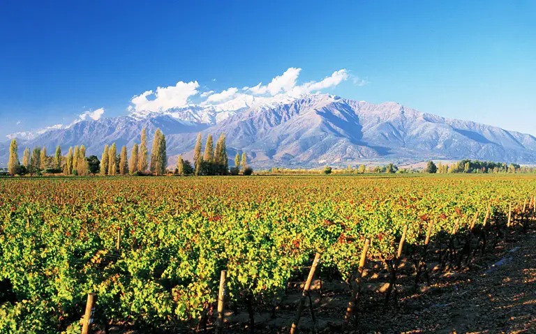
The Mendoza River is used to grow vines, olives and fruit such as cherries, sour cherries, apricots, quinces, walnuts and vegetables such as tomatoes, onions and potatoes. This is possible because the Mendoza River basin has allowed the development of the country’s artificial oasis, useful for irrigating crops (see Alagon River).