
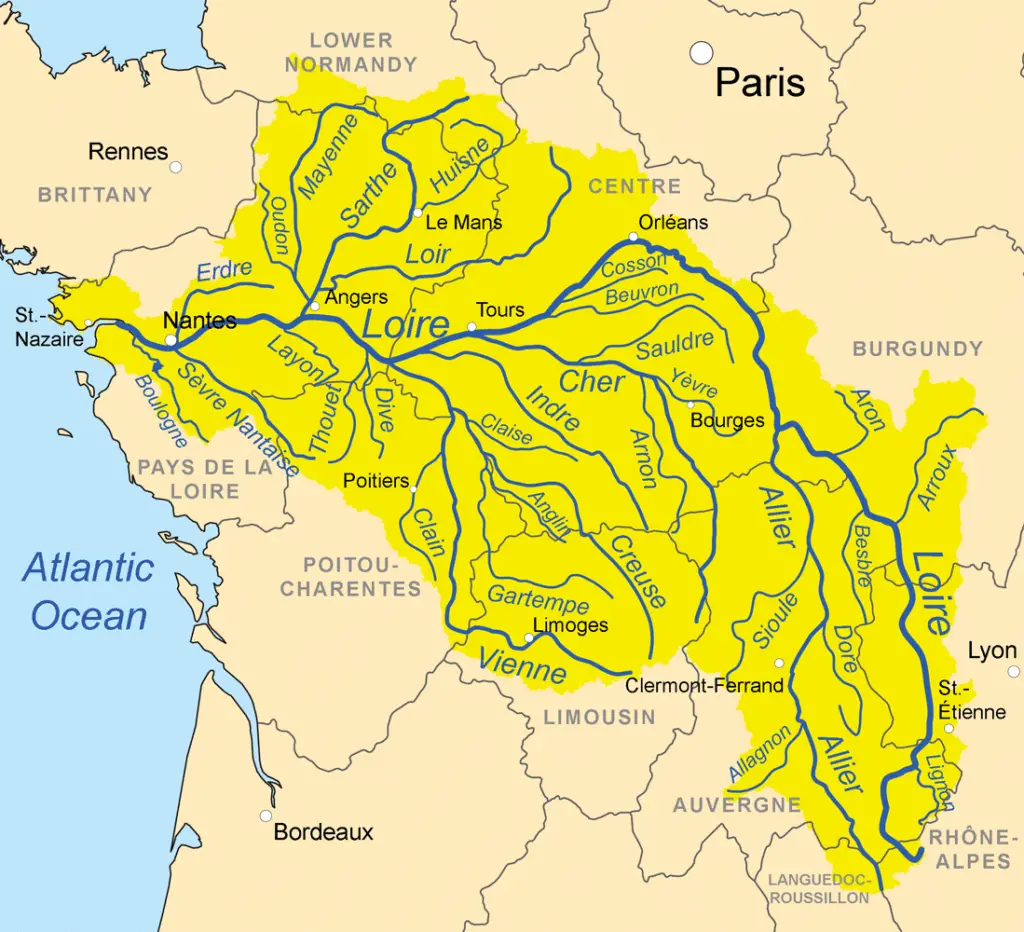
The largest tributary of the Loire is the Allier, which joins the Loire at Le Bec d’Allier. It drains an area of about 45,000 square miles (117,000 square km). The picturesque valley is dotted with castles.
The history
The human history of the Loire Valley begins with the Middle Paleolithic period from 90-40 BC (a thousand years ago), followed by modern man (around 30 BC).
This was followed by the Neolithic period (6,000 to 4,500 BC), the last Stone Age in Europe.
Then came the Gauls, the historic tribes of the Loire during the Iron Age (1500 to 500 BC); they used the Loire as a major river trade route in 600 BC.
Establishment of trade with the Greeks on the Mediterranean coast. Gallic rule in the valley ended in 56 BC when Julius Caesar conquered the neighbouring provinces from Rome (see article: River Nervion).
Christianity was introduced to the valley from the 3rd century AD, when missionaries (many later recognised as saints) converted the pagans. During this period, settlers planted vineyards and began to produce wine.
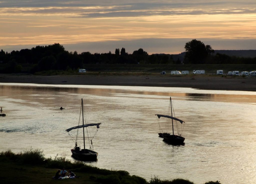
Location and map of the Loire
The longest river in France, the Loire rises in the south of the Massif Central and flows north and west for 634 miles (1,020 km) to the Atlantic Ocean, where it enters the southern peninsula of Brittany.
The river rises to about 4,500 feet (1,370 m) above sea level at the foot of the Gerbier de Jonc in the Cévennes, near the Mediterranean coast.
On its upper course it flows through a series of shallow, faulted basins in the upper Massif Central (see article: Papaloapan River).
As it crosses them, its valley narrows into gorges. After joining the Allier, the greatly enlarged river flows through the limestone platform of Berry and its valley becomes a slight gully.
The upper course of the Loire tends to flow northwards towards the centre of the Paris basin, but then diverges in a large bend beyond Orléans and flows westwards to the sea through its long estuary at Nantes.
Climate of the Loire
The Loire basin has a temperate maritime climate, with no consistent dry season and heavy rainfall, including winter snowfall, in the highlands that occupy its upper basin.
The headwaters are also subject to violent autumn storms from the Mediterranean.
The river generally peaks in late winter, but there is no reliable rule; floods can occur in any month, although usually not in July and August.
In its middle course, the river occupies a shallow but steep gorge. Its floodplain, once marshy, is protected from flooding by levées (“dams”) built progressively between the 12th and 19th centuries.
The economy of the Loire
Effective agricultural recovery began in the 14th century and was stimulated by the presence of the French court in the 15th and 16th centuries, when the middle Loire valley supported a strip of land intensively cultivated for cash crops.
It reached the height of its prosperity in the 18th century, before the French Revolution. The river was the great highway for the movement of goods and the towns on its banks were busy ports.
During the development of river transport in the 17th and 18th centuries, canals were built to link the navigation of the Loire with the waterway system of the Seine.
This made it possible to transport goods to Paris. These connecting canals are too narrow for modern ships and their use is limited (see article: Pilcomayo River).
Left behind by modern developments, the Loire countryside remains predominantly rural, Old World, and little affected by modern industry.
Cities on the Loire
Rises in the south-eastern highlands of the Massif Central in the Cévennes (in the department of Ardèche) to 1,350 m (4,430 ft).
Near Mont Gerbier de Jonc; it flows north through Nevers to Orléans, then west through Tours and Nantes to the Bay of Biscay (Atlantic Ocean).
At Saint-Nazaire. Its main tributaries are the Nièvre, Maine and Erdre on its right bank and the Allier, Cher, Indre, Vienne and Sèvre Nantaise on its left bank.
The Loire gives its name to six provinces along its course, through several towns named after the river, such as Loire and Haute-Loire.
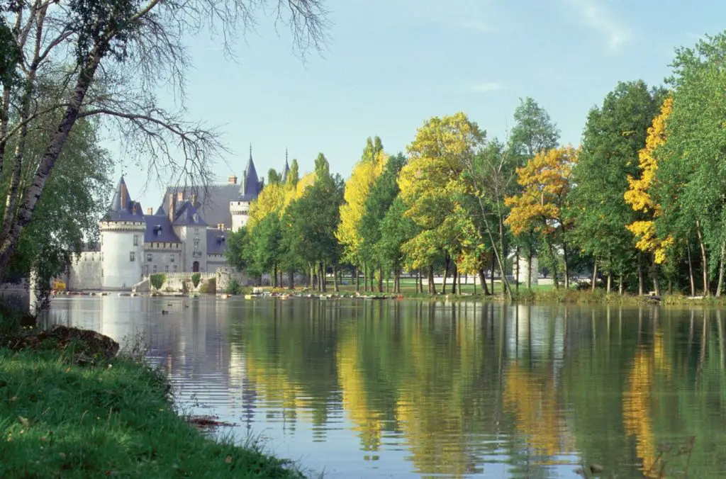
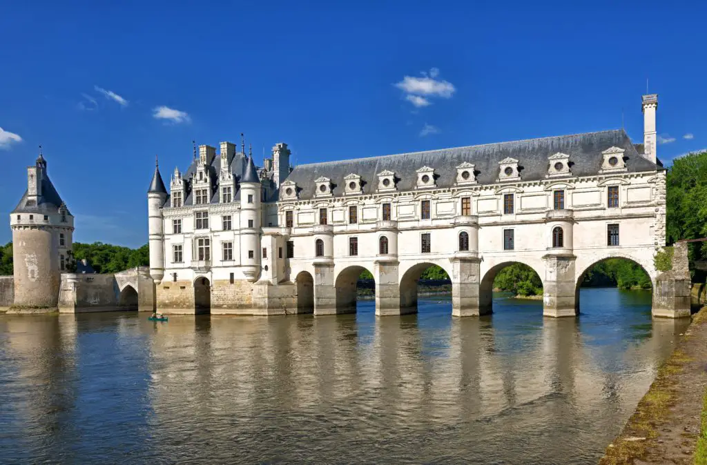
It was included in the UNESCO World Heritage List on 2 December 2000. Vineyards and castles line the banks of the river.