
The Hudson River is an icon of life in the eastern United States, especially in New York City, where it flows for much of its length.
Location and map of the Hudson River
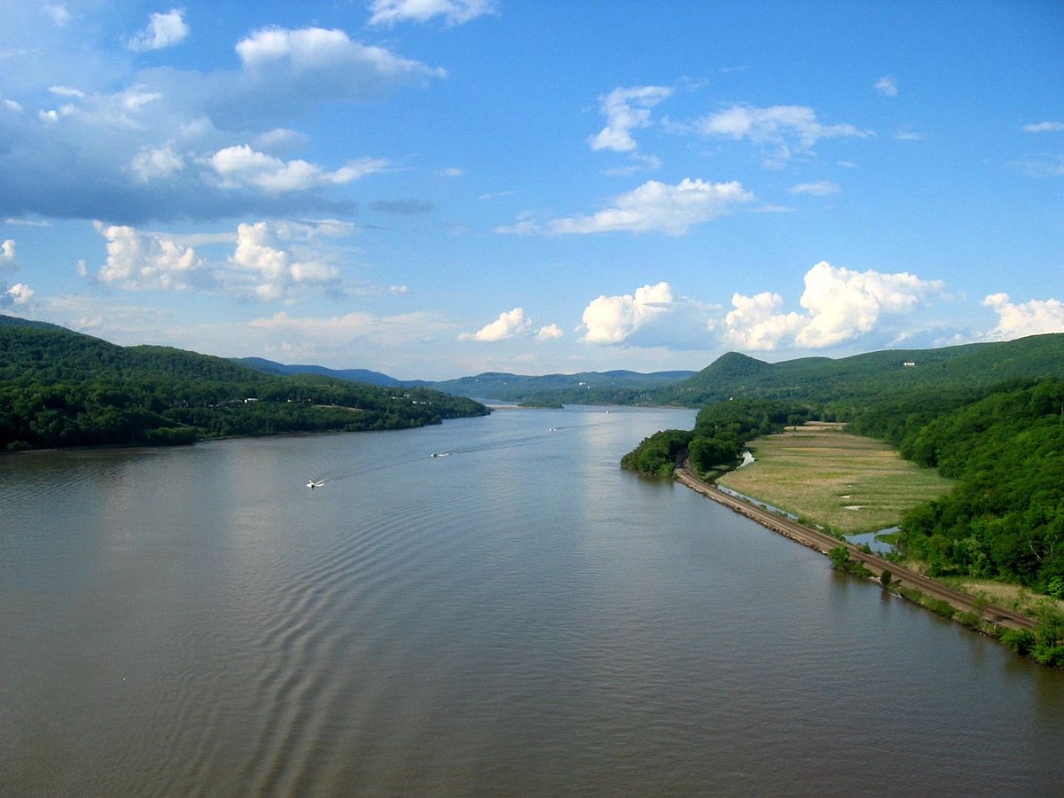
The Hudson River is a mighty river. Its course is wide in many places and its tides are quite strong, making navigation difficult in some harbours, especially in New York.
It reaches a length of 506 kilometres, making it one of the longest rivers in the United States, although much of its water forms a long marine estuary (see Sado River) in the Lower Hudson River Valley.
The headwaters of the Hudson River are Tear of the Clouds Lake in the Adirondacks, at an elevation of 4,050 feet (1,309 metres).

But there it actually emerges as Feldspar Brook, which becomes the Opalescent River and then flows into the Hudson near the town of Tahawus, at Henderson Lake, which is where it can actually be considered to begin.
Course and characteristics of the Hudson River
The movement of the Hudson River is complicated in its upper reaches, as it flows south below Hudson Falls and drops into Glens Falls.
It then meets its main tributary, the Mowhawk River, at Cohoes, north of New York’s capital, Albany, and south of Federal Dam, which serves as the confluence of the Upper Hudson River Valley and the Lower Hudson River Valley.
From there, the Hudson River gradually widens until it reaches the mouth of the Atlantic Ocean at Manhattan, Saten Island and New Jersey in New York’s Upper Bay.

In its final stretch it forms the natural boundary between the states of New York and New Jersey, then joins Lake Erie through the Erie Canal, connecting the Atlantic Ocean to the Great Lakes.
Hudson River depth
The Hudson River has a drainage area of 36,260 km2, an average flow of 606 m3/s and a maximum depth of 62 metres.
Its major tributaries are the Opalescent Brook, Cedar River, Indian River, Boreas River, Schroon River, Sacandaga River, Battenkill River, Hoosic River, Mohawk River, Normans Kill, Croton River, Pocantico River, Saw Mill River, Catskill River and the Mill, Esopus, Rondout, Roeliff-Jansen Kill, Crum Elbow, Wappingers, Fishkill, Moodna, Sparkill and Wicker Creeks.
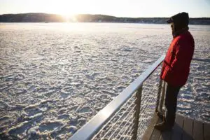
The frozen Hudson River
During the winter months, the Hudson River often has blocks of ice floating back and forth as low temperatures freeze some of its waters (see Lena River).
This phenomenon is not as common as it was in previous centuries, when it was possible to cross the entire river on sleds, but it does occur, depending on the intensity of the season. In some stretches, it makes navigation difficult, especially river trade.
On the other hand, this river is known as the “flooded river”, due to the fact that its waters rise continuously as a result of the Wisconsin glaciation.
History
The Hudson River was named after the Englishman Henry Hudson, the second man to explore it on behalf of France and Holland, after the Italian Giovanni Verrazano sailed it in 1524.
Shortly afterwards, the first official map was made by the Portuguese Esteban Gómez, who christened it San Antonio on behalf of Spain.
The Dutch, on the other hand, called it the Noort Rivier, or North River, in contrast to the Delaware, which they called the Zuide Rivier, or South River.
It also has a Mohican name, “Muh-he-kun-ne-tuk”, which translates as “the river that goes up both banks”.
The Hudson Valley was the site of the first Dutch settlements in the early 17th century and became a bustling centre of trade and military activity in colonial times.
Later, the Hudson River was a major thoroughfare during the Revolutionary War, and the completion of the Erie Canal further solidified the importance of commerce along its banks. In addition, many recreational activities take place along its banks.
In the late 1990s, President Bill Clinton named it one of the 14 waterways that make up the Heritage Rivers of the United States of America (see Ohio River).
Narrows of Narrows on the Hudson
The Hudson River has a narrow waterway called the Narrows, which borders Brooklyn and Staten Island at its mouth, connecting the northern and southern areas of New York Bay, and is considered the main port of entry to the city (see Colorado River).

In ancient times, the Hudson River flowed into the ocean at Raritan Bay, a little further south, and on a path to New Jersey, through the Watchung Volcanoes. This was because Staten Island and Long Island were joined, so the Hudson did not pass through the present strait to flow into the Atlantic.
Hudson River Waterway
On 15 January 2009, the Hudson River made headlines around the world for an unusual event that took place in its waters.
US Airways pilot Chesley B. Sullenberger decided to dive into the Hudson within minutes of taking off from La Guardia International Airport.

The commander of Flight 1549, feeling a bird strike that had severely damaged the aircraft’s turbines and finding himself at an unsuitable altitude to fly to a nearby airport, decided to take the river route.
Fortunately, his skill was successful and all 150 passengers and 5 crew members survived to be rescued in the largest water landing in aviation history.