
Last Updated on September 13, 2023 by Hernan Gimenez
Formerly known as Tabasco and locally as Chiapas or Mezcalapa, the Grijalva River is Mexico’s second longest river and largest producer of hydroelectric power.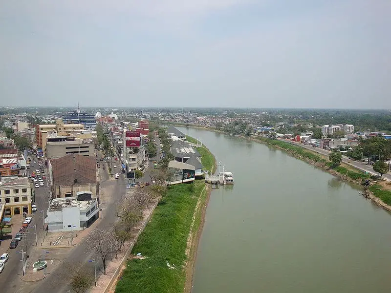
Location and map of the Grijalva River
The Grijalva River flows in the southeast of Mexico and is 480 kilometres long. It is formed by the confluence of the San Gregorio and San Miguel or Cuilco rivers, which originate in the Ecija Valley in Guatemala. These rivers cross separately at the border between the two countries, and when they unite they form the source of the Grande de Chiapas or Alto Grijalva River.
After crossing the central depression of Chiapas and the metropolitan area of Tuxtla Gutierrez, the Grijalva River crosses the famous Sumidero Canyon and enters the plain of Tabasco, where it takes the name of Mezcalapa, passes by the city of Huimanqullo, turns east in the area known as Nueva Zelanda and forms a tributary that becomes the Samaria River.
The Mezcalapa also continues to the east and before reaching Villahermosa it divides into two streams, the larger known as the Carrizal and the smaller known as the Viejo Mezcalapa, both of which surround the city before joining the Grijalva.
The Río Grijalva, like the Río Pánuco, flows into the Gulf of Mexico and forms a wide delta with the Río Usumacinta, called the Pantanos del Centla. Together, the two rivers produce 125 billion cubic metres of runoff, or 35% of Mexico’s total runoff.
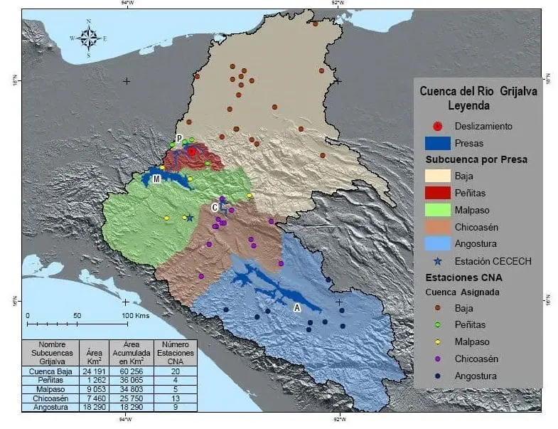
Grijalva River Basin
The Grijalva River Basin includes the states of Tabasco and Chiapas and covers an area of 51,569 km2. The hydrological region of the Grijalva is divided into two sub-regions, the Upper Grijalva and the Lower Grijalva.
The Upper Grijalva includes the part of the river from its source in the Ecija Valley in Guatemala to the Angostura dam, covering an area of 9,643 km2. There it enters Mexican territory through the state of Chiapas, crossing the mountains of the Sierra Madre del Sur and the central depression of Chiapas, where the main hydroelectric dams of the system are located.
The Lower Grijalva sub-basin runs from the city of Villahermosa to the mouth of the Gulf of Mexico at Barra de Frontera, Tabasco. It is the largest and most important in Tabasco, with an area of 21,780 km².
The Mezcalapa River crosses the plains of Tabasco, passing by the city of Huimanquillo, and continues to the east, where it branches off into the Samaria River and continues until it divides into two rivers: the Carrizal River and the Viejo Mezcalapa River, which surround the city of Villahermosa, before joining the original Grijalva River.
Sumidero Canyon of the Grijalva River
The Sumidero Canyon is a narrow canyon of great depth, located 5 km from Tuxtla Gutierrez, the capital of Chiapas.
It has a cliff (see Colorado River) that exceeds 1,000 metres above sea level and has an extension of 21,789 hectares that rise above the Grijalva River.
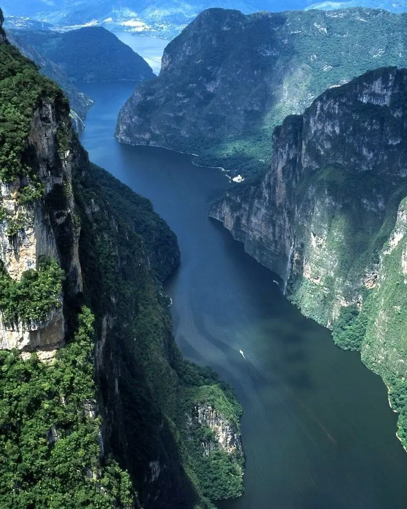
It is one of the most spectacular in the Americas, with walls rising more than 1,300 metres from the depths of the gorge. At its southern mouth, the canyon begins or has its source in Chiapas de Corzo and flows into the artificial reservoir of the Manuel Moreno Torres hydroelectric dam, popularly known as Presa Chicoasén.
Pollution in the Grijalva River
The Grijalva River receives a lot of waste along its course, which in certain areas contaminates it and affects the flora, fauna and the normal development of the activities that take place there.
This heavy pollution comes from the fishing, domestic, industrial, agricultural and commercial sectors, among others. Untreated or uncontrolled sewage from more than 20 municipalities, discharges of toxic and chemical substances, unplanned and illegal construction and settlement are just some of the elements that pollute the river.
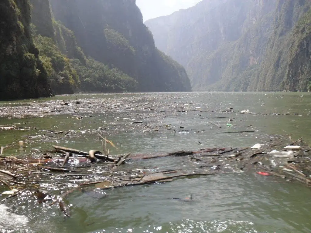
The communities are not aware of the damage they are doing to their own ecosystem and throw waste into the river or wherever they want, and it ends up in the river.
The environmental impact (see Ganges pollution) is huge and if not stopped, the ecological degradation will be irreversible in a few years.