
Last Updated on February 11, 2024 by Hernan Gimenez
First Nations people have inhabited the Columbia River Basin for about 10,000 years. Prior to European contact, these people were primarily semi-nomadic, using the river for transportation and subsisting on fish, land mammals, roots, berries and other wild vegetables native to the region.
Originally called “San Roque River” by Spanish explorers in 1792. The river was renamed “Columbia” by Boston fur trader Robert Gray, who named it after his boat. At the time, the region was home to more than 100,000 indigenous people.
Physiography and hydrology
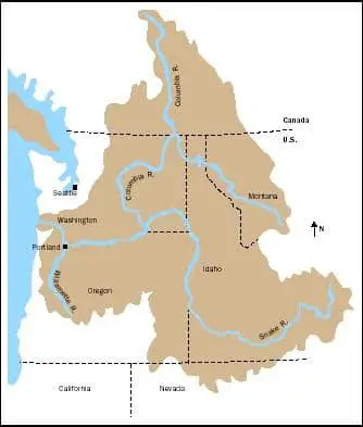
The Columbia drains about 258,000 square miles (668,000 square km), about 85% of which is in the northwestern United States.
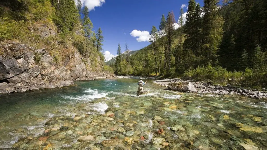
The major tributaries are the Kootenay, Snake, Pend Oreille, Spokane, Okanogan, Yakima, Cowlitz and Willamette rivers. High flows occur in late spring and early summer as snow melts in the mountain basin. Low flows occur in autumn and winter, causing water shortages at the river’s hydroelectric plants.
The ice sheets were instrumental in creating a series of northeast-southwest trending coulees in the northern part of the Columbia Plateau; Grand Coulee is the largest of these (see article: Balsas River).
The coulees were formed when immense torrents of water, intermittently released from ice-dammed lakes upstream, swept down the valley.
Location of the Columbia River
The Columbia River is the largest river in North America flowing into the Pacific Ocean. The Columbia River Basin covers about 260,000 square miles from its headwaters in British Columbia, Canada, to its mouth at Astoria, Oregon, bordering Washington and Oregon.
The basin includes parts of seven states, 13 federally recognised Indian reservations and one Canadian province. Nineteen per cent of the basin is in Washington.
Columbia River Washington
The Columbia River rises in the Rocky Mountains of British Columbia, Canada. It flows northwest and then south into the US state of Washington, then turns west to form most of the border between Washington and the state of Oregon, before emptying into the Pacific Ocean.
Columbia River Oregon
The Columbia’s largest tributary, the Snake River, flows over a thousand miles from the Two Oceans Plateau in Yellowstone National Park, across the Snake River Plain and into North America’s deepest canyon, Hells Canyon, on Oregon’s eastern border. The Snake joins the Columbia in southeastern Washington, just a few miles from Oregon’s northern border.
Columbia canada river
The non-federally recognised Chinook tribe living near the lower Columbia River call it Wimahi in the Chinookan language,
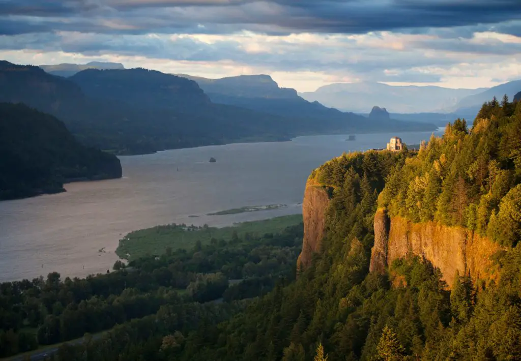
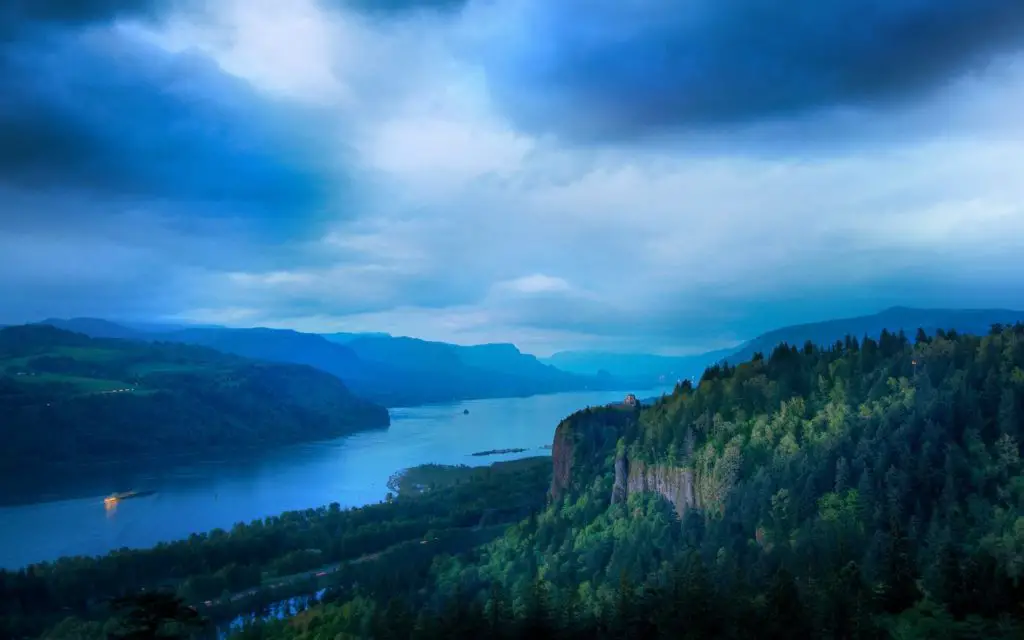
Columbia River Gorge
It is a gorge of the Columbia River in the Pacific Northwest of the United States. Up to 4,000 feet (1,200 m) deep, the gorge stretches for more than 80 miles (130 km) as the river meanders westward through the Cascade Range, forming the boundary between Washington State in the north and Oregon in the south (see article: Mekong River).
Stretching roughly from the Columbia’s confluence with the Deschutes River (and the towns of Roosevelt, Washington, and Arlington, Oregon) in the east to the eastern reaches of the Portland metropolitan area, the water gap provides the only navigable route through the Cascades and the only water connection between the Columbia River Plateau and the Pacific Ocean.
The gorge is federally protected as the Columbia Gorge National Scenic Area and is managed by the Columbia River Gorge Commission and the U.S. Forest Service. The Gorge is a popular recreation area.
Features include
Columbia River, the largest river in North America flowing into the Pacific Ocean. On the mainland, it is surpassed only by the Mississippi, St. Lawrence and Mackenzie rivers.
Climate
The climate of the Columbia River Basin is partly continental and partly marine, and is strongly influenced by orography. The Rocky Mountains to the east block most of the severe winter storms from the interior of the continent, and the Cascade Range to the west protects the basin from the moist air of the Pacific Ocean.
Summers are generally hot and dry with occasional thunderstorms; winters are moderately cold and dry with occasional snow or even rain. West of the Cascades, the climate is maritime, with long, rainy winters and cool, dry summers.
Temperature and rainfall
In the central basin, average daily temperatures in January range from about -4 to -1°C (-25 to 30°F), and July averages are mostly between 21 and 24°C (70 and 75°F).
Average annual precipitation varies from less than 8 inches (200 mm) at lower elevations to about 15 inches (380 mm) near the foothills and 40 inches (1,000 mm) or more in the mountains.
Vegetation
Native vegetation in the lower elevations of the interior basin is primarily shrub-steppe, dominated by sagebrush and grasses. As elevation increases, the shrub-steppe gives way to ponderosa pine and then to spruce, larch and other pines.
More than half of the original shrub-steppe vegetation has been removed by grazing and agriculture. Saltgrass and alkaline saltgrass dominate the poorly drained saline soils, while willow and black cottonwood dominate along the watercourses.
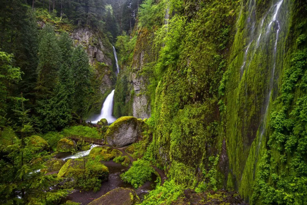
West of the Cascades, Douglas-fir forests with hemlock and western red cedar dominate the uplands.
Here is a documentary about the Columbia River to learn more about it and its boundaries.