Last Updated on September 4, 2023 by Hernan Gimenez
The Cauca River is considered the second most important source of surface water in Colombia, after the Magdalena River.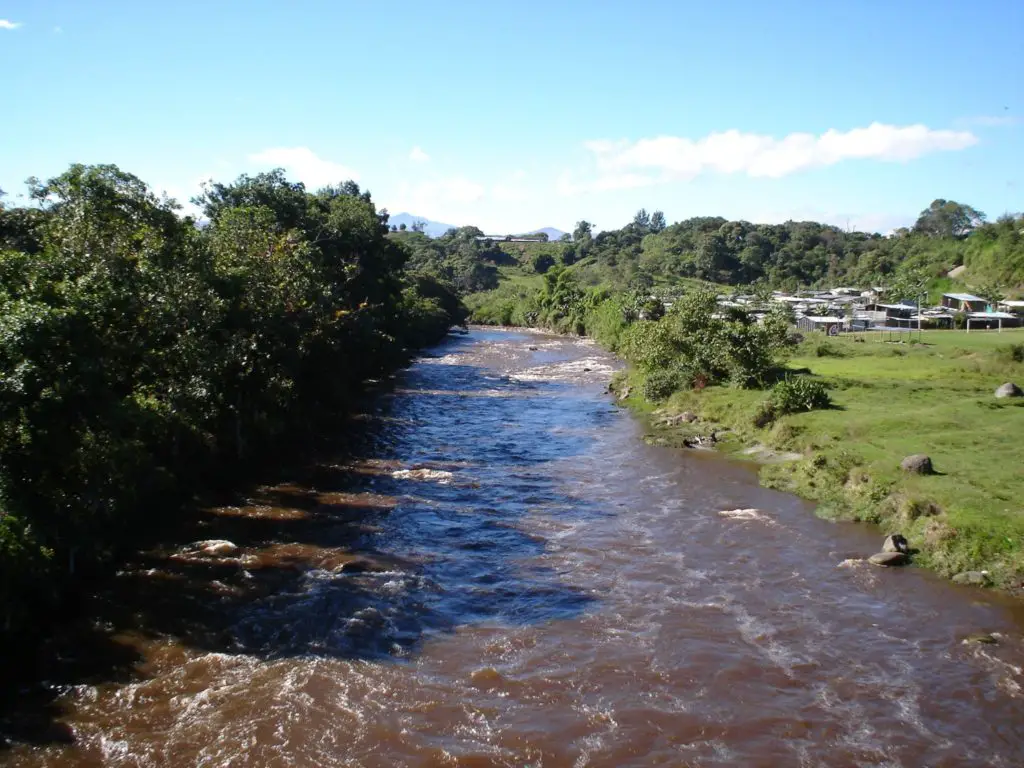
Characteristics
The Cauca River, or Rio del Cauca, is a region of exceptional beauty and abundant resources, and is one of the most fascinating places in the country. Its spectacular landscapes, the diversity of its climates, the richness of its soil and forests, and its booming cities make it a fascinating place (see article: Turia River).
Cauca is located in western Colombia and covers an area of 22,140 square kilometres. It is home to almost four and a half million people. It borders the departments of Chocó, Quindío, Risaralda, Tolima, Cauca and the Pacific Ocean.
The Cauca region has many different topographical features: the Pacific plain, the western Andean cordillera, the western slope of the Central Andes and the inter-Andean valley of the Cauca River, a very fertile area where agriculture is the main sector of the economy.
Importance of the Cauca River
As for the importance of the Cauca River, it is the largest producer of sugar cane in Colombia. It also has large rice fields and grows sorghum, manioc, coffee, cocoa, cotton, corn and beans. The livestock industry is based on cattle, sheep, pigs and horses.
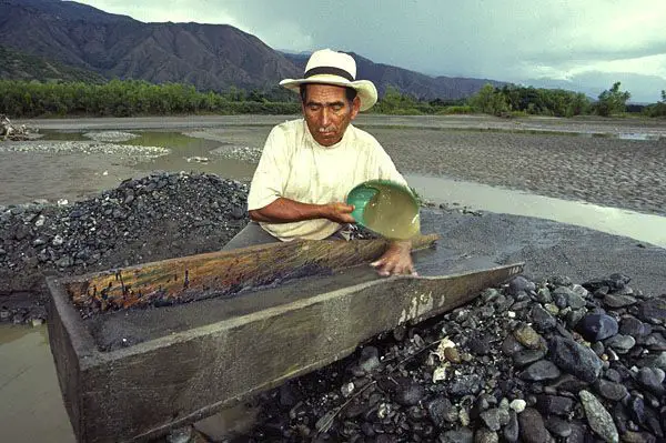
The department is also rich in coal, limestone, marble, gold, silver, platinum, iron and asbestos. The department ranks third among Colombian departments in terms of industrial development (see article: Usumacinta River).
The Vallecaucanos are the descendants of different racial groups that have intermarried for many generations. Many centuries ago, different indigenous groups lived in this region, such as the Lilíes and the Gorrones.
Then the Spanish arrived and brought Africans as slaves. Later, large groups from various European countries arrived, and at the beginning of the 20th century there was a large influx of Japanese.
Buenaventura, a port city on the Pacific Ocean, is the country’s most important seaport due to the immense amount of import and export cargo traffic.
Close to Buenaventura is the Malpelo Archipelago. This is a beautiful place (World Heritage Site) visited by many tourists for its biodiversity and coral formations.
Agricultural pottery societies
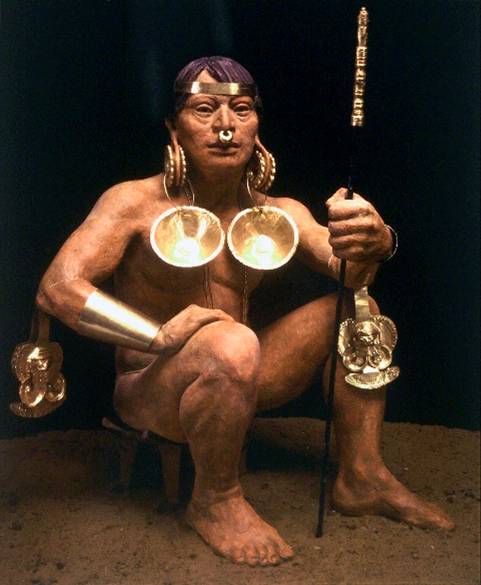
Regarding the importance of the Cauca River, it should be mentioned that in 1500 BC the first agricultural ceramic society appeared, the Ilama culture, which extended along the river (where the cities of Restrepo and Darien are located today).
The chief or “cacique” was the head of the settlement, which also had “shamans” (spiritual leaders), warriors, farmers, hunters, potters and goldsmiths. By 100 AD, the Ilamas had evolved into the Yotoco culture, which extended the region of the Ilamas further up the Cauca River to the Pacific Ocean and south to the region of the modern city of Cali.
The Yotoco were a highly stratified society led by chiefs who oversaw multiple settlements. They existed in the region until 1200 AD. The population had increased, forcing them to develop efficient agricultural techniques to feed their population, which also improved pottery and metallurgy techniques.
The agriculture of the Yotoco was more varied than that of the Illamas and was based on maize, cassava, beans, arracacha and achiote, among others. The Yotoco began to decline in the 6th century AD.
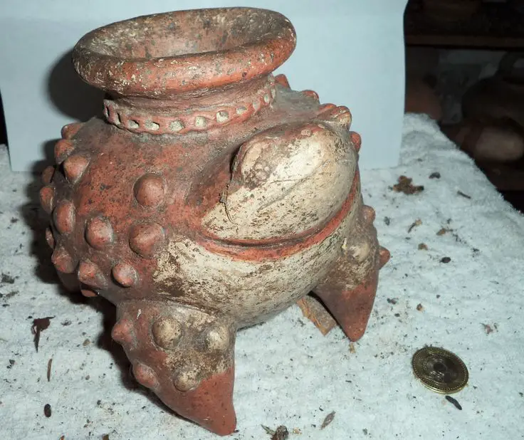
Pre-Columbian agricultural ceramics
This archaeological period is called the Late Period and is divided into the Late Period I (6th to 13th centuries) and the Late Period II (14th to 16th centuries). During the Late Period I, the region of the Cauca Valley was inhabited by the Early Sonso, Bolo, Sachamate and La Llanada cultures (see article: Niger River).
As for the whole history of the Cauca River, we have that during the Late II Period, the region was inhabited by the Late Sonso, Pichinde, Buga and Quebrada Seca cultures. Their development is attributed to population growth. Almost all the settlers in the area were under the rule of a chief.
Spanish arrival and conquest
The first 67 Spanish explorers arrived in the area after an expedition from Quito led by Sebastián de Belalcázar discovered the town of Popayán.
In the Cauca Valley, the explorers founded the town of Villa de Ampudia, named after one of them, Juan de Ampudia. On Belalcázar’s orders, the town was moved to the banks of the Cauca River, in the territory of the Gorrones Indians.
In 1536, Captain Muñoz ordered the city to be moved to the valley, where the city of Cali was founded on 25 July of that year. Another Spanish explorer, Juan de Vadillo, came from the village of Cartagena de Indias.
He arrived in Cali on 23 December 1538 with a second group of explorers, but returned to Cartagena, leaving many of his men behind, including Pedro Cieza de León.
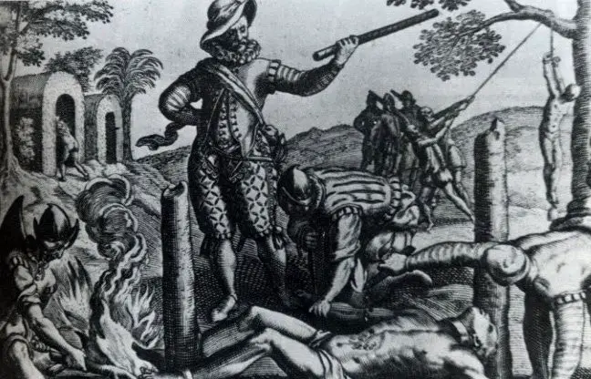
A third group of explorers, led by Admiral Jorge Robledo under the orders of Lorenzo de Aldana, advanced to the north of the Cauca Valley and founded the towns of Anserma (now part of the department of Caldas).
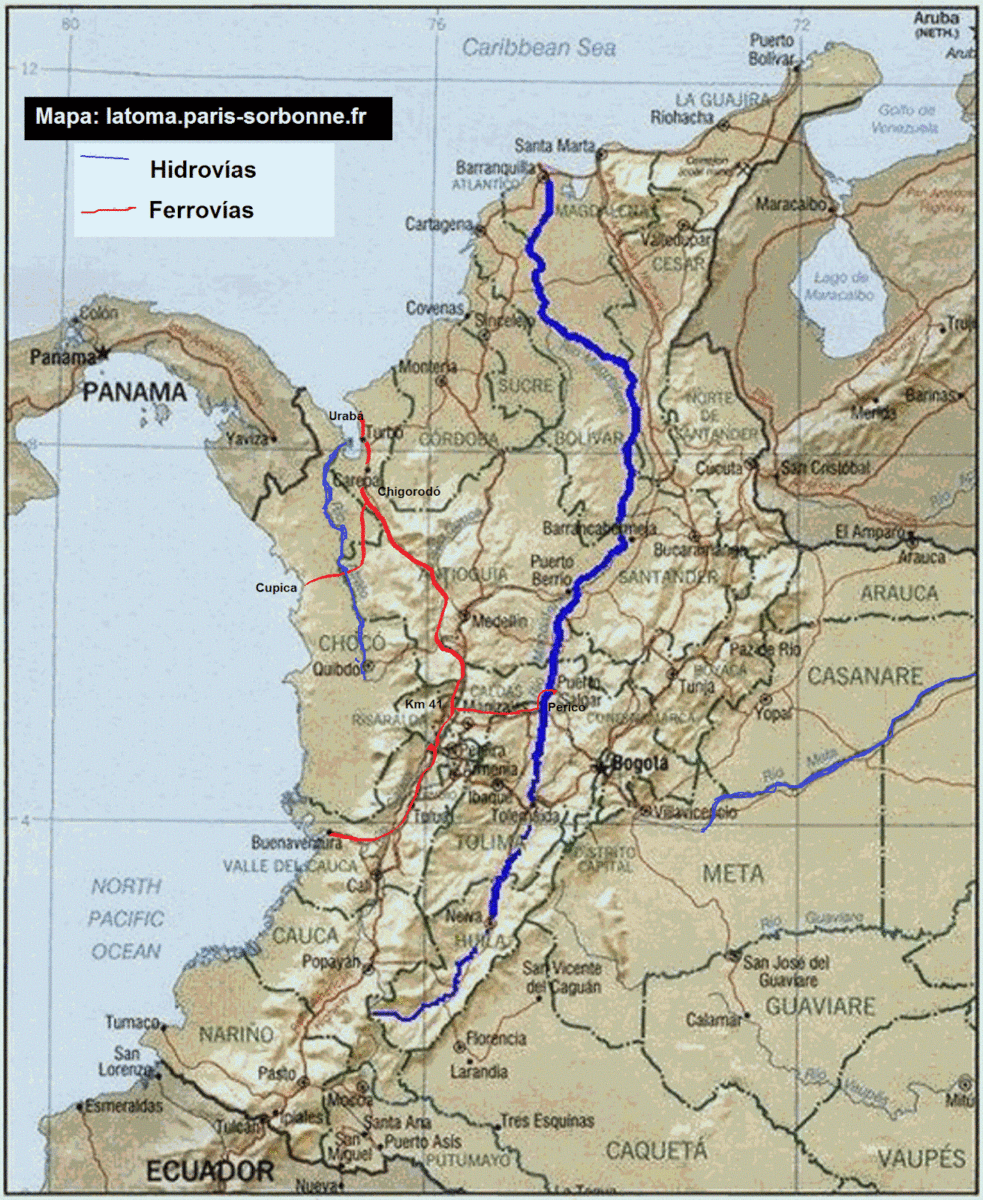
Cauca River map and location
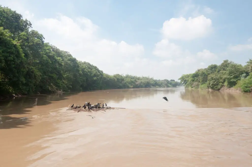
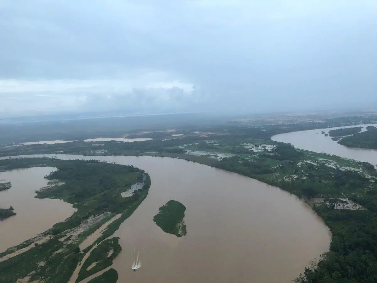
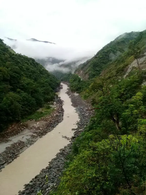
The Cauca flows north for 838 miles from its source south of Popayán to its confluence with the Magdalena at Pinillos, in the state of Bolívar. The canal is divided into three zones.
The first, which defines the rich agricultural area of the Cauca Valley, is easily navigable. From here the river descends into the largely impassable “Cañón del Cauca” (a source of gold in colonial times) through the departments of Caldas, Risaralda and Antioquia to the city of Valdivia.
Its fertile second valley turns into a vast swamp before entering the Magdalena Basin, the third zone, a desolate region until the development of a coffee-based economy in the early 20th century.
In its middle reaches, the Cauca flows through the broad, fertile intermountain depression of the Cauca Valley (where sugar cane, cocoa, bananas, corn and rice are grown and cattle are raised) at an altitude of 3,100-3,300 ft (940-1,000 m).
Map of the Cauca River
On the map of the Cauca River we can see that it is the second largest and most important river in Colombia. We can also see that the source of the Cauca River is near the Buey Lagoon in the Colombian Massif, which is the department of Cauca.
We can also mention that the valley, together with the adjacent highlands, has been organised under a regional authority to promote balanced agricultural, commercial and industrial development.
The food, paper and textile industries are important. The volcanic highlands produce two-thirds of Colombia’s coffee. The river is navigable by river steamers below Cáceres in the department of Antioquia.
The history of the Cauca River tells us that during the colonial period, cattle ranching and tobacco production in the upper valley complemented gold mining activities in the region’s economy, which was complemented by sugar and coffee production in the late 19th century. The Cali region is one of the most diversified and dynamic economic centres in Colombia.
Source of the Cauca River
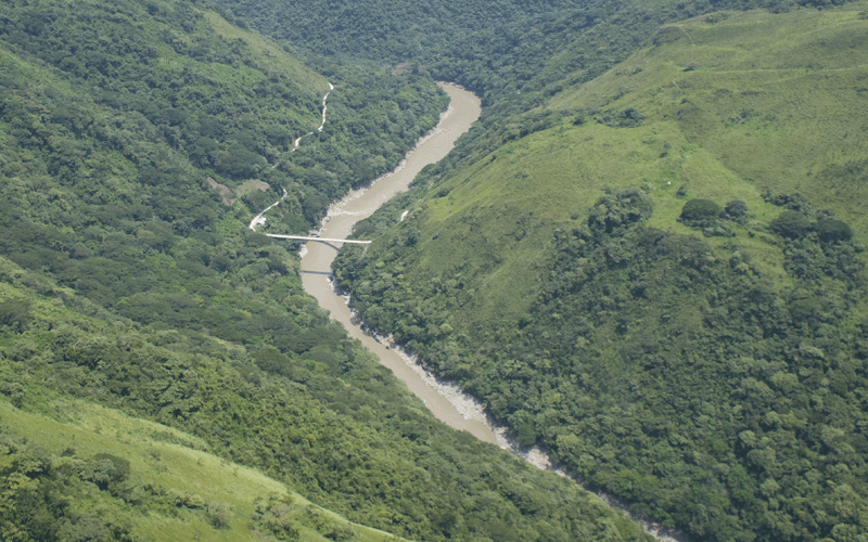
The Cauca River rises at the northwestern end of the Andes in southwestern Colombia. The Cauca Valley, located between the western and central mountain ranges of the Andes, extends for 600 km in a south-north direction between 2° and 8° north latitude.
The gentle slopes of the foothills of the Cauca Valley, starting at an altitude of 1000 m, give way to a steep topography at higher altitudes, with deep canyons and numerous rivers and streams that flow into the Cauca River. (See article: Río de la Plata).
Elevations in the central Andes reach over 5000m, with several volcanoes and perpetually snow-capped peaks. The Western Cordillera, lower and narrower than the Central Cordillera, reaches altitudes of up to 4000m.
Cauca River and its tributaries
Among the tributaries of the Cauca River we can mention the following:
Left tributaries: Timba River, Rioclaro River, Jamundí River, Lilí River, Meléndez River, Cañaveralejo River, Cali River, Arroyohondo River, Vijes River, Mediacanoa River, Piedras River, Riofrío and Pescador River.
Rivers on the right: Desbaratado River, Frayle River, Párraga River, Amaime River, Cerrito River, Zabaletas, Guabas River, Sonso River, Guadalajara, Tuluá River, Bugalagrande, La Paila and La Vieja River
Route of the Cauca River
We can start by asking ourselves: What is the Cauca River, because this river is the second most important river in Colombia, where is the source of the Cauca River, this river is born next to the Buey Lagoon in the Colombian Massif.
As for the course of the Cauca River, we can mention that it runs between the central and western mountain ranges, this river crosses more than 180 municipalities in the departments of Cauca, Risaralda, Valle del Cauca, Sucre, Caldas, Antioquia and finally Bolivar.
The mouth of the Cauca River in the department of Bolivar is on the Magdalena River, very close to the town of Pinillos.
The Cauca River Basin, from where it is born until it reaches the entrance in the Atlantic Plains, includes the mountain range slopes from the separation of waters, in the sub-regions Valle del Cauca and Alto Cauca, but on the other hand, for the Cauca Canyon, the limit manages to go down to the elevation of 1,500 m., allowing the elevations to be reached above this height, and encompassing in the regions Macizo Central Antioqueño, Costa Pacifica and Vertientes de la Cordillera Occidental.
Geology
Geologically, the ecoregion has a complex history, and the two mountain ranges that define the valley have different origins. The orogeny of the Colombian Andes began in the late Palaeozoic, when the ancestral Cordillera Central intruded into the western margin of a myogeosyncline.
The Central Sierra was formed during the Cretaceous, but was low. The formation of the Western Sierra can be traced back to the end of the Mesozoic. The folding of the Andes during the Miocene gave rise to the present configuration of three Colombian sierras and two inter-Andean valleys.
The present elevations were reached during the Pliocene-Pleistocene. In the western range, the soils are lateritic and there are some limestone deposits in the foothills. In the central range, the soils are of volcanic origin and very fertile.
Flora and Fauna
With regard to the flora of the Cauca River, the vegetation communities of the mountain forests of the Cauca Valley are very diverse, ranging from dry enclaves in the foothills of the eastern slopes of the Western Cordillera of the Andes (rainfall 500-1000 mm/year).
To very humid forests in the middle and upper elevations of the western highlands of the Central Cordillera (rainfall up to 3000 mm/year). This climatic diversity, together with the steep altitudinal gradient, results in high beta species diversity and endemism.
The altitudinal gradient causes rapid species turnover and congeneric species replacement. Point diversities are not very high compared to the lowlands, but regional diversities are very high due to altitudinal species turnover.
This is why, in the case of the Cauca River fauna, we can find that the diversity of birds in certain localities within an altitudinal belt can be less than 200 species, but the total diversity along an altitudinal gradient can exceed 500 species (see article: Yuruá River).
On the other hand, with regard to the fauna of the Cauca River, it should be mentioned that the montane forests on the slopes of the valleys extend from 1000 m to > 3000 m and include the sub-Andean and Andean altitudinal belts.
The humid forests at lower altitudes (<1500 m) are dominated by Leguminosae and Moraceae species, while at intermediate altitudes (1500-3000 m) Lauraceae, Melastomataceae and Rubiaceae are the most common families.
At higher altitudes, above 3000 m, the flora is dominated by species of Ericaceae and Asteraceae. Among the most prominent species are the palms of the genus Ceroxylon, of which the species C. quindiuensis is probably the tallest palm in the world, reaching 60 metres.
The Colombian Andes, including the montane forests of the Valle del Cauca, are a centre of diversification and radiation of several taxonomic groups, including frogs of the genus Eleutherodactylus (Lynch 1986) and shrubs and epiphytic plants of the families Gesneriaciae, Orchidaceae, Rubiaceae and Melastomataceae.
This ecoregion is also a centre of endemism for several plant and animal taxa, and contains one of the BirdLife International Endemic Bird Areas, with 12 species of restricted range (4 of which are found nowhere else) in an area of 19,000 km2.
One of these species is the Cauca River Guan (Penelope perspicax), which is found in humid forests at altitudes between 1200 and 2200 m on both sides of the valley, and is currently restricted to a few remnants of forest. The case of frogs is more remarkable, with 60 species endemic to the ecoregion.
The biodiversity of the montane forests of the Valle del Cauca is the result of complex patterns of biological diversification linked to the geological history of the ecoregion and to the current topographic and climatic diversity.
For this reason, in the fauna of the Cauca River, frogs, for example, show a pattern of allopatric or horizontal differentiation, where populations are isolated on different slopes, contributing to the differentiation of species along altitudinal gradients.
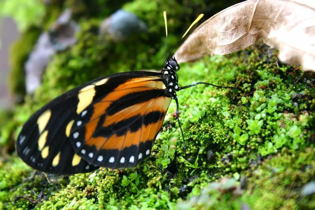
One of the characteristics of the Cauca River is precisely its fauna, since some butterflies, such as the Pronophilini tribe, show a double speciation pattern, one in which closely related species are found on different Andean slopes (allopatric speciation) and a second in which close allies are found in different altitudinal belts on the same slope (parapatric speciation).
Another factor contributing to the biodiversity of the Cauca River ecoregion is the biotic exchange that occurred between North and South America with the formation of the Central American isthmus.
Many of the floristic elements of the Lauraceae that invaded South America differentiated in the northern Andes, where they are important ecological elements in forests at medium and high altitudes.
The montane forests of Valle del Cauca contain populations of several species of special interest, including large mammals such as the spectacled bear (Tremarctos ornatus) and the mountain tapir (Tapirus pinchaque), as well as restricted and endangered bird species such as the Cauca guan (Penelope perspicax).
Brown-cheeked and brown-cheeked antpitta (Grallaria milleri and G. alleni), multicoloured tanager (Chlorochrysa nitidissima) and golden-feathered parakeet (Leptosittaca branickii). Some of these species, such as the golden-feathered parakeet and quetzals (Pharomacrus spp.), undertake regional migrations along the slopes of the Andes.
Current problem
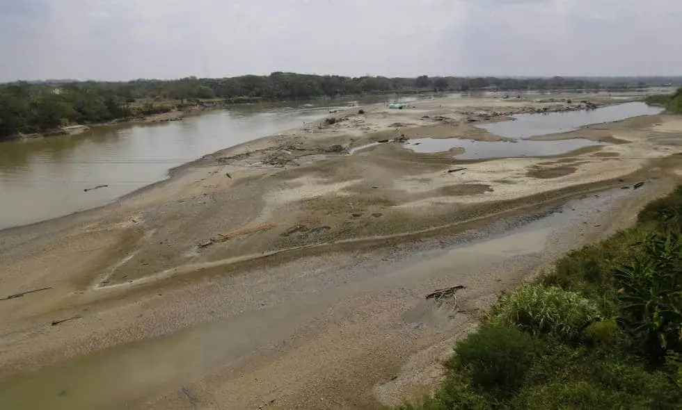
The low level of the river was a cause for concern, as one of the dam gates had to be closed. If this measure had not been taken, the new dam under construction would have been in danger of collapsing because of cracks.
On the other hand, this decision is very worrying for this tributary, as it has led to a reduction in water levels and an increase in fish mortality. It should be noted that this problem also affects those who depend on fishing for their livelihood.
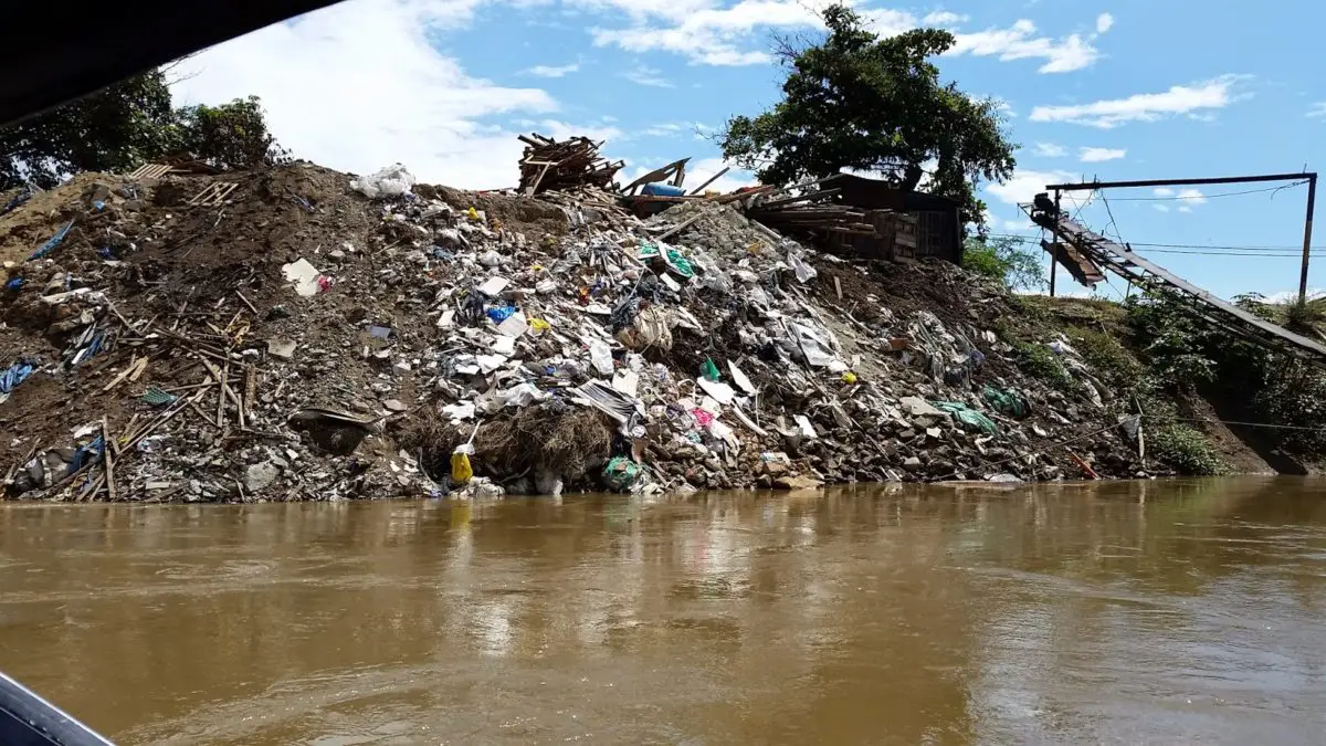
The Contamination of the Cauca River
In Colombia, little attention has been paid to the contamination of the river with polycyclic aromatic hydrocarbons (PAHs). The low level of environmental control and legislation in such an emerging region could contribute significantly to high PAH emissions.
They report on the presence of PAHs in the water and sediments of the Cauca River in Colombia. Three sampling campaigns were carried out between May 2010 and June 2011 and samples were collected from eight relevant sites (see article: Río Portuguesa).
The sampling period included measurements before, during and after a heavy rainfall season influenced by the global coupled ocean-atmosphere phenomenon affecting tropical countries with heavy flooding, commonly called “La Niña” and/or “El Niño” Southern Oscillation (ENSO).
The highest mean PAH accumulations were 4476.5 ng/y and 1582.7 ng/g in water and sediment, respectively. The most abundant PAHs were fluoranthene, fluoranthene and pyrene in sediment and fluorene, acenaphthylene and anthracene in water.
Statistically significant PAH concentrations were detected after the rainy season. The results of the study were compared with other rivers worldwide in both environmental compartments and did not show concentrations of particular concern.
At some sites, the PAH concentrations detected were higher than the detection benchmarks for ecological protection.

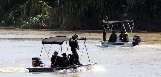
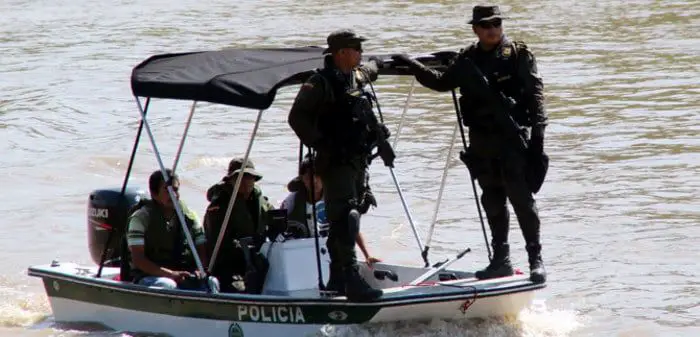
Cauca River or River of Death
Vultures wait at the bend of the Cauca River, where every two or three days at least one mutilated body washes up on the shore, usually the victim of an emerging group of cocaine traffickers whose perversity is terrorising an entire region of the country.
In an area long known for its violence, the recent influx of large sums of drug money into the northern Valle del Cauca has exacerbated long-standing social conflicts over land, politics and water rights (see article: Río Iguazu).
As the new drug barons consolidate their political, economic and military power, they kill with impunity those who oppose them or know too much. Since January 1988, 219 bodies have been recovered from the Cauca River near this city, 66 of them this year alone.
A report released last week by the Attorney General’s Office says that Valle del Cauca leads the country in forced disappearances involving state security forces: 123 cases in the last 15 months.
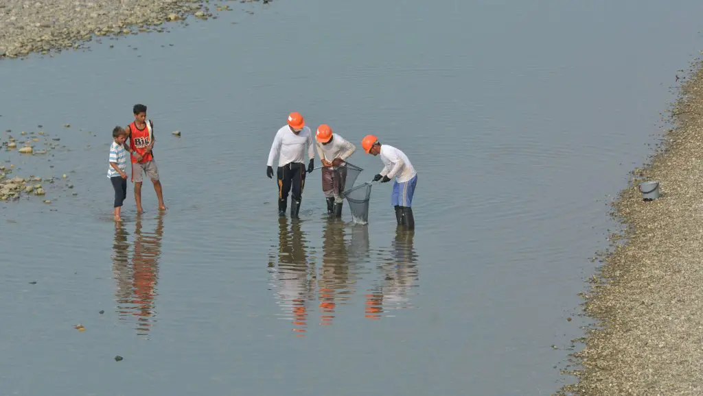
Fishermen say that only a small number of the bodies floating up are removed. Because of the threat to their lives, the people on the river usually only retrieve the bodies of those whose relatives are looking for them, and only if the victim’s clothes match the family’s description.
The bodies are dumped so they can’t be found, so we’re afraid to take them out,” said one fisherman. “If they shot those people, imagine what they would do to us.
While drug trafficking has long been the main source of violence in Colombia, the traffickers in the northern Valle del Cauca have distinguished themselves by the brutality of their killings.
Police who process the bodies of the traffickers’ victims reveal that after the victims have been tortured to death and decapitated, their bodies are often cut open and filled with stones before being thrown into the river, ensuring that the bodies do not surface until they have decomposed beyond recognition.
Killers often pour acid on the victims’ fingers to make fingerprint identification impossible. If a body cannot be identified, murder charges cannot be brought.
Law enforcement officials and human rights activists say the traffickers in the northern valley are more violent than the notorious Medellín cocaine cartel, but have received far less publicity because they kill farmers, local labour organizers and other traffickers rather than high-profile politicians.