
A great route for activities such as canoeing, the Cinca River is also a source of entertainment for anglers. See what you need to know.
Indice De Contenido
River Cinca
It is located in the northeast of Spain. In the so-called Pyrenees, whose name is Aragonese. The Cinca River has its source at an altitude of 2600 metres.
Between the massifs called Tuca Roya and Monte Perdido there is a lake called Lago Helado de Marboré and it is exactly there where the Cinca has its source.
From the lake there is a small stream that receives water from the glacier called Monte Perdido. This is because it runs along a wide valley floor that frames an area known as the Balcón de Pineta.
After an altitude of 2,500 metres, this valley undergoes a sharp, almost vertical cut that forces it to descend more than 1,100 metres in an area of more than 1 km.
The course of the Cinca source.
The River Cinca follows a fairly linear course, starting from the south-east and then turning east. This happens when it falls through important and large waterfalls that lead its descent to the bottom of the so-called Pineta Valley.
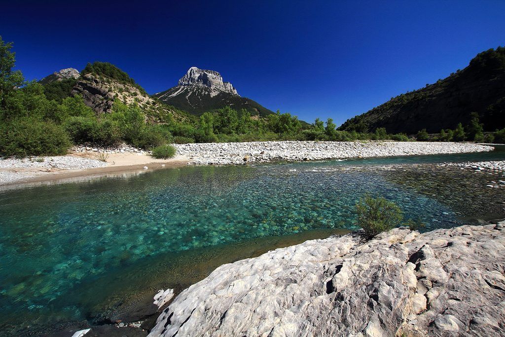
In the lake at the beginning of the Cinca River, it is 100 metres wide and just over 10 metres deep. The bed of the stream that drains it is barely 5 metres wide.
As a result, the water flows into rapids and small shallow pools.
Towards the end of the section there are numerous waterfalls, some of which drop more than 50 metres. The riverbed is completely devoid of vegetation, leaving the bed of rock and stones completely exposed. And for a cruise, we recommend the Spree.
In this area, the Cinca River receives the contributions of the ravines and torrents that come down from the mountains. There are no defined tributaries for this part of the river. This is due to the seasonal dynamics of the high mountains. The river Cabriel is considered to have the cleanest water.
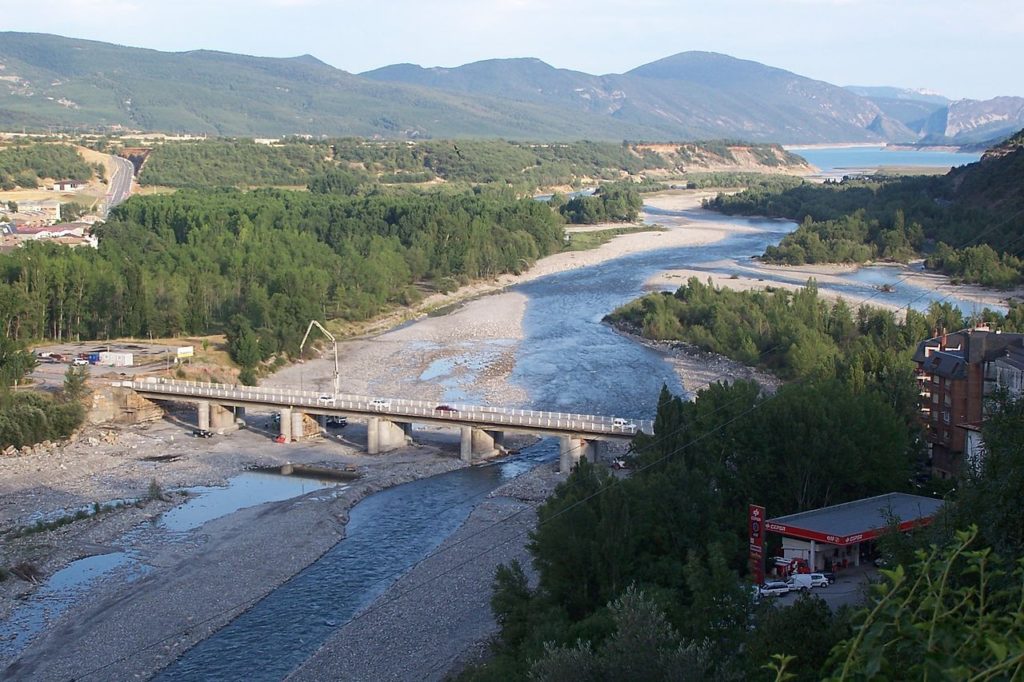
The course of the Cinca
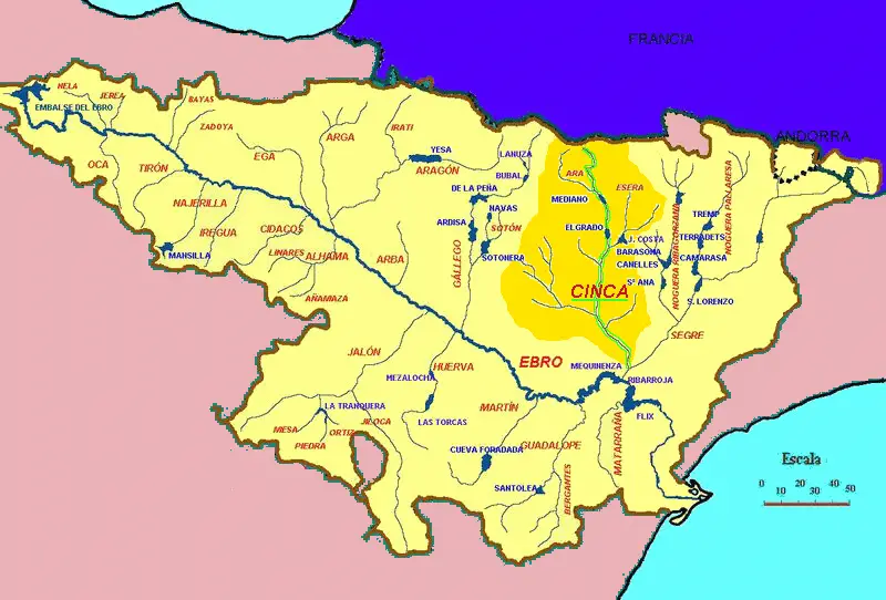
On its descent it reaches a place called Bielsa, where it joins the Barrosa, and continues its descent in a place called Salinas, where it joins the Cinqueta, which then flows into the Gistau valley.
It then continues its course, where, 7 kilometres further down, it meets the waters of the Irués on its left and also the Yaga on its right, in a place called Hospital de Tella.
It continues its course through various places downstream, where it continues to receive water from its tributaries, resting its banks in some localities such as
- Pomar de Cinca
- Albalate de Cinca
- Torrente de Cinca
- Alcolea de Cinca
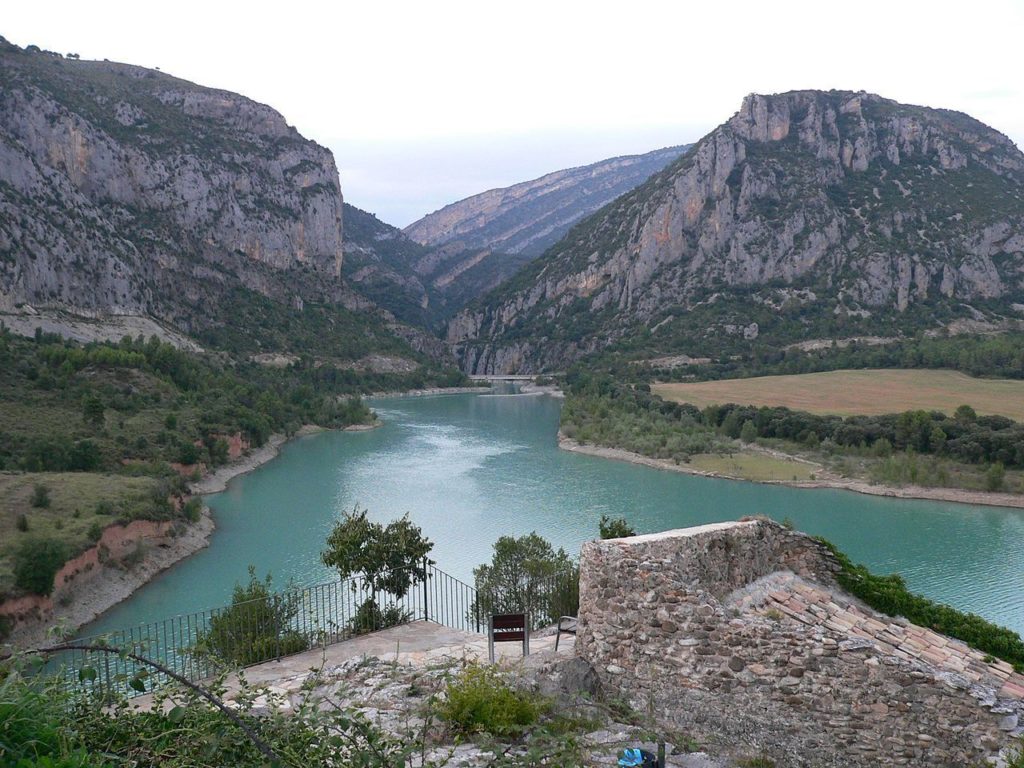
At the end, from its right side, it receives the river Bellos and then the river Ara. There we find the Mediano reservoir, which seals the confluence of the Ara and Cinca rivers. Finally, it arrives at a place called Massalcoreig, where it joins the Segre and finally flows into the Ebro.
Map of the Cinca River
Activities in the Cinca River
Among the activities that can be enjoyed in the waters of the Cinca River are
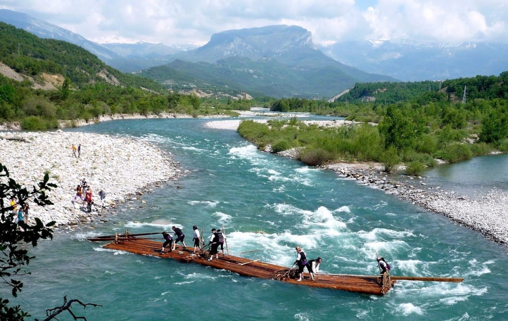
The descent in Nobatas. This is the navigation on the waters of the Cinca River in boats made of logs, recalling the history and the way in which man has used his intelligence to navigate the waters.
It is an activity that takes place on the penultimate Sunday of May, coinciding with the thawing and rising of the Cinca River. It heralds the arrival of spring and the end of winter.
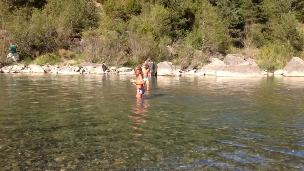
Fishing. Fishing is another activity enjoyed by many residents and tourists. The moments when the crystal clear waters allow you to watch the fish move in the waters of the river.
Fishing in the Cinca River from the air
Canoeing: One of the most attractive and popular activities, this is a favourite with locals and visitors alike. These canoeing events are even held on an international level, with entries from different countries.
Descent of the Cinca 2014
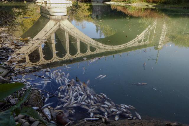
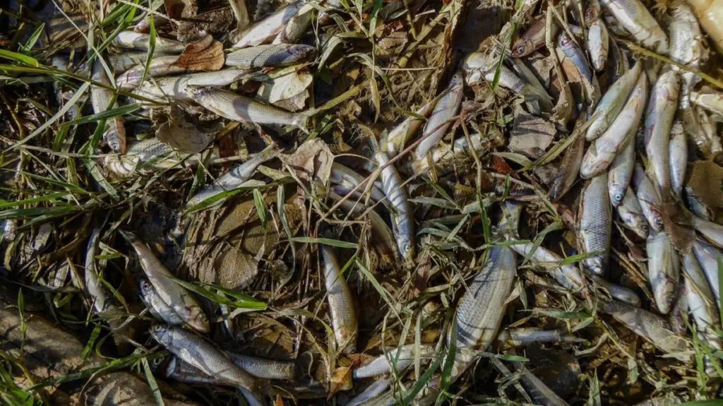
Pollution of the Cinca River
On 19 November 2017, an unfortunate news item appeared indicating the presence of a large number of dead fish in the Cinca River as it passes through Monzón.
The largest number of fish was observed just under the bridge that gives access to the town, close to the town centre and the river.
This fact has led to the main hypothesis that a spill containing a large amount of toxic substances is the cause of this unfortunate disaster in the Cinca River environment.
Measures taken
The CHE (Confederación Hidrogáfica del Ebro) took the necessary water samples at the continuous water quality station. This station is located downstream of the Paúles industrial estate.
The first results showed a certain amount of ammonium. However, it is necessary to wait for the results of the laboratory analysis, which will take a few days.
This is to check for the presence of other toxic substances that were not detected in the preliminary tests carried out at the site.
They also check the permits given to the companies of the so-called Polygon of Paúles and later check with the analyses if there was a leakage of which chemicals, in order to establish by means of file the sanctions of rigor.
Curiosities
Hoping that everything will be clarified and solved. How about going fishing for a while. It is also done in the river Alberche. A place of peace and solace in a magical contact with nature and the wonders that surround us. Enjoy it.
Enate – River Cinca – Spain – Aragón – Game Fishing Reserve.
And for those who don’t like fishing, or don’t know how to fish, or perhaps want a bit more adrenaline, we’ll be canoeing down the Cinca River. Do you want to? Have fun!