
Last Updated on September 19, 2023 by Hernan Gimenez
Among the rivers that exist in the world, there is an important one in Spain. It is the Tagus, not only because of its history and size, but also because of the great monuments it contains and the places where the Spanish monarchy spent its holidays.
Where does the Tagus originate? Origin
Since ancient times, its waters have been a silent witness to the social and economic development of the region. Works of great importance at the time were built on its banks. Several authors have written legends of knights and have mentioned its landscapes.
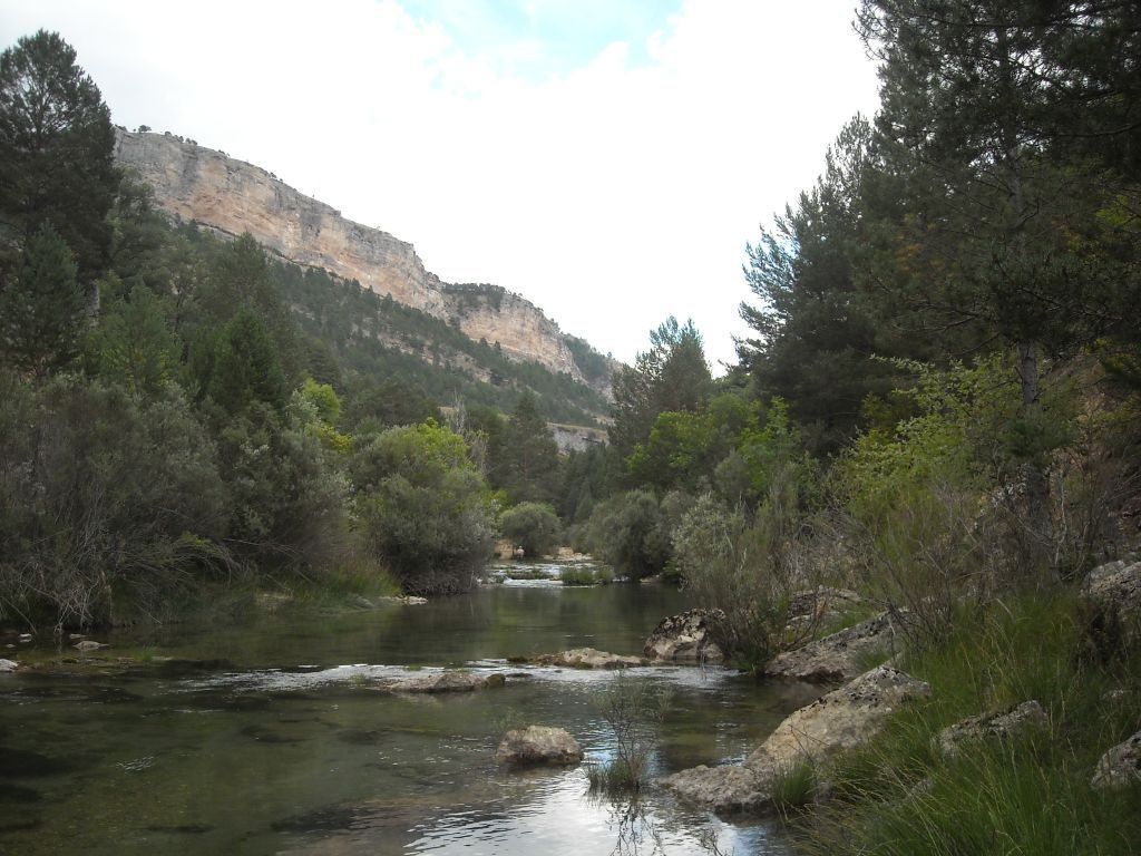
The general river of Spain, the Tagus, rises in the Montes Universales at an altitude of less than 1600 metres in the Sierra de Albarracín, Teruel, where the Fuente García monument has been erected, made up of four sculptures symbolising the Tagus. It begins as a stream and becomes an imposing and powerful river.
The Tagus River crosses the entire Iberian Peninsula, with a length of 1038 km, from the Sierra del Albarracín, passing through several towns, until it reaches Lisbon, Portugal, and ends in the Atlantic Ocean.
Tributaries of the Tagus River
Although it begins as a small stream, its course increases as it joins the Tagus with a series of tributaries that originate in the mountainous areas, among the most important are the following
- Alagón: it has its source in the municipality of Frades de la Sierra and joins the Tagus at Alcántara and Cáceres.
- Algodor: it begins in the Montes de Toledo and joins the Tagus near Aranjuez.
- Almonte: it rises in the peak of Villuercas, flows through the municipality of Cáceres and converges in the Alcántara reservoir, a structure built on the bed of the Tagus.
- Ibor: another tributary of the Tagus. It rises in the Sierra de Guadalupe and ends its course in the Valdecañas reservoir.
- Tiétar: it begins in the Gredos mountain range, near La Venta del Cojo, and forms the Torrejón Tietar and Torrejón Tajo reservoirs. It ends in Villarreal de San Carlos, in the Monfragüe National Park.
- Alberche: rises in the Sierra de Villafranca and flows into the Tagus in Toledo, near Talavera de la Reina.
- Guadarrama: it rises in the Sierra de Guadarrama and flows into the Tagus in the province of Toledo.
- Jarama: rises in the Sierra de Ayllón and flows into the Tagus near Aranjuez.
- Guadiela: it rises in the Sierra de Cuenca, forms the Buendía reservoir and then flows into the Tagus.
- Salor: it rises in the Sierra de Montánchez and joins the Tagus in the Cedillo reservoir.
- Zézere: it rises in the Sierra de la Estrella in Portugal and reaches Constancia.
Flow of the Tagus River
It refers to the amount of water flowing through the river and is determined by the topography, climate and size of the river. Numerous tributaries flow into the river and determine its flow. However, its waters are controlled by the Spanish Ministry of Agriculture, Fisheries, Food and the Environment.
At its mouth it forms the estuary of the Sea of Straw (Mar da Palha in Portuguese), into which it discharges an average flow of 444 m³ per second.
Many of these man-made reservoirs and dams, located at different points along the Tagus in the Iberian Peninsula, serve a variety of purposes, ranging from the control of its tributaries to energy and agriculture.
Bolarque reservoir:
Located between Cuenca and Guadalajara, it is formed by the inflow from other reservoirs and is surrounded by the mountains of the Sierra de Altomira. It supplies water to a small reservoir called La Bujeda, which is transferred to other reservoirs, La Mancha and El Levante Español. It is also used for hydroelectric purposes and for irrigating the surrounding areas.
Buendía reservoir:
Situated in the provinces of Cuenca and Gualajara, it receives water from nearby rivers and is located in the Guadiela riverbed. It is part of the Mar de Castilla and its purpose is to supply water to the region of La Mancha, hydroelectric power and water transfer.
Chincha Mill:
This small reservoir is located in the town of Puente Vadillos and is fed by the Rivers Cuervo and Guadiela. It is visited by tourists for its natural beauty, its facilities, its fishing and its hydroelectricity.
Alcorlo:
Located in Guadalajara, it began irrigating crops in 1978 and since 1996 has supplied the towns that make up Aguas del Bornova. It is also a tourist site where many visitors can walk along its trails and enjoy water sports in its waters.
Almoguera:
Located on the bed of the Tagus River, like other reservoirs in the area, it is surrounded by old buildings, historic castles, ideal for tourism. Another of its uses is to serve as a hydroelectric supply.
Beleña:
In the bed of the river Sorbe in the towns of Belen and Muriel, is the reservoir of with utility for irrigation and hydroelectric.
Where does the gorge flow into? Route
From its source in the Sierra de Albarracín and as its waters are fed by the flows of other rivers. Like the outline of a line, it divides the Iberian Peninsula of Spain in two, making its way through many mountain ranges and plains until it flows into the Atlantic Ocean.
Its journey begins in the Montes Universales, where, by the whims of nature, a stream often feeds the lagoon that begins to form in the Sierra de Albarracín, Teruel.
On its journey through the Iberian Peninsula, in Madrid, Spain, when it has reached 816 km, it begins to flow through the autonomous regions of Aragon, Castilla-La Mancha and Extremadura. On its way it also crosses six provinces. Teruel, Cuenca, Guadalajara, Toledo and Cáceres.
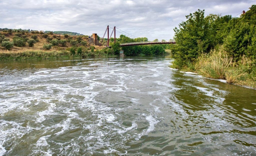
The river is so impressive that it forms the border between Spain and Portugal for 47 kilometres, crossing the Alto Alentejo and Ribatejo regions and integrating the districts of Porto Alegre, Santarénse and Lisbon in Portugal.
It is in Portugal that the Tagus ends its course to join the waters of the Atlantic Ocean, forming the estuary of the Sea of Straw, a stretch of river that is invaded by the ocean tide, with islets and muddy land in winter. This stretch of the Tagus is home to more than 70,000 birds.
Communities along the Tagus
To know a little about the municipalities through which the river flows, it is important to know that the Iberian Peninsula is made up of Andorra, Gibraltar, Spain and Portugal, and it is in these last two countries that its waters will cross municipalities.
A river that is born in Spain, specifically in Teruel, and that on its way will visit many provinces of Madrid until it arrives in
Aragon
It is an autonomous community of Spain, its capital is Zaragoza, with a population of more than 1,300 million inhabitants. It has many places of interest that are important for their history and beauty.
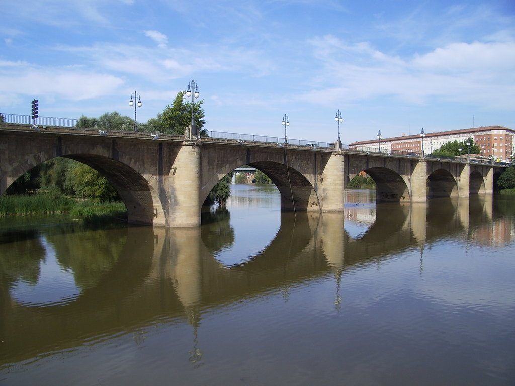
It is the oldest bridge over the Ebro and the second longest in Spain. Its construction made it easier to cross the Ebro and facilitated trade between the inhabitants of the basin.
Roman Theatre of Zaragoza:
Built in the first half of the 1st century AD. The Roman Theatre of Caesaraugusta, built during the reigns of Tiberius and Claudius, is the oldest in Roman Hispania and in 2001 it was declared to be of Cultural Interest.
In the Community of Aragon there are several districts or provinces where the Tagus begins its long and controlled journey.
Teruel
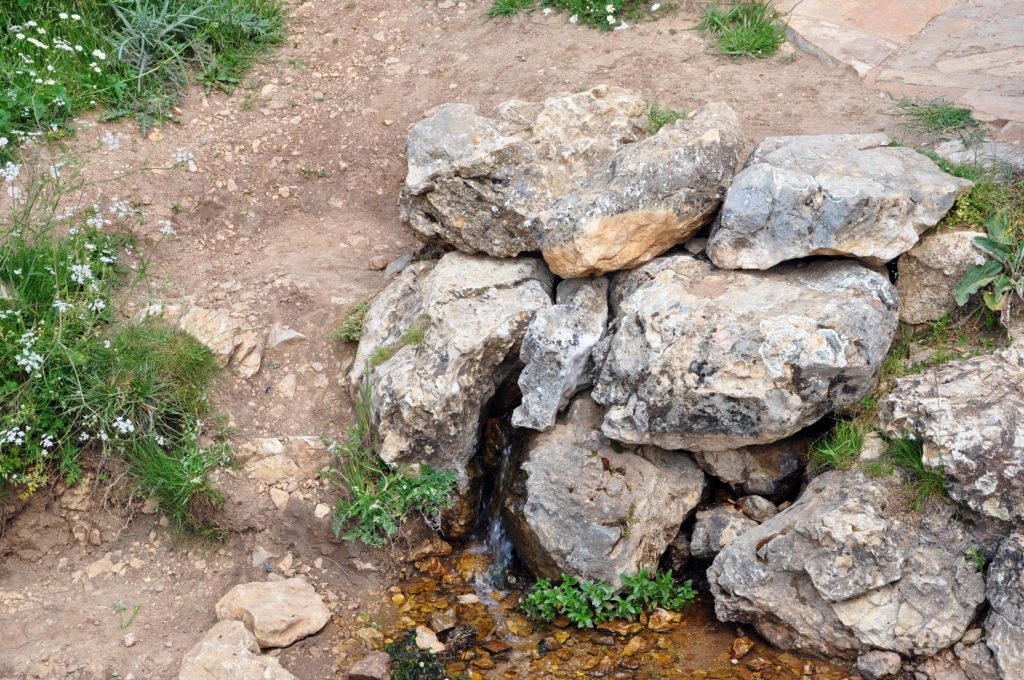
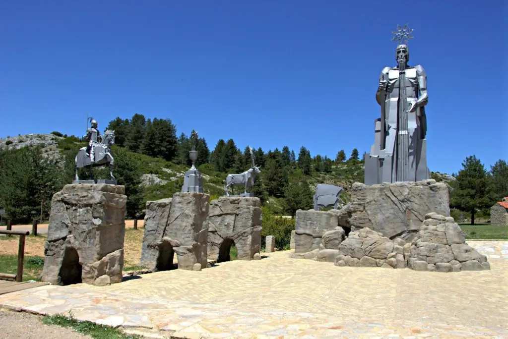
Located in the south of Aragon in northern Spain. For the year 2016 its population was 35,564 inhabitants. It is in this province, specifically in the Frías de Albarracín mountain range, that the Tagus River rises. A sculpture represents the heraldic symbols of the three provinces and the sign where the source is located.
The stream where the monument is located feeds the small fountain with water from the mountains and then begins its long journey. Its spaces are a tourist site, cold weather, snowy mountains and vegetation, are the ideal setting for the park to await visitors and tell stories.
Castile-La Mancha:
An autonomous community located in the central part of the Iberian Peninsula, it is made up of the 919 provinces of Albacete, Cuenca, Toledo, Ciudad Real and Guadalajara.
Geographically, it has mountain ranges, plains and transition zones, an interval of rock that separates the aquifer deposit.
It is over the waters of the Tagus River that a 72,000 m³ concrete bridge supported by a tower of 152 cables can be seen. On the other hand, as in other places, it has a great deal of historic architecture and varied landscapes.
Cuenca:
This is another province crossed by the river. It has more than 55,500 inhabitants. Like many cities in Spain, it has buildings from other periods, as well as natural beauty, which was declared a World Heritage Site in 1996.
A 13th-century castle overlooks the small town of hanging houses, its cathedrals of Santa María and San Julian, and the banks of the river Jucar.
Beteta
A district of Cuenca with 281 inhabitants. It is close to the province of Guadalajara. In ancient times its salt mines were exploited and the iron produced there was considered one of the best of the time.
Its wealth is framed by monuments such as the castle of Rochafrida, located on a hill to the west. Ermita de la Virgen la Rosa, the ruins of a church on the summit of Mount Toloño.
Guadalajara:
Located in the centre of the peninsula and neighbouring Cuenca, it was founded by the Arabs and conquered by King Alfonso VI. It has more than 83,700 inhabitants. It has many places of interest, not only for the passage of the river Tagus, but also for its other places. Among them are:
Infantado Palace, Gothic and Renaissance style. Torreon de Alamín, an old walled tower, this building was part of the Postigo Gate. Parque de la Concordia is the most representative of the green areas.
Peralejo de las Truchas:
It is a natural park formed by mountainous areas, located in the Alto Tajo, between Guadalajara and Cuenca. It has a population of 153 inhabitants, which increases or decreases depending on the weather, weekends or holidays. If the temperature drops, they go elsewhere, otherwise they return.
The climate is variable and the terrain is mountainous, ideal for forests of pine and ash. As well as its varied fauna, including foxes, reptiles, deer, among others.
Poveda de la Sierra:
It is a small village located in the Alto Tajo Nature Reserve, with 131 inhabitants, where you can see the collapse of an old dam, near the “Salto de Poveda”, a fall of more than 20 metres.
On the banks of the river Tajo is La Fuente del Berro, a recreational area where you can bathe in the “crystal clear waters of the river”.
Taravilla:
This municipality in the province of Guadalajara has 41 inhabitants and is close to the Tajo Baths.
Peñalen:
Another village in the Alto Tajo region, it has 82 inhabitants and borders Cuenca and Aragon.
Fuembellida:
It is one of the smallest villages in Spain, with 17 inhabitants, and is part of the Alto Tajo Natural Park.
Corduente:
It belongs to Guadalajara, has 365 inhabitants and is a cultural, artistic and natural heritage site. It is home to the Sanctuary of the Virgin of La Hoz, a Catholic temple located on the banks of the River Gallo and the Barranco de la Hoz. It was formed by the erosion of the Gallo River and is part of the Alto Tajo Park.
Zaorejas:
Considered the capital of the Alto Tajo, due to its territory and its extensive meadows, it is used in the exploitation of livestock and agriculture. It is the venue for several festivals in honour of the Alto Tajo, with demonstrations of the trades practised by the settlers.
Armallones:
The village of Ocentejo is the starting point for what is probably the most beautiful route in the Alto Tajo Nature Reserve. A path that leads to streams and cliffs, always accompanied by the Tagus River.
Madrid:

With a population of more than 6.5 billion inhabitants and located in the central part of the Iberian Peninsula, you will find this municipality and city in Spain. To the south-east of the region lies the Vegas del Tajo.
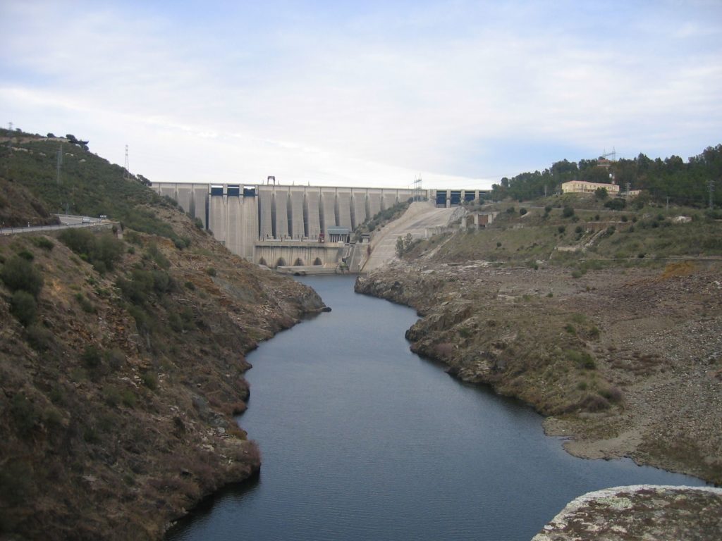
An area of lush vegetation, historic and popular architecture, in its territory the Tagus River is controlled by man in the reservoir José María de Oriol-Alcantara II and then continues its last journey through Spanish lands.
Fishing in the Tagus River:
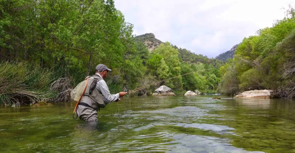
Fishing in the Tagus dates back to ancient times, when there was an abundance of fish and the inhabitants of the area depended on the river for food and trade.
Nowadays, although fish are not as plentiful as they once were, it is still possible to catch everything from trout, pike and perch to barbel and whitefish, with carp being the most common species.
The locals now fish for sport and recreation rather than for food.
Tagus River in Lisbon
The Tagus flows through many provinces and municipalities, such as Portoalegre, Santarem and Lisbon, where its waters come to rest. It is said that the river enters a small delta in the Sea of Straw. It owes its name to the rubbish that its waters carry along with them.
This is where the journey of an imposing river ends, like many others in South America, as the Orinoco flows into the ocean, where it mixes with the waters of the Atlantic and then begins its journey again from the mountains of the Iberian Peninsula.
This is the route that the Tagus takes through the different places.