The Rhône is one of the largest rivers in Central Europe, it is considered one of the most important rivers for the Mediterranean side. It also coincides with the Douro River, as it belongs to two countries.
Where does the Rhone River originate?
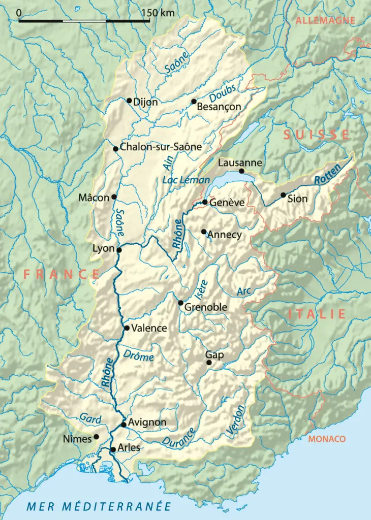
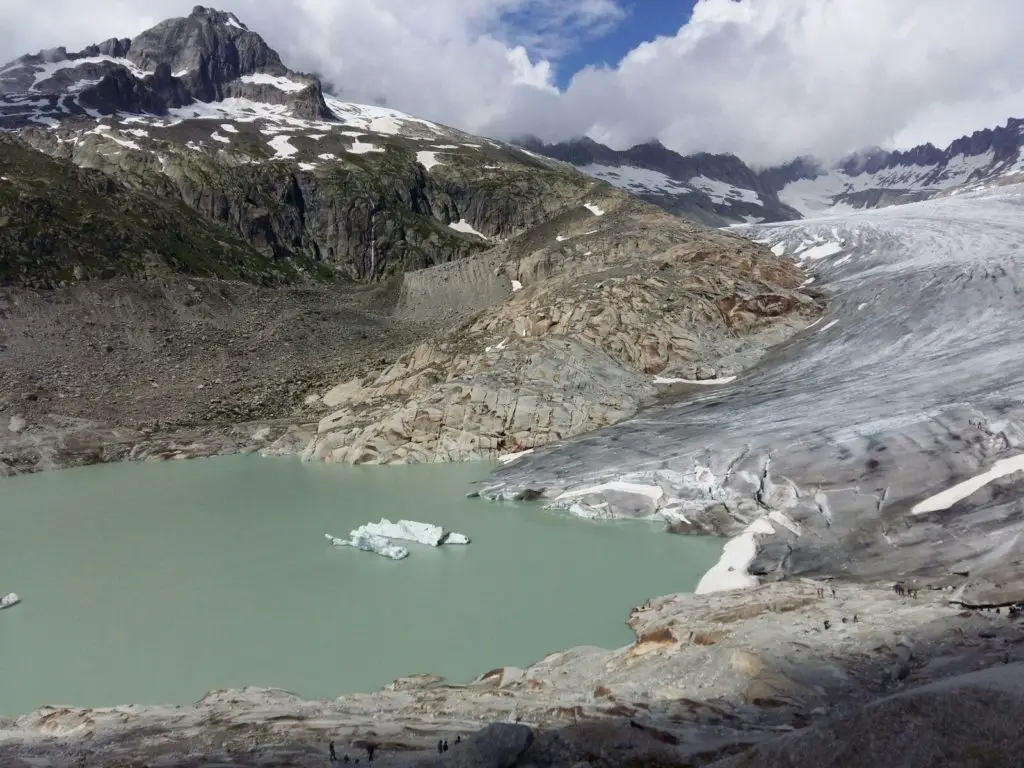
Where does the Rhone originate and where does it flow? To answer these questions, the Rhône has its source in the Rhône Glacier in the Swiss Lepontine Alps, at an altitude of 2209 metres, at the eastern end of the Valais.
Route
The Rhône is 812 km long, of which 290 km is in Switzerland and 522 km in France. The Rhône flows through a glacial valley between the Bernese Alps in the north and the Valais Alps in the south.
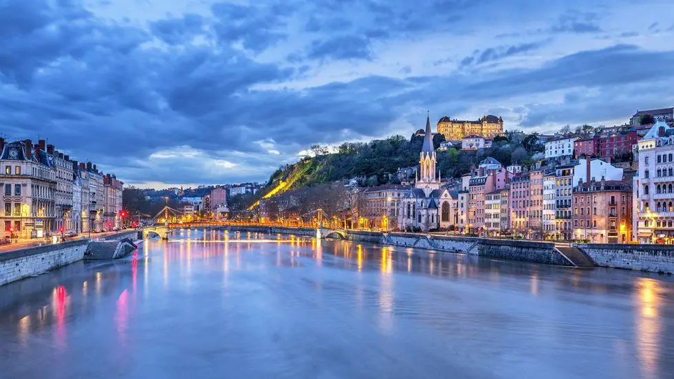
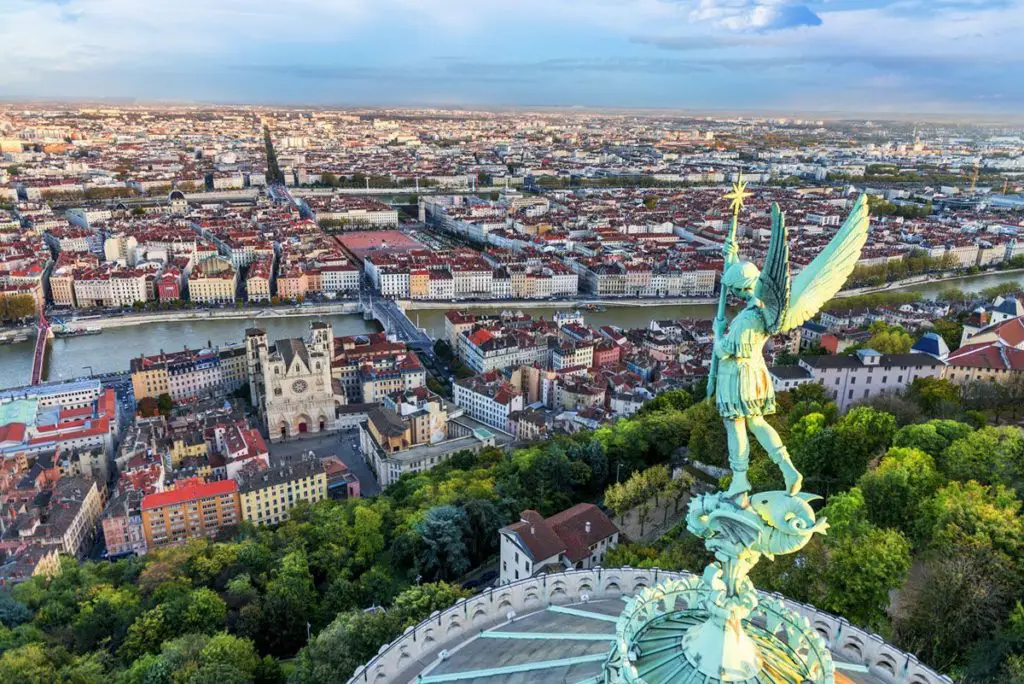
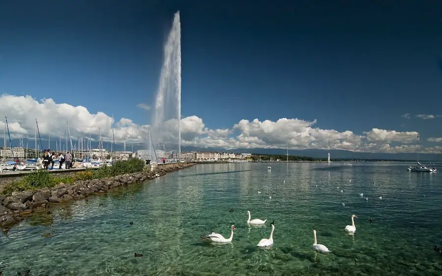
After crossing Lake Geneva, the Rhône enters France from the west through the western foothills of the Alps, i.e. the Rhône flows past the city of Lyon, where it receives its longest tributary, the Saône.
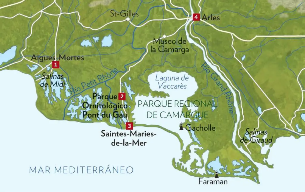
Following its course south, the Rhône flows between the Alps and the Massif Central. At Arles, the river divides into two branches, the Lesser Rhône to the west and the Greater Rhône to the east, forming the Camargue Delta (Rhône Delta).
After this journey, the Rhône finally flows into the Gulf of Lion (Lyon) in the Mediterranean Sea.
Below is a map of the Rhône showing its source, course and mouth.
Provinces through which the Rhone River flows
In Switzerland its waters flow through Geneva and Valais, and in France through Auvergne – Rhône – Alpes, Occitania and Provence – Alpes – Côte d’Azur.
As mentioned above, the map of the Rhône shows the source, course and mouth of the river, and the image below shows the provinces through which the river flows to the Rhône.

Main cities through which the river flows
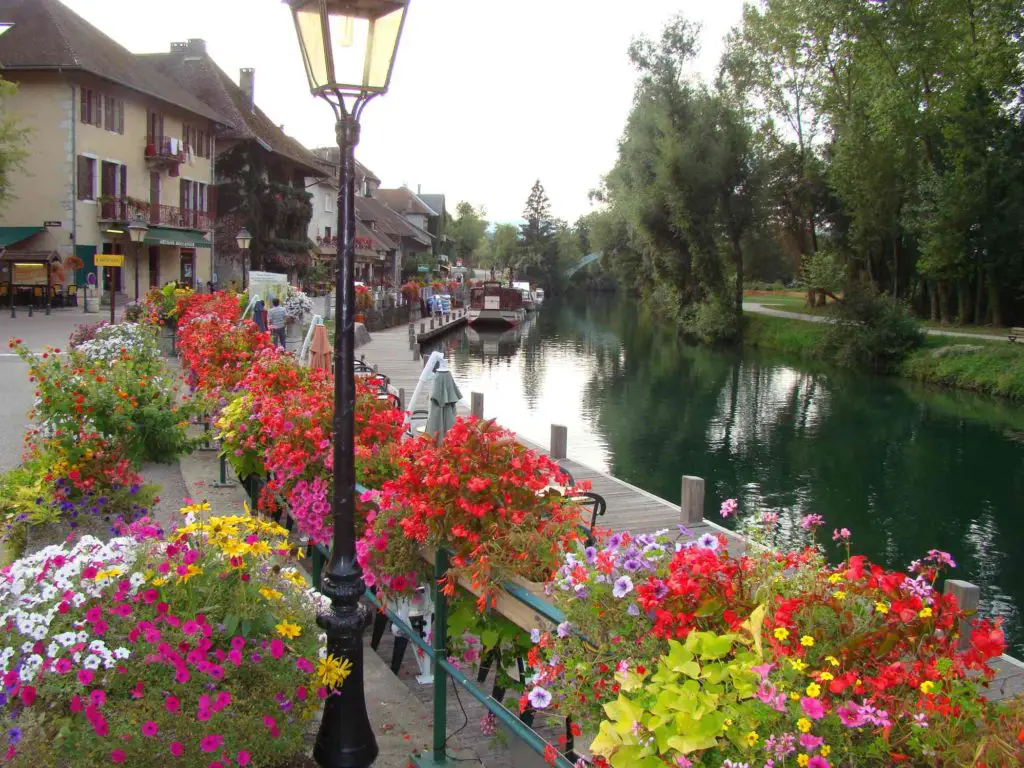
Just as we mentioned the provinces through which the Rhone flows, we will now mention the cities through which the river flows until it reaches its mouth. This is the river that flows through Geneva.
- Ginebra.
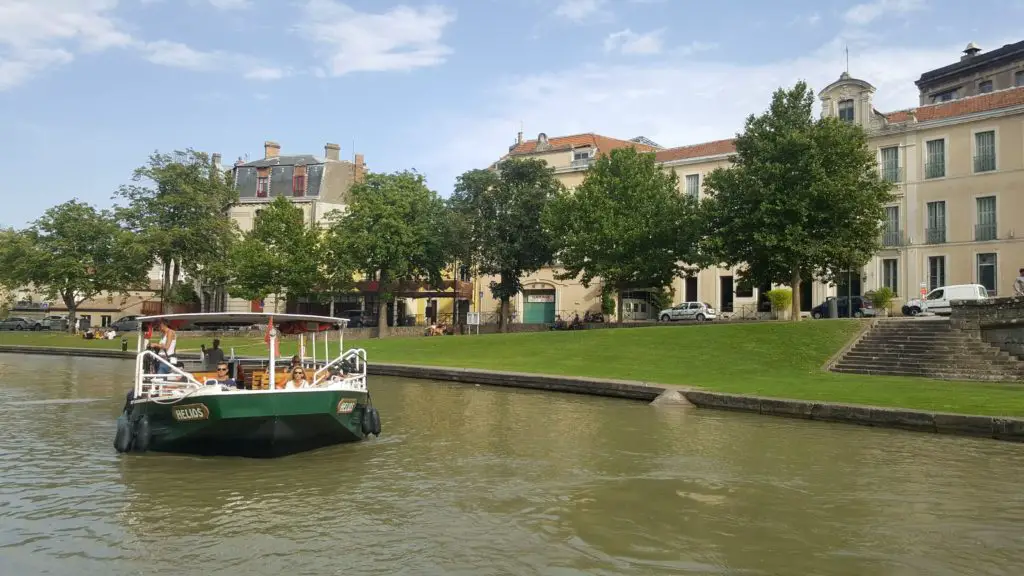
- Lyon.
- Valence.
- Aviñón.
- Arlés. (Ver: Rio Detroit).
Tributaries of the Rhône
We already know the provinces and cities along the Rhône, which, as mentioned above, is the river that flows through Geneva. In the following list you will find the tributaries of the river, from the longest to the shortest:
- Río Saona con 480 km.
- Río Durance con 323,8 km.
- Río Isère con 290 km.
- Río Ain con 190 km.
- Río Cèze con 128 km.
- Río Gardon con 127,3 km.
- Río Ouvèze con 123 km.
- Río Ardèche con 120 km.
- Río Drôme con 110 km.
- Río Arve con 102 km.
Causes of the Rhone River
Before we look at the causes, there are two important facts that will help us understand the river’s behaviour. The first is its average flow rate of 1,820 m3/s and the second is the surface area of its basin of 97,800 km2.
Cause high
As we all know, the Rhône has its source in the glacier of the same name in the Swiss Lepontine Alps, in the extreme east of the canton of Valais. The glacier is located between two massifs, the Alps of Uri and the Alps of Valais (see Rhine).
At Martigny is the bend of the Rhône, where the valley abruptly changes the direction of the water from south-west to north. Before reaching Brig, the Rhône is fed by the waters of the Massa River (6 km), which in turn is fed by the Aletsch Glacier, the largest in Europe.
In this valley between the Bernese Alps to the north and the Valais to the south, there are several torrents and streams that feed the waters of the Rhône. Some of them are the Agene, the Milibach, the Minna, the Minstigerbach and the Wysswasser.
Finally, the Rhône receives the waters of the Dranse (14.3 km long) on its left bank, which turns sharply towards Lake Geneva or Lac Léman to the north. This is the largest lake in central Europe, about 70 km long and 582.4 km² in area, and it also forms the border between Switzerland and France.
Middle Cause
After 290 km, the Rhone enters Swiss territory through the Écluse Gorge. In France, the river is used to demarcate the departments of the country. After leaving the gorge, it reaches the town of Chanaz, where it divides into two branches, which reunite after 15 km. In this section, the banks of the Rhône are protected by the National Nature Reserve of the Lavours Marshes (Rhône River Park).
The river then turns north-west after passing the islands of Sauge, Grand Brotteau and des Chevres. The Rhône reaches Lyon, where it is joined by its longest tributary, the Saône. It flows between the Alps and the Massif Central to the south.
Lower course
The Rhône leaves the metropolitan area and reaches Givors, where it meets the Gère, coming from the left, with its 34.5 km. From here, our river becomes the eastern border of the Pilat Regional Natural Park and then the Isère (290 km), where the Ile de la Platière nature reserve is located. It then reaches the gateway to the Midi or the city of Valence.
At Donzère, the river splits in two in the form of an island more than 20 metres long. At one end we have the natural course of the Rhône, and at the other the Donzère-Mondragon canal, built to improve navigation, cool the Tricastin nuclear power station and feed the Bollène hydroelectric power station. The Rhône then flows towards Codolet, where it is joined by the 128 km long Cèze.
The mouth
Shortly before reaching Fourques, the Rhône divides into two branches, the Grand Rhône on the left and the Petit Rhône on the right, forming a deltaic area commonly known as the Camargue. Its main channel, the Grand Rhône, is over 1 km wide, while the Petit Rhône is only 135 m wide at its mouth (see Vistula).
In the past, the Rhône flowed into the Mediterranean, and because it had no tides, its branches moved westwards. Where is the Rhône? Now the Rhône is dammed and its delta is frozen.