
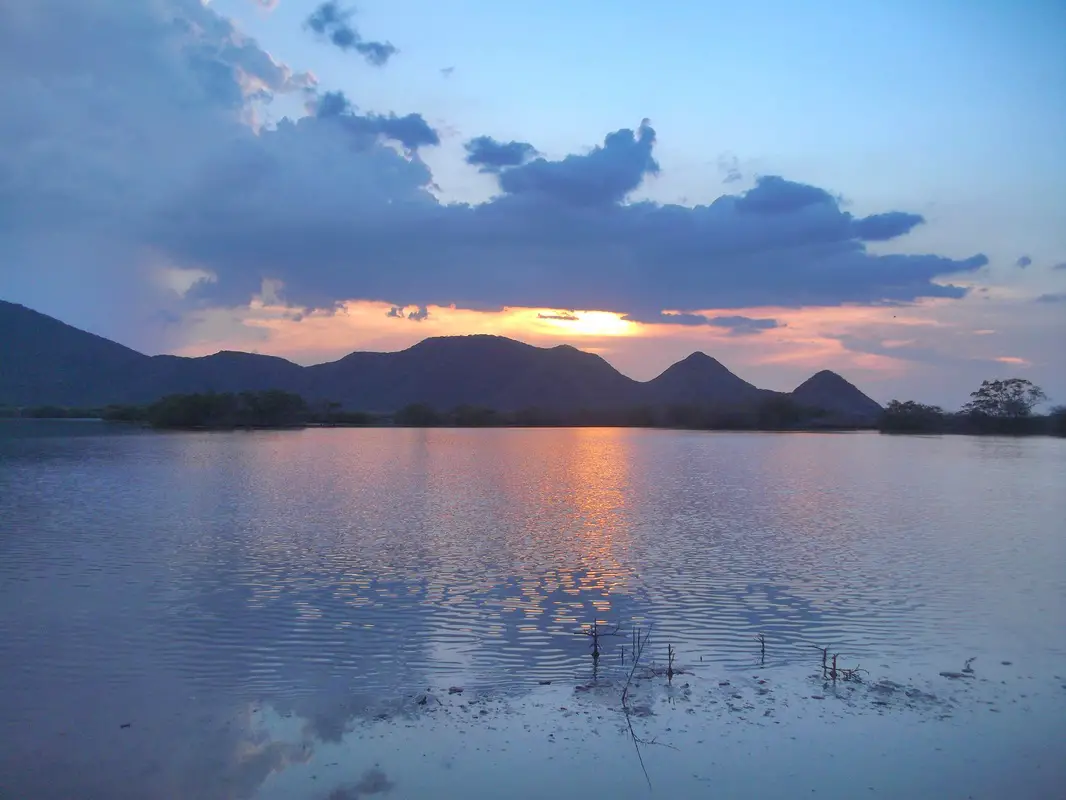
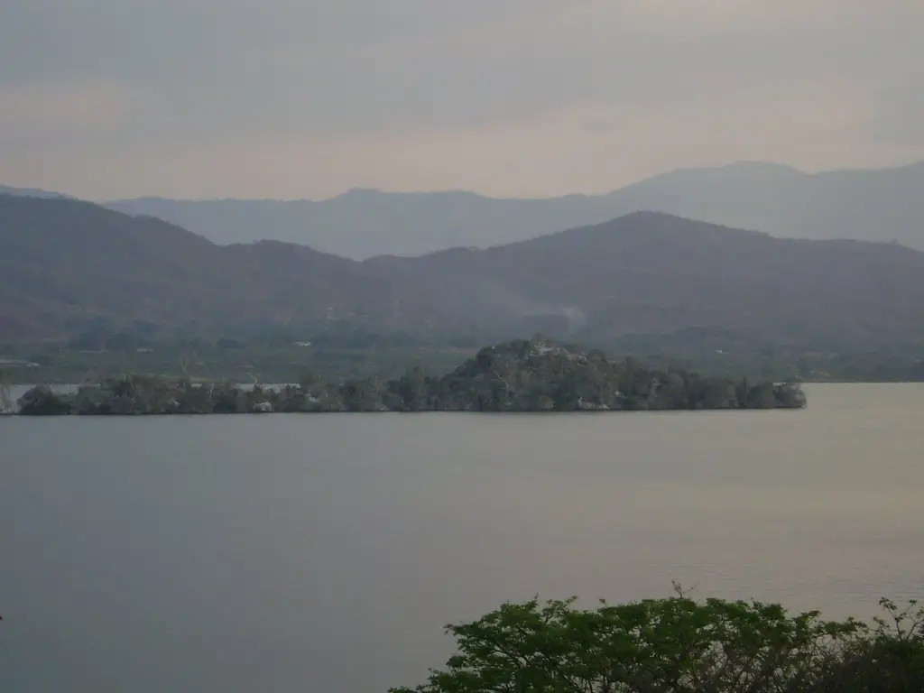
Lake Valencia is the second largest lake in Venezuela, with fresh water that does not flow into the sea, and originates from a tectonic trench known as the Tacarigua Graben. Discover all the information about this important lake, its history, geography, climate and much more. Find out about the environmental and pollution problems it still faces today.
Indice De Contenido
Introduction
On this occasion, we will get to know an important body of water known as Lake Valencia or also called Lake Tacarigua, which is located between the states of Carabobo and Aragua, forming part of the most important hydrographic system in central Venezuela.
This lake belongs to the basin popularly known by all Venezuelans as the Valleys of Aragua, and on its shores are two important cities known as Maracay, capital of the state of Aragua, and Valencia, capital of the state of Carabobo.
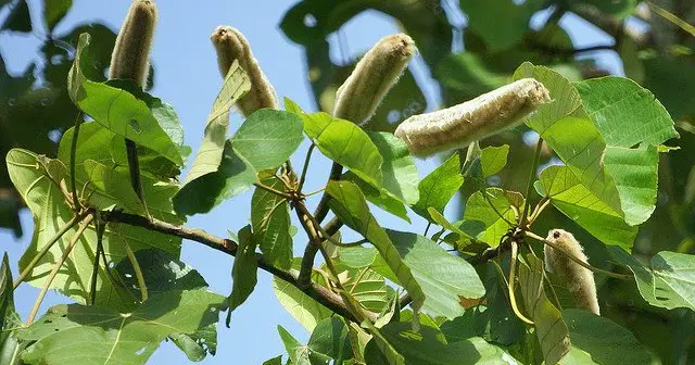
Lake Valencia was originally called Tacarigua, after the indigenous people who inhabited the region before colonisation. This was the name they gave to the balso or tambor tree that grew in abundance in the area.
This tree is called Tacariguo or Tacarigua, and is typical of warm regions, with medium size and an extended crown. In flower it has white buds that open at night and are a delicacy for the bats that pollinate them and drink their nectar. It is also known by other names such as palo de balsa, cambímbora or simply balsa.
History of Lake Valencia
During the year 1547, Don Juan de Villegas appeared on the shores of the tranquil Tacarigua Lake, now known as Valencia, on behalf of the King of Spain, who had left from El Tocuyo, a town in the state of Lara in Venezuela.
The purpose of Don Villegas’ visit was to explore the entire region with a view to founding a city in the place where an indigenous population lived, known as Borburata, an area belonging to the state of Carabobo.
In those years, the shores of Lake Valencia were populated by a series of tribes that took advantage of its waters, including The Tacariguas; The Guayamures; The Guaicaras and Guaios and The Guaicas Mucarias.
All of them gave birth to towns that exist today under the names of Tacarigua, La Cabrera, Mariara, Guacara, Los Guayos and Güigüe. A ranch was also founded by Captain Vicente Díaz, which is now the city of Valencia and the capital of the province.
The purpose of all this was to encourage the inhabitants of Borburata to settle in new places during the colonial period in exchange for cattle so that they could have their own farms.
By order of the governor of the province of Venezuela, Alonso Arias de Villasinda, a city was to be founded near Lake Tacarigua, and this was achieved in 1555 by Alonso Díaz Moreno, with the city of Valencia.
However, since the situation in the colony was quite oppressive, in 1561 the inhabitants of the city of Valencia decided to flee from the tyrant who ruled them at that time, known as Lope de Aguirre, and abandoning everything, ended up taking refuge on the islands of Lake Tacarigua.
The evidence of these antecedents has been determined thanks to the fact that the remains of skeletons belonging to these natives, some representations of their idols, elements such as kitchen utensils, musical instruments and a series of typical indigenous ornaments have been found on the shores of this lake.
Origin
From a geological point of view, Lake Valencia belongs to the Middle Pleistocene (up to 10,000 B.C.), which is why it is considered to be a relatively young area, whose origin is due to the sinking of the earth’s crust, where the water level has been in constant fluctuation and is in danger of disappearing due to numerous geological changes.
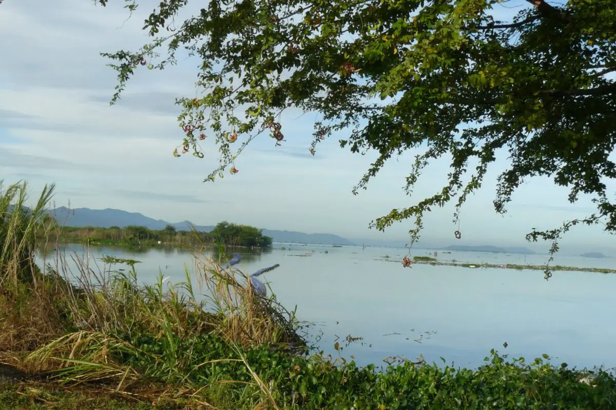
It should also be remembered that it is a body of fresh water that remains stagnant because it has no outlet to the sea, although it receives water from numerous fluvial streams.
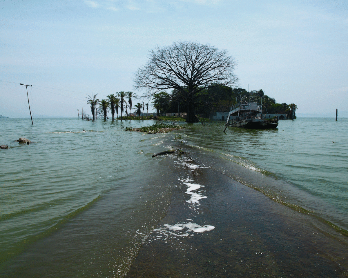
In the 1970s, Lake Valencia suffered several periods of drought, and its water was also used for agricultural and industrial purposes, all of which caused its water level to fall, reaching 401 metres above sea level in 1980.
In times of abundant water, this lake was able to ensure that the excess water produced during the rainy season reached the Orinoco River basin through its outfalls. In other words, the excess water from Lake Valencia was collected by the Paito River, from where it flowed into the Pao River and finally reached the Orinoco River.
At present, all this has changed and the situation has worsened, especially with regard to the level of Lake Valencia, because the necessary drainage channels have not been built to remove the excess water from the basin, allowing it to flow by gravity towards the course of the Cabriales River, which crosses the entire city of Valencia and a large part of the state of Carabobo.
All of this has led to the Lake of Valencia or Tacarigua being seriously polluted as a result of the industrial boom in the surrounding area.
Geography
We know that Lake Valencia is located between the states of Aragua and Carabobo in Venezuela. On the one hand, the Aragua part is the eastern part of the lake’s depression, known as the Valles de Aragua.
On the other hand, the Carabobo part is the central and western part of the lake depression, with the Carabobo fields to the west and the mountains that make up the Serranía del Interior.
Lake Valencia is not completely surrounded by mountains, but there are some bays or passes around it, which can be identified as follows:
The coastal mountain range to the north of the lake.
- Presenting the Bay of Las Trincheras, from where it communicates with cities such as Puerto Cabello de Carabobo, Barquisimeto, San Felipe and Coro; in other states of Venezuela.
- The town of Rancho Grande, which communicates with the towns of Choroní and Ocumare de la Costa, both in the state of Aragua.
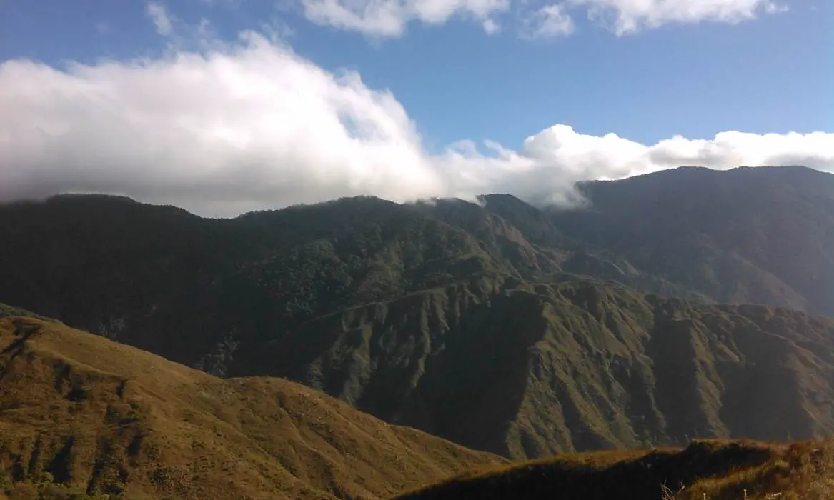
Serranía del Interior to the south of the lake
- The pass of the town of Tinaquillo, which connects it to the western plains.
- The pass of Villa de Cura, where it communicates with the central-western basin of the country.
As mentioned above, it is a lake located between the states of Carabobo and Aragua. The latter state has municipalities that border the lake, such as Libertador, Girardot, Francisco Linares Alcántara and Zamora.
With regard to the State of Carabobo, the municipalities bordering Lake Valencia are: Diego Ibarra, San Joaquín, Guacara, Los Guayos and Carlos Arvelo.
Due to its location, the lake is in contact with some geographical features or different land formations; for example, in the north are the areas identified as Península de la Cabrera, which are 511 metres high and extend into the waters of the lake. There is also the Papayal Cove.
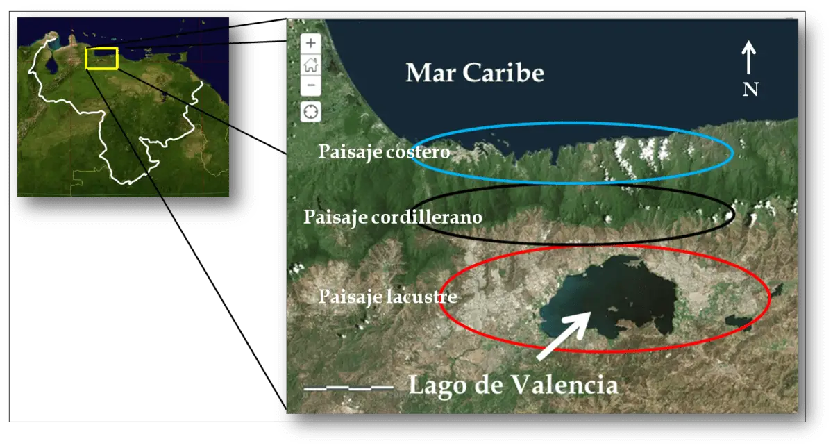
To the south are the Yuma Mountains and the Faltriquera Bay, which also extend into the lake.
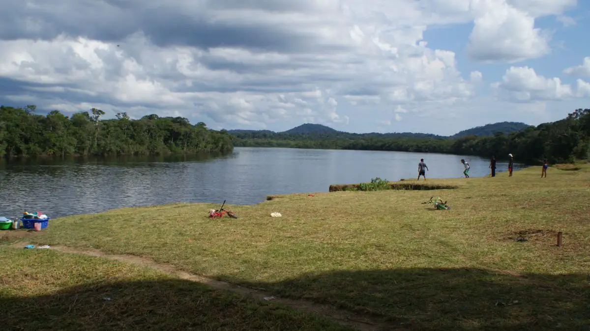
Rivers are also part of the geography of Lake Valencia, which has an endorheic basin, since it has no outlet to the sea, the only one in Venezuela with this characteristic.
This lake receives water from rainfall and from numerous short rivers of low flow, among which the following can be mentioned: Güigüe, Cabriales, El Limón, Los Guayos, Turmero, Güey and Aragua, the most important of which is 80 kilometres long.
Characteristics of Lake Valencia
Lake Valencia has a number of characteristics that make it unique in Venezuela, the first of which is that it is the second largest lake in the country and, above all, that it has no outlet to the sea.
But in addition to all this, we can take into account a series of other characteristics that make it unique, which will be described in detail below:
- It is a lake known by the colonial name of Lago de Tacarigua, but popularly known as Lago de Valencia, the capital of the state of Carabobo, although the centre of the city is very far from the lake.
- It is situated between two Venezuelan states: Aragua and Carabobo.
- Unlike other lakes, it is not completely surrounded by trees or mountains, but around its shores there are not very extensive bays, with areas without trees, as well as other passes that serve as communication with other regions or cities in Venezuela.
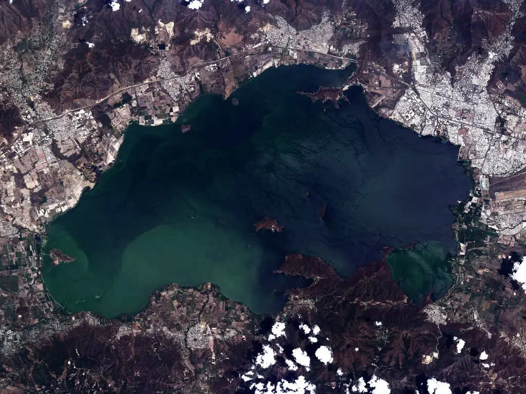
- It has an area of 344 square kilometres, at an altitude of 413.10 metres above sea level, while its basin has a total area of 2,646 square kilometres.
- It has several coastal towns built around it.
- It has several islands, among which the following stand out: El Burro, Otama, Burrito, El Zorro, Horno, Chambergo and Caigüire.
- It has two water diversions, the first of which sends its waters to the Pao-Cachinche reservoir, and the second to the Taiguaiguay lagoon, which in turn sends them to the Tucunemo River.
- The Tucunemo River, which receives the waters of Lake Valencia, flows with them to the Guárico River, which feeds the Camatagua Reservoir, responsible for 80% of the hydrological supply of the Caracas Aqueduct, which meets the water needs of the Venezuelan capital.
- Another of the most striking features of Lake Valencia is that it has shrunk over the years. It used to occupy almost the whole of the great central valley where large cities such as Valencia are now located.
- Its waters are mainly used to meet the water needs of nearby and even distant population centres, thanks to the Acueducto Regional del Centro (Regional Aqueduct of the Centre).
Vegetation
Much of the vegetation present in Lake Valencia was identified by Alexander von Humboldt, who, during his visit to the region in 1799, recorded all his observations of Lake Tacarigua or Valencia.
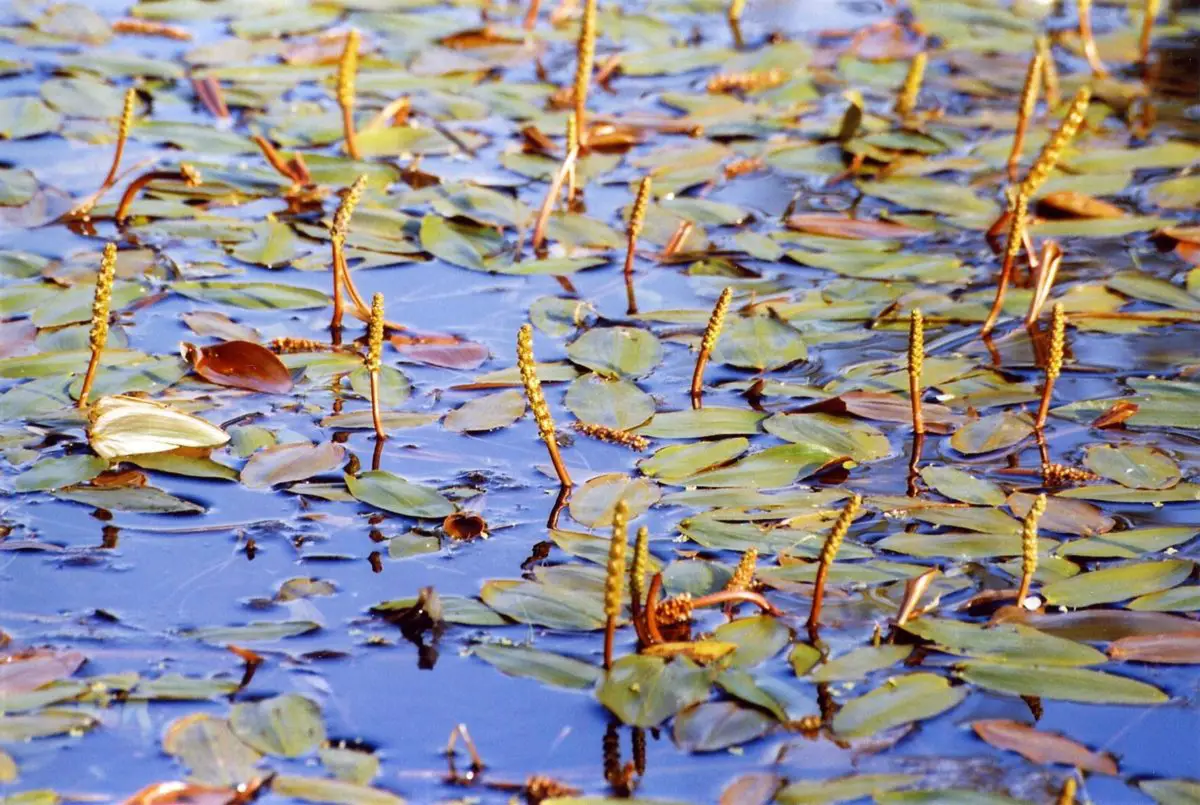
Among these observations, he highlighted the presence of the papaya of the lake, the Carica papaya or, as it is also known in the region, the lechosa. In addition to others such as the Pancratium Undulatum, a beautiful lily that grows in many regions of Venezuela, his notes also included the Amaryllis Nervosa, a plant with long, slender stems that end in a beautiful flower.
Continuing the observations of this important geographer, naturalist and explorer, they allowed him to establish the presence of Potamogeton Tenuifolium, floating plants similar to the lotus flower, but instead of a flower it has a kind of cluster or pistil. Another representative species of vegetation is the Chara Compressa, which resembles fine shrubs, and the Typha Tenuifolia, shrubs with spikes formed by elongated stamens.
In general, the vegetation in the area is of a tropical type, with green areas in the nearby hills and some parks created in the surroundings. In fact, much of the vegetation found in the basin of Lake Valencia is conditioned by the changes in humidity it experiences, as well as other aspects such as the type of soil, the slopes or simply human intervention.
In its wooded areas there are some specimens such as bromeliads, ferns or the emblematic tree of the state of Carabobo, known as Camoruco, belonging to the species Sterculia Apetala, of large size with a straight-branched trunk.
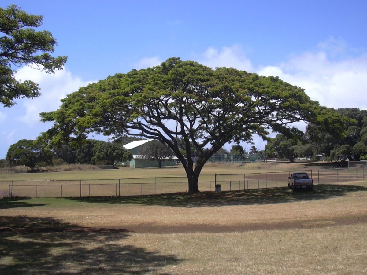
Also present in this region around the lake is the saman, the emblematic tree of the state of Aragua, also known by other names such as the rain tree or the couji of Caracas, which reaches a height of up to 20 metres and is also symbolic of Venezuela. Among them is the famous Samán de Güere, located in the town of Turmero, near Maracay, in the state of Aragua.
This magnificent tree is the symbol of the place where the liberator of Venezuela, Simón Bolívar, met with his army during the War of Independence; a tree used for the liberator’s rest and in whose shade he conceived many of his ideals of freedom for the entire Venezuelan territory and many other South American countries.
Fauna
In the mountains close to the lake, especially in the more remote areas of this territory, you can find anteaters, picture anteaters, deer, porcupines, iguanas, different types of snakes and some other reptiles.
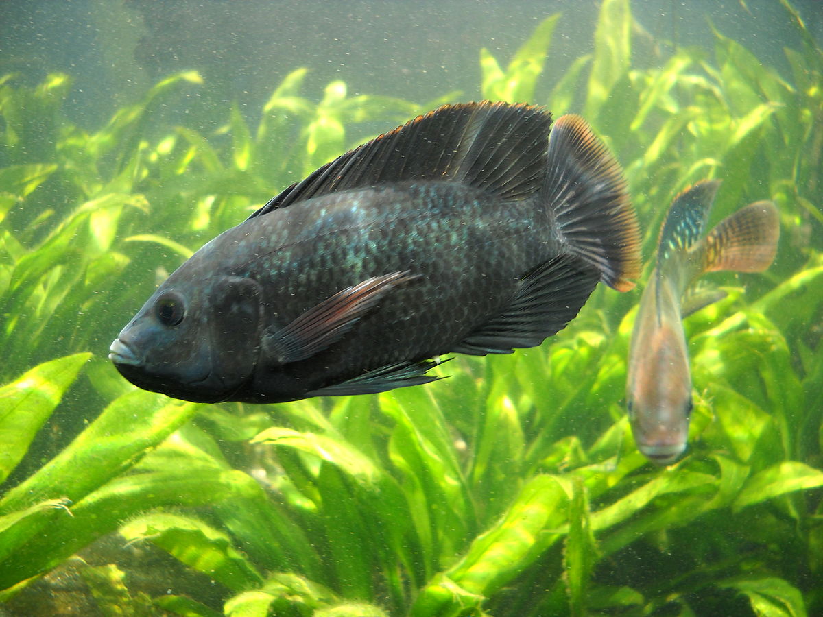
There are also several species of fish, such as Lithogenes valencia, typical of freshwater and tropical climates; Moenkhausia pittieri, also known as the tetra-diamond, Pimelodella tapatapae, no more than 15 centimetres long and native to this region.
Other species include the corroncho, the tinicalo and the tilapia, an exotic fish used in Japanese cuisine to make sashimi, which is illegal to catch in Lake Valencia.
Climate
The climate of Lake Valencia is variable, but in general, as it lies in a depression, it tends to be quite warm, cooled by the winds during some hours of the day.
The lake has an average annual temperature of around 26°C, which drops to 23.3°C in the shade. However, the pattern remains fairly stable, with a maximum of 32.6°C and a minimum of 18.5°C.
As mentioned above, the region is quite warm during most of the day and is cooled at night by the trade winds that pass through. As for the rainy season, it generally falls between the months of May and November, with some sporadic but infrequent showers.
Its islands
Lake Valencia has several islands, 22 to be precise, some of which are more prominent than others. Therefore, the most famous ones are identified by the names of Otama, El Burro, Burrito, El Zorro, Chambergo, El Horno, La Culebra and Caigüire.
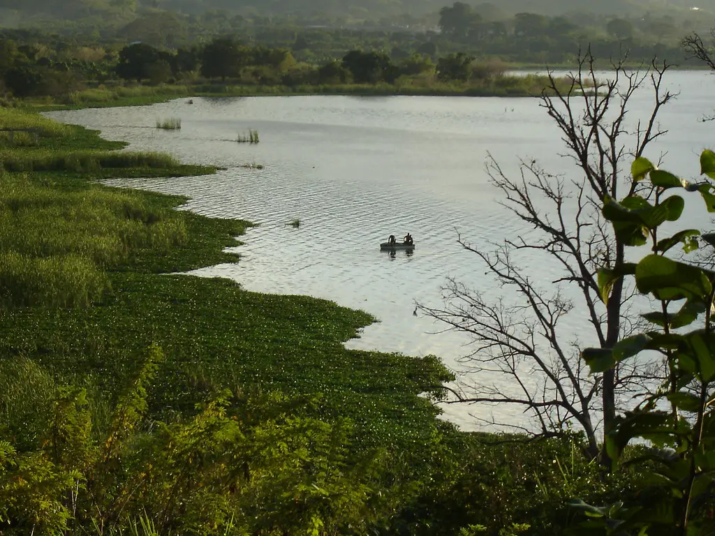
Some of the islands of Lake Valencia have problems due to the flooding of the lake, where they are submerged as a result of increased rainfall; this is the case of La Culebra, the only inhabited island, where the inhabitants live in fear that these floods will end up destroying their homes.
El Burro Island
Popularly known as Tacarigua Island, it is the largest of the 22 islands in Lake Valencia. It has an area of 2.47 square kilometres and its highest point is 470 metres above sea level. It is uninhabited and belongs to the municipality of Guacara, Carabobo state.
There is an old building that was used as a prison in the 20th century, but has been used for other purposes since 1980.
This is a very representative island for Venezuela, as it was the property of the general and president José Antonio Páez, one of the heroes of the independence of this South American nation. But during the government of General Juan Vicente Gómez, also a prominent political figure, the island was used as a prison where all anti-Gómez politicians were held, at least until 1935, when Gómez died.
Later, during the government of Rómulo Betancourt, the prison on the island continued to be used to hold political prisoners. Until it ceased to be used as a prison and efforts were made to restore the whole island as a tourist attraction.
The island is covered with vegetation with different types of trees, as well as many animals, among which we can highlight: crocodiles, spiders, worms, lizards and several species of beautiful birds.
Pollution of Lake Valencia
Lake Valencia is a body of fresh water that does not drain into the sea and is home to at least 140 species of mammals and around 500 species of birds, all of which are considered to be in a critical state of survival and in need of timely conservation projects.
Part of this need is due to the fact that the entire region surrounding the lake is full of industrial complexes and residential areas, and the rivers that flow into its waters are polluted with a series of chemical substances, such as detergents for domestic and industrial use, which cause a great ecological imbalance that directly and significantly affects the subsistence of its fauna and flora.
A clear example of this is algae, which need to absorb large quantities of phosphates present in the water in order to develop, and which, due to the effect of these pollutants, reproduce more quickly than usual, consuming most of the available oxygen and causing eutrophication, an ecological imbalance that leads to the death of other creatures, such as fish.
The obvious consequence of all this is that the water becomes greenish and smells bad, mainly due to the decomposition of organic matter coming from the rivers that feed the lake.
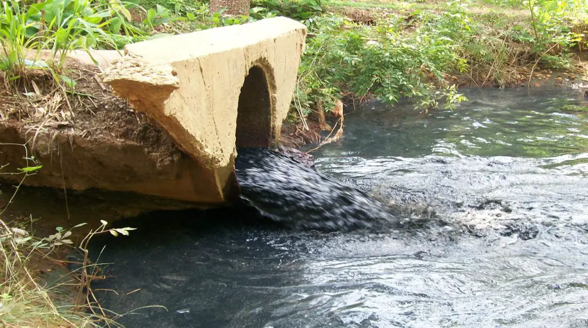
These rivers are being used to collect sewage, creating a serious ecological problem for the Lake of Valencia, which deserves the timely involvement of the Venezuelan government to resolve the situation and restore all the natural beauty to this lake, which is a source of life for the central region of the country.
If you have enjoyed reading this article, we invite you to find out more by clicking on the links below:
- Lake Titicaca
- Lake Baikal
- Guadalete River
- Magdalena River