
Last Updated on September 6, 2023 by Hernan Gimenez
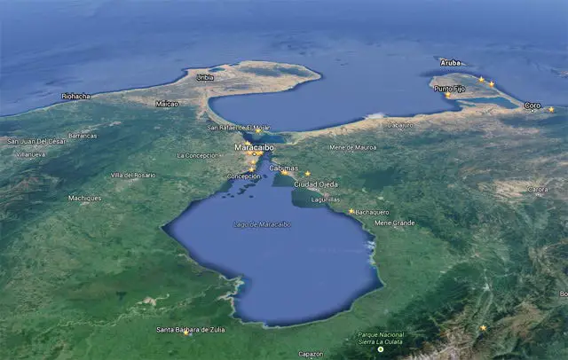
Lake Maracaibo is the largest lake in the Zulian region of western Venezuela, the largest lake in Latin America and one of the largest in the world. We invite you to learn about its history, national park, characteristics, flora, fauna, geology and much more about this emblematic lake.
History of Lake Maracaibo
Lake Maracaibo is a symbol for all Venezuelans, its history begins with the first chronicles that have been preserved about it, where it is stated that on the 24th of August 1499, Alonso de Ojeda, a Spanish conquistador navigator, travelled along the coast of Venezuela from Paria to the place known as Cabo de La Vela.
During this journey, he entered a water channel known as the Barra del Lago de Maracaibo and continued his journey along the coast belonging to the Gulf, which he called Coquivacoa, to find himself face to face with the enormous lake, which at that time was baptised the name of San Bartolomé, as its discovery coincided with the day of this saint.
The years went by and the German Ambrosio Alfinger, also a conqueror of the American territory under the command of Emperor Charles V, arrived at its waters when these lands were in the hands of the Spanish Crown and proclaimed himself the second governor of the province of Venezuela between 1529 and 1531.
During his mandate, on the 8th of September 1529, Alfinger changed the name of Lake San Bartolomé to Lake of Our Lady, and at the same time founded the glorious city of Maracaibo, today the capital of a Venezuelan state identified as Zulia.
According to the stories of the time, Alfinger landed in a small indigenous village at the tip of the Haticos, now known as Santa Lucía. There he became popular with the inhabitants and managed to increase the number of settlers in order to build a city, in accordance with the Spanish monarchs’ objective of finding good cities and fortresses.
Since the small indigenous village that existed at the time was called Maracaibo, the same name was chosen for the city. Thus the lake became known as Lake Maracaibo, an excellent means of communication between the Caribbean Sea and the lands that made up New Granada, which was made up of the territories that are now Ecuador, Colombia, Panama and Venezuela.
Through its basin it was possible to access a series of navigable rivers that allowed fluvial transport to all the surrounding regions and even further, as far as these rivers would allow. The city of Maracaibo began to grow thanks to the goodness of its lake, which allowed the adequate transfer of goods in a bilateral way, becoming an important port city.
In 1914, at the beginning of the 20th century, the exploitation of the oil well known as Zumaque 1 made Venezuela and the whole world aware of the great oil potential hidden in the depths of Lake Maracaibo.
Later, in 1922, the Barroso 2 oil well was discovered, making the world famous for its black gold, while the lake was filled with towers for the commercial development of oil exploration and exploitation, which altered its geology by dredging a channel for the passage of large ships that transported the crude oil.
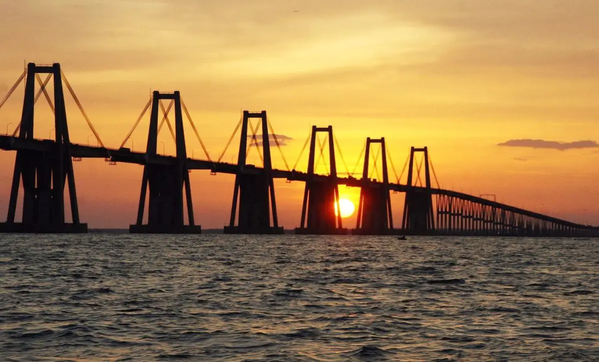
In 1962, during the government of President Rómulo Betancourt, a colossal bridge was built over this great lake, inaugurated under the name of General Rafael Urdaneta. The purpose of this architectural marvel was to connect Punta Iguana, on the eastern shore of the lake, with Punta de Piedras, on the western shore.
The bridge over Lake Maracaibo is about eight kilometres long and took almost four years to build. At the time, it was the longest prestressed bridge in the world.
Characteristics of Lake Maracaibo
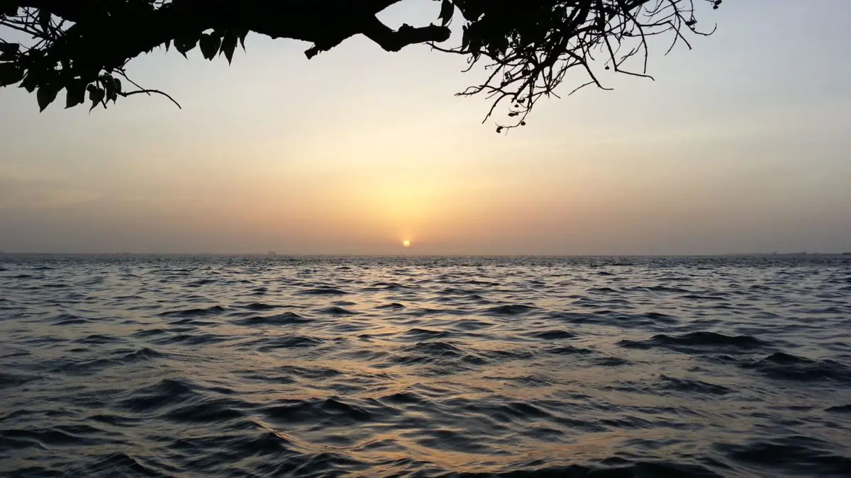
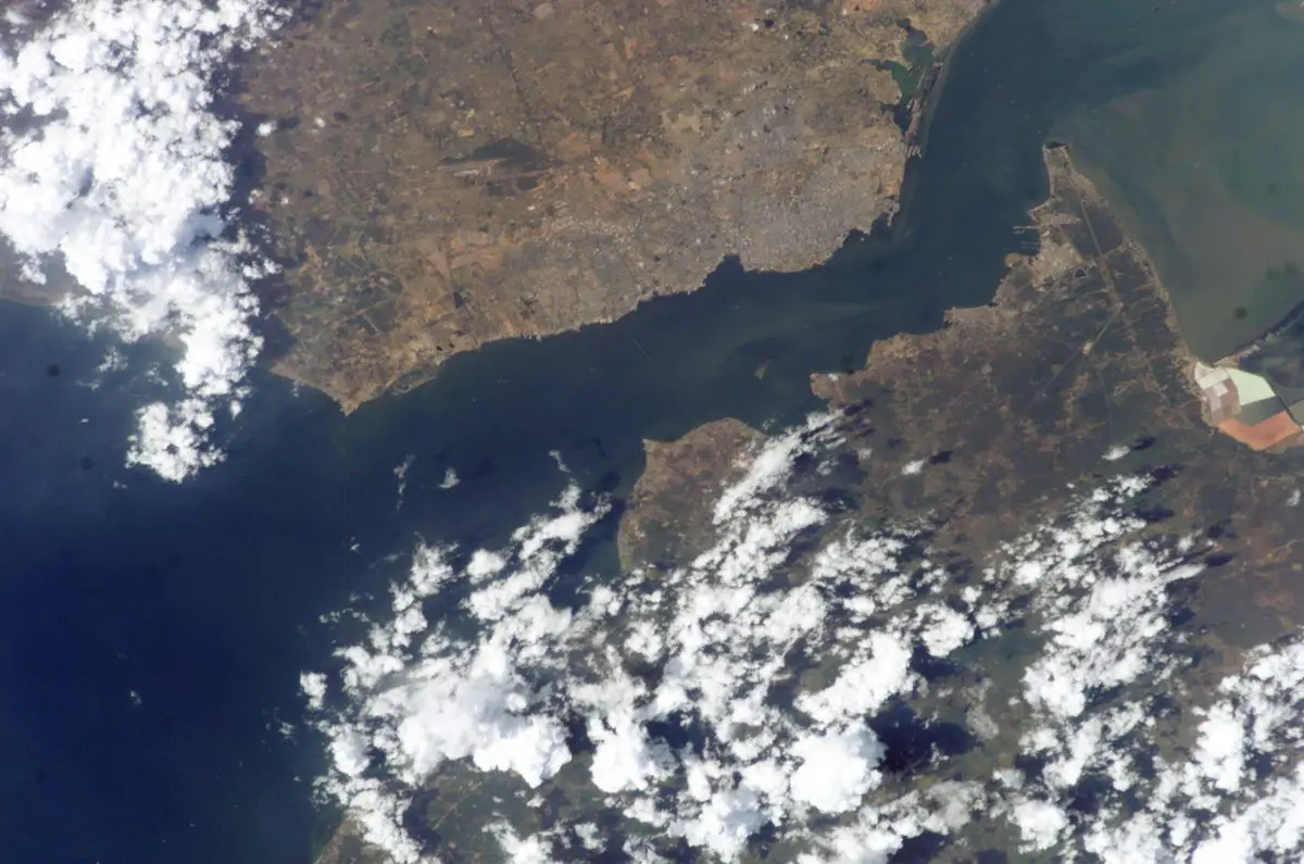
Lake Maracaibo has a number of characteristics that distinguish it from other lakes in the world, and perhaps its greatest peculiarity is that it is the only lake directly connected to the sea. Especially in its northern part, where, despite the freshwater discharges it receives, there are brackish sea tides.
A look at the characteristics of Lake Maracaibo reveals the following:
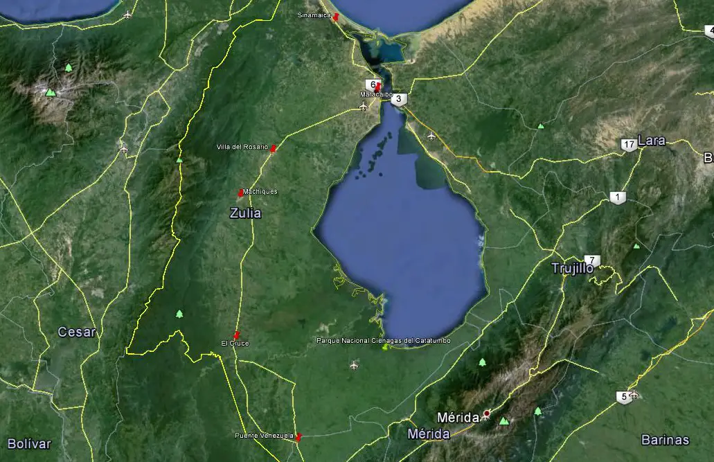
- It is located in three states of Venezuela: Zulia, Trujillo and Merida.
- It is considered to be a large, semi-enclosed bay of brackish water.
- Its has an estimated surface area of 13,820 square kilometres, with a depth of 46 metres and an altitude of three metres above sea level; it also and 728 kilometres of coastline.
- The lake has a maximum width of 110 kilometres, a length of 160 kilometres and a depth of 50 metres during the rainy season.
- It is the largest lake in Latin America and is approximately 36 years old.
- It is connected to the Gulf of Venezuela by a narrow stretch of about 55 kilometres.
- It is fed by several rivers, the largest of which is the Catatumbo, which originates in Colombian territory, but there are also the following tributaries: Chama, Escalante, Santa Ana, Apón, Motatán, Palmar and others.
- It has a large amount of oil reserves in its basin, with more than 15,000 wells drilled since 1914.
- In this lake there is a beautiful spectacle known as the Catatumbo Lightning, where about 1176,000 flashes occur in a year, something of incalculable value in replenishing the entire atmospheric ozone layer of the planet, which the indigenous people called Coquivacoa.
Climate of the Lake
The climate of the region around Lake Maracaibo is tropical and humid, due to the fact that its water masses cause the air temperature to rise, which makes the lake and the whole city quite hot.
Summers are short, very hot and cloudy, but winters are long, although the heat is maintained by the presence of cloudy skies. In general, the temperature ranges between 28°C and 40°C throughout the year, with no major variations.
Another element related to the climate is the one that occurs south of Lake Maracaibo, known as the Catatumbo lightning, which is manifested by the presence of a large number of flashes that occur almost continuously, like a great light show that illuminates the sky of this city.
The origin of this event lies in the fact that the clouds develop vertically and generate a series of electrical discharges that can be observed between one and four kilometres high. This is due to the high humidity on the surface of Lake Maracaibo, combined with a series of winds and the altitude of the lake basin in relation to the surrounding mountains, the Sierra de Perijá and the Cordillera de Merida.
An interesting aspect of the rainfall over Lake Maracaibo is that it is higher in the south of the basin than in the north. The trade winds cross the surface of the lake in a north-east-south-west direction.
Flora, Fauna and geology
If we start with the geology of Lake Maracaibo, we find that it is part of a tectonic rift that formed during the Jurassic period, more precisely during the Mesozoic era, when the Earth lived more than 145 million years ago. The lake was formed as a rift, or elongated tectonic crack, which originated from the separation of Pangaea, the name given to the Earth when it was a large continent separated by the movements of tectonic plates.
After that, the lake went through several phases of formation, with different sizes, being part of the sea or dry. However, since the Pliocene Epoch, 2.59 million years ago, it has been a freshwater inland lake. The basin of Lake Maracaibo is marked by three geological faults: Oca-Ancón, Boconó and Santa Marta, which makes it a region considered a potential seismic risk zone.
According to its geology, this lake was born in the Miocene Epoch, more or less five million years ago, with the appearance of advanced mammals, and during the following geological period it became the current depression that is Lake Maracaibo as it is known today, whose shores were defined by all the rivers that flow into it. This is how the southern delta of the lake was formed, with the confluence of rivers such as the Escalante, Santa Ana and Catatumbo.
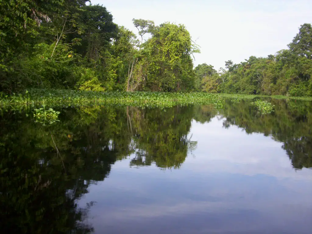
Lake Maracaibo has water that is considered to have sufficient oxygen, which makes it rich in algae and therefore fish. It has an enormous variety of fauna and flora.
Among the animals found in the lake are: caimans, herons, shrimps, iguanas, blue crabs, catfish, pelicans, groupers, bocachicos, mullets, yellow fish, some peacocks and even dolphins.
There are even some species endemic to the lake basin, such as the Lamontichthys maracaibero, a fish of the Loricariidae family that needs oxygen-rich water to survive.
Among the species that make up the flora of the lake, there are many coconut trees, although on the mainland there are other tree species such as the apamate, the cují yaque, the vera and some other exotic species such as the nim, which is cultivated to reduce the high temperatures that are present almost all year round, as it requires little water and care and provides a lot of shade.
Its islands
Lake Maracaibo has a series of paradisiacal islands surrounded by lush beauty, full of vegetation, diverse fauna and colonial architecture.
Some of these islands are of sedimentary origin, as in the case of Pescadores, Zapara or San Carlos and others of tectonic type, like the island of Toas, but very interesting and attractive to tourists, counting also with some of artificial type. Among the long list of islands in the lake are the following:
Natural
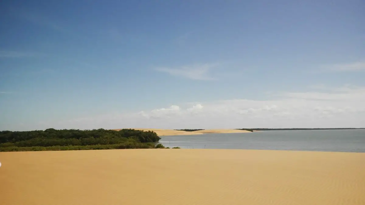
- Zapara Island, located at the entrance to El Tablazo Bay, with a fortress built during the colonial period; it is seven kilometres long and is mostly covered by sand dunes or sand formations that reach up to thirty metres high, with coconut trees and reefs.
- The island of San Carlos is located in the north of Zulia, separated from the municipality of Páez by the Bay of Urabá. Its historical heritage is represented by the Colonial Castle of San Carlos, built in 1643.
- Isla de Toas, to the south of the San Carlos peninsula, with a surface area of three kilometres, with the El Toro and Aracho salt mines, some deposits of lignite sulphur, clays and copper minerals, which have been industrialised to produce cement.
- Providencia Island, located in the Bay of Tablazo, in the municipality of Almirante Padilla, in the department of Zulia, with an area of one square kilometre.
- Isla Los Pájaros, also known as Isla del Diablo (Devil’s Island), located in northwestern Venezuela, in the municipality of Santa Rita, in the state of Zulia.
- Isla de Pescadores is located in the northwest of Venezuela and belongs to the insular municipality of Almirante Padilla in the state of Zulia, with an area of two square kilometres.
- The island of El Burro, two minutes by boat from the community of Santa Rita, is a strip of land about three square kilometres wide and two kilometres long. It is deserted and forgotten.
- Isla Hicacal, is located about 16 kilometres from the city of Maracaibo.
Artificiales
- Isla Dorada, built as a residential complex in the parish of Coquivacoa, in the city of Maracaibo.
- Isla La Salina is built on the shores of Lake Maracaibo, specifically on its eastern shore, opposite the city of Cabimas. It was originally built to store deposits and hydrocarbon tanks, with its own docks.
Lake Depression
The Maracaibo Lake depression is a tectonic trench that gradually sinks as the Perijá and Andes mountains rise.
Several studies have been carried out on the subsoil where the depression is located, since it is considered to be a phenomenon that only occurs in very few parts of the world; on the one hand it sinks, but on the other it contains the greatest source of Venezuela’s wealth, as well as the mouth of the Caribbean Sea.
The question is whether the riches in the subsoil of Lake Maracaibo will continue to sink or whether they can be extracted as before.
The subsoil in the lake’s depression is made up of sandstones, shales and other rocks of different geological ages, which can be drilled to extract valuable resources such as gas and oil.
But all this is not for free, as the lake has suffered a series of damages that have killed off much of its marine flora and fauna, making it a polluted lake, mostly used for shipping or oil activities.
The depression of Lake Maracaibo has a flat relief, in contact with the Sierra de Perijá and the Sierra de Siruma, but this depression is no more than about 80 centimetres, with irregularities, over an area of about 15,000 square kilometres.
Affluents of Lake Maracaibo
This important lake, located in the state of Zulia in Venezuela, has one hundred and thirty-five tributaries, some more important than others, but in general all of them are essential for the ecological maintenance of this great lake. Let us mention some of them.
Among the most important tributaries are the rivers: Catatumbo, Escalante, Chama, Motatán, Limón, Palmar, Aricuaisa, Apón, Bravo, Onía, Misoa, Tucaní, Santa Ana, Burro Negro, Caús, Machango, Mene, Ulé, Tamare, Aurare, and many others.
The Lake Maracaibo system is completed by the Maracaibo Strait, which is about 55 kilometres long and is located in the northern part of the lake, the Bahía El Tablazo, a coastal area between two capes, but smaller than a gulf, and the Gulf of Venezuela, located in the southern part of the Caribbean Sea, as part of northern South America, specifically between the peninsulas of Paraguaná and La Guajira.
The Maracaibo Basin
Two formations of the famous Andes penetrate Venezuela, represented by the Sierra de Perijá, which forms the border between Venezuela and Colombia, and the Cordillera de Mérida.
In the region between the Andes and the Cordillera de Mérida is the Maracaibo Basin, which is identified as a flat-bottomed basin with the lake in the centre. This basin has been world famous since the discovery of a series of oil and coal deposits in its subsoil around 1914.
The northern part of the basin, together with the Gulf of Venezuela, is characterised by a dry climate and arid vegetation, and is the most densely populated and has seen the greatest industrial development, with the city of Maracaibo as the driving force behind this development.
However, the further south you go, the more humid it becomes, and there is evidence of marshland in the southern and south-western parts of the lake, where there are extensive developments dedicated to both agriculture and cattle ranching.
At this point, it is important to mention that the exploitation of hydrocarbons and minerals is the main cause of deforestation in the Maracaibo basin. It is therefore necessary to raise awareness and find ways of reforesting the area, which is an important source of water for many of the inhabitants.
This lake, as mentioned at the beginning of this article, is an exceptional geographical phenomenon in the world, as it is the only lake that is directly connected to the sea, and it is therefore the duty of all those connected to this natural wonder to preserve it through the rational use of all the resources it provides.
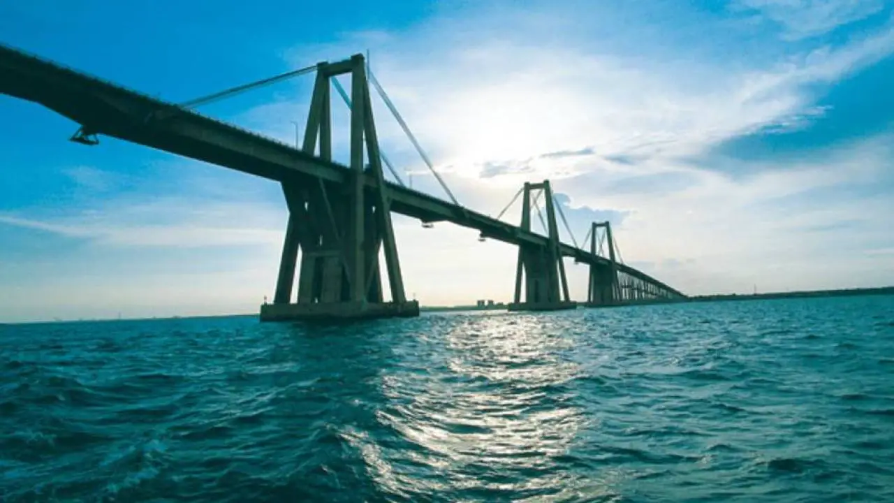
Bridge over Lake Maracaibo
The bridge over Maracaibo Lake is called the General Rafael Urdaneta Bridge, 8,678 metres long and 17.40 metres wide, made of reinforced concrete, cable-stayed by the engineer Riccardo Morandi, inaugurated on 24 August 1962 under the government of Rómulo Betancourt.
This bridge was built at the narrowest point of the lake to connect the city of Maracaibo with the rest of Venezuela. It connects the western shore of the lake with the eastern shore, with two channels in each direction for vehicular traffic, and its height above the water allows the passage of boats up to forty-five metres high.
Popular history of Our Lady of Chiquinquirá
Our Lady of the Rosary of Chiquinquirá is the patron saint of many regions of South America, including Colombia, Venezuela, especially the state of Zulia, and the city of Caraz in Peru. For the people of Zulia, she represents their popular Chinita, a symbol that all the inhabitants of this region of Marabá carry in their hearts and to whom they pay homage throughout the year, but especially on her day, 18 November.
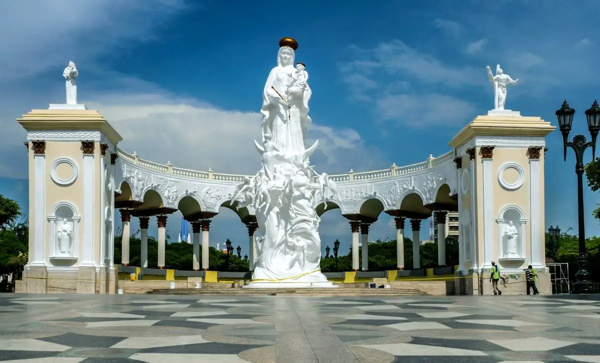
On this day, the city practically comes to a standstill to celebrate, with infinite devotion and love, the Virgin of Chiquinquirá in the Land of the Beloved Sun, as the city of Maracaibo is affectionately known. She is part of the legends and stories with which the inhabitants of this Venezuelan region grow up, where it is said that Chinita arrived in Maracaibo on the waves of its immense lake.
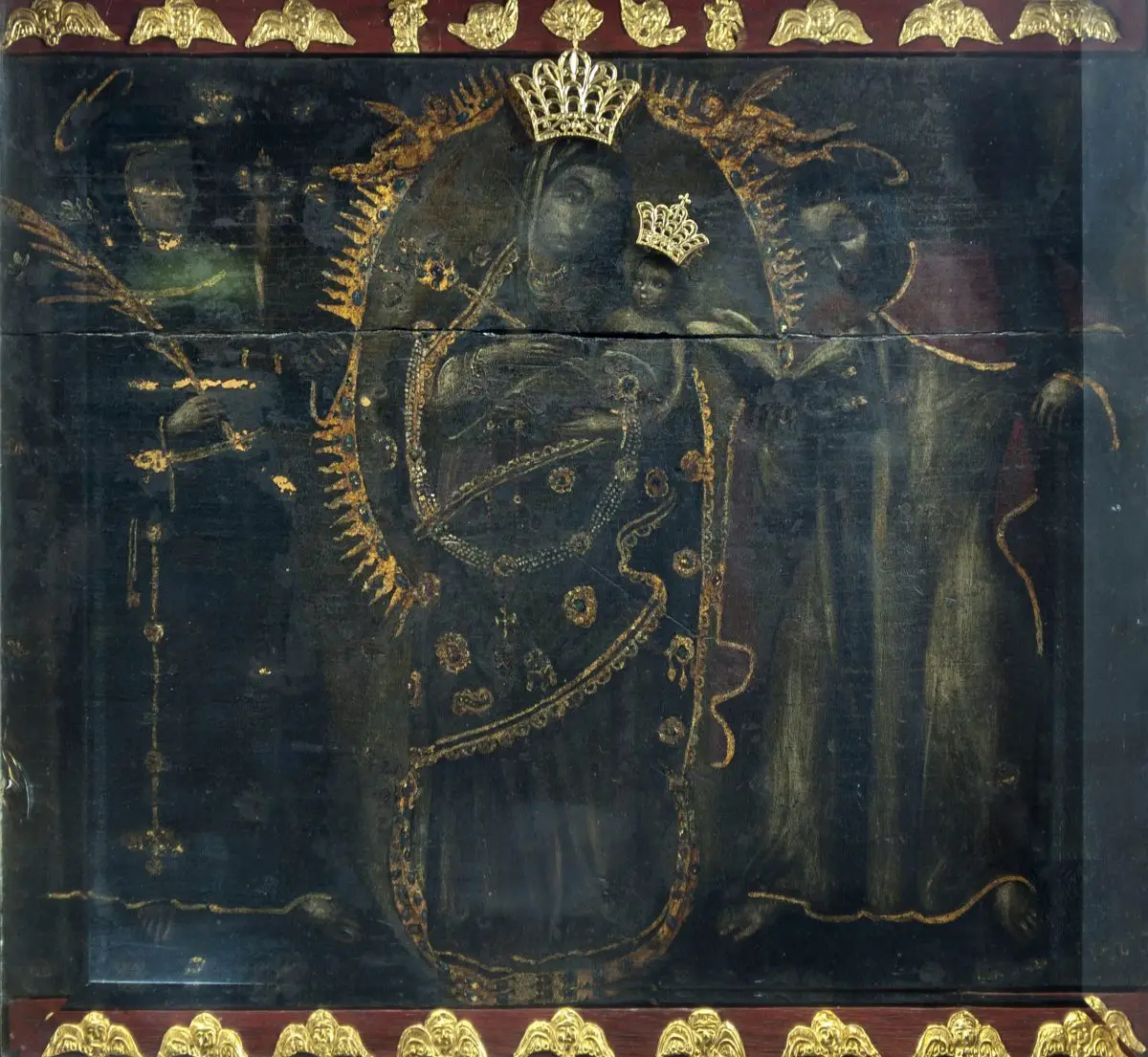
The story goes back to the year 1709, when a humble washerwoman, identified as María Cárdenas, was doing her work on the shores of Lake Maracaibo when she saw a small board arrive, which she took and carried back to her house to cover her water jar, a clay vessel traditionally used for this purpose.
Some say that the board could have fallen from a boat that was sailing on the lake, but on the 18th of November of the same year, while the woman was making coffee, she noticed that there was an image of the Virgin on it, so she decided to hang it on the wall as part of her decoration.
Then she heard a knocking, as if someone was calling her, and as she approached she was dazzled to see the image on the plaque radiating a spectacular light. Her neighbours came to see what was happening to the woman, and they also witnessed that there was a holy image of the Virgin on the plaque.
As the years went by, the authorities decided to organise processions in honour of Chinita, the Virgin of Maracaibo. The Virgin was carried on the shoulders of the people in the procession through the city of Maracaibo, until the image became so heavy that it was difficult to carry it.
After prayers and petitions to heaven, one of the people present said: “Perhaps the Virgin does not want to go to the Mother Church and prefers the Church of San Juan de Dios”. It was then that they decided to change the route of the Virgin’s procession, from the ostentatious cathedral to a humble church that was a refuge for the prayers of the city’s poor.
At that moment, the image regained its normal weight, as proof that the faithful had followed the path chosen by the Virgin. That is why, since that day, her beloved Chinita has protected them from her temple, now consecrated as the Basilica of Our Lady of the Rosary of Chiquinquirá.
For this reason, the Lake of Maracaibo is intimately linked to the Virgin of Chiquinquirá, and the two together represent the deepest feelings of all the people of the Zulia region, who for almost 100 years have been paying her religious homage with a series of popular activities that have become a celebration throughout Venezuela and even beyond its borders.
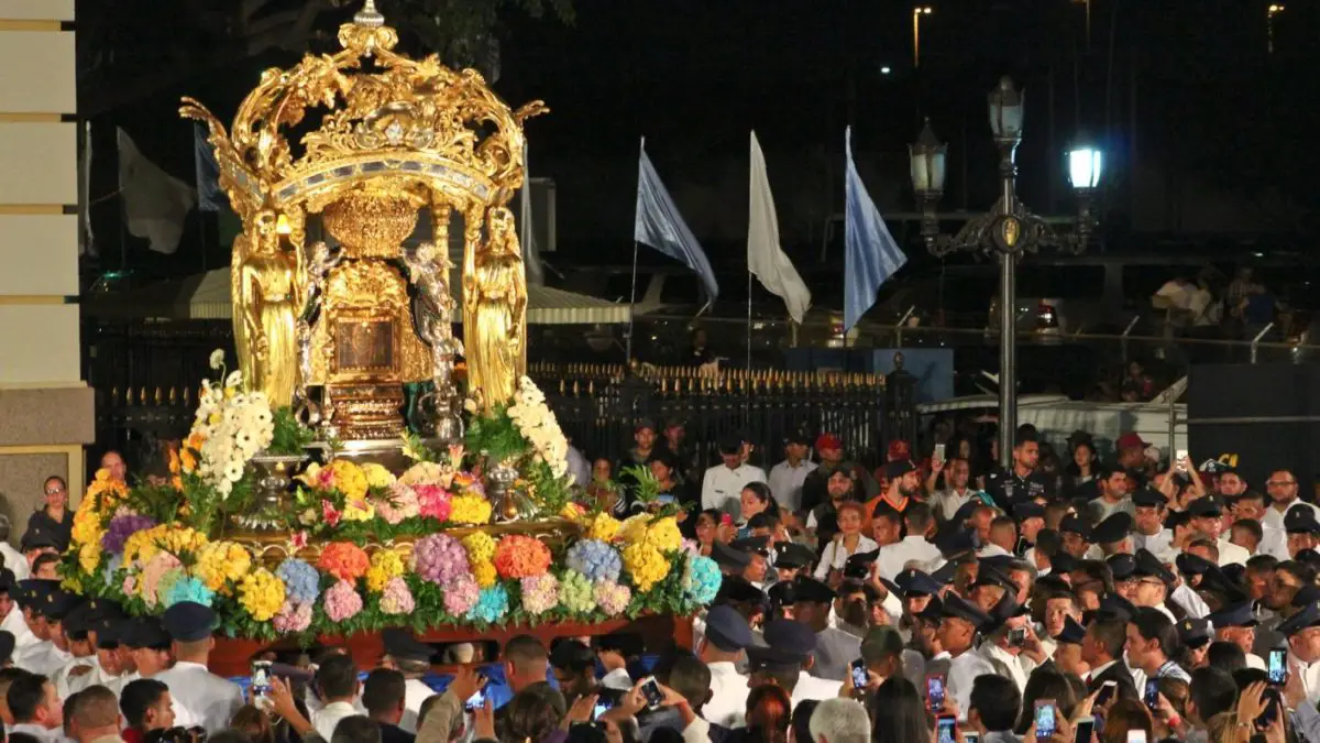
This festival, known as the Feria de La Chinita, is a major tourist attraction that is still held today, with the performance of traditional gaitas, which are representative of an original musical genre of the state of Zulia, in which most of the lyrics are dedicated to the Virgin, Lake Maracaibo and the state of Zulia.
The festive activities in honour of the Virgen Morena, as she is also known, are centred around a series of events such as those mentioned below:
- La Bajada de la Virgen, where she is lowered from her camerán and reunited with her people.
- Procession and walk that takes place on the descent and on the day of La Chinita, where all the people walk with their patron saint.
- Aurora de la Chinita, a Eucharist that takes place at dawn.
- Procesión Lacustre, a procession on the lake of Maracaibo as a representation of the origin of the Virgin.
- Serenata a la Virgen, an impressive manifestation of faith in which all the people gather at the doors of the Basilica at dawn on 18 November to wish their Virgin Marabina a happy birthday.
Pollution problems
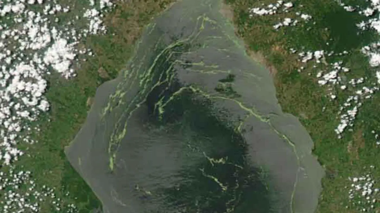
All the development of the Zuliana region, where Lake Maracaibo is located, and especially after the unscrupulous oil exploitation, has led to the total pollution of the lake.
Unfortunately, after having known this lake as one with clean and oxygenated waters, the oil exploitation has caused the presence of innumerable spills, due to mechanical failures that lead to the grounding of large ships, causing the bottom of the lake to turn black, which is very visible, especially on its shores, where the rocks are covered with this sticky substance that is oil.
On the other hand, there is also the polluting influence of a series of nearby crops, in which pesticides and fertilisers are used and which run off into Lake Maracaibo, resulting in the appearance of a large quantity of duckweed, identified as Lemna obscura, which takes advantage of the remaining fertilisers to grow and multiply, reaching dimensions of up to 15% of the total surface of the lake.
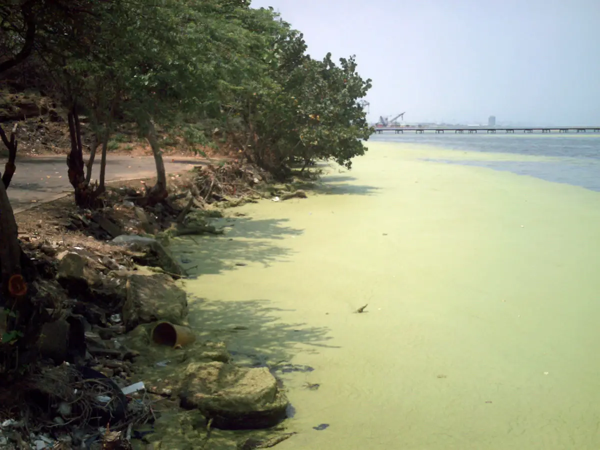
The presence of this type of fluvial pest prevents light from penetrating into the depths of the lake, causing a dramatic change in the entire ecosystem and destroying many of the algae and plants on the bottom of the lake, as they are unable to photosynthesise due to the lack of light.
In the end, some of the lemons also die, but they leave behind their residues, which are toxic emissions that cause a series of lung diseases and allergic reactions in people who use the lake for bathing.
But that is not all, because this great lake is also used as a garbage dump and a sewer for a large part of the city of Maracaibo, Cabimas and other neighbouring towns, who are not aware of the damage they are causing to this lake that was given to them as a gift by nature.
For all of the above reasons, it is imperative that a series of measures be taken that will allow a real clean-up to take place, but the first of these is to raise awareness, both on the part of the Venezuelan government and among all its citizens, that the lake needs to be cared for and recovered, not only to take advantage of all the resources it offers, but also to sustain the economy of this nation.