
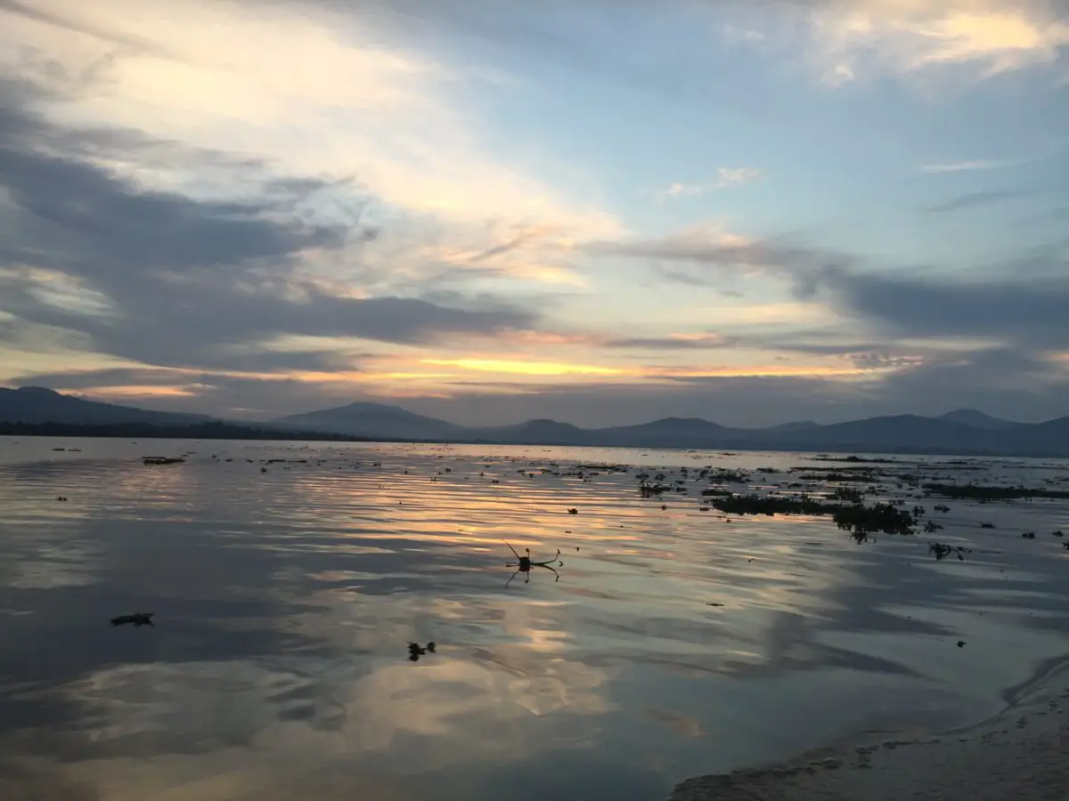
Lake Patzcuaro is located in the state of Michoacan, Mexico, 63 km west of the city of Morelia. It is one of the most important tourist attractions in the region. Its history and archaeological culture are the pride of its inhabitants. Find out all about Lake Patzcuaro.
History of Lake Patzcuaro
Today, Lake Patzcuaro is a reserve of historical, archaeological and cultural sites with the greatest tourist attraction in the state of Michoacan.
Among its inhabitants are the indigenous Purepecha people, who live in settlements from Morelia to Uruapan.
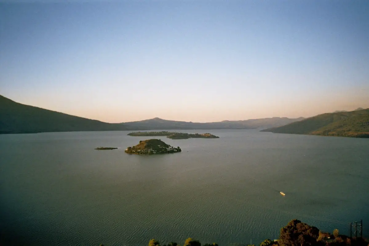
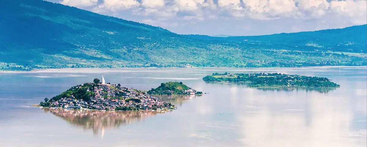
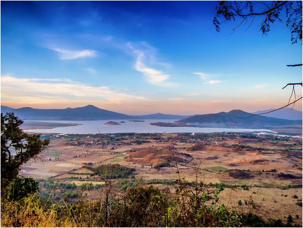
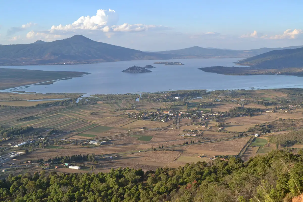
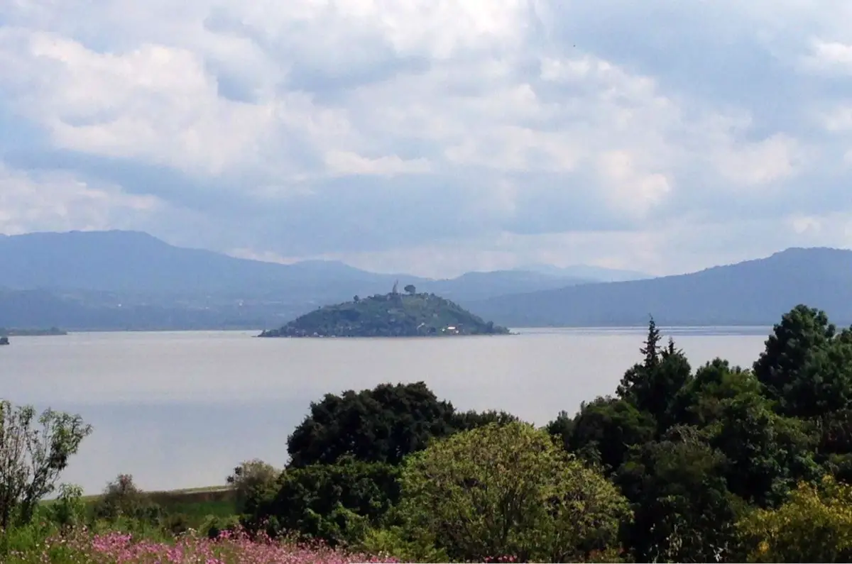
The lake has 55 kilometres of coastline and along its entire length it is possible to find seven islands, among which stand out: Janitzio, La Pacanda, Yunuén, Tecuena and an islet identified as Copujo, located near the island of Tecuena, Jarácuaro.
But the history of the lake is linked to the ancestors who populated Patzcuaro. It is said that the Chichimeca chieftains, Páracume and Vápeani, found the ideal place for their settlement in these lands, because there were four rocks together.
The number four was very important to them because in their culture it represents the four cardinal points and the four points of the southern cross. They were immigrants from Iré-Ticáteme.
Due to the scarce evidence that has been found, dates are estimated and it is said that Patzcuaro was founded in 1324, using as a reference the dates of death of these two caciques, who died in 1360.
At that time, three different indigenous groups inhabited Lake Patzcuaro and its surroundings: the Coringuaro, the Isleños and, of course, the Chichimecas, who recognised Iré-Ticáteme as their oldest chief.
Later, the Tarascans were established in the area, initiated by Tariácuri, who was their first chieftain, so it is said that Patzcuaro was the first capital of the Tarascans.
Chief Tariácuri divided the region into three lordships: the first was identified as Ihuatzio, the second as Tzintzuntzan and the third as Pátzcuaro. Years later, he bequeathed the lordship of Patzcuaro to his son Hiquigare, and when he died it remained as a ceremonial centre.
Despite the fact that all the tribes that coexisted in the area had different languages and lived in conflict with each other, a commercial relationship based on barter or exchange existed between them.
When the Spanish colonisers arrived in the region of Mexico, the Chichimecs, who had become Tarascans, took refuge in Patzcuaro, where they maintained a position of resistance against the Spanish. The area where they fought is now known as Barrio Fuerte.
Despite their courage and bravery, the conquistadors were relentless and in 1526 the most bloodthirsty of the Spaniards, known as Nuño de Guzmán, arrived and attacked the indigenous population, killing the last Tarascan Calrzontzin and forcing the inhabitants of Patzcuaro to flee to the mountains.
In 1538, the Bishopric of Michoacan was founded in a desolate Patzcuaro, which became the capital of the province. Two years later, the Spaniard Vasco de Quiroga began to repopulate the area, taking with him several Indian and Spanish families, and many historians consider him the true founder of Patzcuaro.
Thus began the construction of the Cathedral, in the same place where the Indians had built the temple of the goddess Cueráppari. In 1565, after the death of Tata Quiroga, as the natives called him, Patzcuaro began to decline and the schools and authorities moved to Valladolid.
During the struggle for independence, Patzcuaro was the victim of several attacks that led to its political division, but in 1824 it became the capital of the XII District of the Western Department.
Later, in 1886, the construction of the Morelia-Pátzcuaro railway encouraged the arrival of foreign companies, which indiscriminately exploited the forests and the local workforce.
In 1913, Patzcuaro was the scene of civil wars, some of them revolutionary, others led by the Huerta government and others by the bandit Inés Chávez. It was not until 1920 that the reconstruction of the city began, with the aim of preserving the colonial and indigenous population.
Today, this area includes the municipalities of Erongarícuaro, Quiroga, Pátzcuaro and Tzintzuntzan. Both the lake and the islands are reflected in the city’s coat of arms.
As we have seen, the history of Lake Páztcuaro is linked to the city of the same name, which has witnessed battles, power struggles, revolutions and independence. Today, the lake is surrounded by 26 indigenous villages that enrich it with their history and legends.
However, Lake Patzcuaro is currently undergoing a process of desiccation caused by climate change, which is having a significant impact on the water level.
In addition, the pollution caused by the population growth on its shores and islands contributes to the proliferation of algae on its surface, as well as the irrational use of resources, high rates of deforestation and soil erosion, all of which work against Lake Patzcuaro and the need to implement timely policies and programmes for its conservation.
Characteristics
Lake Patzcuaro is located in the state of Michoacán, Mexico, 63 km west of the city of Morelia, as mentioned above. It can be reached from the state capital via Highway 14.
It has a surface area of 260 km², is 55 km long, 34 km wide and has an average depth of between 5 and 8 metres. It has a temperate and humid climate, with rainfall in the summer and an average annual temperature between 16°C and 24°C.
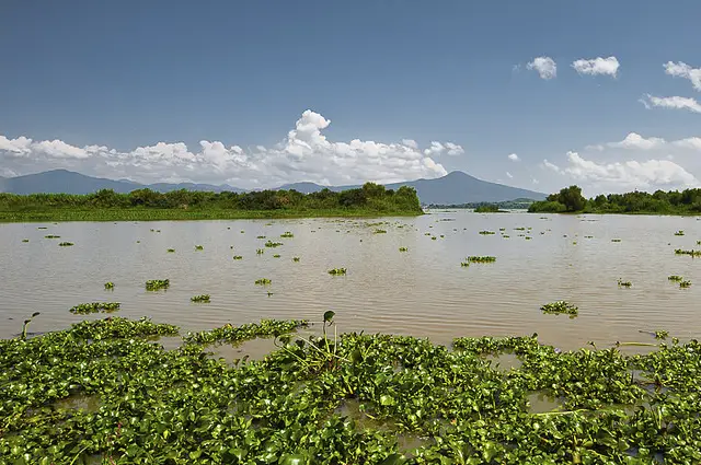
It also has light and moderate winds. Its water has a bluish-green colour due to its shallow depth and the presence of sediment.
For a long time, the lake has suffered from the intervention of its ecosystem, through the exploitation of its fishery resources, the modification of its coastal environment and the introduction of alien species of plants and animals, which have caused the modification of its natural biological characteristics.
Lake Patzcuaro is an endorheic lake, which means that it has no sewage and is fed by rainfall, surface runoff and springs.
Its main tributaries are the Grande de Morelia and the Queréndaro rivers, as well as some small thermal springs, but it also receives untreated sewage from the city of Morelia, which affects its productivity and the maintenance of its ecological balance.
Among its more specific characteristics, it has a trophic index with values between 70 and more than 100. Chlorophyll values are between 56 and 155, phosphorus concentrations are between 96 and 384 and light penetration is between 0.5 and 0.25 in depth.
Water losses are due to evaporation, transpiration by plants and abstraction by residents to provide the liquid needed for irrigation and electricity generation.
The average annual runoff of Lake Patzcuaro is 456 mm3 and evaporation is 766 mm3, leaving a deficit of 310 mm3 that must be compensated by rainfall. As a result, the lake is in a constant process of drying out, reaching an average annual water volume of 255 mm3.
Another important feature is the composition of the water. The various analyses carried out show that the predominant salts are carbonates and bicarbonates associated with sodium (61.5%), calcium (8.2%) and magnesium (13.2%); however, the concentration of sodium, magnesium and calcium is very low, which is why it is considered a soft water lake.
The soil of Lake Patzcuaro is very plastic and clayey, therefore it is not very permeable, it has a considerable amount of sulphate salt, potash and limestone that give it its salinity level, which is why its waters are salty.
https://www.youtube.com/watch?v=Jh38XsDqPoU
Climate of the lake
Lake Patzcuaro has a temperate sub-humid climate, with rainfall in the summer. The average annual temperature varies between 12ºC and 16ºC in the lake itself, while in the surrounding areas the average temperature is between 16ºC and 24ºC.
The average annual rainfall is between 1,000 and 1,200 mm. In the central-southern region, the climate is generally warmer and semi-dry, with average rainfall of 600 mm and a temperature of 27 °C.
Towards the north-west, the climate remains warm and sub-humid, with rainfall increasing to 800 mm and temperatures of 20 °C. The wettest months are identified as June to September.
The villagers classify the winds that blow over the lake into two groups, one of which heralds the cold seasons and is present during the dry period, circulating along the Quiroga-Tzintzuntzan corridor towards the lake. The other is present after the rains and is known as the southerly wind, which sometimes accompanies the trade winds.
Flora, fauna and geology
Lake Patzcuaro is an environment with an important biodiversity that develops in the different ecosystems that make up life in this region. We can start by mentioning the types of vegetation found on the islands and shores of Lake Patzcuaro, where we can find mixed forests of pine and oak, or mixed forests of pine and oyamel.
The oyamel, whose scientific name is Abies religiosa, is a tree native to southern Mexico, while oaks belong to the Quercus genus and are widespread throughout the world.
There is also vegetation typical of the low deciduous forest, which is characterised by a single layer not exceeding 15 cm in height. In most cases, it is easy to distinguish it from other plant communities, both in terms of its physiognomy and its floristic composition.
In other areas, grasslands and subtropical scrublands are established, as well as microphyllous desert scrub, mainly consisting of huizache-mezquite associations.
The huizache is a secondary vegetation species that generally establishes itself in ecosystems where tropical broadleaf forests used to be. It is therefore a species that establishes itself in areas that have been disturbed. Mesquite is a leguminous plant of the genus Prosopis and is a shrub that can develop into a tree.
Halophilic vegetation is also characteristic of these saline soils, and we must not forget the presence of aquatic and subaquatic vegetation, since in Lake Patzcuaro there are different types of habitat, such as flat or shallow waters, rivers, streams, wetlands, among others.
The vegetation of Lake Patzcuaro itself includes the following species Clethra mexicana, Arbutus xalapensis and Garrya laurifolia. Pine species include Pinus michoacana, P. leiophylla and P. lawsonii.
The holm oak woods consist of Quercus candicans and Q. castanea, while the aquatic vegetation includes Bacopa monnieri, Bidens aurea, Ceratophyllum demersum, Eleocharis montevidensis, Cyperus niger, Lemna gibba, Sagittaria latifolia latifolia, S. platyphylla, Scirpus californicus, S. validus, among others.
The riparian vegetation includes Salix bonplandiana and Taxodium mucronatum. Finally, among the plant species endemic to Lake Patzcuaro are Arenaria bourgaei, Panicum sucosum and Sagittaria macrophylla.
In terms of fauna, Lake Patzcuaro is home to five commercially important species of fish: the famous white fish, which is in danger of extinction; the black bass, a trout; the acúmara, tiruhs and cheguas, charal, freshwater catfish and mojarras, to name the most important.
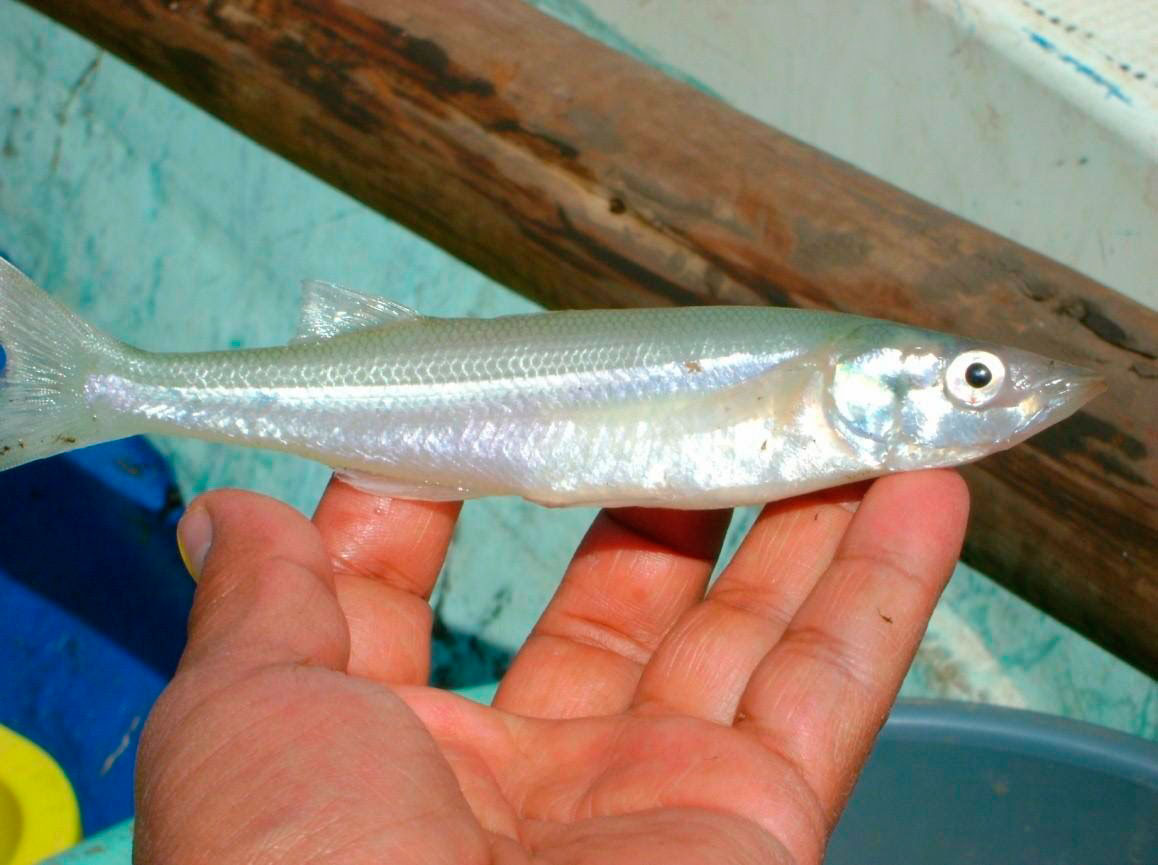
Other fish endemic to Lake Patzcuaro include Chirostoma patzcuaro (possibly extinct), Algansea lacustris, Allotoca dugesi, Chirostoma attenuatum, Goodea atripinnis, Notropis calientis and Skiffia bilineata, among others.
As for the species associated with the terrestrial habitats of the lake, there are some domestic animals that coexist in each of the human settlements on its shores, including poultry.
Mammals include the skunk Conepatus mesoleucus, the weasel Mustela frenata, the opossum Didelphis virginiana, the badger Nasua narica and the rabbit Sylvilagus floridanus, among others.
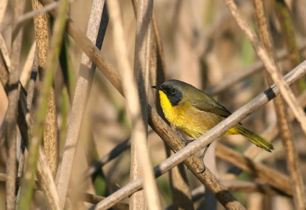
Birds such as the thrush, gull and swallow are also present. The bird Geothlypis speciosa is endemic to the lake area. Unfortunately, this natural area has also suffered from the introduction of alien species, which has had a negative impact on the region’s native flora and fauna.
Among the exotic fish introduced into the lake is the largemouth bass, an exceptional predator with an undemanding diet and a high reproductive rate, which competes with the white fish and preys on most of the native species in the lake.
The carp is native to Asia and was accidentally introduced. As it feeds on lake sediments, it causes resuspension of particles, increasing water turbidity, as well as removing and ingesting eggs of native species.
To counteract the effects of these species, mojarra and guatapote del Lerma have been added for ecological regulation purposes, but their effects have not yet been studied.
Geologically, the area of Lake Patzcuaro is of volcanic origin, where basaltic and andesitic rocks predominate. Geological and biological evidence suggests that the basin was initially open and was part of the water system formed by Lakes Zirahuén, Pátzcuaro and Cuitzeo.
Later, tectonic processes separated these lakes, each forming its own basin, becoming an endorheic or closed basin.
Islands of Lake Patzcuaro
Lake Patzcuaro is a beautiful ecosystem and is classified as one of the highest lakes in the world, the highest being Lake Titicaca, which forms the border between Peru and Bolivia.
It also has countless stories and legends related to its first inhabitants, the Purhépechas, and their origins. Within its surface it has more than seven islands, which we will talk about below:
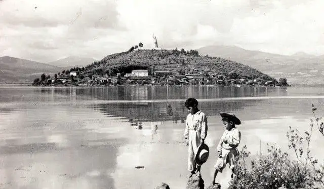
Janitzio Island
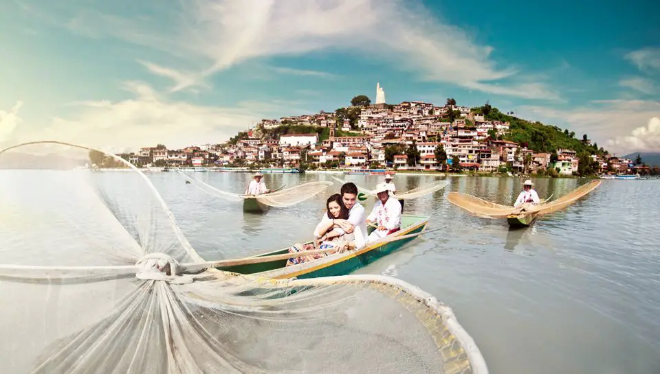
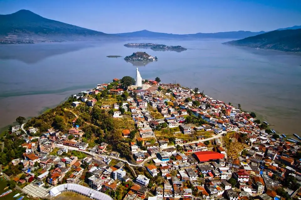
Janitzio is the largest and most populated island of Lake Patzcuaro, its name means “corn hair”, as the Mexicans usually refer to the ear of corn. This island is located in the southern part of the lake, just off the city of Patzcuaro.
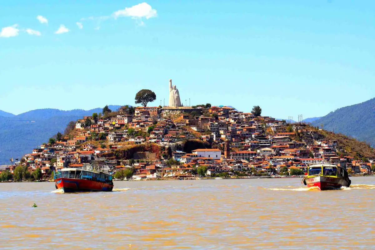
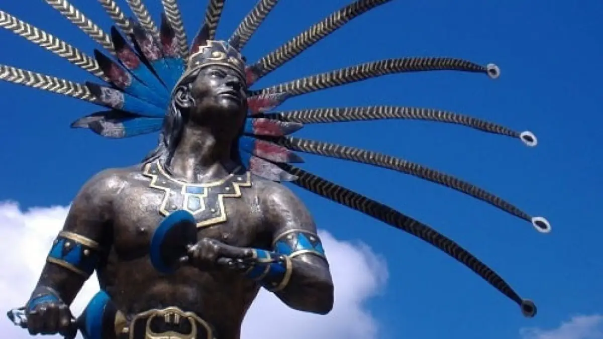
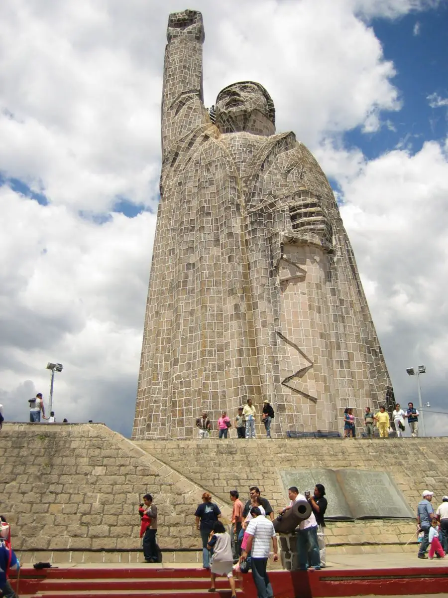
It is one of the most visited islands in the whole lake, it has pre-Hispanic origins and one of the main attractions it offers are the boat trips. It is very well developed to take care of the tourists that visit it, so when you arrive in Janitzio you will find several offers. One of the attractions offered by the island is to visit and see the statue of Don Jose Maria Morelos.
Inside you can enjoy the murals that decorate the interior of the statue, telling the story of Morelos and the War of Independence.
This statue is located on the highest part of the island, so it also offers one of the most spectacular views of Lake Patzcuaro.
During your visit, you can buy some of the beautiful handicrafts made by the locals or sample some of the traditional food of the region, as there are different options, from restaurants to street stalls, and both are run by the islanders themselves, who will not hesitate to tell you the typical stories of the place.
Island of Jarácuaro
Jarácuaro Island is located on the western shore of Lake Patzcuaro and its name refers to the place where the god Xaracua is worshipped. The island is connected to the mainland by a bridge and can be reached by car.
Its inhabitants are of the Purepecha ethnic group, who preserve their language and traditions, so a visit to the island is an opportunity to get to know this beautiful culture up close.
You can also enjoy their handicrafts, which are based on the use of palm fibres, which the inhabitants weave into thin and delicate braids that are later used to make beautiful hats, tablecloths and tortilla holders. This material also lends itself well to embroidery.
Pacanda Island
Pacanda Island is located in the middle of the lake and is the second largest island after Janitzio Island. Its name means “you push something into the water”.
One of the island’s attractions is a beautiful internal lagoon that offers unparalleled beauty. It is teeming with commercially important species such as carp and ducks, which are also a source of livelihood for the people of Pacanda Island.
The island’s economy is based on agriculture, where the soil and topography allow. It is worth mentioning that this is one of the best preserved natural areas, offering an environment full of nature and tranquillity.
Tecuena Island
Tecuena Island is the smallest island in the lake. Its name has a beautiful meaning that translates as “good honey” and it is located to the north of Janitzio Island.
Urandenes Islands
They are a group of three islands south of Lake Patzcuaro, surrounded by beautiful channels. The name Urandenes means ‘raft’.
These islands offer a preserved and safe environment for the important white fish, which is threatened by competition from introduced species.
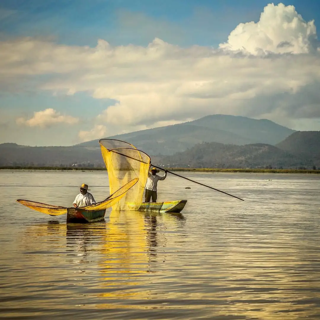
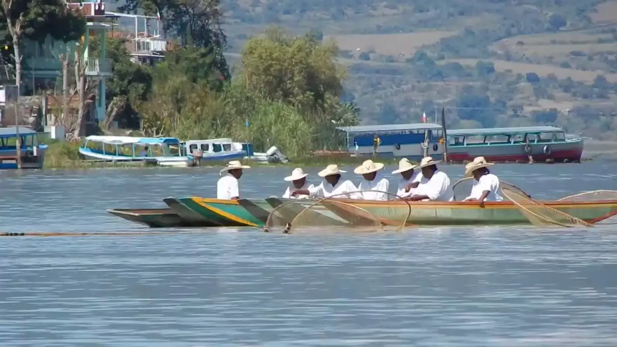
The Urandenes Islands are therefore the most important reserves of whitefish in the area. The inhabitants of the islands are experts in the use of fishing gear known as butterfly nets. It is a privilege to visit the islands and admire their skill in using these nets.
Yunuen Island
Yunuen Island is relatively close to Janitzio Island, but unlike the hectic life on Janitzio Island, this island is very peaceful. Its name means ‘half moon’.
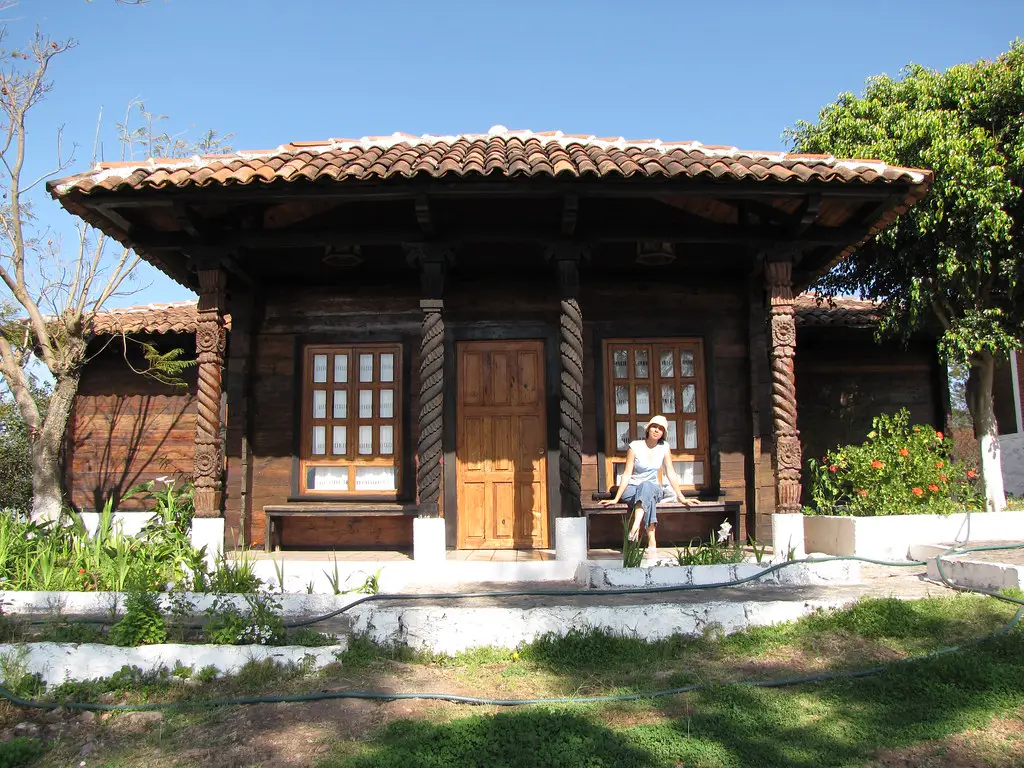
Its main attraction is its beautiful, dense and well-preserved vegetation, characterised by evergreen species. The architecture developed on the island, often based on the use of wood, is also noteworthy and has become a tourist attraction.
Yunuen Island is a nesting area, so it is always possible to see beautiful herons and various birds in the southwestern part of the island, which choose the tranquillity of the place as the perfect place for their nests.
There is also an attractive lighthouse surrounded by trees near the jetty. In addition, the locals have built a group of huts that offer all the services for the attention of its visitors. It is an ideal place for couples to enjoy and relax.
Economy of the lake
The Lake of Patzcuaro is widely known for the artisanal fishing that takes place in its waters, using butterfly nets made by the inhabitants of the region, which has become the main economic activity.
Water is undoubtedly the strategic resource par excellence on which the inhabitants of Lake Patzcuaro depend, and in this sense the lake is used for the development of a wide range of activities linked to the communities.
These include food supply, irrigation of crops, fish farming, electricity production, tourism activities linked to the lake and it also serves as a means of transport.
There is no doubt that this lake system is the lifeblood of the economic activities in the area and therefore needs to be conserved, while its resources need to be used in a sustainable manner through the implementation of effective and strategic community policies.
Secondly, tourism is another important economic activity around Lake Patzcuaro, although it is more developed in certain areas and islands, such as Janitzio, while it is still in its infancy in other islands of the lake.
Agriculture also makes an additional contribution to the subsistence economy, as the surplus from the harvests is sold, so it must be considered as an economic activity linked to the lake.
Among the crops grown in the region are: corn, beans, janamargo, lentils, barley, alfalfa, potatoes, wheat, beans and tomatoes.
Also worth mentioning are the handicrafts of each of the cultures that coexist around the lake, using wood and plant fibres, as well as clay to make pottery. But perhaps the best selling products are textiles, embroidery, tule mats and chuspata.
It would be important to develop forestry in the lake basin so that it becomes part of the region’s economy and not just an extractive resource.
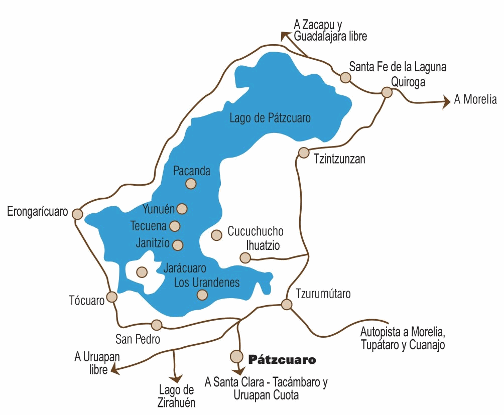
Map of Lake Patztcuaro
Below we offer you a map of Lake Patztcuaro, where you can see the shape of this body of water, the location of its islands, as well as each of the towns and communities that make up life in this beautiful natural corner.
If you have enjoyed this article, we invite you to learn more about these incredible lake systems through the following links:
- Lake Titicaca
- Lake Baikal
- Lake Texcoco