
The Barents Sea is one of the parts of the Arctic Ocean north of Norway and Russia, named after the Dutch navigator Willem Barents, one of the first pioneers of the European North. Discover all the information about this interesting and cold body of water, including its history, characteristics, climate, harbours, craters and much more, don’t miss it.
Introduction
The Barents Sea is an interesting body of saltwater, part of the Arctic Glacial Ocean, with a large surface area and home to a wide variety of the world’s flora and fauna, making it of great economic interest, especially to the nations that have coastlines on its shores.
It is a sea with harbours that belong to territories such as Russia or Norway; where its bays, capes, straits, peninsulas and even its inland island called Kolgugev, which belongs to Russia, stand out.
In short, a sea full of riches and great biodiversity, which we invite you to discover by reading our article.
History of the Barents Sea
We begin with a look at its history, as in most cases this is the first indication of what kind of sea it is, especially if it has been widely sailed and used by the ancient cultures present in the region.
In the case of the Barents Sea, records show that it was previously known as the Murmansk Sea, which is the name of a port city in Russia, but also by the name Murmanskope Morye, which is evidenced by maps from the 16th century showing it under this name.
The map in question was made by Gerard Mercator, a Flemish mathematician and cartographer, who published it as part of his atlas in 1595. It included the Pechora Sea, corresponding to the area formed by the mouth of the Pechora River.
The Barents Sea was given its present name in honour of Willem Barents, a famous Dutch explorer and navigator who played a leading role in the most important expeditions to northern Europe in the 16th century.
It is a well-known fact, not only in the case of the Barents Sea, but also in other seas, such as the Baltic Sea, that the world wars have made them part of their own conflicts, and the territories surrounding these seas have been dragged along with them.
During the Second World War, an armed conflict that took place between 1939 and 1945, the Barents Sea was the scene of numerous naval operations, including a battle between the British Royal Navy and the German Kriegsmarine in late 1942.
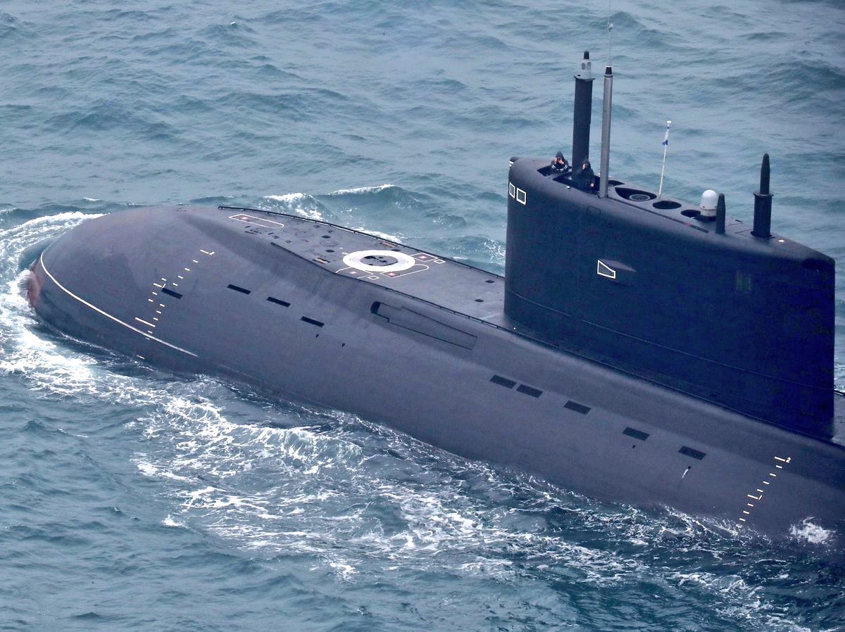
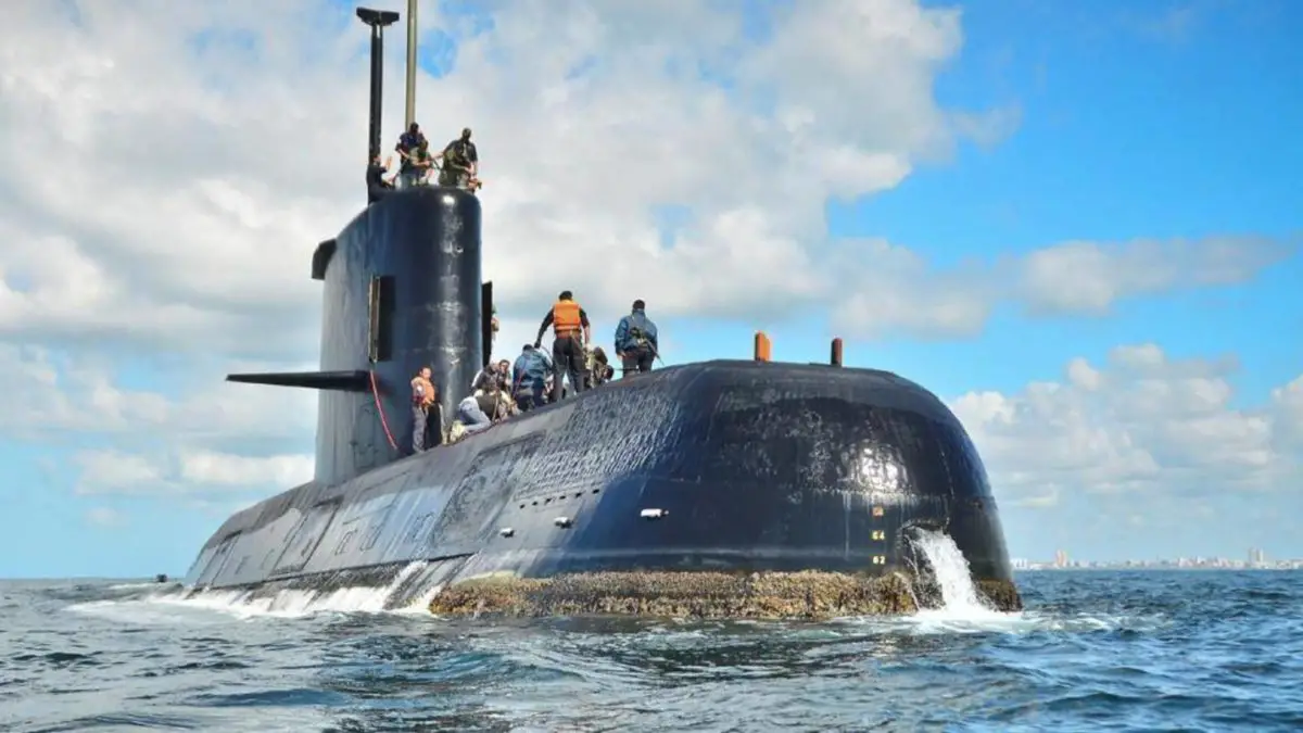
Its waters were also used during the Cold War, in another war led by the United States on one side and the Soviet Union of Russia on the other, between 1941 and 1991. Representatives of the Soviet Navy used the Barents Sea as a stronghold, hiding submarines loaded with nuclear missiles in its waters, something that is said to still be typical of the Soviet Union’s strategies.
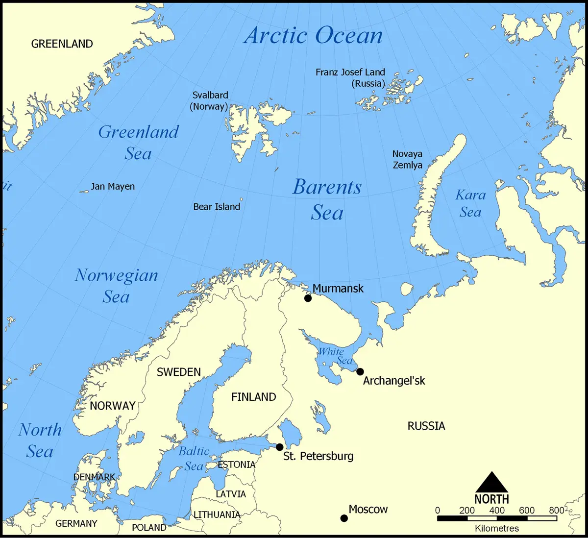
Location
The Barents Sea is part of the Arctic Ocean, within the subdivisions of the Pechora Sea and the White Sea; it is part of the territory of Russia and Norway.
It is the smallest of the world’s oceans and the northernmost ocean on the planet, located in the so-called Arctic Circle, with areas between the continents of North America, Asia and Europe; the region corresponding to the latter continent is the Barents Sea.
This cold sea is located at a latitude of 75° North and a longitude of 40° East, touching the archipelagos of Franz-Josef-Land and New Zembla and forming part of the administrative region of Finnmark, an area corresponding to Norway and the Russian territories identified as the Murmansk Oblast, the Republic of Karelia, the Archangel Oblast and the Yamalia-Nenets Autonomous District.
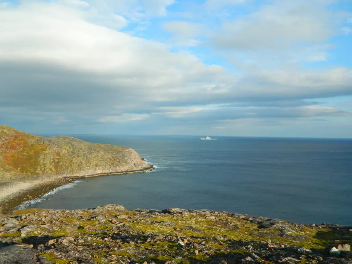
Among the subdivisions of this body of water is the Pechora Sea, which lies off the Siberian coast of northwestern Russia and forms an arm of the Barents Sea in its southeastern region. On the other side is the White Sea, which forms a large gulf off the northwest coast of Russia. The following image shows a beautiful view of the Pechora Sea.
Maritime boundaries
The Barents Sea is part of the Arctic Ocean and covers an almost rectangular area of about 1.4 million square kilometres. It is 1,300 kilometres long from north to south, stretching from Franz Josef Land to the White Sea.
On the other hand, it is about 1,050 kilometres wide, which can be seen from the New Zembla Islands to the Svalbard Islands and the well-known Norwegian Sea.
Its correct location is determined by knowing its maritime boundaries within the region it occupies, which we indicate by the following points.
- To the north-east it has the Franz-Josef-Land, an archipelago also known as the Fritjof-Nansen, part of Russian territory, from which it continues in a straight line.
- At its eastern end is New Zembla, another archipelago of the Russian Arctic, which also serves as a separation from the Kara Sea, a sector of the Arctic Ocean located in northern Siberia, a region of Russia.
- To the south is Russia, a federal republic considered to be the largest country in the world, with an area of 17,098,242 square kilometres, which includes much of the coastline of the Barents Sea.
- To the southwest is Norway, a sovereign state in northern Europe with a parliamentary monarchy government and an area of 323,802 square kilometres, the other country on the shores of the Barents Sea.
- To the west, in a straight line, is Norway’s North Cape, where the Svalbard archipelago lies, separating it from the Norwegian Sea, which is part of the Atlantic Ocean.
Features of the Barents Sea
Once we know that the Barents Sea is part of the Arctic Ocean and that it is specifically located on the European continent, north of Norway and Russia. We will now look at the specific characteristics that identify it and distinguish it from other known seas in the world:
- It is a sea with a surface area of 1,405,000 square kilometres, a volume of 282,000 cubic kilometres and a depth that varies between 230 and 600 metres.
- It bathes the coasts of two countries in the world: the coasts of Finnmark in Norway and the coasts of Arkhangelsk, Karelia and Murmansk in Russia.
- In ancient times it was known as the Murmean Sea by the Vikings and the Russians. Today it honours Willem Barents and is widely known as the Barents Sea.
- It has a salinity of 3.4%, above the world average.
- On its western mainland coast it has large cliffs and deep sea depressions, while on its eastern side, where the Kanin Peninsula is located, it has low coastlines with bays and several shallow inlets.
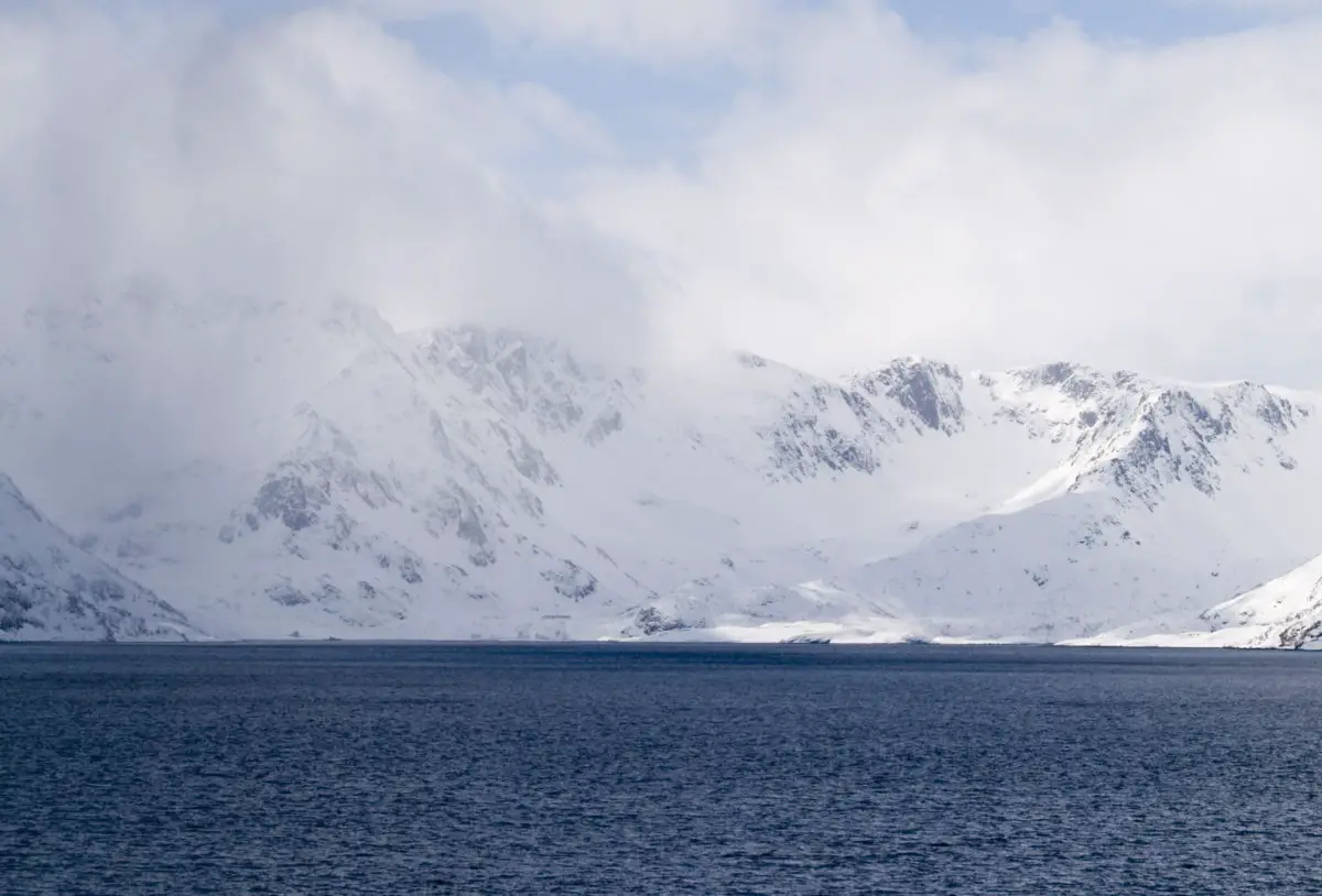
- The northern part of the Barents Sea is a series of steep and high archipelagos with glaciers ending in the sea.
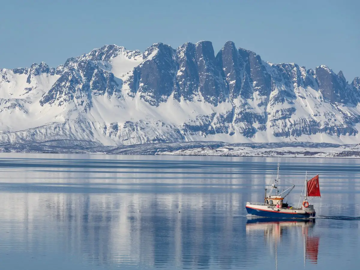
- Important ice-free ports are Tromso and Vardo near the North Cape in Norway, and Murmansk and Teriberka on the Kola Peninsula in Russia.
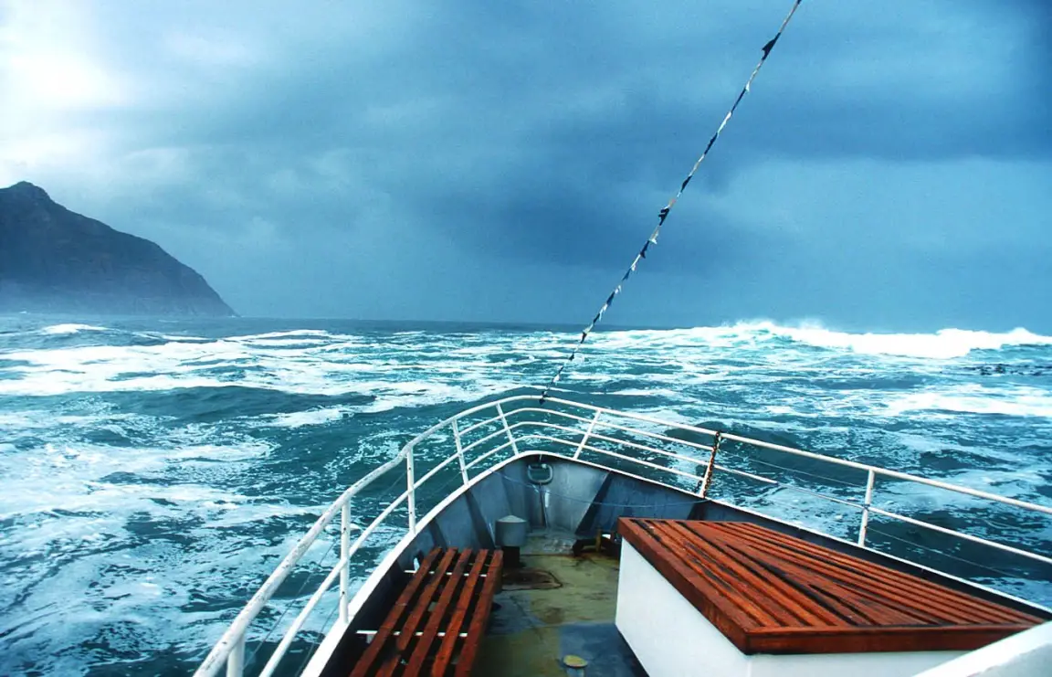
The climate
In terms of the climate generally experienced in the Barents Sea, it can be described as subarctic, with temperatures as low as -25°C during the cold winters, especially in the northernmost parts of the Barents Sea, and as low as -8°C in areas close to the mainland.
During the summer, temperatures vary relatively, ranging from 0°C to 10°C, which is still cold but quite tolerable. Only the northernmost parts of the Barents Sea are permanently frozen.
The Gulf Stream brings warm water from the west, so that the southern and western coastal regions of the Barents Sea are ice-free all year round, allowing navigation. This is supported by annual precipitation of 1,000 mm in the north and 2,500 mm in the south.
The climate of the Barents Sea is influenced by the Greenland-Norway meteorological processes, which, as mentioned above, create large areas of low pressure due to the convergence of warm and cold water masses, so that in some areas the climate is more moderate, while in others the ice makes it almost impossible to navigate the sea.
Flora and fauna
One of the interesting features of this sea is that it is shallow in its southern part, where it is also ice-free, and there are warm currents from the Atlantic Ocean that mix with the cold waters of the Arctic Ocean.
This meeting of waters leads to the formation of a marine polar front, with optimal light conditions, where special nutrients are generated for the proliferation of phytoplankton.
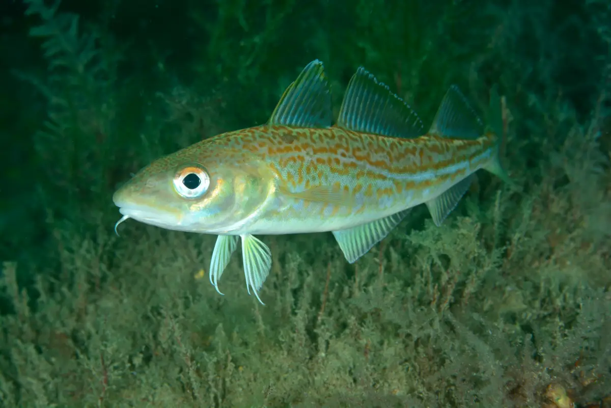
This type of marine flora is the food for zooplankton, which are marine organisms, and for krill, a type of small shrimp that normally lives in the open sea. This zooplankton is consumed by many of the representative species of this sea, including Arctic cod, Atlantic cod, capelin, whales and the Atlantic murrelet, a small migratory bird.
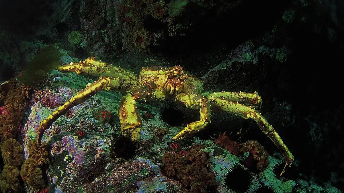
Other species include seals, arao and the giant crab known as the Kamchatka king crab, which is astonishing in size and volume. They devour everything in their path, which has made many of the coasts of the Barents Sea look like a desert.
In the following picture you can see what the cod that can be found in the waters of the Barents Sea look like.
Kamchatka king crab
This is a large crab known as the Russian, under the scientific name Paralithodes Camchaticus, or simply as the Giant Red Crab; some even know it as the Alaskan Spider Crab; but it is a lithodomous decapod that is basically native to the Bering Sea, which is in the northern Pacific Ocean, very close to both the Kamchatka Peninsula and Alaska.
It is a marine species with a carapace width of 28 cm and legs up to about 1.8 metres. The name red crab comes from the fact that it takes on this colour when cooked, while when alive it can be appreciated in a colour similar to burgundy wine.
The justification for the presence of this crab along the coasts of the Barents Sea is due to the fact that the Russians introduced it into the Murmansk Fjord of this sea in the 1960s, thus providing the Soviet nation with a new fishing resource, which is now commercially exploited by both the Russians and the Norwegians and marketed worldwide as a delicacy.
The meat of this Russian crab is considered an international gourmet delicacy due to its great taste, although it should be noted that catching this animal is a high risk for fishermen, as it is bred in areas with extreme climatic conditions.
Ocean currents
The issue of ocean currents, which have a particular influence on the temperature of the waters of the Barents Sea, is of great importance as the Barents Sea is a distinctive sea in northern Europe and is considered to be the oceanographic gateway between the Atlantic and the Arctic Oceans.
The Gulf Stream, one of the most important ocean currents, is formed by the convergence of currents from the Gulf of Mexico and the West Indies, which also cross the entire Atlantic Ocean. They carry warm, salty water from the Atlantic into the Barents Sea, towards the centre of the Arctic Ocean.
Conversely, fresh water in the form of sea ice flows from the Arctic Ocean itself into the Barents Sea. What happens when they cross or merge is that they cause the ice to melt, and this is why the sea has large parts of its body of water that are ice-free all year round, although they remain quite cold.
The waters of the Barents Sea, identified by its currents, have the following characteristics
- It has warm, salty waters coming from the Atlantic Ocean, where the temperature is above 3°C and the salinity is above 35.
- In the north, where the Atlantic Ocean meets the Arctic Ocean, the temperature is below 0°C and the salinity is less than 35.
- On the coasts of the Barents Sea, the temperature is above 3°C and the salinity is below 34.7.
There is also a polar front, where Atlantic and Arctic waters meet, in the western part of the Barents Sea, in a region close to Bear Island, where the temperature is stable throughout the year due to the topography of the seabed, whereas in the east, close to New Zembla, the temperature is constantly changing.
Fishing
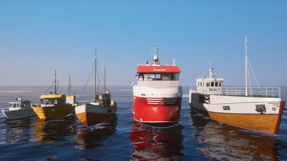
Fishing is one of the most abundant elements in this sea, with many fishing boats arriving from northern European ports full of hake and cod in particular, making this an important activity for both Norway and Russia.
The marine life in this sea is very active, due to the contribution of the currents coming from the Atlantic Ocean; this allows the abundance of phytoplankton and zooplankton, which contributes to the feeding and sustenance of species such as cod, whose fishing is vital to the economies of both Russia and Norway.
We would like to point out that fishing for this marine species was an activity carried out by the Spanish cod fleet more than 500 years ago, and then became very important in the 16th and 17th centuries. In ancient times, there were large shoals of this fish in the waters of Newfoundland, which is part of the north-east coast of North America and Greenland.
However, the establishment of Exclusive Economic Zones by the United Nations for each coastal state in 1977, together with the collapse of cod stocks in Atlantic waters in the 1990s, led to a sharp reduction in the number of fishing vessels.
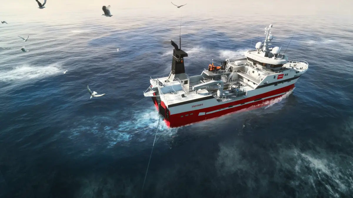
As a result, the Barents Sea is currently the main fishing area, especially for cod. According to the regulations of 8 June 1981, only the cod fleet is allowed to fish there. In accordance with this, the census of cod fishing vessels is published every year by decision of the Spanish General Secretariat for Fisheries.
With regard to the fishing zones in the Barents Sea, Norway’s exclusive zone is 62° N and Russia’s is Svalbard.
Likewise, the Russian-Norwegian Commission sets the level of fishing activity for the coastal states in this sea each year between October and November, in addition to the quotas available to Spanish vessels in these waters, which are published each year by means of a Community Regulation.
This allows other EU countries to benefit from fishing in certain waters of this sea, depending on the definition of certain stocks and groups of fish.
Natural resources
The Barents Sea is home to the world’s largest population of cod. For those unfamiliar with this type of fish, it is a marine animal up to 170 cm long with an elongated olive green body, lighter on the belly.
It has a large head, three dorsal fins and two anal fins. It has a fleshy, beardlike appendage on its lower jaw; it is usually very active and voracious, forming schools with other species, and its edible meat is widely traded, so much so that since 1976 fishing in this sea has been shared between the countries of Norway and Russia, each of which has a total catch limit.
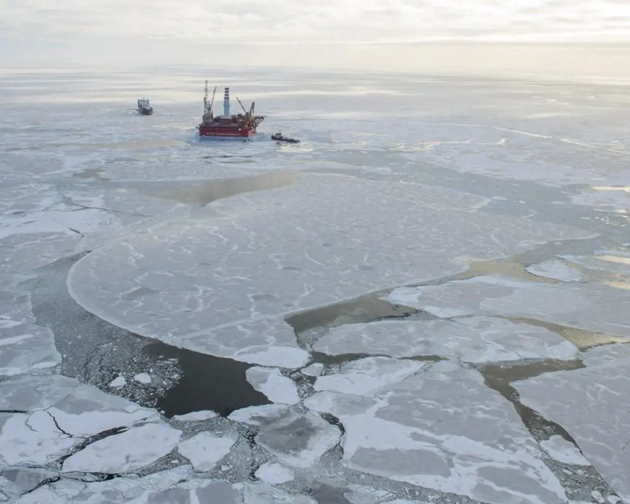
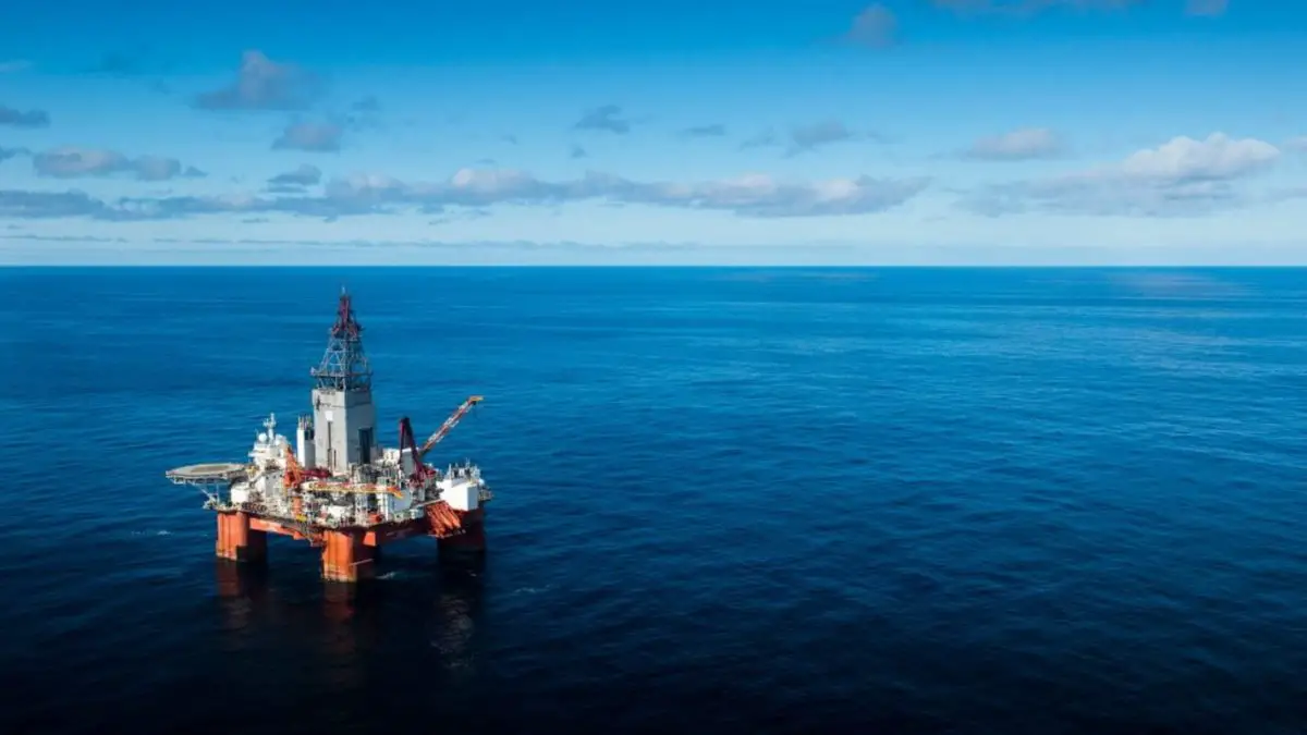
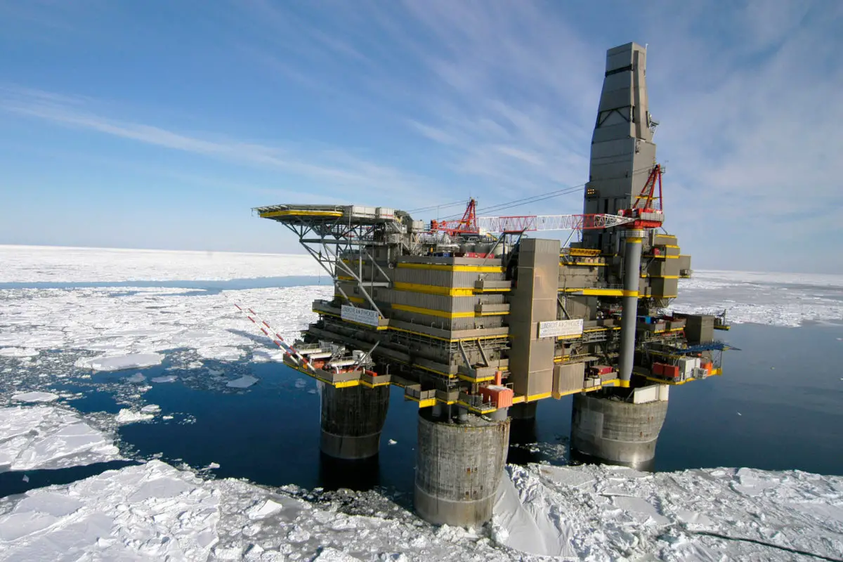
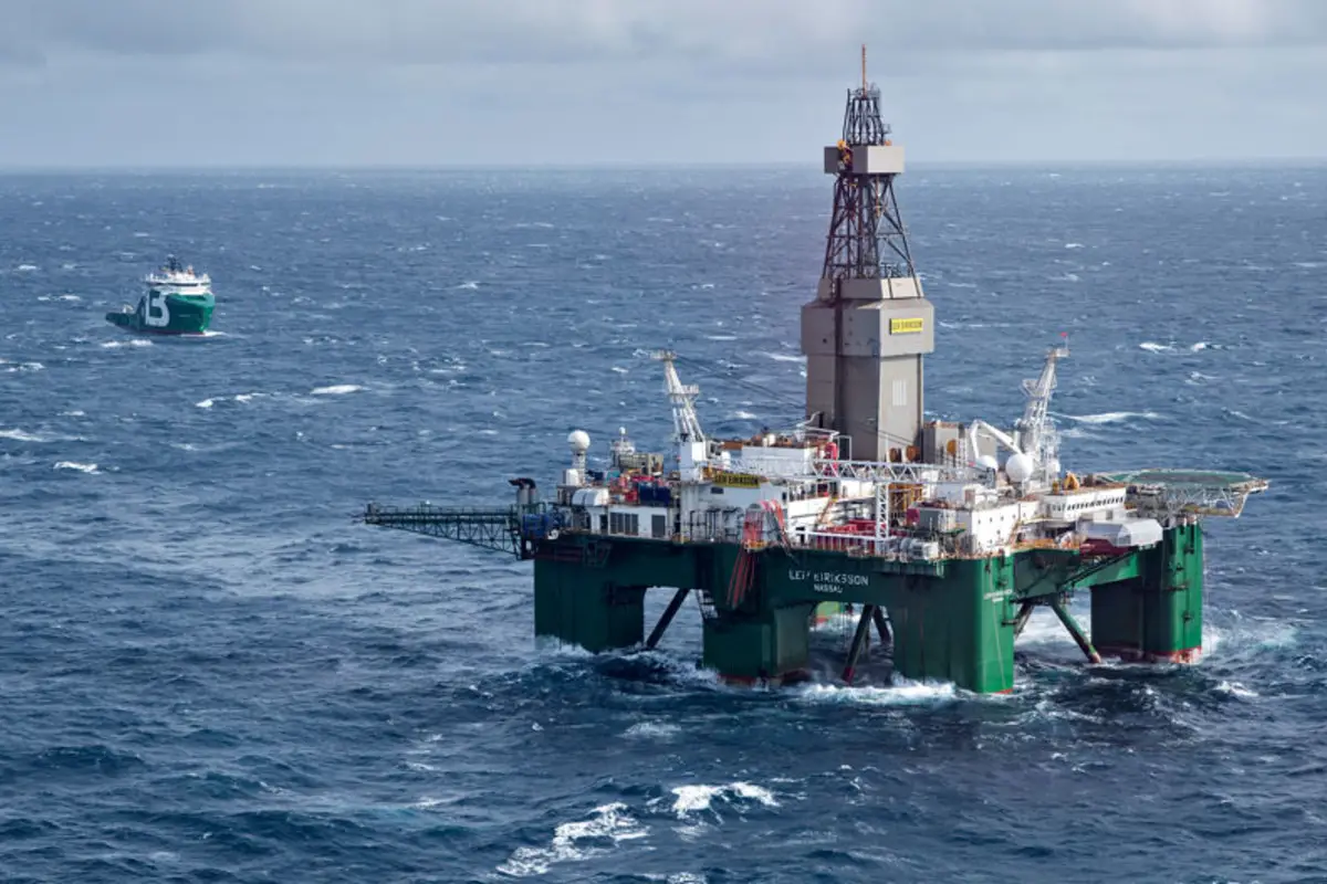
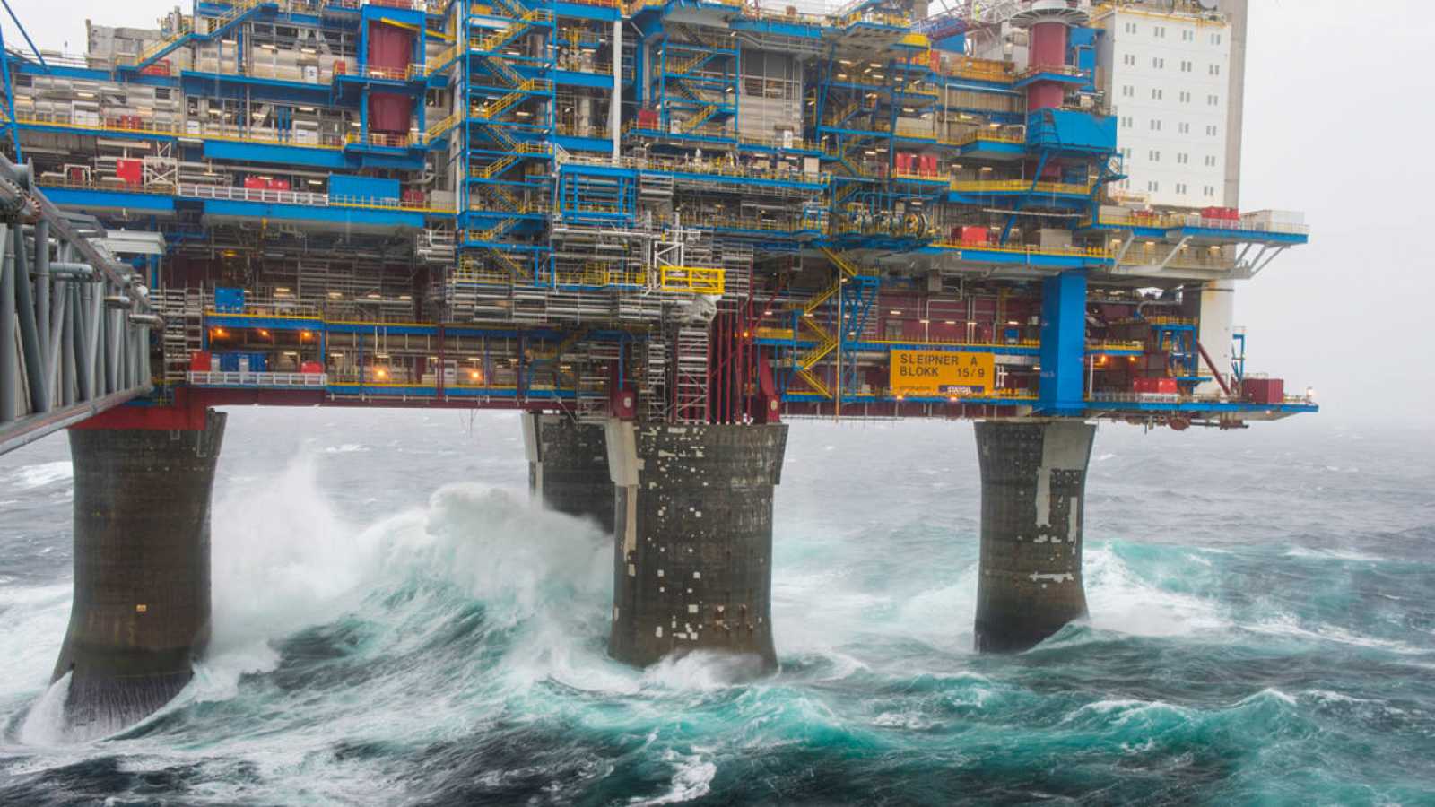
On the other hand, Norway has been exploiting hydrocarbons in the Barents Sea since 1969, but on a larger scale for gas and oil in 2000.
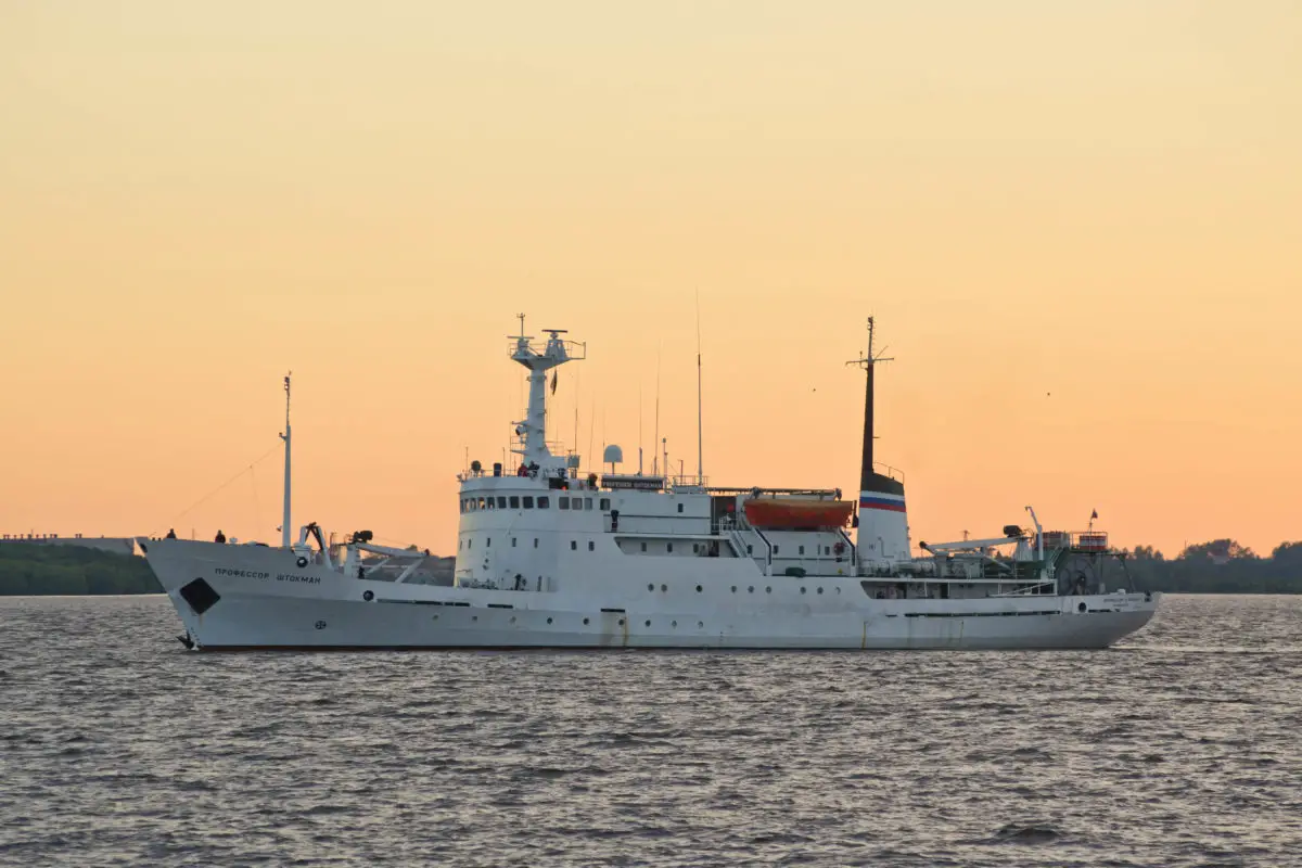
The Russians, for their part, are not far behind, as they stand out in the exploitation of the Shtokman gas field, considered to be the fifth largest in the world.
Energy resources
The importance of the Barents Sea to both Norway and Russia is undeniable, providing both countries with a wealth of resources, especially energy resources. This makes them exporters of gas to the European continent and suppliers of oil to the world.
In fact, in 2010, agreements were signed to demarcate a maritime border in the Arctic Ocean, with the aim of allowing both nations to benefit from the energy resources found under the waters of the North Pole.
This pact has divided the Barents Sea, which occupies a large part of the Arctic Ocean, in two, but these resources are also vulnerable to the effects of global warming.
In this sense, when the sea has less floating ice, it allows the smooth transit of many oil tankers coming from the Siberian oil fields, which in turn favours the exploitation of these energy resources.
Studies in this area suggest that the oil and gas deposits off the east coast of Greenland can be exploited when they are not covered by ice, given that around 6% of the world’s oil reserves are located in the Russian Arctic Ocean, and perhaps even more for gas.
This simple equation of less ice equals more oil is followed by many nations who are constantly exploring the situation, trying to take advantage of the exports of these Barents Sea nations, similar to the gold rush of the 19th century.
The truth is that the reserves in the Barents Sea are so unpredictable that these countries must tread carefully, as there may be less than they expect and they may end up depleting this important energy resource.
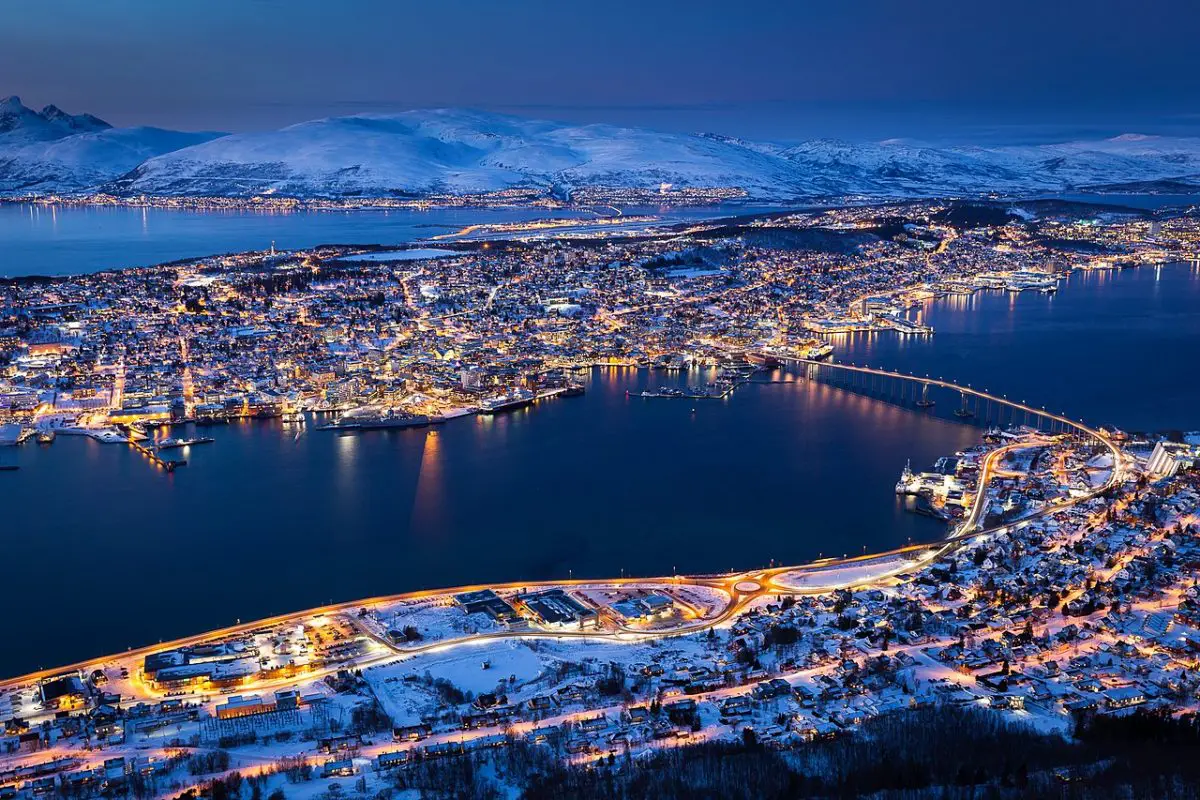
Ports in the Barents Sea
The Barents Sea has harbours in its southern half, which are ice-free all year round due to the presence of the North Atlantic currents, a phenomenon we have already described in previous paragraphs.
The ports of this sea are identified by the names of Murmansk and Teriberka under the territory of Russia on the Kola Peninsula and the names of Tromso and Vardo near the North Cape in Norway. We will get to know them in detail in the following points:
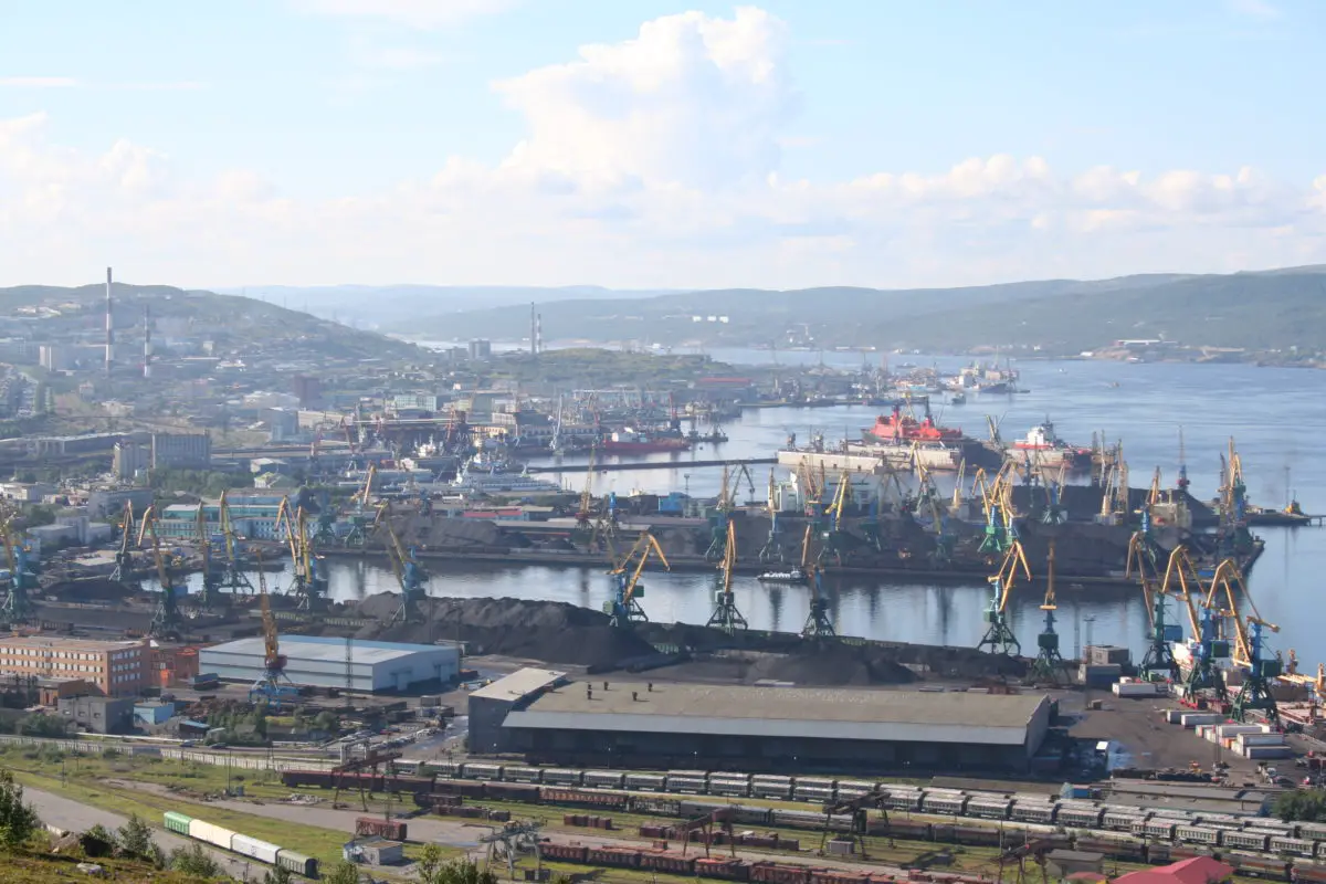
Murmansk
This is a commercial port on the eastern shore of the Kola Bay and part of the Barents Sea, belonging to the Russian city of Murmansk.
It is the second largest port in north-west Russia, after the prominent port of St Petersburg, and is therefore the backbone of the city’s economy.
It is a port near the mouth of the Kola River, facing the Barents Sea and close to Russia’s borders with Norway and Finland. It is also used as the headquarters of the Russian Navy, thanks to the fact that it is ice-free.
Teriberka
Teriberka is an old port in the city of the same name in the Murmansk region, one of the most popular tourist destinations, where films such as Leviathan by Russian director Andrey Zviaghintesev have been shot.
After that, the city was visited by many tourists from Europe, South Korea and China, and new hotels had to be opened to meet the demand of so many visitors. Especially when the festival “Teriberka. New Life”, where tourists could get to know the nature of this region up close, accompanied by concerts and gastronomic tastings.
Vardo
This harbour is part of the town of Vardo, which is believed to be the only Norwegian mainland town in the Arctic climate zone, although it is actually located on an island two kilometres off the northeastern coast of the Varanger peninsula.
As a result, the harbour has access to the waters of the Barents Sea, which are ice-free all year round thanks to the North Atlantic currents.
The port is located near the town of Vestervagen, Vardo in Norway, and is now known as the most important port on the Barents Sea coast, east of St Petersburg, Kiev and Istanbul.
Tromso
This is a port that forms part of the city of Tromso in Norway, considered to be one of the most populous cities in the northern region of Norway. It is a port that is part of a network of Hurtigruten ferries that call on its shores daily; in fact, its founder was born in this community.
These ferries, known as Hurtigruten, are responsible for the commercial links from the city of Tromso to Finnsnes, Harstad and Skjervoy, which are also part of Norwegian territory.
But they are not the only ferries that use this port, as there are other ships that leave from here to transport cars, as well as summer services between the city of Tromso and Botnhamn, which is located on the island identified as Senja, 300 kilometres from the Arctic Circle.
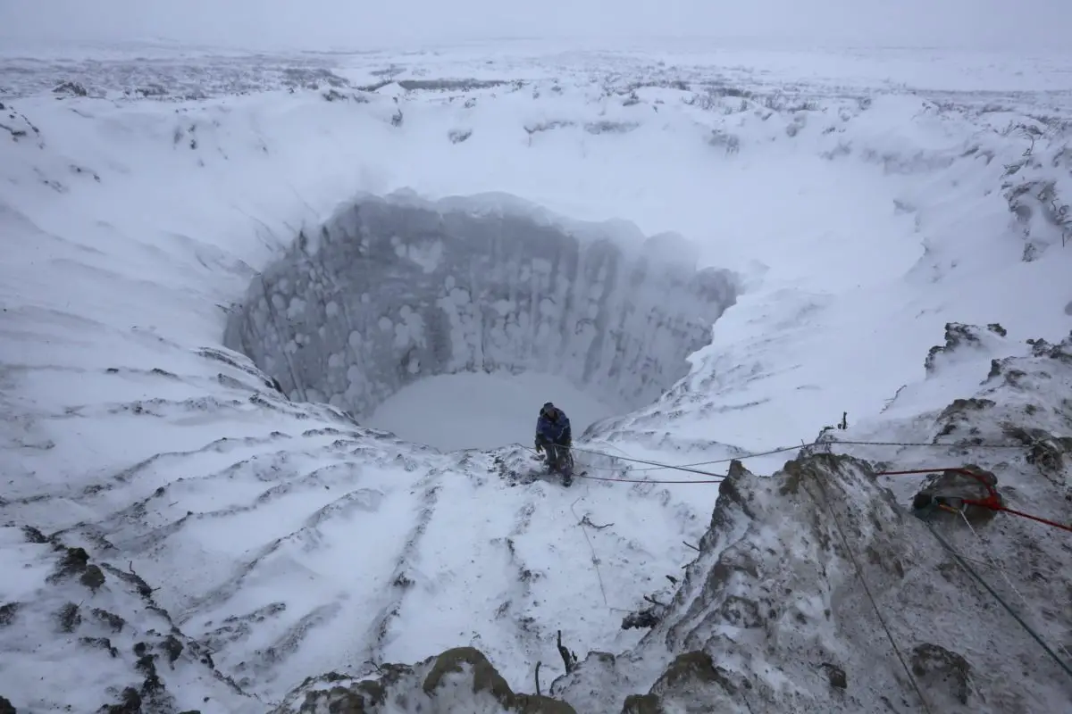
The craters of this sea
At the bottom of the Arctic Ocean, particularly where the Barents Sea is located, there is evidence of the presence of craters, which many scientists believe are due to the presence of accumulated methane that later exploded after the end of the last major global glaciation.
This is accompanied by a series of bulges which are thought to be an additional consequence of such explosions. It is still believed that there are vast reserves of methane beneath these submarine craters, which serve as the seabed in the Arctic region.
This gas is thought to be emitted in small quantities, but the craters were formed by massive explosions and later released into the atmosphere.
This is the conclusion of scientists reporting on a study published in Science, carried out by researchers from the Arctic University of Norway in Tromso, with the help of the Centre for Arctic Gas Hydrates, Environment and Climate (CAGE).
This research has made it possible to map hundreds of craters on the floor of the Barents Sea. The reason the explosions were recorded is that a warming climate 15,000 years ago suddenly released gases that exploded and disintegrated kilometres of ice above them, creating the craters.
These craters were first identified in the 1990s, but today, thanks to new technologies, they are being studied by many scientists, as craters of 300 metres and one kilometre in diameter have been found, although there are many smaller ones.
Curiosity linked to craters
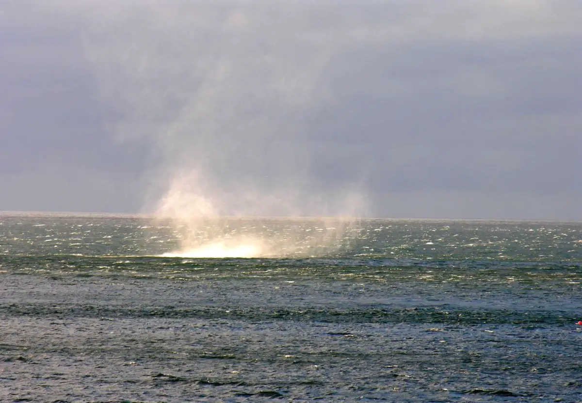
A study carried out in 2016 suggested that these craters could be linked to the existence of the Bermuda Triangle, a discovery that links the two phenomena. The link is made because these craters explain the reports of fishermen in the area who have seen bubbles in the sea, as if it were boiling, for no apparent reason.
This relationship between the phenomena occurring in these two regions of the world was raised by the Russian scientist Igor Yelstov, who referred to the mystery of the Bermuda Triangle, where he said that many theories suggest that the disappearance of ships in the Atlantic Ocean in the region between Miami, Puerto Rico and the Bermuda Islands could be caused by the reaction of gas hydrates trapped in the seabed.
It should also be noted that, according to studies of the largest bodies of water on the planet, the most dangerous areas are in the South China Sea, the North Sea and even the Mediterranean, but the Bermuda Triangle does not even make the top ten list, despite being one of the busiest roads in the world, where compasses are said to show anomalies when entering this body of water, which has more of a bad reputation than anything else.
Contamination of its waters
In 1961, about four kilometres above the island of New Zembla, the so-called Tsar Bomba, developed by the Soviet Union using hydrogen and considered to be the largest man-made explosion ever, was detonated.
This apparently led to the contamination of the Barents Sea with nuclear reactor waste, which has been a major problem ever since.
This problem has been exacerbated by the economic difficulties of the Russian state, which, since the collapse of the USSR, has not had sufficient resources to maintain both ships and submarines. This has been blamed for the accidents and shipwrecks that occurred in 2000.
But before that, in the 1970s, the search for oil began, with discoveries made by both governments off the Barents Sea, meaning that both Russians and Norwegians began to see their economic horizons widen.
The first to come into production was the Snohvit field, which is Norwegian territory, but the largest of these fields is the Shtokman field, which belongs to the Russian government. However, there are still border disputes between the two nations, with the Norwegian government accepting a median line and the Russians insisting on meridians.
The exploitation of energy resources by these two nations has led to the pollution of the waters of the Barents Sea, as well as the construction of infrastructure in the sea, which has had a negative impact on its ecosystem.
The species that make up its fauna and flora, which are also an important part of its natural resources, are damaged by the constant small spills that occur in the areas where gas and oil are extracted, not to mention the noise caused by all these types of machinery.
On the other hand, many animals have a form of communication based on sound waves that are often altered by the presence of noise. This leads to the destabilisation of the animals’ natural radar, disrupting their entire development as a species, with the risk of their eventual extinction.
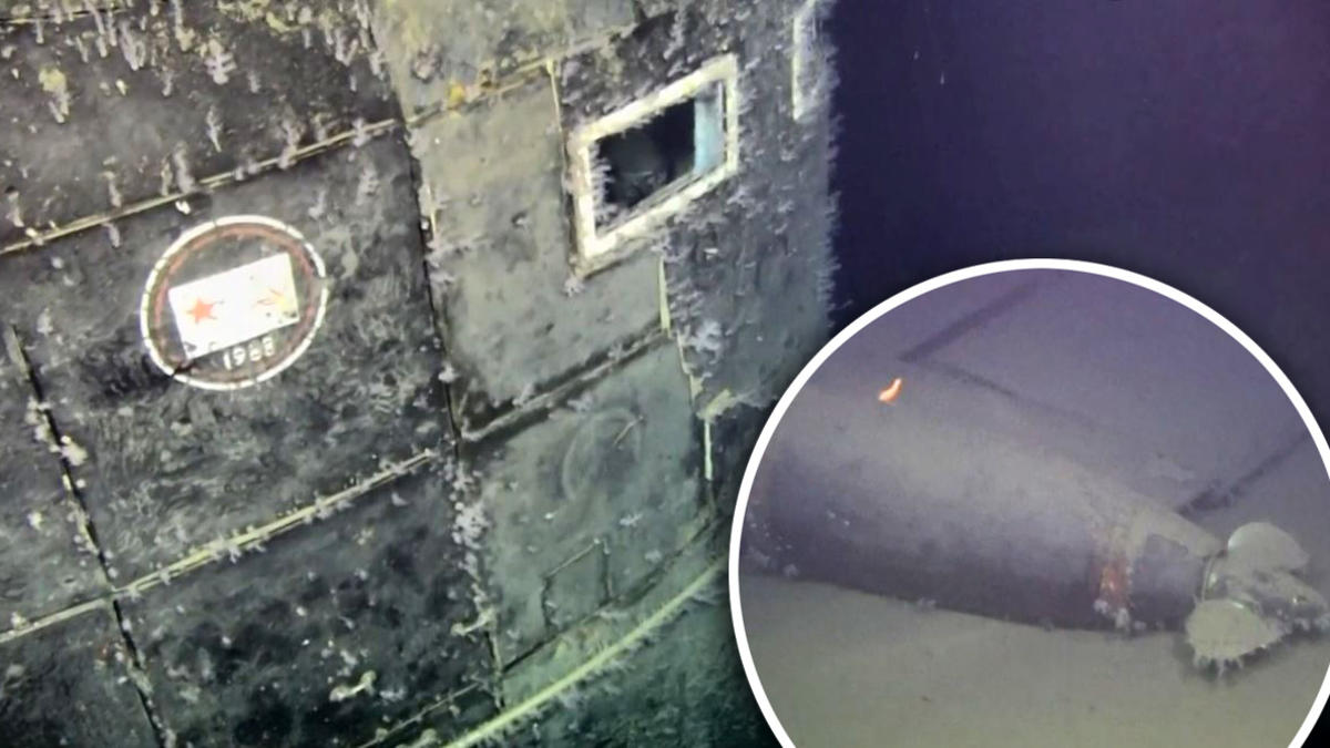
In addition, Norwegian researchers have found radioactive leaks from the Soviet submarine Komsomolets, which sank between the Norwegian coast and the Svalbard archipelago in 1989.
The submarine is believed to have been abandoned in the Barents Sea area with two nuclear reactors, two torpedoes with nuclear warheads and 16 long-range missiles. The area is one of the largest fishing grounds in the world, although it has been reported that measurements so far have shown no danger to fish or the people who feed on their flesh.
Although radiation measurements were taken in the submarine’s ventilation pipes eleven years ago and the results were normal, these levels are being monitored again as high levels are beginning to be detected.
It is said that, depending on the depth, the 10 becquerels are diluted a thousand times, making them practically negligible. But it all depends on what kind of substances are coming out of this submarine.
In statements made by the expert Andrei Solotkov to the Russian newspaper Novaya Gazeta, it is stated that
“A warning to everyone. Everything depends on what substances come out. “If it is caesium and strontium isotopes, then we are talking about the reactor, it will be a blow to the fishing industry and we will have to say goodbye to the idea of a pure Arctic”.
He added that the most worrying thing so far has been a cloud that has been observed rising from the submarine’s vent hole from time to time, but which is also directly linked to the nuclear reactor.
Finally, we would like to point out that this submarine is under the waters of the Barents Sea at a depth of 1,665 metres and that its hull is completely damaged after thirty years at the bottom of the sea, which is really worrying.
If you liked the information in this article, we invite you to discover more through the following links:
- Lake Como
- Lake Maracaibo
- Lake Texcoco
- Lake Victoria