
Last Updated on September 29, 2023 by Hernan Gimenez
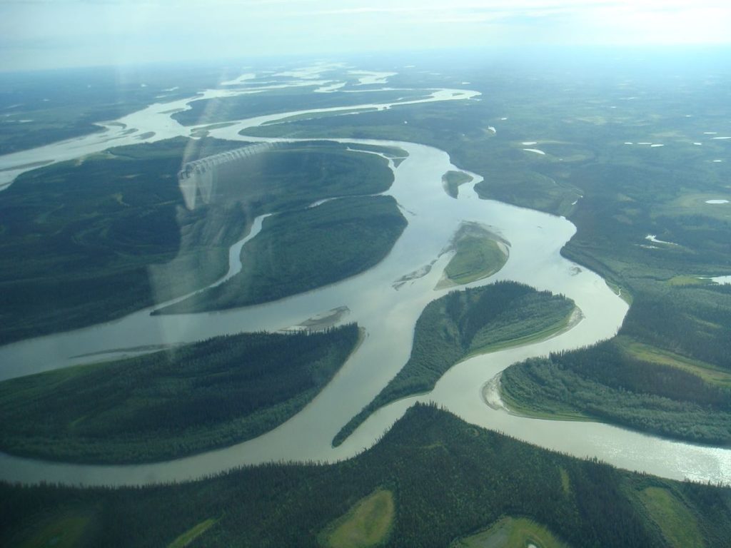
The Yukon River is a giant; no words can accurately describe the scale of things along its 2000+ mile length. There are mudflats running through large forested islands that are larger than most rivers.
If you need to be on one side of the river at a certain point, you’d better start travelling many miles of distance to get to that side.
Leaving the Canadian subarctic and crossing the breadth of Alaska to its gigantic delta that meets the Bering Sea, the Yukon would take a lifetime of exploration to learn even a fraction of its lessons.
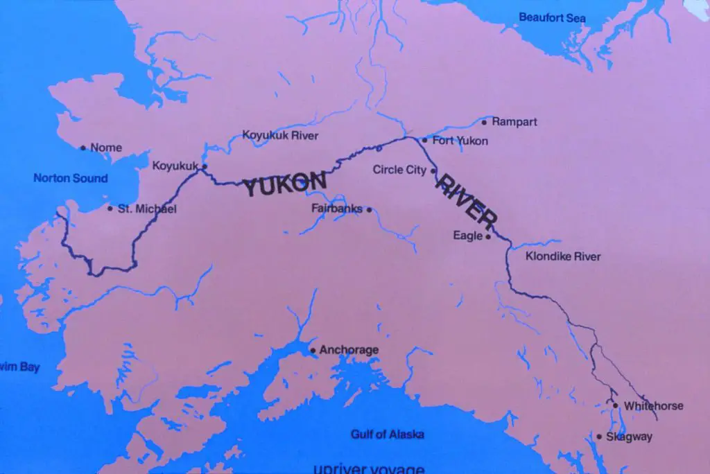
The Yukon River, North America’s principal river flowing through the central Yukon Territory in northwestern Canada and the central region of the U.S. state of Alaska. It measures 1,980 miles (3,190 km) from the headwaters of the McNeil River (a tributary of the Nisutlin River).
The Yukon discharges into the Bering Sea after flowing northwest and then generally southwest across a low plateau that slopes down through Alaska.
Indice De Contenido
Ubicación del Río Yukon
The Yukon River begins at the north end of Marsh Lake, south of Whitehorse. it has a major flow when it reaches the Yukon at Hootalinqua. The upper end of the Yukon River was originally known as the Lewes River until it was established that it was actually the Yukon.
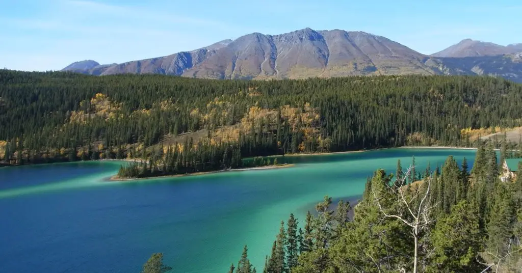
North of Whitehorse, the Yukon River widens into Laberge Lake, made famous by Robert W. Service’s “The Cremation of Sam McGee”. Other large lakes that are part of the Yukon River system include Kusawa Lake (on the Takhini River) and Kluane Lake (on the Kluane and then White River).
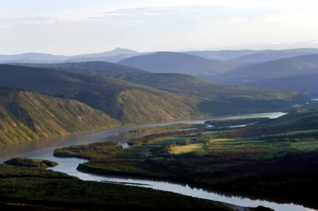
The river passes through the communities of Whitehorse, Carmacks, (just before Five Finger Rapids) and Dawson City in the Yukon Territory, and at Circle, Fort Yukon, Stevens Village, Tanana, Ruby, Galena, Nulato, Grayling, Holy Cross, Russian Mission, Marshall, Pilot Station, St. Marys (which is accessible from the Yukon at Pilot Point), and Mountain Village.
After Mountain Village, the main Yukon waterway splits into many channels, extending through the delta. There are a number of communities after the “head of the passes”, as the division of channels is called locally: Nunum Iqua, Alakanuk, Emmonak and Kotlik (see article: Segura River).
Of these delta communities, Emmonak is the largest with approximately 760 people in the 2000 census. Emmonak’s gravel airstrip is the regional hub for flights.
Yukon River tributaries
The main east and north bank tributaries are Teslin, Big Salmon, Pelly, Stewart, Klondike, Porcupine and Koyukuk; west and south bank tributaries are Takhini, White and Tanana. Its headwater tributaries drain an area of approximately 328,000 square miles (850,000 square km) outside a surrounding semicircle of high mountains.
Physiography and Hydrology
The headwaters of the McNeil rise in the Pelly Mountains in south-central Yukon Territory and flow southward to Teslin Lake and thence to the Teslin River. However, the main headwaters of the Yukon River flow from Atlin Lake and Tagish Lake in the vicinity of the border between British Columbia and the Yukon Territory.
Approximately 50 miles (80 km) downstream of the Yukon once rushed through the rocky walls of the narrow Miles Canyon and fell on the rocks at Whitehorse Rapids.
The latter became the southern terminus of the northbound water transport. Since then, the river has been dammed south of Whitehorse by hydroelectric power; the rapids are buried below the reservoir lake, and deep water fills the ancient canyon (see article: Snake River).
Plant and Animal Life
Conifer forests grow at low elevations and low densities in the valleys and on the mountain slopes of the Yukon River watershed.
The top tree line is at an elevation of approximately 3,500 to 4,500 feet (1,070 to 1,370 metres), depending on local exposure and drainage; therefore, about two-thirds of the Yukon’s mountainous territory is treeless.
Spruce budworm outbreaks threaten large areas of these forests. In addition, alpine fir and lodgepole pine are found in the lower areas along the Alaska Highway through southern Yukon.
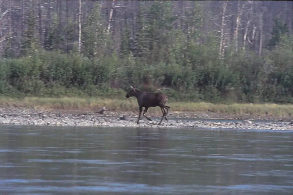
A variety of animal life inhabits the forested valleys. Larger mammals include black and brown (grizzly) bears; caribou, deer and moose; and mountain goats and sheep at higher elevations. Timber wolves are common.
Game birds such as grouse and ptarmigan are found, and waterfowl include many species of geese, swans and ducks. The usual furries trapped by the Indian population include muskrat, mink, marten, lynx, weasel, fox, fisher and squirrel as well as the Columbia Rivers.
The river itself is home to fish species such as Arctic grayling, burbot, pike, salmon and Colorado River whitefish.
Here is a video (documentary) about the Yukon River.