
Last Updated on November 7, 2023 by Hernan Gimenez
The Ural River is considered one of the most important rivers in Europe, being the third longest after the Danube and the Volga. It forms the natural border between Russia and Kazakhstan.
The location
The Ural River is located in the far east of Europe. It rises in the south-eastern part of the Ural Mountains near the city of Uchaly in Russia and its waters flow first south, then west and then south again. It is considered the natural border between Russia and Kazakhstan and is 2428 km long.
The Ural River flows through the Orenburg and Chelyabinsk Oblasts in Russia, the Autonomous Republic of Bashkortostan and the Atyrau Oblast in Kazakhstan (see Mississippi).
It has a catchment area of 231,000 km² and flows very gradually across a desert plain before emptying into the Caspian Sea. Although it is called a sea, it is an endorheic saline lake with a surface area of 371,900 km².
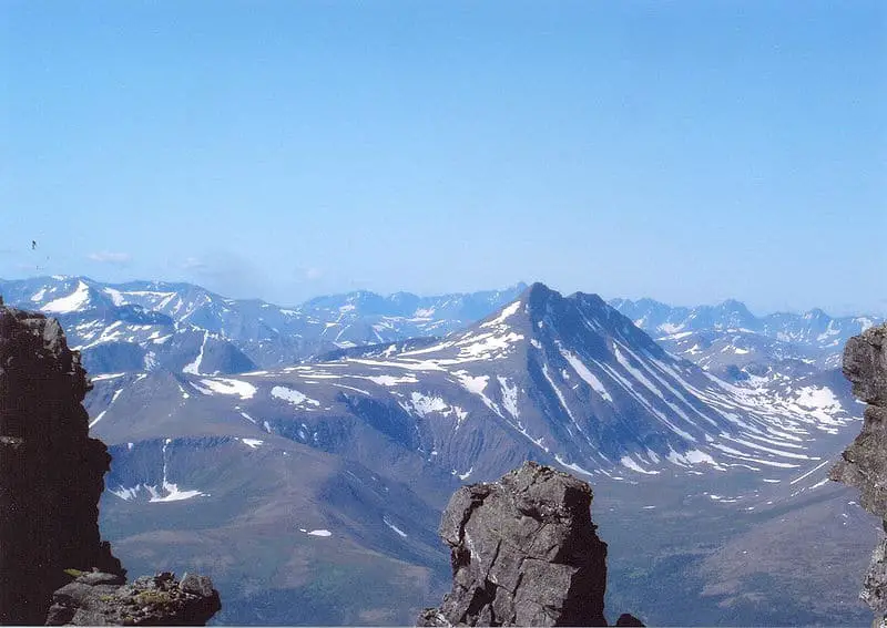
Map of the Urals
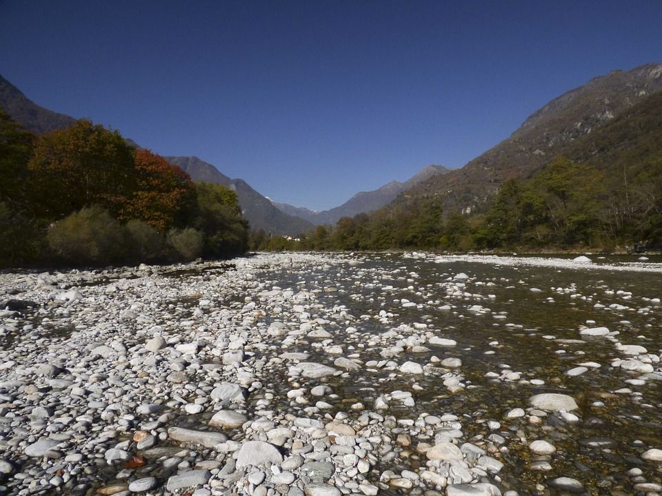
It rises in the south-east of the Ural Mountains, at the foot of the Nazhimtau Mountains, near the town of Uchaly in Russia, at an altitude of 637 m above sea level. It is said to have originated as a stream or spring. In its upper reaches, the Ural behaves like a mountain river.
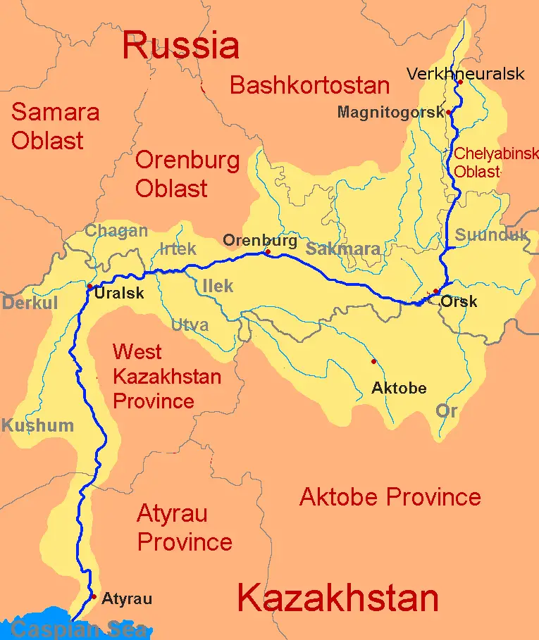
In the first section, the current flows southwards into the Kazakh steppes, which cause the Ural to divert to the north-west. The water flows towards Orenburg, turning southwest of the Ural Mountains.
The river meanders from north to west and flows south to the estuary, where it divides into two branches and flows into the Caspian Sea, forming numerous channels, lakes and oxbow lakes.
Tributaries
The main tributaries of the Urals are
- Sunduk River
- Tanalyk River
- Great Kizil River
- Or River
- River Guberlia
- River Salmys
- Sakmara River
- Kindelia River
- Bolshaya Choba River
- River Ilek
- Utva River
- River Irtek
- Chagan River
Despite its length (2,428 km), the Ural River drains an area of about 231,000 km² and has tributaries with important basins. The main tributaries are the Ilek and Or (right) and the Sakmara (left). The dry climate makes the basins smaller than some rivers such as the Uil, Kaldygajty or Olenty, making them endorheic basins.
Navigation on the Ural
The Ural is not completely navigable. Its width is about 50-170 m and its depth is about 3.5 m. Its bottom is sandy and the water velocity is about 0.3 m/s. The banks of the Urubamba are about 5.9 metres high and generally steep (see History of the Urubamba River).
The only part of the river that is navigable is downstream from the city of Uralsk. The reasons for its non-navigability are winter ice, shallow riverbed and melting ice in spring.
Other reasons why the Urals is not navigable are
- The average difference in height from its source to its mouth is 30 cm to 1 km.
- In the upper part of the river, the width of the current is 60 to 100 metres; it has beaches with cliffs and ravines.
- The lower part is sandy with gravel and pebbles.
- Downstream at Orenburg there are an estimated 700 rapids.
- At Kruglovskaya the river becomes very narrow and deep, creating whirlpools.
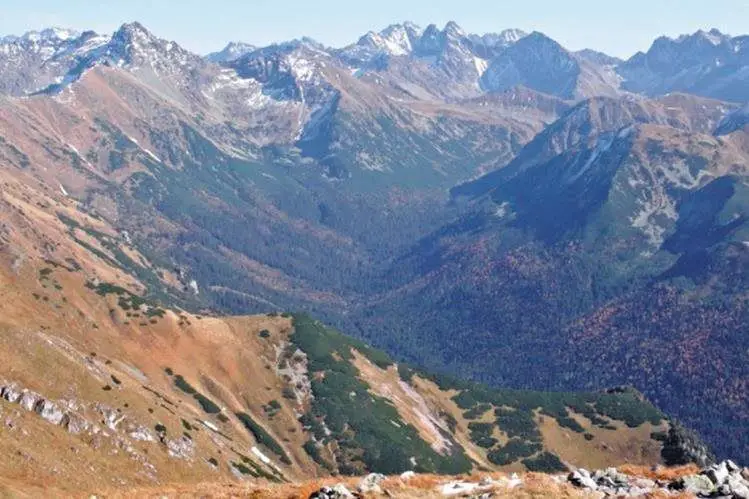
What are the Ural Mountains?
The Ural Mountains are a low, long, 2500km north-south mountain range that divides or forms a natural border between Russia and Kazakhstan. It is often recognisable by the undulations and plains of the area it covers. Its highest point is Narodnaya Mountain, which rises to 1895 metres.
The Urals have a rich subsoil, mainly oil, iron and coal; it is for this attribute that they are qualified as a great industrial centre for Russia, with numerous metallurgical, chemical and iron and steel industries in cities such as Perm, Yekaterinburg, Magnitogorsk, Ufa and Chelyabinsk (see Rio Bravo).
The Urals are divided into five mountain ranges: the Polar or Arctic, the Subpolar, the Northern, the Central and the Southern Urals.
- The Polar or Arctic Urals are located to the north and are 385 km long, rising from Mount Konstantinov and culminating in the Khulga River in the south. The Polar Urals are characterised by sharp, prominent, rounded or flattened peaks (see Yellowstone River).
- The Subpolar Urals: 225 km long, its highest peak is Mount Narodnaya (1895 m), and its boundary is the Shchugor River in the south. It has jagged peaks separated by river valleys.
- The Northern Urals are elongated parallel mountain ranges (1000-1200 m high) with longitudinal depressions. They are 560 km long and run north-south from the Usa River. Their peaks are mostly flat.
- The Central Urals: the highest peak is Basegi (994 m) with a rounded peak, located south of the Ufa River.
- The Southern Urals are made up of numerous valleys and parallel south-west-south mountain ranges, 550 km long, extending to the sharp bend of the Ural River and ending in the Mughalzhar Hills. Its highest peak is Mount Yamantau at 1640m.
Cities along the river
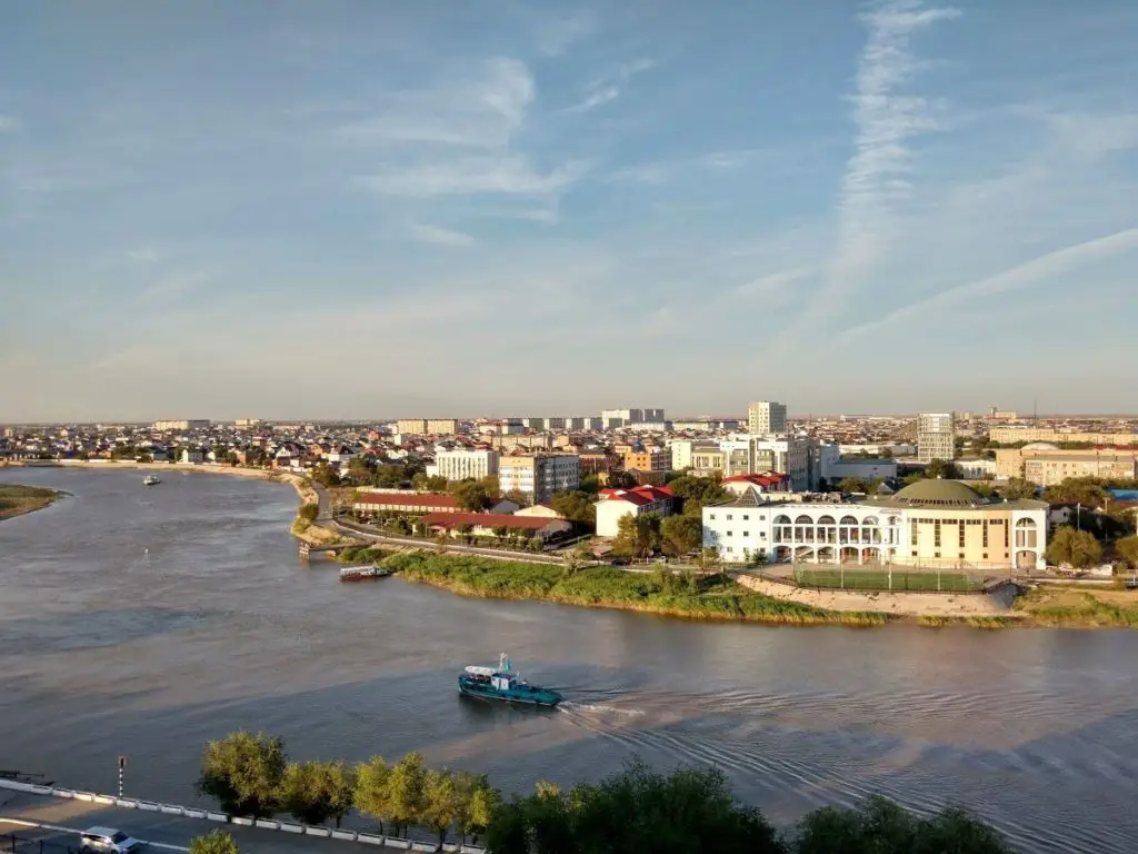
The main cities along the Ural River are:
- Magnitogorsk
- Orsk
- Oremburgo
- Novotroitsk
- Oral
- Atyrau