
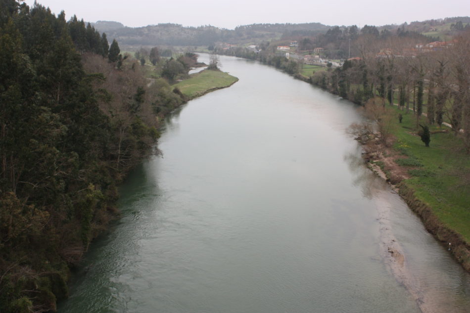
The Sella River is located in the coastal area of Spain and flows into the Cantabrian Sea, passing through the provinces of León and Asturias. In this article, we will present all the characteristics of this important water source in Spain.
Indice De Contenido
The source of the river Sella
Its waters come from the Picos de Europa mountain range, cross the route known as the Fuente del Infierno and reach the Fonseya National Park, in the province of León, before flowing into the Cantabrian Sea, next to the Ribadesella river. It covers a distance of 70 kilometres, with an average length of 1,300 square kilometres.
Knowing its tributaries
On the left, the Sella receives water from other rivers such as the Ponga and the Piloña, while on the right it meets the waters of the Dobra and the Güeña.
Thanks to its tributaries, the River Sella has two sub-basins, formed by the waters of the Rivers Ponga and Piloña, with an area of more than 510 square kilometres, whose course passes through the town of Arriondas and diverts eastwards. The Güeña, on the other hand, drains an area of 125 kilometres that is somewhat uneven.
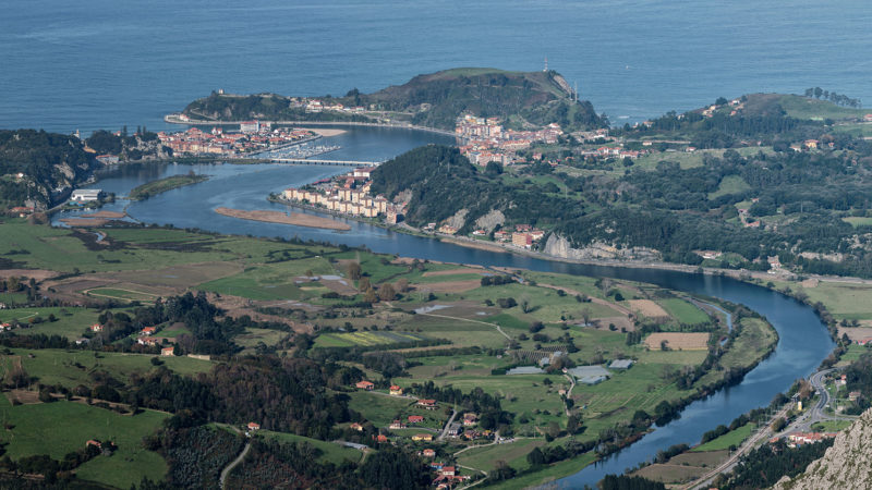
Where does it flow into?
The place where this river flows into the sea is called the Gulf of Biscay, a large bay that forms part of the Atlantic Ocean to the west of the European continent.
This gulf stretches from Cape Ortegal in Galicia (Spain) to Punta de Pern on the island of Ouessant in Brittany (France) and includes the coasts of the following Spanish regions Asturias, Cantabria and the Basque Country, and the French regions of New Aquitaine, Pays de la Loire and Brittany.
In Spain, this gulf is known as the area that includes the coastal sea that bathes the northern coasts of the country and the southwest of France. According to its history, in the 1st century BC, the Romans called it Sinus Cantabrorum (Bay of the Cantabrians), while the northern part was known as Sinus Aquitanus or Mare Aquitanicum (Sea of the Aquitanians).
What is its flow and length?
The river is 66 kilometres long and has an average annual flow of 18.07 m³/s (cubic metres per second, the unit used to measure flow according to the International System, corresponds to a cube with a side of one metre).
Flora and fauna of the Sella river
This section describes the flora present in the Natural Park in which the Sella River is located, as well as some of the animals that inhabit it. Birds, mammals and reptiles are included, as well as information on the habits of the species that will be described next:
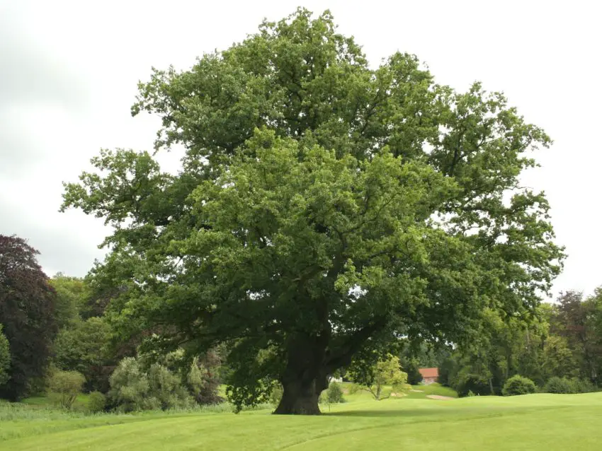
Flora
Close to the river, there are many oak trees that take advantage of its waters to absorb the necessary humidity, which has allowed them to grow into strong and leafy specimens that offer shade to visitors to the park and shelter to the species that inhabit it.
In the lower areas there are other plant species, such as fruit trees, which grow on flat, sunny ground, and hazelnut and walnut trees, which stand out for their height. The tall vegetation in these areas has a leafy appearance and can reach heights of more than 500 metres.
You can also see specimens of Carballo (known as the common oak) and Rebollo, which are related to the holly and can reach a height of over 5 metres.
The fauna
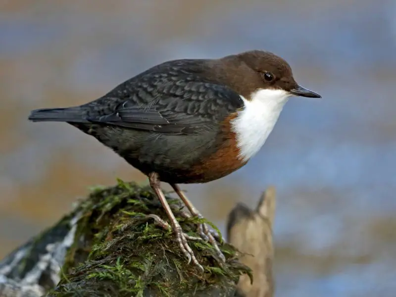
Around the Sella river there are many species of birds, among which the water blackbird stands out. This species lives in the vicinity of rivers at medium and high altitude. This bird prefers the areas of the Sella where the water flow is low and where there are uncovered rocks on which to perch. Occasionally it also visits deeper areas of the river in search of invertebrates to feed on.
It can be seen semi-submerged searching for food, sometimes even swimming to reach its food. It has a habit of making 10 dives per minute and is one of the easiest birds to see in the river.
Another of the most common species in the area is the Cantabrian brown bear, which finds the conditions it needs to thrive and survive here, thanks to the presence of large forests and protected areas with few access points.
The wolf, on the other hand, has a small population in the sector; these animals permanently occupy low areas during the growth of their young and then move to shelters at higher altitudes, where they can settle and have access to other species that serve as food in this ecosystem.
The otter is another mammal found in this region and is also protected by national law. Specimens of this species can sometimes be seen wandering around the area.
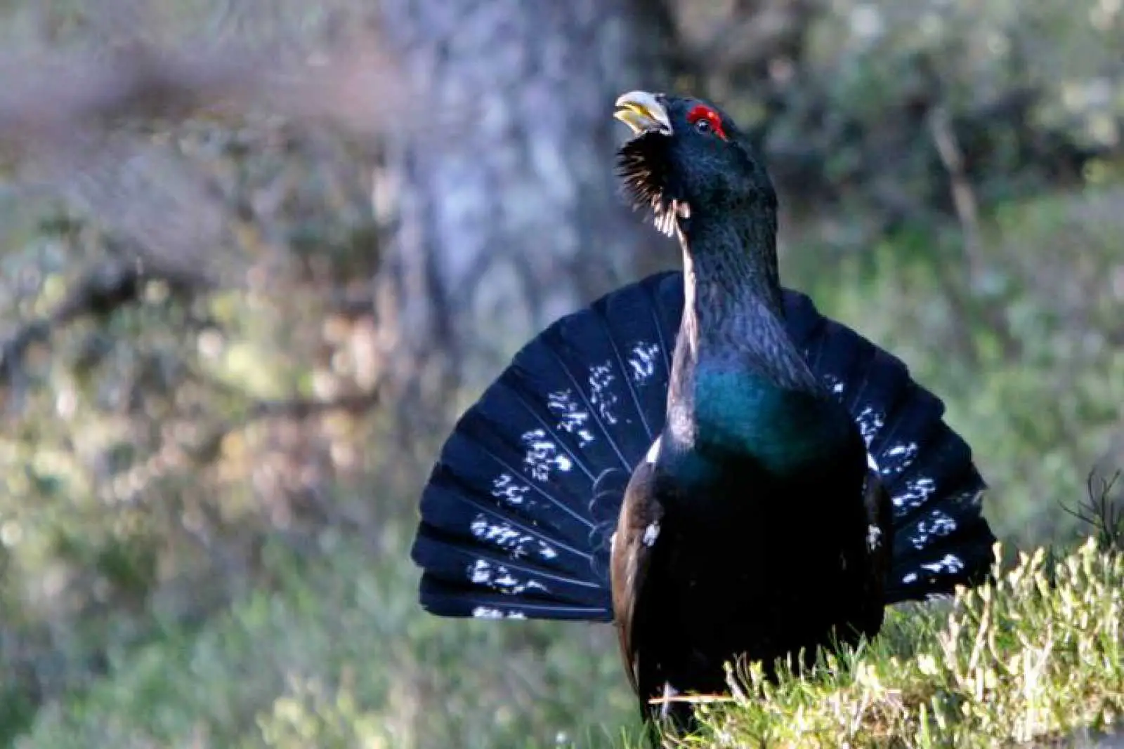
Among the birds that can be observed is the capercaillie, which has a notable presence throughout the region, and there are also reptiles that can be found in the wetlands where they make their homes.
Pollution of this popular river
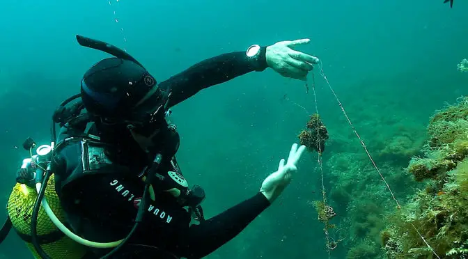
As far as pollution in the river’s surroundings is concerned, it is worth mentioning the huge deposits of lead that have accumulated over the years. A project has been launched to improve this situation by replacing it with alternative elements that do not pollute the environment.
Lead is a very toxic heavy metal and when it decomposes it poses a great threat to the health of living beings. The residues of this material found at the bottom of the river undergo a slow decomposition process during which they contaminate the soil and water, and quickly pass through the trophic chain when ingested by animals and plants.
The above project is called “Project Sella” and is an initiative of Alpha Ocean, a company dedicated to the development, study and conservation of the entire marine ecosystem.
The project began in the autumn of 2001, when a group of professional divers who were studying the fauna of the Sella River discovered the presence of lead in its waters. Until then, the lead had been hidden among sand and gravel, and its grey colour made it impossible to distinguish it from the ordinary stones present in the river.
Which towns does it cross?
The towns through which the river Sella flows are as follows Oseja de Sajambre, Ponga, Amieva, Parres, Cangas de Onís and Ribadesella.
It is worth mentioning that between the towns of Parres and Cangas de Onís there is a Roman bridge that connects both parts to the town of Cangas, this bridge is considered to be one of the most symbolic structures in all of Asturias.
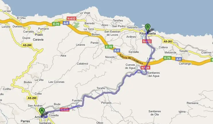
Map of the river Sella
In this map we show how the river is distributed, where you can see the town of Ribadesella as the final destination. From here the river flows towards the Cantabrian Sea, and it is also possible to see all the towns that are close to it, which we have referred to throughout this article.
Curiosities about the Sella river
Here are some curious facts that may not be known to our readers, in order to complete the information presented so far about this important source of water in Spain:
Roman bridge of Cangas de Onís
This is a bridge located in the Asturian town of Cangas de Onís. The river Sella flows under this structure, which is estimated to have been built in the Middle Ages, possibly in the 13th century.
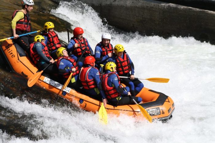
International descent of the Sella
The descent of the river Sella by canoe is one of the most important activities in the region, with the waters of this important hydrological source as its protagonist, now known throughout the world. Another equally famous activity is the Fiesta de las Piraguas, which attracts locals and visitors from all over the world and is an important source of income for the entire region.
This activity takes place every year on the first Saturday in August between the towns of Arriondas and Ribadesella, with a 20-kilometre route along the Sella River. The event is organised by the Spanish Canoeing Federation and the Organising Committee of the International Descent of the Sella, an activity that has been declared a Festival of International Tourist Interest.
There is also a shorter race for children between the ages of 2 and 4. Participants can be professionals or beginners who wish to take part in the competition next year. To take part in this activity, they must complete a course of at least 60 days, in which they learn all the safety measures and manoeuvres of the canoe in the water, an excellent way to promote teamwork.
During the event, the start takes place at 12 noon, where the participants approach their assigned places in their kayaks, the paddles are attached to a metal structure and are released when the traffic light turns green.
The finish is under the Ribadesella bridge, about 20 kilometres from the start. The competition ends 30 minutes after the arrival of the first boat in each category.
These are the categories available at the time of registration for that particular event:
- Junior
- Senior
- Veterans
- Centenarians (this category adds the age of the crew, which must be at least 100 years old).
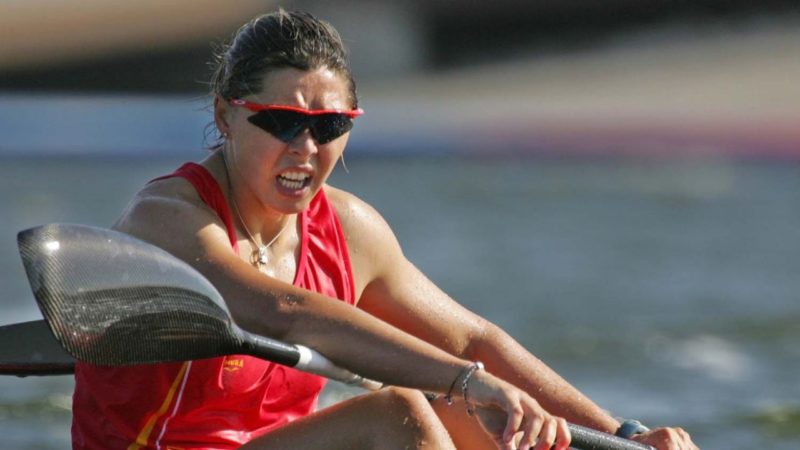
Complaint of discrimination against women
In 2017, Beatriz Manchón, triple world champion in canoeing, denounced the incident of discrimination because she is a woman, as she was not allowed to participate in the downhill competition because the rules do not provide for the participation of a woman in a category, despite the fact that the Spanish Canoeing Federation changed all the rules in 2015, where it is expressed that women can participate in all the national championship events.
If you liked the information you found in this article about the river Sella, we invite you to continue discovering the following rivers:
- River Palancia
- River Chillar
- River Narcea