
Last Updated on September 27, 2023 by Hernan Gimenez
The Júcar River burst through the Tous reservoir, causing the largest flood in Spanish history at a rate of 16,000 cubic metres per second, killing more than 30 people.
This flood was the most important in the history of Spain at that time, because people thought that the Tous reservoir was indestructible. The flood was called La Pantanada de Tous.
History of Tous
When the Iberian Peninsula was part of the Roman Empire, there were several important settlements in the province, such as Segobriga, Ercavica and Gran Valeria. However, the area where Cuenca is now located was uninhabited at the time (see article: Río Duero).
When the Muslim Arabs conquered the area in 714, they soon realised the value of this strategic location and built a fortress (called Kunka) between two excavated gorges of the rivers Júcar and Huécar.

Surrounded by a 1 km long wall. The basin soon developed into a city producing various agricultural products and textiles, and enjoyed increasing prosperity.
Around the 12th century, the Christians who had lived in northern Spain during the Muslim presence began to slowly reclaim the Iberian Peninsula. Castile took over the western and central parts of Spain, while Aragon expanded along the Mediterranean coast.
The Muslim kingdom of Al-Andalus began to break up into small provinces (Taifa kingdoms) under Christian pressure, with Cuenca becoming part of the Taifa of Toledo. In 1076 it was besieged by Sancho Ramirez of Aragon, but not conquered.
In 1080, King Yahya al-Qadir of Toledo lost his taifa and his vizier signed a treaty in Cuenca with Alfonso VI of Leon and Castile, ceding some fortresses in exchange for military aid.
After Alfonso’s defeat in the Battle of Sagrajas (1086), Cuenca was taken by the king of Seville, Al-Mu’tamid ibn Abbad. However, when his lands were attacked by the Almoravids, he sent his daughter-in-law Zaida to Alfonso, offering him Cuenca in exchange for military support.
The first Christian troops entered the city in 1093. However, the Almoravids conquered it in 1108. Its governor declared independence in 1144, followed by the rest of Murcia the following year.
In 1147, Muhammad ibn Mardanis was elected king of Cuenca, Murcia and Valencia. He had to defend his lands against the Almohad invasion until his death in 1172, after which his son had to sign a tribute pact with the newcomers.
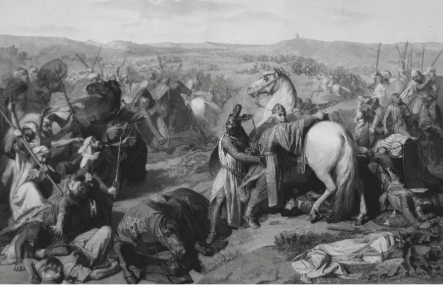
The 17-year-old Alfonso VIII of Castile attempted to conquer the city, but after five months of siege he was forced to withdraw when troops sent by the Almohad caliph Abu Yaqub Yusuf arrived (see article: Río San Lorenzo).
Alfonso signed a seven-year truce, but when in 1176 the Moors occupied some Christian lands in Huete and Uclés, he intervened at the head of a coalition that included Ferdinand II of Leon, Alfonso II of Aragon and the military orders of Calatrava, Santiago and Montegaudio, and besieged Cuenca for months from Epiphany in 1177.
The commander of the city, Abu Bakr, again sought the support of Ya’qub Yusuf, but the latter was in Africa and sent no help. After a failed attack on the Christian camp in Cuenca on 27 July, the besieged city was taken by Alfonso’s troops on 21 September 1177, with the Muslim garrison taking refuge in the citadel.
The latter fell in October, ending the Muslim rule in Cuenca. Alfonso VIII granted the city the title of “very noble and very loyal”. It was given a set of laws, the Fuero, written in Latin, which governed the citizens of Cuenca and was considered one of the most perfectly written at the time.
The diocese of Cuenca was founded in 1183 and its second bishop was Saint Julian of Cuenca, who became the patron saint of the city.
Characteristics of the River Júcar
In the interior of Spain you will find the region of Castilla-La Mancha. It is mainly dominated by large plains and wide valleys. However, this region also has some truly amazing landscapes.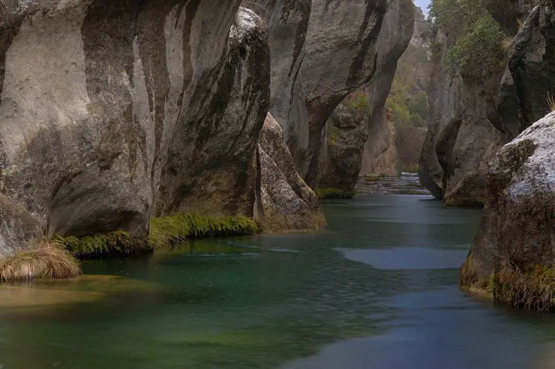
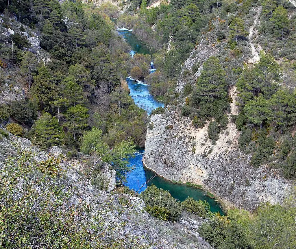
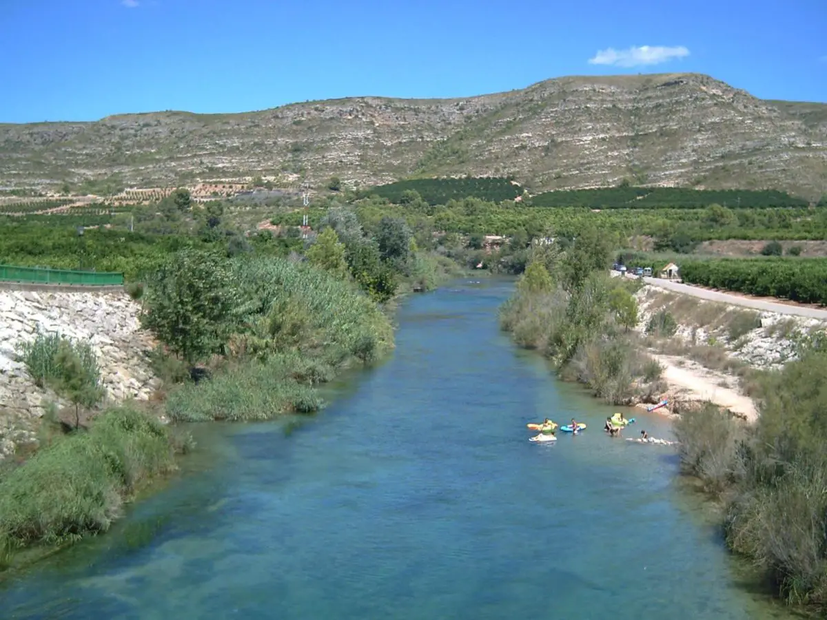
The Júcar Gorge, in the province of Albacete, is one of them. Along the way you will be able to appreciate its extraordinary beauty, with small riverbeds, villages that seem to float in the air and houses carved out of the rock.
When the river Júcar flows through the province of Albacete, it creates one of the most unusual landscapes in Castile-La Mancha: the Júcar Gorge. It is located in the northeast of the province, in an area known as La Manchuela (see article: Snake River).
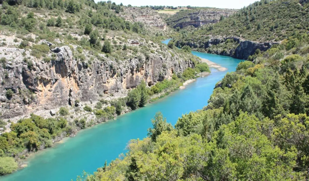
At first, the landscape is dominated by orchards and riparian vegetation. As the river continues, however, it gradually changes: it begins to meander, forming sharp bends, and flows through narrow gorges with walls over 100 metres high.
The surrounding steep slopes are covered with juniper, pine and holm oak forests, while the more vertical parts of the canyon walls are ideal shelters for birds of prey such as eagles and vultures.
However, one of the most remarkable aspects for visitors to the Júcar Gorge is the unique setting of its villages. They are located at the top of the ravine, with incredible views of the surrounding area.
If you want to discover the main attractions of the area, we recommend a route from Valdeganga (25 kilometres from the city of Albacete) to the village of Villa de Ves, along the road that runs parallel to the river.
The source of the river Júcar
The source of the river Júcar is in the Montes Universales, at an altitude of 1,506 metres, in the place called Ojos de Valdeminguete, in the city of Cuenca (Castilla-La Mancha), and flows into the Mediterranean Sea in the city of Cullera (Valencia), after 497.5 kilometres.
The River Júcar, which follows a west-east course, flows through the eastern part of La Mancha until it joins the River Cabriel (Catalan: Cabriol), crosses the city of Cuenca and, at Alarcón, is retained in the first of its two main cores (see article: Río Columbia).
After crossing the lands of Albacete, it enters the Valencian Country through the Vall de Cofrents, where it is squeezed between the transitional buttresses between La Mancha and La Ribera, a circumstance used for hydroelectric exploitation.
The river enters the Ribera Alta where it is dammed at Tous and irrigates the extensive orchards of the Ribera through numerous canelas, such as the Séquia Reial del Xúquer, some of which feed the Albufera de Valencia.
The course and mouth of the river Júcar
The River Júcar, located in eastern Spain, has its source in the Universal Mountains, north of the city of Cuenca. It flows south and then east for 309 miles (498 km) through the provinces of Cuenca, Albacete and Valencia, entering the Gulf of Valencia at Cullera.
Beyond Cuenca, the valley widens and then narrows into a series of gorges as the river rushes over the edge of the southern central plateau. The Alarcón dam on its upper course and other dams on its lower course generate electricity, supply water to the city of Valencia and irrigate the coastal plains.
The waters of the Júcar irrigate a large part of the plain of La Ribera, from Alberique to the lagoon of La Albufera, mostly under orange groves and rice fields. The river has a strong tendency to flood (see article: River Turia). The river flows about 509 km from its source at Ojuelos de Valdeminguete, on the eastern flank of the Montes Universales, Sistema Ibérico. Its main tributary is the River Cabriel.
[The River Júcar flows southwards and then eastwards through the towns of Cuenca, Alcalá del Júcar, Cofrentes, Alzira, Sueca and Cullera, a town close to its mouth in the Gulf of Valencia, in the Mediterranean Sea. It crosses the provinces of Cuenca, Albacete and Valencia[/su_note].Map of the river Júcar
In the map below we can see where the river Júcar is born, as well as its course and mouth, we already know that it has its source in the Montes Universales, just in Ojos de Valdeminguete, and also flows into the Mediterranean Sea, Cullera (Valencia).
The Júcar river basin
The basin is located on a steep mountain spur whose slopes descend into the deep gorges of the Júcar and Huécar rivers. It is divided into two separate settlements: the “new” town lies to the southwest of the old one, which is divided by the course of the Huécar (see article: Río Caroni).
The city of Cuenca is located in the heart of the Andes, in a valley watered by four rivers:
- Tomebamba.
- Yanuncay.
- Tarqui.
- Machangara.
This site has a long history of close contact with the natural environment. The Historic Quarter of Santa Ana de los Ríos de Cuenca includes the area occupied by the city of Cuenca until the first half of the 20th century, as well as the archaeological site of Pumapungo and the corridors that include the old access routes to the city.
The historic centre of Santa Ana de los Ríos de Cuenca is a remarkable example of a planned inland city in Spain (entroterra), which testifies to the interest shown in the principles of Renaissance urbanism in the Americas (see article: Rio Bravo).
Founded in 1577 according to guidelines issued thirty years earlier by the King of Spain, Charles V, its original orthogonal plan has been preserved for four centuries. At the time of the arrival of the Spaniards, there was already an Indian community (Inca-Canari), and it is from this period that the character of the city of Cuenca is derived.
The urban layout and urban design of its historic centre, which are typical of colonial cities in an agricultural hinterland, are clear evidence of the successful fusion of the different societies and cultures of Latin America.
The urban fabric of the historic quarter of Santa Ana de los ríos de Cuenca consists of a system of parks, squares, atriums, churches and other public spaces.
Around the Plaza Mayor (Parque Abdon Calderón), the three powers of society are always present: the political, with the Town Hall and the Governor’s Office; the religious, with its two cathedrals facing each other; and the judicial, with the Courts of Justice (see article: Río Arkansas).
Its cobbled streets are wide and sunny. In addition, simple colonial houses were often transformed into more important residences, especially during the period of relative economic expansion due to the production and export of quinine and straw hats (19th century).
This led to the development of a specific architecture, combining various local and European influences. Some of the most notable buildings are the New Cathedral, begun in 1885, the Old Cathedral, the Carmelite Monastery and the Church of Santo Domingo.
Religious architecture, closely linked to public spaces where community life is expressed, contributes greatly to the urban profile of the city.
Vernacular architecture, which illustrates the techniques and organisation of space during the colonial period, is mainly found on the outskirts of the historic centre and in rural areas.
A strong concentration of this type of architecture can be found along the river (the Barranco), which defines the boundaries of the historic quarter on the southern side.
Also in this area is the site of Pumapungo (Puma Gate), in the heart of the Inca village of Tomebamba, and that of Todos Santos (All Saints), where archaeologists have unearthed remains from the Canary, Inca and Spanish cultures.
Tributaries of the Júcar River
Among the main tributaries of the river Júcar we have on the right:
- Cantabant.
Escalona.
Belmontejo.
Sellent.
Albaida.
On the other side the following rivers:
On the right: River Cabriel, River Magro, River Valdemembra.
On the left: River Huécar, River Moscas, River Valdemembra, River Abengibre, River Cabriel.
Ecology
There are concerns about the ecological impact of dams, pollution from cities, factories and agricultural landfills. Invasive species are also a burden, affecting much of the original ecosystem; introduced species have rapidly caused the extinction of many native species.
In the past, many lagoons, endorheic saltwater ponds, swamps and freshwater marshes have been drained, dried up or filled in. Almost all the riparian forests have been cleared for crops or pulpwood plantations.
As a result of these changes, many species of plants and animals have disappeared. Dams and hydraulic canalisation have altered the dynamics of the river, creating new drift bars, new oxbow lakes and new abandoned meanders.
Over time, many of these phenomena tend to dry up or become filled with sediment. Some small examples of these river dynamics and wetlands are protected.
The introduction of the American crayfish Procambarus clarkii, which has caused economic losses, has been introduced elsewhere for farming, and its success is due to its ability to colonise disturbed habitats that would be unsuitable for edible Iberian crayfish.
The semi-aquatic rodent Myocastor coypus, or otter, is thought to be expanding into some of the country’s north-western tributaries and protected national parks. Fish from the Júcar River have high levels of mercury and the European Union bans the sale of fish from the Júcar, particularly the large Welsh catfish.
The zebra mussel, an invasive species, is spreading upstream in the waters of the Júcar. Due to its rapid reproductive rate, the species has a negative impact on the underwater machinery of ports, dams and hydroelectric plants, as well as competing with native species.
Following the introduction of the Welsh catfish, there has been a marked and rapid decline in fish numbers. Since its introduction into the Mequinenza reservoir in 1974, it has spread to other parts of the Júcar basin and its tributaries, especially the Magro River.

Some endemic species of Iberian barbels, the genus Barbus in the Cyprinidae, were once abundant, especially in the Júcar. Competition and predation by the Welsh catfish led to its complete disappearance in the middle channel of the Júcar around 1990.
The ecology of the river is also highly developed in terms of aquatic vegetation, seaweed and algae. The barbel species in the tributary of the mountain stream of the Júcar, where the Welsh catfish has not colonised, has not been affected.
Flora of the Júcar
The soils are mainly found where the delta meets the sea and where the salinity is caused by the direct action of the sea or by the salinity of the water table.
The plants that grow here have high concentrations of soda in their tissues, allowing them to maintain a high osmotic pressure and thus resist dehydration. These salty areas often include sand dunes (known locally as “tores” or “muntells”), which are more or less held together by vegetation.
In the first stage, marram grass (Ammophila arenaria) and spurge (Euphorbia paralias) become established. Then other species appear: first a ring of Sporolobuspungens and then, on top of them, sea narcissus (Pancratium maritimum) and, in higher and more mature places, marrow grass (Ononis natrix), Thymelaea hirsuta and Erianthus ravenae.
In the northern part of the delta, the rare Limoniastrum monopetalum grows in the last stage. Sedge banks are found throughout much of the delta in places where the water table is very high and the land is often waterlogged.
The most characteristic plants here are the reed (Phragmites communis and Phragmites communis isiacus) and the great bindweed (Convolvulus sepium). In places where the water is deeper and stays longer, sedges (Cladium mariscus and Carex sp) and rushes (Thypha sp) are found.
The last two species were used in the past to make chair seats, mats, baskets, etc. Riparian forests are the only forest community in the Delta. They are found along the banks of the Júnco River, where the land is higher and water is always available.
White poplars occupy the higher areas and willows (Salix alba) the lower ones. Other common trees include alder, ash, elm and water willow, as well as subspecies such as black poplar, eucalyptus, carob, plane and others such as Lonicera biflora (“lligabosc de riu”), which are particularly interesting.
Where the influence of the sea is stronger, the wood becomes thinner and only oleanders and tamarisks remain. There is also spontaneous vegetation in the rice fields.
In the small freshwater ponds known as “ullals”, water lilies (Nymphaea alba) grow together with algae (Potamogeton sp), which is a serious problem for agriculture because it invades irrigation channels and even the rice fields themselves.
In the rice fields, which act as small ponds for most of the year, we find reeds (Lemna sp, “llaponet de pato”) and bladderwort, in addition to those already mentioned.
Other species considered to be the most representative adventitious plants in the rice field flora are Ammania coccinea (“presseguera”), Bergia aquatica and Lindernia dubia (“aufabigueta”).
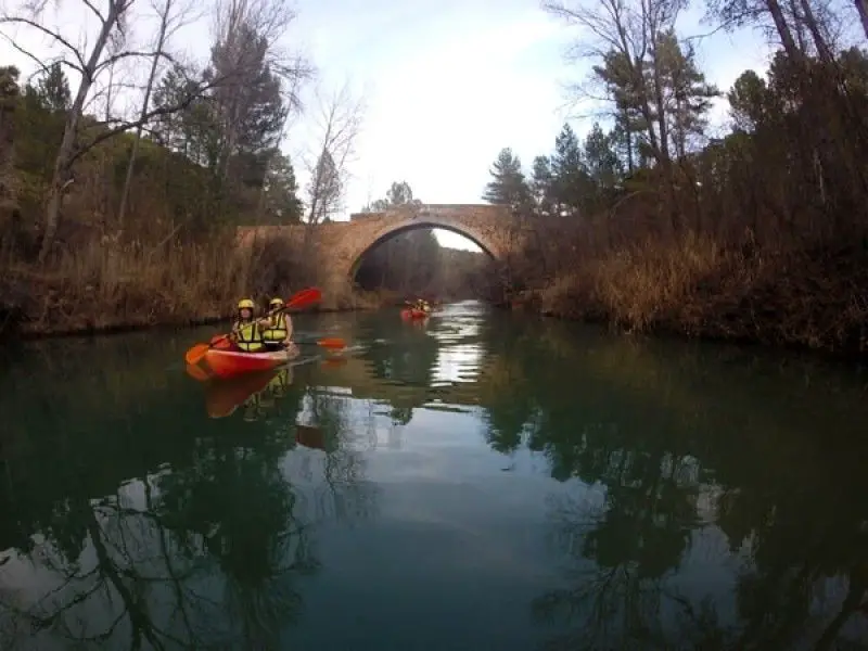
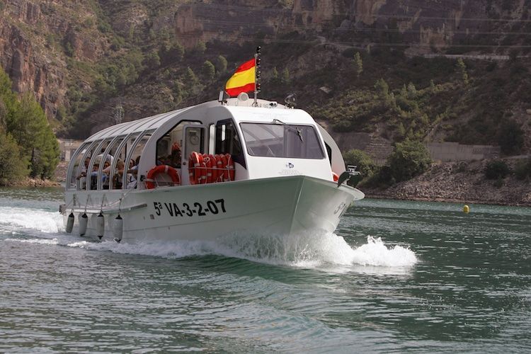
Fishing in the River Júcar Cullera
The River Jucar, one of the largest rivers in Spain, is famous throughout the world for its enormous quantity of fish. Thousands of anglers spend their fishing holidays in Spain along the Jucar to catch carp, catfish, pike-perch and black bass.

Other species include crucian carp, chub, barbel, eel, mullet, rudd and dace. Saltwater species such as sea bass, bluefish and leerfish can be found as far north as Albacete.
The upper Júcar flows through rocky gorges in Cuenca before forming a wider valley in its upper reaches. The water level of the Júcar is at its highest in spring, when other rivers release large amounts of water during the snowmelt in the Pyrenees.
Tours
You can visit the entrance to the former church of the village of Tous. This door was the entrance to the colonial church of Tous, which is still under the water of the reservoir. On the upper floor there is a niche containing the sculpture of Saint Michael the Archangel, surrounded by Corinthian columns and crowned at the time by a double-edged triangular tympanum.
It is a monument of great ornamental interest from the early 18th century. It was built for the Baron of Tous and Terrabona, Jorge Juan de Castellvi. After the flooding of the old village, the façade was submerged in the waters of the reservoir.
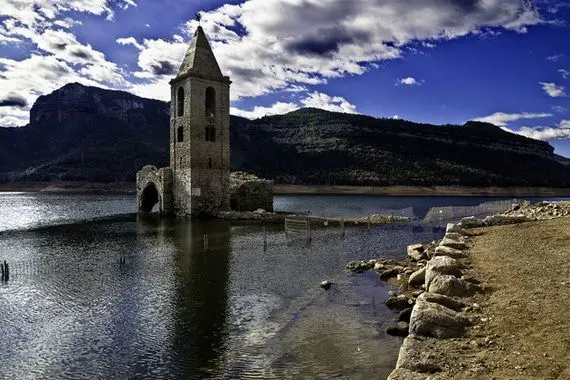
However, in 1987 its stones were recovered, it was rebuilt and reopened in 2002. If we visit the old settlement of the village, we can see the tower and the castle, located on the left bank of the river Júcar, in the southern foothills of the mountainous area of “La Cruz”.
The castle was declared an Asset of Cultural Interest in 2002. Today only the remains of what was once an important fortified Muslim town can be seen. The tower, about 200 metres from the castle, is still standing despite the earthquake that broke one of its sides.
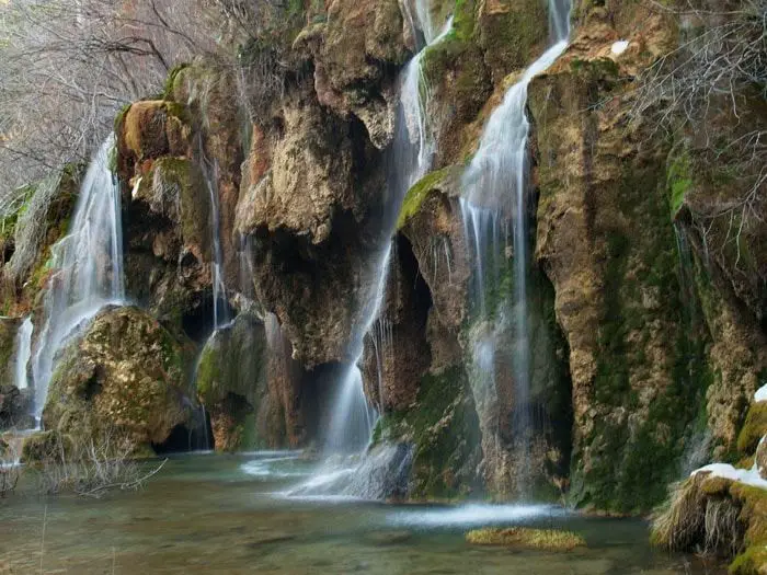
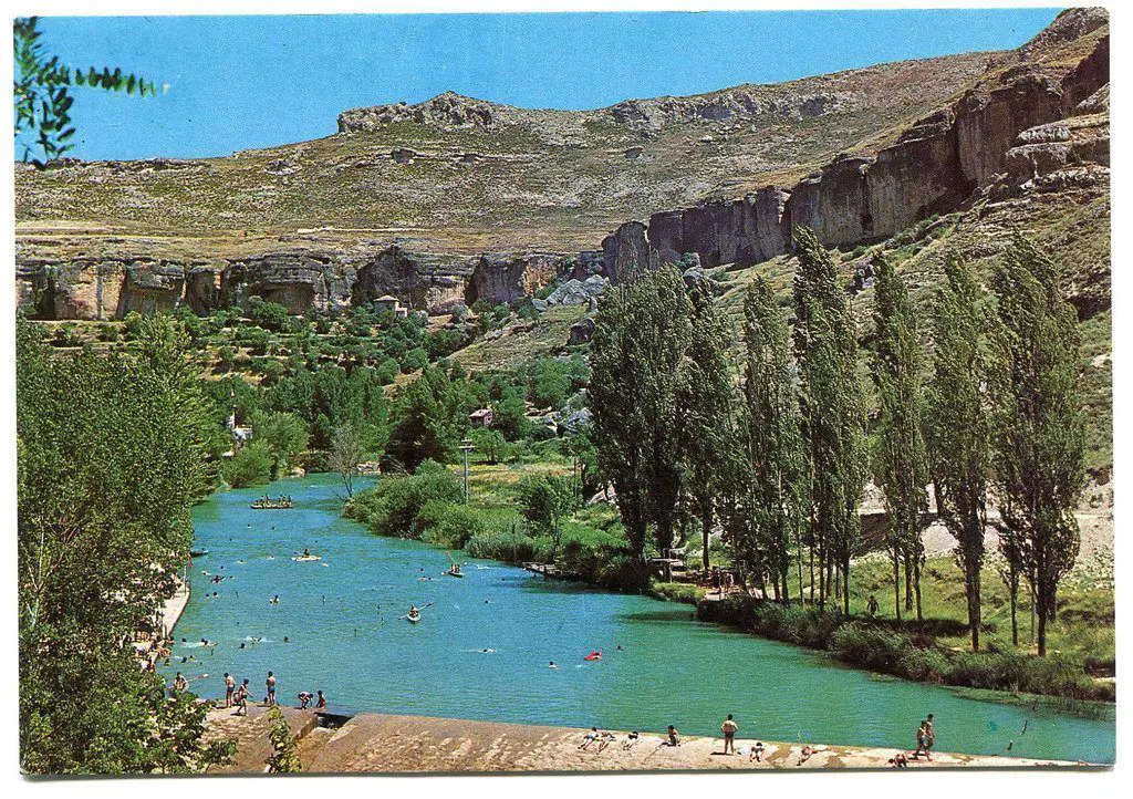
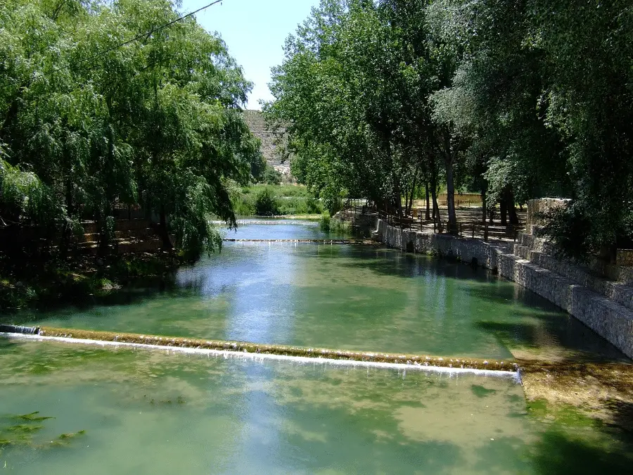
Another place of interest is the Tous reservoir. Its water comes from the Júcar and Escalona rivers. Its waters are very clean, ideal for fishing and hiking in the beautiful surroundings.
The Alarcón dam
The Alarcón dam is a gravity dam on the upper tributary of the river Júcar. It is located 5 kilometres from Alarcón, in the province of Cuenca, in the autonomous community of Castilla-La Mancha, Spain.
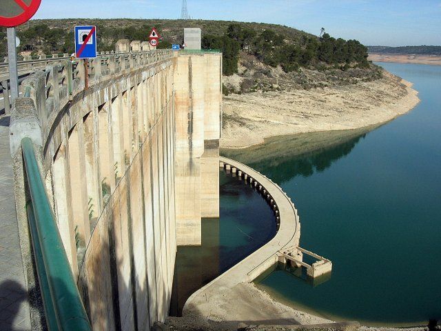
The reservoir created by the dam has a capacity of 1,112 cubic hectometres (901,513 acre-feet) and covers an area of 6,840 hectares (26 square miles). Its total catchment area is 3,033 km2 (1,171 mi2). The dam houses a hydroelectric power station with an installed capacity of 56 MW.
The Tagus-Segura water transfer, which joins two other major rivers, briefly joins the reservoir on its way south, entering it at the northern end and mixing its waters with the Júcar River.
Construction of the dam began in 1941, thanks to the efforts of Valencian farmers who wanted to stabilise the flow of the river, since irrigation in the province of Valencia depends on this water supply.
This initiative is unique in the history of Spain, as it was the farmers who bore the full cost of the project, organised by the Unidad Sindical de Usuarios del Júcar (USUJ), an association of irrigation communities.
Beneath the waters of the Alarcón reservoir lie the remains of the village of Gascas, which was flooded when the dam was built. When the water level drops, traces of the streets and walls can be seen, as well as a stone wall with an arch.