
Are you passionate about learning all about the world’s rivers? In this article we will give you all the information concerning the Iguazu River you need, from the origin of its name and its geographical location to its waterfalls, recognised worldwide as one of the seven natural wonders of the world.
Origin of the name Iguazú
The name comes from the Guarani language, it is a compound word “Y” meaning “water” and “guasú” which translates from the language as “big” meaning Iguazú “Big River”. This river was also known for a long time in colonial Brazil as the Curityba River.
Characteristics of the Iguazu River
One of the characteristics of the Iguazu River is that this marvellous river, which belongs to the silver basin, divides its size between the northeast of Argentina and the southeast of Brazil, flowing into the Iguazu Falls, one of the main tourist attractions in the region.
Location
This river belongs to the Plata river basin, the Iguazu River is located in the central-eastern region of South America.
Where does the Iguazu River originate? To answer this question, the Iguazu River originates in the southeast of Brazil (if you want to see other rivers crossing Brazil, go to the Amazon River link) in a region known as Serra Do Mar, located in the State of Parana.
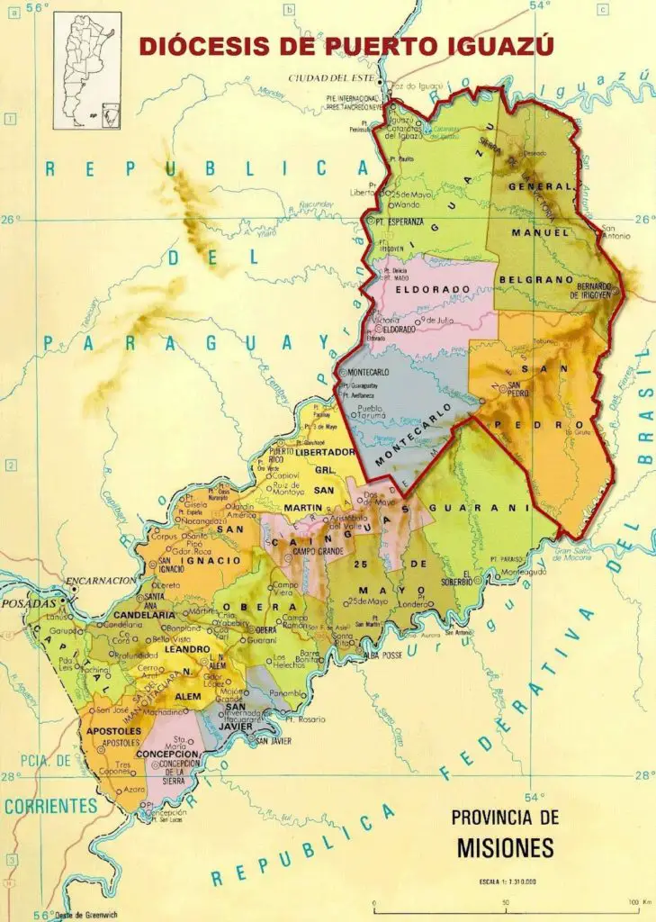
Below is a map of the Iguazu River, where we will show its exact location, as well as its source, mouth and even its course. Here you can see a map of the Iguazu River and its location (See Article: Parana River).
Source of the River
The source of the Iguazu River is located, as mentioned above, a few kilometres from the Atlantic Ocean at an altitude of 900 metres above sea level, in the mountainous region called Serra Do Mar. This region is a mountain range belonging to the Barsileño relief and stretches for about 1500 kilometres along the coastline and runs from the east to the south of Brazil.
Length
The Iguazu River is approximately 1300 kilometres long, of which 1205 kilometres belong solely and exclusively to Brazil and 115 kilometres are divided along the border (Argentina-Brazil). The border starts when the Iguazu River receives its main tributary, the San Antonio River, and ends at the point where the Iguazu River flows into the Parana River.
Routes
The route of the Iguazu River is divided into two sections, one known as the Upper Iguazu and the Lower Iguazu.
Upper Iguazu: This runs mostly in Brazil as we have already mentioned is about 1205 Kilometres and is commonly known as the Upper Iguazu and runs from its source in Serra Do Mar to the Iguazu River Falls. In this course in Brazilian territory five dams were installed that could affect with the passage of time this area of great natural, touristic and ecological value. These dams are: Foz do Areia, Salto Osorio, Segredo, Salto Santiago and Salto Caxia, the latter being the closest to the border.
Lower Iguazú: Also known as the lower Iguazú and refers to the final part of the river’s course, this section is already on the border of both countries and includes from the falls to where the Iguazú River flows into the river, which is on the left bank of the Paraná River at the triple border of Argentina, Paraguay and Brazil.
Iguazu River Basin
The Iguazu River basin has a size of 62000 square kilometres which makes it a very important hydrographic reference.
Main tributaries of the Iguazú River
The Iguazú River receives a large number of tributaries among which are the Bacacher and Baringüí streams that give life to the Chopim and San Antonio rivers, which particularly bears the name of a saint like many cities and towns in the world that have been named after the Christian faith (if you want to know another river named after a saint go to the link San Lorenzo River).
Waters
Its waters come from the rain that falls on its Imbrífera basin, which is the space delimited by all those headwaters that make up the main river.
Another important part of the waters that reach this river are those that filter through the fissures of the plateaus and reappear through the lower slopes that flow abundantly towards the river.
Course
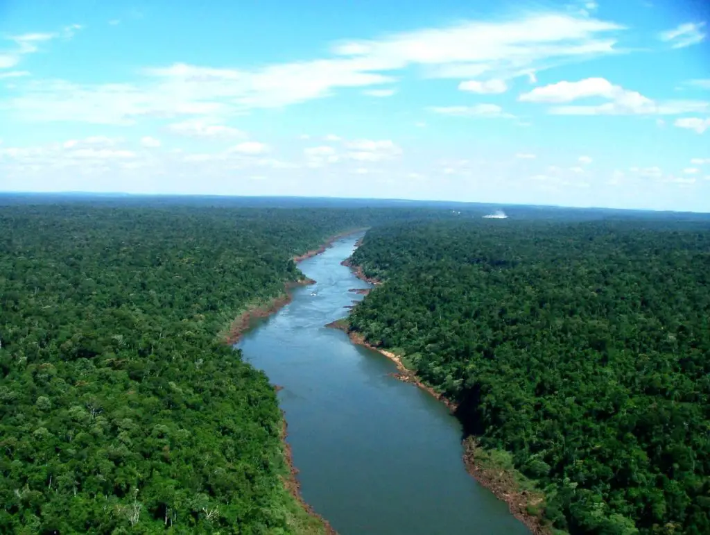
The course of the Iguazú River is generally meandering, i.e. with sharp bends and is embedded in the basaltic or rocky soil. In the Sierras de la Victoria, the river forms a kind of opening. In its bed, rapids and slides are formed thanks to the obstruction produced by the rocks and the change of inclination in the slopes.
Flow of the Iguazú River
Its maximum flow generally reaches 2,500 cubic metres per second in the month of October and the minimum flow is around 1,320 cubic metres per second in the month of April.
Where does the Iguazú River flows into the river?
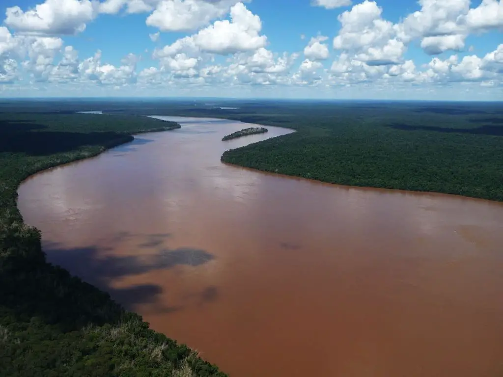
With a width varying between 250 metres and 400 metres (depending on the height of the Iguazú River at the time) the Iguazú flows into the Paraná River but its waters do not mix immediately and for a while you can see how the waters of the Iguazú River, which are cleaner, greenish in colour and of great clarity, are distinguished and swirl with the reddish and darker waters that belong to the Paraná River and which finally end up absorbing the former.
Waterfalls
The river in its wide course in Brazilian territory generates numerous waterfalls of lesser importance than the Iguazu River falls, the biggest falls being the Cayacanga waterfall, a waterfall of approximately 10 metres high and the Do Funil waterfall of approximately 12 metres. The other falls with a much smaller drop are the Passo Falls, the Osorio Falls, the Santiago Falls, the Caxías Falls and the Faraday Falls.
The River Plate Hydrographic Basin
It is to this basin that the Iguazú River belongs, among other rivers, with a diameter of approximately 3,170,000 square kilometres.
The basin is distributed over the territory of the following five countries: Uruguay, Argentina, Brazil, Bolivia and Paraguay, which makes it the second largest basin in South America and the fifth largest basin in the world after the Amazon, the Nile (see link Nile River), the Congo and the Mississippi.
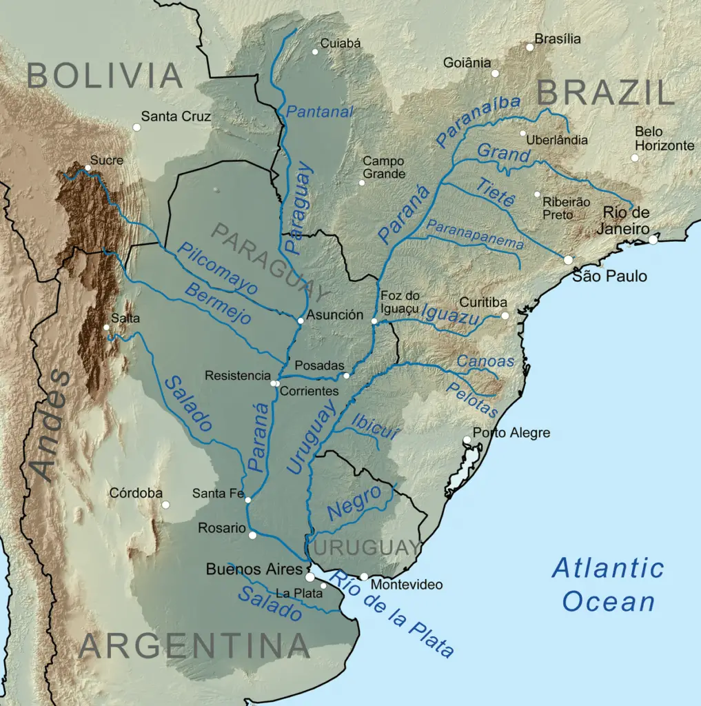
All the rainfall that falls in this basin flows into the Paraná and Uruguay rivers, which finally flow into the Río de la Plata, which finally empties into the South Atlantic Ocean.
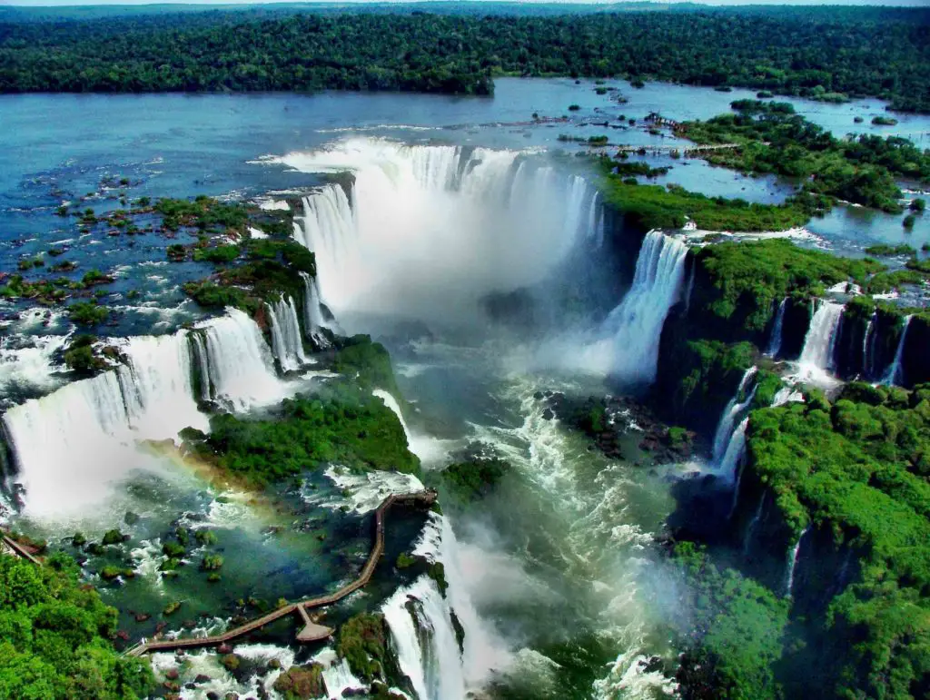
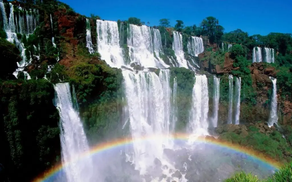
Iguazu River Falls
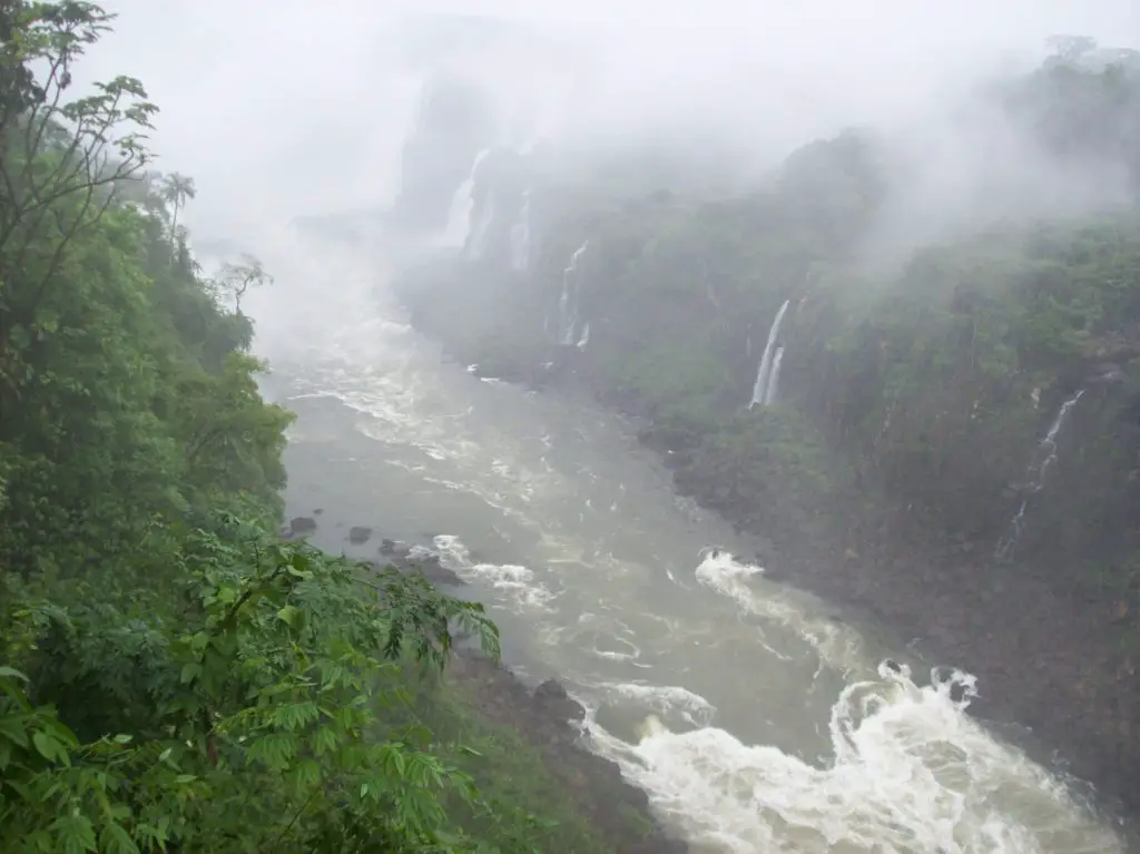
They are considered the largest waterfalls in the world due to their great extension and also to their conformation and disposition that in a natural way forms an asymmetrical arc of numerous waterfalls with greater development in the Argentinean section.
Known in Portuguese as “Cataratas do Iguaçu” this beautiful and impressive waterfall originated by the Iguazu River has been considered as one of the 7 natural wonders of the world along with the Amazon (South America), Jeju Island (South Korea), Komodo National Park (Indonesia), Table Mountain (South Africa), Puerto Princesa Underground River (Philippines) and Ha-Long Bay (Vietnam).
Location
This set of waterfalls are confined on the Iguazu River, located on the border between Argentina more specifically the province of Misiones and Brazil in the Brazilian state of Parana.
The falls are delimited in natural areas protected by the laws of both countries; the section of the falls in the Argentine province is within the Iguazu National Park, while the section in the Brazilian region is in the Parque Nacional do Iguaçu.
Distribution
The falls are arranged in the shape of an inverted “J”. On the north right bank of the falls is the Brazilian section, which accounts for a little more than 20 % of the falls, and on the south left side are the falls in the Argentinean section, which makes up almost 80 % of the waterfalls.
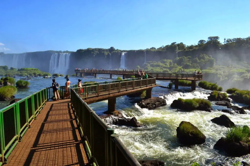
In order to fully appreciate the falls, tourists visiting the falls from all over the world are advised to go to the Argentinean side as well as the Brazilian side, as each side offers a panoramic view of the other.
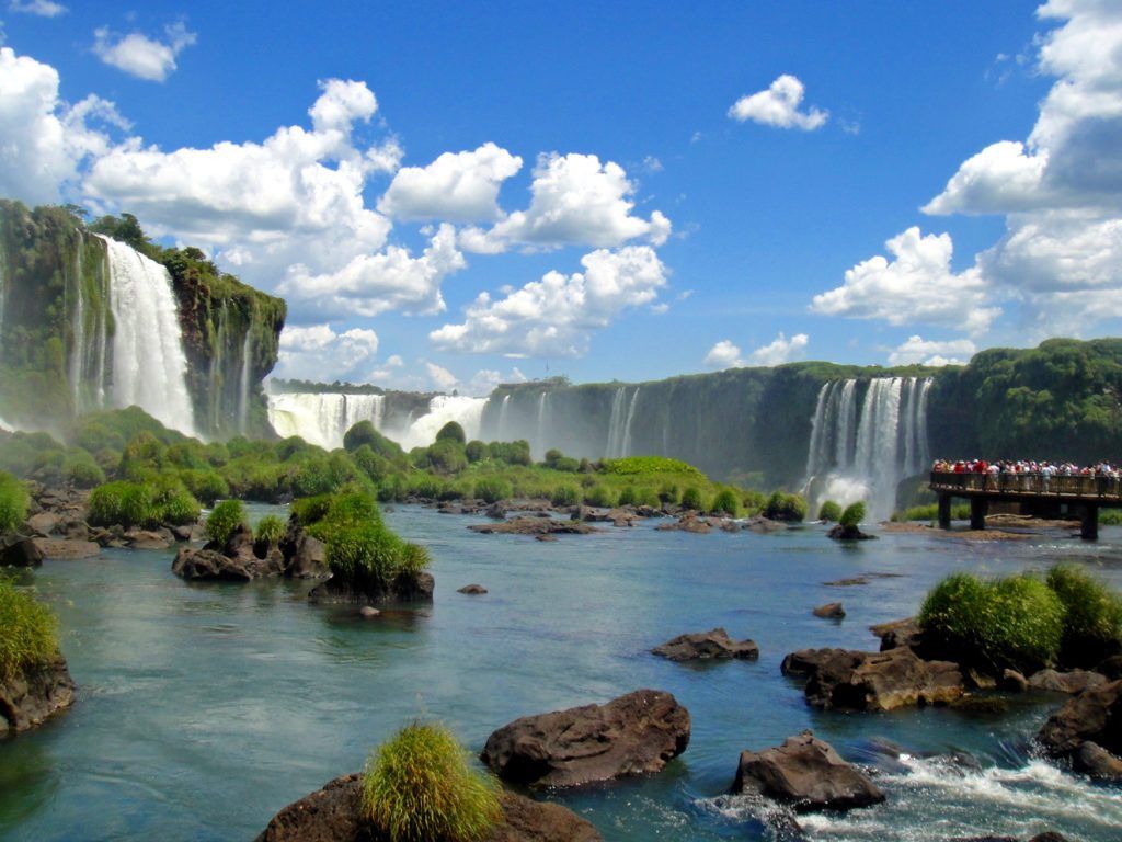
From Brazil you will have the full panoramic view of the falls and their majesty can be admired in full and from the Argentinean side those who visit the falls have the possibility to move between the waterfalls in the boat rides and through the footbridges that allow a close look at the impressive waterfalls.
Waterfalls
There are 275 waterfalls, approximately 80% of which are located in the Argentinean section of the falls.
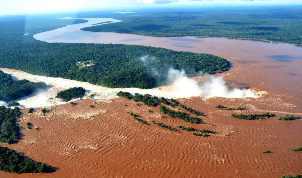
The line of waterfalls reaches a length of 2700 m, 600 of which belong to Brazil. When all the falls are surpassed, the river narrows its course and flows between walls, with the Iguazú River reaching a height of approximately 50 m and a width varying between 30 m and 50 m.
Its highest waterfall, known as the “Garganta del Diablo” (Devil’s Throat), is a basalt wall with a height of 80 metres, where the border between the two countries is located.
In this video you will be able to appreciate the flow of this enormous waterfall and its imposing force which can be appreciated by all tourists who decide to visit this natural wonder:
Flow rate
The usual flow rate of the Iguazu Falls is between 1.5 and 1.7 million litres per second. In June 2014, the Iguazú Falls registered more than forty-six million litres of water per second (surpassing the record flow of thirty-five million litres of water per second previously registered in 1983) due to the heavy rainfall registered at that time.
Fauna of the Iguazú River
The fauna existing in the falls is very diverse and is composed of: 450 species of birds, 80 species of mammals, a great variety of insects and river fauna not recorded in its entirety to date.
The waterfall swifts are the most characteristic birds in the area; they fly across the spaces between the water columns that form the falls and land on the rocky walls where they nest or rest to continue their flight.
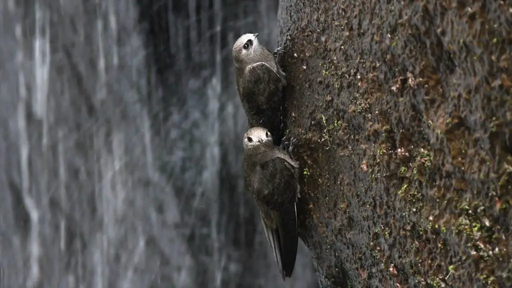
These birds are the symbol of the park, although groups of coatis and the great toucan, one of the five species of toucans known in the area, are also frequently found in the sector of the walkways.
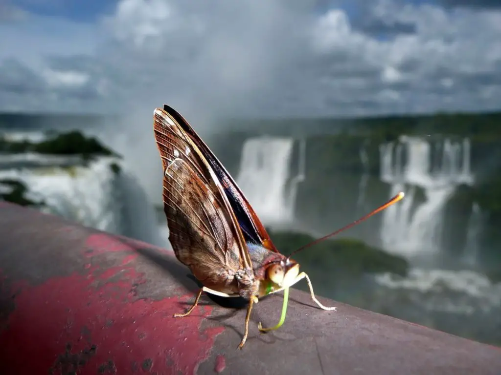
A variety of butterflies can be observed on the park’s trails. Some of them have yellow tones with black spots and dots.
In the midday hours, in the sunny parts of the trails you can observe the lizards belonging to the Tropidurus genus, climbing up the walkways or the stairs of the park in search of a bit of sunshine.
Waterfalls represent a natural refuge for some endangered animals such as:
- The jaguar.
The tapir.
The jungle eagles.
The ocelot.
The anteater.
The yacutinga.
The yacaréovero.
Here in these videos you will be able to observe some of the species we have already mentioned:
Flora
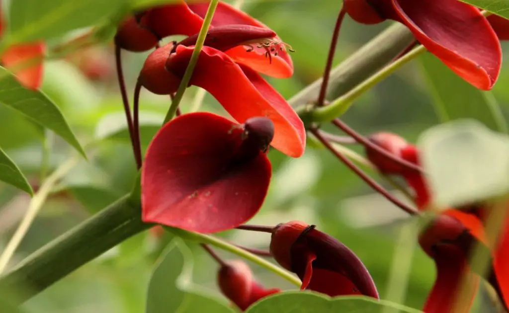
In this area there are several trees with high humidity, as well as several species such as the curupay, the white laurel, the aguay, the cupay, the ingá and the ceibo, from which the Argentinean national flower is born.
Thanks to the particularity of the climate in this tropical region, close to the equator, certain rarities can be found, among which two communities stand out: the grasslands of Paspalum lilloi, a grass (herbaceous plants) that develop and grow between the stones of the river, and the cupay forest.
This forest is composed of these trees with particularly drooping leaves that sprout with a certain coppery colour. Both species can only be found in this Argentinian section of the falls.
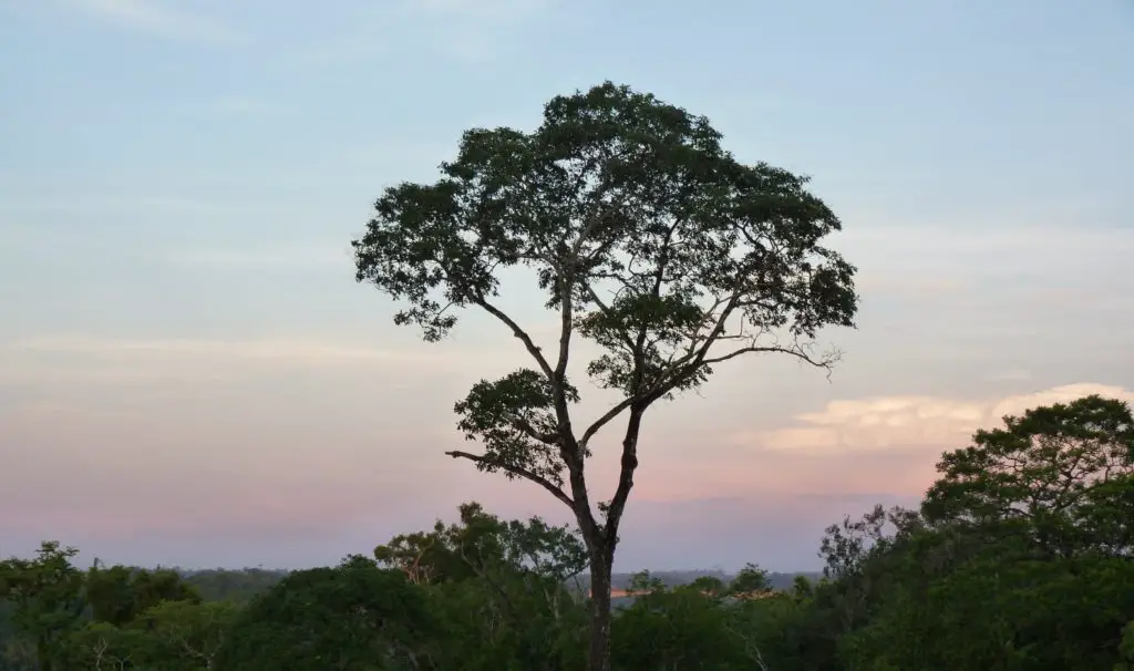
Here you can also find the palo rosa jungle, a tree with a trunk that reaches 2 metres in diameter and is over 40 metres high.
At its feet and at the feet of other large trees of the region, which generate a vast shade, grow the palmitos, well-known palm trees from whose trunks a very coveted edible is extracted, which necessarily requires the complete destruction of the plant in order to be harvested.
History of the falls
It was in the year 1542 that Álvar Núñez Cabeza de Vaca, on his way to Asunción del Paraguay from the Atlantic Ocean, saw these amazing and majestic waterfalls of the Iguazú River in Argentina, which he baptised with the name of Saltos de Santa María (Santa María Falls).
This name, redundancy aside, would be replaced over time by the primitive Guaraní name Iguazú, whose epistemology and toponymic conformation we already know and saw at the beginning of this article.
In this Latin American region, due to political and economic differences with the Spanish crown, the Jesuits were expelled in 1768.
The area of the waterfalls regained new impetus in mid-June 1881, shortly before the Missions were federalised and at a historic moment in which the province of Corrientes, which was in full jurisdiction, sold some 50 square leagues of land touching the Paraná, Iguazú and Uruguay rivers to Ernesto Arnadey and Severo Fernández, who later transferred their rights to Rafael Gallino in October of that year.
Among the travellers on this expedition was Jordan Hummell, who years later would organise the first tourist trip to the Iguazú Falls.
In 1888 Martín Erracaborde Cía would buy the Iguazú lands, as they were known at that time, from Gregorio Lezama.
On September 20, 1895 the province was divided into 14 departments and the Department of Iguazú became part of the Frontier Department.
In 1897 Jordan Hummell would have made a new incursion to the falls through the Brazilian section, because from the Argentinean section the jungle made the task a feat as it was very dense and almost impossible to penetrate. It is from this trip that the government became interested in promoting the arrival of tourists to the area.
In 1902 the architect Carlos Thays was commissioned by the Ministry of the Interior of Argentina to carry out a study of the falls, a study that would be the basis for the creation of the Iguazú National Park in 1934, a park that houses 67,620 hectares of jungle belonging to the Missions.
Legend of “Boi”
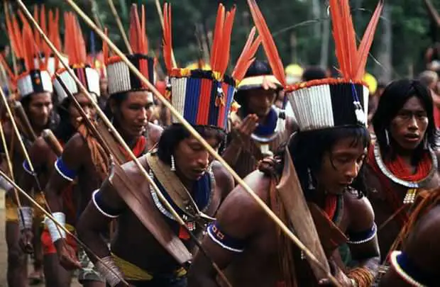
One or perhaps the most picturesque of the indigenous legends that try to explain or give reason for this particular natural spot and its conformation is the legend of the giant snake known as “Boi”, this monstrous beast that inhabited the waters of the Iguazú River in Argentina was to be honoured by the Guaraní Indians that covered the whole region, these had to, once a year sacrifice a maiden in the waters of the river giving her to Boi.
All the Guarani tribes had to participate in this ceremony, including those tribes that were further away from the river region where the falls would later be built.

Tarobá, a young chieftain who had come to lead his tribe, decided that year, in the days before the ceremony and due to the great beauty of the maiden known as Naipi, to oppose the decision of the elders of all the tribes and kidnap the young and beautiful Naipi so that she would not be sacrificed.
In his vain attempt to achieve this, Tarobá fled with Naipi in his canoe the night before the sacrifice, but when he found out about this, Boi, blinded by his anger, raised his back and threw himself against the river, splitting it in two, thus creating the falls. Boi trapped Tarobá and Naipi, turned the hair of the young maiden into the water that falls from the falls and the young cacique turned him into all the trees that inhabit and cover the upper part of the falls.
Finally, the serpent plunged into the “Devil’s Throat” from where he watches that the lovers never again unite in that region, except on days when the sun shines and the rainbow appears, overcoming the strength of Boi and thus uniting the lovers.
Tours and tourist activities
As the main tourist centre located in the northeast of Argentina and one of the main tourist centres in the whole country, the Iguazu Falls offer more tourist and recreational activities on the Argentinean side than on the Brazilian side, even though from this side you can appreciate the whole composition of the falls with a panoramic view.
Close to the falls is the Argentinean city of Puerto Iguazú, where the Iguazú and Paraná rivers meet. This is where the river of the triple border between Brazil, Argentina and Paraguay is located.
Walks
There are two walks that tourists and visitors to the falls can take: the lower walk and the upper walk:
- Inner Walkway: This walkway starts from the lookout point and descends natural stairs carved by erosion into the rock until it reaches the river. This beautiful stone path is surrounded by lush jungle and will allow visitors to enjoy views of the lower part of the park’s falls.
It begins with a visit to the Lanusse waterfall and then passes by the Álvar Nuñez Cabeza de Vaca waterfall (named after one of the first settlers who arrived in this region) and then you will reach a point that allows a panoramic view of the Devil’s Throat and as you go a little further on you will be able to admire the San Martín Island and just to the right of the island you will see the waterfall of the same name. At the end of this route, tourists will be able to admire the Bossetti waterfall.
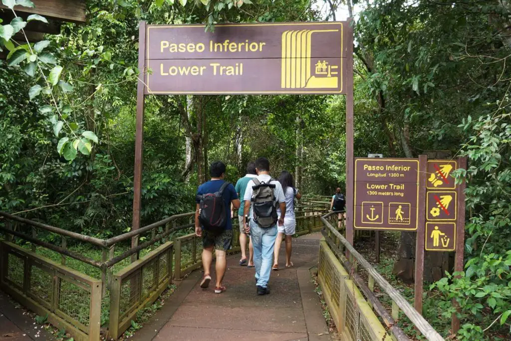
At this point of the route, you will be able to witness how the water vapour produced by the water hitting the rocks forms a weak but constant rain and then, when descending from the path towards the place known as Punta Peligro, tourists will be able to sail along the Iguazú River, if the river conditions allow it, and thus cross to San Martín Island. On the way back they will pass the waterfall known as Dos Hermanas.
Upper Walk: You start from the same place mentioned above and you will walk along the upper part of the falls, just as the name of the walk shows us, this observation point from the upper part of the falls gives you a totally different view of the whole landscape as you can feel and admire the force with which the water cascades down the falls.
We visit again the Salto Dos Hermanas, the Salto Bossetti and the Salto Chico as a small foretaste of the imposing force of the Garganta del Diablo (Devil’s Throat).
Devil’s Throat
This is accessed by the well-known Waterfall Train, and descending at the Devil’s Throat Station is the starting point for a walk along a footbridge that meanders between the islands and covers approximately 1100 metres until reaching the spacious boxes located at the edge and in front of the Throat.
San Martin Island
The San Martin Island located inside the falls is to the south of the Devil’s Throat and it is possible to access it through a circuit of boats that leave from the lower part and thus be able to observe both the San Martin Falls and the panoramic view of the Devil’s Throat.