
Last Updated on September 14, 2023 by Hernan Gimenez
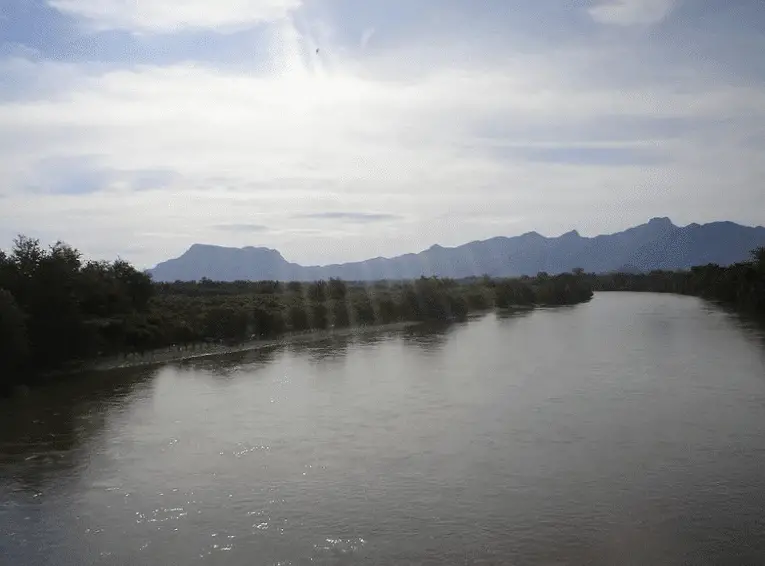
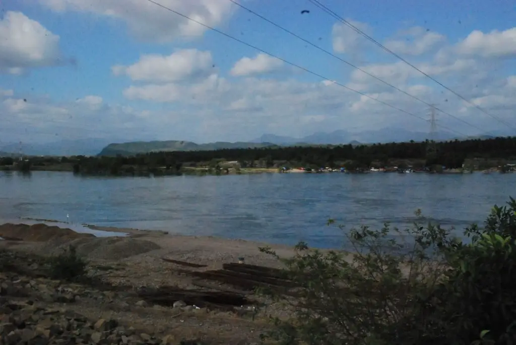
The Balsas River is one of the largest rivers in Mexico. It rises where the Atoyac River flows into the confluence of the San Martin and Zahuapan Rivers in the state of Puebla.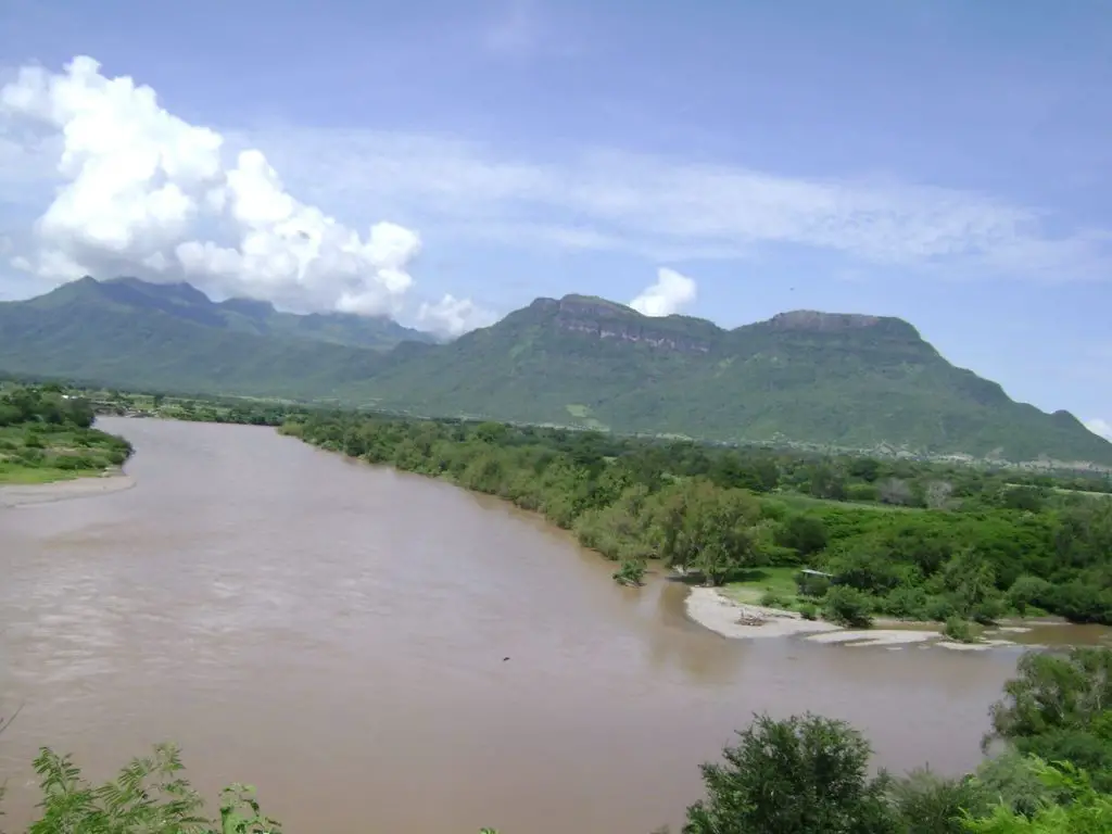
It then flows southwest and then west through the Balsas tributary into the state of Guerrero, where it is the main river and is locally known as the Mezcala.
Location and map of the Balsas River
It covers the state of Puebla, the states of Mexico, Morelos and the mountainous region of Guerrero, as well as several river systems of the Central Plateau.
It forms the border between the states of Guerrero and Michoacán and flows into the Pacific Ocean at Mongrove Point. Although its 479-mile (771 km) course is unnavigable because it is frequently interrupted by rapids, the river is widely used for hydroelectric power and irrigation (see article: Snake River).
Map of the Balsas River
In terms of the location and importance of the Balsas River, the following map shows the course, source and mouth of the Balsas River.
Where the Balsas River originates
The main system or source of the Balsas River is the Tlapanec River, with tributaries coming from the mountains, such as the Mixteca of Oaxaca. It is joined by the Amacuzac River, fed by streams around the Xonacantapec volcano, and by the San Jeronimo and Chontalcoatlan Rivers.
The latter two rivers originate around the Popocatepetl volcano and flow through the state of Morelos (see article: Río Segura).
Economy
The Balsas River basin has seen a great deal of economic development. Through the construction of dams, these activities have been aimed at irrigation, electricity generation and the improvement of agriculture and the living conditions of the indigenous peoples, mainly the Nahua, who form the majority group
Corn, coffee, cotton, sugarcane, tropical fruits and vegetables are the main crops grown in its basin (see Missouri River article).
Seven hydroelectric projects are planned for the Balsas River. The two main projects are La Villita and El Infiernello (in Michoacán). The Carlos Ramirez Ulloa (El Caracol) project is being developed in Guerrero, and four others are planned for the future.
Two dams on the river provide irrigation and electricity. The water stored by the dam at Tierra Caliente is used to grow cotton and rice.
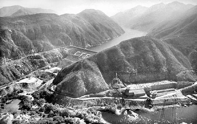
The Balsas River basin was first considered for hydroelectric development in the 1940s. The basin covers 105,900 km2 and the two projects implemented are La Villita and El Infiernillo (both in Michoacán).
The El Infiernillo dam is a 149 m high rockfill embankment dam with a narrow central core. It is located on the Balsas River, approximately 200 miles (320 km) southwest of Mexico City.
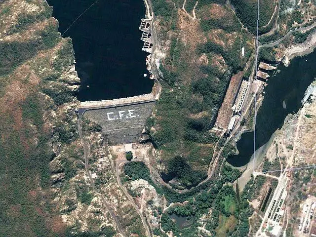
Its height is approximately 148 m, the length of the crest is 344 m and the width of the base from the upstream toe to the downstream toe is 570 m. The reservoir has a storage capacity of 7.09 billion m3. It is the largest hydroelectric project in Mexico and is also expected to reduce flooding in the area.
La Villita is an earth and rockfill dam with a crest length of 320 m, a height of 60 m and a generation capacity of 300 MW. It was the first dam built on the Balsas River. It is located 15 km from the Pacific Ocean.
Both dams are structurally sound and have withstood the five magnitude 8.1 earthquakes that have occurred since their construction.
Pollution of the Balsas River
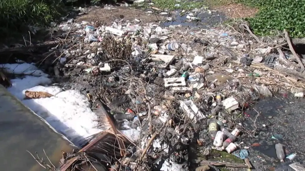
With the installation of the textile, the spillage of indigo, a dye used to colour denim, and sodium hypochlorite, a bleaching agent, began.
In the state of Puebla, 2.3 million people are directly affected by the pollution of the river. Every day, 146 tonnes of organic waste are dumped into the river, along with 62.8 tonnes of solids and heavy metals such as zinc, aluminium and manganese (see article: Solimoes River).
Type of water in the Balsas River
According to studies carried out in the river basin, pollution is the result of untreated wastewater discharges, whether for human consumption, industry, agriculture, livestock or mining.
At the end of 2001, more than 70% of the river showed signs of pollution. The catchment area has a high level of pollution.
Due to the characteristics of the hydrological cycle, a river can be cleaned up in a short time if the source of pollution is stopped and a significant amount of pollutants is not trapped in the sediment.
Below you can watch a video about the restoration of the Balsas River.