
With a length of 1,813 km and a basin of 148,000 km, the Putumayo River forms the border between Colombia, Peru and Ecuador, making it a very important transport waterway. To find out where the Putumayo River is, read on to find out more!
Location and source
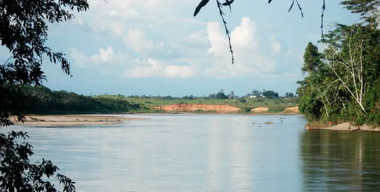
Where does the Putumayo River originate? This long Amazon river rises in the Nudo de los Pastos in Colombia and flows into the Solimoes River in Brazil. It crosses the countries of Colombia, Peru and Ecuador and the Putumayo River flows into the Amazon River.
When it reaches the Amazon, the name of the Putumayo River, when it becomes Brazilian, is Iça River. From the first part of the river at Nudo de los Pastos, the river is entirely Colombian until it reaches the mouth of the San Miguel River.
From here it shares its waters with Ecuador and becomes Colombo-Ecuadorian (Putumayo River in Ecuador). In Colombia, the Putumayo River is characterised by its higher altitude, which means that more people live near it.
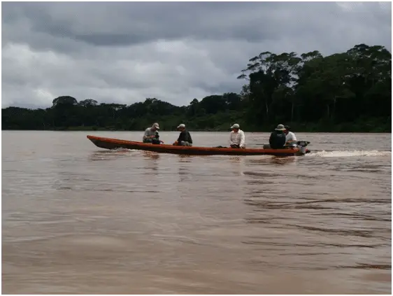
Although its main use is for navigation, as part of the river is used by tourists and locals, it poses problems for boats and canoes in its lower part, between Puerto Asis and Puerto Ospina.
Map of the Putumayo River in Colombia
The map of the Putumayo River in Colombia shows how the river flows through the three countries of Colombia, Ecuador and Peru.
Distribution of its tributaries
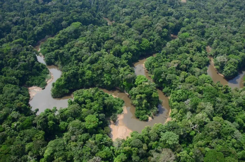
The Putumayo River in Colombia, explains how its waters flow through the whole of Latin America, these waters are spread out by smaller rivers that form them further downstream.
Colombian stretch
Guamúez River
Quebrada Cehembí
Stretch on the border of Colombia and Ecuador
- Güepí River
- San Miguel River
- Yavineto River
- Campuya River
- Cara Paraná River
- Algodón River
- Igara Paraná River
- Yaguas River
- Cotuhe River
- Pureté or Puretá river
Navigation
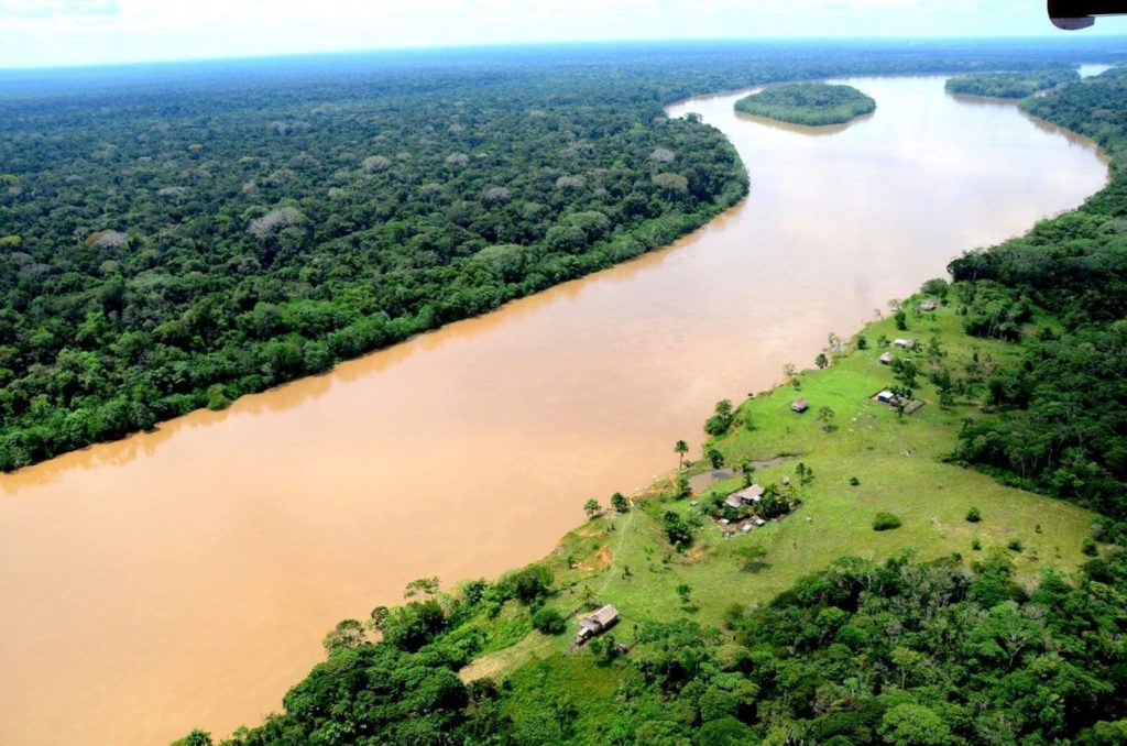
Regarding the navigation of the Putumayo River in Colombia, we have that its current varies from 0.5 to 1.5 m / s, depending on the season and the stretch of the river, nevertheless it is considered navigable in its entirety from Puerto de Asis to the mouth, which is located in the Amazon River in Brazil.
The characteristics of the Putumayo River are that it is 1,800 km long and easily navigable, including the middle and lower parts, which have depths between 4 and 9 m and speeds that vary between 0.9 m/s at the level of the municipality of Tarapacá.
All the countries that are part of these waters want to promote their use as a means of easy transport for the local people. Ecuador and Peru have also joined.
The aim is to promote trade between the countries of the South until full social and economic development is achieved.
Putumayo River Ecuador
This part of the river is linked to the border between Colombia and Ecuador, as both countries share an international border made up of a maritime section and two land sections.
When it reaches the confluence of the Guamúez and San Miguel rivers, after the Cehembí ravine, it begins a 1,500 km stretch where it joins the south of Colombia, starting with Ecuador and then Peru.
Currently, a small part of the river belongs to Ecuador, and the tributary called San Miguel de Sucumbíos forms a border with Colombia.
Putumayo River Peru
According to the location of the Putumayo River, the border between Colombia and Peru consists of a large international boundary of 1626 km that separates the two countries, with the Putumayo River between them.
The Amazonian trapezoid between the Putumayo River and the Amazon River is not counted as part of this territory, as it is completely controlled by Colombian sovereignty. We have already mentioned where the Putumayo River is.
Even the Colombian government has checkpoints scattered along the border to monitor what enters, leaves and crosses the Putumayo River from Peru.
However, Colombia and Peru have signed treaties to better understand each other on the border of the rivers that separate them:
- The Güepí and Putumayo rivers and downstream to the mouth of the Yaguas River belong to Peru.
- The line from the beginning of the Yaguas River on the Putumayo to the beginning of the Atacuari River on the Amazon.
- On the Amazon River, further downstream, along the same path until reaching the mouth of the San Antonio ravine, where the border with Brazil comes into view.
Some of the border cities in Peru are:
- Güepí.
- Flor de Agosto.
- Santa Mercedes.
- San Antonio del Estrecho.
- Francisco de Orellana.
- Santa Rosa de Yavarí.
- Puerto Limón.
The main border rivers that form part of the Colombian-Peruvian border are:
- Putumayo River.
- Yaguas River.
- Atacuari River.
- Amazon River.
- Loretoyacu river.