
The main rivers of the Pánuco are the Santa María, which rises in the interior plateau near San Luis Potosí and becomes the Tamuín as it descends from the Sierra Madre Oriental, and the Moctezuma, which flows through the mountains from the southern state of Querétaro.
The river system (316 miles [508 km] long, including Santa Maria) is of considerable economic importance (see article: Rhine River).
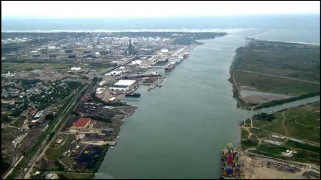
It has served to drain Texcoco and other inland lakes through a system of tunnels and canals; its waters are used to irrigate the fertile lowlands of La Huasteca, and its lower course is navigable (ocean-going vessels can dock at Tampico), hence the name Panuco de Tampico River.
Characteristics of the Panuco River
In order to know where the Panuco River originates and flows, it is important to know that near its source, the Panuco serves as a drainage channel for Mexico City. From there it becomes the state boundary between Hidalgo and Querétaro as it flows towards San Luis Potosí. (See article: Río Tamesis).
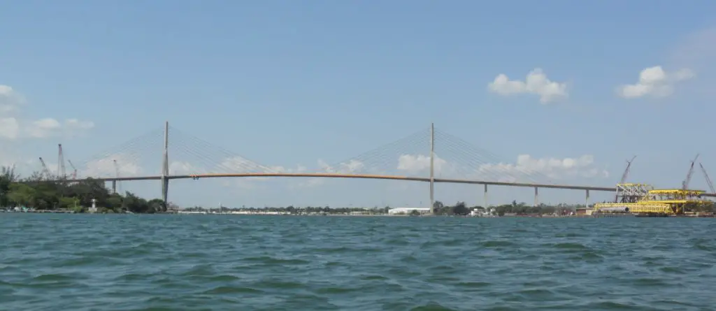
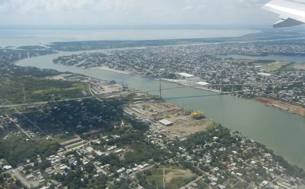
It takes the name of Río Pánuco only when it reaches the state of Veracruz, i.e. Río Pánuco de Veracruz. On the other hand, the Panuco flows into the Gulf of Mexico at Tampico and Ciudad Madero, where the border between the states of Tamaulipas and Veracruz begins. The Pánuco bridge in Tampico crosses the river near its mouth in the Gulf.
In total, the Pánuco is over 500 km long, although only the last 15 km are navigable for larger vessels. According to the Atlas of Mexico, it is the fourth-largest river in Mexico in terms of flow, and forms the sixth-largest watershed in Mexico in terms of area (see article: Río Caqueta).
The entire basin of the Pánuco and its tributaries drains parts of Tamaulipas, San Luis Potosí, Guanajuato, Querétaro, Hidalgo, Mexico, Puebla and Veracruz.
Location and map of the Pánuco River
The Pánuco River is located in the state of Veracruz, in central-eastern Mexico. Formed by the confluence of the Moctezuma and Tamuín rivers at the San Luis Potosí-Veracruz state border, the Pánuco generally meanders east-northeast past the city of Pánuco to the Gulf of Mexico.
About 6 miles (10 km) below Tampico. Just upstream of Tampico and Ciudad Madero, the Pánuco joins the Tamesí, which forms the border between Veracruz and Tamaulipas.
We already know where the Pánuco River rises and where it flows, now we will show where the Pánuco River is located, and its exact location, as we have already mentioned that it belongs to the state of Veracruz, in Mexico, so here is a map of the Pánuco River.
Water types of the Pánuco River
We have already mentioned where the Pánuco River is located, now it is time to mention the types of water of the Pánuco River in Veracruz. The Santiago River and the Pánuco River both originate in the Central Plateau of Mexico and flow in opposite directions. The Santiago River flows over a tectonically active margin that drains into the Pacific Ocean, and the Panuco River flows into the passive margin of the Gulf of Mexico.
Annual and monthly averages of suspended sediment load and water discharge over about 50 years were used to assess sediment load and water discharge in these two rivers (see article: Snake River).
Our results showed that the Santiago River discharges about 45% more sediment to the ocean than the Panuco River. However, we found that the Santiago River has about half the water discharge of the Panuco River.
The high river gradient along the Santiago River is likely to increase net erosion and sediment transport capacity. Water discharge in the Panuco basin is higher than in the Santiago basin because of the higher annual precipitation in the former.
The difference in sediment and water discharge for both rivers is also related to El Niño Southern Oscillation events. Our results show that water discharge in the Santiago River increases during El Niño and La Niña events. In contrast, the Pánuco River is mainly affected by La Niña events.
Pollution of the Pánuco
The main source of pollution in the river is the wastewater discharged into the urban and rural sewerage systems of Mexican cities, as it is apparently discharged without proper treatment after being used by various industries, including mining.
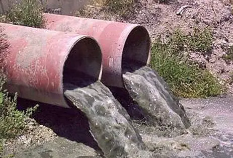
In the Valley of Mexico region, which covers four states, 36 per cent of the water is extremely polluted.