
Last Updated on August 1, 2023 by Hernan Gimenez
If you are one of those who like to learn about the magic of nature and especially about rivers, I invite you to continue reading this information about one of the most important rivers in the world, the Orinoco.
Orinoco River
As one of the most important rivers in Latin America, it is the largest river in Venezuela, about which there are some interesting legends that tell of monsters, as well as a stone called “La del Medio” that stands out in the middle of the river. Besides being a source of great mineral, ecological, natural and water wealth, it is also the owner of the antiquity of the country.
Its name comes from an indigenous Venezuelan tribe, now extinct, that lived near the state of Apure and the banks of the Orinoco River.
Location and length of the Orinoco River
As for the location of the Orinoco River, we can say that it is in Venezuela, in the state of Amazonas, which begins at the confluence of the Guaviare River, where it borders Colombia, and flows before a place called San Fernando de Atabapo. It is considered the fourth largest state in Latin America. And the largest in the country. Accompanying in its size in the south to the Amazon River.
The length of the Orinoco River alone is 2,140 kilometres, which together with the Orinoco-Guavire system increases to 2,800 kilometres, making it one of the largest in the world. The second largest river in South America is the Paraná, which follows the Amazon.
The Orinoco River divides the Venezuelan states of Guárico, Apure, Monagas and Anzoátegui on the left side of the state of Bolivar. At the beginning of the delta it opens up and from there the state of Delta Amacuro is formed. This is where the Orinoco Delta is located, which is so vast that the first explorers thought it was a sea.
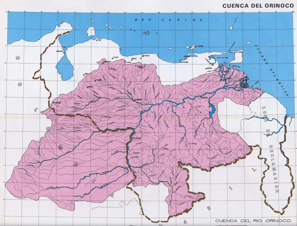
The Orinoco River basin is of great historical and economic importance to Venezuela, as its waters have been used to transport different types of goods to the cities for consumption. And also for the indigenous people who live in the area.
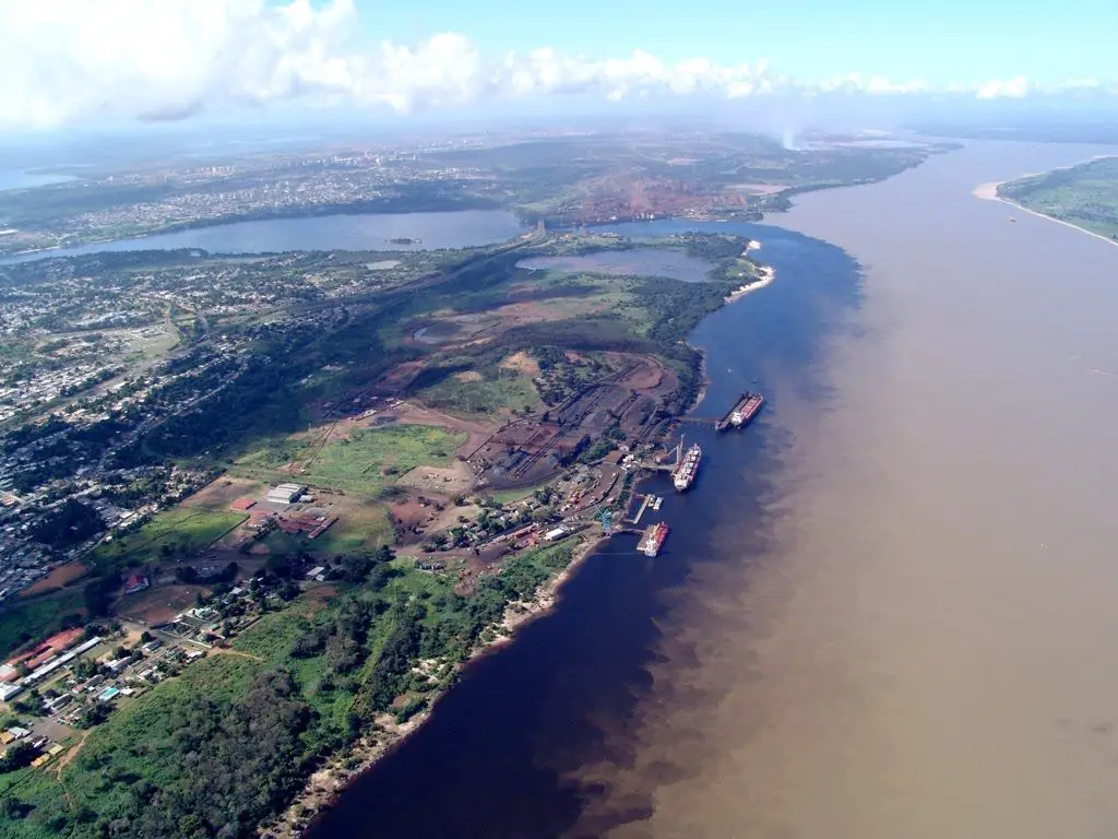
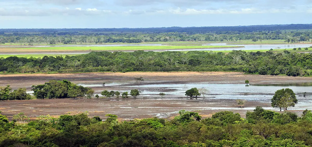
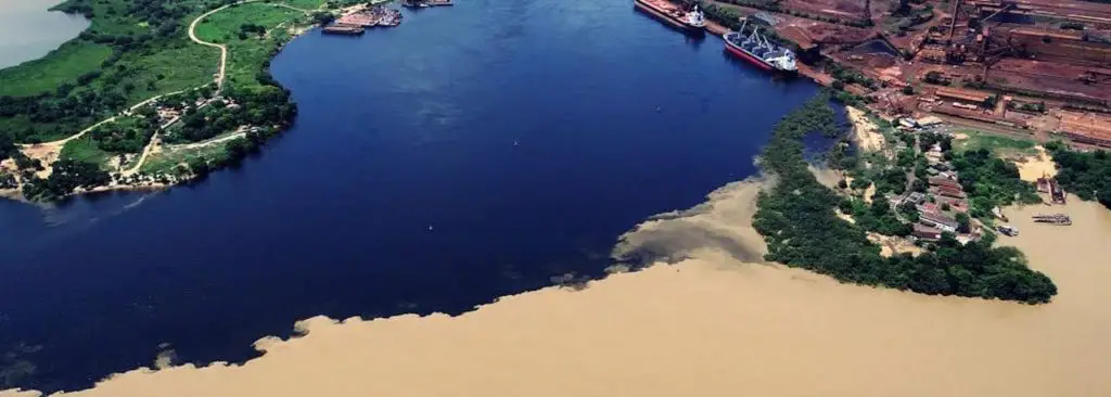
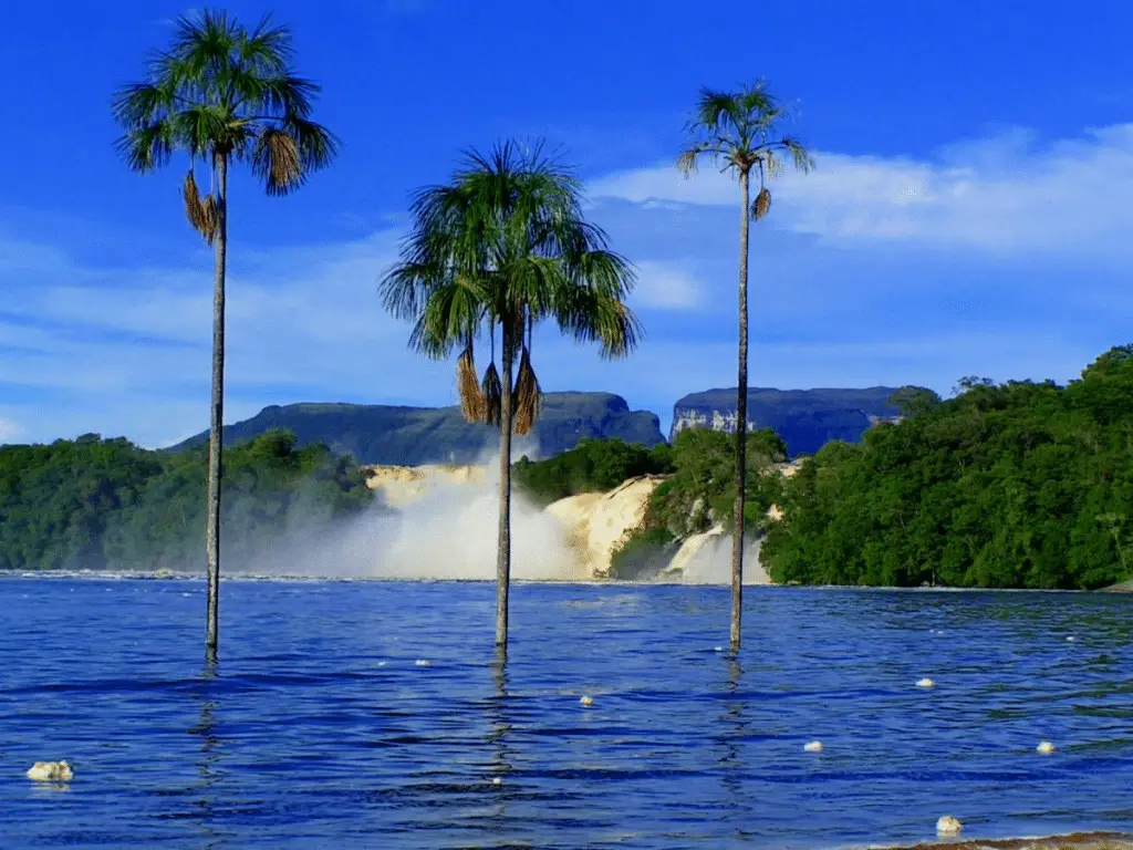
It is also of great ecological importance, since it is an extensive and vast area, full of species of flora and fauna that are used for the conservation of the place and for the enjoyment of those who visit the area, as well as for studies for the benefit of the conservation of these species, not to mention the mineral resources that it possesses. This area is immensely rich in every way imaginable. [caption id="attachment_2016" align="aligncenter" width="1280"]
 Ciudad Guayana a las márgenes del Río Orinoco
At present, the main reason for the attention given to the authorisation of open-cast mining is that the majority of ecologists and indigenous ethnic groups in the region have begun to denounce the imminent danger of these measures, which will lead to environmental, ecological, water, etc. deterioration in the area in particular, and something very serious as it is the climate change that could be generated throughout the country and part of South America.
Orinoco River Plain
The Orinoco plain covers an area of 300,000 km2. It stretches from the Andes massif in the west to the Orinoco estuary in the east, and is 1300 km long and 400 km wide. This immense plain presents some very smooth undulations, but most of it is extremely flat, although it is very attractive for some travellers.
It has the peculiarity of descending towards the Orinoco so gently that it has been calculated that there is only about 70 centimetres per kilometre in the direction of the river. Within this great plain there are 3 different regions called the Eastern, Central and Western Plains.
Within these plains there are several tributaries. These rivers give the region a very natural and cultural landscape, although those of the western part are geographically the most important, they all have a slightly different peculiarity.
In these plains, the dominant vegetation is the “savannah”, which refers to an area that generally does not contain trees, but rather grasses, which are herbaceous plants.
Where does the Orinoco River originate?
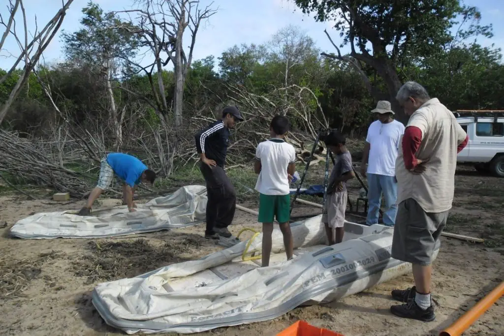
The first exploration by non-indigenous people dates back to 27 November 1951, when a Franco-Venezuelan group, led by army major Franz Risquez, set out on the first expedition to reach the source of the Orinoco River.
This multidisciplinary team included scientists as well as specialists in archaeology, geography, entomology, geology, hydrography, botany, astronomy, photography, topography, meteorology, geopolitics, navigation and some other fields relevant to such a large expedition.
It should be noted that during the course of the expedition it was necessary to take several of the participants to San Fernando de Atabapo and Caracas because some of them had broken bones, injuries and tropical diseases due to the adverse weather conditions in the area.
Only 27 members of the expedition reached the source of the Orinoco at 8:51 a.m. on 27 November 1951. Where it was marked at 2 19′ latitude and 63 15′ longitude at 1,100 metres above sea level.
The Orinoco River has its source in Venezuela, in the state called Amazonas, specifically in a hill called Delgado Chalbaud, the Sierra Parima, located south of the state, the same is a mountain range and in turn divides two basins of the Orinoco River and the Amazon River.
It is worth mentioning that the Sierra Parima, being the dividing line between the two rivers, becomes the natural border between the countries of Venezuela and Brazil.
Very interesting is this video, in which an expedition in search of the origin of the Orinoco River was made in 1993, divided into three parts, in which you can appreciate the plundering of the resources found along the Orinoco River. Also all the adventures and misadventures that happened to reach the zone of the sources where the Orinoco is born.
Course and Tributaries of the Orinoco River
The Orinoco River has its source, as mentioned above, in the Venezuelan Amazon, in the highlands of the state of Amazonas, in the Delgado Chalbaud Hill of the Sierra Parima, in the extreme south-east of Venezuela, where the border with Brazil is located.
It flows northeast until it reaches a point called La Esmeralda, where it joins the Casiquiare River, which comes from the south, after a journey of 290 km, from where it has taken part of the flow of the Negro River, a tributary of the Amazon.
Its main source continues to the northeast, and in this way it receives the waters of the Ventuari River, on its way to the city of San Fernando de Atabapo. To receive the waters of the Guaviare River and continue north, another tributary is the Capanaparo River, where it forms a natural border between Venezuela and Colombia.
It passes through the Maipures and Atures rapids to receive the tributary of the Meta River, which comes from the west, and then joins the Apure River. From here, the Orinoco takes a north-easterly course through the plains and the Venezuelan highlands.
Afterwards, the waters of the Carura and Caroní rivers, all of which flow into the Atlantic Ocean, are deposited in the state of Delta Amacuro. Its tributaries include the Ventuari, the Caura-Merevari, the Caroní-Cuquenán (925 km), the Guaviare, the Vichada, the Meta, the Arauca, among others.
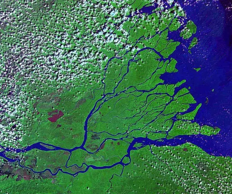
Many people wonder where the Orinoco River flows into the Venezuelan coast, and the answer is documented by Christopher Columbus, on 1 August 1498, during his third voyage. It is the Venezuelan beaches of the Atlantic Ocean that receive the mouth of the Orinoco River. They form a delta that extends for 300 km of coastline.
All this happens from Punta Playa, on the eastern side, to Boca Bagre, on the left bank. The mouth of the Orinoco River, which has 17 outlets and 36 branches, is so large that the first explorers, including Columbus, thought they had found a new sea.
This mouth, which is made up of some 300 channels, forms the great and mighty delta, which covers an area of around 30,000 square kilometres.
Importance of the Orinoco River
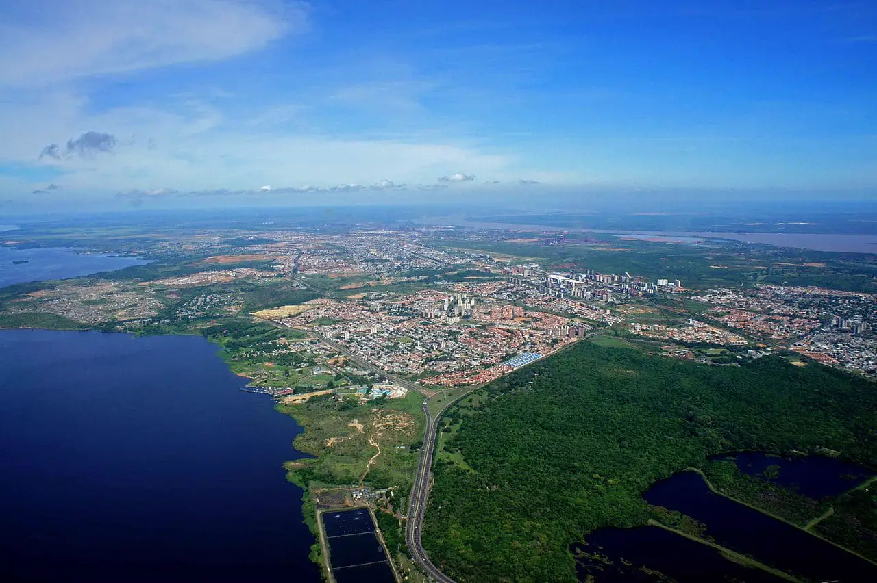
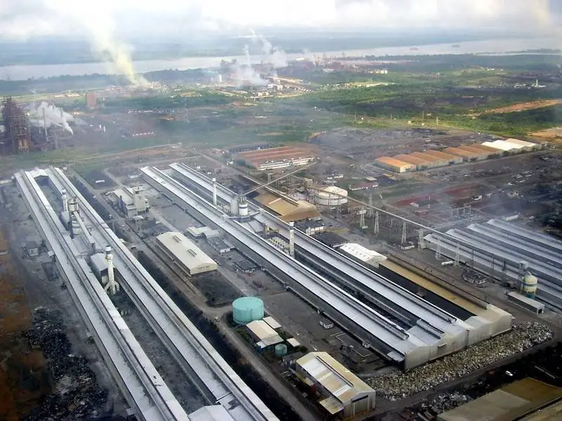
The Orinoco basin is currently of great importance. At present it is exploited in the forestry area, where Ciudad Bolivar becomes the great centre of everything related to this activity of exploitation of some mineral wealth with steel and aluminium.
Another area of exploitation that takes place in the zone where the Orinoco River meets the Caroní River, in Cerro Bolívar, are the large iron deposits that are found specifically in the cities of Palúa and Puerto Ordaz, centres of exploitation in this area.
On the left bank of the Orinoco, in the states of Monagas and Anzoátegui, oil is extracted through pipelines from the town of El Tigre to the cities of Barcelona and Puerto la Cruz in the state of Anzoátegui. Gold mining along the banks of the river is also considered important.
Cities close to the Orinoco River have become the headquarters of mining and hydroelectric companies that have developed a thriving and somewhat planned region. In addition to the basic companies Alcasa, Carbonorca, Bauxilum, Venalum, which work with aluminium, bauxite and coal.
There is also Ferrominera, which deals with the processing, production and sale of iron. It is also the headquarters of Siderúrgica del Orinoco.
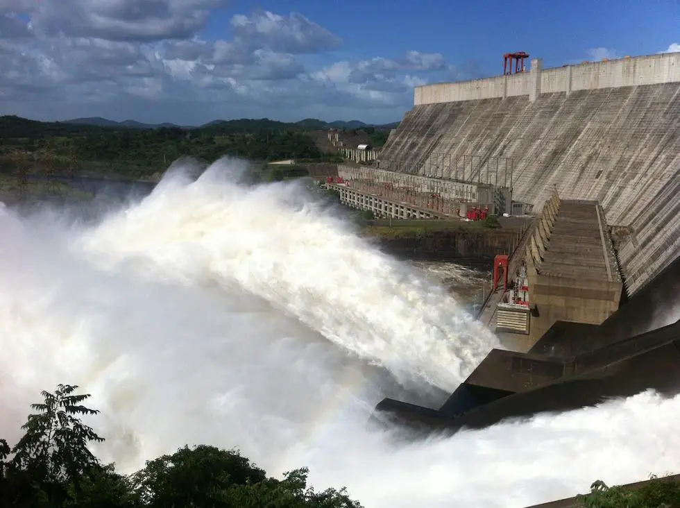
The area is also home to the country’s main electricity company. Edelca Electricidad del Caroní (Edelca) is also based in Puerto Ordaz and operates several hydroelectric plants, including the Guri, the second largest dam in the world in terms of capacity.
This hydroelectric plant created the Guri reservoir, located about 80 km upstream from the confluence with the Orinoco River.
Today, the Orinoco is home to several natural resources, including the Orinoco Oil Belt to the north of the Orinoco River, as well as other mineral resources and a wide variety of vegetation.
Another important aspect of the Orinoco River is tourism, ecology and landscape. Given the natural diversity found framing its banks and riverbed. Even within its waters with the enjoyment of the beautiful pink dolphins, a species of singular beauty unique in our country.
The diversity in flora and fauna that surrounds the Orinoco River is of a singular beauty, being the cradle of innumerable species of which perhaps do not even have knowledge, due to the intricacy of the jungle that surrounds it in some areas such as the Amazon.

Another fundamental importance is that, due to its size, it becomes the main artery for navigation and the flow of economic activities that support the development of both the region and the country in general, given the communication it has with other South American countries, as it is the entrance of large ships.
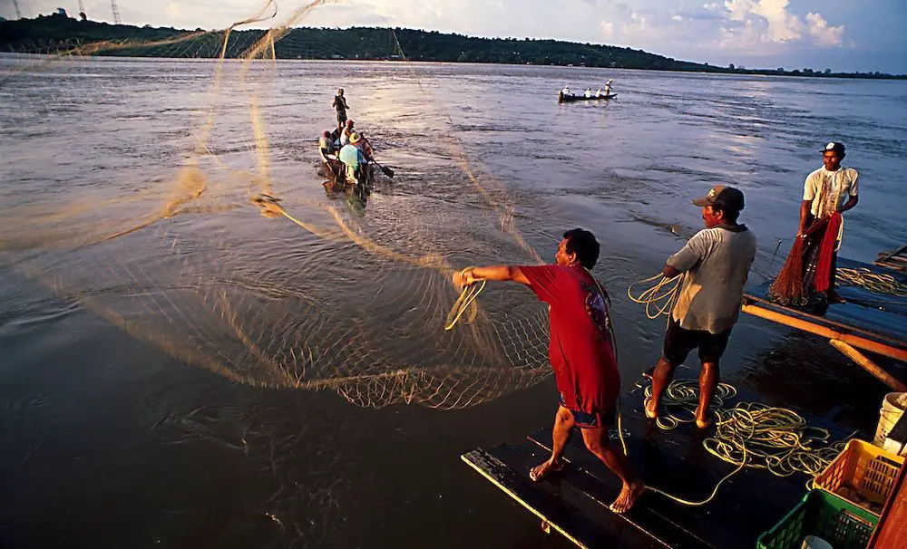
It is also important in terms of fishing, since its surroundings are home to indigenous tribes such as the Piaroa, Coti and others, who live from fishing in the Orinoco River and also sell their handicrafts to tourists who visit the area.
For many, this may seem like a trivial matter, but for these indigenous people who live on the banks of the Orinoco, it is a noble cause.
Another important function of the Orinoco River is that of collecting and channelling the water that reaches its bed, allowing it to be used and enjoyed in various areas of agricultural and livestock development, as well as for domestic and industrial uses that the region needs for its daily life and development, being one of the most important sources.
Orinoco River in Colombia
The region where all the waters of the Orinoco River flow into Colombia is called Orinoquia. It is formed by the tributaries of the great river, have created regions and subregions, where some of them formed plains that have been called Orinoco.
The Orinoquia, where all the waters of the Orinoco River flow into Colombia, is also known as the Llanos Orientales and is considered one of the six natural regions of Colombia. This area is defined by the immensity of the Orinoco basin. It is important to know that this place was one of the most active during the struggle for independence of both countries.
This area is often confused with the neighbouring area on the Venezuelan side, which shares the same Orinoco River, including tributaries such as the Guaviare. On the other side are the Llanos, a beautiful region with large ecosystems of extreme beauty. And the customs of the region are similar in their cultural aspect.
Because their customs, their music and their plains, among other things, are very similar to those that make up life in the same Venezuelan plains.
A very good audio-visual material where you can appreciate all the immensity and conformation of what the Colombian Orinoquia is and means. Enjoy it.
Union of the Orinoco and Caroní Rivers
For Venezuela, the Orinoco River can be considered the source of life, given its size, its majesty and its richness, as many of the rivers of 17 of the 23 states that make up the country have their waters from the Orinoco. The Portuguesa River is one of them, and others like the states:
- Amazonas.
- Apure.
- Aragua.
- Anzoátegui.
- Barinas.
- Bolivar.
- Carabobo.
- Cojedes.
- Delta Amacuro.
- Guárico.
- Lara.
- Mérida.
- Monagas.
- Portuguesa.
- Táchira.
- Trujillo.
- Yaracuy.
The Caroní River is also catalogued as one of the country’s main rivers, although it is not as abundant or as wide as the Orinoco, it is still considered the second largest river in the country, with a length of 952 km. It has its source in the Tepuy Kukenán, where it joins the Orinoco.
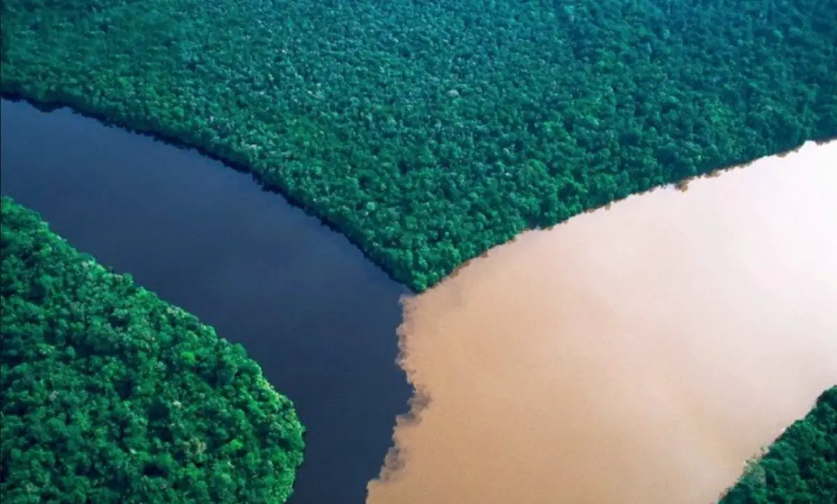
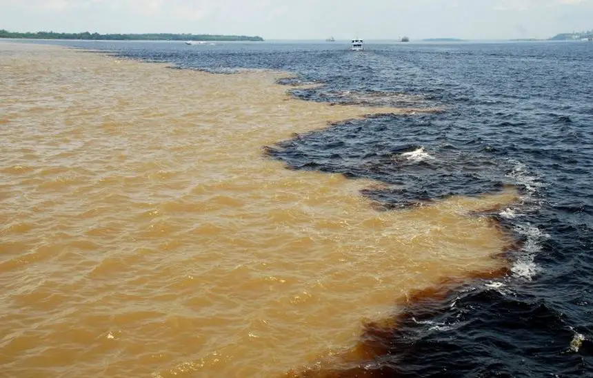
The confluence of these two great and magical rivers is a great visual spectacle for both locals and visitors, as their waters do not merge at the time of joining, which has given rise to great stories related to this phenomenon.
But the gods were against this union and did not allow them to unite under any circumstances, so they agreed to meet in a distant place and thus be able to realise their union and make their love a true reality. Even when many tributaries tried to conquer her love, she remained faithful to her beloved.
And so, at the end of the road, under the magical bubbles of fresh water, they manage to give each other a sweet and loving kiss and are united when they reach the sea, where, holding hands, they set off through the salty waters to discover the world and finally enjoy their greatest love.
Scientific explanation for the non-union of the Orinoco and Caroni waters
We know from chemical studies that it is the different composition of the water that determines its colour, so in principle the Orinoco and Caroní Rivers have different colours because their components are different.
On the other hand, it has been suggested that the Orinoco, being the source of the river, receives sediments from other rivers, which makes its water yellowish.
As for the Caroní, chemical studies have shown that its components are loaded with high concentrations of humic acids, as well as fulvic acids, which are organic acids produced by the leaves that fall into the river, coming from the Guiana Shield and also from the Amazon.
In any case, the magical and spectacular beauty that can be appreciated in this pass, where the two rivers meet but do not mix, is one of the natural spectacles that cannot be seen in many places and that is worth enjoying the maximum experience of being there.
The arrival of these rivers, so imposing and majestic, frames a beauty that has been known for many years and centuries, they come together but do not mix, even if both are water. Because they are different, we know one with dark water and the other with clear water.
Nor are their temperatures the same, one being cold and the other warm. In addition, the species that inhabit them are different, even though they are the same species. For example, the Orinoco sapoara is not the same as the Caroní Bosachico.
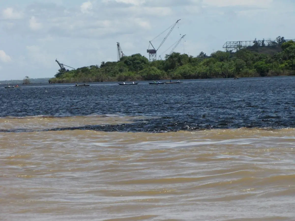
And there is such a natural blend that only creation can do, that blend between the sapoara and the bosachico, as it is the Coporo.
Swimming the Orinoco and Caroní Rivers
Among the experiences that can be enjoyed in the area where the Orinoco and Caroní rivers converge, an annual event is held in the sports area, in which people dedicated to swimming participate, who want to feel the thrill of crossing both rivers and feel the sensation that can be experienced in such an event.
A video where you can appreciate the party they celebrate when they do this competition.
Current status of the Orinoco River
The Orinoco River is one of the largest in the world. With a great wealth in different areas such as hydrological, mining, cultural, among others. However, with the passage of time, in recent years, the entire basin has been affected by the expansion of areas to be developed on its banks.
The activities carried out are, for example, agro-industrial and livestock farming, mining and hydrocarbon extraction, as well as infrastructure development. All these activities have changed the environmental and natural conditions of the Orinoco’s biodiversity.
Like any activity developed by man without control, it has degenerated into the disappearance and degradation of life around it, with dark consequences that are seen throughout history when there is no awareness of the damage caused to the ecological system, as well as to a whole natural system that was created to be cared for and not degraded, since the life of the population depends on it.
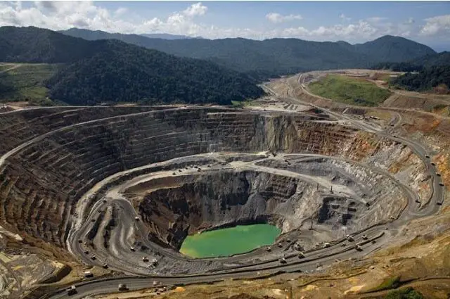
The use and exploitation of the Orinoco Oil Belt has been strongly questioned by those defending the country’s ecological space, as it is feared that the practice of open-cast mining and exploration, which has been and will be authorised by companies from other countries, will be without any type of environmental control to protect the country’s biodiversity.
It is worrying to see that the studies carried out for the exploration and exploitation of the different elements that are being exploited and will be exploited through the approval of the Orinoco Mining Arc, do not take into account the environmental impact that will be caused once the exploitation of the area begins.
In the following, some statements are made with the sole purpose of dealing only with the aspect related to the part of the open-pit mining authorised in the Orinoco Mining Arc.
In the last few months, the Orinoco River has experienced several major floods, which have been a disaster for the people living along its banks, who have lost their crops, their homes and their belongings.
Implications of the Mining Arc on the Orinoco River
Located on the south side of the Orinoco River, and is a large extension of 111,843 K2, which easily exceeds the size of some countries in the world such as Bulgaria, Portugal or Cuba: Bulgaria, Portugal or Cuba, and located in the state of Bolivar, is the largest mineral wealth of the country, and can also be said to be one of the most important in the world.
The idea came from the then President of the Republic, the late Hugo Chávez, who on 20 August 2011, in one of his programmes, presented a sketch of what he would call the Orinoco Mining Arc and developed his proposal for it. It is worth noting that no environmental or other impact is foreseen for this matter.

The development of this proposal begins with the inclusion of the Orinoco Oil Belt with the Orinoco Mining Arc, in order to develop both economic projects together. For this reason, it approves a point of account in which the Joint Strategic Action Plan of the aforementioned Orinoco developments is considered.
For the year 2016, the President of the Republic, Nicolás Maduro, in order to alleviate the difficult economic situation of the country and with the purpose of diversifying income, promotes and approves the development of the Orinoco Mining Arc, given the conditions and the serious economic problems that the country is facing due to, among other things, low oil prices.
In order to carry out the large-scale financing of this project, the government invited around 150 Venezuelan and foreign companies, but only 16 of them formalised the agreements, resulting in 4 joint ventures, of which only 1 has a visible presence in the eastern zone of the Orinoco Mining Arc.
It is truly alarming how the consequences of the degradation caused by mining on the land and the climate are not effectively anticipated, depriving the people of the most elementary appreciation of what is based on their land, their environmental resources, their ecology, the formations that gave rise to the country and the antiquity and history relevant to the cultural and natural heritage of the planet.
It could be said that one of the most affected groups are the indigenous peoples, who have lived in this area since time immemorial, because their territory has been invaded prematurely, being taken out of its natural habitat, which is part of the Amazon. Not to mention the ill-treatment they have received, some of them have even been dismissed.
Today, the extension of the Orinoco Mining Arc represents 46% of the state of Bolivar and approximately 12% of the country’s total territory.
This is an exaggerated part of the territory, which is not receiving the attention it deserves in terms of its ecosystems, biodiversity and fresh water sources.
In addition, the conservation and purity of this water is in serious jeopardy, and the large amount of biodiversity is threatened by illegal mining and the stability of the Guri River, which generates 45,000 gigawatt/hour for the national electricity market, is at risk.
Within the area formed by the Arco Minero del Orinoco, there is the Imataca Forest Reserve, in addition to exalted natural monuments, beautiful natural parks, there are also extensive biosphere reserves and wildlife refuges, among others, aspects of biodiversity and the ecosystem of the area.
One of the most important reserves located in this area is the Caroní River Basin, which is the main source of fresh water in Venezuela, in addition to supplying the hydroelectric plants that generate 70% of the energy consumed in the country.
The position of the indigenous peoples in relation to the Mining Arc is very clear. Firstly, their rights have been violated, as they have been dispossessed of their lands and crops and forcibly evicted by the so-called miners who have taken over the area in question.
There are many environmental impacts resulting from the development of this mining arc, including the following
- Loss of biodiversity
- Deterioration of water quality coming from surface runoff.
- Increased deforestation
- Soil contamination
- Pollutants such as heavy metals that contaminate the surrounding areas will be incorporated.
- As well as air pollution.
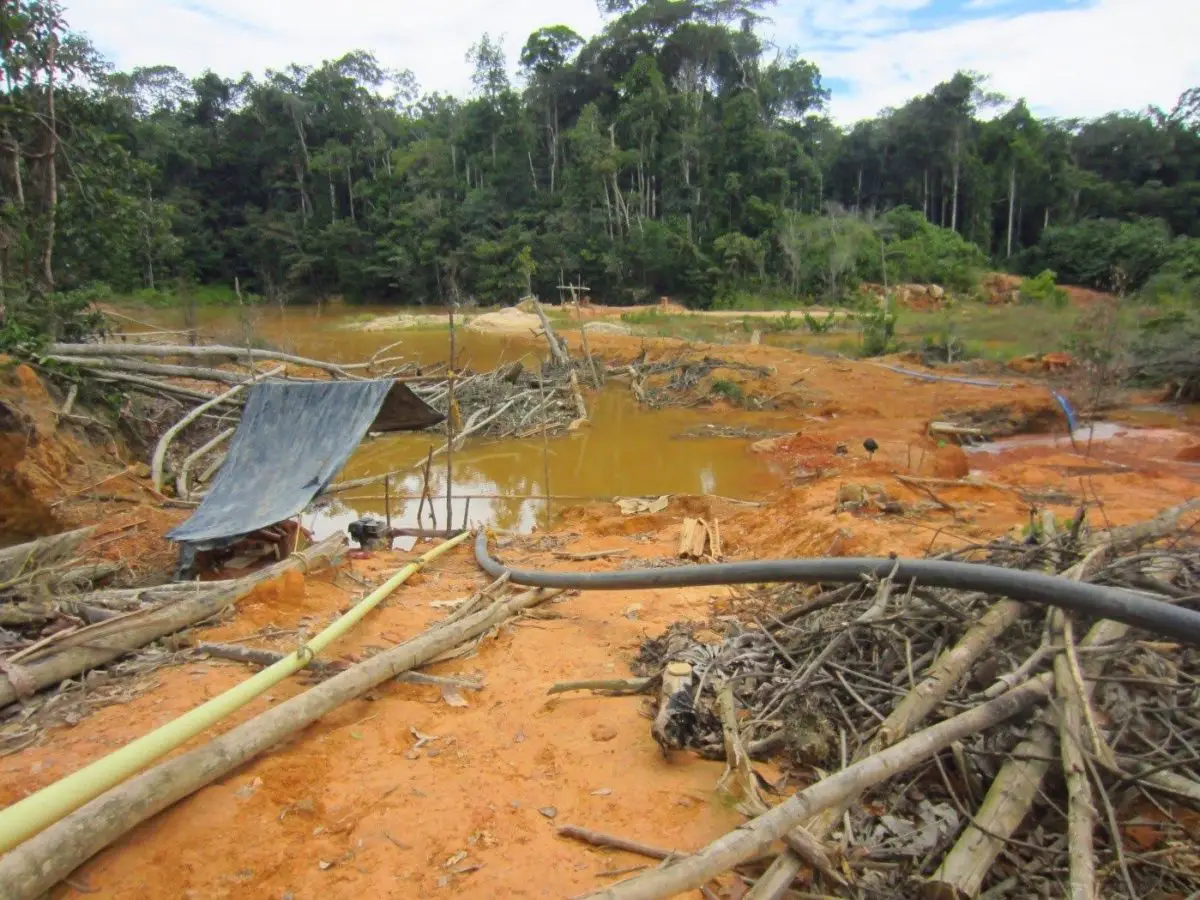
It’s worth noting that a study by the University of Oriente found that most Ye’kwana and Sanema Indians had 40 times the World Health Organisation’s limit for mercury in their hair.
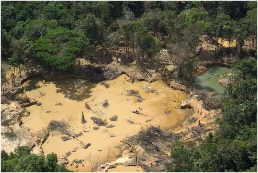
It is also important to note that the damage caused by illegal mining is so severe that if the activity were to cease completely by 2016, it would take at least 30 years to restore the entire area. The damage caused by this practice is incredible.
It is worth remembering that the Constitution of the Bolivarian Republic of Venezuela, in its article 127, states that the Venezuelan State has the obligation to protect the environment, biodiversity, ecological processes, national parks and all areas of ecological importance.
Considering all the information about the great damage that would be caused to the country, to its environment, to its ecological reserves, to its environmental factors, to its people and to future generations, who would suffer the consequences of the disaster caused by the mining, which until now has been illegal, known as open-pit mining. It would be necessary to say
Contamination of the Orinoco River
Sadly, it is no longer possible to drink the water of the Orinoco River in Venezuela, or to eat the Aymara fish or any other fish that can be caught in its waters, because of the mercury contamination used in the process of extracting the minerals. Worse still, some species found far from the mine are also contaminated.
Perhaps it could be said that all societies share a common problem, which is the usufruct of everything that comes from nature, without taking into account the parameters for its use, nor considering the fragility of these natural resources, not to mention the damage that can be caused, which in the end is passed on to each of the beings that inhabit the planet.
This is particularly the case with the Orinoco River in Venezuela, which has suffered the worst pollution over the years due to the lack of measures and control over the development and growth of the population in the area, which has led to a lack of planning for the disposal of waste water so that it does not end up in the river.
A study carried out by the National Experimental University of Guayana found that there were 17 points of sewage discharge in a stretch of land from Ciudad Bolívar to San Felix, where it was established that Ciudad Guayana was the most polluted area of the Orinoco studied.
There, one could conclude that it is the same person who does not give the nature of the ecosystem that surrounds him the value that it deserves, and who does not consider the measures necessary to cause the least possible damage to the environment that surrounds him. And think of the environment that will be left to future generations.
On the other hand, the mining activities are causing serious problems of pollution in the waters of the Orinoco River, as other studies have found high levels of metals used by the people who mine, causing irreversible damage to this non-renewable resource.
Due to their chemical characteristics, we find that heavy metals are chemical substances that do not evaporate, on the contrary, they concentrate in water, thus concentrating toxic substances for humans such as iron, zinc, mercury, etc.. Sooner or later they will certainly affect the health of those who come into contact with them.
The Orinoco basin is currently threatened by the contamination of its waters, as a result of agricultural, mining and industrial exploitation, as well as the growth and development of the area, which contributes to the increased plundering, use and abuse of fresh water, and the discharge of polluting water pipes into the river, according to sources from ecological groups in the area, among others.
A study carried out by the World Wildlife Fund identified the deforestation of more than 30,000 hectares a year, contamination of both soil and water by agrochemicals and urban waste, and chemicals from mining as major threats.
The main recommendation of these studies was that these areas should be quickly declared protected to minimise their use and abuse. Biodiversity criteria should also be included, with particular emphasis on water resources and the climatic risks posed by the practices allowed.
Located between Colombia and Venezuela, the Orinoco Basin covers some 980,000 km2 and is part of the northern Andean and Amazonian biome. It is made up of jungles, wetlands, savannahs and forests where the species known so far live:
- 420 species of plants.
- 300 species of birds.
- 100 species of fish.
- 250 species of mammals.
- 119 species of reptiles.
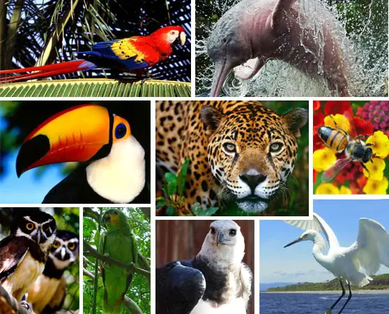
This makes it a very important ecosystem that needs to be cared for and protected from human predation. Because all this helps to maintain the climate we enjoy today. And if the ecosystem were destroyed, it would radically change our climate cycles.
Denunciations of the ecological movement
Through the Ecological Movement of Venezuela, a response has been demanded from the relevant authorities on what is happening with the pollution of the rivers of the state of Bolivar, since they are the ones called upon to regulate everything that has to do with the use of the waters of the rivers of the region.
Through this movement it has been pointed out that a large part of the waste water from the surrounding areas is indiscriminately dumped into the waters of the main rivers of the region, which, in addition to other polluting factors, causes a very high concentration of contamination in the fresh waters of the area.
They also denounced the dumping of large quantities of sewage along the Orinoco River, which ends up in the Caroní River, and the fact that the sewage treatment plant in the area is not functioning, as it has been dismantled and the authorities have not done anything to put it back into operation, which is urgently needed at this time.
The organisation also commented on the toxic waste from open-cast mining that is being dumped into the waters of the Orinoco River, noting that 75% of the population consumes water that has not been properly treated, which points to the high risk of disease caused by the contamination of the region’s rivers.
This organisation has made an urgent appeal to the authorities responsible for the conservation and management of the environment and the waters of their regions, since a United Nations agreement has called on those in power to protect waters from human activity and climate change, and to consolidate objectives for the management of rivers.
The Orinoco River and its Mysteries
We begin by explaining where the Orinoco River is, this river begins or is born in Venezuela, its passage is between Venezuela and Colombia and finally it flows into the Atlantic Ocean. There are many interesting mysteries that surround the Orinoco River, one of which is the confluence with the Caroní River, perhaps the product of legends, or perhaps the product of ancient wisdom, we do not know more, but what is certain is that they are those things that have no explanation, among these mysteries we have below:
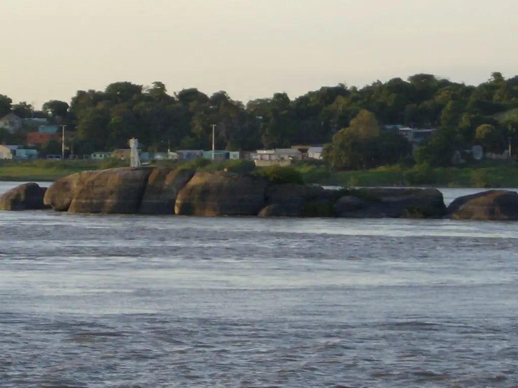
The Middle Stone
The Stone of the Middle is an enormous rock located in the middle of the Orinoco River, near the passage between Ciudad Bolivar and Soledad, measuring approximately 350 metres long and 100 metres wide. It has been the subject of Orinoco legends and mysteries for centuries.
In summer time it can be appreciated in a more precise way in almost all its splendour, since the waters that cover the Piedra del Medio go down, it has been possible to make the full measurement being its height of approximately 52 meters with a seat of white sand.
It was the German scientist Alejandro Humboldt who, during a visit to the region in 1800, after observing the rock formation, pointed out that it could be used as an excellent tool for measuring the variation in the level of the Orinoco River in different climatic conditions, in rainy and dry weather.
This is how the Piedra del Medio came to be known as the Orinococómetro, since it is used to measure the level of the Orinoco River.
In the past, a tree used to grow through its cracks, hence the name “Piedra del Arbolito”, but unfortunately it was cut down by unknown hands, so that this name no longer identifies it.
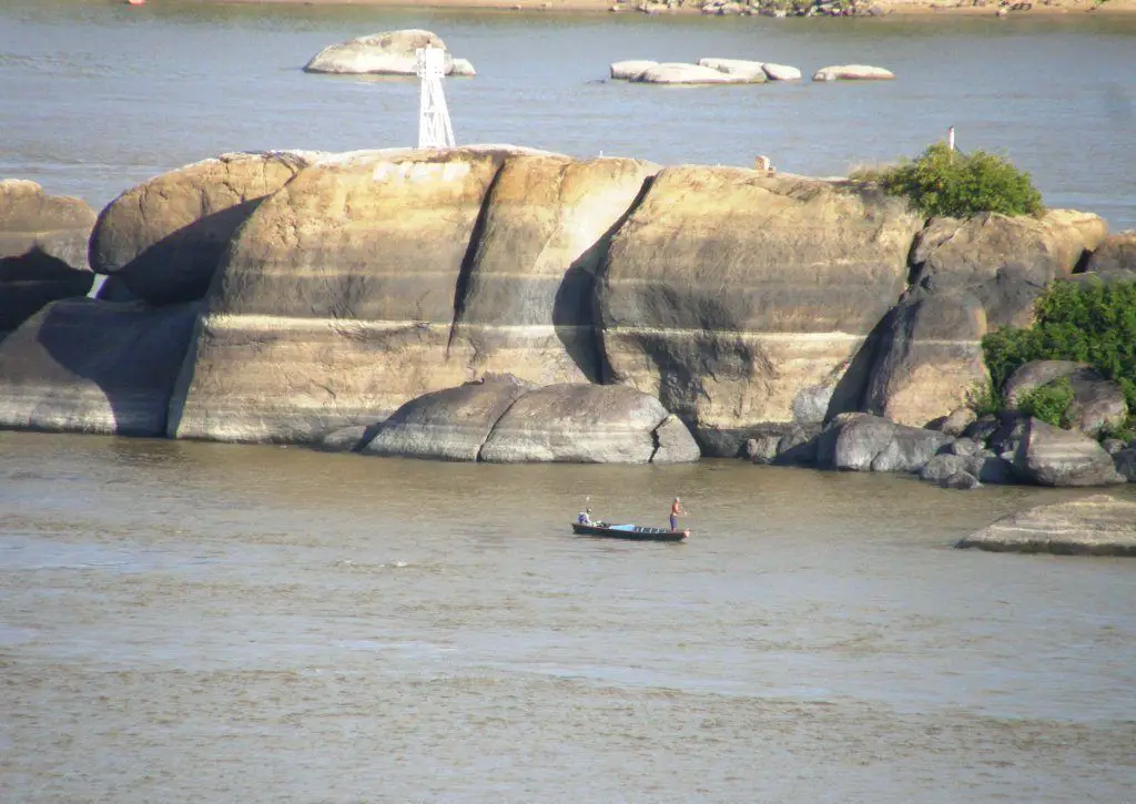
Also at some time on the same one worked an antenna tower of the transmission of the postal service of telegraphy of the time, which was retired at some time that this type of service was no longer used. Today there is only a buoy that helps the navigation of barges that transport iron and other vessels in general.
The Mystery of the Hydra
Before the arrival of the Spaniards, the indigenous people who inhabited the region had a myth about the depths of the Piedra del Medio, according to which a seven-headed serpent lived there, and when it devoured everything around it, it created great whirlwinds capable of sinking even heavy boats.
They also said that the inhabitants were not spared, and that it even dragged away people walking along the banks of the Orinoco. They say that when the water went down, it was because it drank from its great thirst, and when it rose, it was because it expelled a great quantity of liquid from its intestines.
In the early twentieth century, three accidents were recorded in the area of the Piedra del Medio, one involving the sinking of a barge carrying several vehicles and the other two involving two vehicles that fell from the Angostura Bridge and were carried by the current to the area of the Piedra del Medio.
It should be noted that the rescue and recovery of the victims and the vehicles themselves never took place. And when the divers who were sent down to try to make a rescue when they went up, they indicated that it was impossible to reach the bottom of the water there, as it was too deep.
Studies were carried out by the Oceanographic Institute of the University of Oriente, which concluded that there was a deep depression of about 160 metres, with a funnel-shaped structure. That it has its source in the western part of the rock from its top.
It is said that in the middle of the 20th century, the Universidad de Oriente sent ships to carry out oceanographic studies in the Orinoco River, specifically in the Piedra del Medio.
During these studies, divers were submerged to carry out the tasks of the study, but one of them, who was submerged around the Piedra del Medio, in the middle of a nervous breakdown, asked to be quickly brought to the surface, saying that he had seen a monster in the depths around the stone.
All this raised many questions about the boats and vehicles that disappeared without a trace, given that the depth at the top of the stone is a pit of around 160 metres. This gives the impression that something mysterious is submerged in this pit.
Is this story similar to the Greek one? The Hydra, which in its story speaks of an animal identified as a seven-headed serpent that inhabits and protects the underwater entrances to what they call the underworlds.
The Orinoco Mermaid
According to the fishermen of the Orinoco, there are mermaids in the depths of the Orinoco, they even say that in the area of the Bocas del Caris there is one, which they call the Carona, that if the fisherman is kind to them, he gives them a good fish, but if not, he scares them away by shaking the curiara strongly so that they leave.
On the other hand, fishermen say that in the Upper Orinoco, the Toninas are transformed into mermaid-like female figures to seduce the men who go fishing in these high areas of the Orinoco.
They say that there are enchanted cities on those sides in the deep waters of the Orinoco, and that when the fishermen are fishing in that area and cannot get the woman they love out of their minds, the Toninas take on this form to seduce them and take them to those enchanted cities.
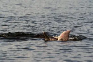
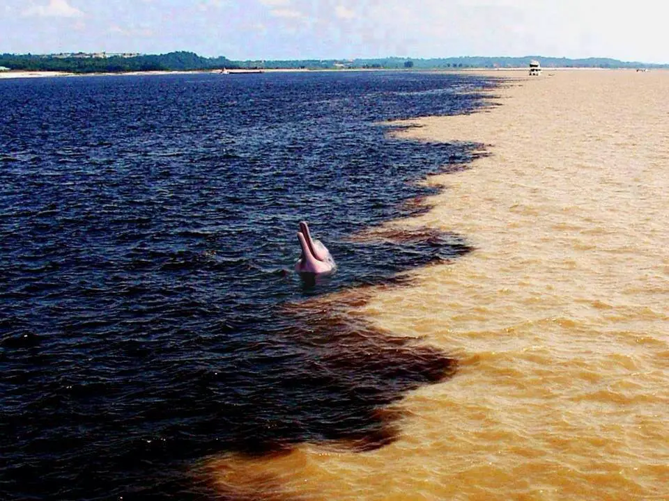
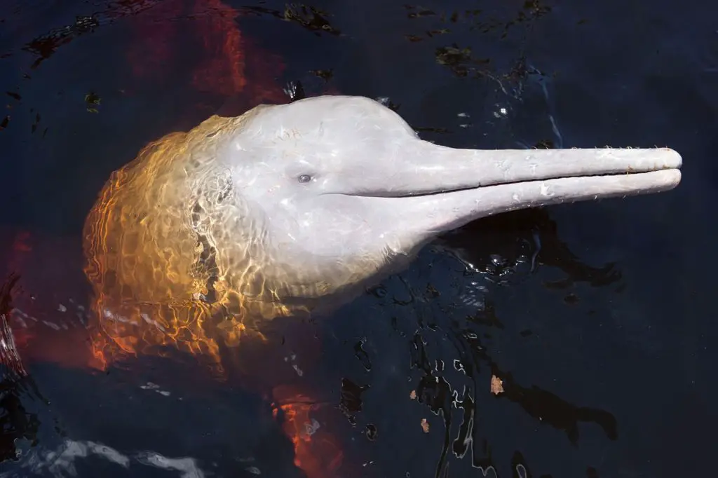
Commerson’s dolphins
They have also been christened the pink dolphin or Amazon dolphin, as they can be considered a freshwater dolphin, the largest dolphin that exists, with a great resemblance to the sea dolphin. The Commerson’s dolphin lives in swampy, deep and fast waters, such as the waters of the Orinoco River.
Within the variety of species of Commerson’s dolphin, the one found in the Orinoco River is called Innia geofrensis humboldtianay. The main threats to this species are considered to be the alteration of its natural habitat through the construction of dams and the pollution caused by mining.
Given that the Orinoco River currently suffers from both of these threats, this species is particularly vulnerable and could be on the verge of extinction. Although their life expectancy is between 30 and 40 years, they are considered to be quite long-lived.
The Commerson’s dolphin is an animal that feeds mainly on fish, crustaceans and turtles, which is why it is called a piscivore. They have been the subject of indiscriminate hunting, which is a real threat to them. They are used as bait to catch a fish called mapurite, which is not consumed in the country and is exported to Colombia for commercialisation.
In the Valencia Aquarium, in the state of Carabobo, Venezuela, pink Commerson’s dolphins have been exhibited to the public for several decades and have been kept in captivity since 1975. They have also been part of shows presented to the public visiting the aquarium.
During this time, however, a number of them have died for various reasons, some of which have been caused by the stress of not being in their natural habitat. How ideal it would be if man could learn to coexist with the nature that surrounds him, trying not to harm or destroy what, in the end, is what keeps us alive.
Next we will see 5 myths related to the state in which we have made this wonderful walk, as it is the state of Bolivar.
Curiosities
This is a song dedicated to the famous Orinoco River, a gaita, typical music of the Christmas season, which in Venezuela is sung and danced with great power in honour of the majestic Orinoco River. Enjoy it.