
Last Updated on September 29, 2023 by Hernan Gimenez
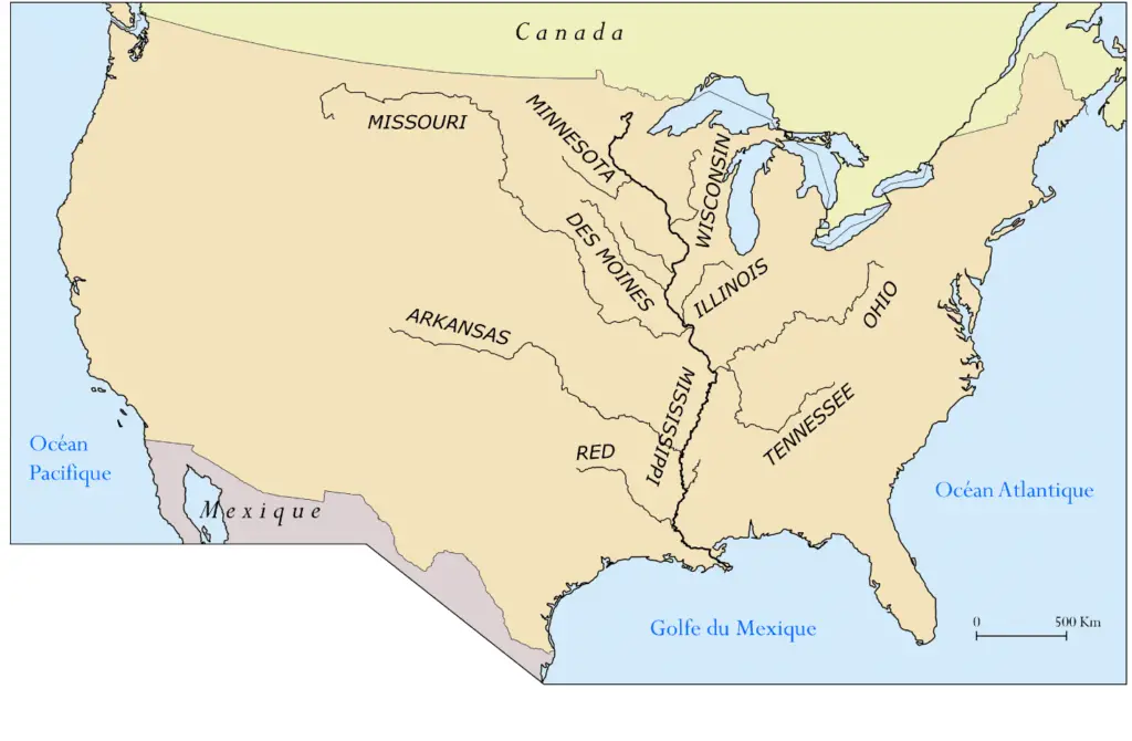
The Missouri River is the longest river in North America. Rising in the Rocky Mountains west of Montana, the Missouri flows east and south for 2,341 miles (3,767 km) before joining the Mississippi River north of St. Louis, Missouri.
The river drains a sparsely populated, semi-arid basin of more than half a million square miles (1,300,000 km2), including parts of ten US states and two Canadian provinces.
Together with the lower Mississippi, it forms the fourth-longest river system in the world.
For more than 12,000 years, people have relied on the Missouri and its tributaries for food and transportation.
Historia
More than ten major Native American groups inhabited the basin, most of them nomadic and dependent on the vast herds of bison that once roamed the Great Plains.
The first Europeans encountered the river in the late 17th century, and the region passed through Spanish and French hands before finally becoming part of the United States through the Louisiana Purchase.
It was long believed that the Missouri was part of the Northwest Passage, a water route from the Atlantic to the Pacific, but when Lewis and Clark became the first to travel the entire river, they confirmed that the mythical route was nothing more than a legend.
Ubicación
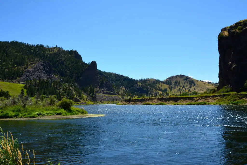
The Missouri first flows north and northeast (via Great Falls) through western Montana before turning east through the northern part of the state.
Shortly after entering western North Dakota, the Missouri begins to turn southeast before continuing south into northern and central South Dakota just south of Bismarck until it reaches Pierre, where it begins to turn southeast again.
As it continues through southern and central South Dakota, the river forms part of the South Dakota-Nebraska border, the Nebraska-Iowa border, the Nebraska-Missouri border, and the northern part of the Kansas-Missouri border (see article: Solimoes River).
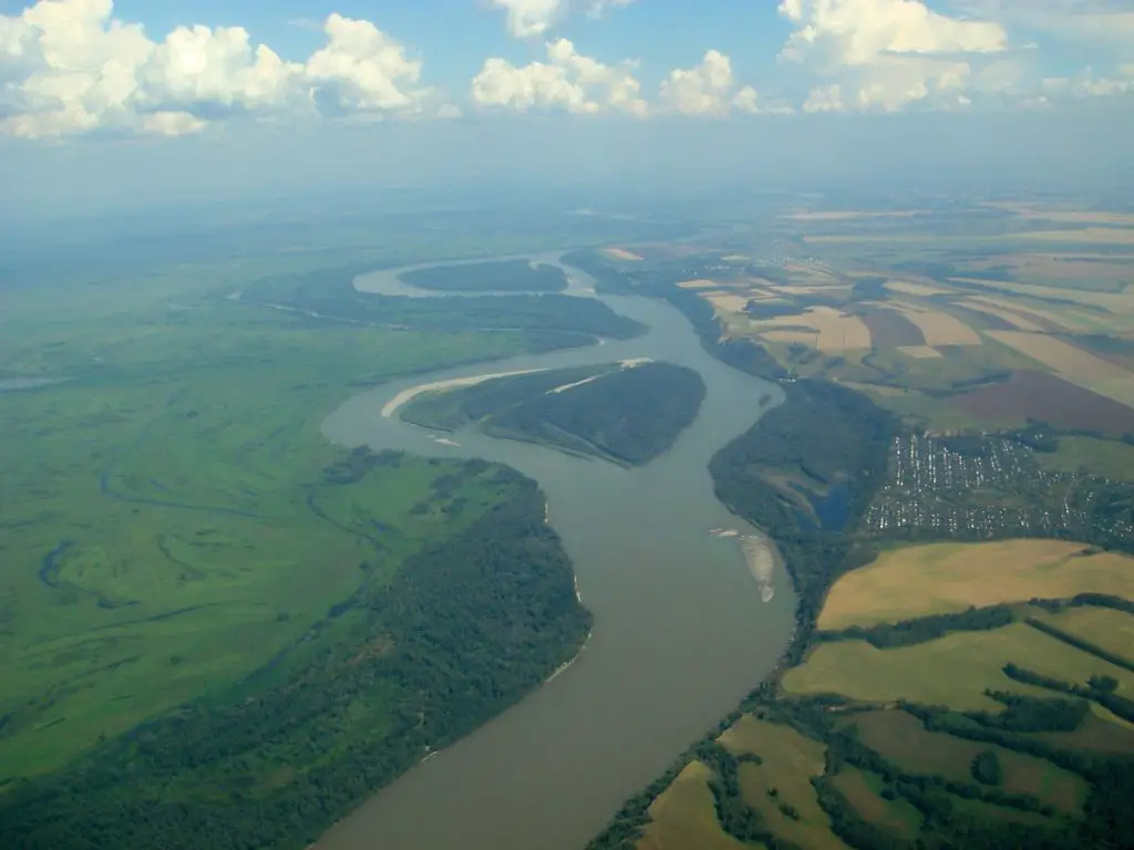
At Kansas City, Kansas, the river turns east again and, after passing through Kansas City, Missouri, meanders east through west-central Missouri before turning southeast again to Jefferson City.
There it makes its final turn east, flowing until it joins the Mississippi River about 10 miles (16 km) north of St. Louis.
Características
The river’s watershed covers about 529,400 square miles (1,371,100 square km) of the Great Plains, of which 2,550 square miles (16,840 square km) are in southern Canada.
The range of elevations within its watershed is considerable: from about 14,000 feet (4,300 metres) above sea level in the Colorado Rockies near the Continental Divide to 400 feet (120 metres) where it joins the Mississippi River.
The flow of the Missouri and most of its tributaries is extremely variable, ranging from a minimum of 4,200 cubic feet (120 m3) per second to a maximum of 900,000 cubic feet (25,500 m3) per second. Erosion and sedimentation are major problems because of the unprotected slopes and the large fluctuations in flow.
Afluentes del Río Missouri
Major tributaries include the Cheyenne, Kansas, Niobrara, Osage, Platte and Yellowstone, which flow from the south and west, and the James and Milk, which enter from the north.
Other tributaries include the Bad, Blackwater, Cannonball, Gasconade, Grand, Heart, Judith, Knife, Little Missouri, Moreau, Musselshell and White rivers, which enter from the south and west.
The Big Sioux, Chariton, Little Platte, Marias, Sun and Teton rivers enter from the north and east (see article: Caqueta River).
Economía
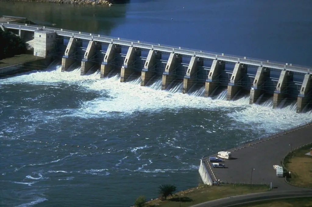
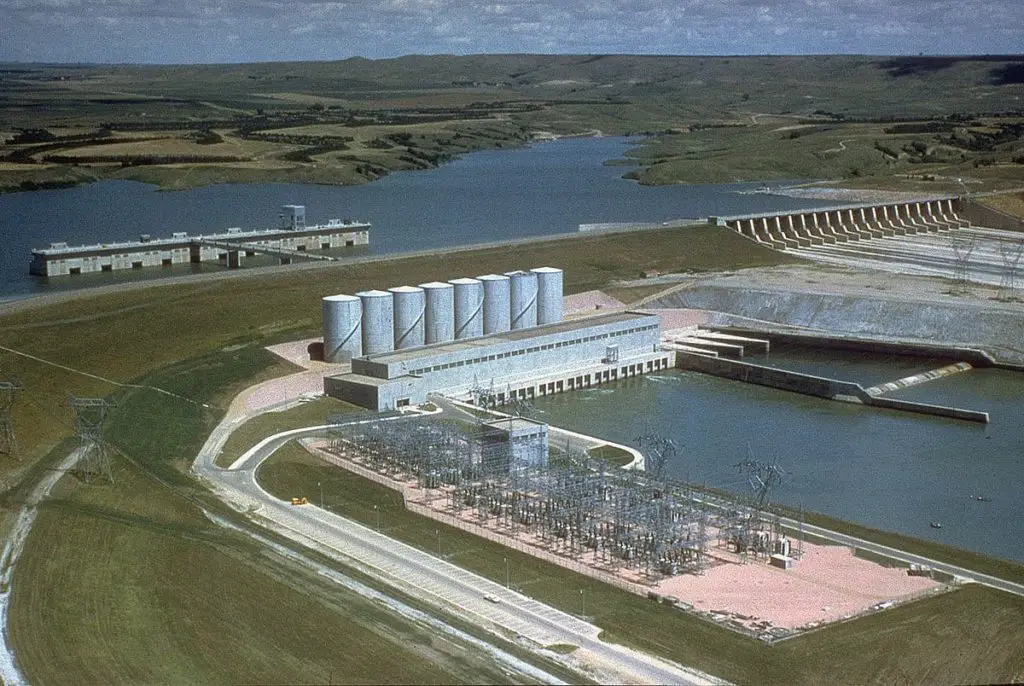
For the first 150 years after settlement along the river, little was done to develop the Missouri as a useful waterway or as a source of irrigation and power. In 1944, the U.S. Congress authorised a comprehensive flood control and water resources development programme.
It authorised a comprehensive programme for flood control and water resources development in the Missouri River basin. It provided for a system of more than 100 dams and reservoirs on the Missouri and some of its tributaries.
On the Missouri itself, from Sioux City, Iowa, to the Mississippi, a distance of 760 miles (1,220 km), local flood control was provided through levees and bank stabilization, as well as a deeper river channel.
By the time an even more ambitious plan – the Missouri River Basin Programme, known as the Pick-Sloan Plan – was adopted in the 1950s, canal improvements had allowed commercial barge lines to begin operating on the Missouri in 1953.
The major dams built on the Missouri were Fort Peck (near Glasgow, Montana), Garrison (North Dakota) and Gavin’s Point, Fort Randall and Oahe (South Dakota). Fort Peck Dam is one of the largest earth dams in the world.
The entire system of dams and reservoirs has greatly reduced flooding on the Missouri River and, like the Snake River dams, provides water for irrigating millions of acres of farmland along the main river and its tributaries.
Hydroelectric dams along the river generate electricity for many communities along its upper reaches.
Below is a video showing more of the Missouri River.