
Last Updated on August 1, 2023 by Hernan Gimenez
Native Americans have long lived along the Mississippi River and its tributaries. Most were hunter-gatherers, but some, like the Mound Builders, formed productive agricultural societies.
The arrival of Europeans in the 16th century changed the indigenous way of life as early explorers, then settlers, ventured into the basin in increasing numbers.
The river served first as a barrier, forming the boundaries for New Spain, New France and the early United States, and then as a vital artery of transportation and communication.
In the 19th century, during the heyday of the ideology of manifest destiny, the Mississippi and several western tributaries, especially the Missouri, provided pathways for the westward expansion of the United States.
Characteristics and location of the Mississippi River
Mississippi River, the longest river in North America, drains with its major tributaries an area of about 1.2 million square miles (3.1 million square km), or about one-eighth of the entire continent.
The Mississippi is the fourth longest and fifteenth largest river in the world by volume. The Mississippi is the main river of the second largest drainage system on the North American continent, after the Hudson Bay drainage system.
It flows entirely within the United States (although its drainage basin extends into Canada).
As the central river artery of a highly industrialised nation, the Mississippi has become one of the world’s busiest commercial waterways and an ungovernable neighbour to some of the continent’s richest agricultural land.
It has been subject to considerable control and modification. In addition, the river’s unique contribution to the history and literature of the United States has woven it into a common thread of North American folklore and national consciousness.
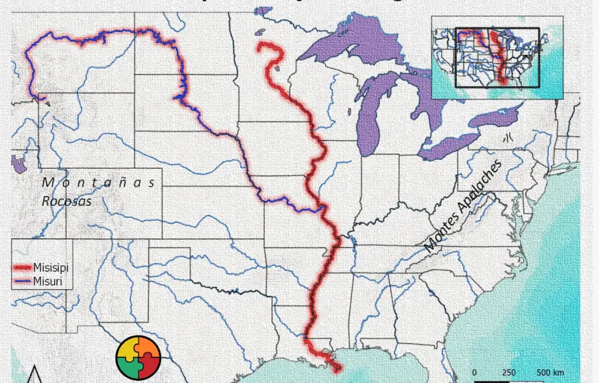
Map of the Mississippi River
The Mississippi River starts near Minneapolis and flows 2900km to the Gulf of Mexico.
Source and mouth of the Mississippi River
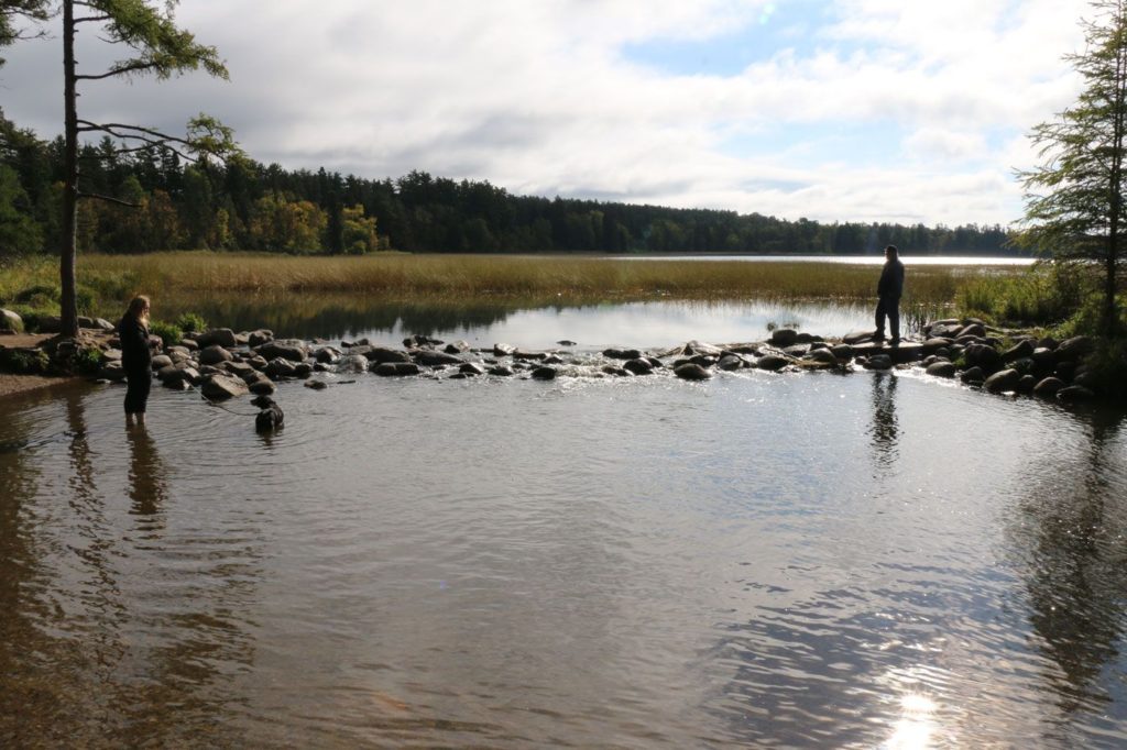
Where does the Mississippi originate? It is entirely within the United States. Rising in Lake Itasca in Minnesota, it flows almost due south through the interior of the continent, collecting the waters of its main tributaries, the Missouri River to the west and the Ohio River to the east.
Based on its physical characteristics, the Mississippi River can be divided into four distinct sections. In its headwaters, from the source to the head of navigation at St. Paul, Minnesota, the Mississippi is a clear, cool stream that meanders through a rural landscape of lakes and marshes.
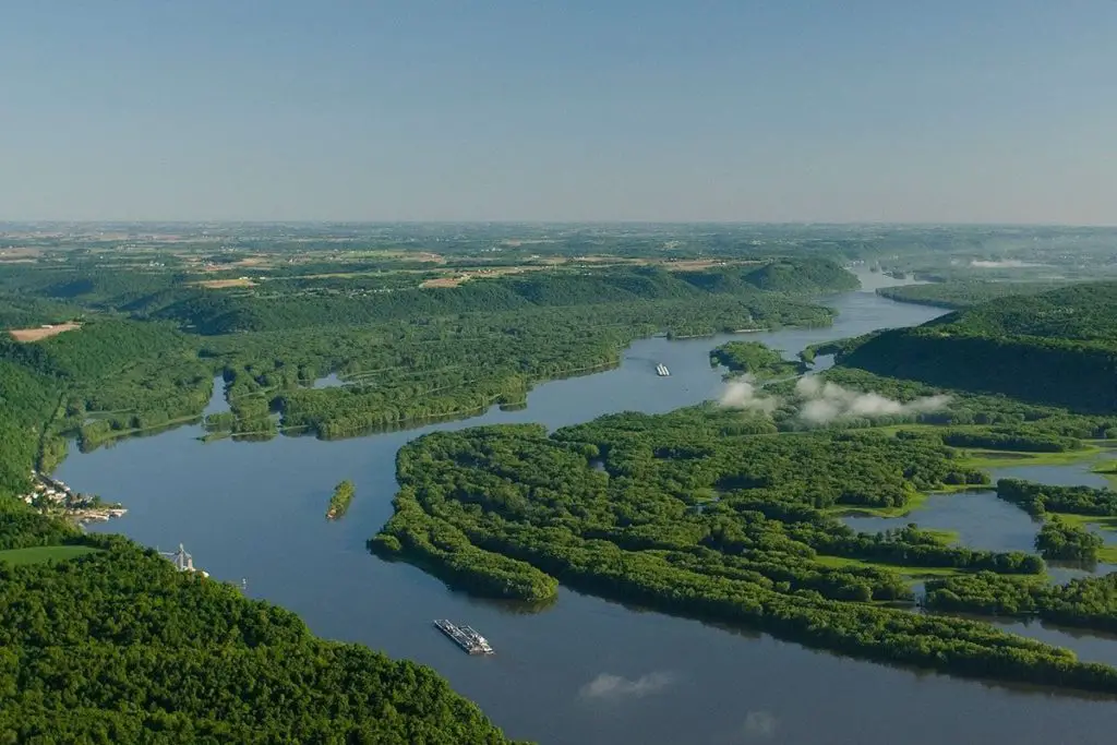
The upper reaches of the Mississippi stretch from St. Paul to the mouth of the Missouri River near St. Louis, Missouri. Flowing through steep limestone cliffs and receiving water from tributaries in Minnesota, Wisconsin, Illinois and Iowa, the river in this section takes on the character that led the Algonquin-speaking Indians to call it the “Father of Waters”.
After crossing the Missouri River, the middle Mississippi flows 320 km to the mouth of the Ohio River. The turbulent, turbid to muddy, debris-laden Missouri, especially when flooded, adds momentum and huge amounts of silt to the clearer Mississippi.
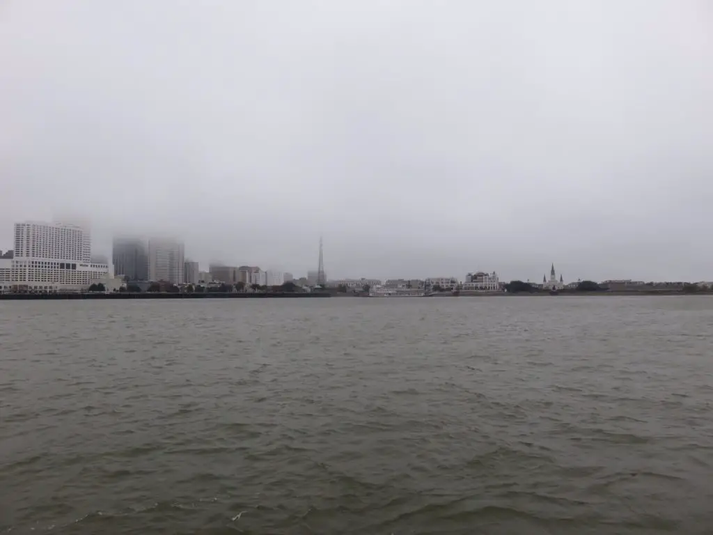
Beyond the confluence with the Ohio River at Cairo, Illinois, the lower Mississippi reaches its full splendour. Where these two mighty rivers meet, the Ohio is actually the larger of the two, so below the confluence with the Ohio, the Mississippi swells to more than twice its size.
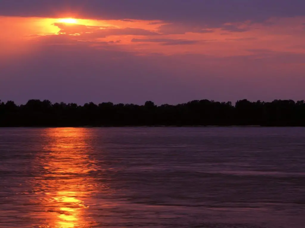
Often 1.5 miles (2.4 km) from bank to bank, the lower Mississippi becomes a brown, lazy river that flows with deceptive calm into the Gulf of Mexico.
Mississippi River length
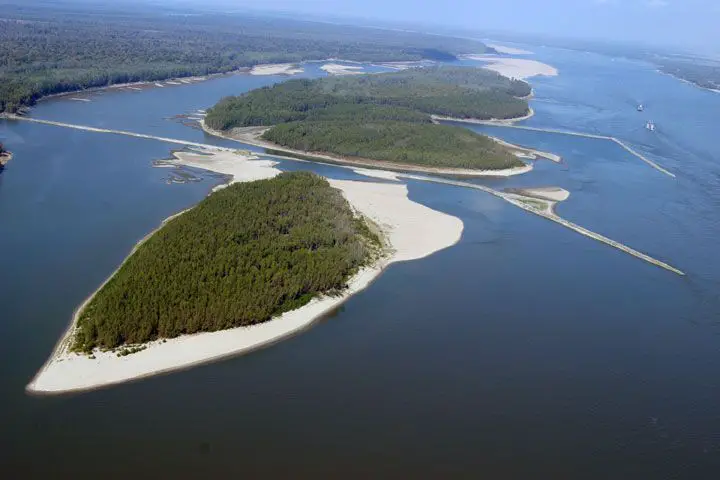
About halfway to the Gulf of Mexico through a vast delta southeast of New Orleans, a total distance of 2,340 miles (3,766 km) from its source. Together with its tributaries, the Mississippi drains all or part of 31 US states and two provinces in Canada.
Mississippi River Cities
The river crosses or flows through the states of Minnesota, Wisconsin, Iowa, Illinois, Missouri, Kentucky, Tennessee, Arkansas, Mississippi and Louisiana.
Cultural life
From Mark Twain’s evocative description of the pre-steamboat era in Life on the Mississippi (1883), based on his own experiences as a steamboat pilot, to the nostalgic lyrics of Oscar Hammerstein II’s song “Ol’ Man River” (1927).
There is a tremendous wealth of literature and music about the Mississippi created by people who have lived along the river.
Literary Life on the Mississippi
No writer is more indelibly associated with the river than Twain (born Samuel Clemens), whose pen name was derived from a river man’s expression for finding water two fathoms (12 feet or 3.7 metres) deep (see Researcher’s Note: Origins of the name Mark Twain).
Twain grew up on the river in Hannibal, Missouri, and the Mississippi is practically a character in his classic novels The Adventures of Tom Sawyer (1876) and The Adventures of Huckleberry Finn (1884).

Mississippi River tributaries
The Mississippi is joined by the Minnesota River at Fort Snelling in the Twin Cities; the St. Croix River at Prescott, Wisconsin; the Cannon River at Red Wing, Minnesota; the Zumbro River at Wabasha, Minnesota; the Black, La Crosse, and Root Rivers at La Crosse, Wisconsin; and the Rock River at Prairie du Chien, Wisconsin.
The Wisconsin River at Prairie du Chien, Wisconsin; the Rock River in the Quad Cities; the Iowa River at Wapello, Iowa; the Skunk River south of Burlington, Iowa; and the Des Moines River at Keokuk, Iowa.
Other major tributaries of the Upper Mississippi are the Crow River in Minnesota, the Chippewa River in Wisconsin, the Maquoketa and Wapsipinicon Rivers in Iowa, and the Illinois River in Illinois.
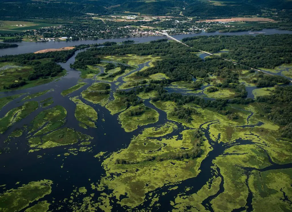
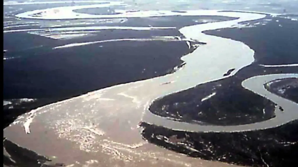
The Upper Mississippi is largely a braided river with many bars and islands. From its confluence with the St. Croix River downstream to Dubuque, Iowa, the river is heavily entrenched, with high rocky bluffs on either side.
The height of these bluffs decreases south of Dubuque, although they are still significant at Savanna, Illinois. This topography contrasts sharply with the Lower Mississippi, which is a meandering river in a wide, flat area, rarely flowing along a bluff.
Mississippi River and Gulf of Mexico
The New Madrid Seismic Zone, along the Mississippi River near New Madrid, Missouri, between Memphis and St Louis, is associated with an aulacogen (failed rift) that formed at the same time as the Gulf of Mexico. The area is still seismically active.
Four major earthquakes in 1811 and 1812, estimated at around 8 on the Richter scale, had enormous local effects in the sparsely populated area and were felt in many other places in the Midwest and Eastern United States. These earthquakes created Reelfoot Lake in Tennessee from the altered landscape near the river.
Physiography
The geology and physical geography of the Mississippi River basin is essentially that of the inland lowlands and Great Plains of North America. It also touches the Rocky Mountain and Appalachian mountain systems and the edge of the Canadian Shield (Laurentian) to the north.
The centre of the system, the lower Mississippi floodplain, is of particular interest because of the geology and physical geography of the region in which the river is formed. Like a large funnel, the river has drawn sediment and debris from adjacent areas near the rim of the funnel.
It has deposited much of the product in the floodplain at the top of the funnel, illustrating the interdependence of the entire Mississippi system.
In recent times, the most significant area of contribution has been west of the river. Rivers such as the Red, Arkansas, Kansas, Platte and Missouri, which rise in the western highlands, particularly in the foothills of the Rocky Mountains, remove significant amounts of silt from the rolling plains.
These tributaries meander and braid their way through a broad, gently sloping mantle of unconsolidated material deposited on Cretaceous (about 100 million years ago) bedrock towards the ‘Father of Waters’.
Rainfall in these western areas is mild to moderate, usually less than 25 inches (635 mm) per year, but because at least 70 per cent of this falls as rain between April and September, the erosive capacity of the rivers is increased (runoff from winter snowmelt is slower than from rainfall).
The sandy sediments also offer little resistance to erosion, so many of these rivers are only braided in their course.
The eastern rivers contributing to the eastern Mississippi drain the well-watered Appalachian mountain system. Most of this group, including the Kentucky, Green, Cumberland and Tennessee rivers, flow through well-defined valleys to join the Ohio and then the Mississippi.
The erosive capacity of these rivers varies according to the geological structure of their watersheds. These consist of harder rocks at higher elevations and a softer limestone sill of the Late Carboniferous Period (i.e. about 300 million years ago).
They are found below the 300 metre elevation line between the Ohio and Tennessee Rivers and in the glaciated area of the right bank tributaries of the Ohio.
Climate
In winter, average monthly temperatures in the Mississippi Basin range from 55°F (13°C) in subtropical southern Louisiana to 10°F (-12°C) in subarctic northern Minnesota. Average monthly summer temperatures range from 82°F (28°C) in Louisiana to 70°F (21°C) in Minnesota.
Precipitation sources are low-level moisture from the Gulf of Mexico and some low-level and high-level moisture from the Pacific Ocean. Winter and spring precipitation occurs near fronts and storms from the east and south.
Average monthly winter precipitation varies from 5 inches (130 mm) or more in the south, to over 3 inches (75 mm) in much of the Ohio River Basin, to less than 1 inch (25 mm) in the western and northern Great Plains.
Rainfall in the summer and early autumn occurs primarily as isolated showers and thunderstorms and as weaker frontal storms. Average monthly precipitation ranges from six inches (20 cm) in southern Louisiana and over the mountains of Tennessee and North Carolina to only two to three inches (10 cm) over the Great Plains.
The Mississippi River climate is humid in the eastern half of the basin, with large amounts of winter and spring runoff occurring in the Tennessee, Ohio and southern Mississippi River basins.
A north-south band of sub-humid climates, neither fully humid nor semi-arid, extends from central Texas north to eastern North Dakota. To the west are the semi-arid climates of the Great Plains.
And along the peaks of the Rocky Mountains is an alpine climate, where winter snowfall is released as meltwater runoff in spring and early summer.
Hydrology
Not surprisingly, the hydrology of a river as mighty as the Mississippi has been the subject of intense study. In the 19th century, Mark Twain wittily described how Mississippi paddlewheelers banded together to run a joint information service on changing conditions along the waterway.
Today, the Mississippi River Commission is responsible for work on the river and finds it worthwhile to maintain a working model of the river so that its engineers can test new plans in miniature before embarking on costly full-scale projects.
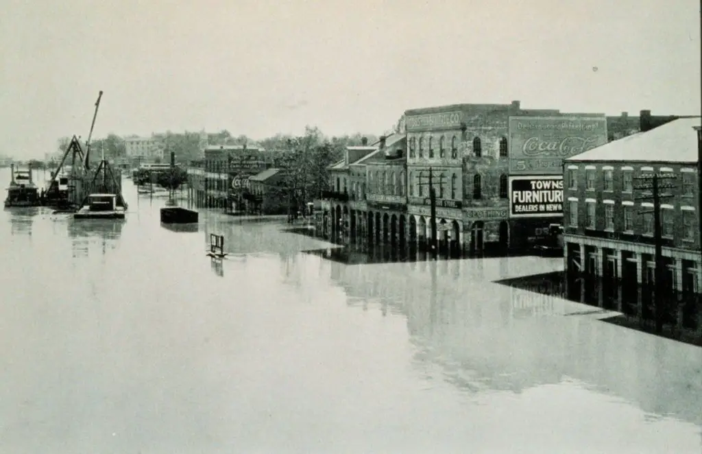
Indeed, by the 1920s it was widely believed that enough was already known about the river’s hydrology and that enough control structures had been built to tame it. Then, in 1927, came the most devastating flood in the recorded history of the lower Mississippi Valley.

More than 23,000 square miles (59,600 square km) of land was flooded. Communications, including roads, railways and telephone services, were cut off in many places. Farms, factories and entire towns were temporarily submerged.
A huge amount of property was damaged and at least 250 people lost their lives. River engineers took another look at the Mississippi’s hydrology.
Since the abnormal conditions of 1927, the average flow of water in the lower Mississippi from its major tributaries has been carefully monitored. The average flow of the main river at Vicksburg, Mississippi, is estimated to be 570,000 cubic feet (16,140 cubic metres) per second.
About 135 miles (215 km) downstream from Vicksburg, about 25 percent of the river’s sediment and water discharge is diverted into the Atchafalaya River through the Old River Control Structures complex.
However, this statistic masks large variations in river flow related to the fluctuating condition of the Mississippi’s larger tributaries.
In general, the western tributaries have the most erratic flow regimes. They reach a spring or early summer peak that is up to three to four times greater than their winter contribution.
The upper Mississippi and its tributaries peak at about the same time (March-June) when snowmelt is followed by early summer rains. However, winter runoff from this area is also significant.
The Ohio River peaks slightly earlier. At Metropolis, Illinois, just upstream of the confluence with the Mississippi, the highest monthly discharge is usually recorded in March, when the Ohio can provide more than three-fifths of the water monitored downstream of Vicksburg.
The Ohio is therefore primarily responsible for flooding in the lower Mississippi, which can be exacerbated by factors such as early rains in the Great Plains, a sudden warm spring that melts snow in the north, and heavy rains in the lower valley.
Under such conditions, the lower river will rise above its banks and push against its artificial levees. Tributaries will back up and form lakes on the other side of the same dams.
The flow, which normally does not exceed 2 to 3.5 knots (2.5 to 4 miles [4 to 6.5 km] per hour), can double at narrow points along the main channel.
For example, the Vicksburg gauge, which recorded only 93,800 cubic feet (2,660 cubic metres) per second at low water in 1936, recorded 2,060,000 cubic feet (58,330 cubic metres) per second at high water the following year.
Mississippi River Basin
The Mississippi River Basin is the fourth largest in the world and the largest in the United States. Covering an area of approximately 3,238,000 km², it drains 31 states and supports much of the country’s biodiversity. The Mississippi is the source of 23% of the public water supply.
Mississippi river plains
The Mississippi River floodplains are also called alluvial plains because of the amount of rainfall they receive throughout the year. Throughout the ages, these plains have endured and have been a major part of people’s lives. There are approximately more than 4,000,000 hectares that accompany this tributary.
Plant and Animal Life
Although the natural vegetation of the immediate Mississippi Valley is the product of climate and soil rather than the river, the marshes and backwaters of the Mississippi are ecologically remarkable.
Along the river, from the wild rice marshes of Minnesota to the coastal wetlands of the delta, there are pockets of thriving plant and animal communities.
There, the abundance of natural cover, relative isolation and the food provided by plants such as sedges, aquatic plants and millet encourage regular colonisation by waterfowl.
The path of these birds as they migrate up and down the river with the seasons has been dubbed the Mississippi Flyway, an apt name for the vast airway that stretches from the delta to the summer nesting grounds in northern Canada.
An estimated eight million ducks, geese and swans spend the winter on the lower part of the flyway, and many more use it on their way to Latin America. Typical flyway migrants are Canada geese and smaller snow geese.

Large numbers of mallards and wood ducks, black ducks, widgeons, pintails, ring-necked ducks and coots are found in the St Lawrence.
The main fish species found in the river include several species of catfish (some of which grow to considerable size and are commercially fished by local companies along the middle and lower river).
The American paddlefish is an ancient relic of the Mississippi.
The Mississippi basin is home to a very diverse aquatic fauna and has been called the freshwater “mother fauna” of North America.
Approximately 375 fish species are known from the Mississippi basin, far more than any other river basin in the Northern Hemisphere, which, with the exception of the Yangtze River, is located exclusively in temperate, subtropical regions.
Within the Mississippi basin, streams originating in the Appalachian and Ozark highlands are particularly rich in species. Fish species in the basin include many endemic species and relict species such as paddlefish, sturgeon, gar and bowfin.
Because of its size and diversity, the Mississippi basin is often divided into sub-regions. The Upper Mississippi River alone is home to some 120 species of fish, including walleye, sauger, largemouth bass, smallmouth bass, largemouth bass, northern pike, bluegill, crappie, channel catfish, flathead catfish, common bluegill, freshwater drum and shovelnose sturgeon.

Walleye and suckers, which thrive in the upper river and form the basis of a sport fishing industry in Minnesota and Wisconsin; carp; and garfish. Alligators are now rare, found only in the most remote backwaters, and the brackish shrimp and crab fisheries are in decline.
Other Fauna
In addition to fish, the Mississippi Basin is home to several species of turtles (such as the snapping, musky, mud, map, cooter, painted and softshell turtles), the American alligator, aquatic amphibians (such as the hellbender, mudpuppy, three-toed amphiuma and lesser siren) and cambarid crabs (such as the red swamp crab).
Introduced species
The Mississippi River is home to many introduced species, some of which are invasive. Introductions include fish such as Asian carp, including silver carp, which have become notorious for competing with native fish and for their potentially dangerous jumping behaviour.
They have spread throughout much of the basin, even approaching (but not yet invading) the Great Lakes. The Minnesota Department of Natural Resources has designated much of the Mississippi River in the state as infested with exotic species of zebra mussels and Eurasian clams.
Future
Geologists believe the lower Mississippi could take a new course to the Gulf. Either of two new routes, through the Atchafalaya Basin or Lake Pontchartrain, could become the main channel of the Mississippi if flood control structures are overtopped or severely damaged during a major flood.
Failure of the Old River Control Structure, the Morganza Spillway or nearby levees would likely divert the main channel of the Mississippi River through Louisiana’s Atchafalaya Basin and down the Atchafalaya River to the Gulf of Mexico south of Morgan City in southern Louisiana.
This route provides a more direct path to the Gulf of Mexico than the current Mississippi River channel through Baton Rouge and New Orleans. The risk of such a diversion exists during any major flood event.
Until now, such a diversion has been prevented by active human intervention involving the construction, maintenance and operation of various levees, spillways and other control structures by the US Army Corps of Engineers.
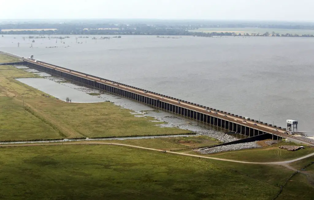
The Old River Control Structure complex. Looking east-southeast, downstream on the Mississippi River, with the three dams across the Atchafalaya River channels to the right of the Mississippi. Concordia Parish, Louisiana, is in the foreground on the right, and Wilkinson County, Mississippi, is in the background, crossing the Mississippi on the left.
The Old River Control Structure, between the present Mississippi River channel and the Atchafalaya Basin, is at normal water level and is normally used to divert 30% of the flow from the Mississippi River to the Atchafalaya River.
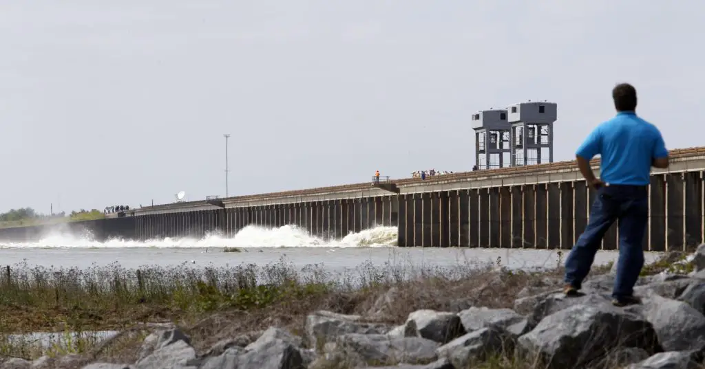
There is a steep drop from the main channel of the Mississippi into the Atchafalaya Basin. If this structure were to fail during a major flood, there is great concern that the water would scour and erode the riverbed to the point where the main channel of the Mississippi River would become inaccessible.
The structure was almost lost in the 1973 flood, but repairs and improvements were made after engineers studied the forces at play. In particular, the Corps of Engineers made many improvements and built additional facilities to divert water through the area.
These additional facilities give the Corps much more flexibility and potential flow capacity than in 1973, further reducing the risk of catastrophic failure in this area during other major floods, such as the 2011 flood.
Because the Morganza spillway is slightly higher and set back from the river, it is normally dry on both sides. Even if it were to fail at the crest during a major flood, the floodwaters would have to erode back to normal levels before the Mississippi could permanently jump the channel at this point.
During the 2011 floods, the Corps opened the Morganza Spillway to 1/4 of its capacity, allowing 150,000 ft3 /sec of water to flood the Morganza and Atchafalaya Canals and continue directly to the Gulf of Mexico, bypassing Baton Rouge and New Orleans.
In addition to reducing the crest of the Mississippi downstream, this diversion reduced the likelihood of a channel change by reducing the stress on the other elements of the control system.
Some geologists have suggested that the possibility of channel shift in the Atchafalaya also exists in the area immediately north of the Old River Control Structure. Army Corps of Engineers geologist Fred Smith once said, “The Mississippi wants to go west. 1973 was a forty-year flood.
The biggest one is somewhere where the structures can’t hold all the water and the levee has to give way. That’s when the river will jump its banks and try to break through.
Another option for the Mississippi is to divert to Lake Pontchartrain near New Orleans. This route is controlled by the Bonnet Carré Spillway, which was built to reduce flooding in New Orleans.
This spillway and an imperfect natural levee about 4-6 metres high are all that prevent the Mississippi from taking a new, shorter course through Lake Pontchartrain to the Gulf of Mexico.
Rerouting the main channel of the Mississippi River through Lake Pontchartrain would have similar consequences to an Atchafalaya diversion, but to a lesser extent, because the existing river channel would remain in use beyond Baton Rouge and into the New Orleans area.