As in many cases of cities that grow on the banks of a river, the Medellín River tells the story of the development of an urban population with Andean roots. In this article you will learn about the before and after of the Medellín River.
History of the Medellín River
In the beginning, this city in the northwest of Colombia had swamps, creeks and marshes that, together with the Medellín River that crossed the valley, showed a very different local geographical organisation.
The history of the Medellín River begins at the end of the 19th century with the first expansion of the city’s roads. The Santa Elena stream was dammed, the Medellín riverbed was canalised and new bridges were built.
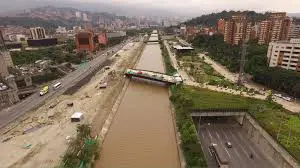
In the twentieth century, in order to improve health and hygiene and to adapt many plots of land to urban development, emphasis was placed on the canalisation of the Medellín River, transforming its role as a boundary to the west into that of a channel to guide and organise the city.
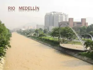
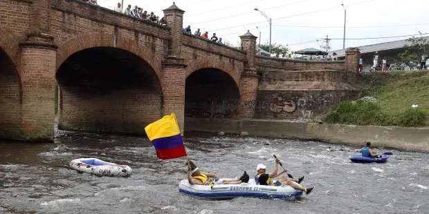
With the construction of the Guayaquil Bridge, the two banks of the river were reunited, and today the Medellín Canal runs through a large part of the city (see also bridges on the Isere River).
The importance of the Medellín River is such that the metro runs along its banks and on its slopes you can see places of interest such as the Metropolitan Theatre, the International Convention Centre, the University of Antioquia, the La Macarena Exhibition Centre and Nutibara Hill, among many others.
Map of the Medellín River
The Medellín River, also known as the Paisa River, is located in the department of Antioquia and runs through the entire city of Medellín, the second largest city in Colombia.
The map below shows the source and mouth of the Medellín River, as well as the river’s entire course.
Source of the Medellín River
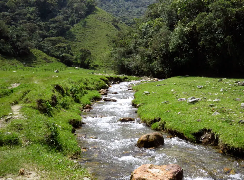
The Medellín River has its source in Alto San Miguel, at 3,100 metres above sea level, in the Aburrá Valley (Aburrá River), Itagüí, Caldas municipality.
Its waters flow through ten municipalities before joining the Grande River to form the Porce River. The Medellín River flows into the Cauca River, which flows into the Magdalena River.
With regard to the course of the Medellín River and its basin, the basin has an area of 1,251 km2, with an irregular topography and a high percentage of population, which is almost 60% of Antioquia and 8% of the country.
It is surrounded by rivers and streams, the Medellín River and the mountains of the municipalities:
- Caldas.
- Sabaneta.
- Envigado.
- La Estrella.
- Itagüí.
- Medellín.
- Bello.
- Girardota.
- Copacabana and Barbosa.
- The Aburrá Valley
Pollution of the Medellín River
Only 3 or 4 kilometres of the Medellín River are free of pollution, which is a cause of great concern to the inhabitants and the authorities.
As far as the pollution of the Medellín River is concerned, it is known that it has always served as a recipient of sewage and has been polluted with organic matter and toxic waste such as cyanides, phenols, sulphides, mercury and lead, in addition to deforestation, solid waste, rubble dumping and other aggregates that aggravate its situation (see also Bogotá River).

In response to the seriousness of the situation, a network of pipes has been installed parallel to the river and streams to collect contaminated water, and deep sanitation campaigns are being carried out.
There are two treatment plants in the region. One is San Fernando, in the municipality of Itagüí, which treats water from Envigado, Itagüí, Sabaneta, La Estrella and part of the city, removing about 85% of the contaminated water, which is then returned to the Medellín River.
The second, a recent addition, is in Bello, north of the Aburrá Valley (Aburrá River), which is expected to triple San Fernando’s treatment capacity to cover 95% of the water entering the river.
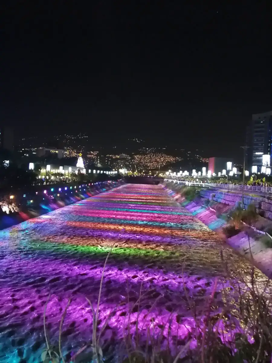
Medellín River at Christmas
It has become a tradition to light up the Medellín River at Christmas, giving the city a new point of tourism and entertainment for locals and foreigners alike, in an illuminated festival of cultural events.
As we already know, the aforementioned Paisa River is a good option for the Christmas season, as it has 21 parks in 4 kilometres of the city centre, making December an excellent time to enjoy Medellín, starting with the lighting of the lights, whose installation is in charge of the company EPM, and the Parade of Dances, Myths and Legends, one of the most important traditions of the city (see also Caroní River).
This is where he puts on his most elaborate display, which has earned him a place among the 10 most amazing cities in the world to celebrate Christmas, according to the National Geographic website.