Last Updated on August 23, 2023 by Hernan Gimenez
Would you like to know more about European rivers such as the Douro in Spain or the Rhine in Switzerland? Enter this article and learn all about the Guadiana River, from its location to the length of its course and much more.
Indice De Contenido
Location of the Guadiana River
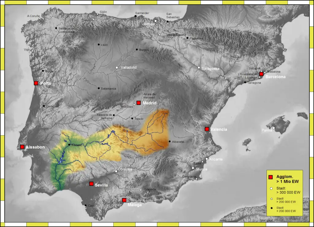
On the map, the Guadiana is the fourth longest river in the Iberian Peninsula and the fourth largest river, it flows through two nations; Spain and Portugal, running from east to west along the southern sub-plateau, this at the level of the Spanish city known as Badajoz then heads south, a direction that will continue until it reaches its mouth in the Atlantic Ocean.
Characteristics of the Guadiana River
The Guadiana, as we have already seen, is a river of a flow and length for this European region, as well as the Danube (see link Danube) or the Thames in Great Britain (see link Thames). Here is a breakdown of its main geographical characteristics:
Longitude
FlowThe upper Guadiana is 76 km long and the Guadiana itself is 742 km long, making it, as we have seen, the fourth longest river in the world.
The average flow in the Spanish section is 26 cubic metres per second and in the Portuguese section, including the border, it is about 78 cubic metres per second.
Catchment area
Its catchment area is the Guadiana river basin and its surface area is 67,733 square kilometres, a much smaller basin than, for example, the Rhine river basin (see Rhine River link).
Altitude
The altitude of the Guadiana River is about 608 metres above sea level at its source, and its mouth, which is in the Atlantic Ocean, is of course at sea level.
Source of the Guadiana river
Another tradition says that the Guadiana flows out of the Lagunas de Ruidera. From the Lagunas de Ruidera the Guadiana flows underground, where it disappears, i.e. a part of the river flows underground and reappears in the so-called Ojos del Guadiana.
Today, however, it is believed that the Guadiana originated earlier, in the Campos de Montiel, a high plateau in Castilla (La Mancha) where several underground waters converge to form the springs of Pinilla. The exact origin of this source of the Guadiana is known as the River Pinilla.
Ruidera Lagoons
The upper Guadiana, which already bears the name of the river Pinilla, reaches, thirty kilometres from its source, what is known as the White Lagoon, the first of the 15 small lakes that make up the Lagunas de Ruidera, which stretch for 25 kilometres in a conformation of natural dams.
This park is called Parque Natural de las Lagunas de Ruidera and its origin is due to the following process: the water in these lagoons was formed by a process of stagnation of the water itself, where the limestone that enveloped the aquifers filtered and dissolved, leaving on the surface all the accumulated water that would form each of the 15 lagoons.
In this video you can appreciate the majesty of the Lagunas de Ruidera:
Courses of the Guadiana River
As for the course of the Guadiana River, we can mention that it crosses the town:
Curso Alto
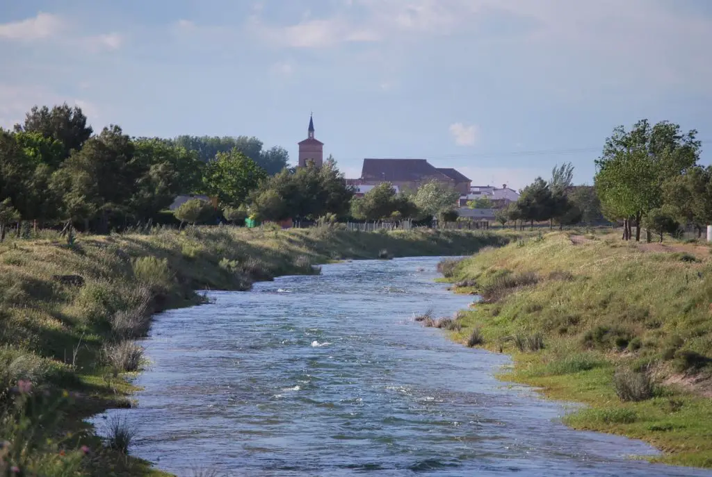
Ojos del Guadiana Spring (Ciudad Real), a point that hydrologically recognises the conformation of the Guadiana as a river.
Middle course
It is in the province of Bajadoz that the Guadiana flows, after leaving the region of Castilla (La Mancha), which it crosses before entering Bajadoz, forming the tail of the Cíjara reservoir.
Lower course
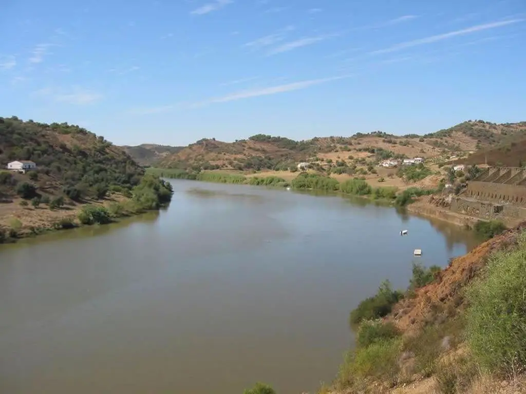
When it leaves Bajadoz, the Guadiana changes direction from east to west, turning south. This course of the river, like other rivers in the world (see link Detroit River), marks the border between two nations, in this case between Portugal and Spain.
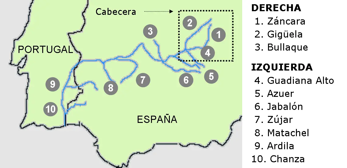
The main tributaries are on the right bank of the river. They are characterised by a very low relief, which means that the streams that pass through the area are waterlogged. There are large aquifers that favour the formation of marshes and lagoons through drainage.
The following are the tributaries of the Guadiana


