
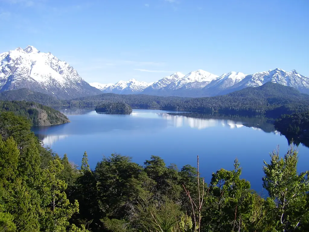
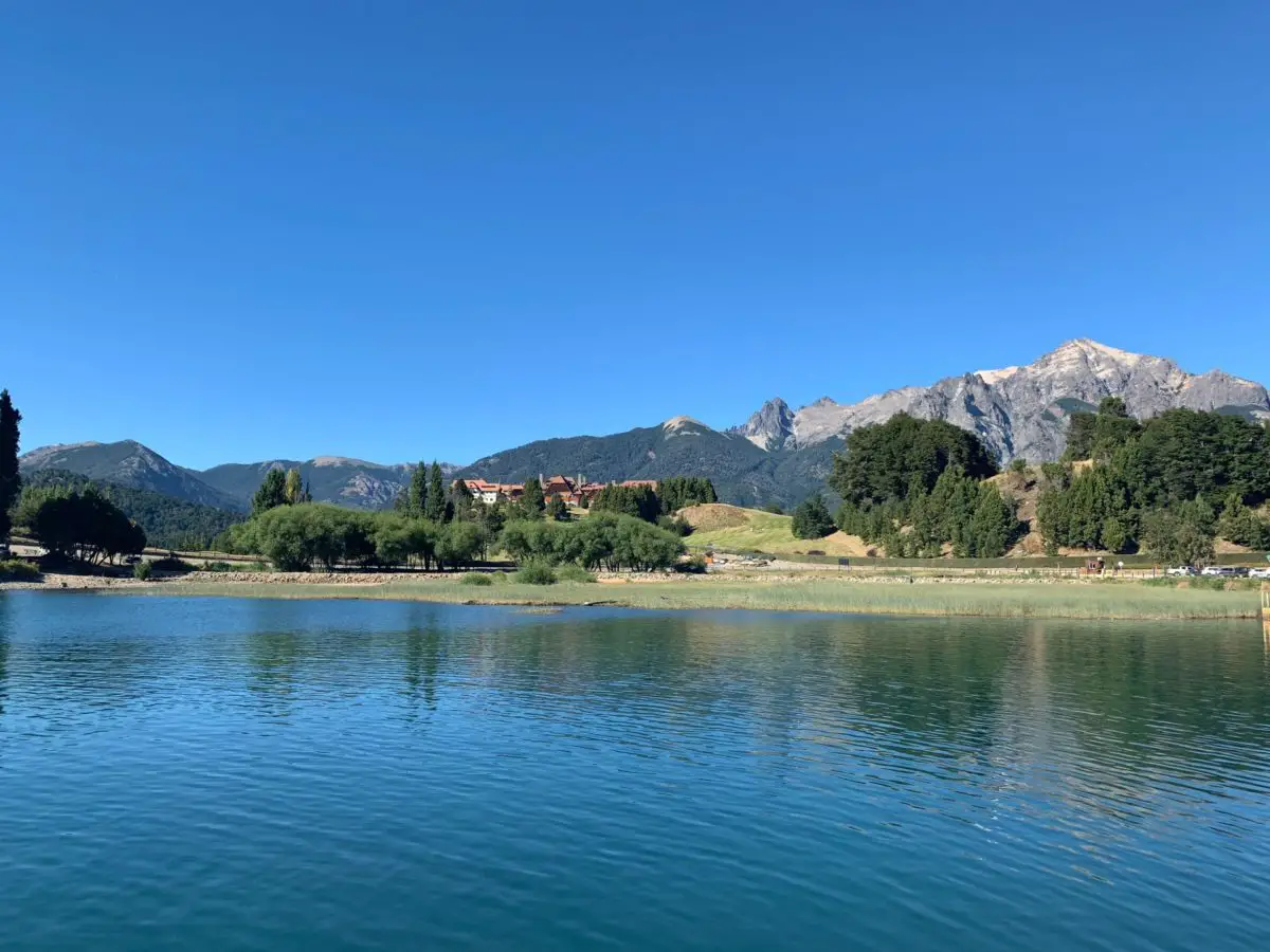
The Nahuel Huapi Lake belongs to the Argentine Patagonia and is of tectonic – glacial origin, it was also formed as a border between the provinces of Río Negro and Neuquén. But that is not the most incredible thing about this lake, here you will learn about its history, characteristics, flora, fauna, hydrography, national park and much more.
History of the Nahuel Huapi Lake
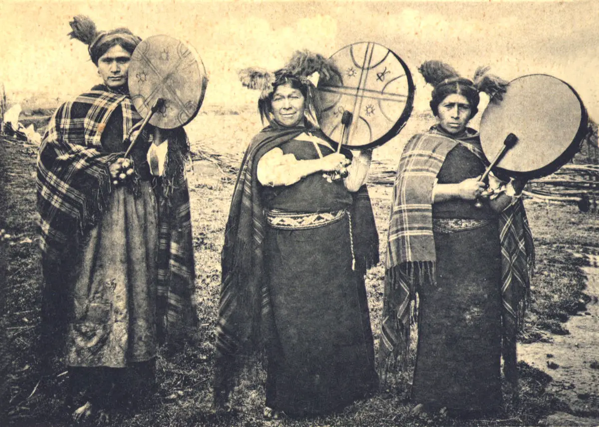
Lake Nahuel Huapi was inhabited by several local indigenous peoples or ethnic groups of the Argentine Patagonia who lived in the surrounding area, among them the Mapuches, who are descendants of the Tehuelche, Puelche and Pehuenche, indigenous settlements known since the Neolithic or Stone Age.
These original ethnic groups were absorbed by the Mapuche, or Araucanians as they were later called, who came from the south of Chile. Until the 16th century, they also shared space with other indigenous peoples of Patagonia called Vuriloche, which in their language means people from the other side.
The Mapuches, an indigenous ethnic group that inhabited Lake Nahuel Huapi, claim the name, which in the Mapuche language means “Island of the Jaguar” and is pronounced mapudungun, actually referring to Victoria Island, which is recognised as the largest island in the lake.
It is thought that the name alludes to a totem of the Puelche ethnic group, who live in the area, and it is also said that it may refer to the relationship of bravery and courage between the indigenous people and the yaguaretés, characteristic animals of the area, a species of wild cat known in other areas as the jaguar.
The first European to arrive in this area was the Spaniard Diego Flores, a military man who was part of the Captaincy General of Chile, in 1621. Later, in 1670, the indigenous Vuriloche were interfered with in their native culture by the Jesuits, who founded the Nahuel Huapi Mission in the area. The most prominent of these was Nicolás Mascardi, who together with his Jesuit followers carried out the evangelisation of the Vuriloche.
However, since the arrival of Diego Flores, there had been resistance from the natives in defence of their territory. It was a fierce battle between conquerors and natives that lasted almost without interruption. The first to be evangelised by Nicolás Mascardi were the slaves who had been freed.
In 1718, the death of five Jesuits belonging to the Nahuel Huapi Missionary Order led to the abandonment of the mission built on the Huemul Peninsula of Lake Nahuel Huapi.
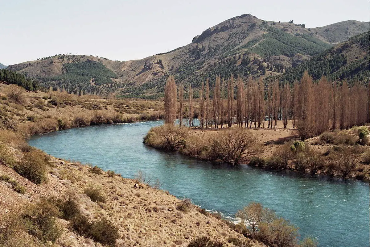
It was not until two centuries later that Francisco Pascasio Moreno, an Argentine scientist, explorer, geographer, naturalist, conservationist and politician, ascended the Limay River to the western shore of Lake Nahuel Huapi. It was the first time the lake had been reached by water since the Jesuits left.
This feat was awarded to Lieutenant Eduardo O’Connor, who was in charge of the voyage. This exploratory mission was ordered by General Julio Argentino Roca, President of the Republic at the time, and allowed them to connect the Argentinean Sea with Lake Nahuel Huapí. To do this, they used a boat with sails and oars, and when they reached the island in the lake, they named it after Lieutenant O’Connor’s wife, calling her Modesta Victoria.
This part of the history of Lake Nahuel Huapi is so well known and admired that today many of the boats used for the tour bear this name. So when you visit Lake Nahuel Huapi and notice that the boats are called Modesta Victoria, you will know why.
Where does the name come from?
As we have already mentioned, the name of Lake Nahuel Huapi comes from the Mapuche ethnic group, in whose language Huapi means island and Nahuel means jaguar.
Therefore, the name refers to the largest island in Lake Nahuel Huapi, Isla del Yaguar or Yaguareté, also known as Victoria Island. During the colonisation and arrival of the Europeans, the area was called Isla del Tigre (Tiger Island), as this was the European name used to identify the jaguar.
The legend of Nahuelito
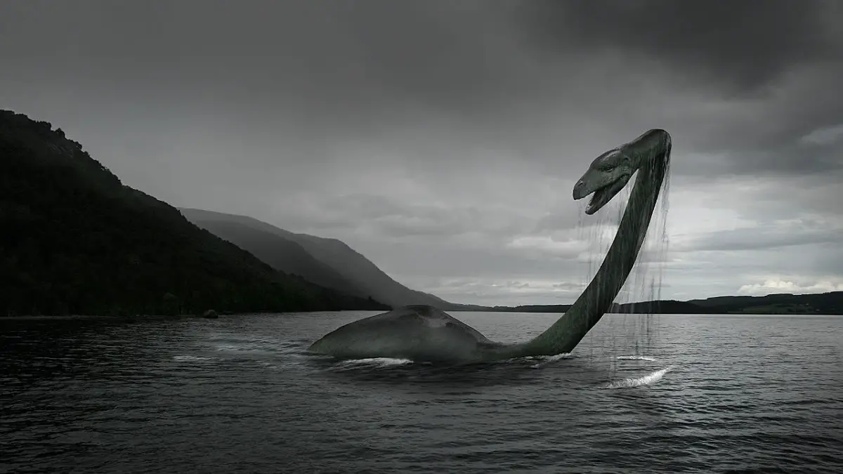
In the depths of Lake Nahuel Huapi there is the legend of a monster, about which there are numerous accounts, some of them based on ancient indigenous legends, which claim that a gigantic creature emerged from the lake’s depths. Others say that this creature has an enormous hump, a very long neck that is more than 5 metres high, and that when it is on the surface it resembles a cow’s skin, which is why it is also called “leather”.
The legend became really popular at the beginning of the 19th century, when the Buenos Aires Zoo decided to invest in the search for the monster of Lake Nahuel Huapi, due to the alleged sightings that were becoming more and more frequent.
There is even a certain resemblance to the famous Loch Ness Monster, a legendary dinosaur-like animal that lives in a deep lake near the city of Inverness, Scotland, and was sighted at least 10 years after the Nahuel Huapi Lake Monster.
Around 1897, Dr Clemente Onelli, who was the director of the Buenos Aires Zoo, began to receive information about the strange creature that had been seen in Lake Nahuel Huapi, so he organised several expeditions to go in search of the mysterious creature.
The animal sought in Lake Nahuel Huapi is an aquatic creature that was first sighted in 1910, when George Garret, an American employee, claimed to have seen a creature about 5 to 7 metres long, with its neck protruding two metres above the water.
The most popular hypothesis is that it is a prehistoric monster, a surviving dinosaur from the Jurassic period, characterised by a broad body that fits the description of an extended cowhide, a short tail and a relatively elongated neck.
Another hypothesis is that it is a genetically modified animal, a mutation caused by the nuclear tests carried out since the 1960s. And finally, that it is a submarine that enters the lake.
Despite all the research that has been carried out in search of answers to this legend, which comes from the Mapuche Indians, the original inhabitants of the region, who called it “El Cuero”, none of the hypotheses that have arisen around the legend have been proven. Today, the monster of Lake Nahuel Huapi is known as Nahuelito, an elusive creature that lives in the depths of the lake and remains a mystery to this day.
Characteristics of Lake Nahuel Huapi
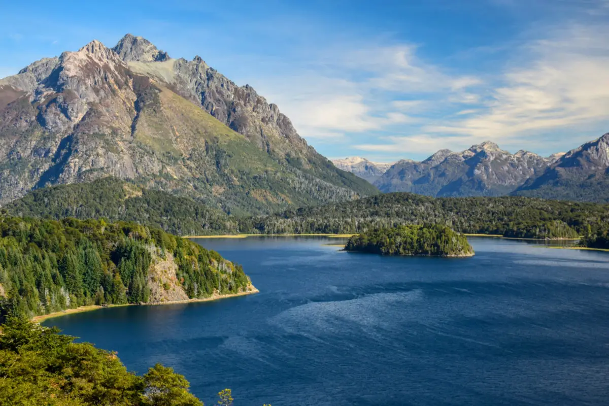
Nahuel Huapi is a lake of tectonic-glacial origin located in the Argentine Patagonia. It is divided between two provinces of the country, which allows it to serve as a natural border between Neuquén, where it occupies approximately 80% of its surface, and Río Negro, where the remaining 20% is located.
When we talk about tectonic origin, it means that it was formed by the collision, sinking or fracturing of the plates that make up the earth’s crust. When we talk about glacial origin, it means that it is formed by the depressions carved or excavated by the movement of ice layers on the crust. Lake Nahuel Huapi is the result of these two types of processes, which occurred at different times, and is therefore considered to be of tectonic-glacial origin.
The geology in which Lake Nahuel Huapi is located is characterised by the presence of ancient rocks. At the beginning, this area was a shallow sea bed, later volcanic processes began to take place where igneous rocks erupted about 200 million years ago.
About 65 million years ago, the Andes began to appear in the relief of the land through the process of subduction, which occurs when two tectonic plates meet and one sinks under the other. In the case of Lake Nahuel Huapi, the Nazca plate sank beneath the South American plate.
This is the tectonic process that also caused the fracturing of the earth’s crust, giving rise to several volcanoes. After this process, the glaciation took place about 2.5 million years ago, the movement of the ice masses during all this time carved the U-shaped valleys that form the current landscape where the Nahuel Huapi Lake is located.
Located at 700 metres above sea level, it has a surface area of 557 square kilometres, a maximum depth of 464 metres, an average depth of 157 metres and a maximum width of 10.2 kilometres. Its geographical structure is characterised by the presence of 7 arms known by the following names
- El Campanario, with an area of 7.9 square kilometres, 50 metres deep and 7 kilometres long.
- Brazo de la Tristeza, with an area of 18.5 square kilometres, 250 metres deep and 14 kilometres long.
- Brazo Huemul, which has a surface area of 21.5 km², is 14 km long, 2.4 km wide and 380 metres deep.
- The others are El Rincón, El Machete and Última Esperanza.
It is related to other lakes in the area, such as Lago Gutiérrez, which has an approximate surface area of 16.4 km², Lago Moreno, which is similar in size to the previous one, Lago Espejo, whose surface area is unknown, and Lago Correntoso, which has a surface area of 27 km².
It also has the Huemul, Bonito, Pireco, Cántaros, Frías and Ñirihuau rivers as tributaries, as well as other smaller streams such as the Angostura and the Ñireco. The outflow of Lake Nahuel Huapi is the source of the Limay River.
This lake has several islands in its interior, the most important of which is Victoria Island, with a surface area of 31 km², originally called Isla del Yaguar or Yaguareté by its indigenous Mapuche inhabitants, due to its surface area and tourist interest. There are also the islands of Gallinas, Huemul, Fray Menéndez, Centinelas and Las Gaviotas.
Its important coastline has crystalline waters, where tests have shown that sunlight penetrates to a depth of 55 metres, which contributes to photosynthesis processes, making it a lake with an important amount of dissolved oxygen.
The landscape varies as you travel through it, from dense Valdivian rainforest on the west side to semi-desert or arid transitional landscape on the east.
Flora and Fauna
The flora and fauna associated with Lake Nahuel Huapi have been seriously altered by human intervention in its habitat, which has led to the endangerment of one of the most important species in the ecosystem, the jaguar. Since the end of the 19th century, no specimens of this species have been seen in the northern part of Patagonia, and it is believed that they have died out as a result of the intense hunting pressure exerted by the colonists.
Lake Nahuel Huapi is a dynamic ecosystem that offers a variety of microhabitats used by an important number of plant species. There are areas that behave like wetlands and others where the soils are dry, the mountains allow the establishment of high altitude species, the dry cold also generates desert areas, in short, the diversity of habitats in the region dynamises the biological diversity associated with the lake.
As a result, we can find species such as the famous Arrayanes, a beautiful tree with the scientific name Myrceugenella apiculata, which can reach a height of over 18 metres and has a very distinctive cinnamon-coloured bark with white spots. It is also a species of ethnobotanical value, meaning that some of its parts are used for medicinal purposes.
This species, together with the umbrella, make up the Andean forests of Patagonia, accompanied by the incredible Valdivian Forest, which is itself recognised as an ecoregion. They are characterised by being evergreen forests, with different strata recognisable by the dominance of different species at different altitudes.
The most important thing about the Valdivian Forest is that of the 4000 identified plants, almost half are endemic, meaning that they only exist in this area and belong to this forest. One of the most impressive is the giant Fitzroya cupressoides, commonly known as alerce, which is said to be one of the oldest plant species on the planet.
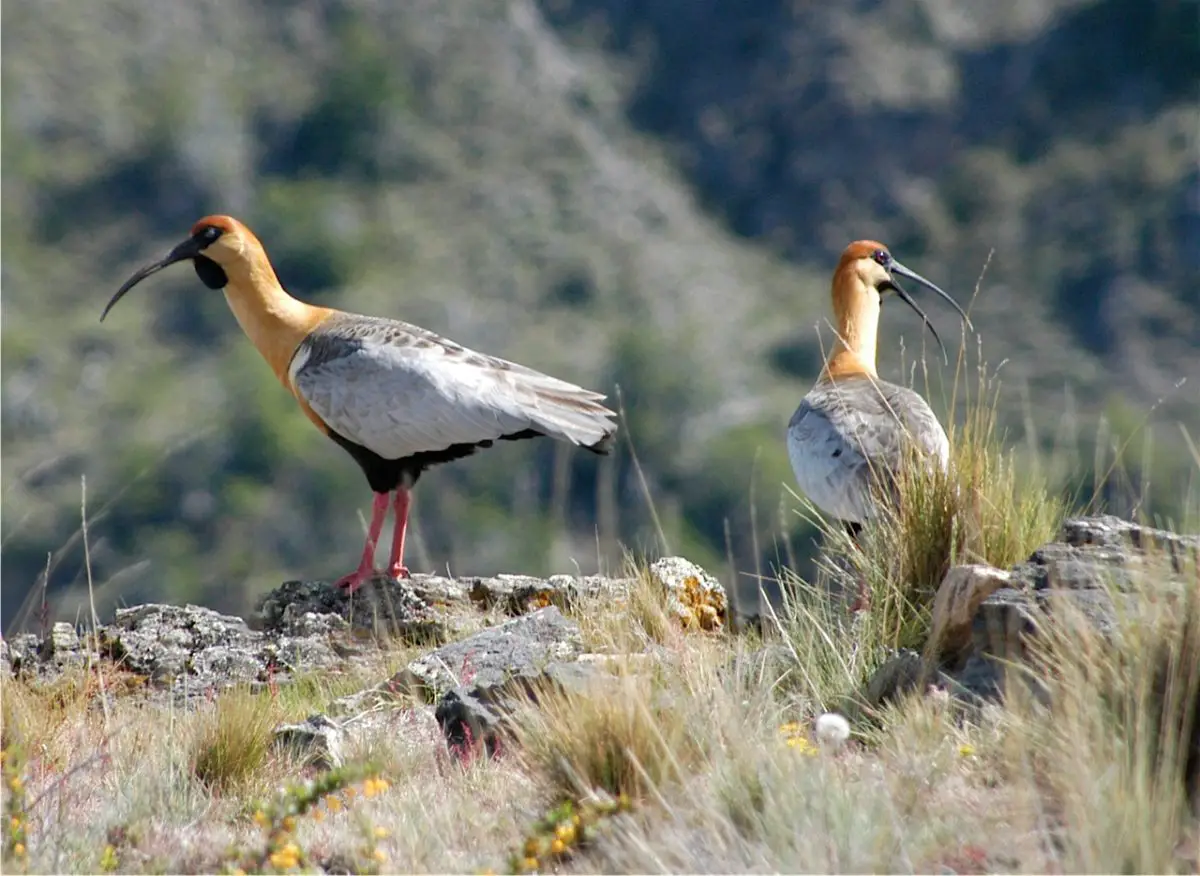
As far as fauna is concerned, there are also curiosities related to the bird communities established on the cliffs, among which there is an important population of imperial cormorants, with the scientific name Leucocarbo atriceps, a bird associated with marine environments. It is also possible to see the beautiful and well-known gull, scientific name Larus dominicanus, of large size, with a white breast and black back.
Another important bird of the Nahuel Huapi lake is the Columba araucana, better known as the Araucanian Pigeon, a red-legged pigeon with brown plumage and a beautiful white collar. However, this beautiful species is threatened by habitat encroachment, hunting pressure and a poultry-borne virus that has severely affected it.
This lake is also visited by seasonal birds that take advantage of the warm seasons to nest for a while in the surroundings, among them the Cauquenes, a beautiful endangered species, currently under protection, the hunting pressure on this species is very strong. This bird is sexually dimorphic, meaning that the plumage of the female is very different from that of the male.
Another species associated with seasonal permanence is the bandurria, a large bird with delicious meat, which is also a victim of heavy hunting pressure. Finally, we can mention the fío fío, a small bird with a beautiful song that can be recognised by its white plumage in the middle of its head, while the rest of its plumage is grey.
A mammal that belongs to this beautiful basin of Lake Nahuel Huapi is the Lontra provocax, known as the huillín, a beautiful otter that lives in the streams, rivers and shores of the lake. It is carnivorous and feeds on the fish that are part of this ecosystem.
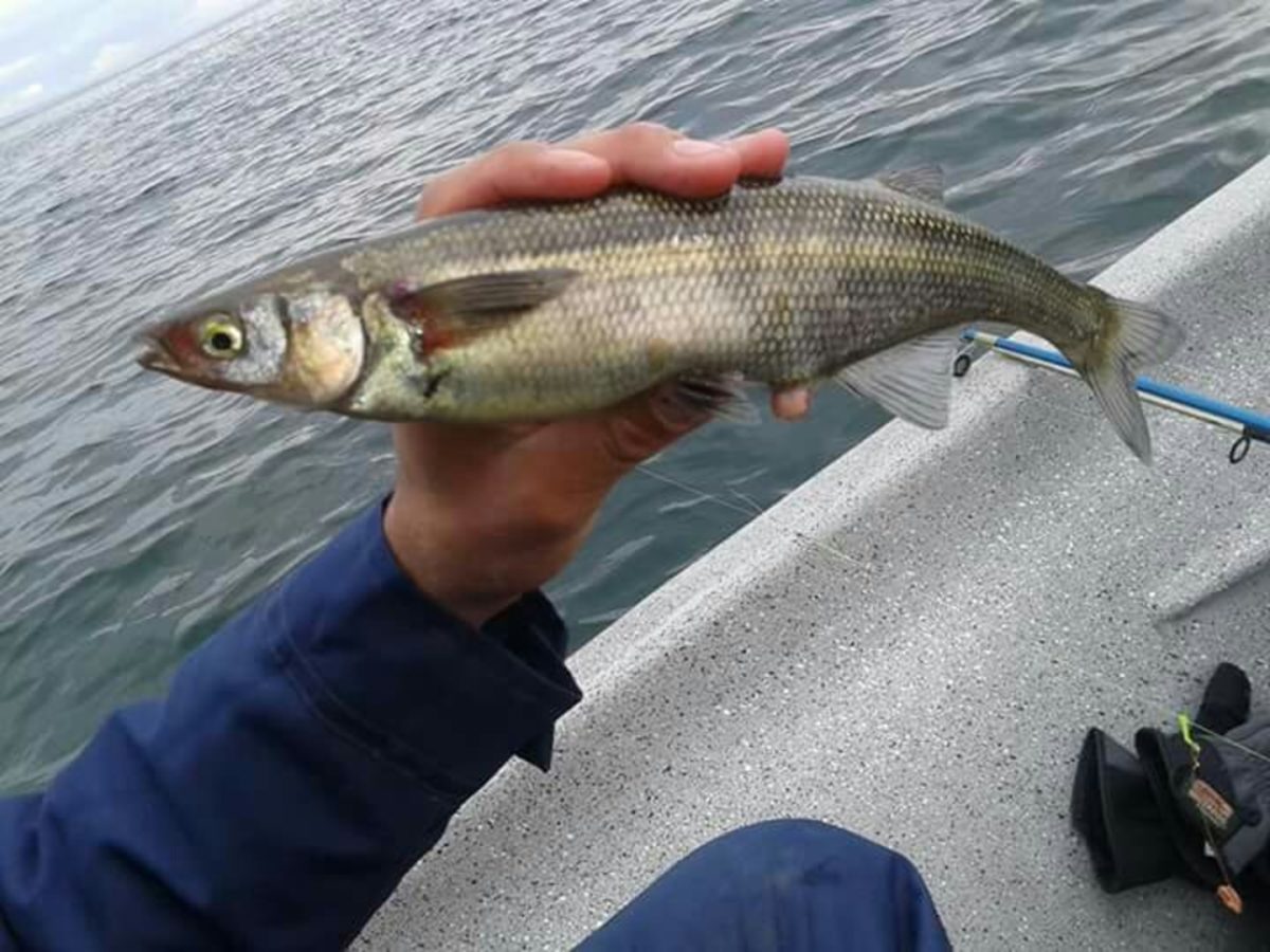
In colonial times, alien fish species were introduced into the lake, which affected the native fish populations, including the Odontesthes microlepidotus, an endemic species known as the Patagonian silverside. Also the trout with the scientific name Percichthys trucha and the puyén with the scientific name Galaxias maculatus, among others.
The most abundant fish is the rainbow trout, whose fishing is a great tourist attraction. The smallest specimens weigh between 0.5 and 6 kilos, but the most abundant are between 2 and 4 kilos. This species is accompanied by brown trout and fontianalis, which do not pose a problem of competition because they prefer to be found in the outlets of the river, while the rainbow trout prefers more open areas.
Climate of the lake
Lake Nahuel Huapi has all four seasons, which means that this beautiful part of Argentine Patagonia has an extremely delicate, but also very dynamic, biological balance. Let’s start with the summer season, when temperatures range from 10°C to 26°C. In autumn, the temperature varies between 2°C and 26°C. In autumn, the temperature varies between 2°C and 17°C. In winter, it snows, with temperatures ranging from 8°C to -15°C.
Humid Pacific winds and heavy rainfall are present between the west and east. In spring, temperatures vary between 6°C and 20°C and days can be hot and breezy or breezy and cool.
For those who do not like extreme temperatures, the hottest months are between November and February, with temperatures ranging from 15°C to 20°C. The coldest months are between May and August.
With regard to rainfall, there is a clear pattern in which rainfall is concentrated between April and August, with June being the month with the highest rainfall, with average values between 20 and 50 mm. On the other hand, the months with the least rainfall are between November and February, with values ranging from completely dry days, i.e. 0 mm of rainfall, to a maximum of 2 to 5 mm of rainfall.
Depth
Lake Nahuel Huapi has a maximum depth of 464 metres, but its cold waters and the alleged presence of Nahuelito have not allowed a thorough study of the depths of Lake Nahuel Huapi.
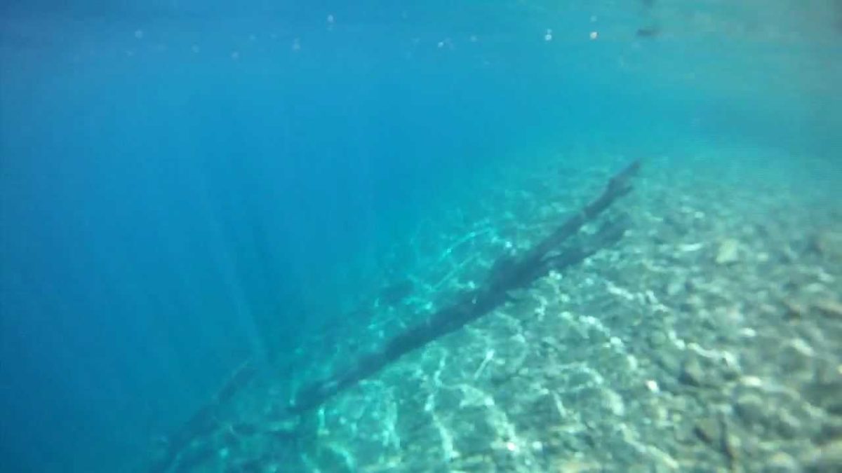
There are many explorers who have ventured into its depths, who speak of the existence of an immense chasm, but no one has ever entered it. The icy waters and the lack of minerals in its composition make this adventure more complicated than usual.
The Argentine Naval Prefecture acquired a submarine for rescue and salvage purposes, but it could only reach a depth of 350 metres, which made it possible to identify an eroded seabed with a large amount of sediment. The pilots who plumbed the depths of the lake pointed out that there was no greater diversity of fauna than in the sea, but they did observe a great variety of fish.
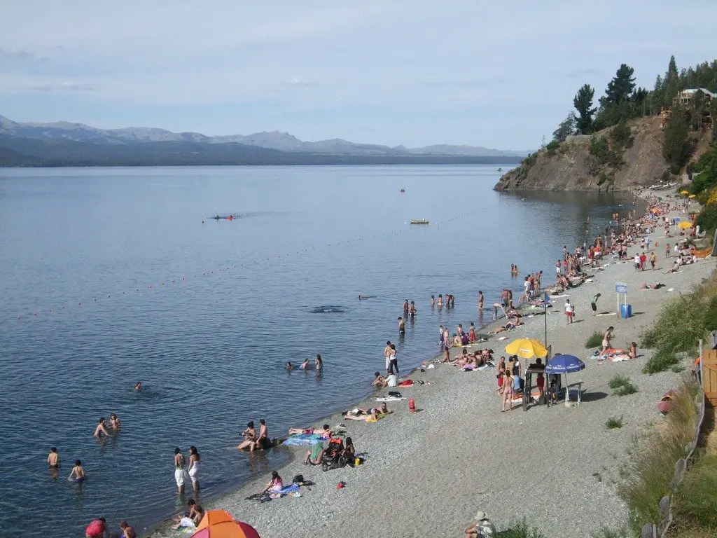
Beaches of the lake
In summer, Lake Nahuel Huapi is the delight of locals and visitors alike, its crystal clear beaches are very popular and there are occasions when the temperature allows a delicious swim in its waters. Of course, it is important to remember that its waters have a low buoyancy, so be careful when swimming.
Many people just go to rest and enjoy the beautiful scenery that its beaches offer, one of them and in fact the most crowded is Playa Bonita, this beautiful beach is located at kilometre 8 of Ezequiel Bustillos Avenue, it has all the facilities to enjoy, such as lifeguards, restaurants, besides renting the necessary equipment for water sports such as kayaking, diving and more.
Playa Serena, on the other hand, is much quieter and less crowded, but it has nothing to envy the previous beach, as it has finer sand, warmer waters and water sports facilities, including stand up paddle, which consists of a board that you stand on and propel yourself with a paddle. It is located at kilometre 12 of Ezequiel Bustillos Avenue.
Centenario Beach is located in the Ñireco neighbourhood, it is a very central and accessible beach to visit, it is a beautiful beach close to the bus station and the trains, where you can practice windsurfing, among other sports.
Playa Centro is identified by its location, it is in front of the town centre, it is a beautiful pebble beach with lifeguards and places to enjoy. Melipal Beach, on the other hand, is located at kilometre 4 of Avenida Ezaquiel Bustillo, it is a small beach characterised by its rocks that can be climbed, making it a fun place for the little ones.
Finally, Villa Tacul Beach is more secluded and therefore less visited, but it stands out for its beauty, surrounded by a forest, and although its water is colder, which is a disadvantage, it is still worth a visit.
Hydrography
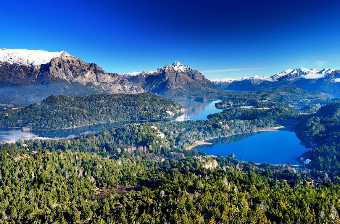
Lake Nahuel Huapi is characterised by the fact that it is immersed in a hydrographic basin that it shares with other lakes and rivers, causing the formation of important peninsulas such as Quetrihué, located in the northeastern region. There are also the Llao Llao, San Pedro and Huemul peninsulas.
In addition, the meandering course of its waters allows the presence of several branches, as we have already mentioned, creating a very interesting hydrographic structure in Lake Nahuel Huapi, depending on its tributaries, which determine its shapes. The presence of islands scattered throughout the lake also defines its currents.
The main tributaries of the Nahuel Huapi Lake are the Bonito, Machete, Pireco and Ñirihuau Rivers. We cannot forget to mention the streams that also form part of the lake’s hydrography, such as Ñireco, Bravo, Castillo, Frías and Chimuraco.
Those that provide more water flow come from the lakes surrounding Lake Nahuel Huapi, such as the tributaries of Lake Gutiérrez, Gallardo, Espejo, Moreno, Correntoso, Frey and Frías. The source of the River Limay is in Lake Nahuel Huapi, making it the only river that has an outlet to the Atlantic Ocean.
Another important aspect of the hydrography of Lake Nahuel Huapi is the amount of rainfall and its variability depending on the area of the lake, which is higher in the west, where it can reach up to 4,000 mm per year, while it decreases considerably towards San Carlos de Bariloche, reaching a maximum of 1,500 mm per year.
Nahuel Huapi National Park
The Nahuel Huapi National Park is located in the southwest of the province of Neuquén and the northwest of the province of Río Negro, bordering Lanín National Park to the north, Los Arrayanes National Park to the west and Chile to the west. In neighbouring Chile, in approximately the same geographical location, there are two national parks: the Vicente Pérez Rosales National Park and the Puyehue National Park.
As you can see, this is a very large national park with a lot of administrative complexity, as it is both a national park and a protected area. Since 2007, part of the park has also been constituted as an Andean-North Patagonian Biosphere Reserve. It has a total area of 759,840 hectares, of which 330,000 belong to the reserve and 428,000 to the park.
In order to understand a little more about the Park’s administration, we can point out that in 2011 it was declared a Complex I Protected Area, which means that it is assigned an Intendant and he is responsible for managing 6 departments for the operation of the Park, which include
- Administration
- Works and Maintenance Department.
- Conservation and Environmental Education Department.
- National Park Rangers Department.
- Human Resources and Training Department.
- Public Use Department.
- Two departments are also under his responsibility: The Entrance, Exit and Notification Office and the Legal Department.
The Nahuel Huapi National Park was born from a donation of land made by the Perito Francisco Moreno, which was given with this commitment, so in 1922, on the 8th of April, the Nahuel Huapi National Park was created.
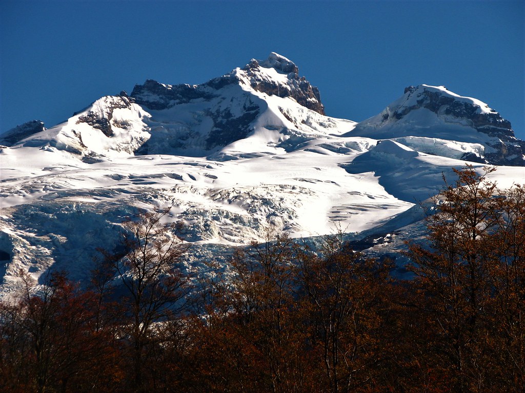
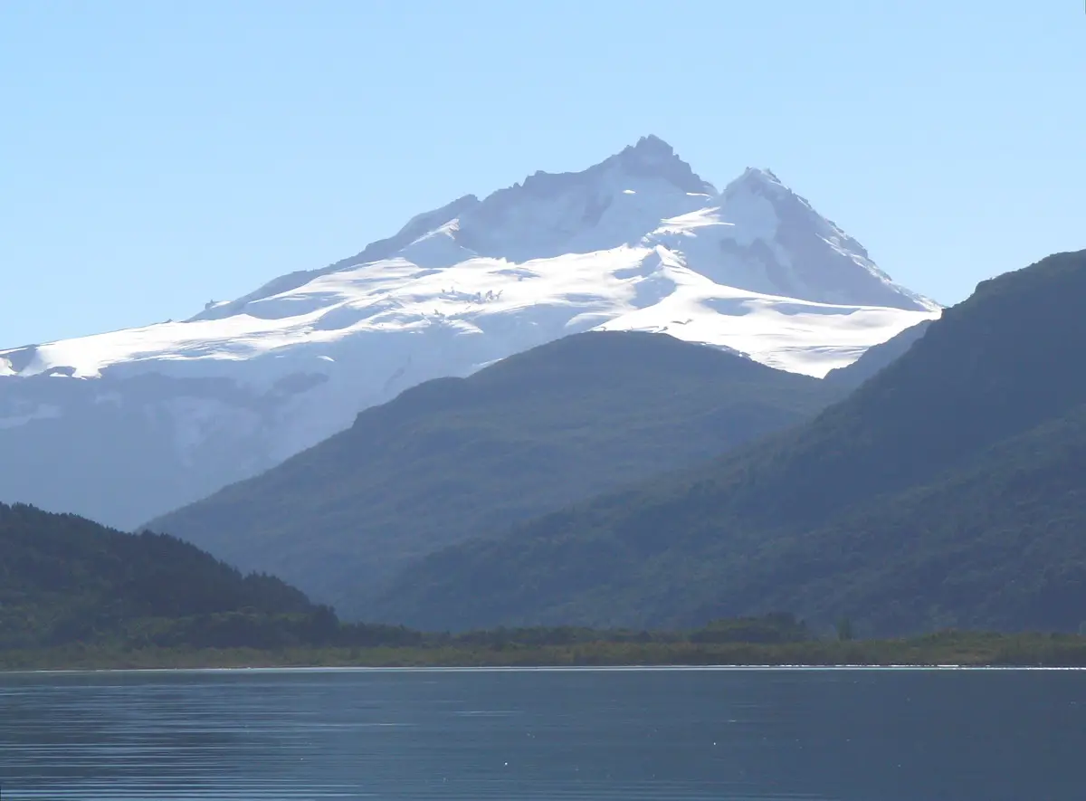
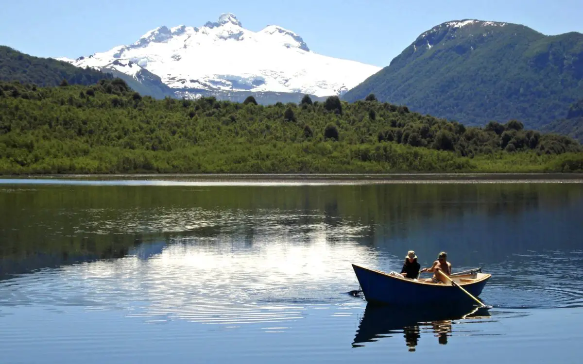
Its altitude ranges from 700 to 3,400 metres above sea level, making it a typical environment of the Patagonian Andes, with a rugged geography in which Mount Tronador stands out.
Sharing space with other lakes, valleys, rivers, streams and mountains, makes this National Park a beautiful place, with different ecosystems such as humid forest, Patagonian Andean forest, Patagonian steppe and high alpine forest, allowing the establishment of numerous plant and animal species.
Scientific studies and the arrival of explorers have made it possible to identify a number of plant and animal species, some of which are currently endangered or threatened. In this sense, the Nahuel Huapi National Park is home to a large number of mammals, fish, reptiles, birds and insects.
It is a space that allows conservation and ecological recreation, but it is visited by around 600,000 people a year and the human footprint is beginning to be felt, so it is necessary that people understand that they must respect these spaces that were created precisely to preserve these species.
The number of activities that can be practised in Nahuel Huapi National Park is endless, from hiking to climbing, water and winter sports, camping and much more.
In addition, in order to conserve this magnificent and unique ecosystem, protected areas have been created, dividing the park into sectors. The Central Zone, which is less protected, includes the province of Neuquén, the Limay River and its adjacent areas, Victoria Island, the northern shore of Lake Nahuel Huapi, except for the Blest and Tristeza branches. It also includes the ejidos and Villa Angostura and Villa Traful.
At this point it should be noted that there are two zones on Victoria Island that have been designated as protected areas, one is a Strict Nature Reserve located at the northern end of the island and the other is a Wild Nature Reserve located in the southern part of the island.
There is also a Nahuel Huapi National Reserve, called Zona Gutiérrez, which includes the province of Río Negro, the Llao-Llao peninsula, the municipality of San Carlos de Bariloche, Villa Mascardi and the Moreno and Gutiérrez Lakes, as well as the southern end of the Manso River. Between these two areas, a total of 160,686 hectares are protected.
Its history
The first settlers in the area where Nahuel Huapi National Park is located belonged to the Tehuelche ethnic group, one of the most famous being Cacique Inacayal, who was the leader of the indigenous group at the end of the 19th century.
There is archaeological evidence of the presence of settlers in the area as early as 13,000 years ago. It is thought that they were hunter-gatherers who came to the region from the north of the continent.
According to Jesuit Father Nicolás Mascardi, there were three distinct indigenous groups in the area of Lake Nahuel Huapi, the Puelches of Nahuel Huapi, who settled on what is now Victoria Island, although they also visited the steppe area. For this type of travel they used a dismantled wooden canoe called a dalca, and they had their own dialect.
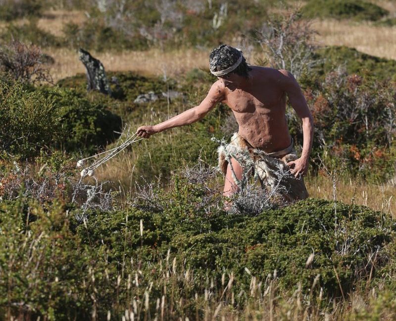
There were also the Poyas, later identified as the Tehuelches, hunters and gatherers who lived to the east and south of Lake Nahuel Huapi. There is evidence of some of their hunting tools, called boleadoras, which consisted of two or three stones covered with leather and tied together with rope.
They also used bows and arrows and dogs to track their prey. They were skilled in the use of skins, the most common for clothing and shelter being that of the guanaco, a large furred animal similar to the llama but wild and undomesticated. The Poyas or Tehuelches also had their own language.
The third ethnic group were the Puelches, who moved from the north bank of the Limay River to the area around the Lanín volcano to the north. This group spoke a dialect of Mapudungún, which was the common language of the various groups that settled from the Aconcagua Valley to the Chiloé Archipelago. Over the next two centuries, they were absorbed by the Mapuches and the first two groups, which is why they were called “Mapuchised”.
Then came the incursions of the Jesuit missionaries and other European explorers and colonisers, who put the Park’s original inhabitants under great pressure. Cacique Inacayal was forced to move his tribe to the Tecka in Chubut in 1880.
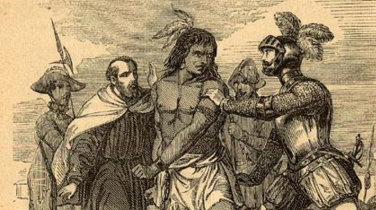
There are stories of conquistadors, pressure, slavery and death in these beautiful lands that now make up Nahuel Huapi National Park. It is said that between the 16th and 18th centuries, Spanish military incursions from Chile crossed the Andes and, when they encountered indigenous peoples, they attacked them and killed those who did not submit.
Nevertheless, these groups of European soldiers, who came from Peru and Chile with a mission of conquest, had a clear objective in the area of the Nahuel Huapi Lake, but they never imagined the strong resistance they would meet from the Araucanian natives, as they called them.
The fierce resistance of the indigenous people of the area forced the Spaniards to adopt armed strategies against the natives. With the excuse of a supposed lost city of gold and silver founded by the first Spaniards who came to Patagonia on expeditions, a legend that fed the greed of the invaders and worked against the original settlers.
The Spanish began to use sea, lake and continental routes to reach Lake Nahuel Huapi. This route had already been used by the Mapuche Indians, who knew this vast territory well. The Spaniards called it El Camino de las Lagunas (The Road of the Lagoons).
Then came the Jesuit missionaries, who built a mission called Nahuel Huapi. They managed to establish themselves and even evangelise some of the natives in the area, but there was always resistance and they had to abandon the mission.
These were difficult times for the inhabitants of the lake area, the Spanish colonisers had a double discourse, they spoke of rapprochement and they used extermination. This maintained a situation of permanent struggle to defend their territory.
In 1876, Dr Francisco Pascasio Moreno arrived in the area. He was the first man to come from the Atlantic Ocean, using the Limay River to reach Lake Nahuel Huapi. This route had been used by the indigenous people, but never before had a white man used it.
Dr. Francisco Pascasio Moreno was an expert on the Boundary Commission and devoted much time and effort to solving the border problems between Argentina and Chile. In recognition of his hard work, the Argentine government gave him 25 square leagues of fiscal land at a point of his choice within the National Territory of Neuquén or south of the Negro River. Dr Pascas chose the land where the Nahuel Huapi National Park is now located.
In 1903, Francisco Pascasio Moreno approached the Minister of Agriculture, Wenceslao Escalante, and expressed his wish to donate 3 square leagues, or 7500 hectares, with the sole condition that it be used as a National Park, with the intention of preserving the area and building only basic facilities for visitors.
A year after his proposal, the government of Julio Argentino Roca accepted it and issued a decree stating that Francisco Pascasio Moreno had renounced the amount of land he had reserved for the creation of a future national park. This became the first reserve in the whole of Argentina. Later, during the government of José Figueroa Alcorta, the area was expanded to 43,000 hectares.

On 8 April 1922, President Hipólito Yrigoyen decreed the creation of the Parque Nacional del Sur, based on the donation of Francisco Pascasio Moreno. On 9 October 1934, the Dirección de Parques Nacionales was created and the name of the Parque Nacional del Sur was changed to Parque Nacional Nahuel Huapi and also Parque Nacional Iguazú.
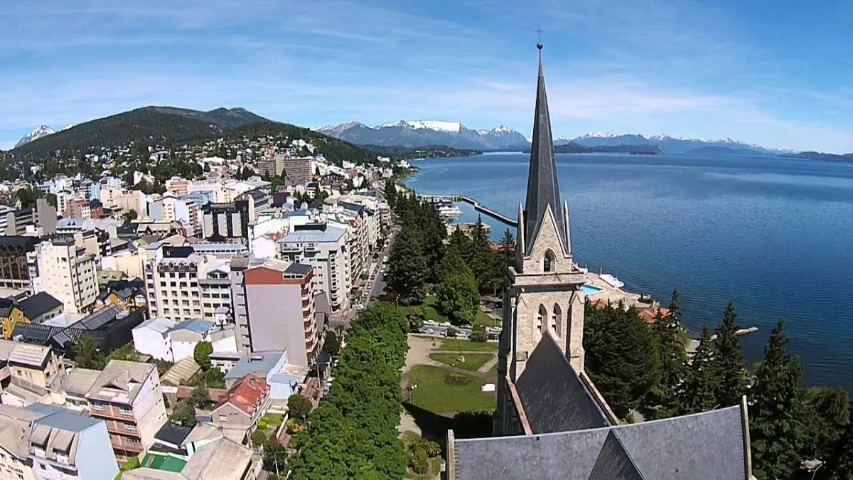
In order to guarantee the conservation of a larger area, full of fragile ecosystems and inhabited by plant and animal species of global importance, the law included the agricultural colony of Nahuel Huapi, the city of San Carlos de Bariloche, the Llao-Llao peninsula and the present-day Villa la Angostura.
Within the Nahuel Huapi National Park there is a forest area of real importance, known as the Arrayanes Forest, which was declared an autonomous entity by law in 1971, becoming the Arrayanes National Park. This law also divided the administration of the Nahuel Huapi National Park into 3 sectors: the Nahuel Huapi National Park, the Nahuel Huapi National Reserve, Central Zone, and the Nahuel Huapi National Reserve, Gutiérrez Zone.
Flora and fauna
As is well known, a large part of the National Park is located in the Andes, an area whose geology and geography are the result of millions of years of tectonic plate movements and the presence of glaciers. This has created a series of ecosystems that contribute to the biological richness of the area.
https://www.youtube.com/watch?v=2G7YBnQD6Lk
In this sense, the Nahuel Huapi Park has a series of perfectly identified ecosystems, which are determined by the altitude, temperatures and amount of rainfall that falls in each area each year, together with the different geomorphological formations present in the Park, which allow us to identify
- The Andean mountain zone.
- The humid forest.
- The Andean-Patagonian forest.
- The Patagonian steppe.
Andean mountains
The area known as the Andean mountain range is located between 1,600 and 1,700 metres above sea level and is the upper part of the mountain range. It includes large rock formations, sandy soils that are beginning to develop and small areas of grassland. Because of its location and altitude, this part of the Park is exposed to strong winds and snowfall. The climate is cold and dry, with large differences between day and night temperatures.
The vegetation that grows in this type of environment is very low, especially in areas where it can be protected from snowstorms. More than 250 plant species have been identified, including mosses, lichens, grasses and compositae. In the upper part of the mountains, especially in the foothills, the common Murtilla, whose scientific name is Ugni molinae, is known for its exquisite berry-shaped fruit.
Abrotanella diemii, described in 1969, Menonvillea hirsuta and Senecio carbonensis are considered endemic species, as they have only been found in the park areas of northwestern Patagonia Argentina.
There are also small forests of lengas, known locally as “stunted” lengas because their height does not exceed 3 metres, in the lower areas of the Andean mountains associated with the lagoons. This is due to the effect of the snow that falls in the area for most of the year, which limits their growth.
Humid or Valdivian forest
The humid or Valdivian forest zone is located in the extreme west of the Park, on the border with Chile. In this part of the National Park, the area of Puerto Blest and Lake Frias, near Mount Tronador, are accessible. This is where the greatest amount of rainfall is recorded, due to the arrival of humid winds from the Atlantic. This immense amount of rainfall allows the development of lush vegetation.
It is characterised by being a stratified forest, meaning that its structure is determined by the altitude and the way of life of the species that make it up. In this forest you can find the beautiful Guaitecas cypress, whose scientific name is Pilgerodendron uviferum.
Another important and dominant species in the forest is the fuinque, whose scientific name is Lomatia ferruginea, an arboreal fern and one of the region’s endemic species, which means that it does not exist anywhere else in the world.
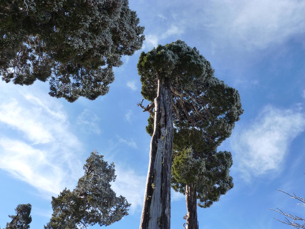
Also in the Valdivian Forest is the Podocarpus nubigenus, commonly known in the area as Mañiú Macho or Hembra and as Huililahuán. It is a large tree that can reach a height of 25 metres or more. This beautiful and impressive tree is endemic to the region.
We must not forget to mention the giant larches, which are the true witnesses of this corner of nature, as they are one of the longest-lived plant species on the planet and can live to be over 4,000 years old. These beautiful trees can be seen on the road between Puerto Blest and Lake Frias.
There is also an abundance of cañas colihue, scientific name Chusquea culeou, a shrubby grass belonging to the bamboo family. These species, together with lianas, form an important part of the lower layer of the Valdivian forest.
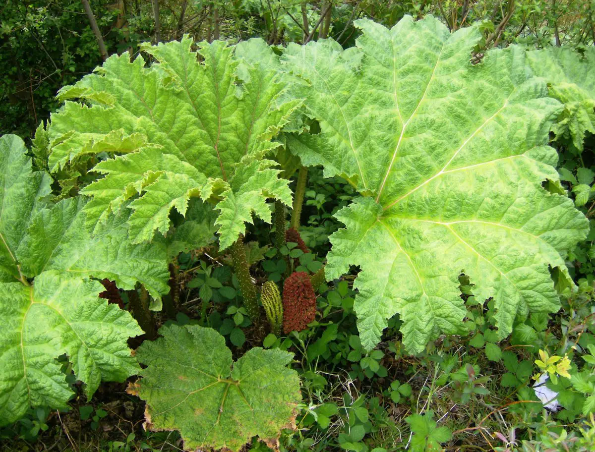
The dynamics of the forest allow for the opening of clearings, scientifically known as gaps, which allow for the establishment of other species that need more sunlight for their development, such as Gunnera tinctoria, commonly known as Nalcas. This species is characterised by its large green leaves, which can reach a diameter of 150 cm.
Andean-Patagonian Forest
This forest comes from the east and extends to the area of the Patagonian steppe. It is characterised by low rainfall, which varies between 600 and 1,200 mm per year, often occurring between April and August.
With these climatic conditions, the species that establish themselves are different from those of the Valdivian forest, in it we find the Austrocedrus chilensis, known by the common name of cypresses of the mountain range, it is a beautiful pine tree characteristic of Patagonia. It shares the space with a large tree scientifically identified as Fitzroya cupressoides, known as the Lahuán. Other species that make up this Andean forest are the Roble, the Canelo and the Raulí.
As the altitude varies, the species are replaced by others, for example, above 1000 metres above sea level we find lenga forests, as in the Andean highlands, but the species that grow here are larger. In autumn, they offer one of the most striking spectacles in the Park due to the ochre or reddish colour of their leaves.
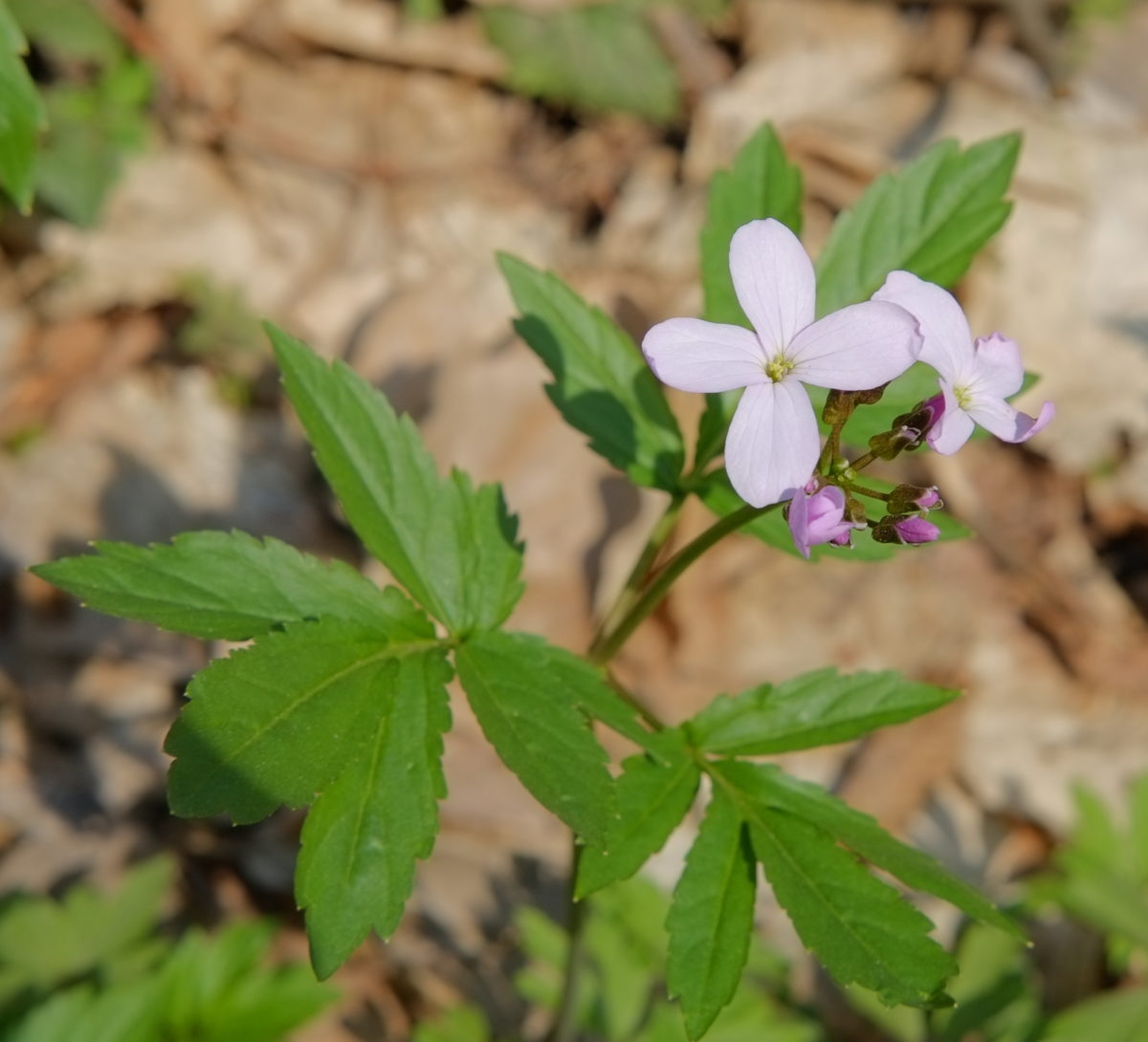
The forests that grow in this part of the Park are also stratified, and in the undergrowth we can find species with showy flowers, such as the queen mora, with its lilac flowers, the mutisia, with its orange flowers, and the notro, with its red flowers, which offer locals and visitors a beautiful spectacle at different times of the year.
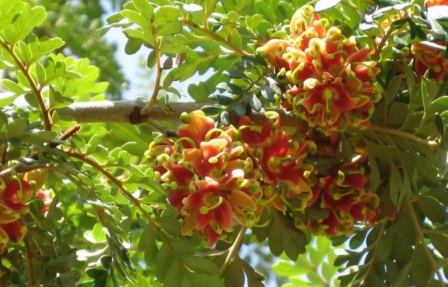
In this type of forest we can also find the black hawthorn, whose scientific name is Rhamnus lycioides, with its bright yellow flowers, which also have medicinal properties and are used to treat aphonia or sore throats.
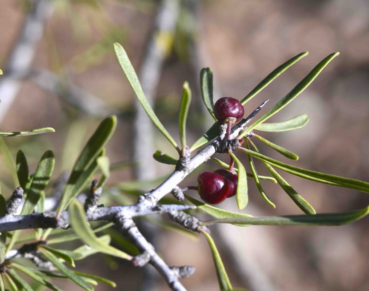
Other shrubby species, such as the michay, whose scientific name is Berberis congestiflora, and the Berberis microphylla, known by the common name of calafate, are endemic to the Huanel Huapi National Park, and their purple fruits are edible.
In the area where the forest approaches the western foothills of the mountain range, there is a transition between cypresses and oaks or coihues, large and very beautiful trees with the scientific name Mapudungun koywe. Finally, along the banks of the streams and in the forest you will find a wide variety of plants, such as the famous waterfall flower and the topa topa.
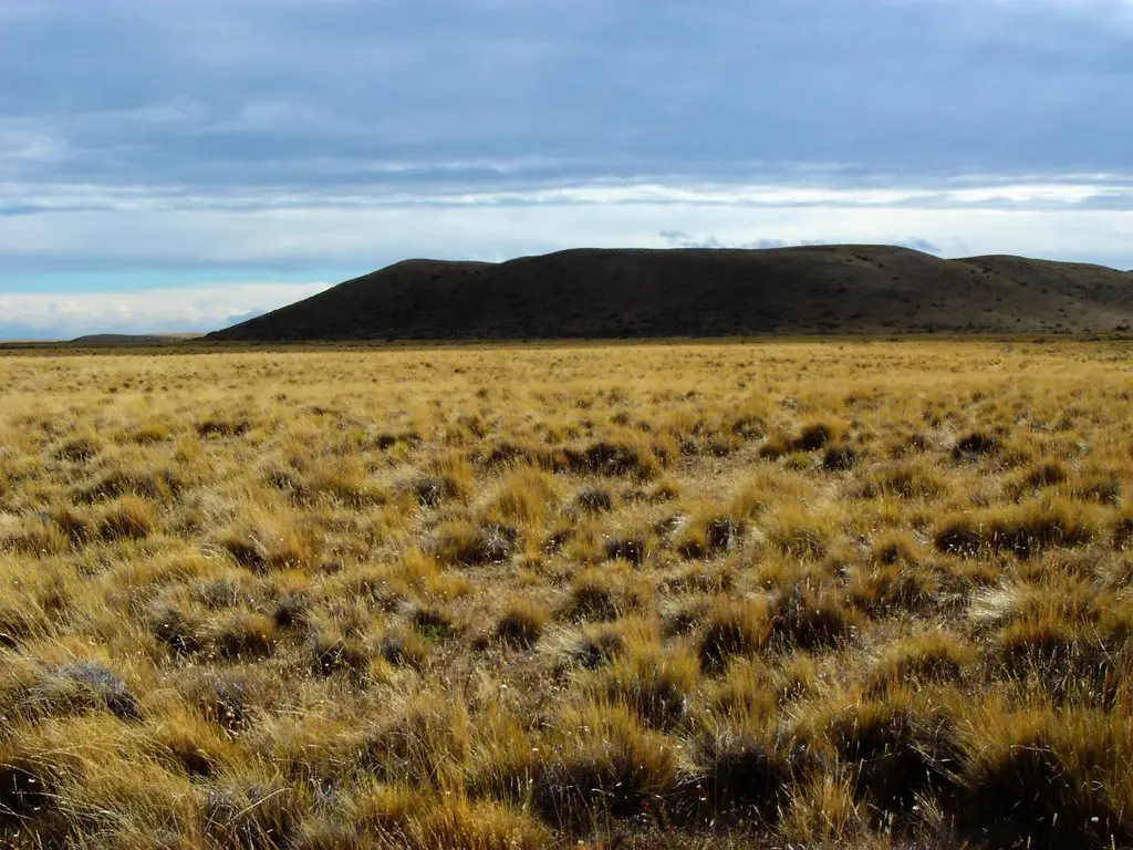
Patagonian steppe
This habitat is located between 700 and 900 metres above sea level, to the east of Nahuel Huapi National Park. It is characterised by plateaus and mountain ranges, which are geomorphological forms resulting from tectonic processes. Rainfall does not exceed 700 mm per year, but the area is almost constantly exposed to strong winds from the mountain range, and the soils are poor and sometimes stony.
The vegetation associated with this environment is small stands of Patagonian cypress, but in areas where the terrain is deeper and has an important organic layer, michay, calafate and maitén can grow.
In the open areas you can find hard grasses and thorny bushes such as Mulinum spinosum, known as neneo, one of the endemic grasses of the park, which shares the space with the chuquiraga, a plant belonging to the Asteraceae family. The adesmia of the Fabaceae family and the ephedra of the Ephedraceae family give us an idea of the floristic diversity of this habitat, with species adapted to living in extreme conditions of low temperatures and constant winds.
The fauna
With regard to the fauna of this National Park, we will refer to the autochthonous species of the area, where we must necessarily begin by referring to the imposing Andean Condor, this is a bird of great span, whose extended wings can measure more than three metres. It is exuberant and beautiful, and usually lives in the high areas, in rocky areas above 2000 m.a.s.l.
The scientific name of the Andean Condor is Vultur gryphus, its plumage is black and it has white feathers that cover its neck. A curious fact is that its head has no plumage, it is usually red but can change colour depending on the bird’s mood.
Similarly, the Leopardus guigna, commonly known as the huiña, is an endemic species of the Nahuel Huapi National Park, which prefers the forests of the Patagonian Andes. Another endemic species is the horned weasel, with the scientific name Rhyncholestes raphanurus, a marsupial that lives in the Valdivian forest.
Among the mammals, the huemul is worth mentioning, a beautiful and robust deer with a beautiful brown coat. This animal moves around the Park depending on the season, preferring the highlands in summer and the valleys in winter. Another endemic deer is the Pudú, known for its small size, not exceeding 40 cm in height, which has led to it being recognised as the smallest deer in the world.
Another endemic of the lake area is the monkey of the mountain, a rare marsupial mammal that lives in the Nahuel Huapi National Park. It belongs to an infraclass of metatherian mammals, animals that are born as foetuses and finish their development in the marsupium or pouch. This bush monkey has a short development in the maternal uterus and completes its growth attached to the mammary glands found inside the marsupial pouch.
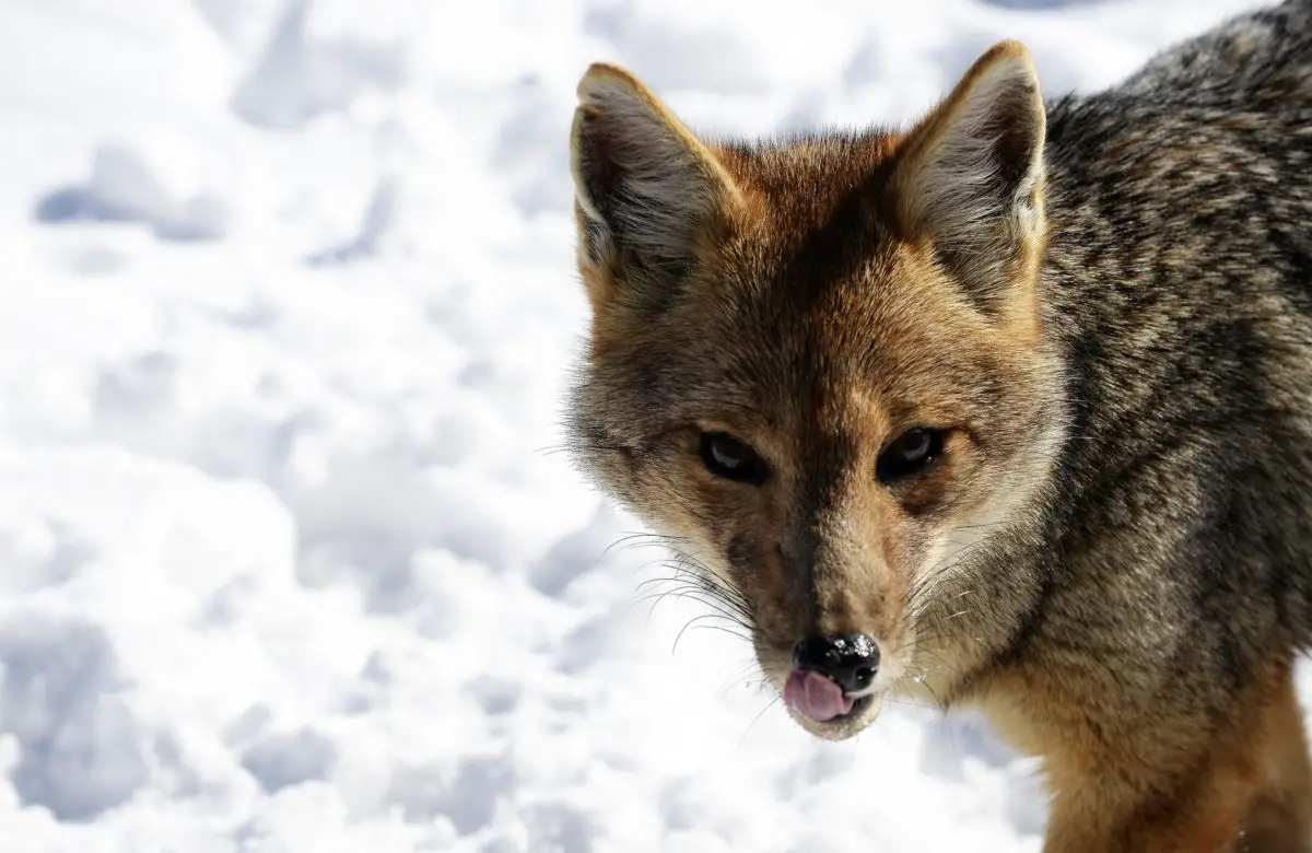
The red fox is a predator at a high level of the food chain, it likes to live in deciduous forests that lose their leaves once a year, it also likes to inhabit the steppe zone. However, it is an endangered species because the presence of humans has caused it to move to other less populated areas.
Another highly endangered animal, currently classified as an endangered species, is the huillín, a type of endemic brown-furred otter that eats crustaceans, crabs and shrimp and lives in remote lake areas surrounded by dense vegetation.
Herds of guanacos, beautiful indigenous mammals with thick coats, are common in the steppes. They share space with their main predator, the puma, which also lives in the steppe, although it sometimes moves into the forest. Another feline is the Leopardus guigna, the huiña cat, a small cat of 45 cm in length, with an irregular black spotted coat, which lives in the humid forests.
There is a great variety of birds, the cauquenes, the tero and the bandurrias can be seen in open areas, while in the undergrowth we can see woodpeckers, hummingbirds, thrushes and the chucao.
Fish-eating birds, such as the kingfisher, inhabit the areas close to the waters of Lake Nahuel Huapi, where you can find fish such as trout, Patagonian silverside and puyén, which are the Park’s native fish fauna.
The climate
The climate is determined by the influence exerted by the presence of the Andes in this region, as it somehow controls the manifestation and speed of the winds, which also influences the amount of rainfall. In this sense, there is a rainfall pattern that decreases in millimetres as you move from the west to the east of the park.
There are areas with rainfall of up to 4,000 mm per year, and towards the east a maximum of 600 mm per year. This rainfall is concentrated in the autumn and winter seasons, with frequent snowfalls.
Temperatures are determined by altitude, with temperatures remaining below freezing in areas of perpetual snow above 2200m, while below 900m the average temperature is 8°C. The warmest month is January with an average temperature of 15°C and the coldest month is July with an average temperature of 2°C.
There are also strong winds that blow constantly from the west and there are areas that remain snow-covered from late autumn (May) to late spring (October-November).
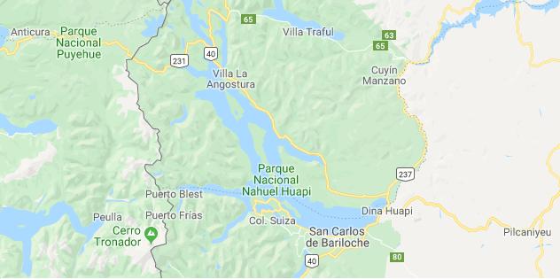
Location and map of the lake
Lake Nahuel Huapi is located in the American continent, specifically in South America, in the Argentine Patagonia. Below is a map showing the surface and shape of the lake, the location of Cerro Tronador, the national parks and the towns nearby.
Pollution problems in Lake Nahuel Huapi
The presence of human settlements in the areas surrounding Lake Nahuel Huapi has become one of the threats to its natural equilibrium, due to the permanent and sporadic increase in population linked to tourism, which has led to overuse of the areas.
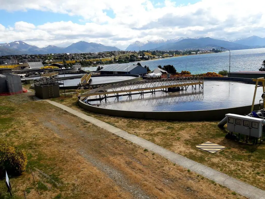
However, one of the main problems with regard to the pollution of the lake is, of course, the sewage that reaches it as a result of run-off. Although the city of Bariloche has a sewage treatment plant, the increase in population in recent years has exceeded its capacity. In addition, there are many houses that are not connected to the city’s sewage system.
In addition to this, Villa Angostura has asked the City of Bariloche for help in treating its sewage, which is already more than its own population can handle, but has been refused.
New settlements are also being built around the lake, putting pressure on this beautiful ecosystem. The facilities built to promote tourism in the area are also contributing to the pollution. The construction of hotels such as the Llao Llao and various villas only exacerbates the problem.
There is also a series of anthropic impacts that have taken place over the years in the Nahuel Huapi Lake and its surroundings, such as the introduction of alien species that have affected the populations of endemic species, leading to their reduction or displacement.
The displacement of ornamental species that were introduced in the gardens of the city have migrated to the ecosystems associated with Lake Nahuel Huapi and have also affected the native vegetation, as in the case of the rose hip, a non-native species that is spreading around the lake.
In addition, cattle and sheep are raised in certain areas, and wood is harvested for fuel and construction. Solid waste disposal is another problem that worsens during the high season.
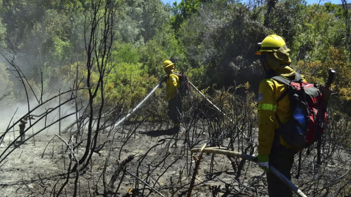
Forest fires are another polluting factor and have a major impact. In fact, one of the arms of Lake Nahuel Huapi, known as the “Brazo de la Tristeza”, was named after a fire that ravaged the forest for a long time, in memory of the sad and desolate scene of burnt tree trunks.
It is a fragile and unique ecosystem in the world, therefore its inhabitants and visitors must participate in its conservation. From this space we make a call to deepen in environmental education, with special importance in its endemic species and all the species of flora and fauna that live in this important environment of the Nahuel Huapi Lake.
If this article has been of interest to you, we invite you to continue learning more about this type of ecosystem and, why not, about rivers? We leave you with the following links with very interesting information:
-
- Lake Baikal
- Lake Titicaca
- Magdalena River