
2The Elbe is a river that flows through central Europe. It stretches from the Czech Republic through Germany to the North Sea, generally flowing north-west. It is necessary to know where the river Elbe originates, continued in this article.
History of Hamburg
The city of Hamburg dates back to the early 9th century. Together with Lübeck, Hamburg founded the Hanseatic League in 1241 (see article: Rio Soto).
Today it is the second largest city in Germany after Berlin. Another ancient city on the Elbe is Magdeburg, which was a trading post on the border between the Germans and the Slavs in the early 9th century.
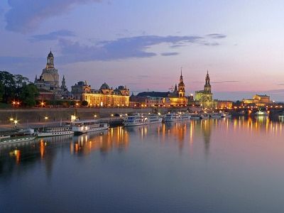
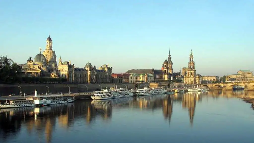
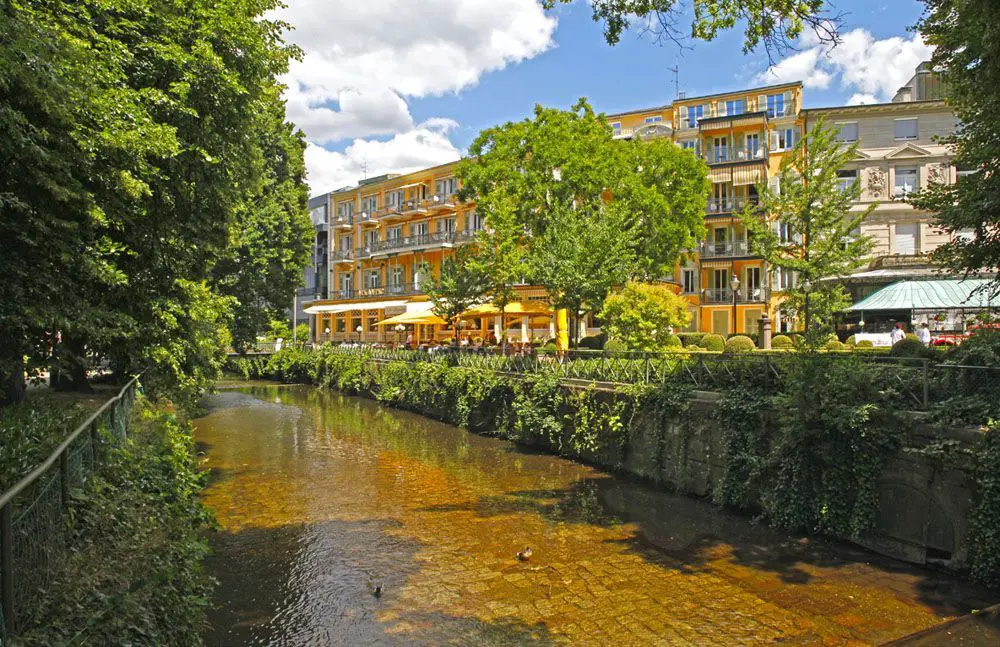
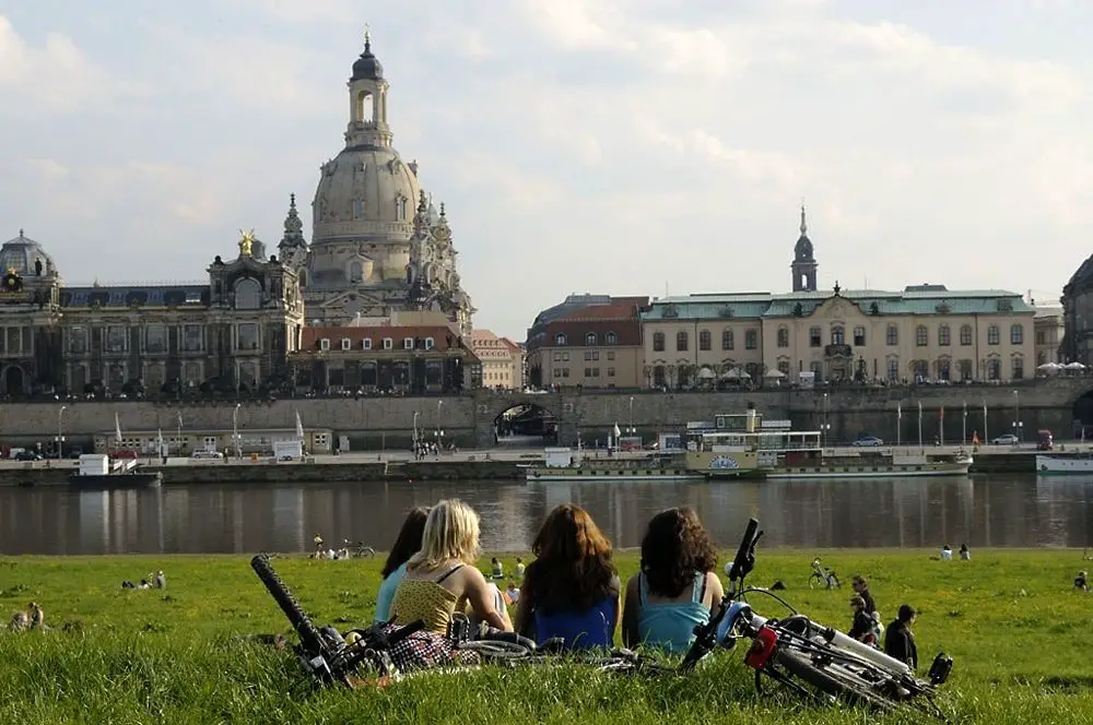
In the 13th century it was a flourishing trading town and an important member of the Hanseatic League. Today it is the largest inland port in eastern Germany. The other major city on the Elbe is Dresden, founded around 1200.
During the 18th century, Dresden became a great centre of the fine arts, known as the ‘Florence of the Elbe’. Its beautiful architecture, almost completely destroyed during the Second World War, has been partially rebuilt.
Other towns of historical interest along the Elbe include Wittenberg, the birthplace of the Elbe and the Protestant Reformation, and Meissen, famous for its porcelain.
The Elbe basin has been inhabited since prehistoric times. Until the Middle Ages, the river was the western boundary of the area inhabited by the North Slavs.
In the 12th century, the Germans began to colonise the lands east of the Elbe and along the Baltic Sea (see article: Río Aluminé).
[During the Second World War, a point on the Elbe at Torgau was the meeting point of the Soviet and American armies. From the end of the war until 1990, the river was part of the border between East and West Germany.Characteristics of the Elbe
Its total drainage area is 55,620 square miles (144,060 square km). Its main tributaries are the Vltava, Ohře, Mulde and Saale, all joining from the left, and the Iser, Schwarze Elster, Havel and Alster from the right.
Since we already know where the Elbe is, it is also necessary to know that it is formed by the confluence of numerous headwater streams in the Krkonose Mountains a few miles from the Polish-Czech border.
It flows south and west, forming a wide arc of about 225 miles in the Czech Republic to its confluence with the Vltava at Melník, where it is joined 18 miles downstream by the Ohre.
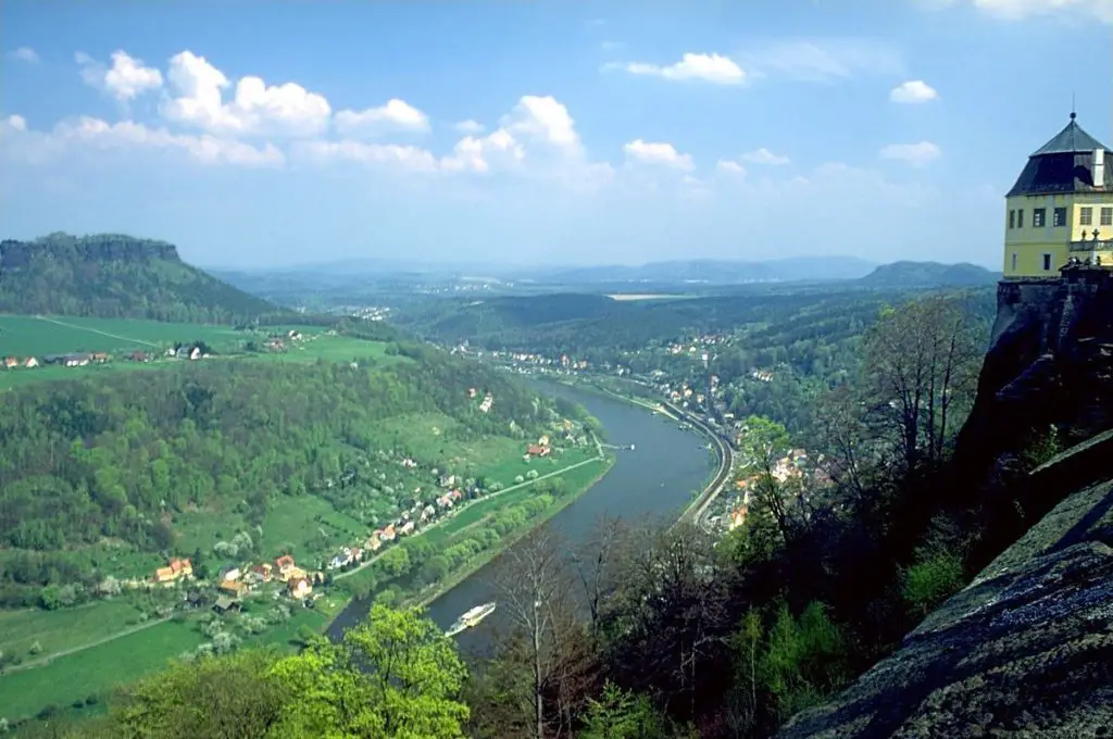
It then cuts northwest through the picturesque Elbe Sandstone Mountains and enters Germany in a four-mile-long gorge.
Between Dresden and Magdeburg, the Elbe receives many long tributaries, all of which, except for the Schwarze Elster, are left-bank streams.
These are the Mulde and Saale and their tributaries, including the Weisse Elster, the Unstrut and the Ilm. These left-bank tributaries rise in the Mittelgebirge or Thuringian Forest and form the middle Elbe drainage basin, with its geographical centres at Halle and Leipzig.
Halle lies on the Saale, just below the confluence of the Weisse Elster; Leipzig lies at the confluence of the Pleisse and the Weisse Elster (see article: River Chimehuin).
Below Magdeburg, the Elbe receives most of its water from its right bank. Most of these tributaries rise in the Mecklenburg Uplands.
Location and map of the Elbe
The River Elbe rises on the southern side of the Giant Mountains near the border with the Czech Republic and Poland.
As far as the location of the river Elbe is concerned, it belongs to Germany. Below we show a map of the river Elbe to know its exact location.
Route of the Elbe
The River Elbe in Germany flows through Bohemia (northwest of the Czech Republic) and enters eastern Germany about 25 miles (40 km) southeast of Dresden.
It flows through Germany for the rest of its course. Above Hamburg, the Elbe splits into two branches; these join further downstream and the river widens as it approaches its estuary, which is at Cuxhaven, where the Elbe flows into the North Sea.
The total length of the Elbe is 724 miles (1,165 km), of which about one-third flows through the Czech Republic and two-thirds through Germany.
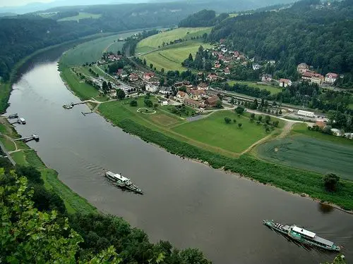
The river enters the North German Plain at Riesa, 25 miles below Dresden; below Riesa it meanders in a wide floodplain and has some abandoned loops. The dikes begin there and continue to the confluence with the Mulde. Between Wittenberg and Dessau, the east-west valley narrows to five miles wide, and hilly land rises to the north (Flaming Heath) and south.
From Dessau to Magdeburg, the floodplain widens and dikes have been continuously built all the way to the sea. Below Magdeburg, the floodplain is two miles wide until it joins the Havel.
The German Elbe keeps to the left of its floodplain, sometimes cutting into the low hills on its banks. Below the confluence with the Havel, the river flows south-east-north-west; the floodplain widens and has distributaries and backwaters, often flanked by low sandy hills.
The reclaimed marshes begin at Lauenburg. Above Hamburg, which the Elbe crosses in two branches, the North Elbe and the South Elbe, the floodplain is eight miles wide, but narrows to four miles between the sandy Schleswig-Holstein Geest and the Lüneburg Heath (see article: River Adour).
The Lower Elbe stretches from Hamburg to Cuxhaven, a distance of about 55 miles. It varies in width from one to two miles, but much of it is occupied by mudflats and sandbanks. The main channel is activated and dredged. At high tide the channel is about 53 feet (16 metres) deep.
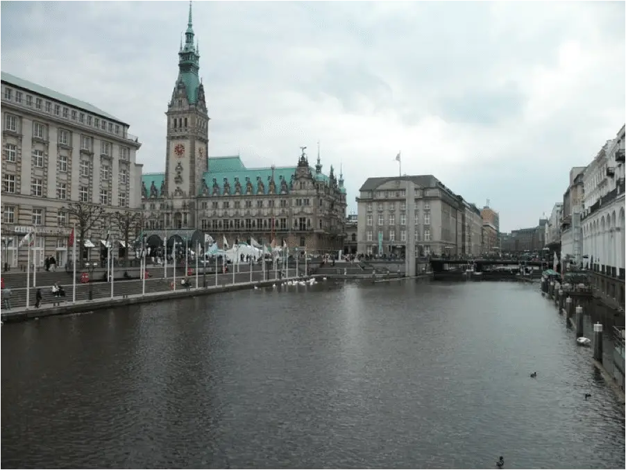
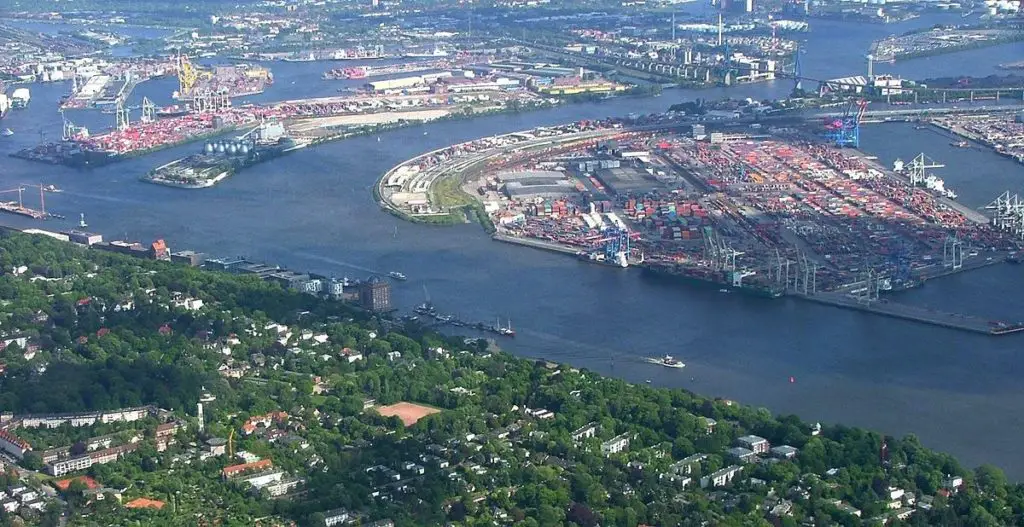
The south or left bank is low and marshy and the river has sandbanks; the right bank is steep below Hamburg, but downstream there are marshes, dikes and drains, which are intensively farmed. The great port city of Hamburg grew up along the Alster on the low sandy hills above the marshes. Modern port facilities have been extended to the south bank of the Elbe.
Hydrology of the Elbe
The flow of the River Elbe in Hamburg varies considerably with the amount of rainfall and snowmelt in its catchment area. At Dresden, the discharge averaged 11,200 cubic feet (317 cubic metres) per second in the period 1931-75, but varied from a minimum of 800 cubic feet to a maximum of 118,700.
At Neu-Darchau, about 140 miles above the estuary, the discharge was 24,700 cubic feet per second in the period 1926-65, with extremes of 5,100 and 127,700. These large fluctuations sometimes make navigation difficult.
Although there are dams on the Upper Elbe in the Czech Republic and at Geesthacht, Germany. Large dams have been built on the Vltava and the Saale in the Thuringian Forest, but these are not sufficient to control the water level of the Elbe in Hamburg.
The lower reaches of the River Elbe are tidal up to the dam at Geesthacht above Hamburg, where the flow of the river periodically reverses direction.
The average tide in Hamburg is about eight feet. However, during storms the water can rise much higher, occasionally flooding parts of the city.
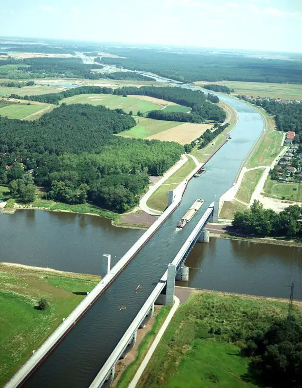
Elbe Canal
The Elbe-Weser waterway consists of the Hadelner canal, the floodplain, the Bederkesa-Geeste canal and the Geeste. It connects the two rivers through the marshes of the Lower Elbe between Otterndorf and Bremerhaven (see article: Congo River).
The waterway is owned by the Land of Lower Saxony and maintained by the Stade branch of the NLWKN.
In addition to the 54.7 kilometres of canal itself, there are 60 kilometres of canal embankments, 45 kilometres of canal roads, eleven canal bridges and two locks. Ensuring the proper functioning of the lock with smooth shipping traffic and sufficient water depth.
Ensuring sufficient inflow for shipping, reed beds and moorings, while providing flood protection through safe canal embankments.
Improvement of nature conservation and appropriate landscape management for all maintenance measures and new constructions.
The Hadelner Canal lock is currently being rebuilt to meet modern coastal protection requirements. Construction has not yet started, so shipping will not be affected in 2017.
This is for coastal protection reasons, essentially outside the storm surge season.
From mid-April to mid-September. During this period, the lock can only be closed for a limited period of time (approximately three to four weeks in total) (see article: River Ter).
Shortly after crossing the Czech-German border and passing through the sandstone gorges of the Elbe Mountains, the river takes a northwesterly course that continues all the way to the North Sea. The river rolls through Dresden and finally, past Meißen, begins its long journey across the North German Plain along the former East German border.
In its northern section, both banks of the Elbe are characterised by flat, very fertile marshes (Elbe marshes), which were once dikes of the former floodplains of the Elbe. From the Geesthacht sluice (at km 586) downstream, the Elbe is subject to the tides, the tidal section of the Elbe is called the Lower Elbe.
The Elbe soon reaches Hamburg. Within the city state, the Lower Elbe has a number of tributaries, such as the Elbe Pigeon, Elbe Gose, Kohlbrand, North Elbe (Norderelbe), Reiherstieg, South Elbe (Suderelbe).
Some of these were separated from the main river by dikes. In 1390, the Gose Elbe (literally: shallow Elbe) was separated from the main river by a dike connecting the two islands of Kirchwerder and Neuengamme.
The Dove Elbe (literally: deaf Elbe) was drained at Gammer Ort in 1437/38. These hydraulic works were carried out to protect the marshes from flooding and to improve the water supply to the port of Hamburg.
After the heavy flooding of the North Sea in 1962, the western part of the South Elbe split off and became the Old South Elbe. While the eastern waters of the South Elbe now flow into the Kohlbrand, which is bridged by the Kohlbrandbrücke, the last bridge over the Elbe before the North Sea.
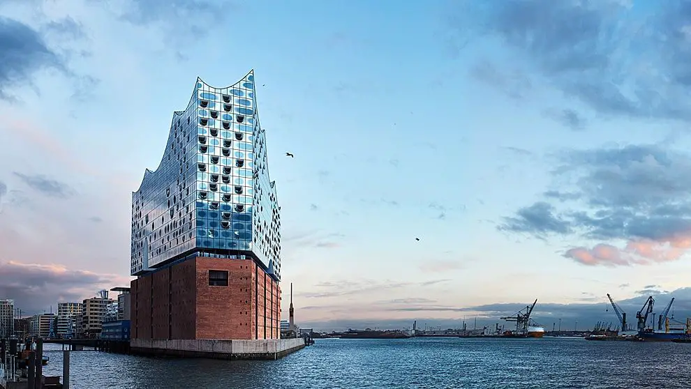
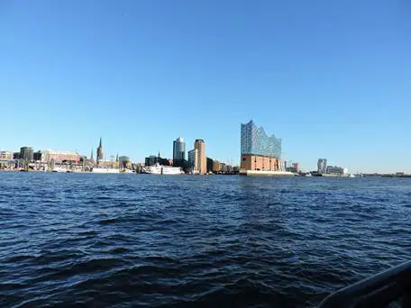
The North Elbe passes by the Elbphilharmonie and then crosses the old Elbtunnel, both in the centre of Hamburg. A little further downstream from the two main avenues of the Lower Elbe, the North Elbe and the Kohlbrand meet south of Altona-Altstadt, a district of Hamburg (see article: River Tormes).
Shortly after the confluence of the two canals, the Lower Elbe passes under the New Elbe Tunnel (Neuer Elbtunnel), the last structural link across the river before the North Sea. At Muhlenberger Loch in Hamburg, at kilometre 634, the North Elbe and the South Elbe (now the southern meander of the Old Elbe) used to meet, so the bay is considered to be the starting point of the Lower Elbe.
Leaving the city state, the Lower Elbe flows between Holstein and the Elbe-Weser triangle at Stade before entering the North Sea at Cuxhaven. Near its mouth it passes the entrance to the Kiel Canal at Brunsbuttel before flowing into the North Sea.
River Elbe Hamburg
Without the River Elbe, Hamburg would not be the economic powerhouse it is today. About 100km from the North Sea, the Elbe has been the city’s gateway to the world since at least the time of the Hanseatic League.
It’s safe to say that Hamburg owes its multicultural atmosphere and cosmopolitan character to this mighty river.
The Landungsbrucken docks are a great starting point for exploring the Elbe. For the price of a regular public transport ticket, ferries take visitors to the industrial harbour, the Elbe beaches or the musical theatres on the south bank.
Today it is best seen on foot or by bicycle. At weekends the tunnel is closed to traffic, so it is a quieter time to pass through. However, you can still explore the rest of Wilhelmsburg.
Cyclists can also enjoy the 23-kilometre Elbe hiking trail, which runs from Wedel through the Wittenberger Heide nature reserve to Blankenese.
You pass the beautiful Ovelgonne and finally reach the Landungsbrucken quays. There are many shortcuts and return ferries depart from many points along the way.
In summer, the Elbe beaches around Blankenese are a popular place to spend sunny days sunbathing, barbecuing or just enjoying the view of the container port on the other side.
A small path leads along the beach to several cafes and restaurants. The ‘Strandperle’, a short walk from the Ovelgonne ferry, is considered the mother of all urban beach clubs.
Today, clubs such as Hamburg City Beach Club, Lago Bay, Hamburg del Mar and StrandPauli offer a relaxed summer atmosphere with views of the River Elbe. Also worth mentioning is the ‘Old Swede’ – a 217-tonne boulder pulled from the River Elbe. This colossal rock was found during dredging work on the river in 1999.
The economic importance of the Elbe
The River Elbe and its connecting waterways allow ships to travel from Hamburg to Berlin, the central and southern parts of eastern Germany and the Czech Republic.
The Mittellandkanal, just below Magdeburg, extends westwards for some 200 miles to the Dortmund-Ems Canal. It carries barges of up to 1,000 tonnes to the German industrial cities of Osnabrück, Hanover, Salzgitter, Hildesheim, Peine and Wolfsburg, linking with the rivers Weser and Rhine.
The Elbe-Havel Canal transports from Magdeburg eastwards to the Berlin waterway network and beyond to Poland. The Kiel Canal runs from the mouth of the Elbe to the Baltic Sea, and the Elbe-Lübeck Canal from Lauenburg also runs to the Baltic Sea, following an older canal (from the 14th century).
Another canal connects the lower Elbe with Bremerhaven on the Weser. The Elbe itself is navigable for 1,000-tonne barges to Prague via the Vltava. In eastern Germany it serves the river ports of Magdeburg, Schonebeck, Aken, Dessau, Torgau, Riesa and Dresden, carrying bituminous coal, lignite, coke, metal, potash, grain and general cargo.
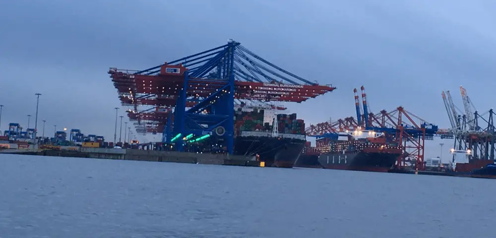
Although Hamburg lies upstream from the mouth of the Elbe, it is one of Europe’s largest seaports; a six-lane railway tunnel and a multi-lane road tunnel under the Elbe are important links in trans-European traffic flows.
Flora and fauna of the Elbe
Few rivers in central Europe flow as freely as the Elbe and change their appearance so much over the years.
In winter, the water rises and the floodplain becomes an impressive landscape of lakes: the forests are under water. Ice floes float downstream and creak against the banks.
The sky echoes with the cries of thousands of wild geese, swans and ducks. It’s migration time: the winter guests head north, bidding farewell with impressive formations in the sky until they return in autumn.
With the return of spring, the water recedes. Meadows and grasslands become visible and colours return with the spring: cuckoo flower, common meadow and peas grow in the floodplain meadows.
Gradually the floodplain comes to life: frogs and toads gather in the many small ponds and lakes, creating an impressive chorus.
The storks return home and move into their nests on the roofs of the barns. Ticks, oystercatchers and ringtails can be seen searching for suitable nesting sites.
Summer on the Elbe: the water level continues to fall, revealing the banks. What is revealed is a delight for man and beast: a sandy beach, fine-grained and white.
Sand that invites you to walk barefoot and look for footprints: the footprints of the family of grey geese that have spent the night here. If you are lucky, you might find the distinctive tracks of an Elbe beaver on its way to the water.
The air above the river hums with the heat. Cows and sheep gather in the shade of the mighty oaks. A family of storks circles above the marshes, rehearsing their long journey south.
In autumn, fog moves across the Elbe floodplains. Everything seems still. The storks have long since finished their breeding season and are heading for the warm south. But the silence does not last long. Suddenly they are here: the first winter guests returning from their northern breeding grounds.
They make a stopover on their long journey south, and some will spend the winter months on the Elbe. Then the nights are filled with the loud trumpeting of cranes and the sonorous calls of whooper swans. The Elbe floodplains are not only a unique and beautiful landscape. They are also a landscape of unique value because they are home to hundreds of kilometres of typical habitats, animals and plants.
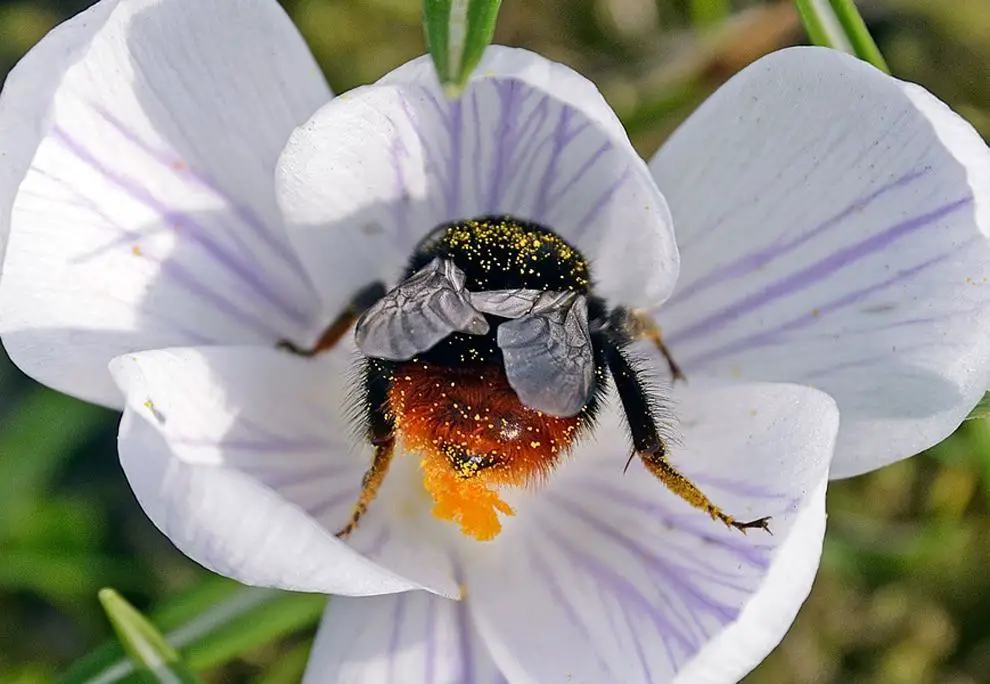
The Elbe floodplain was originally a forest that extended into the floodplains. Floodplain forests are the most species-rich habitats in Central Europe: a wide variety of insects provide the staple food for more than 40 species of songbirds.
They are a nursery for fish, the Elbe beaver uses the softwoods for food, and black storks and cranes breed in the wet forests. Most of the wet forests have been sacrificed to civilisation in recent centuries. Only a few remnants of Central Europe’s wet forests have survived in the Middle Elbe region.
Fortunately, the low point of the Elbe’s fish population was several years ago: until 1990, large amounts of industrial waste water had turned the river into a stinking sewer. Since then, water treatment plants have improved the water quality to an extent that many thought impossible.
Today, the middle Elbe is home to around forty species of fish, the main food source for species such as otters, eagles and ospreys. The Elbe is home to twelve different species of amphibians and provides a variety of ideal spawning grounds.
The richly laid table of the wet meadows feeds on egrets, herons and, of course, the great white stork. Around 500 pairs of white storks breed on the Elbe floodplain, making the Elbe floodplain the most important distribution axis in Germany for the master stork.
During the cold season, the extensive Elbe floodplains are an important resting place for wading birds and waterfowl. They come from the far north of Scandinavia and Russia and continue their journey south. Huge flocks of geese, ducks, mergansers, whoopers and Bewick’s swans can be seen here.
Undisturbed wetlands provide food and shelter for the birds to recover and build up important fat reserves for the journey ahead. The Elbe floodplain is also an ideal location for cranes, between their autumn gathering places on the Baltic coast and their winter quarters on the Iberian Peninsula.