
Last Updated on August 8, 2023 by Hernan Gimenez
The Ebro River, rich in legends and landscapes, drowns our imagination in a well of beautiful landscapes, valleys, mountains and beautiful cities that have the privilege of seeing it flow along its 930 km length, making it the longest river in Spain and second, after the Duero, in the Iberian Peninsula.

Location
The Ebro River is considered to be the longest and most abundant river in Spain, and its course is exclusively within Spanish territory, which is one of its most important characteristics, as it occupies the first place in the world in this area.
As for the location of the Ebro River, many people wonder where it originates, for this reason the answer is that it originates in Cantabria and the Ebro River in turn flows to Tarragona, on the Mediterranean Sea, both in Spain. Let’s see more…
Map of the Ebro River
The map shows the exact location of the Ebro River, where it originates, and all the cities through which it flows.
Where is the source of the Ebro? Its course
The route of the Ebro River begins at the Tres Mares Peak, 2,175 metres above sea level, in the Sierra de Hijar mountain range, where three different basins meet, and through whose slopes the water flows to the three seas that border the peninsula: the Nansa to the Cantabrian Sea, the Pisuerga to the Atlantic and the Ebro to the Mediterranean.
It flows through the region of Campoo Los Valles or Valle de Campoo until it reaches the Ebro Canyon in the province of Burgos. It is bordered by the Pyrenees, the Iberian mountain range and the Picos de Europa.
From Burgos, the river heads towards La Rioja, an autonomous community in Spain, and from there, where it forms Las Conchas de Haro or Conchas de Ebro, a natural channel made of limestone that gives life to an incomparable natural landscape, it crosses several Spanish municipalities until it reaches Logroño, the capital of La Rioja. From La Rioja to Navarre, it flows through several towns, each with its own characteristics and history, until it reaches Catalonia (see: River Turia).
Where does the Ebro flow into the river?
The Ebro River has its mouth in the city of Tarragona, where it forms a delta with the Mediterranean Sea. There is the island of Buda, the largest in Catalonia, and the flow of the river is divided into two branches, called the North and South Golas. There is also the Ebro Delta Natural Park, which covers 20% of the delta and benefits from being a legally protected area. The Segura river also flows through this sea.
This park was created in 1983 and has the distinction of being the largest wetland area in Catalonia, with 7,802 hectares; agricultural areas, mainly rice fields, make up the remaining 80%, totalling more than 21,000 hectares, which says a lot about the importance of this crop in the area.
Flow of the River Ebro
The Ebro has a flow of about 600 m3/s, but its variability is notorious, as it can reach 440 hm3 in one month and 2896 hm3 in another. During the cold seasons, the river is more prone to floods, the most notorious and devastating of which have been in Castejón and Zaragoza.
There has been a significant decrease since the 1960s (18,286.7 hm3/year) until 2017, when there was a minimum of 35 m3/sec in the town of El Pilar. The Duero is not in a better state, which this August did not exceed 6 m3/sec.
A few days ago, the Orinoco River was put on alert due to its high water levels, as it was close to surpassing the 1976 record of more than 35 metres, causing flooding in lower areas.

Ebro River Basin
It has a triangular shape. It occupies an area of 85,362 km2, with the greatest presence in Spain. It also touches, to a lesser extent, areas of Andorra and France. Its most populated area or city is Zaragoza, which currently has more than 700,000 inhabitants (2017). The largest river basin in the world is that of the Amazon, with 6,100,000 km2!
The lower part of the Ebro is visited by an estimated 1.7 million tourists a year, either for sightseeing, extreme sports such as canyoning, rafting, kayaking and others, using its thermal baths, sport fishing and camping.

Tributaries of the River Ebro
The Ebro has a large number of tributaries that cross almost all of Spain. Among them we can list, in no particular order:
-
- River Nela
- River Bayas
- River Zadorra
- Aragon river
- River Izarilla
- River Najerilla
- River Gallego
- River Jalón.
River Nela
Located in Burgos. It begins its flow in the Montes de Somo and ends in Trepademe, Ebro River. It is 75 km long. It is of vital importance to the surrounding area, providing water for domestic, industrial and agricultural use. There is a hydroelectric power station in Nofuentes and fish farming in its rivers in Busnela and Pedrosa.
River Bayas
It begins in the town of Ávala and ends in Burgos. Its condition is not suitable for any kind of consumption, so it is classified as bad water, especially when it reaches its mouth in Miranda, Burgos.
River Zadorra
It begins in the municipality of Ávala, in Puerto de Opakua, and ends in the Ullibarrí-Gamboa reservoir, the largest of the three in the Basque Country. Its waters are in an acceptable state and provide greenery for the city of Vitoria, Ávala.

River Aragón
Its source is in the municipality of Jaca, in the Community of Aragon, its climate is cold because it is 2,050 metres above sea level and it is collected in the Yesa reservoir, in Jacetania. On the peak of Collarada, at 2,886 metres above sea level, abundant snowfall is normal and causes frequent spring floods.
River Izarilla
It rises in the Sierra de Hijar, in Cantabria, and as it passes through different places with plains and thickets, it flows into a reservoir in Reinosa, where its course and quality deteriorate due to the pollution that prevails in the area, especially in Matamorosa.
River Najerilla
From the Picos de Urbión, one of the highest mountain ranges in the Iberian Peninsula, in Burgos, this river flows through La Rioja, passing through the Mansilla reservoir, among other places, and ends in Torremontalbo, a town in La Rioja.
Its name comes from the town of Nájera, through which it flows. It is characterised by its turbulent currents, which are used by canoeists and trout farmers (see: River Yarra).
Galician River
It is known to have its source in the Pyrenees, a mountainous area between Spain, France and Andorra. It ends its course in Zaragoza, where its flow slows down. In its upper part, rafting and canoeing are practised due to its intense flow, and in the Escarra, due to its height, it is common to see canyoning enthusiasts (see: Pacuare River).
Jalon River
With a length of 224 kilometres, it begins in Soria, specifically in Medinacelli, and along its route it passes through areas of great natural interest and beauty. The Sabinares del Jalón, the Gorges and the Hoces de Jalón are some of them. It flows into the Ebro at Torres de Berrellén, a town in the province of Zaragoza.
Hydrographic map of Spain
Below is the hydrographic map of Spain, showing the sections of the rivers of Spain and the Ebro.
Provinces through which the Ebro River flows
As for the cities of the Ebro, in the course of its 930 km, the Ebro gives a bath of freshness and beauty in its journey in the following provinces or cities: Cantabria, its source, Castile and Leon, La Rioja, the Basque Country, Navarre, Aragon and Catalonia, its end.
Cantabria
It has a cold climate, it receives snowfall throughout the year, due to its altitude, 850 metres above sea level, where Campoo-Los Valles is located, an area called Alto Ebro. It falls into the category of oceanic climate, which is pleasant and characteristic of Western Europe and other countries such as Chile and Australia.
Among its most emblematic places are the Picos de Europa Natural Park, the Oyambre Natural Park, the Peña Cabarga Massif Park, the Alto Asón Caves, among other natural beauties suitable for tourism.
Castile and Leon
It is an autonomous community within Spain, it is rich in architecture, culture, art, among some of its strengths are that it has nine properties declared World Heritage Sites, more than 100 historical monuments, four hundred (400) museums, in short, it is also called Historical and Cultural Community.
La Rioja
The river Ebro crosses it in the north. The vegetation in the highlands includes pine, oak and beech trees. Its livestock is remarkable, cattle, sheep and horses, and its agricultural strengths are cereals, beetroot and potatoes. It is worth mentioning that the grapes for its famous wines come from the highlands of La Rioja.
Basque Country
The Basque Country, or Euskadi, is also an autonomous community made up of the provinces of Alava, Guipuzcoa and Vizcaya. It covers an area of 7234 square kilometres and its most populous city is Bilbao.
Navarre
This region is located in the north of Spain. Its territory is divided into a mountainous area and an area of alluvial plains. The Ebro River receives the currents of the rivers of Navarre and transports them to the Mediterranean Sea.
Catalonia
It is an autonomous community with a distinct language and culture, different from the rest of Spain. Its climate is fragile, with rainy seasons and hot, dry summers, typical of the Mediterranean climate, and it is home to two major river basins, the Ebro and the Catalonia, both of which flow into the Mediterranean Sea.
Aragon
Also a Spanish autonomous community, its provinces are Huesca, Teruel and Zaragoza. It lies in the Ebro valley, with the Pyrenees to the north and the Iberian system (a group of mountains and peaks) to the south. The highest peaks, Aneto and Moncayo, are in Aragon.
Ebro River Delta
It is well known that deltas form at the mouth of rivers, and each one has its own peculiarities, depending on the materials that make it up and the tides that are present, whether from the river, the sea or the lakes. The Ebro Delta is specifically located in Tarragona, Catalonia, on the island of Buda, at the exit to the Mediterranean Sea.
The materials come from the Pyrenees, the Iberian system and the mountains of Cantabria, where the river originates. The Ebro delta is arrow-shaped, with 22 km of penetration into the sea, the third largest in the Mediterranean. The Nile delta covers an area of 24,000 km2.

The delta was declared the Ebro Delta Natural Park in 1983. It is the wettest area in Catalonia, so its soil is very fertile, which favours flora and crops, as well as a great variety of birds. Rice, fruit, aquaculture, fishing and tourism are its main economic activities. Part of the delta is home to eucalyptus and water lily forests, as well as turtles, frogs and birds.
Threats to the river Ebro
There have been many threats that have attacked the Ebro, among them pollution, subsidence and floods that have threatened and caused many disasters, here are the details of them.
Floods
Zaragoza was the last city to be affected by the severe flooding of the river, causing serious material and human damage due to the increasingly frequent flooding caused by the incessant rainfall and the lack of foresight on the part of the inhabitants and the neglect of the State, which has not implemented any programmes to dredge, clean and protect the river.
Sinking of the Delta
In the not too distant future, the Ebro Delta could be subject to a subsidence that would leave at least 50% of its surface area below sea level. This is due to its sensitivity to climatic changes that cause sea levels to rise.
Pollution
Agricultural, livestock and industrial activities continue to cause serious damage to river basins. In Spain, the Ebro River is deteriorating its river ecosystems and, even worse, the quality of the water supplied to the inhabitants of the basin.
The presence of nitrates, ammonium, nitrites, pesticides and other chemical elements, coming from three (3) million hectares of cultivated land, also cause the deterioration of soils, reservoirs and others. Many rivers in America, Europe and other continents show this situation, in Argentina the Paraná River is one of them.

Hydroelectric dams
Contrary to the benefits of having more than 457 waterfalls and hydroelectric plants, it is considered a risk to the normal life of the river and its inhabitants, especially in Ribarroja, Flix and Mequinenza, in the Lower Ebro.
In addition to the existing ones, Spain has presented a hydrological plan for the years 2010 to 2015 in which it plans to install more hydroelectric plants to increase the current capacity of 3,894.5 MW, using 38,000 hm3 of water per year.
Other information of interest to tourists
Here are some curious and interesting facts about the Ebro River in Spain, where it has managed to survive despite the threats mentioned above.
- The Ebro River in Spain serves as a shipping channel for hundreds of tourist boats, and this service has been improved since 1999.
- There are 23 golf courses in the basin, attracting players and tourists from home and abroad.
- The greatest sugar production was in the Ebro region, in Zaragoza, and Tarragona was a pioneer in agricultural exports until the outbreak of the Civil War.

- Between the months of April and October each year, around 300,000 people visit Spain to take part in adventure activities on the Ebro, including canoeing, canyoning, windsurfing and kayaking, for both adults and children.
- Along the river, between the natural riverbeds and the reservoirs, they are also visited by a considerable number of tourists and anglers who want to use some of the 300 fishing reserves in the Ebro basin.
- And there are those who simply want to enjoy exotic and magical natural places for their unspoilt beauty, where children and adults can spend a day of adventure, such as the Monasterio de Piedra in Zaragoza, the Ordesa Park and Monte Perdido in the Aragonese Pyrenees.
Activities on the Ebro River
There was a time when the river was famous for its excellent variety of fish, which were the delight of fishermen. It was home to trout, eels, crabs, sabogas, very large mussels; today many of them have disappeared due to the damage done to the river by the pollution caused by chemical waste and sewage, which has destroyed their natural habitat.
It had an ecological and privileged potential, as it was possible to fish both freshwater and saltwater fish in its region, the Ebro and the Mediterranean. With the proliferation of reservoirs, new species niches have been created, as well as barriers that prevent the passage or transfer from one side to the other to help their reproduction.
Catfish, permit, wolffish, pikeperch and scardinia are some of the fish that have voluntarily or accidentally taken up residence in the Lower Ebro, Ribarroja and a large part of the river basin.

Reservoirs on the river Ebro
Reservoirs on the Ebro River in Spain have been known since the 1st and 2nd centuries BC in Zaragoza. With only 0.15 to 6 mh3, Muel, the oldest dam in Spain, and Almonacid de la Cuba, the highest in the world, were used in their time for irrigation and motive power. They are no longer in use.
There are currently more than 110 reservoirs in use or under development, not counting those currently undergoing filling tests. The main purpose of the construction of these reservoirs is to harness hydroelectric power. There are about 4,000 MW of power in 360 installed plants, about a fifth of the country’s total.
There are about 5 dams under construction and 7 more in the pipeline, approved by official authorities, until 2016. There are about 22 under study, which, if we add up all the capacities that would be added to the existing ones, would reach 9,200 hm3, making the Ebro basin the second most important after the Tagus basin, which has 11,012 hm3.

There are also 20 that have been abandoned for various reasons, mainly because of their environmental, social and ecological impact; it is estimated that 2,800 hm3 of installed capacity have been abandoned. Among the most famous dams or reservoirs on the Ebro are the Ebro reservoir, the Mequinenza reservoir and the Ribarroja reservoir. Among the most outstanding in the world is Lake Kariba, the largest in volume, on the Zambezi River, between Zambia and Zimbabwe.
Lake Victoria on the Nile in Africa, the largest freshwater lake in the world, is located between Uganda, Tanzania and Kenya. The Bratsk reservoir in Russia, the world’s third largest, was dubbed the “world’s largest man-made lake” when it was built.
In the United States, the possibility of eliminating as many unnecessary reservoirs as possible is being studied in order to restore the original courses and flows of rivers.
The “Ebro Reservoir”
The Ebro reservoir, also known as the Ebro, Reinosa or Arija reservoir. This reservoir stores the water from the Alto Campoo, the Hijar (the sierra where the Ebro originates), the Ebro and the Izarrilla. Its surface area is divided into 30% for Burgos and 70% for Cantabria.
Its installed capacity of 541 hm3 puts it in third place in terms of capacity, after Mequinenza and Canelles. It was inaugurated in 1952, when it posed its first dangers by flooding a large part of the region where it was built, and villages had to be rebuilt on the banks of the reservoir.
The inhabitants of this part of the basin cannot use the water to irrigate their crops, but they can use it for grazing, and the frequent floods make it very fertile for cattle and horses.
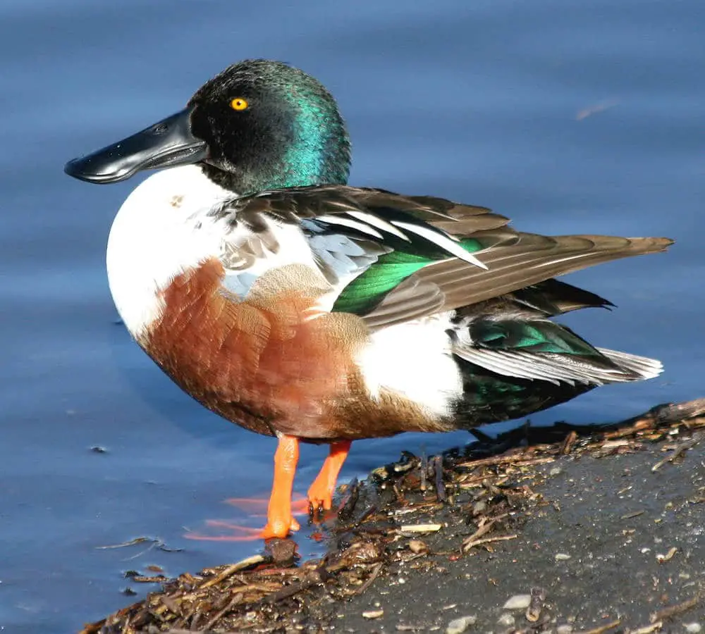
It has been declared a National Waterfowl Reserve because it is a meeting place for several species of migratory birds, including storks, red ducks, grey herons and kingfishers. As for fish, there are trout, barbels and sometimes crabs. In the summer season it is common to see windsurfers, kayakers and kite-surfers.
For a few decades, around the 1970s, German fishermen are said to have introduced fish into the Ebro that are native to European rivers with very cold water, and due to the shock of the habitat, the climate and the river temperatures, they multiplied and grew disproportionately.
Their appearance is unpleasant, they seem to have degenerated and, to make matters worse, they have become the dominant species in the Ebro, wiping out the existing and original fauna of the area. This invader is called the catfish. They can reach more than two (2) metres in length. They are classified as monsters because of the shape of their heads, their whiskers and their enormous size and weight. They are the “monsters of the Ebro”.
Current Events
In Huesca and Zaragoza, people are celebrating the victory of overturning plans to build a dam on the Gallego River, which would have affected part of the city’s territory. Organised residents and environmental groups succeeded in getting the National High Court to annul the preliminary project for the construction of the dam.
The exhibition “Ebro Nuestro: El Ebro y el Aragón’ presents more than 50 images of life around the river in Zaragoza, from the 19th century to the present day.

According to Greenpeace, 75% of Spain’s territory is suffering from the effects of climate change, which could lead to rampant desertification, affecting more than 250 million people.
In Zaragoza, the lowest river flows have been recorded in recent months. In June, the river flowed at 64.9 cubic metres per second, a significant drop compared to the last twenty (20) years.
Navigation before the time of Christ?
It is believed that a confrontation took place in 194 BC over the Romanisation of the Euro Valley, but there is no evidence or record that this happened. What did happen is that a currency was born to make the various exchanges of goods and commodities. This developed in Miranda de Ebro, in the city of Burgos.
This boom in trade meant that Miranda became the economic, social and strategic centre of this area of the Ebro around the year 1099.
Did you know that…
- The Ebro is the only river that flows through two capital cities of an autonomous community: Logroño and Zaragoza.
- The River Ebro has been navigable since Roman times.
- The Stone Bridge of Zaragoza, a monument over the Ebro, does not date from Roman times, but from the 15th century.
- The saying “Ebro traitor, born in Castile and watering Aragon” is used in Cantabria to say that the river, born in Castile and considered proper, watered and benefited an old enemy such as the Crown of Aragon.
- According to scientists from the Superior Council of Scientific Research (CSIC), the Ebro existed more than 37 million years ago and was a marine basin connected to the Atlantic Ocean.

- Pharmacological residues have been found in the river which, due to their high concentration, very similar to those found in the Danube, have been detrimental to existing species.
- During the Tortosa flood of 1907, the river reached a height of 9.95 metres and a flow of 23,484 m3/sec.
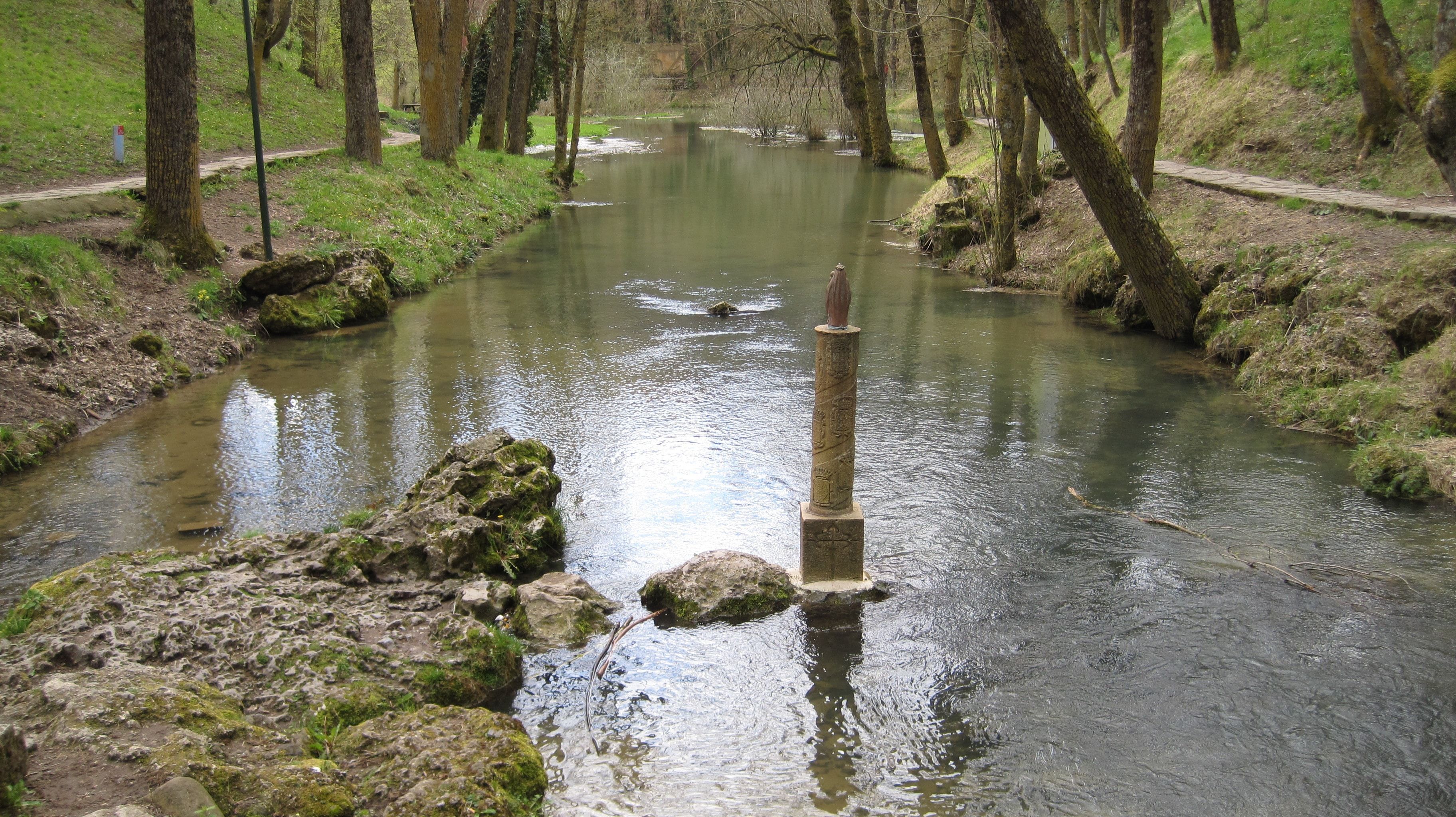
- There are writings which claim that the Virgin Mary appeared to the Apostle Santiago on the banks of the Ebro River.
Worrying pollution in the Ebro River
Recent studies have revealed worrying levels of mercury along the river, affecting river bed wildlife throughout the catchment. This is according to the annual report of the Hazardous Substances Monitoring Network, which found residues of the heavy metal in fish and river sediments.
The results are worrying because they exceed the limits of quantification and the environmental quality standards. It can be deduced that the high level of this heavy metal is due to a significant amount of mercury found at the bottom of the river, but this does not rule out the possibility of illegal contamination, as the samples were also taken near industrial areas.