
Lake Titicaca is a vast expanse of water that covers the territory of Peru and Bolivia, it is also the highest lake in the world, with navigable waters, suitable for fishing and on whose surface some floating islands have been built where a whole community lives. We invite you to know all the details about this lake, also known as the Sea of the Andes.
Introduction
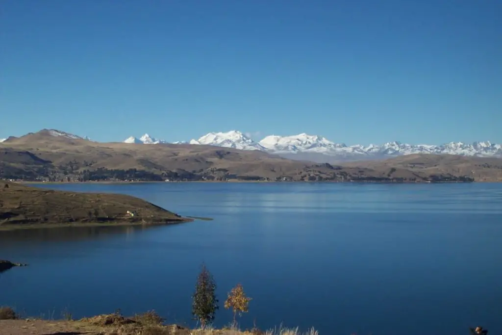
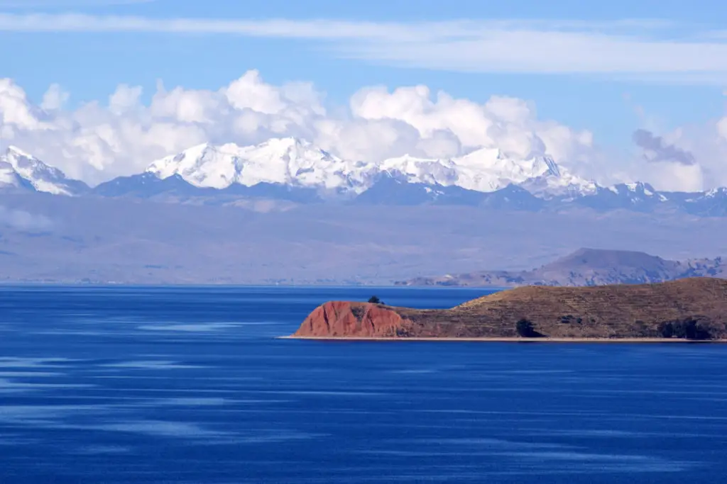
Lake Titicaca is one of the most impressive lakes in the world, at 3,812 metres above sea level, and due to its geographical location it has the peculiarity of being shared between two Central American countries, being 56% Peruvian and 44% Bolivian.
But its qualities do not end there, because if we compare its surface area of 8,560 square kilometres with the other lakes in the Latin American region, Lake Titicaca is the second largest in this vast area.
Its dimensions stretch 204 kilometres from side to side, with an extension of 1,125 kilometres of coastline bordering its surface, making it the highest navigable lake in the world.
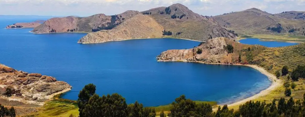
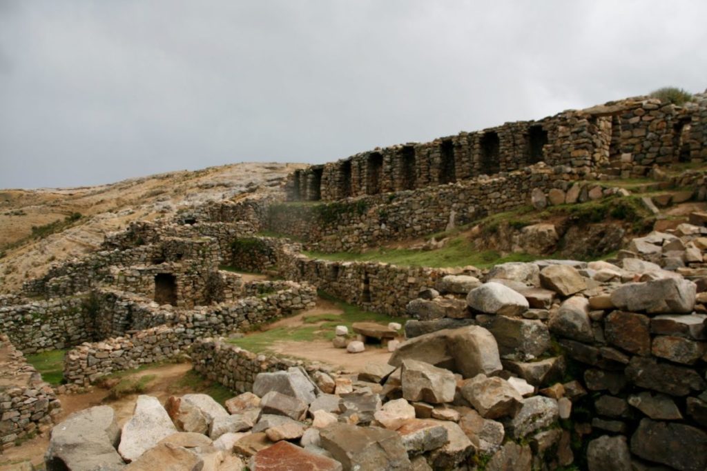
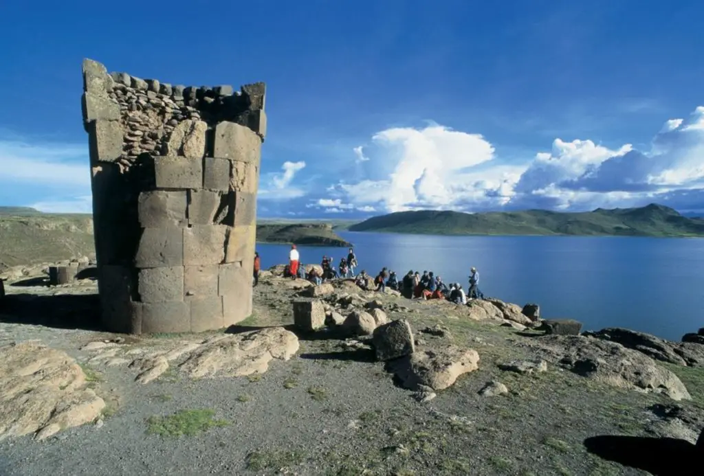
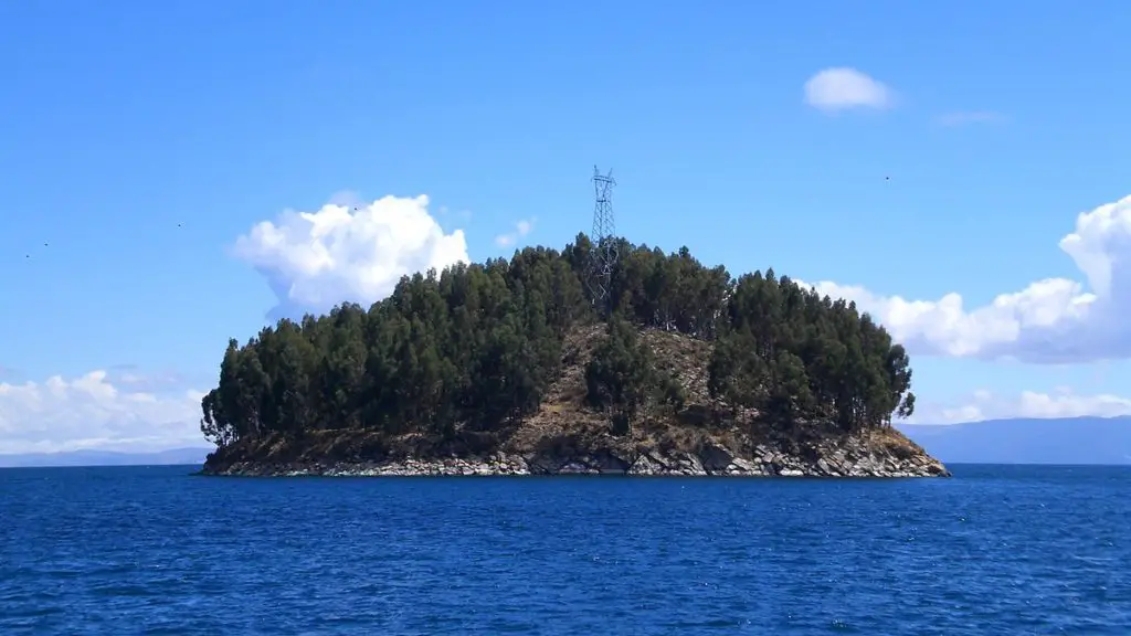
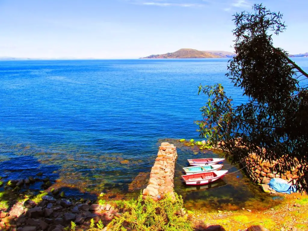
In addition, this beautiful lake has more than 42 islands in its interior, of which the most famous is the Isla del Sol, whose importance above the others is due to the fact that it was the birthplace of the Inca Empire, which is why it has a series of ruins that testify to the existence of this ancient civilisation.
Nowadays, the population is mainly indigenous, and although they have been influenced by modern customs, they still maintain many of the traditions of their Inca origins.
Let’s take a closer look at Lake Titicaca, a magical place full of history, tradition, biological and cultural biodiversity, which is not only the highest lake in the world, but also a magical environment that we cannot miss.
Origin of Lake Titicaca
In order to better understand the formation of Lake Titicaca, we must briefly explain what tectonic forces are, as they are responsible for its formation.
The tectonic forces are generated by the magma of the earth, this geothermal energy is transformed into mechanical energy that causes the movement of convection of the underground plates that make up our continents.
The formation of Lake Titicaca was caused by these tectonic forces, which provoked the uplift of the eastern and western mountain ranges of the Central American Andes. The force of this movement caused the formation of a plateau, a type of flat and high relief. This plateau is known as the Meseta de Collao.
The location of the Collao Plateau, more than 3,000 metres above sea level, meant that the waters remained frozen during the Ice Age, preventing sedimentation.
This allowed it to maintain its shape and depth, so that when the interglacial period arrived, these ice masses thawed and became what is known today as Lake Titicaca.
The semi-arid and arid climate of the Peruvian and Bolivian endorheic basin has also influenced its minimal and slow drainage, contributing to the permanence of this large body of water.
Numerous studies on the lake systems of the Altiplano indicate that Lake Titicaca is the result of the evolution of a very ancient system that began in the Lower Pleistocene, between 2.558 and 0.781 million years ago, with the transition towards the end of the Pliocene.
The climatic changes that took place during this period, from a relatively warm to a cold and humid climate, had a direct influence on the existence and size of Lake Titicaca and other lakes in the Altiplano.
During the same phenomenon, the foothills of the Cordillera were fractured by tectonic forces in a north-south direction. Finally, in the Lower Pleistocene, 2.9 million years ago, after the formation of Lake Cabana and before the existence of Lake Balliván, the tectonic rift was born that would be occupied by the majestic Lake Titicaca.
History of the lake
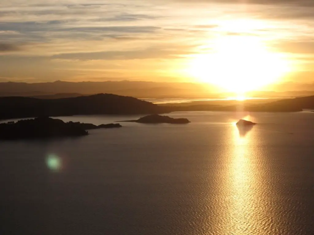
Its history stretches back to a time when the world was illuminated only by the moon. In this section we will refer to its impressive islands, inhabited by men and women who are dedicated to preserving their millenary traditions and their history, full of love, heroism and tragedy.
Its inhabitants tell us that many years ago, Lake Titicaca was a fertile valley where the land provided its inhabitants with everything they needed to live, so it was characterised as a place where happy people lived together in peace. There were no feelings of hatred or ambition in the valley communities.
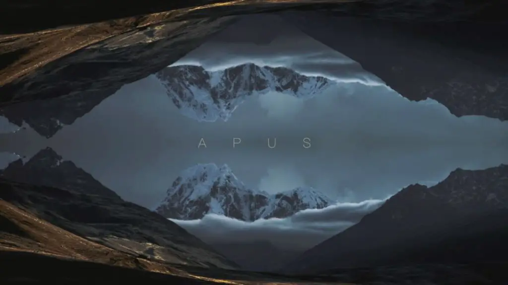
Also in these millennial lands, the so-called Apus, known as the gods of the mountains, were worshipped. They protected all the people who lived in the valley, in exchange for one rule: the gods had forbidden climbing to the top of the mountains, because there was a sacred fire that humans could not enter.
Evil has always dwelt among men, so temptation and that evil spirit that has always hated love and happiness appeared, sowing discord among them and testing their courage by tempting them to disobey the rule of the Apus gods.
The men climbed to the top of the mountain where the sacred fire was, but the Apus were on the lookout for them, and because of their disobedience they decided to wipe out the lineage living in the valley.
So they unleashed thousands of pumas to devour every one of the men. The devil watched from afar, smiling at the cries for help from each of the men, but of course did nothing to save them.
As the sun god watched the devastation, he wept inconsolably for more than forty days, so much so that his tears flooded the valley and gave birth to Lake Titicaca.
When the sun came up, they found themselves in the middle of a huge lake where they could see the pumas turned into stone statues, hence the name Lake Titicaca, which means Lake of the Stone Pumas in the indigenous language.
The inhabitants of this beautiful and mythical place keep their roots alive by showing them to people from all over the world who visit this unique place.
Likewise, the communities that live around Lake Titicaca, proud of their history and their Inca roots, through rural and experiential tourism, let people know their origins, their legends and their current lifestyle, which is a unique mixture of history shared by two countries.
We have begun the history of Lake Titicaca from the magical-religious aspect, because its past has a lot of mythical aspects, but its history is perfectly divided into periods, which we will comment on below.
Pre-Inca period
The pre-Inca period is marked by one of the oldest cultures that developed on the shores of Lake Titicaca, the Chiripa. This culture inhabited an area on the Taraco peninsula of Lake Titicaca from around 1,500 to 100 BC.
Important archaeological remains have been found in the region, which have made it possible to date the most important period of the Chiripa culture to between 591 and 116 BC, 31 years after Christ.
Studies of other archaeological discoveries have shown that there is a contemporaneity between the Chiripa cultures and the early periods of the Tiwuanacu culture, which had settlements on the southern side of Lake Titicaca.
Another culture to the north of the lake is the Pucará. However, it was the Tiahuanacota culture that dominated the Lake Titicaca area around 200 AD.
There are similarities between the aforementioned cultures in that they lived off the crops they grew in waru warus, which are mounds of earth built to protect them from frost.
Inca imperial period
In the 13th century A.D., the Incas settled in Cuzco and from there began the expansion of their empire into the Andes, controlling what is now Colombia, Ecuador, Peru, Bolivia, Chile and Argentina.
History tells us that the Inca Empire has its legendary origins on the famous Island of the Sun, where Manco Capac and Mama Ocllo founded Tahuantinsuyo.
Lake Titicaca has an important religious significance, as it became part of the Inca Empire at this time, through the installation of Pachacutec Inca Yupanqui in the region of Lake Titicaca, who annexed this territory and its surroundings to the Empire.
Pachacutec Inca Yupanqui was a ruler of the Incanate, the fourth of the Hanan Cuzco dynasty. Also at this time, the expansion of the empire forced the mobilisation of other cultures, including the Urus, who fled the Inca attack.
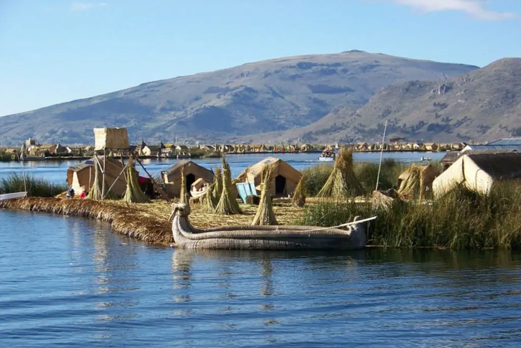
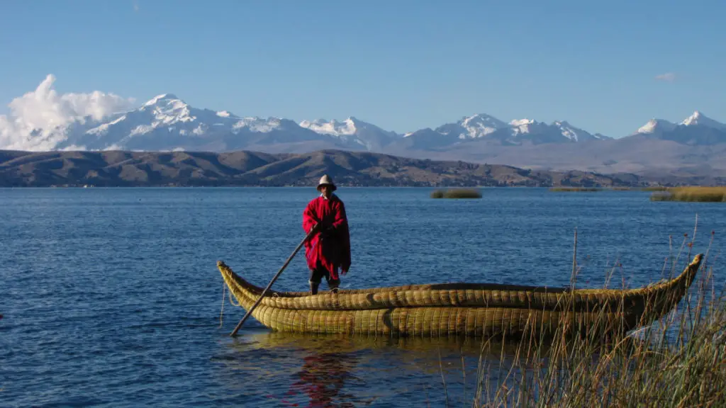
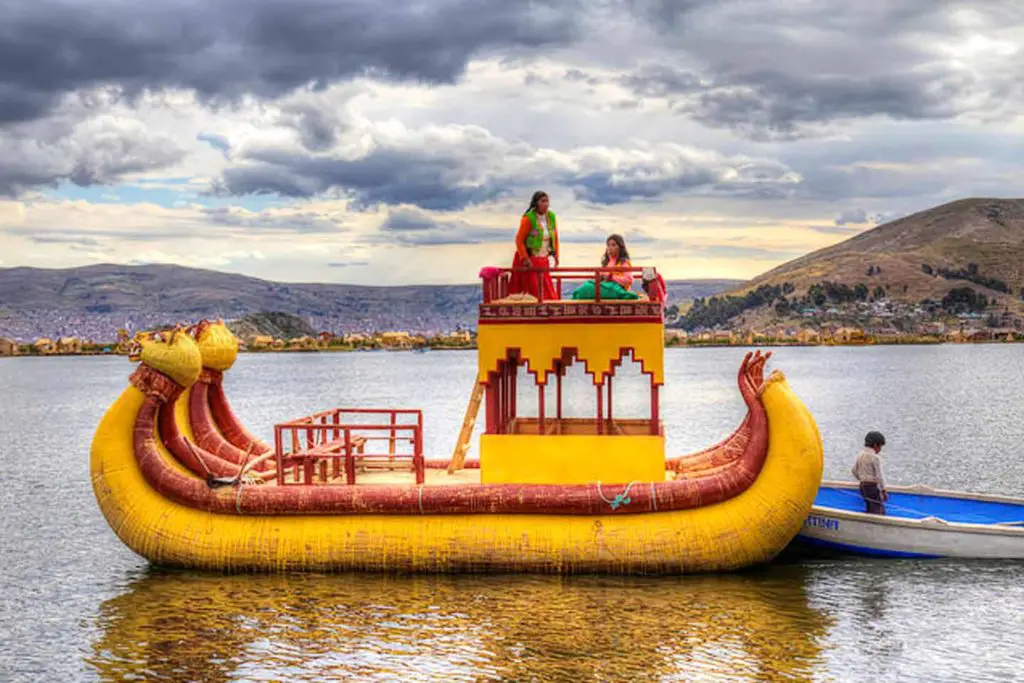
They found refuge in the vast waters of Lake Titicaca, where they built floating islands from totora reeds, a perennial aquatic plant that grows in the lake and became the basis for the Urus’ dwellings in Peru.
Colonial period
As many people know, the Inca Empire fell due to the Spanish invasion, but it is important to note that with the death of the Inca Huayna Capac, a conflict began in the empire that led to an internal war to ensure the continuity of the dynasty.
This was fought by Huascar and Atahualpa, which allowed the Spaniards to colonise the areas that had belonged to the Inca Empire in a shorter period of time. Since the creation of the Viceroyalty of Peru in 1542, Lake Titicaca has been administered by Spain.
Then, through a series of administrative changes carried out by the members of the Bourbon monarchy with the aim of reorganising the situation and relations with the conquered provinces, they created the Viceroyalty of the Río de la Plata.
This reorganisation included the Intendancy of Puno, which in colonial times had been part of the Audiencia de Charcas and therefore included the whole of Lake Titicaca. When the Audiencia of Cuzco was created in 1787, the districts of Carabaya, Lampa and Azángaro were merged into one district.
Later, almost ten years after the creation of the district, a royal decree incorporated Puno into the Viceroyalty of Peru and the districts of Paucarcolla and Chucuito into the Audiencia of Cuzco.
Lake Titicaca was then divided between the Audiencia of Cuzco, which belonged to the Viceroyalty of Peru, and the Audiencia of Charcas, which belonged to the Viceroyalty of the Río de la Plata.
Republican period
It was during this period that the wars of independence began, led by the Venezuelan Simón Bolívar, which resulted in the independence of Peru in 1821 and Bolivia in 1825. The independence of both countries led to the division of Lake Titicaca, making it a bi-national lake.
In 1932, in the city of La Paz, a protocol was signed ratifying the division of Lake Titicaca, detailing how the lake would be divided between the two countries.
The protocol states that from the bay of Cocahui there is an imaginary straight line that reaches the equidistant point between the island of Soto, which belongs to Peru, and the island of Chiquipa, which belongs to Bolivia.
Another straight line goes from the equidistant point between Isla del Sol, in Bolivia, and Punta Pomata, in Peru. From the latter, another straight line is drawn to Punta Kasani as the boundary, where landmark No 22 is located.
From signpost 22, follow a route that respects the border between the two countries, following the Copacabana peninsula to the Sehuenca stream. This route divides Lake Titicaca as follows: the north of the peninsula is Bolivian and the south Peruvian.
From Lake Huiñaymarca, between the island of Iscaya, which belongs to Peru, and Punta Huancallani, which belongs to Bolivia; passing through the island of Cana, which belongs to Peru, and the island of Limina, which belongs to Bolivia, is another border.
Similarly, a straight line is drawn in an imaginary south-westerly direction to a coordinate that defines a midpoint between Punta Taraco, which belongs to Bolivia, and Punta Zepita, which belongs to Peru, with another line that goes south to where the Desaguadero River begins.
At Lake Huiñaymarca, the borders that divide Lake Titicaca between the two countries are defined. This protocol has been maintained and respected to this day.
Legend of Lake Titicaca
One of the best known legends about the origin of Lake Titicaca is that in the beginning the world was a place of darkness, illuminated only by the faint light of the moon.
One day the sun lit its flame on the back of a stone puma that was on the island, and it was at that moment that people were able to see the immense lake that was all over the plateau and called it Lake Titicaca. The island where the sun first shone was called the Island of the Sun.
It was on this island that the Incas settled, and it is said that their temples were beautiful constructions with walls covered with sheets of gold, there was also a convent of young priests, while on the Island of the Moon there was a convent of virgins.
Once a year a theatre was performed on the lake and the moon and the sun met as if they were alive. Priests and virgins sailed across the lake in beautiful canoes, caressing each other as they met, embodying the moon and the sun and asking them to show themselves every day.
Legends also tell of the arrival on the island of tall, white, bearded, cruel and bloodthirsty men known as the Lupacas. The leader of this group, called Kan, had the island’s inhabitants killed.
It is said that the colour of their skin and the way they dressed made them look like witches with evil powers. Lake Titicaca is full of legends like these, linked to its history and the origin of its name.
Tributaries
The Titicaca basin receives its water from the endorheic basin of the Altiplano, which drains into Lake Poopó at 3,686 m above sea level.
These waters are transported by the Desaguadero River, which in turn flows into the Coipasa salt flat at 3,657 m above sea level, although this supply only occurs during periods of high water.
Also within the hydrographic basin is the Salar de Uyuni, at 3,653 metres above sea level, which receives water from the Rio Grande del Lipez.
As can be seen, the outlet is the Desaguadero River, which begins in Bolivia, belongs to Lake Titicaca and flows 398 km into Lake Poopó, with a difference in altitude of 124 m.
Another characteristic of the basin in which Lake Titicaca is located is that it contains non-perennial waters, with the only truly perennial surface water being Lake Titicaca itself.
If we calculate the surface area of the entire basin of the lake, including the surface water up to the beginning of the Desaguadero River, it is 56,300 km2.
Of all this area, the largest extension is in Peru, specifically in the Puno sub-region, and a smaller extension is in Bolivia, in the department of La Paz.
The main tributaries of Lake Titicaca are
- The Ramis River, with a basin of approximately 14,684 km2, an average flow of 76 m3/s and an extension of 283 km.
- The River Llave, with a basin of 7,705 km2 and an average flow of 39 m3/s.
- The Coata River is also one of the main tributaries, with a basin area of 4,550 km2, but with a higher average flow than the Llave, contributing 42 m3/s.
- The River Huancané, with a surface area of 3,540 km2 and an average flow of 20 m3/s.
- The River Suches, with a surface area of 2,825 km2 and an average flow of 11 m3/s.
- The Catari River, with a surface area of 2,022 km2 and an average flow of 10 m3/s.
These tributaries of Lake Titicaca have their source in the snowy peaks of the Andes, which completely surround the lake basin. It is a really large and complicated basin, as it is made up of 25 rivers that discharge their waters into the lake, but we have named the most important ones according to their size and average contribution.
The secondary tributaries are the Yanarico, Zapatilla and Ilipa rivers, which are on the Peruvian side, and the Keka, Sehuenca, Tiahuanacu, Huayco, Khullu, Cachi and Putina rivers on the Bolivian side.
It is also important to mention that within the basin there are four main lagoons, the largest of which is the Arapa Lagoon with 132 km2, followed by the Lagunillas Lagoon with 50 km2, the Umayo Lagoon with 28 km2 and the Saracocha Lagoon with 14 km2.
Characteristics of Lake Titicaca
Lake Titicaca is a diverse and very complex ecosystem with characteristics that distinguish it from other lakes. The following points will first outline its most general aspects and then highlight its specific features:
- Its dimensions make it the largest lake in South America. It has a surface area of 8,562 square kilometres, divided between two countries: 56% (4,772 km²) belongs to Peru and 44% (3,790 km²) to Bolivia.
- Despite its altitude, its waters do not freeze. Its endorheic nature gives it other unique characteristics, which we will describe later.
- Lake Titicaca has a surface area of 8,562 km2 and a water volume of 930,106 million m3.
- It is situated at an altitude of 3,810 metres above sea level.
- It has a maximum depth of 283 metres and an average depth of 105 metres.
- Its maximum length is 176 km, with a perimeter of 1,750 km and a width of 70 km.
- There are eighty-seven islands in Lake Titicaca, distributed as follows:
58 of the islands are located in the so-called basin of Lake Titicaca, of which 43 are in the main basin and 15 in the Bay of Puno. - The other 29 islands are located in the basin known as Lago Menor.
- This lake is divided into two basins, one called Lago Menor or Huiñaymarca with a surface area of 1,400 km2 and the other called Lago Mayor or Chucuito with a surface area of 7,000 km2.
Climate of the Lake
The climate of Lake Titicaca is determined by its altitude, being a lake at more than 3,000 m.a.s.l., it has temperatures that vary radically between day and night. Temperatures can reach 25°C during the day and 0°C at night.
The average annual temperature of the lake is 13°C. The water surface temperature varies between 11 and 25°C in August and between 14 and 35°C in March.
It may seem strange that at such a high altitude, temperatures are so warm during the day. This is because Lake Titicaca is able to moderate its temperature by absorbing the sun’s energy during the day and retaining it in the lake’s surroundings.
At night, this energy is radiated away, which is why the temperatures are not as extremely cold as we might expect.
Bathymetry
Bathymetry is the tool that allows us to know the depths of the sea and, therefore, the topography of the lake environment. We will begin by describing the bathymetry of the Lake Maggiore basin, which is characterised by steep slopes away from the shore, with an average depth of 135 metres.
The bathymetric study identifies four distinct zones: the first is the so-called Great Central Zone of Lake Maggiore, where the greatest depths are found in Lake Titicaca, the deepest point being 283 metres, located near the island of Soto.
Another zone is found in Copacabana Bay, with average depths between 200 and 100 metres. There is also the famous shallow water zone, located between Puno Bay and Achacachi Bay, with average depths between 100 and 20 metres.
Finally, there is the so-called littoral zone, located along the eastern coast, with depths of less than 20 metres.
On the other hand, the bathymetry of the Minor Lake is characterised by slight slopes and much shallower depths compared to those determined for the Major Lake.
In this sense, three bathymetric zones have been identified for the smaller lake: the first corresponds to the deepest zone, which is located in the Chúa trench and is 41 metres deep.
Then there is the area known as the Central Canyon, which is located between the Taquiri, Paco and Calhuita Islands in a central-western direction and is bordered to the south by the Taraco Peninsula; in this area, the maximum depth was found not to exceed 20 metres.
Finally, there is the northern area of Lake Titicaca, also known as Guaqui Bay, which happens to be the outlet of the Desaguadero River. The bathymetry shows that this is an area with a depth of less than 5 metres, which explains why the Desaguadero River and Lake Titicaca only have a real relationship during high water.
Sedimentology
Sedimentological studies of Lake Titicaca are very recent. Sedimentology allows us to understand the processes of formation of the lake bed, as well as the important dynamics of transport and deposition of the material that accumulates as sediment in this type of environment.
Its importance lies in the fact that it allows us to understand the system and the changes that can occur at the bottom of the lake and how these may or may not affect the dynamic equilibrium of the ecosystem. It has been established that the sedimentation rates of Lake Titicaca are extremely diverse, as they depend on the zones and their layers, known as facies.
In this sense, sedimentation rates of 0.5 mm/year have been calculated for Lago Mayor and 5.0 mm/year for Lago Menor. The detrital and organodetritic facies predominate in the area known as Lago Mayor.
Hydrology
Most of the water in Lake Titicaca is lost through evaporation, and this phenomenon is exacerbated in some areas where salt flats are being created because the minerals in the lake that have been carried by the rivers remain deposited.
It is estimated that only 5% of the lake’s water is drained into the Desaguadero River, which flows into Lake Poopó, which is much more brackish than Lake Titicaca.
The water drained from Lake Titicaca actually ends up in the Coipasa salt flat, where the little water that arrives evaporates quickly.
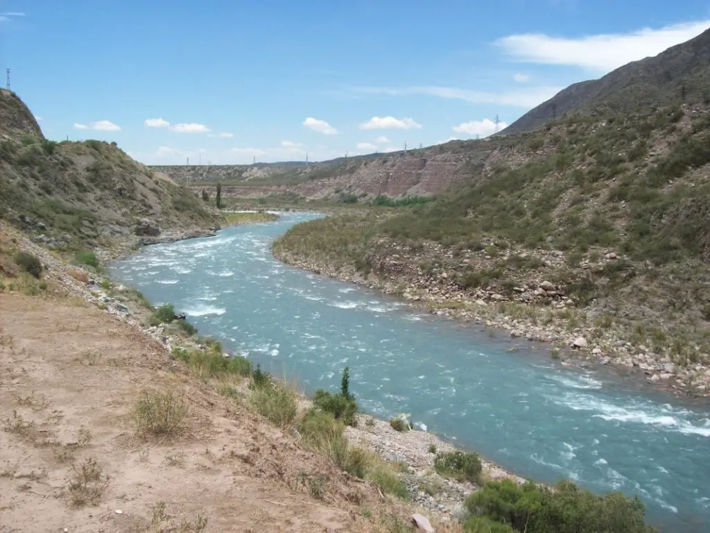
Another characteristic of its hydrology is that the rivers that make up its hydrographic basin are very short, the most important and longest being the Ramis, Azángaro and Carabaya, the Ramis being the longest at 283 kilometres.
The flow of the tributaries is low and irregular and their contribution is determined by the seasonal rainfall, which is between December and March, while the drought or absence of rainfall is between June and November.
The tributaries of Lake Titicaca are characterised by a very low gradient, which means that they are meandering, i.e. sinuous, with no turbulence, which influences the transparency and the type of flora and fauna associated with the system.
Water quality
The waters of Lake Titicaca are characterised by being slightly brackish and there is no programme to determine, control and monitor the quality of its waters. In fact, the sampling that has been carried out has been done on an ad hoc basis, which means that a large part of the surface of the lake has not been studied in this respect.
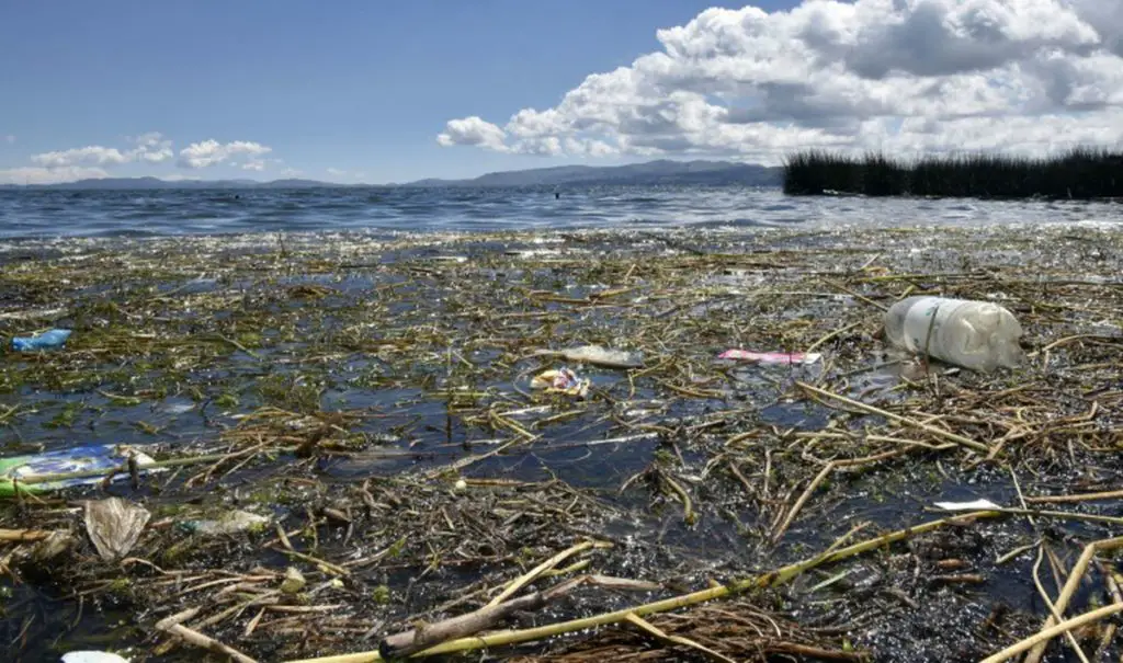
However, it is known that the waters of the Bay of Puno are currently polluted due to the fact that the city’s sewage is discharged into the lake without any kind of treatment.
Geographical features
There are many geographical features on the plateau, as it has been raised by the action of tectonic forces. In this sense, it is possible to identify straits, isthmuses and peninsulas that give Lake Titicaca a varied geography.
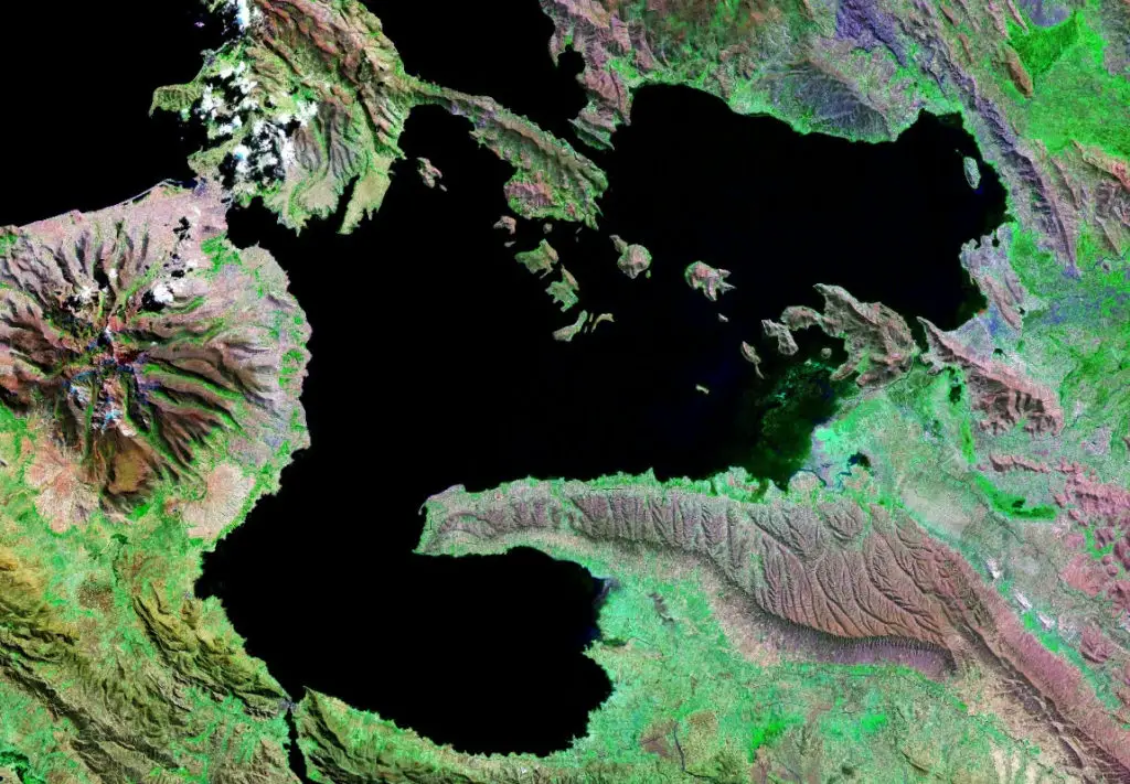
We can start by mentioning the Strait of Yampupata, located between the peninsula of the same name and the Isla del Sol, in Bolivia.
There is also the Strait of Tiquina, between the Copacabana and Huata peninsulas, which divides Lake Titicaca into the larger Lake Chucuito and the smaller Lake Huiñaymarka. There is also an isthmus that connects the Copacabana peninsula to the mainland, called Yunguyo.
As for the peninsulas that dominate the landscape of Lake Titicaca, there are
- The Capachica Peninsula, located to the west of Lake Titicaca.
- The Chucuito Peninsula.
- The Copacabana Peninsula, whose size allows it to be divided between Peru to the south and Bolivia to the north.
- The Yampupata Peninsula.
- The Huata Peninsula, which forms the Tiquina Strait on the Bolivian side.
- The Huata Peninsula, on the Bolivian side, is the largest.
- The Taraco Peninsula, located in the small Huiñaymarka Lake, on the Bolivian side.
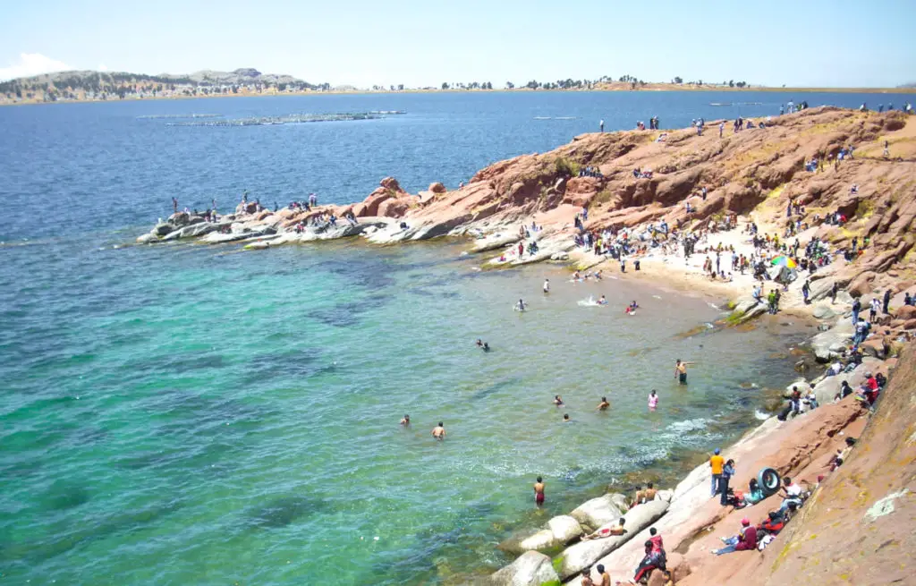
Beaches
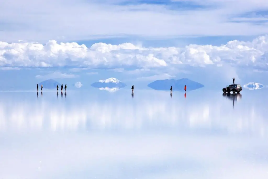
The famous highest beaches in the world have become a tourist attraction, with at least 6 of them located on the Peruvian side of Titicaca, and the famous Copacabana beach on the Bolivian side.
Each one has its own unique charm, offering locals and visitors a place to relax that is becoming more and more famous every day. In this section we will get to know each of these beaches, their location and their outstanding characteristics.
As we have indicated on the Peruvian side, there are at least 6 beaches, identified with the following names Capachica, Charcas, Chifrón, Juli, Chatuma and Ccotos, located in the department of Puno.
Capachica Beach is located southeast of the city of Juliaca, in the district of Pomata in Chucuito. It is one of the largest and most visited beaches, with sand and temperatures that vary between 18° C and 21° C.
On the southwest side of the Titicaca Peninsula, in the department of Acor, is the beach of Charcas, considered one of the most beautiful on Lake Titicaca, with white sand and turquoise water.
Further south, in the province of Chucuito, is the beach of Juli, which is much closer to the city and therefore always very crowded, but is also a beautiful sandy beach.
Chatuma, on the other hand, is located in the province of Chucuito and is characterised by large rocks that give it a beautiful landscape, it is very crowded by tourists.
In the same province of Punos is Chifrón beach, preferred for its sandy beaches and warm waters for bathers. Every year there is a contest called “Señorita Playa” (Miss Beach), which attracts a lot of tourists.
In the district of Capachica is the beach of Ccotos, also beautiful and wide, which completes the sextet of beaches of the Altiplano, located on the Peruvian side.
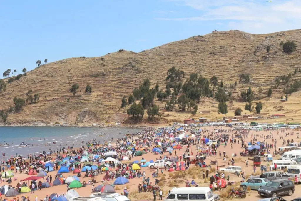
On the Bolivian side is the beautiful Copacabana beach, a worthy reward for the Pacific War that left Bolivia landlocked.
Its waters have an average temperature of 20°C in the summer months, surrounded by mountains and volcanoes, it offers visitors an orographic spectacle bathed by its intense blue waters.
Flora, fauna and geology
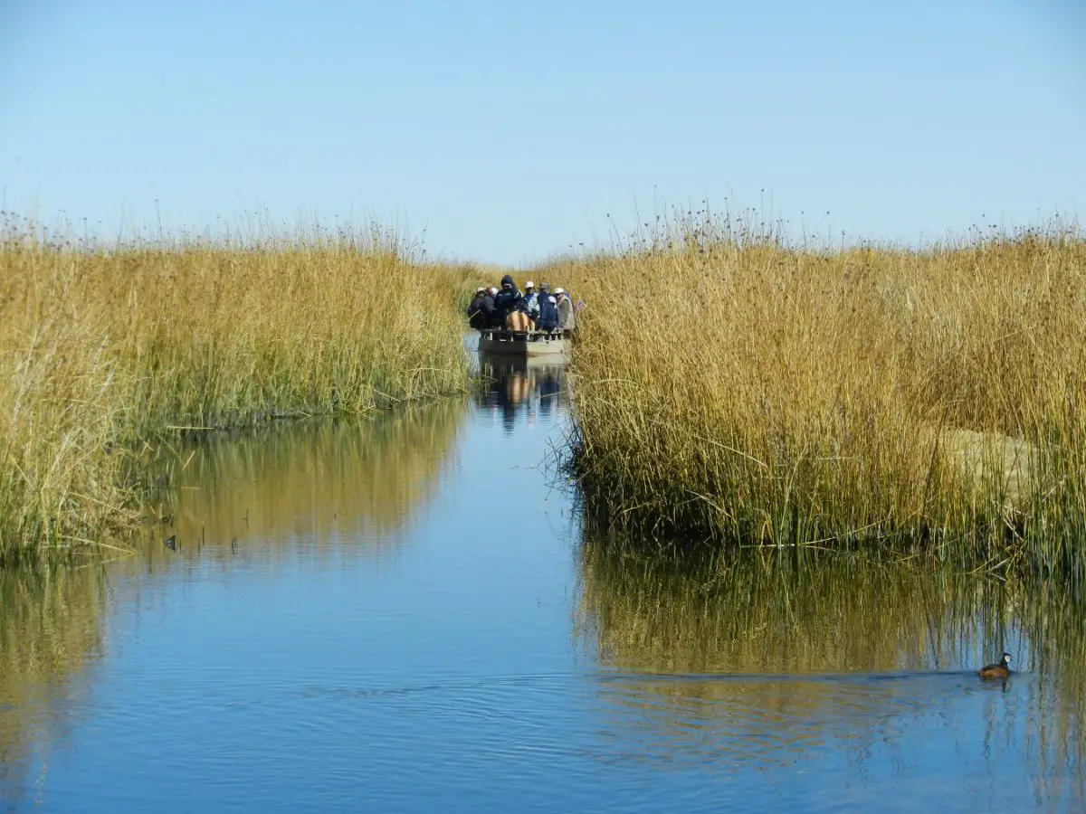
The flora that forms part of the ecosystem of Lake Titicaca is characterised by its predominantly aquatic vegetation, among which the commonly known totora, an aquatic reed whose scientific name is Scirpus californicus, stands out.
There are more than 11 species of aquatic plants that accompany the Totora in this wonderful lake ecosystem, such as Lemna sp, better known as duckweed, generally associated with water qualities with high levels of phosphorus.
The presence of the yana llacho, with the scientific name Elodea potamogeton, and the purima of the genus Chara sp. are also noteworthy for their abundance and distribution.
The microscopic flora of the lake is rather poor, which is due to the carbon fixation in its waters. At the bottom of the lake there is a significant amount of carophycean algae, which is the most important plant mass in the area.
There is also a flora associated with the shore zone of Lake Titicaca, made up of more than 64 different plant genera. There are also plant formations in the area classified as subtropical humid montane-humid forest, which have been significantly disturbed, although some remnants of the original forest can be seen.
The aquatic paramo zone also has very humid montane and subtropical forests, very humid paramo vegetation and subalpine subtropical vegetation specific to Lake Titicaca. This is a diverse mixture of grasses and other perennial herbs.
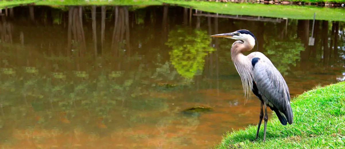
The fauna is made up of animals adapted to the lake habitat, such as: the diving ducks, the South African duck (Anas georgicas), the Puna duck (Oxyura ferruginea), the ruddy duck (Anas flavirostris), the great white egret (Egretta alba) and the parihuana (Phoenicoparrus andinus), to name just a few of the most representative birds that can be found in this diverse ecosystem of Lake Titicaca.
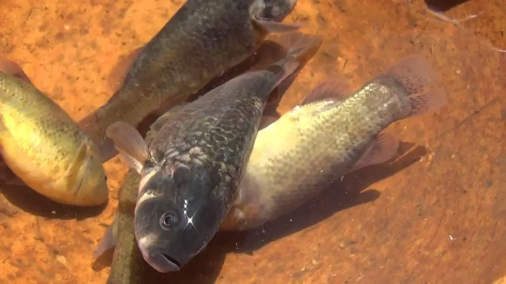
Among the fish species that can be found in its waters are: black carachi, white carachi, yellow carachi, yellow carachi, gringo carachi and the dwarf carachi.
Also worthy of note are the suche (Trichomycterus rivulatus) and several species of orestias that are native to the lake, as well as introduced species such as trout and silverside.
Zooplankton is made up of copepods and cladocerans, which play an important role in the sustainability of fish. At least 22 different species of molluscs have been identified, of which 18 are snails and 4 are clams.
Unfortunately, the fishery resources of Lake Titicaca have been overexploited, which has led to a significant decline in the populations of boga and umanto, the lake’s native fish species.
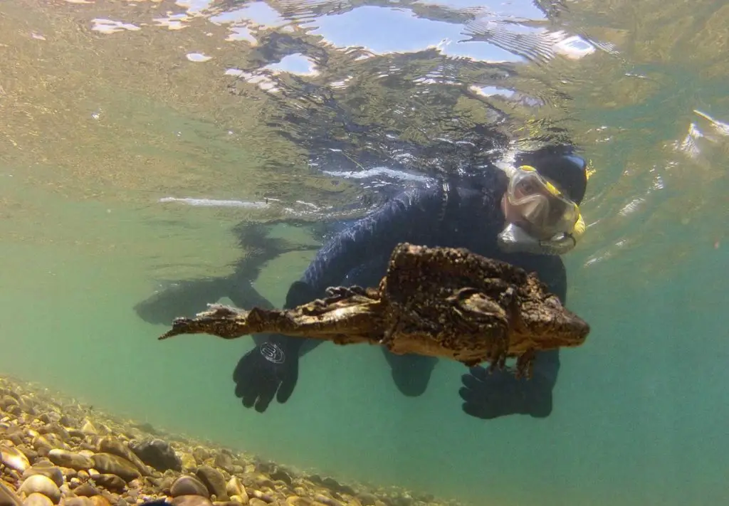
There are also endemic species such as the giant Titicaca frog (Telmatobius culeus), which has a loose skin that allows it to breathe underwater, and the Ballivian sponge, which has been in the lake for 7,000 years. There are also around 21 species of amphibians and a species of snake that frequents the wet banks of the lake.

Associated with the terrestrial habitats of the islands and riverine areas of Lake Titicaca are some mammals, including the famous alpacas, llamas and guinea pigs, found in the wild and in breeding farms, among others.
At least 116 species of vertebrates have been identified in the Titicaca National Reserve, including 15 species of mammals, 87 species of birds, 4 species of reptiles and 4 species of amphibians, as well as the strange bony fish of the genus Orestias.
It is worth mentioning that the geology of Lake Titicaca belongs to the Quaternary period, in which the evolution of the Altiplano is closely linked to climatic changes.
The presence of periods dominated by humid climates, replaced by dry and warm climates, as well as glaciers and interglacials, have conditioned the geology of the endorheic basin of Lake Titicaca.
There is scientific evidence that has determined the occurrence of glacial phases that modified the surface of Lake Titicaca, there is evidence that indicates that for the Pleistocene era the area of the lake was approximately 50,000 km2.
During some periods of the Pleistocene, when glaciations dominated, the level of Lake Titicaca was much lower than it is today.
During periods of dry climate, the Desaguadero River did not carry water from the endorheic basin of Titicaca, and the other rivers that used to discharge their waters into the lake had very eroded beds that drew or carved inlet channels, as shown by bathymetric studies.
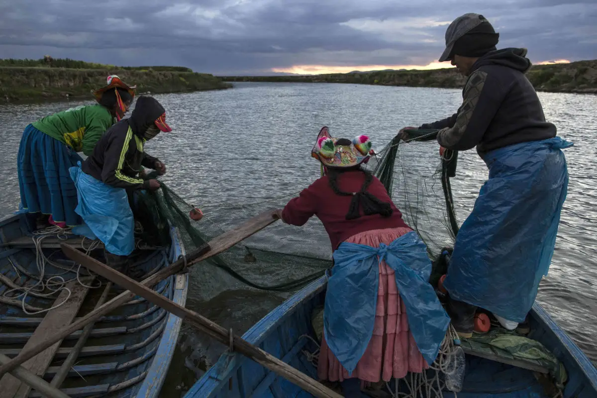
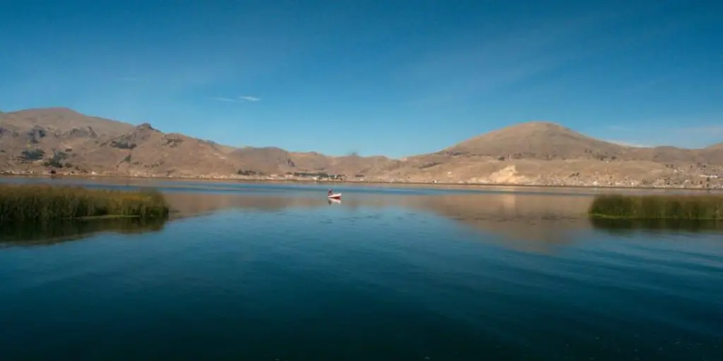
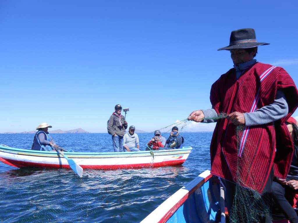
Fishing in Lake Titicaca
Fishing is one of the most important economic activities in Lake Titicaca, sharing space with agriculture and tourism, but it is also linked to the sustainability of the communities that live around the lake. It has also become a real tourist attraction, so fishing has a dual purpose in both the economic and social spheres.

Fishing is the activity that has sustained these populations for thousands of years, and the exploitation of the resource is still focused on subsistence.
Fish is the main source of protein for the inhabitants of Lake Titicaca, although the catching or fishing of this species is linked to a commercial activity in the hands of intermediaries who sell it to communities in the same area of Lake Titicaca.
In this sense, the millenary fishing gear is still used to fish mainly for subsistence, rather than for commercial purposes.
The most common species caught with the fishing gear used by the inhabitants of Lake Titicaca are the Karachi, an indigenous species, and the Silverside, an introduced species.
Fishing is carried out with nets and hooks, but despite this, there are fish that have shown a significant decline in their populations, both natural species of the lake and introduced species.
For example, using hydroacoustics, results have been obtained that show a permanent decline in endemic species of the genus Orestias.
In the same way, it is worth mentioning that there are several factors that affect the fish populations of Lake Titicaca, not only related to fishing, but also to the absence of fishing bans or closures in areas used by fish for spawning.
It has also been affected by the introduction of non-traditional fishing methods, such as the use of explosives, and the resulting change in the lake’s water quality, which has affected the ecosystem.
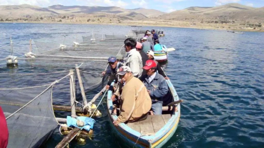
Alternatives such as fish farming are showing positive results, although production is directed towards species not native to the lake, such as trout farming. However, aquaculture is geared more towards fattening than production, although it is still an activity that can become an important source of income linked to the fish farming sector.
For this reason, fishing concessions have been granted for intensive farming, but this activity needs to be regulated to prevent it from having an impact on the native fish populations of Lake Titicaca. In response to this potential collateral damage, a programme for the production and repopulation of native or endangered species is being implemented in the region.
On the other hand, sport fishing is on the rise in the lake region and is offered as an activity linked to tourism, which is generally allowed without any kind of regulation for the extraction of species introduced into Lake Titicaca, such as trout and silversides.
The islands of Lake Titicaca and its activities
As we have already mentioned, Lake Titicaca is characterised by a group of islands, many of them natural and others built by its inhabitants. These islands are distributed between the Peruvian and Bolivian territories.
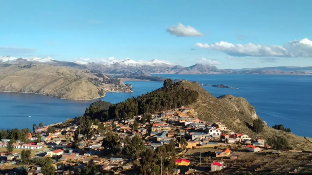
One of them has an important role in the Inca mythology, we are talking about the Island of the Sun, because it is related to the Inca sun god called Inti. It is also linked to Inca legend as the birthplace of Manco Capac, the founder of the first dynasty of this ancient civilisation.
Located in Bolivia, the Island of the Sun is one of the largest in Lake Titicaca, with a surface area of 14.3 km² and an elongated geography with two large bays, the most prominent of which is Kona Bay, located to the north of the Copacabana Peninsula.
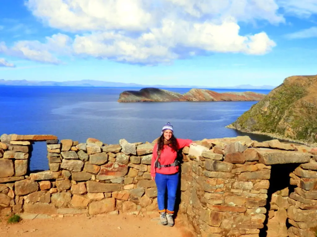
A rugged relief, the presence of several agricultural terraces and archaeological remains ranging from the Tiahuanaco culture to the Incas give the Isla del Sol its unique characteristics.
On the Bolivian side, there are other islands such as Chelleca, Chiquipa, Pariti, El Campanario, Cojata, Jochihuata and the Island of the Moon or Koati, located to the north of the Copacabana peninsula, with a surface area of 1.05 km².
But the list would not be complete without mentioning the following islands: Chipi, Jhamiti, Jhamiti chico, Kellayhuata, Limina, Morochuata, Wiskawahata and Taquiri, the latter of which has been declared a national monument due to the important archaeological remains found there.
For its part, Peru has the island of Amantani, located at the bottom of the Capachica Peninsula, with an area of 9.28 km², which is the largest Peruvian island in Lake Titicaca.
Also in Peru are the famous floating islands of the Urus, specifically in the Bay of Puno; Chirita Islands 1 and 2 and Esteves Island, with a surface area of 0.12 km², just 2 km from the city of Puno. This island is an important archaeological site where remains of the Colla, Tiahuanacota and Pucará cultures have been found.
Another important island is Soto, located to the north of the lake, with an area of 2.6 km² and inhabited by Aymara communities.
Also on this side of Titicaca are the islands of Suasi and Taquile, located in front of the Chucuito and Capachica peninsulas, as well as Anapia, the second largest island in the Huiñaymarca archipelago, with a surface area of 3.40 square kilometres.
Isla Caana, Suaana, Islote de Ccaño, Islote de Huatacaana, Islote de Iscaya, Islote de Patahuata and Islote de Yute complete the most important islands on the Peruvian side.
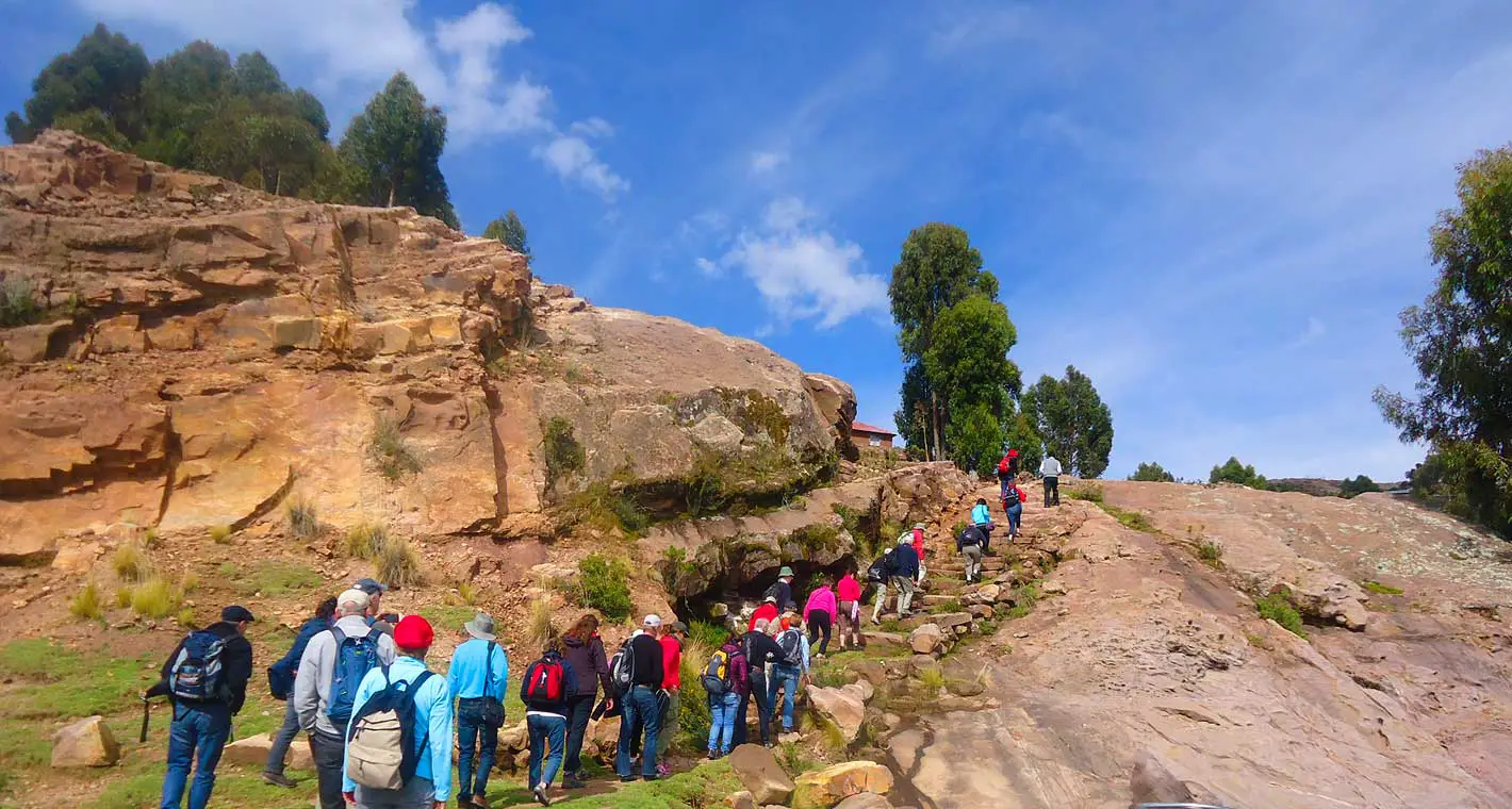
We will now take a closer look at the floating islands of Uru, Amantani Island and Taquile Island, as they are important places of culture, history, tradition and tourism.
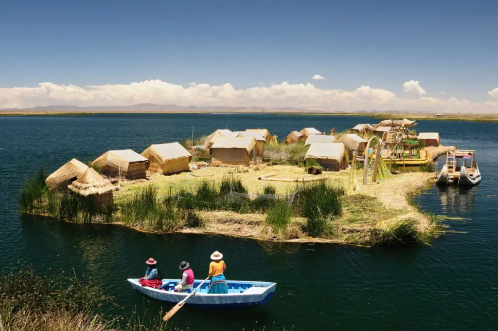
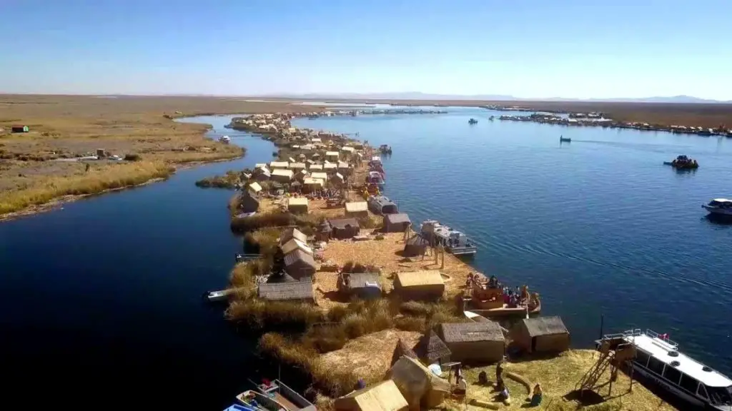
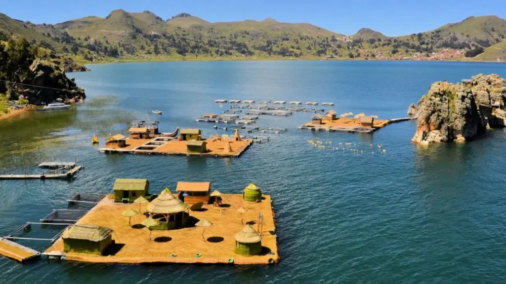
The floating islands of the Uros
This is a group of islands that have been artificially built using the totora plant, a reed that grows naturally in Lake Titicaca and has incredible properties.
This species was used by the descendants of the Uru ethnic group, an indigenous community of Lake Titicaca. The floating islands of the Uru were originally on the Peruvian side of Lake Titicaca, although since 2007 artificial islands have been built on the Bolivian side, more for tourism than for subsistence.
The artificial islands, built from totora reed, are not only homes for the inhabitants of Lake Titicaca, they are actually floating cities, with schools and even churches built from the same plant, allowing the development and growth of their inhabitants’ lives.
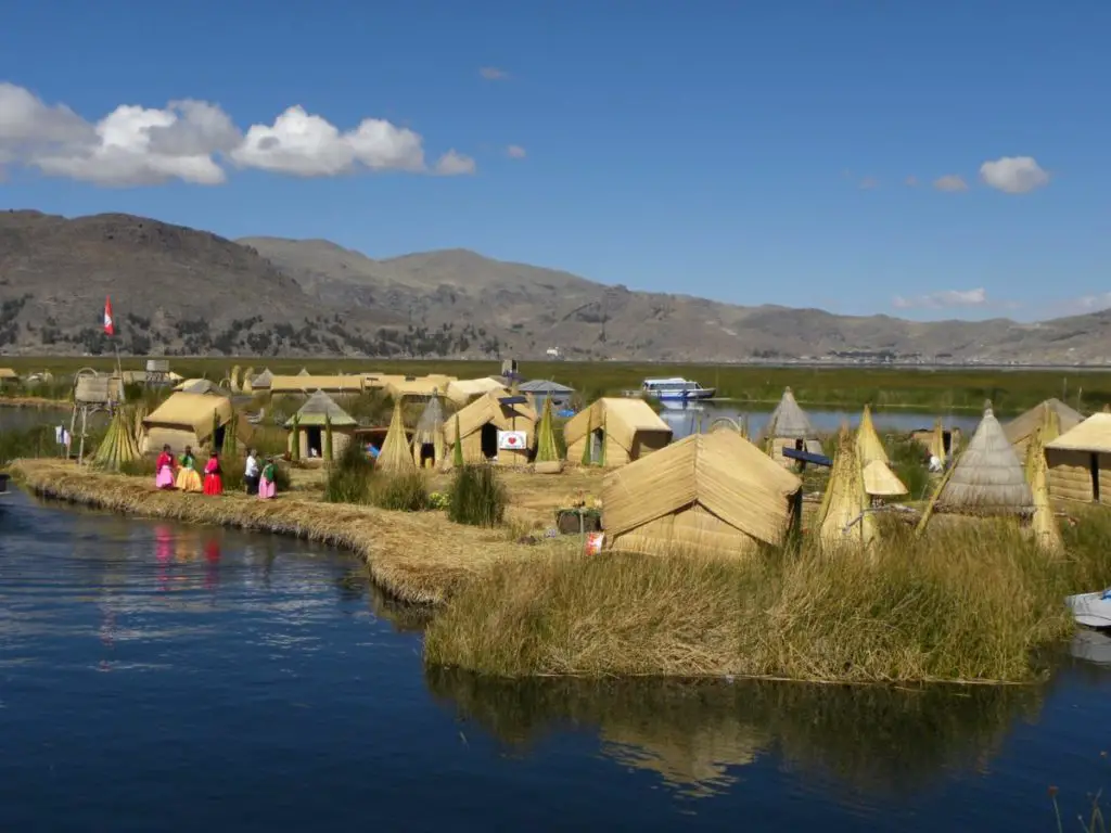
On the Peruvian side of Lake Titicaca are some 40 artificial islands inhabited by the Aymara, the oldest Andean community in the Peruvian highlands. Their economy is based on hunting, fishing, agriculture, handicrafts and barter.
It is said that the Urus were forced to flee from the Incas because they were being besieged by Pachacutec. They used the totora to build their lives and, over time, created the so-called caballitos de totora, the boats they use to transport themselves. These inhabitants call themselves kotsuña, which means ‘people of the lake’.
The floating islands of the Uros are located about 30 minutes from the shore of Lake Titicaca and are considered to be one of the oldest Andean civilisations; these artificial islands are a great tourist attraction.
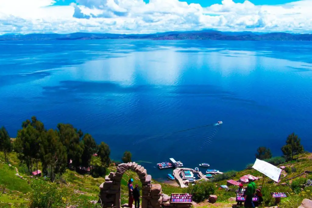
Amantani Island
Amantaní Island is the largest island in Lake Titicaca, also known as the “Island of Love”. It is one of the most beautiful islands because of its enchanting fields of flowers and eucalyptus trees.
This island is considered a remote place as it is about 3 hours away from the city of Puno and the transfer is by boat. It has no hotel facilities, so tourists stay in the homes of its inhabitants, giving them a unique opportunity to learn about their culture, customs and enjoy the warmth and hospitality of their people.
Another peculiarity of the island of Amantaní is that, due to its remoteness, it has no internal communication routes, so it must be visited on foot.
One of the places not to be missed when visiting Amanti Island is the Pachatata Sanctuary, a stone structure where the inhabitants worship Mother Earth, known as Pachamama in the local language.
Taquile Island
Taquile Island is about 3 hours away from Uros Island. It is a place for experiential tourism, as it has no hotel facilities, so visitors stay in the homes of the local people.
It is common for visitors to participate in some of the work that is done to survive on the island, which allows them to practice true community tourism.
One of the activities most enjoyed by visitors is trekking, which is nothing more than taking long walks through the beautiful scenery, an activity that is a must if you want to enjoy one of the most beautiful views of Lake Titicaca. You have to climb 567 steps to reach the highest point of the island and enjoy the view.
The island is world famous for the textile craftsmanship of its inhabitants, and the textile trade is one of the main sources of income, along with barter and agriculture.
The islands of Lake Titicaca offer an infinite number of activities, especially water sports such as kayaking and sailing, scuba diving, rowing, fishing, as well as the daily activities of the islanders, which will allow you to get to know their culture better.
Let yourself be carried away by the mysticism of the place as you stroll through the archaeological sites that show us the most ancient civilisations, visit the Palace of the Sun, the Challapampa labyrinth or drink water from the eternal fountain of youth.
These are just some of the activities you can enjoy when you visit Isla del Sol. Trekking is the perfect way to get to know and access the most hidden and majestic places in these Andean landscapes of Lake Titicaca, a sacred place.
Pollution in Lake Titicaca
Lake Titicaca, the highest navigable lake in the world, is threatened by a number of activities that pollute its waters. On the Peruvian side, waste from artisanal mining is dumped in the Puno region, while on the Bolivian side, solid waste and sewage are dumped from the towns of Copacabana, Cohana and Tiquina.
Measures have been taken to protect the fragile and unique ecosystem of Lake Titicaca, including the sustainable use of resources and the ecological recovery of the system through the repopulation of endangered species, in order to minimise the anthropogenic impact.
However, the pollution of the lake is a problem that requires urgent attention, as it has a strong impact on aspects as important as the lives of its inhabitants.
Similarly, the ecological imbalance of the system leads to the loss of species, which reduces the fishing industry, tourism and increases the risk of contracting certain diseases.
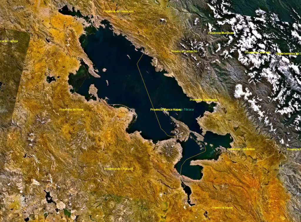
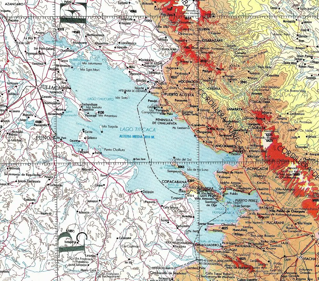
Map of Lake Titicaca
Below we leave you with the map of Lake Titicaca, where you can graphically see its exact location and visualise the way in which the ownership of its waters has been distributed between the countries of Peru and Bolivia, as explained above.
If you enjoyed this article, we invite you to read more about other fascinating rivers at the following links:
- Guadalete River
- River Bidasoa
- River Sella