
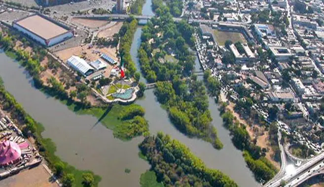
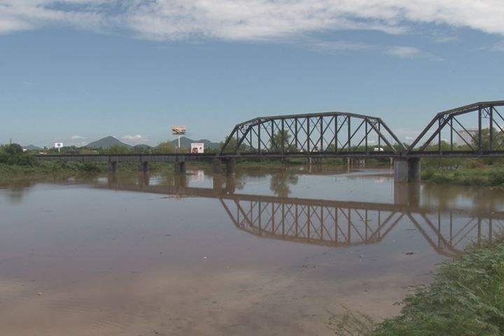
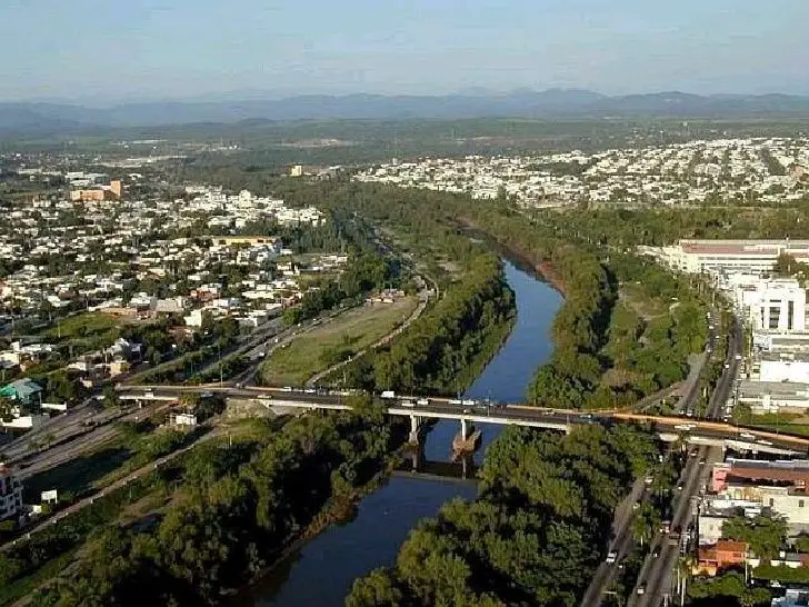
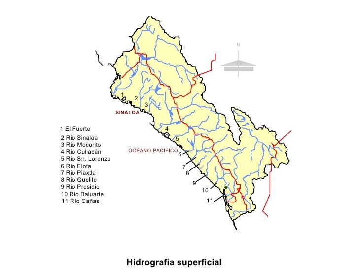
The Culiacán River is a river formed at the confluence of the Tamazula River and the Humaya River in the city of Culiacán, in the state of Sinaloa, in northwestern Mexico. The river flows from the confluence of the headwaters of the Sierra Madre Occidental, generally westward and into the Gulf of California from the Pacific Ocean.
History of the Culiacan River
The most accepted translation would be Colhuacan “place of those who worship the crooked god Coltzin”. Another translation is that it comes from the word coahuacan, which can mean “palace of snakes”. Before the Spanish arrived from Europe, this site had been a small indigenous settlement since 628, when it was first founded by the Amerindians.
The city that exists today was founded in 1531 by the Spanish captain Nuño Beltrán de Guzmán and was called San Miguel de Culiacán. The same decade saw the end of the long journey of Alvar Núñez Cabeza de Vaca and company among the natives. The explorer Francisco Vásquez de Coronado left Culiacán to explore what is now the southwestern United States.
Settlers from Europe came to Culiacán, and in the centuries that followed, Culiacán remained a quiet town. It was not until the federal government built dams in adjacent areas in the 1950s that agriculture exploded and the city began to grow exponentially (see article: Río Machángara).
Some of Mexico’s largest agricultural conglomerates operate on the vast and fertile coastal plains. The agro-industrial economy remains the main contributor to the region’s legal economy.

While the vast majority of technical and skilled workers are trained locally, the once-seasonal rural labour pool now faces annual labour shortages. International migration patterns now draw workers from Mexico’s deep south to the northern border states and the United States (see article: Tomebamba River).
Characteristics
Natural and/or anthropogenic activities in this area cause soil loss through the process of erosion, which greatly reduces its productivity. This study proposes an integrated management tool for the rational use and conservation of water resources and for the appropriate management and planning of the territory.
In order to assess the changes in land use and land cover that occurred during the periods 1990-2000 and 2000-2014, a methodology combining the use of digital image classification techniques, geographic information systems (GIS) and statistical analysis was used.
Transition matrix analysis was used to distinguish these changes as a product of transitions. The results of the type of change obtained in this study showed the occurrence of significant changes in land cover for both study periods (see article: Paute River).
Length of the Culiacán River
The Culiacán River is a river in the state of Sinaloa, Mexico. Its course is 87.5 km long and its basin covers 17,200 km2, with an annual flow of 3,280 million Hm3. The river originates at the confluence of the Tamazula and Humaya Rivers, near the city of Culiacán.
It follows the same route along the Pacific coast, initially flowing westwards until the town of Navolato, where its course turns south to finally flow into the bay near the Lucerna Peninsula, in the Pacific Ocean.
Climate of the Culiacán River
The Culiacán River has a semi-arid climate, despite an annual rainfall of over 600 mm (24 inches), due to its high temperatures and high evaporation. Summers are very hot and humid, with temperatures in the shade reaching 45°C (113°F).

High humidity can produce heat indexes of 50-55°C, with the risk of heavy rainfall from rotting tropical cyclones. Winters are much milder, with lower humidity and average highs of 27°C, with warm nights.
Economy of Culiacán
Culiacán’s economy is primarily agricultural and commercial, being a trading centre for agricultural products, meat and fish. Among other industries, Culiacán accounts for 32% of the state’s economy (see article: Rio Chira).

Some nationally important companies are based in Culiacán, such as Coppel, Casa Ley, Homex and others. The Sinaloa Cartel, a drug trafficking and organised crime syndicate, is based in Culiacán.
Sinaloa has the largest percentage of irrigated agricultural land in Mexico. Due to its economic contribution, the export of fresh fruits and vegetables represents one of the most important activities in this region.