
The Catatumbo River is a torrent to the north of Santander in Colombia and flows into Lake Maracaibo in Venezuela, it is an international river. Find out all about this wonderful waterway, from its source to the end of its course.
Map of the Catatumbo River
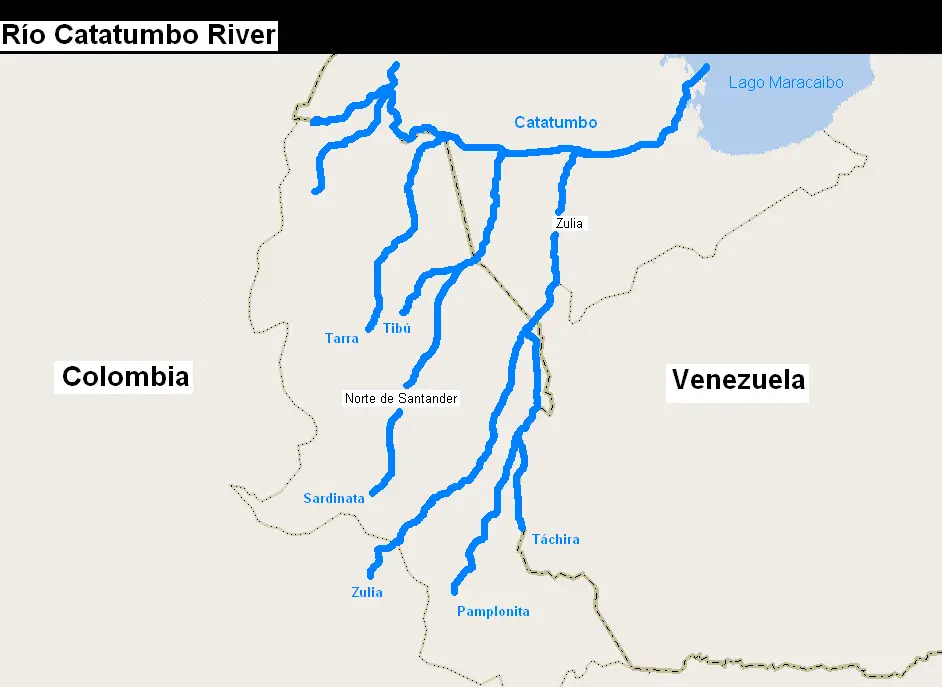
This is a river with two nationalities, as it begins in Colombia and ends in Venezuela. Its source is located at three thousand eight hundred and fifty metres above sea level, in the Hill of Jurisdictions, in the Colombian department of Norte de Santander, in the east of the country.
After a journey of four hundred and fifty kilometres, it ends up in the Maracaibo Lake in Venezuela. It contributes sixty per cent of its fresh water. The Catatumbo River enters the lake in the form of a delta, which allows it to reach the interior of the lake, breaking its symmetry.
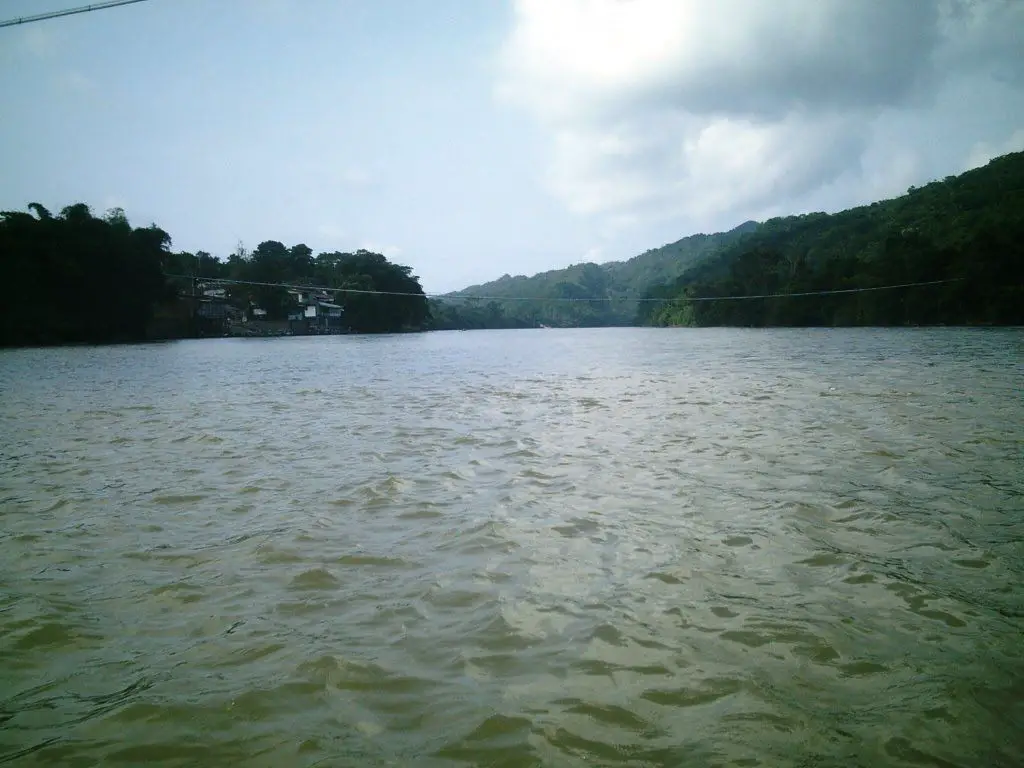
The Catatumbo River serves as a kind of hideout for the few remaining indigenous people in the area, such as the Barí tribe or the Motilones mansos, as they are also known, who live in the dense jungle along the banks of the river.
This spectacular river is not known by the name of Catatumbo from its origin, in the area of its source it is known as the Oroque, from there it moves northwards until it reaches the mountain range between Abrego and Ocaña, where it is known as the Algodonal, and after crossing the Ocaña table it is known as the Catatumbo.
 Among the tributaries of this river we have the River Tarra, which donates its waters when it passes through the municipality of the same name, then when it passes through the municipality of Tibú it arrives at him, the River of Gold, to then finish its journey to the north of the dead waters in the Lake of Maracaibo Venezuela, It also receives the waters of other smaller watercourses among streams and canyons are the San Miguel River, the Socuavo River south and north, the Tibú River, the Sardinata River and the New President, there are many more streams that donate their waters to it. (See article: Naya River)Río Naya)
In the Colombian territory, the Catatumbo River is of great water value as it is the only source of water for more than 1.2 million inhabitants of the thirty-three municipalities through which the river flows (see article: Mapocho River).
Catatumbo River, Venezuela
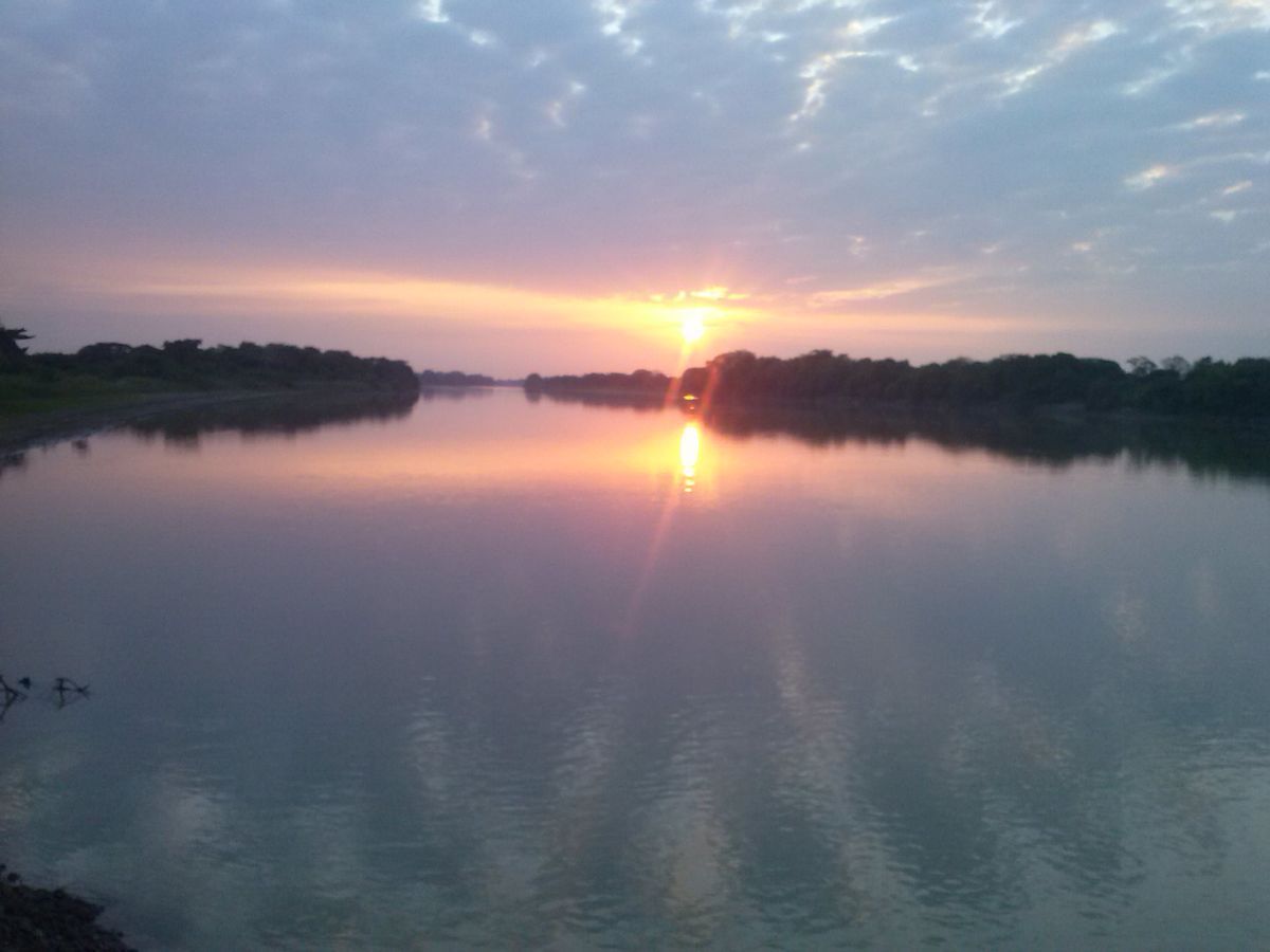
The Catatumbo River in Venezuela is located in the Ciénagas de Juan Manuel National Park. It is a swampy area and is the site of the meteorological phenomenon that gives it its name, the Catatumbo Flash.
It is a unique phenomenon in the world, the causes of which are unknown, and it occurs in the area where the Catatumbo River flows into Lake Maracaibo. It is a series of very luminous flashes that occur almost every night and more than one at a time, it is an impressive spectacle and well worth seeing. The most striking thing is that these flashes occur without any thunder or storms.
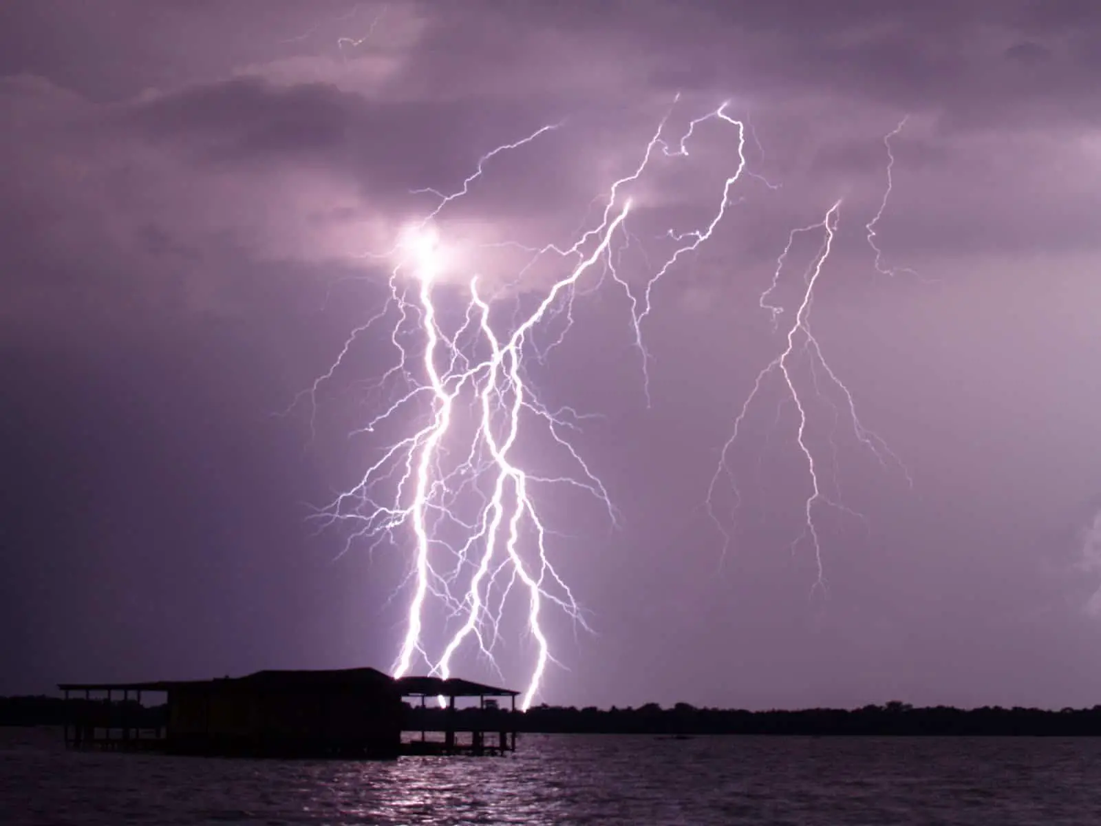
This phenomenon is so important that it has been included in the state anthem and flag, and several gaitas have been dedicated to it. In 2005, it was declared a Natural Heritage Site in the state of Zulia. It has also been recorded as having the highest average number of lightning flashes per year in the world (see article: Río Chama).
They are doing their best to make it a UNESCO World Heritage site, which would be the first meteorological phenomenon to be so designated.
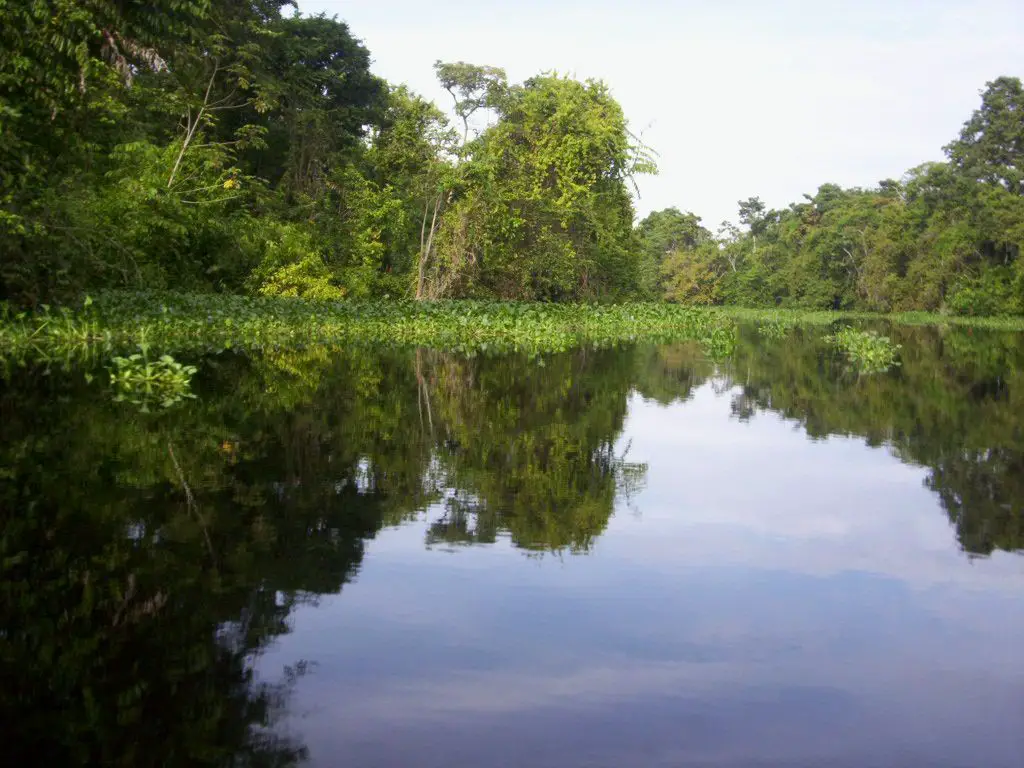
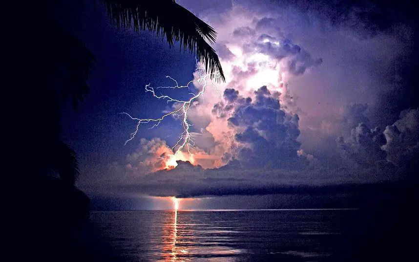 This phenomenon has been a great tourist attraction for the Bolivarian Republic of Venezuela and has helped the state of Zulia a great deal. To visit it, you can make the complete tour of the park, starting with a walk along the river, enjoying the beauty of the flora and spectacular fauna. Among them, we can enjoy manatees, monkeys and a great variety of birds, and finally, at sunset, the spectacle of the lightning of Catatumbo.
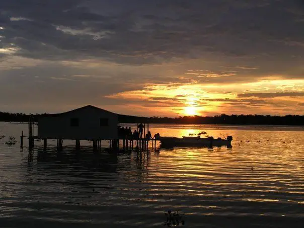 You can get there quickly by plane to Santa Barbara or La Fria airports, or by plane to the Campo Rosario airstrip. By land, the route is longer, partly by road and partly by boat along the river.
What happened in 2016 with Catatumbo?
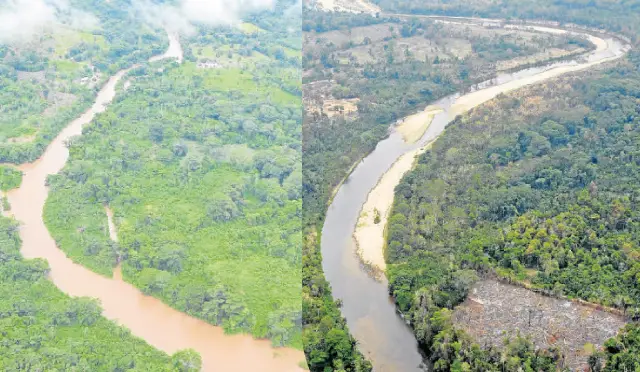
One of the worst years for this river and the local people who depend on its fish and other resources. An enormous drought lowered the water level, leaving this great tributary to feel like a simple stream. This natural phenomenon called “El Niño”, together with the indiscriminate deforestation of the area, made it one of the worst years for the Catatumbo and the people living around it.