
Last Updated on September 7, 2023 by Hernan Gimenez
The Usumacinta River, located in southeastern Mexico and northwestern Guatemala, is formed by the confluence of the Pasión River, which rises in the Sierra de Santa Cruz (Guatemala), and the Chixoy River, which descends from the Sierra Madre de Guatemala.
History of the Usumacinta River
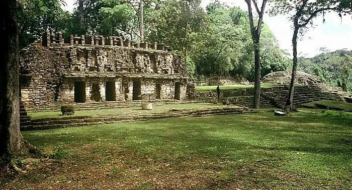
The Usumacinta River and its tributaries were important trade routes for the ancient Maya civilisation. Along its banks are Yaxchilan and Piedras Negras, two of the most powerful cities of the Classic Maya period (see article: Arkansas River).
Before the Mexican government built the border highway in the early 1990s, the river was the only means of transportation in the region.
Frans and Trudi Blom first brought the idea of conservation to the watershed in the 1950s by proposing that part of the Selva Lacandona be set aside for the Lacandon Maya.
Her idea was both cultural and habitat conservation, the principle being that indigenous integrity and habitat are inextricably linked in the watershed and should guide any future conservation plans. Thus it can be said that it is characteristic of the Usumacinta River that it forms the border between Chiapas and Tabasco.
Location and map of the Usumacinta River
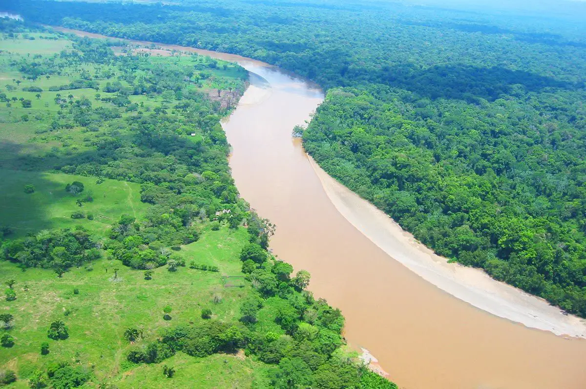
The Usumacinta River forms the border between Chiapas and Tabasco and flows generally northwest. The main tributary joins the Grijalva River and flows into the Bay of Campeche. Below is a map of the Usumacinta River in Mexico.
On the map we saw the location of the Usumacinta River, past La Frontera, in the northern state of Tabasco; the central tributary, called San Pedro and San Pablo, flows into the bay of the town of San Pedro; and the eastern tributary, the Palizada, flows into the Laguna de Términos in the state of Campeche (see article: Putumayo River).
The total length of the main channel, including the Chixoy, is about 600 miles (1,000 km). The Usumacinta is navigable for about 250 miles (400 km) inland and was of great economic importance as a means of communication for the towns on its banks and for the export of logs, chicle and other lowland products.
Where does the Usumacinta River originate, the answer is that the Usumacinta River has its source in the department of El Quiche Guatemala, where the Usumacinta River flows into the Gulf of Mexico, Puerto de Frontera in Tabasco.
Usumacinta River Guatemala
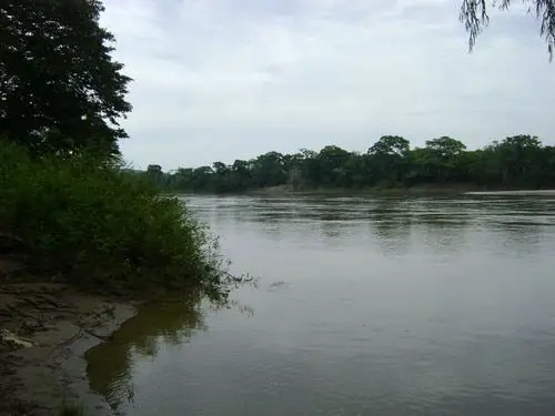
Below the Mayan ruins of Piedras Negras in Guatemala, the river begins its meandering course through the swampy lowlands of the southern shores of the Bay of Campeche. The Usumacinta River in Guatemala is variously called the Usumacinta River:
- Pacaranat.
Río Negro.
Xayab River.
Xalala in the Queen Zone.
Salinas River in the Ecija Valley.
San Carlos Sija.
Caribbean in the Petén.
To know where the river Usumacinta flows through, we have to know that its course begins in Totonicapán, where the river flows from south to north, marking the departmental border of El Quiché with Totonicapán and Huehuetenango, making a turn and entering El Quiché. It then passes the Chixoy hydroelectric dam, which separates the Verapaces from Quiché.
It then returns to its northern course where it turns east and then north again, forming the border between Mexico and Guatemala, entering Mexican territory through the state of Tabasco, where it divides into three branches and forms the Grijalva basin.
Economy
The first major hydroelectric project on the Usumacinta, "Boca del Cerro", Tenosique, Tabasco, was proposed in the 1980s and would have extended to the Pasion and Lacantún tributaries, flooding Piedras Negras and Yaxchilán, among other known and unknown Mayan sites (see article: Yukon River).
At the time, the Guatemalan coast was guarded by rebels, whose presence discouraged illegal logging, poaching and looting. It also discouraged dam builders.
Ultimately, the hydroelectric project failed under the weight of its own incentives: sedimentation, geology, seismic activity, distance from markets, politics, etc., but the outcry from conservationists, archaeologists, writers and the public also contributed to its demise.
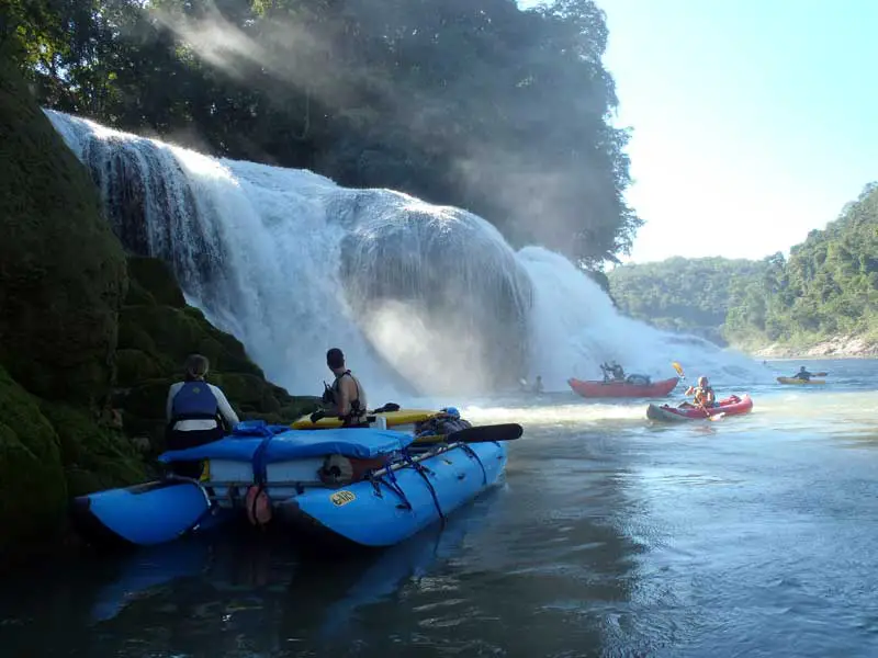
A thriving seasonal wildlife tourism business began in the river forests. And its surroundings became a popular destination for river travellers, archaeologists, birdwatchers and wildlife tourists.
In 1990, Carlos Salinas de Gortari (President of Mexico) proposed a smaller but still monumental hydroelectric project and completed the perimeter road around the Montes Azules reserve.
In the late 1990s, a consortium of scientists, governmental and non-governmental organisations met in San Cristóbal de las Casas, under the auspices of the Wildlife Conservation Society and the University of Florida, to determine the extent and types of habitat remaining in the region and to map the watershed.
The Zapatista rebellion in 1994 and 1995, and the Guatemalan peace accords in 1996, changed the politics of the watershed. As a direct result, and with the dramatic fall of the peso, bandits began robbing travellers on rafts, putting an end to desert travel in the corridor.
One of the most promising tourist activities, with the least impact and the greatest potential for conservation, archaeology and cultural preservation, came to an end. Illegal activities of all kinds took over the river basin (see article: Río de la Plata).
Here is a video of the Usumacinta River as it flows along the border between Mexico and Guatemala.