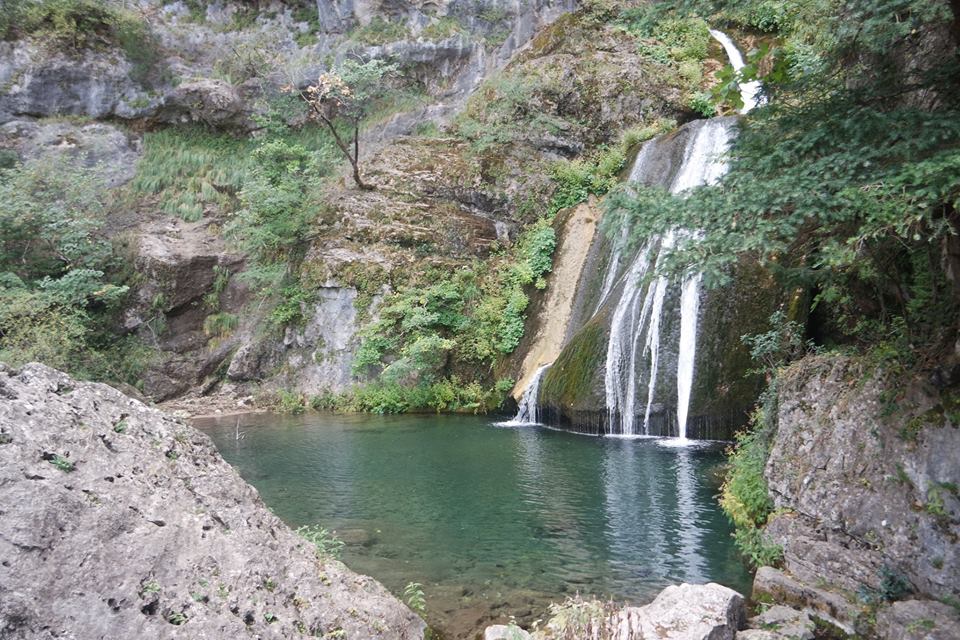
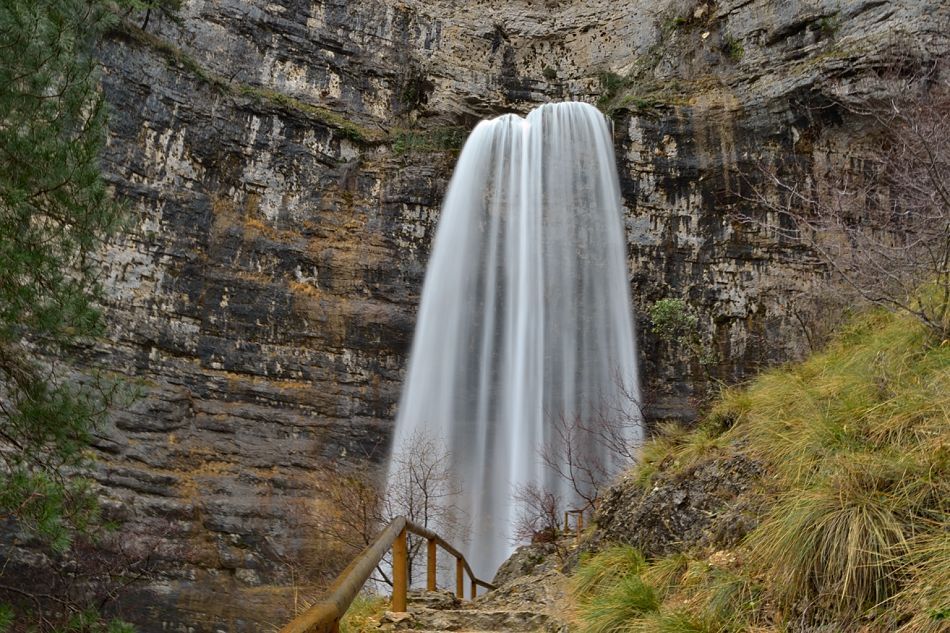
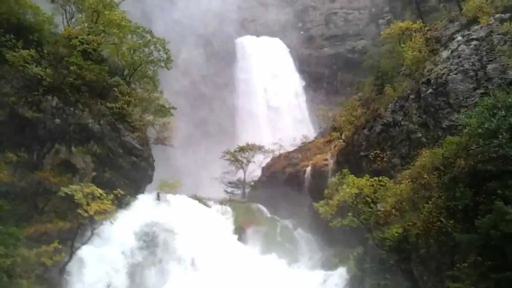
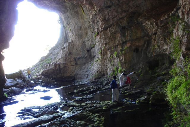
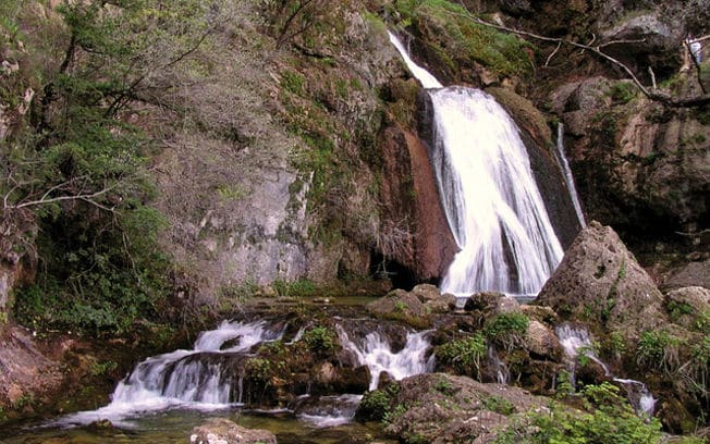
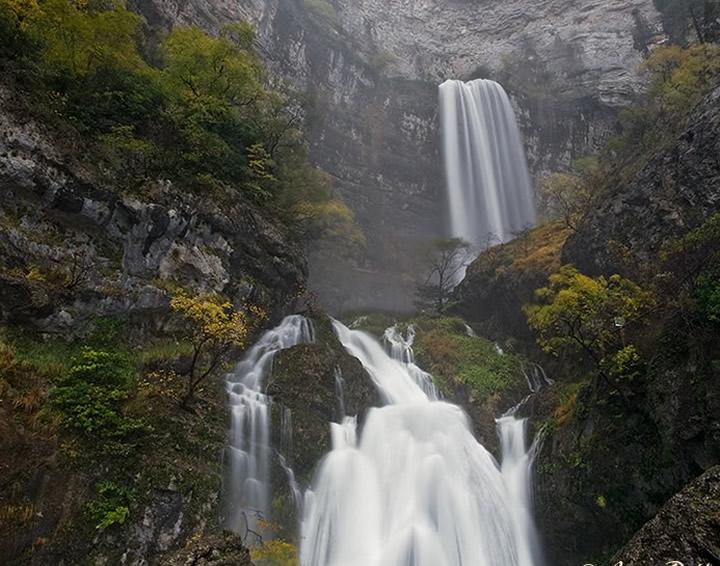
The Mundo River is well known for its picturesque source, considered one of the most beautiful in the world. The river rises in a cave in the middle of a high cliff and forms a waterfall almost 100 metres high.
The river then forms a series of small waterfalls and pools. The cave itself is about 15 metres wide and 25 metres high, and forms the end of a large cave system beneath the World River Calar (see article: Euphrates River).
Indice De Contenido
Source of the World River
The River Mundo is a river in south-eastern Spain. Where is the source of the River Mundo? It rises just south of Riopar on the Calar del Mundo plateau. From there it flows to Riopar and then westwards until it joins the Segura south of Hellín.
The source of the river is 1,075 metres above sea level, while at the canyon where the Talave reservoir is located, some 75 kilometres downstream, it is 472 metres above sea level. About 30 km upstream from the Talave reservoir, the River Mundo joins the River Bogarra on the left, the only permanent tributary that collects water from the eastern slopes of the Sierra de Alcaraz.
Its low flow is usually lower than that of the Mundo, although in periods of heavy rainfall or thaw, the two low flows are approximately equal.
Between Ayna and the Isso bridge, several streams flow into the Mundo, some of which have a significant impact. Normally they do not contribute to the flow of the river Mundo, but in times of flooding they can generate a considerable flow in the river (see article: River Guadiana).
After the bridge of Isso, there are no major tributaries on the right bank, but on the left bank there is the Minateda (or Tobarra) riverbed, which has a very large catchment area (almost the whole of the downstream Mundo tributary of the Talave reservoir), but virtually no flow except during floods.
The northern boundary of the Mundo river basin, from the Sierra del Saúco to the east, is difficult to define. Here there is very little land relief, the hydrographic network is very irregular and there are significant landlocked areas. There is no permanent contribution to the river and most of the tributaries are dry, except during the floods.
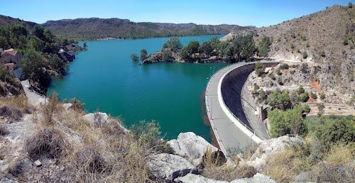
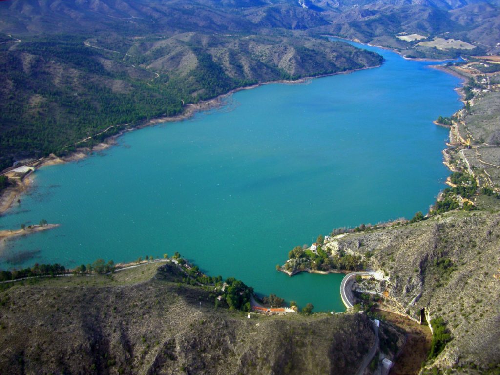
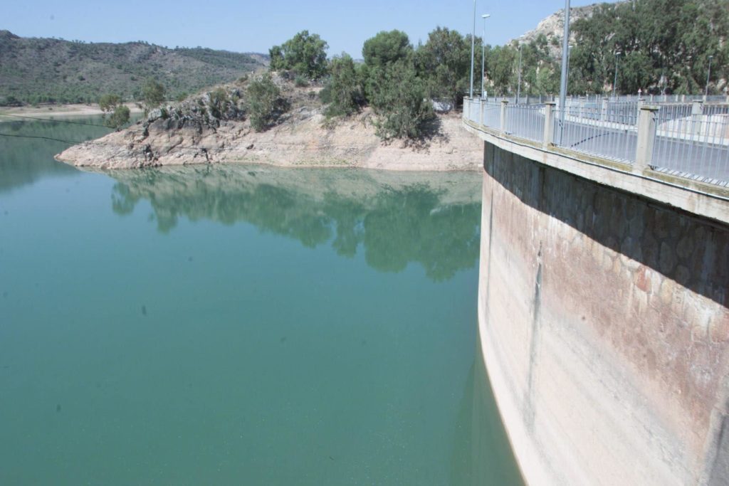
The Talave reservoir covers an area of 295 km2 at its highest point and is located entirely in the municipality of Liétor, in the province of Albacete. The capacity of the reservoir at this level is 34.8 hm³. The length of the shoreline is 23.6 km and the length of the Mundo River within the reservoir is 9.1 km.
Map of the Mundo River
To find out where the Mundo River is located, its source, its course, etc., below is the map of the Mundo River.
Mundo River Basin
The Mundo River has a length of 150 km and a drainage area of 766 km2. The river has most of its tributaries, including the Rio de la Vega, Rio de los Vadillos and Rio de Bogarra in its upper reaches, and only the Arroyo de Tobarra in its lower reaches (see article: Rio Limpopo).
Below is a video of the cave of the Chorros del río Mundo.
Along its course there are two reservoirs, the Talave reservoir with a volume of 34 cubic hectometres and the Camarillas reservoir with a volume of 36.5 cubic hectometres. In the Talave reservoir, the River Mundo receives additional water from a 250-kilometre aqueduct that feeds it from the Tagus reservoir.
Talave reservoir
The first feasibility studies for a deposit on this site date back to the second half of the 19th century. Work on the reservoir was carried out between 1903 and 1918.
[A preliminary project for the Talave reservoir was drawn up in 1888 as part of the defence system to reduce the effects of flooding in the Segura and Guadalentín valleys.The design was for a 43-metre high masonry dam with a spillway at the base, but without a closure, as the only purpose was to prevent flooding in the higher areas of the River Mundo. The dam was built in the 1880s.[/su_note]
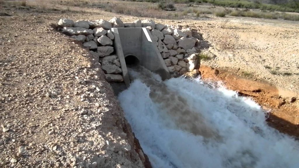
The Talave (Mundo River) reservoir project was drawn up in 1894, reducing the height of the dam to 41m and adding gates to the spillway at the base.
Construction began in December 1896 with preparatory works and the following spring the foundations were laid. From the beginning there were all kinds of difficulties (flooding, too much cement, outbreaks of malaria, etc.).
In April 1899, with the central block already built and everything in place for the construction of the downstream wall, it became necessary to fix the position of the wall with great precision.
As a result, after repeated and meticulous inspections of the banks and bed of the river, the final redefinition of the dam was reached, resulting in a bend with a radius of 250 metres instead of the 190 metres shown in the project that had already been approved (see article: Río Cuervo).
In September 1901, new soundings were carried out, which showed that the river bed in the gorge had changed considerably and that the rock on which the bases of the dam had been placed was little more than a pile of rocks, one embedded in the other, although externally it appeared to form an unbroken continuity.
In June 1903, civil engineers Domingo Muguruza Ibarguren and Juan Romero Carrasco drew up the Proyecto Nueva Presa para el Embalse de Talave.
The proposed solution consisted of a circular gravity reservoir with an embankment 38.5 m high and 145.5 m long at the crest. The structure was to be built in masonry with lime mortar.
On the part of the dam that crossed the river bed there was a metal grating at the base. In the plans, the curve radius of the upstream wall was set at 100.00m, the radius of the downstream wall at 144.86m and the radius of the downstream wall at 144.86m.
The project retained the same arrangement of outlets and inlets as its predecessor; as for the surface spillway, the same general arrangement was retained but the exact location was changed and the length of the spillway was considerably reduced.
The construction of the dam was completed in 1918 and was largely in accordance with the plans of the 1907 project. The dam has a height of 38.00 m above the riverbed, with a triangular profile of vertical slopes upstream and 0.847 / 1 in the lower riverbed.
The original width of the crest was 4.00 m and the width at the base was 32.20 m. Since then, a series of works have been carried out either to provide facilities that were not available or to renovate elements of the original, such as the crest (see article: The Seine).
Since then, several modifications have been carried out, either to provide facilities that the original version did not have (such as the weir system and the gallery) or to renovate elements of the original (such as the crest).
In June 1921, the project for additional work on the Talave reservoir was published, setting out a series of necessary improvements. Some of these were due to the new functions required of the reservoir, which was no longer limited to flood control, but also had to meet the irrigation needs of the lowlands.
These improvements included the construction of flow gauging stations both upstream and downstream of the reservoir, the repair of the access road and the replacement of the maintenance equipment as a result of the rise in the level of the spillway rim.
The main functions of the reservoir are to regulate water flow to meet consumption and irrigation needs, to reduce flooding in the upper reaches of the Mundo River and to generate hydroelectric power (see article: River Ganges).
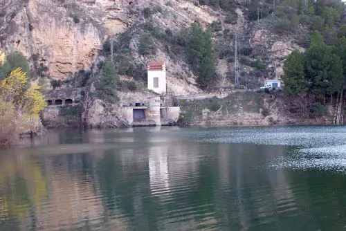
The power station at the foot of the dam was completed between 1931 and 1942. Until recently, this plant, managed by the Confederación Hidrográfica itself, supplied electricity to the Talave, Camarillas and Cenajo reservoirs.
It currently supplies only the Talave dam and can be connected to the Iberdrola grid in case of emergency. There are two groups of 2,765 kW each.
Since 1979, the Talave reservoir has received water diverted from the Tagus to the Segura, which is shared with the Camarillas reservoir (some 38 km downstream).
Camarillas reservoir
The dam was built in two distinct phases. The first, from 1932 to 1935, saw the construction of the tunnels, the outlets and spillway, the service buildings and the main part of the dam at a height of around 13 metres above the foundations.
After the Spanish Civil War, studies for the dam resumed and a series of reports and projects were produced before work finally began in 1953 and was completed in 1961 (see article: Yangzi River).
Since its creation in March 1926, one of the first objectives of the Confederación de la Unión Hidrográfica del Segura has been to develop the hydrological resources of the basin.
At that time, there was only one reservoir, the Talave, the Segura’s largest tributary, which had been completed in 1918.
Although this reservoir was designed for flood control, it was also used from the outset to regulate the flow of water for irrigation, thus providing exceptional benefits for its area of influence.
However, the capacity of the reservoir was clearly insufficient to regulate the entire river, and a reservoir was therefore needed on this stretch of the river.
A study was carried out to find a suitable site for the dam, and the final choice was the ravine at the confluence of the narrow pass known as Los Almandenes, close to where the River Mundo joins the River Segura, and downstream from the Vega de Camarillas.
This vega (fertile area) is bordered to the south by a steep limestone mountain, typical of the river, which is cut through by the narrow gorge of Los Almadenes, which extends for almost a kilometre.
The width at the bottom is between four and five metres and the almost transparent walls rise to a height of around 80 metres. Once the site had been chosen, the preliminary plan for the Los Almadenes reservoir on the River Mundo was drawn up (see article: Río Cabriel).
The document proposed the construction of a gravity dam with a total height of 44 metres, with a spillway on the left bank and a discharge capacity of 200 m³/s. The height of the dam was subject to a number of conditions. The height of the dam was determined by the Madrid-Cartagena railway line, for which a diversion had to be built further downstream.
The uses of the proposed dam included flood control, control of water flows for irrigation and supply to Hellín, and the generation of hydroelectric power.
The capacity of the reservoir was set at the maximum compatible with the Madrid-Cartagena railway line, which was 38.4 million cubic metres, although the line would have to be diverted and some three kilometres of track laid to avoid the dam’s damaging effect on the embankments, some of which were very high.
Mundo River Jets
Located in the heart of the Sierra del Segura and extends over 19,192 hectares including the municipalities of Cotillas, Molinicos, Vianos, Villaverde del Guadalimar, Yeste and Riópar. In this last village you can access the park located 5 km. from the participation of “Cueva de Los Chorros del río Mundo”.
In this natural space, visitors can see the light in the waters of the Mundo River in a truly spectacular way. The waterfall, which plunges more than 300 metres into the void, is one of the most beautiful in Spain.
Rain and snow water seep into the Calar through the sinkhole; the area has the second highest density of sinkholes in Spain. In addition, the network of galleries and caverns extends more than 40 km inland.
With more than 85 cavities explored, it collects the water that later appears in the cave, with an irregular pattern that is not well understood and gives rise to the phenomenon known as “el reventón”.
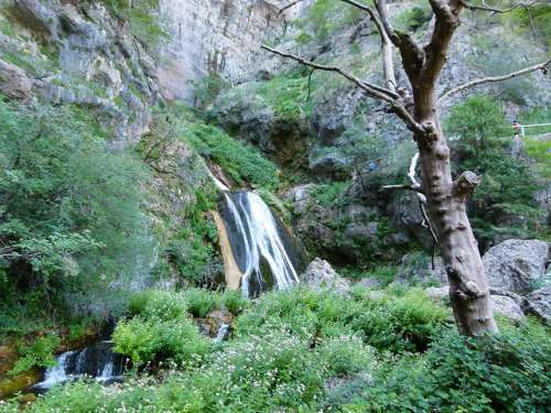
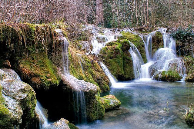
This is nothing more than the sudden and enormous increase in the flow that gives the impression, as the Spaniard suggests, that the cave has burst. As the river plunges into nothingness, it forms beautiful waterfalls and then gathers in crystal-clear pools that the locals call “Las Calderetas”.
Rio Mundo today
Talking about the Mundo River today, we have to say that it is unique because of the landscape, geological and biodiversity heritage of the Nature Reserve. In addition to the Iberian mountain goat and the numerous species of birds of prey that live here, we can point out its rich flora, with species typical of the northernmost areas.
The environment is divided into five main units: Calar del Mundo is a 22-kilometre-long platform with an average width of 5-6 kilometres, with high slopes to the south that drain into the Tus River and to the northeast, where the Mundo River has its source.
The valley of the river runs between the Calar del Mundo and the Sima, forming a deep gorge 4 km long. To the south is the Calar de la Sima, which culminates in the highest point of the Natural Park, the Mentiras, at 1,897 metres.
To the northeast is the Sierra del Cujón, which is divided from the Calar del Mundo by the Celada stream. The river Vega forms a much wider valley than the rest of the rivers in the northern part of the park.
Flora and fauna
The flora of the Park is one of the most extensive, diverse and unique in the region and the country. There are more than 1,300 species, almost one in five of the Iberian Peninsula. It is covered by pine and oak forests, as well as maple, yew, holly, ash, etc.
The high degree of conservation in most of the area covered by the Nature Reserve and the large number of habitats mean that the area is also very important in terms of fauna. A total of 174 vertebrate species have been catalogued, of which 156 are covered by an international protection agreement.
The people
The nearby urban settlements are of great charm, and the numerous mountain villages, as well as the urban centres of Riópar, Yeste, Cotillas, Villaverde del Guadalimar and Molinicos, are well worth a visit.
Geology
The landscape is extremely varied and rich in colour, with the presence of geological formations typical of limestone mountains, such as limestone cliffs, fluvial canyons and all forms of limestone dissolution.
The mountainous relief is striking: quarries, chasms, ravines, sinkholes (of which there are more than 900 in Calar del Mundo) and several caves, the most important of which are Chorros del Mundo and Primavera de Río Mundo.
As a whole, the area has a very different relief. The average altitude is 900 m, with the highest point being the peak of Serralba (1,450 m) and the lowest point being the course of the river, below the Talave reservoir, at 460 m. Geologically, it belongs to the outer Pre-Baetic, to the south of the tabular plateau. The main feature of the area is its tectonic complexity.
The area has an abundance of material belonging to all Mesozoic, Neogene and Quaternary systems, with the Mesozoic (and within it, the Jurassic) being the dominant class. In most cases, the age is deduced from lithological correlations, since conclusive data have rarely been obtained due to the lack of fauna, their destruction during the dolomitisation series, etc.
Lithologically, the area is composed of limestones and marls. The former are more widespread, and in them the rivers have deep gorges and incised meanders. There are two types of marl, one of which corresponds to the Triassic Solar Sea network and is less abundant; its locations are not related to the distribution of the rivers.
The other is the Miocene White Sea, where the wider riverbeds are covered with material that has fallen from the banks, as well as clay deposits eroded by the upwelling current.
The study of these strata is more complex, and the large number of fossils found makes it difficult to draw definitive conclusions.
The largest area includes the canyons of the Segura and most of the rugged mountainous area through which the river flows. It is a massive limestone formation, generally in thick layers that mostly dip to the NE or NNE, forming folds that cross the Segura riverbed diagonally and parallel to the lower reaches of the Mundo river.
These are mid-Jurassic breccia limestones, whose structure is due to the orogenic pressure received from the axial zone of the Baetic chain. These limestones are sometimes hundreds of metres thick.
The pressures to which they were subjected not only caused fragmentation, but also two systems of diaclasis (fragmentation zones); one with planes more or less parallel to the direction in which the pressure was applied, and the other with oblique planes perpendicular to the first. Both types of planes cut through the strata.
The stratum underlying the large limestone mass is Triassic gypsum. It is exposed in the few places where there is no Jurassic limestone cover, especially at the edges of some folds. The Triassic is particularly abundant below the Talave reservoir, where the dam is made of spongy limestone cut into the terrain. It is also found on the slopes above the lake, whose base is made up of Triassic marl.
In several places we find conglomerate deposits, with sandy clay and sometimes calcareous cement, overlying the Jurassic. In addition to these conglomerates, there are sometimes layers of sandy limestone in massive beds that are not heavily mylonitised.
In general, this formation fits well into the structure of the area, but neither its tectonic relationship to the Jurassic nor its age has been determined.
In several places in the area there are large expanses of continental facies of Miocene age with freshwater characteristics; they are generally located in low-lying areas and form large areas that are easily identified because of the contrast of this material with the others in the area.
These materials are white earthy loams with elements of marly limestone with fine pebble concretions and bituminous pyramidal shale. There are a large number of layers, flint intrusions and sulphur impregnations that have been extracted.
The stratigraphic sequence and the facies of this area leave no room for doubt, thanks to the fossil deposits of the mining station, which have yielded fossils of fish, frogs, insects and molluscs, as well as a deposit of small molluscs between Las Casas Altas and Casa del Lobo, near the river Mundo.
The part of the river under study is the part that owes its orography and tectonics to the Alpine orogeny of the Baetic mountain range, which from an orogenic point of view is a branch of the Alps.
The general characteristics of the topography and geological structure of this area have been caused by pressure from the south-east and south-west. This pressure has folded, dislocated and ground the previously deposited terrain in this part of the Earth’s crust and pushed the geological layers that were originally further south towards the north-east and north-northwest.
These phenomena were gradual in the Mesozoic and more active, with intense external consequences, much later in the Tertiary. The older and more important of the two orogenies that can be seen in the area is the one that folded, dragged and ground the Jurassic limestones, forming the basis of the present topography.
The folding took place over the plastic surface of the Triassic clays or marls that underlie the Mesozoic and Tertiary limestone formations. These Triassic marls often appear as incisions between outcrops of the newer strata, dislocated and to some extent displaced from their original position.
Weather on the River Mundo
Now that we know where the Mundo River begins and where it flows into the sea, it is time to talk about the climate. The Mundo River has a continental Mediterranean climate. Winters are cool and summers are hot. Winters and summers are generally dry.
Due to the continental nature of the climate, there is a wide range of temperatures throughout the year. Precipitation is low and falls mainly in spring and autumn, usually as rain, but occasionally as snow.

