
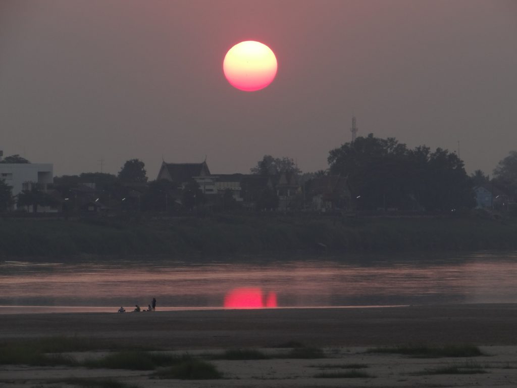
The Mekong River is the longest river in Southeast Asia, the 7th longest in Asia and the 12th longest in the world. It is approximately 2,700 miles (4,350 km) long.
It originates in Qinghai Province, China, and flows through the eastern part of the Tibet Autonomous Region and Yunnan Province.
Indice De Contenido
Map and location of the Mekong
It forms part of the international border between Myanmar and Laos, and between Laos and Thailand. The river then flows through Laos before emptying into the South China Sea south of Ho Chi Minh City (formerly Saigon).
Vientiane (Viangchan), the capital of Laos, and Phnom Penh, the capital of Cambodia, lie along its course. About three-quarters of the river’s drainage area lies within the four countries through which it flows on its lower reaches (see article: Rio de la Plata).
Features
The Mekong drains more than 313,000 square miles (810,000 square km) of land, stretching from the Tibetan Plateau to the South China Sea. Among Asian rivers, only the Yangtze and the Ganges have larger minimum flows.
The contrast between the physical conditions upstream and downstream of the Mekong River as it descends from the Yunnan Highlands divides it into two main parts.
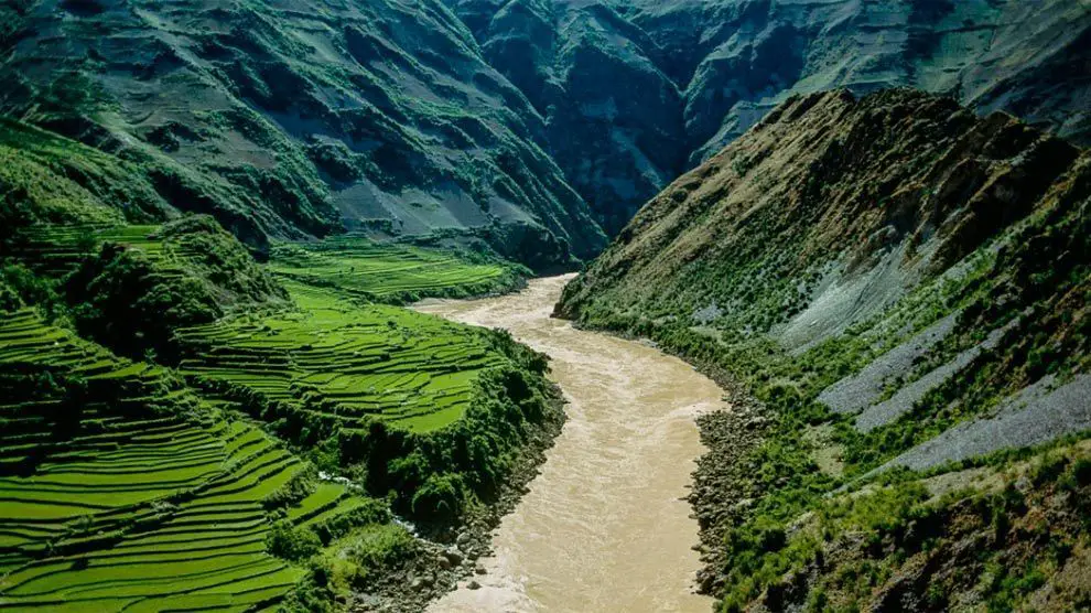
The upper Mekong flows for 1,215 miles (1,955 km) through a long, narrow valley covering about a quarter of the total area, cutting through the mountains and plateaus of southwest China (see article. Caura River).
The lower Mekong, below the point where it forms the territorial boundary between Myanmar and Laos, is a 1,485 mile (2,390 km) long river that drains the Khorat Plateau in northeastern Thailand.
The Mekong rises on the western slopes of the Annamese Range in Laos, Vietnam and Cambodia, before flowing through the distributary channels of its delta in southern Vietnam to reach the sea.
In its upper reaches, the Mekong rises on the Tibetan plateau between the Salween and Yangtze rivers; its riverbed has cut deep into the rugged landscape through which it flows.
Along its course between Myanmar and Laos, the Mekong drains about 8,000 square miles (21,000 square km) of territory in Myanmar, covering rugged and relatively inaccessible terrain (see Yurua River article).
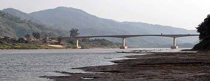
In its gentler lower reaches, where it forms the border between Laos and Thailand for a considerable distance, the Mekong is a source of conflict and cooperation between Cambodia, Laos, Thailand and Vietnam.
Tributaries of the Mekong
The sources of the Mekong, including its main tributary, the Za Qu, rise to an elevation of over 16,000 feet (4,900 metres) on the northern slopes of the Tanggula Mountains in Qinghai Province (see article: Ohio River).
They flow southeast through the Qamdo (Chamdo) region of Tibet, where the Za Qu joins other streams to form the main river, called the Lancang in Chinese.
It descends south through the Yunnan highlands, carving a deep valley, to a point south of Jinghong, where it briefly marks the border between Myanmar and China.
The river turns southwest; for more than 125 miles (200 km) it forms the border between Myanmar and Laos. Although it is crossed by two major roads – the caravan route from the southeast to Lhasa and the road from Kunming to Myanmar – much of the river valley in the highlands of Tibet and Yunnan is remote and sparsely populated.
Important tributaries of the Mekong in this region include the Tha, Ou and Ngum rivers, all of which drain northern Laos.
The Songkhram River drains the northern part of the plateau and joins the Mekong at Tha Uthen in Thailand. The Mun River, one of the major tributaries of the Mekong, drains most of the plateau and joins the Mekong at Ban Dan, Thailand.
The major tributaries of the Mekong in this region are the Kading, Bangfai, Banghiang and Kong, which, with its tributary the San, drains a large area of southern Laos, central Vietnam and eastern Cambodia. Forest degradation due to logging, shifting cultivation and grazing is widespread in the region.
Physiography
Below Myanmar, the watershed can be divided into six main sections based on landforms, vegetation and soils: the northern highlands, the Khorat Plateau, the eastern highlands, the southern lowlands, the southern highlands and the delta.
Most of the vegetation in the lower basin is tropical broadleaf, although the occurrence of individual species varies with latitude and topography.
The northern highlands have highly folded mountain ranges reaching elevations of about 9,000 feet (2,700 metres) above sea level, many with steep slopes.
As far south as Vientiane, these dissected highlands (i.e. cut into hills and valleys by erosion) are covered by dense deciduous forests, degraded by frequent slash-and-burn clearance for shifting cultivation (see article: Caqueta River).
South of the river’s east-west course below Vientiane is the Khorat Plateau, which covers almost the entire Thai part of the basin, as well as the lower reaches of the Mekong’s Lao tributaries.
This is an area of gently rolling hills amidst relatively flat alluvial plains. Soils and deciduous vegetation on the hills are thin, and much of the original forest has been replaced by grassland as a result of repeated grazing and burning.
https://www.youtube.com/watch?v=GAKFzgs8PpQ
The eastern highlands are part of the Annamese Range, from which rivers flow westwards into the Mekong. For most of the distance between Ky Son (Muong Sen) in northern Vietnam and Ban Hèt in southern Laos, the watershed forms the border between Vietnam to the east and Laos to the west.
There is higher relief in the northern and southern parts of the basin, but the highlands are generally characterised by fast-flowing streams that flow through narrow valleys before entering the lowlands bordering the Mekong River.
The southern lowlands border the Mekong on both sides below Pakxé (Pakse) in Laos. The Mekong enters Cambodia with a sudden drop at the Khone Falls. Between the falls and Krachéh there are rapids interspersed with floodplains.
Below Kampong Cham, the river’s gradient becomes gentle as it flows through wide stretches of alluvial floodplain. Near Phnom Penh, the Mekong joins the Sab River, which joins the Tonle Sap, sometimes called the Great Lake.
The direction of flow of the Sab River varies according to the season. During the flood season, when the Mekong is high, water flows down the Sab into the lake, which then expands from just over 1,000 square miles (2,600 square km) to a maximum of about 4,000 square miles (10,400 square km).
In the dry season, when the floods subside, the Sap reverses its flow and drains southeast into the Mekong. The Tonle Sap is a highly productive fishing ground.
The Damrei (Elephant) and Kravanh (Cardamom) mountains in southwest Cambodia form the southern highlands. Several rivers flow from these highlands into the Tonle Sap.
The river divides into two rivers below Phnom Penh: the Mekong and the Bassac (Basak). Below this point, the delta extends into the sea. It has a total area of about 25,000 M/C (65,000 km/C) and can be divided into three main sections.
The upper section, above Chau Doc (Chau Phu), has strong natural dikes (embankments built on both sides of the river by accumulated silt deposits) behind which are low, wide depressions.
The middle section has some well-drained areas and others that are poorly drained and marshy.
In the lower part, formed by the river mouths and the area to the south-west, sediment transported from the upper river is deposited and flooding is less extreme than in the upper parts of the delta. The area north of the Ca Mau peninsula is forested and swampy.
Climate of the Mekong
The flow of the Mekong is mainly due to rainfall in its lower reaches, which varies seasonally with the monsoon winds (see article: St Lawrence River).
The flow is usually lower in April. In May or June, when monsoon winds from the south bring rain, the flow begins to increase, particularly rapidly in the eastern and northern highlands.
The highest water levels of the Mekong occur as early as August or September in the upper reaches and until the end of October in the southern reaches. The northeast monsoon, which usually begins in November in the southern reaches, brings dry weather until May.
During the long dry season, rice cannot be grown without irrigation, and river water is vital for agriculture. Temperatures in the lower Mekong River basin are consistently warm throughout the year.
Daily highs in Phnom Penh average 89°F (32°C) and lows average 74°F (23°C). In the upper basin, temperatures are moderated somewhat by altitude and are generally lower and more seasonally variable than further south.
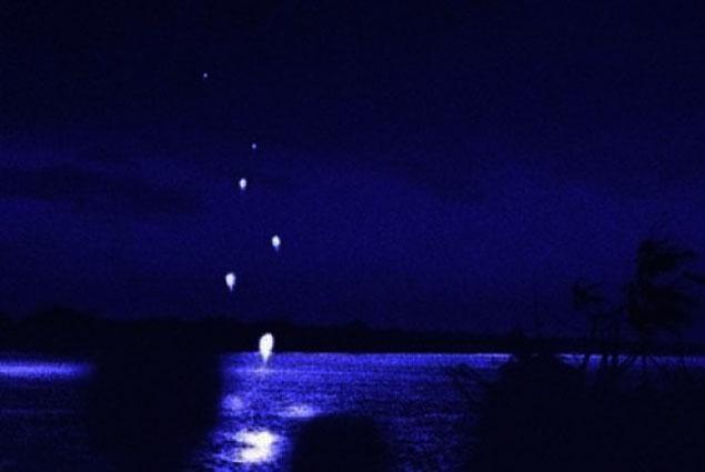
Mekong River Fireballs
The event is known to the locals as bung fai paya nak (Naga fireballs). Some believe that the flaming balls that erupt from the surface of the Mekong are the breath of the dreaded Naga, a river snake of Buddhist lore that roams this part of Nong Khai province.

It’s Thailand’s Loch Ness Monster and, if asked, the people who explain it will be more than happy to describe their fleeting childhood glimpses of the creature or produce floating images of ambiguous objects – a record of the past that no amount of squinting can decipher with any degree of clarity.
The story has certainly stood the test of time (as has the seemingly immortal creature), and there are stories written hundreds of years ago.
The Science
In the 21st century, we live in a world dominated by science rather than folklore or legend, although they do make for charming stories. So for all you realists out there, you must be dying to understand the science behind this beautiful display of Mother Nature.
Well, sorry to disappoint you, but scientists are still not very clear on the subject. Mana Kanoksin is a local doctor and self-taught cosmographer. He has spent 11 years working on the theory that the fireballs are methane gas bubbling up from the bottom of the river.
He attributes the biennial event to the Earth’s position in relation to the Sun. During the full moon of the Buddhist Lent, when the Earth is closest to the Sun, the higher concentration of UV radiation combined with the increased gravitational pull could contribute to unstable oxygen levels on the Earth’s surface.
This could cause methane to escape from the riverbed and catch fire.
This is not an official or accepted scientific theory, but it is one of the few that exists. And it explains why the event occurs on a few days in October and also in May, when the Earth returns to the same position.
Fake
But if options one and two leave you unsatisfied, that leaves option three: that the whole spectacle is a great hoax that has fooled people for centuries.
Perhaps it all started as a fascinating story and some ambitious pyrotechnic products have been recreating the fictional scenario for the last 100 years. If so, how did they manage to fool Thai patrol boats?
Hydrology
The average annual flow of the Krachéh River in Cambodia is about 500,000 cubic feet (14,200 cubic metres) per second, which is about twice the flow of the Columbia River in North America.
The minimum recorded at Krachéh is about one twelfth of the mean, and the annual peak flows are about four times the mean. Below Krachéh, peak flows decrease as the water spreads out into the distributed channels and ridges.
The recorded annual sediment load is highest at Pakxé, where it is about 187 million tonnes; it is about half that at the Myanmar border and about two-thirds that at Phnom Penh.
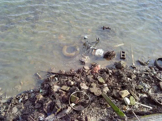
Mekong pollution
Experts have warned that the Mekong Delta, the country’s rice breadbasket, is now at high risk of freshwater shortages as water levels have fallen to their lowest level in 100 years (see article: Apure River).
According to the Vietnam Society of Geology and Hydrology, the water level in the region fell by 15 metres in 2015.
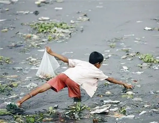
In the past, you had to dig a well to a depth of 100 metres to get fresh water. Today, even if you dug to a depth of 200 metres, you would not be sure whether you could use the water, because a large percentage of the water is contaminated with salt and chemicals.
Meanwhile, a report by the Ministry of Natural Resources and Environment (MONRE) shows that the current flow of the upper reaches of the Mekong River has decreased, leading to the saltwater intrusion that occurred two months earlier than usual in 2016.
Eleven of the 13 provinces and cities in the Mekong Delta have reported saline intrusion. An estimated 210,000 hectares of crops have been damaged since the end of 2015. Approximately 250,000 households with 1.3 million people lack water for daily use.
Meanwhile, Prof Dr Stefan Norra, a groundwater expert from Germany, has warned that water in the Mekong Delta may be contaminated with arsenic.
The expert, who conducts scientific research on solutions for sustainable groundwater use in Southeast Asia, said groundwater in Southeast Asia in many places has an arsenic concentration above the safe level (10 mg/l).
He said arsenic has serious consequences for human health and urged scientists to determine the concentration of arsenic in water in the Mekong River Delta as soon as possible.
The warning was made at a workshop on technological solutions for the management and use of water, energy and land in the Mekong River Delta held a few days ago by Can Tho City authorities, the German Ministry of Education and Research (Vietnam’s Ministry of Science and Technology) and the Karlsruhe Institute of Technology.
The Mekong Delta is one of the three most vulnerable deltas in the world. It is estimated that 39% of its area will be flooded by the end of the 21st century. If sea levels rise by one metre, 70 per cent of the rice-growing area would be affected by saline intrusion, while many other areas would be submerged.
The economy of the Mekong
In the lower reaches, flood control and water management offer important opportunities to increase economic productivity.
Under normal conditions, shifting cultivation farmers in the uplands and rice farmers in the rainfed lowlands can grow only one crop per year, taking advantage of the rainy season.
Half of arable land depends in some way on flood water. However, flood control makes it possible to store water during the dry season and use it for a second or third crop.
In addition, irrigation combined with flood control has improved arable land by reducing losses and delays caused by floodwaters overflowing river banks.
Where storage facilities and gradients are favourable, small-scale hydroelectric schemes have been developed.
Much of this development work was carried out under the auspices of the Interim Committee for the Coordination of Research in the Lower Mekong Basin (Mekong Committee), set up in 1957 by Cambodia, Laos, Thailand and South Vietnam.
After 1975, Vietnam replaced South Vietnam on the Committee and Cambodia ceased to participate, although Cambodia has been a member again since 1991. The Committee has sponsored a number of general scientific and pre-investment studies and has undertaken the construction of several water projects.
These projects include the multi-purpose dam at Nam Phong in north-eastern Thailand and the Nam Ngum hydroelectric dam in Laos. Despite political tensions caused by the war in Vietnam and its aftermath, the Commission countries have continued to work together and to seek assistance from other countries and international organisations.
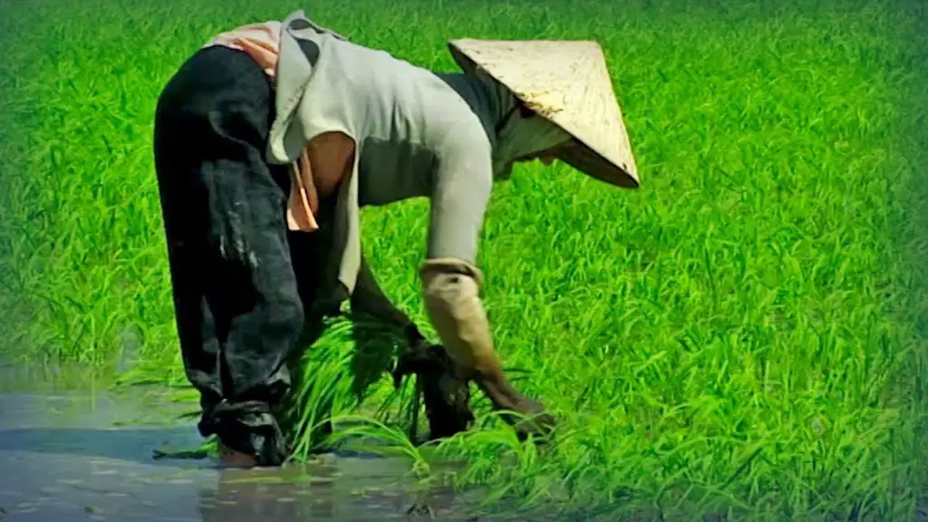
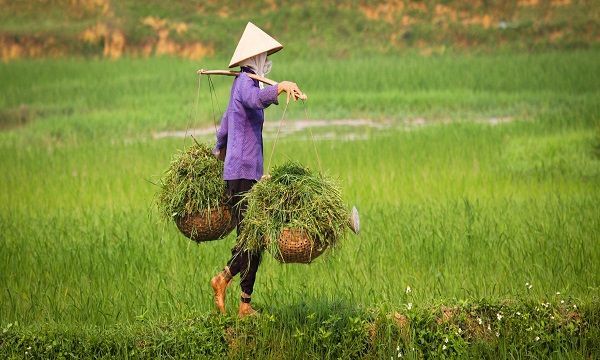
The people
The vast majority of people living along the Mekong River are engaged in agriculture, with rice being the main crop. The largest population concentrations are in the delta and on the Khorat plateau. The small urban population is growing rapidly, mainly through migration to the capital cities.
Villages in the basin are diverse. Most of the inhabitants of the upper Mekong Valley are Tibetan. South of the Tibetan highlands, the peoples of the basin are divided into two broad cultural groups.
The hill peoples are mainly shifting cultivators and have traditionally formed small kinship-based social units, while the lowland peoples, who practice sedentary agriculture, have formed complex state societies.
The mountain peoples speak languages belonging to five different language families: Tibeto-Burman (including the Yi, Hani and Lisu of Yunnan), Tai (including the Shan of Myanmar and the so-called Black Tai and Red Tai of Laos and Yunnan), Hmong-Mien (including the Hmong of Laos and Yunnan), Austronesian and Mon-Khmer (including the various Montagnard peoples of Vietnam).
However, the majority of the population are lowlanders who belong to one of the region’s dominant ethnic groups.
These include the Han Chinese of Yunnan, whose dialect is distantly related to Tibeto-Burman, the Lao of Laos and the Thai of Thailand, both dialects of the Tai family, the Vietnamese of Vietnam and the Khmer of Cambodia, Vietnam.
The Vietnamese of Vietnam and the Khmer of Cambodia both speak Mon-Khmer. The Cham, a lowland minority in Vietnam and Cambodia, speak an Austronesian language.
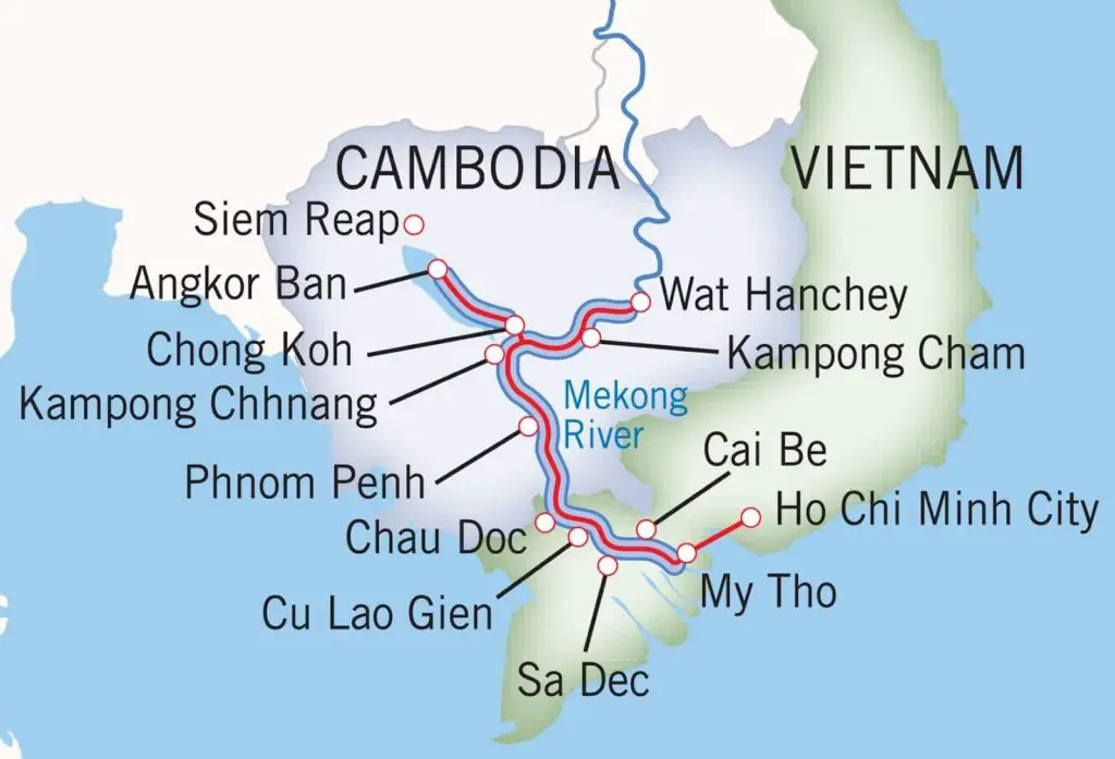
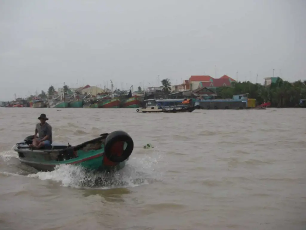
The Mekong in Vietnam
Two thousand years of human history flow along the Mekong River. It is said that the rise and fall of the great Khmer civilisation, responsible for the construction of Angkor Wat, was inextricably linked to the shifting tides of the Mekong.
Today, some 60 million people live, work and play on the Mekong. The river’s fish are Cambodia’s largest source of protein, and it is rightly called the rice bowl of Vietnam, as the fertile lands of the Mekong Delta are where the Vietnamese grow half of their nation’s agricultural produce.
The Mekong is also a centre of Vietnamese culture and an important transport route for the villagers living in the delta. From floating markets selling fish, coconut sweets, tropical fruits, vegetables and flowers to the bee farms that line the river, the Mekong pulsates with vital economic activity from dawn to dusk.
The Mekong in Thailand
The Mekong River in Thailand is one of the most biologically diverse environments in the world and is home to numerous species of flora, fauna and animals endemic to the Mekong River Basin.
It is connected to other major rivers in Thailand, including the Ing, Ruak and Mun rivers, which are in turn connected by the Chi, Dom Noi and Lam Ta Klong rivers.
The Mekong River in Thailand is home to some of the world’s largest freshwater fish species, including the mythical Mekong catfish, the Chaophraya catfish and the giant freshwater stingray.
The Mekong River in Thailand is a magical fishing destination steeped in mystery and the unknown. Fishing this mighty river in Thailand is a challenge for the visiting angler who wants to catch real freshwater fish in one of the wildest and most remote rivers in the world.
Mekong River Laos
The main rivers of Laos are mainly the first and second tributaries of the Mekong River. There are about 39 major tributaries in the Mekong River basin.
The main rivers that have a large catchment area of more than 5000 km² are the Nam Ou River Basin, located in the northern region of Lao PDR, and the Nam Suang River Basin, located in the northern region of Lao PDR.
The total catchment area of the major tributaries is estimated to be about 183,000 km². On the other hand, only 2 major rivers, Nam Ma and Nam Ka, are located outside the Mekong River basin, extending into the eastern part of Houaphan and Xieng Khuang provinces.
Mekong River Cambodia
The Mekong River flows through east central Cambodia. For much of its course it occupies an elevated bed parallel to natural dykes. Beyond the embankments are huge depressions known as bengs.
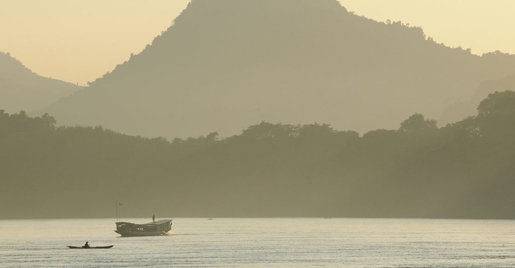
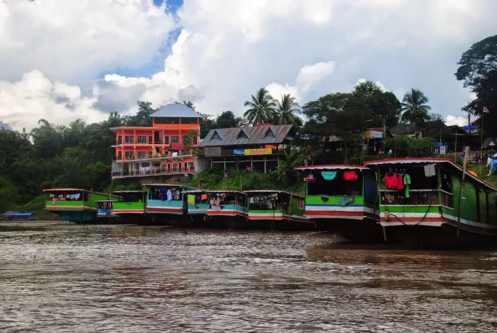
The Mekong is navigable from the sea to Phnom Penh by small ocean-going vessels. Shallow draft boats are required to travel upstream. The area north of the Mekong in Cambodia is poorly developed.
There are some stretches where villages are more than 30 kilometres apart. River traffic is light. The main fishing season is after the rainy season ends in September and the fish begin to migrate north. Villagers use nets to collect small and silver fish.
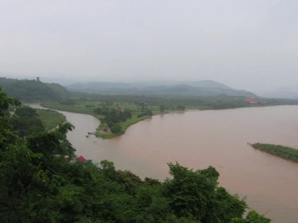
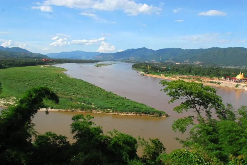
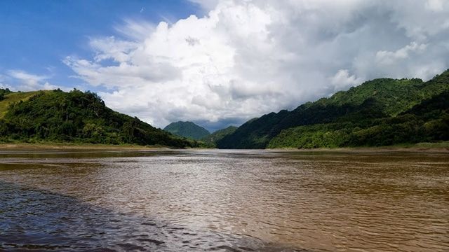
The Mekong is one of the world’s most beautiful rivers. It rises in Tibet, not far from the source of the Yangtze, and flows down through the Himalayas and southern China, crossing the border into Cambodia through the Golden Triangle.
It flows in one direction during the rainy season and in the opposite direction during the dry season. Finally, at the Mekong Delta in Vietnam, it flows into the South China Sea. Its source in Tibet was only discovered in 1994.